Skip to content
MammothSnowman.com
Mammoth Info
Home Page
Mammoth Weather
Mammoth Mountain Locals Snow Report
Things to do from Mammoth Lakes to Bishop to the June Lake
Other Things to Do in Winter
Wednesday Newsletter Sign Up
Mammoth Mouintain Ski Area Information & Overview
Scenic Gondola Rides
Cross Country Skiing in Mammoth Lakes
Sledding and Snow Play in Mammoth Lakes
Mammoth Mountain Snowmobile Adventures
Mammoth Lakes Basin
Hiking Ideas for Summer & Fall
Hike: Panorama Dome Trail
Hike: Crystal Lake Hike / Mammoth Lakes Basin
Disk Golf – Shady Rest Mammoth
Snowmans Mammoth Mountain Interview
About Us – Who We Are
Roads
Local Road Webcams, Conditions & Clousures
Mono County Road Closures
Weather
Mammoth Mountain Weather Forecast from the Snowman with Weather Bell Data
The Powder Forecast from the Mammoth WeatherGuy – (November – April)
(NEW) Current Conditions – Ski Patrol
Ski Patrol Snow Study Site
(NEW) Ski Patrol Storm Summaries
(NEW) Ski Patrol Avy Path Atlas
Local Weather Stations
Ski Patrol Weather Station 9000 Feet
Mammoth Lakes @ 7950 Feet Elevation
Mammoth Pass
Devils Post Pile Weather Station
Mammoth Airport Weather Station
DWP Snow Survey
Bishop Weather Station
All Local Weather Stations
NWS Discusions
NWS Reno Weather Discussion
NWS Hanford Weather Discussion
NWS Vegas Discussion for Bishop
NWS SFO Discussion
NWS Local Area Forecasts
NWS Main Lodge
NWS Mammoth Lakes
NWS June Mountain
NWS Crowley Lake
NWS Bishop, California
NWS Bishop Creek
Eastern Sierra Avalanche Forecast
AQI Stations
AQI MC Coy Station
AQI Mammoth Lakes @ 8000 feet
AQI Near Airport
AQI in Crowley Lake
AQI Bishop Paiute Tribe
The MoJo
QPF – Quantitative Precipitation Forecasts
River QPF Forecast
Eastern Sierra Air Quality Stations
Null Wind Map
Radar Images
Satellite Images
Live Satellite Viewer
NEXLAB Satellite and Radar
Ventusky
Windy.com
Weather Service Glossary
Atmospheric River Forecast
DWP Snow Pillows
Enso Forecast
El Niño and La Niña Years
Weather.us
GGWeather.com – Models
Webcams
Mammoth Mountain Webcams
Mammoth Mountain Webcams You Tube Live Streams
New Webcams @ The Top of Mammoth Mountain
Mammoth Airport Webcams
Snowman Accumulation Webcam – 8200 Feet
Cal Trans Cams
Down Town June Lake Webcam
June Mountain, Silver Lake & Mono Lake Webcams
Gull Lake Webcam
Bishop Webcam
Silver Peak 1
Marzano Peak 1
Eastern Sierra Wildfire Webcams
Whitney Portal Store Webcam
Mt Williamson Webcam
Lee Vining You Tube Stream
Snow
Mammoth Snow Report from the Snowman
Mammoth Mountain Ski Patrol Storm Summaries
Snow Study Site @ Patrol
Ski Patrol Avy Path Atlas
Snowfall History
History of Opening & Closing Dates
Snowmaking System Information
Mammoth Grooming Information
The Sign’s Up Top at 11,053 Feet
Ski Area Winter Trail Map
La Nina Years Snowfall Totals for Mammoth Mountain
👍❄️Curious how much snow fell during the previous decade?
Video: Day in the Life of Ski Patrol
Got Ski Boot Pain – Click Here to fix it!
Videos
Video Library from the Snowman
You Tube Channel
Mammoth Snowman Facebook Videos
Video: Record Break Snow Pack Tour March 30th, 2023
Video: Skiing Summer 2017
Video: Skiing Kiwi Flats
Video: Skiing Hangman’s
Photos
Snowman Photo Albums
Record Breaking Snowpack Photos from March 2023
Mammoth Mountain Photos
Rock Creek Canyon Photos
NEW Mtn.Biking
Eastern Sierra Mountain Bike Report & Guide
(NEW) Video: Lower Rock Creek Canyon Trail
(NEW) Video: Off the Top Mtn Bike Trail
(NEW) Video: Mammoth Knolls Loop
(NEW) Video – Mammoth Rock Trail
Mammoth Lakes Paved Bike Trail System
Bike Repair Shop
Bike Rentals in Mammoth
Menu
Mammoth Info
Home Page
Mammoth Weather
Mammoth Mountain Locals Snow Report
Things to do from Mammoth Lakes to Bishop to the June Lake
Other Things to Do in Winter
Wednesday Newsletter Sign Up
Mammoth Mouintain Ski Area Information & Overview
Scenic Gondola Rides
Cross Country Skiing in Mammoth Lakes
Sledding and Snow Play in Mammoth Lakes
Mammoth Mountain Snowmobile Adventures
Mammoth Lakes Basin
Hiking Ideas for Summer & Fall
Hike: Panorama Dome Trail
Hike: Crystal Lake Hike / Mammoth Lakes Basin
Disk Golf – Shady Rest Mammoth
Snowmans Mammoth Mountain Interview
About Us – Who We Are
Roads
Local Road Webcams, Conditions & Clousures
Mono County Road Closures
Weather
Mammoth Mountain Weather Forecast from the Snowman with Weather Bell Data
The Powder Forecast from the Mammoth WeatherGuy – (November – April)
(NEW) Current Conditions – Ski Patrol
Ski Patrol Snow Study Site
(NEW) Ski Patrol Storm Summaries
(NEW) Ski Patrol Avy Path Atlas
Local Weather Stations
Ski Patrol Weather Station 9000 Feet
Mammoth Lakes @ 7950 Feet Elevation
Mammoth Pass
Devils Post Pile Weather Station
Mammoth Airport Weather Station
DWP Snow Survey
Bishop Weather Station
All Local Weather Stations
NWS Discusions
NWS Reno Weather Discussion
NWS Hanford Weather Discussion
NWS Vegas Discussion for Bishop
NWS SFO Discussion
NWS Local Area Forecasts
NWS Main Lodge
NWS Mammoth Lakes
NWS June Mountain
NWS Crowley Lake
NWS Bishop, California
NWS Bishop Creek
Eastern Sierra Avalanche Forecast
AQI Stations
AQI MC Coy Station
AQI Mammoth Lakes @ 8000 feet
AQI Near Airport
AQI in Crowley Lake
AQI Bishop Paiute Tribe
The MoJo
QPF – Quantitative Precipitation Forecasts
River QPF Forecast
Eastern Sierra Air Quality Stations
Null Wind Map
Radar Images
Satellite Images
Live Satellite Viewer
NEXLAB Satellite and Radar
Ventusky
Windy.com
Weather Service Glossary
Atmospheric River Forecast
DWP Snow Pillows
Enso Forecast
El Niño and La Niña Years
Weather.us
GGWeather.com – Models
Webcams
Mammoth Mountain Webcams
Mammoth Mountain Webcams You Tube Live Streams
New Webcams @ The Top of Mammoth Mountain
Mammoth Airport Webcams
Snowman Accumulation Webcam – 8200 Feet
Cal Trans Cams
Down Town June Lake Webcam
June Mountain, Silver Lake & Mono Lake Webcams
Gull Lake Webcam
Bishop Webcam
Silver Peak 1
Marzano Peak 1
Eastern Sierra Wildfire Webcams
Whitney Portal Store Webcam
Mt Williamson Webcam
Lee Vining You Tube Stream
Snow
Mammoth Snow Report from the Snowman
Mammoth Mountain Ski Patrol Storm Summaries
Snow Study Site @ Patrol
Ski Patrol Avy Path Atlas
Snowfall History
History of Opening & Closing Dates
Snowmaking System Information
Mammoth Grooming Information
The Sign’s Up Top at 11,053 Feet
Ski Area Winter Trail Map
La Nina Years Snowfall Totals for Mammoth Mountain
👍❄️Curious how much snow fell during the previous decade?
Video: Day in the Life of Ski Patrol
Got Ski Boot Pain – Click Here to fix it!
Videos
Video Library from the Snowman
You Tube Channel
Mammoth Snowman Facebook Videos
Video: Record Break Snow Pack Tour March 30th, 2023
Video: Skiing Summer 2017
Video: Skiing Kiwi Flats
Video: Skiing Hangman’s
Photos
Snowman Photo Albums
Record Breaking Snowpack Photos from March 2023
Mammoth Mountain Photos
Rock Creek Canyon Photos
NEW Mtn.Biking
Eastern Sierra Mountain Bike Report & Guide
(NEW) Video: Lower Rock Creek Canyon Trail
(NEW) Video: Off the Top Mtn Bike Trail
(NEW) Video: Mammoth Knolls Loop
(NEW) Video – Mammoth Rock Trail
Mammoth Lakes Paved Bike Trail System
Bike Repair Shop
Bike Rentals in Mammoth
Instagram
Youtube
Twitter
Facebook
Mammoth Info
Home Page
Mammoth Weather
Mammoth Mountain Locals Snow Report
Things to do from Mammoth Lakes to Bishop to the June Lake
Other Things to Do in Winter
Wednesday Newsletter Sign Up
Mammoth Mouintain Ski Area Information & Overview
Scenic Gondola Rides
Cross Country Skiing in Mammoth Lakes
Sledding and Snow Play in Mammoth Lakes
Mammoth Mountain Snowmobile Adventures
Mammoth Lakes Basin
Hiking Ideas for Summer & Fall
Hike: Panorama Dome Trail
Hike: Crystal Lake Hike / Mammoth Lakes Basin
Disk Golf – Shady Rest Mammoth
Snowmans Mammoth Mountain Interview
About Us – Who We Are
Roads
Local Road Webcams, Conditions & Clousures
Mono County Road Closures
Weather
Mammoth Mountain Weather Forecast from the Snowman with Weather Bell Data
The Powder Forecast from the Mammoth WeatherGuy – (November – April)
(NEW) Current Conditions – Ski Patrol
Ski Patrol Snow Study Site
(NEW) Ski Patrol Storm Summaries
(NEW) Ski Patrol Avy Path Atlas
Local Weather Stations
Ski Patrol Weather Station 9000 Feet
Mammoth Lakes @ 7950 Feet Elevation
Mammoth Pass
Devils Post Pile Weather Station
Mammoth Airport Weather Station
DWP Snow Survey
Bishop Weather Station
All Local Weather Stations
NWS Discusions
NWS Reno Weather Discussion
NWS Hanford Weather Discussion
NWS Vegas Discussion for Bishop
NWS SFO Discussion
NWS Local Area Forecasts
NWS Main Lodge
NWS Mammoth Lakes
NWS June Mountain
NWS Crowley Lake
NWS Bishop, California
NWS Bishop Creek
Eastern Sierra Avalanche Forecast
AQI Stations
AQI MC Coy Station
AQI Mammoth Lakes @ 8000 feet
AQI Near Airport
AQI in Crowley Lake
AQI Bishop Paiute Tribe
The MoJo
QPF – Quantitative Precipitation Forecasts
River QPF Forecast
Eastern Sierra Air Quality Stations
Null Wind Map
Radar Images
Satellite Images
Live Satellite Viewer
NEXLAB Satellite and Radar
Ventusky
Windy.com
Weather Service Glossary
Atmospheric River Forecast
DWP Snow Pillows
Enso Forecast
El Niño and La Niña Years
Weather.us
GGWeather.com – Models
Webcams
Mammoth Mountain Webcams
Mammoth Mountain Webcams You Tube Live Streams
New Webcams @ The Top of Mammoth Mountain
Mammoth Airport Webcams
Snowman Accumulation Webcam – 8200 Feet
Cal Trans Cams
Down Town June Lake Webcam
June Mountain, Silver Lake & Mono Lake Webcams
Gull Lake Webcam
Bishop Webcam
Silver Peak 1
Marzano Peak 1
Eastern Sierra Wildfire Webcams
Whitney Portal Store Webcam
Mt Williamson Webcam
Lee Vining You Tube Stream
Snow
Mammoth Snow Report from the Snowman
Mammoth Mountain Ski Patrol Storm Summaries
Snow Study Site @ Patrol
Ski Patrol Avy Path Atlas
Snowfall History
History of Opening & Closing Dates
Snowmaking System Information
Mammoth Grooming Information
The Sign’s Up Top at 11,053 Feet
Ski Area Winter Trail Map
La Nina Years Snowfall Totals for Mammoth Mountain
👍❄️Curious how much snow fell during the previous decade?
Video: Day in the Life of Ski Patrol
Got Ski Boot Pain – Click Here to fix it!
Videos
Video Library from the Snowman
You Tube Channel
Mammoth Snowman Facebook Videos
Video: Record Break Snow Pack Tour March 30th, 2023
Video: Skiing Summer 2017
Video: Skiing Kiwi Flats
Video: Skiing Hangman’s
Photos
Snowman Photo Albums
Record Breaking Snowpack Photos from March 2023
Mammoth Mountain Photos
Rock Creek Canyon Photos
NEW Mtn.Biking
Eastern Sierra Mountain Bike Report & Guide
(NEW) Video: Lower Rock Creek Canyon Trail
(NEW) Video: Off the Top Mtn Bike Trail
(NEW) Video: Mammoth Knolls Loop
(NEW) Video – Mammoth Rock Trail
Mammoth Lakes Paved Bike Trail System
Bike Repair Shop
Bike Rentals in Mammoth
Menu
Mammoth Info
Home Page
Mammoth Weather
Mammoth Mountain Locals Snow Report
Things to do from Mammoth Lakes to Bishop to the June Lake
Other Things to Do in Winter
Wednesday Newsletter Sign Up
Mammoth Mouintain Ski Area Information & Overview
Scenic Gondola Rides
Cross Country Skiing in Mammoth Lakes
Sledding and Snow Play in Mammoth Lakes
Mammoth Mountain Snowmobile Adventures
Mammoth Lakes Basin
Hiking Ideas for Summer & Fall
Hike: Panorama Dome Trail
Hike: Crystal Lake Hike / Mammoth Lakes Basin
Disk Golf – Shady Rest Mammoth
Snowmans Mammoth Mountain Interview
About Us – Who We Are
Roads
Local Road Webcams, Conditions & Clousures
Mono County Road Closures
Weather
Mammoth Mountain Weather Forecast from the Snowman with Weather Bell Data
The Powder Forecast from the Mammoth WeatherGuy – (November – April)
(NEW) Current Conditions – Ski Patrol
Ski Patrol Snow Study Site
(NEW) Ski Patrol Storm Summaries
(NEW) Ski Patrol Avy Path Atlas
Local Weather Stations
Ski Patrol Weather Station 9000 Feet
Mammoth Lakes @ 7950 Feet Elevation
Mammoth Pass
Devils Post Pile Weather Station
Mammoth Airport Weather Station
DWP Snow Survey
Bishop Weather Station
All Local Weather Stations
NWS Discusions
NWS Reno Weather Discussion
NWS Hanford Weather Discussion
NWS Vegas Discussion for Bishop
NWS SFO Discussion
NWS Local Area Forecasts
NWS Main Lodge
NWS Mammoth Lakes
NWS June Mountain
NWS Crowley Lake
NWS Bishop, California
NWS Bishop Creek
Eastern Sierra Avalanche Forecast
AQI Stations
AQI MC Coy Station
AQI Mammoth Lakes @ 8000 feet
AQI Near Airport
AQI in Crowley Lake
AQI Bishop Paiute Tribe
The MoJo
QPF – Quantitative Precipitation Forecasts
River QPF Forecast
Eastern Sierra Air Quality Stations
Null Wind Map
Radar Images
Satellite Images
Live Satellite Viewer
NEXLAB Satellite and Radar
Ventusky
Windy.com
Weather Service Glossary
Atmospheric River Forecast
DWP Snow Pillows
Enso Forecast
El Niño and La Niña Years
Weather.us
GGWeather.com – Models
Webcams
Mammoth Mountain Webcams
Mammoth Mountain Webcams You Tube Live Streams
New Webcams @ The Top of Mammoth Mountain
Mammoth Airport Webcams
Snowman Accumulation Webcam – 8200 Feet
Cal Trans Cams
Down Town June Lake Webcam
June Mountain, Silver Lake & Mono Lake Webcams
Gull Lake Webcam
Bishop Webcam
Silver Peak 1
Marzano Peak 1
Eastern Sierra Wildfire Webcams
Whitney Portal Store Webcam
Mt Williamson Webcam
Lee Vining You Tube Stream
Snow
Mammoth Snow Report from the Snowman
Mammoth Mountain Ski Patrol Storm Summaries
Snow Study Site @ Patrol
Ski Patrol Avy Path Atlas
Snowfall History
History of Opening & Closing Dates
Snowmaking System Information
Mammoth Grooming Information
The Sign’s Up Top at 11,053 Feet
Ski Area Winter Trail Map
La Nina Years Snowfall Totals for Mammoth Mountain
👍❄️Curious how much snow fell during the previous decade?
Video: Day in the Life of Ski Patrol
Got Ski Boot Pain – Click Here to fix it!
Videos
Video Library from the Snowman
You Tube Channel
Mammoth Snowman Facebook Videos
Video: Record Break Snow Pack Tour March 30th, 2023
Video: Skiing Summer 2017
Video: Skiing Kiwi Flats
Video: Skiing Hangman’s
Photos
Snowman Photo Albums
Record Breaking Snowpack Photos from March 2023
Mammoth Mountain Photos
Rock Creek Canyon Photos
NEW Mtn.Biking
Eastern Sierra Mountain Bike Report & Guide
(NEW) Video: Lower Rock Creek Canyon Trail
(NEW) Video: Off the Top Mtn Bike Trail
(NEW) Video: Mammoth Knolls Loop
(NEW) Video – Mammoth Rock Trail
Mammoth Lakes Paved Bike Trail System
Bike Repair Shop
Bike Rentals in Mammoth
August 2022 Photos from Mammoth Mountain and the Eastern Sierra
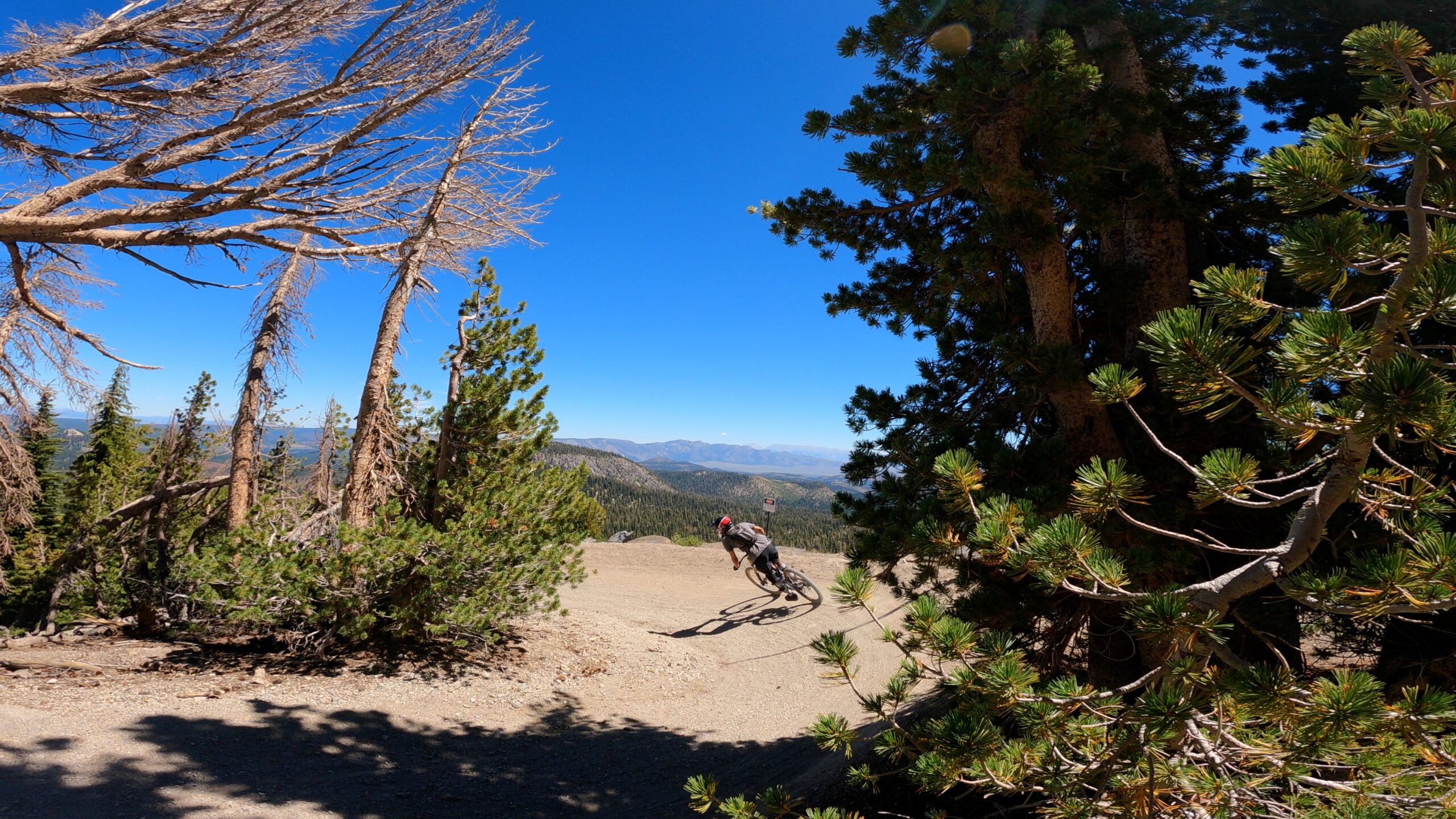
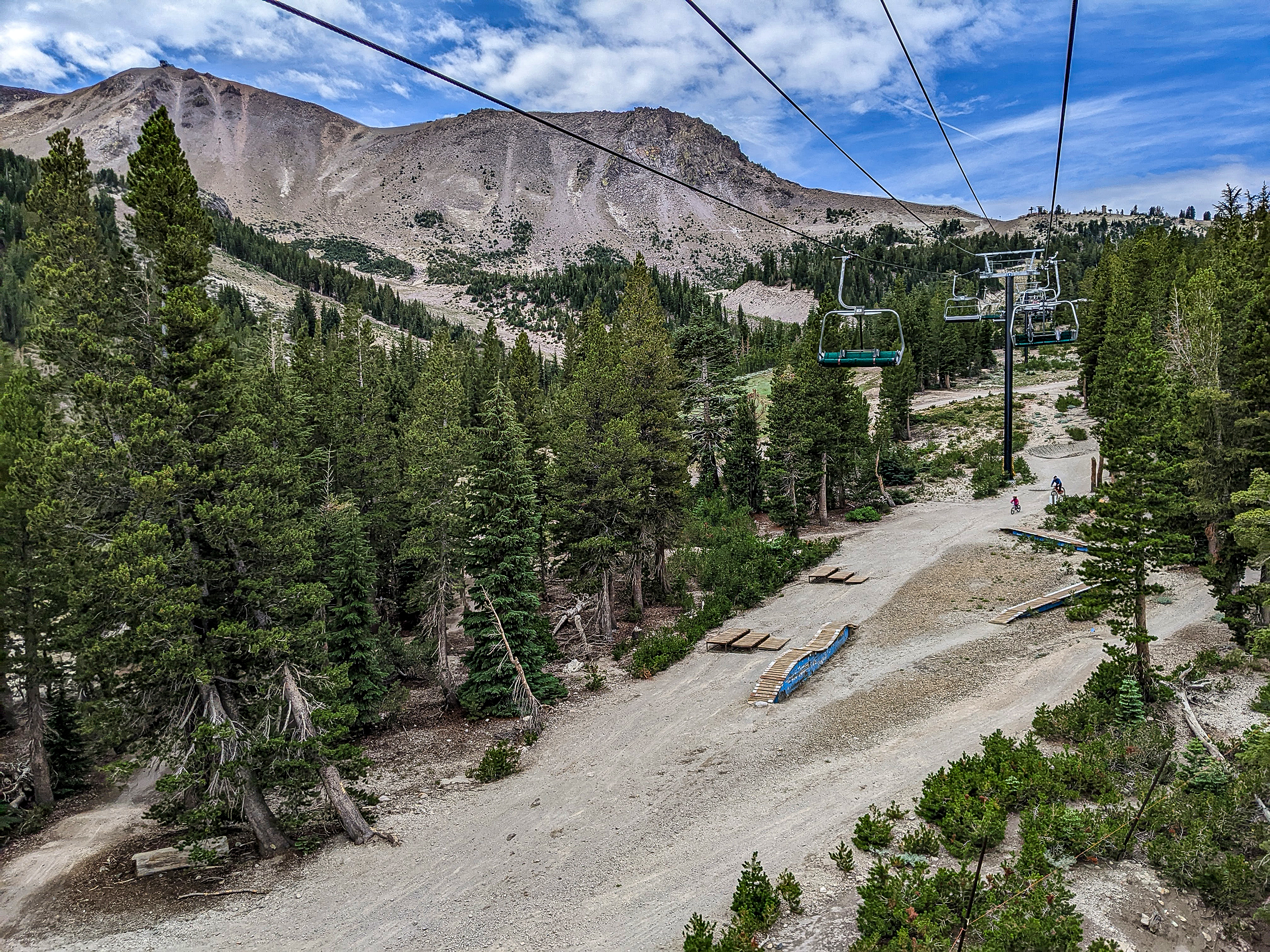
Twilight Zone Trail in the Mammoth Mountain Bike Park
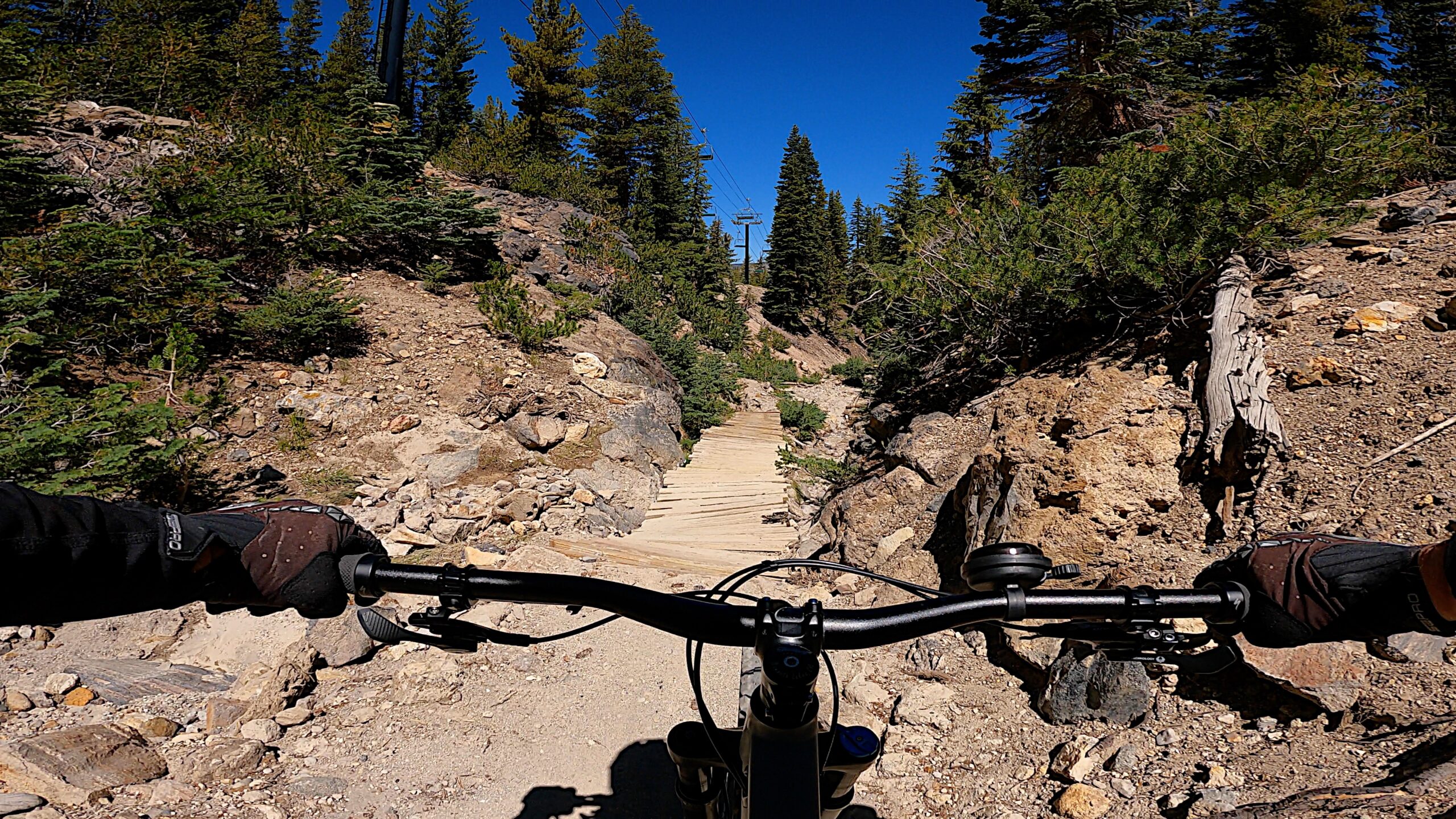
Seven Bridges
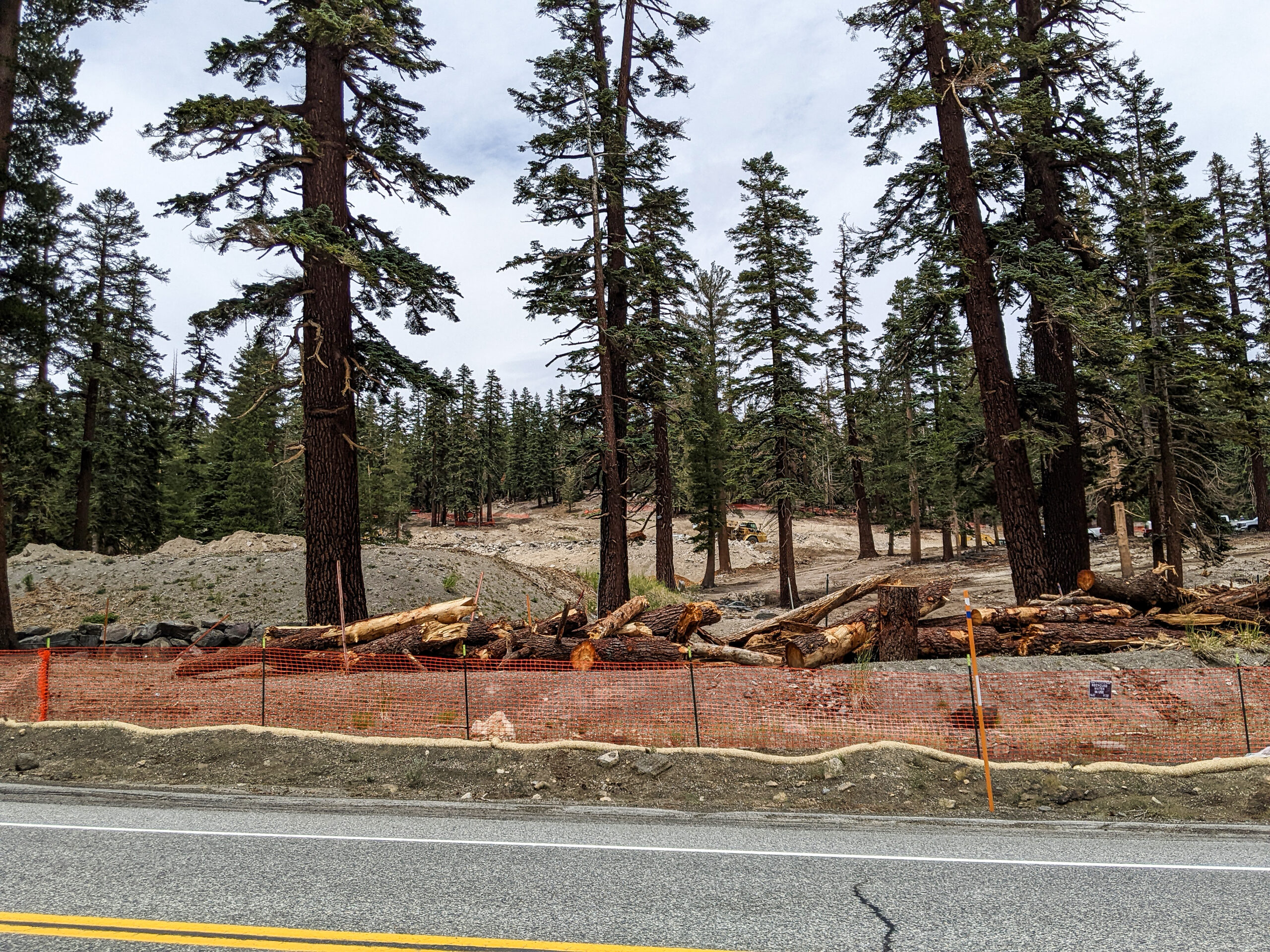
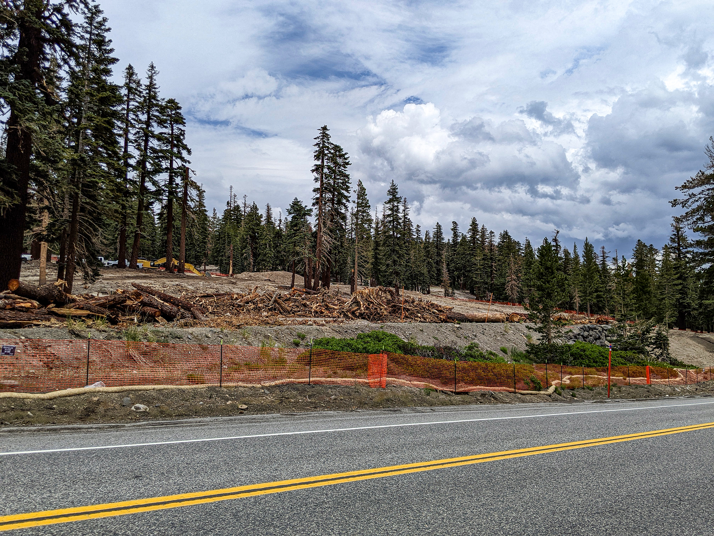
Grading going on at Wollys Tube Park
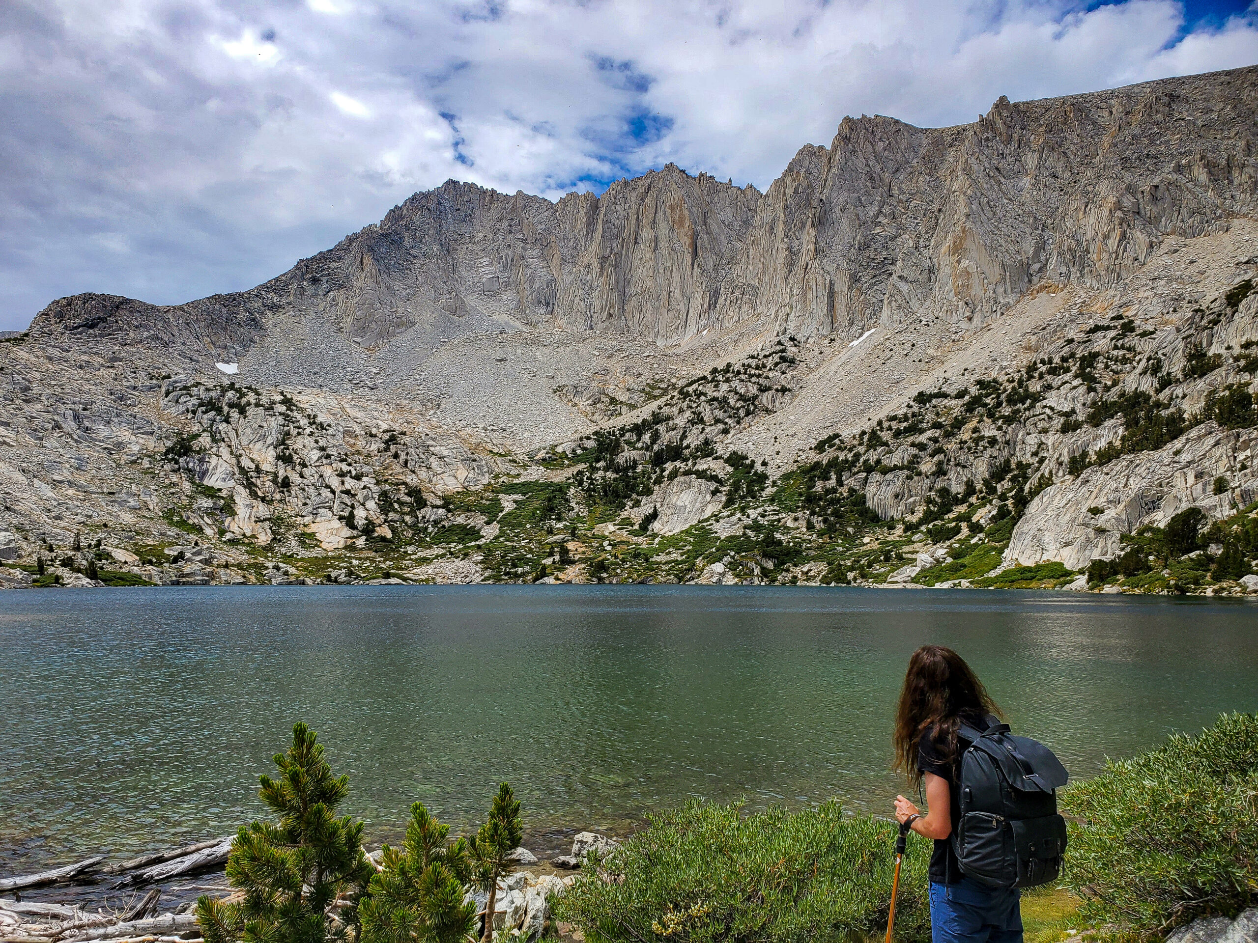
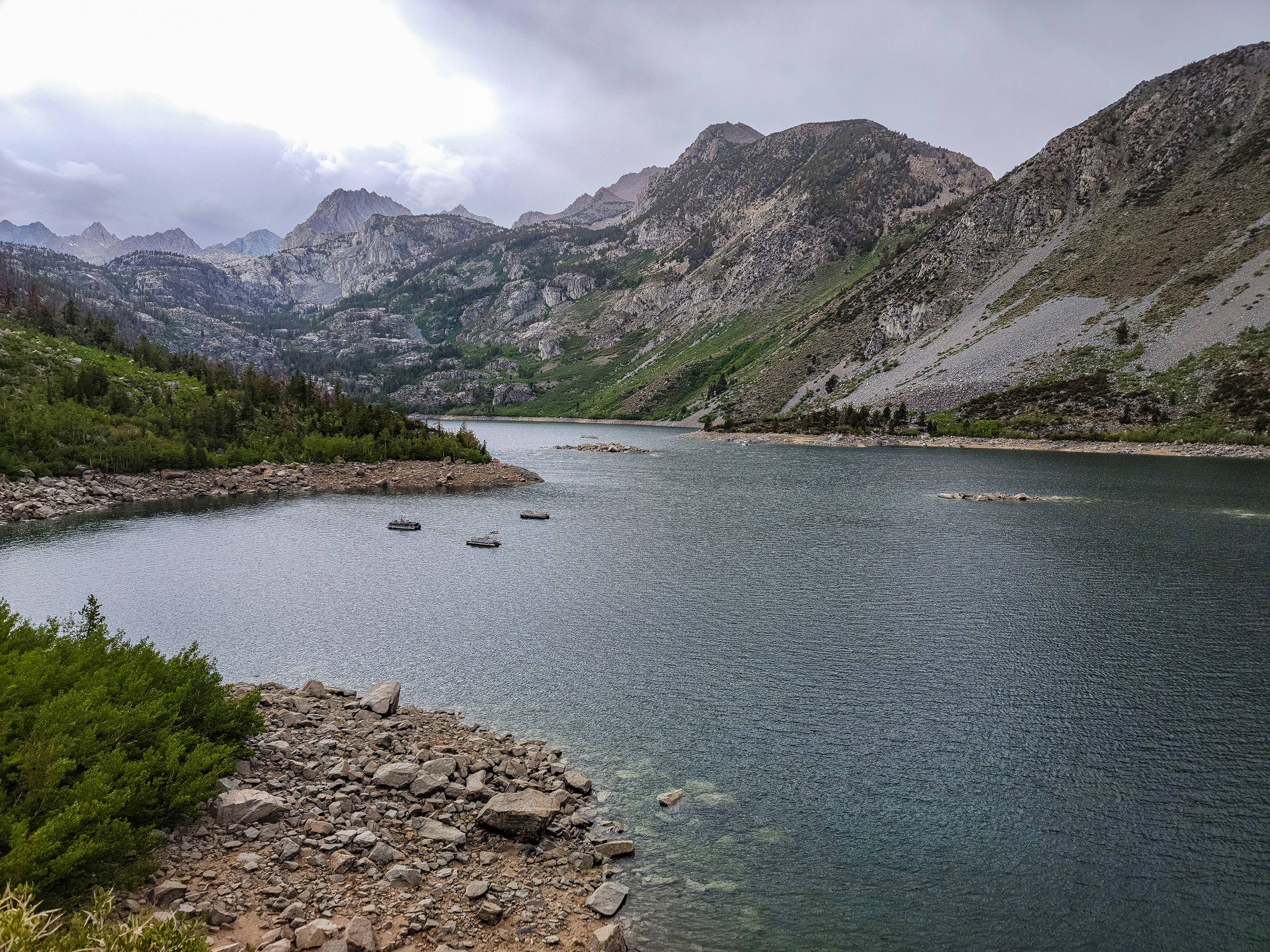
Ruby Lake Hike with Sam and Niel
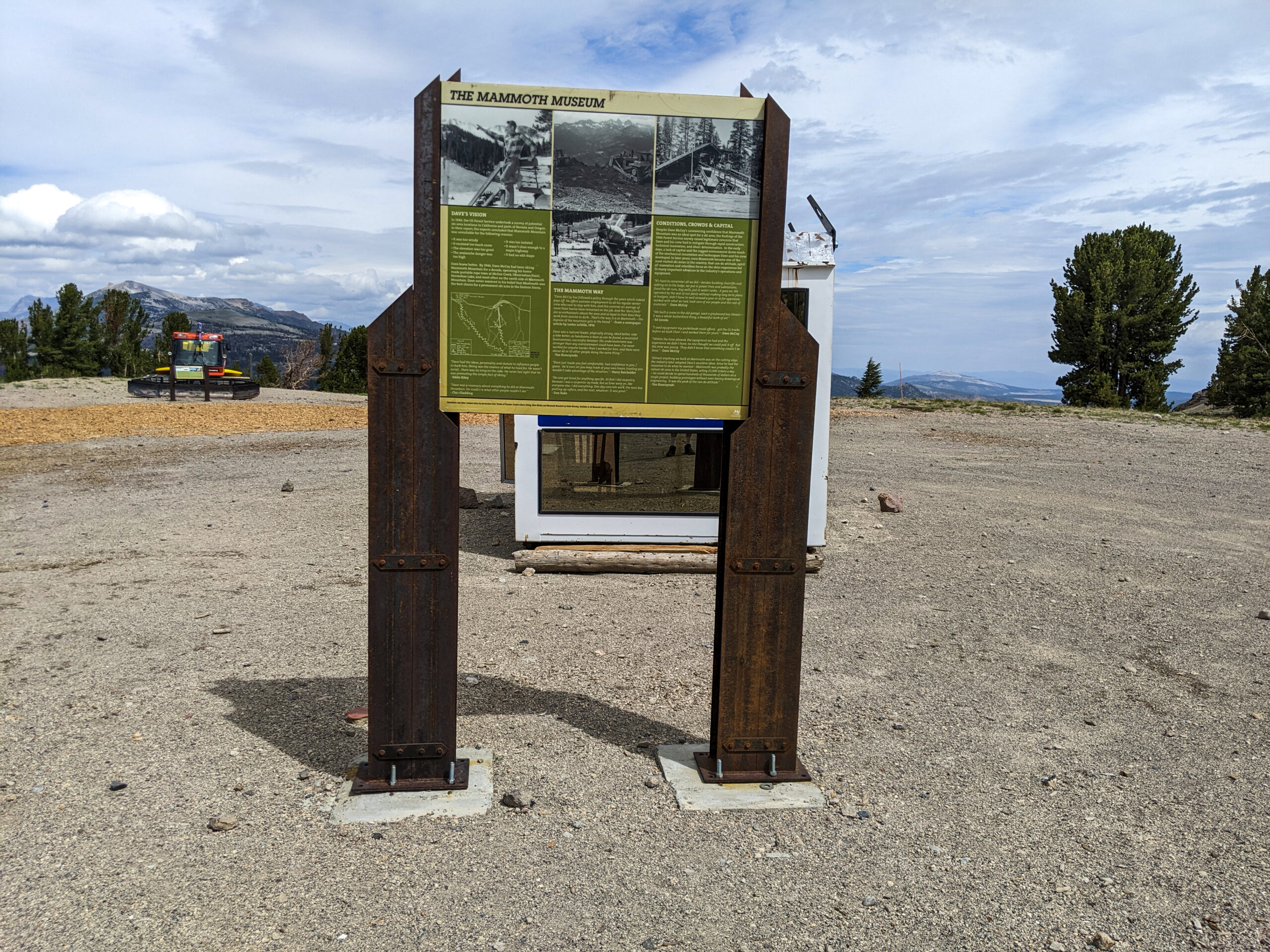
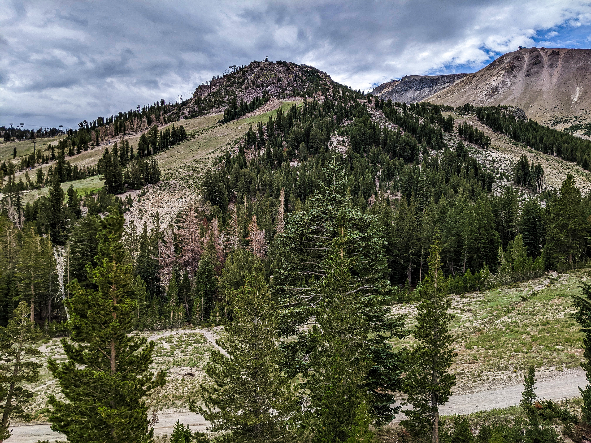
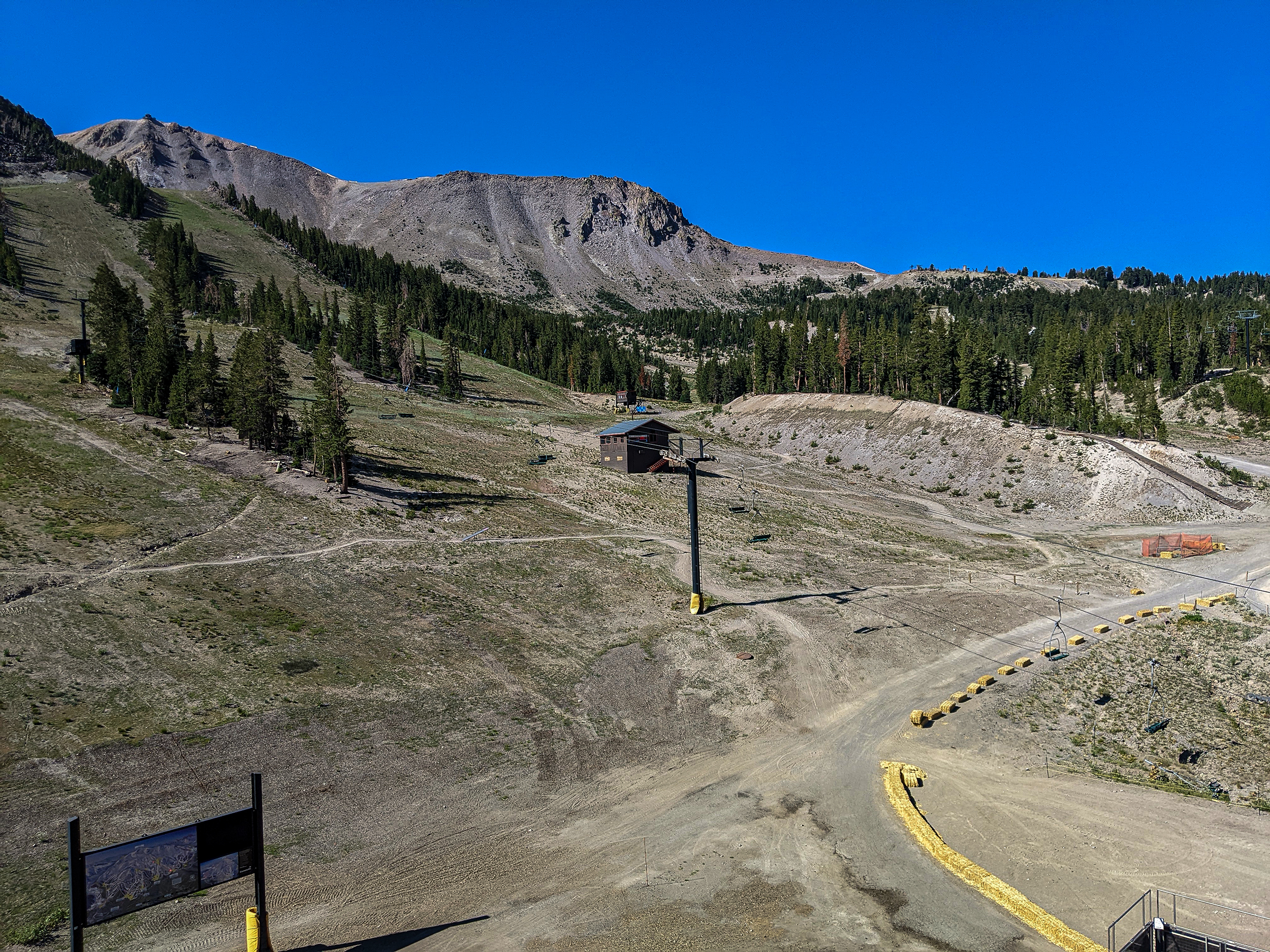
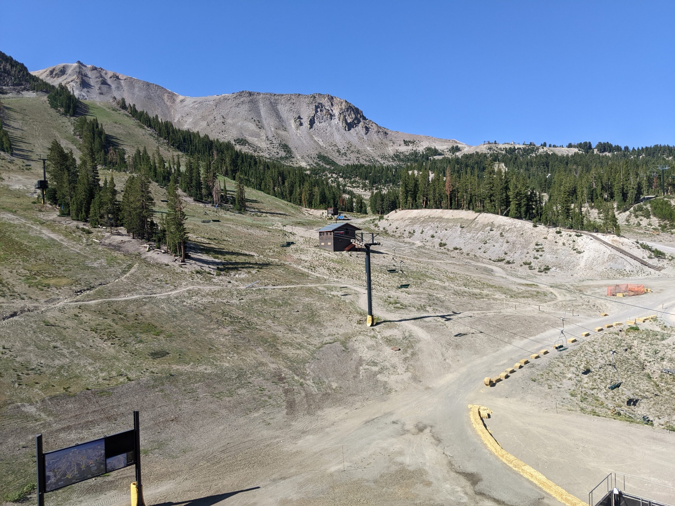
Ski Area History at MC Station
Gravy Train at Bering Straits
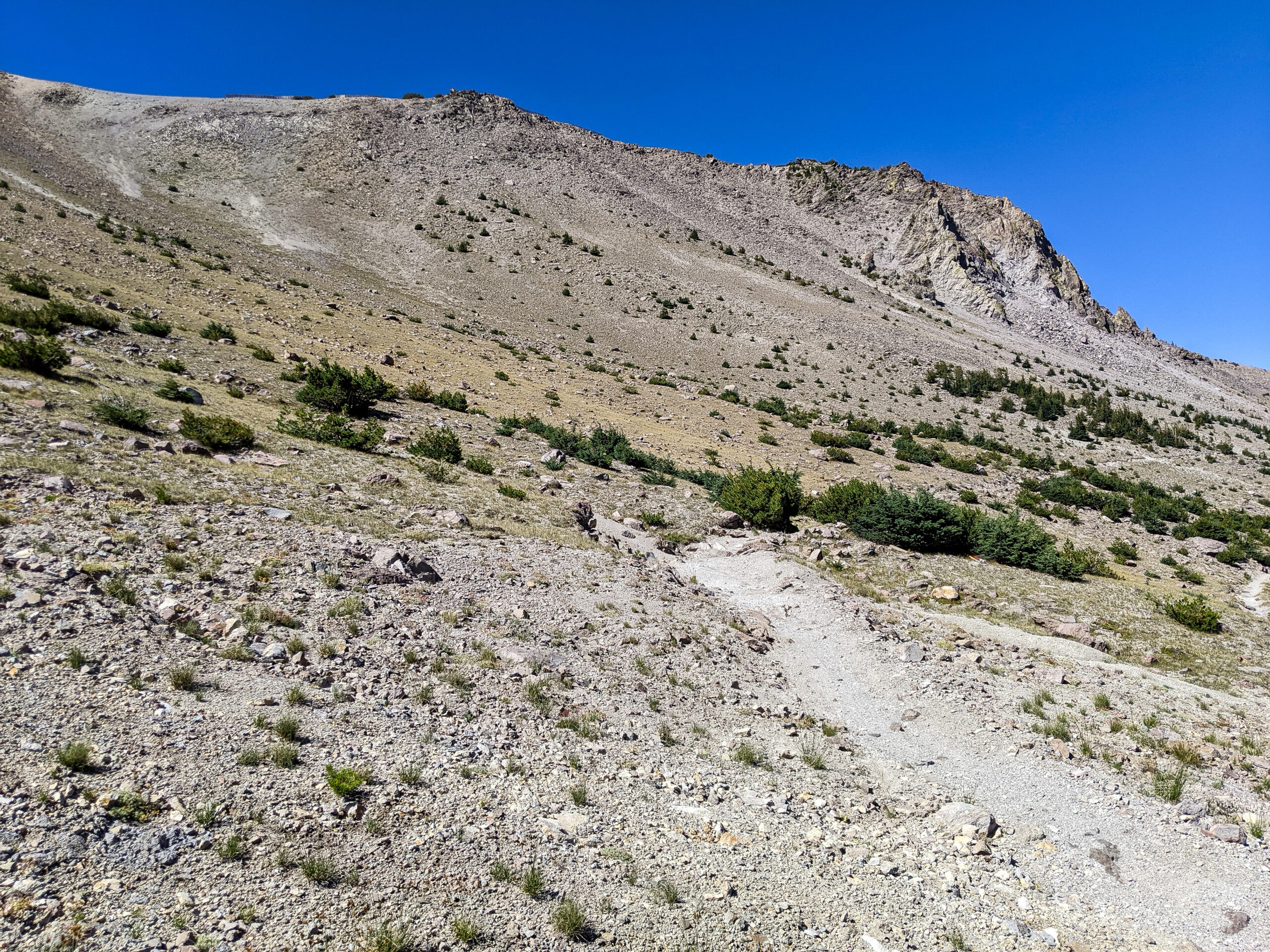
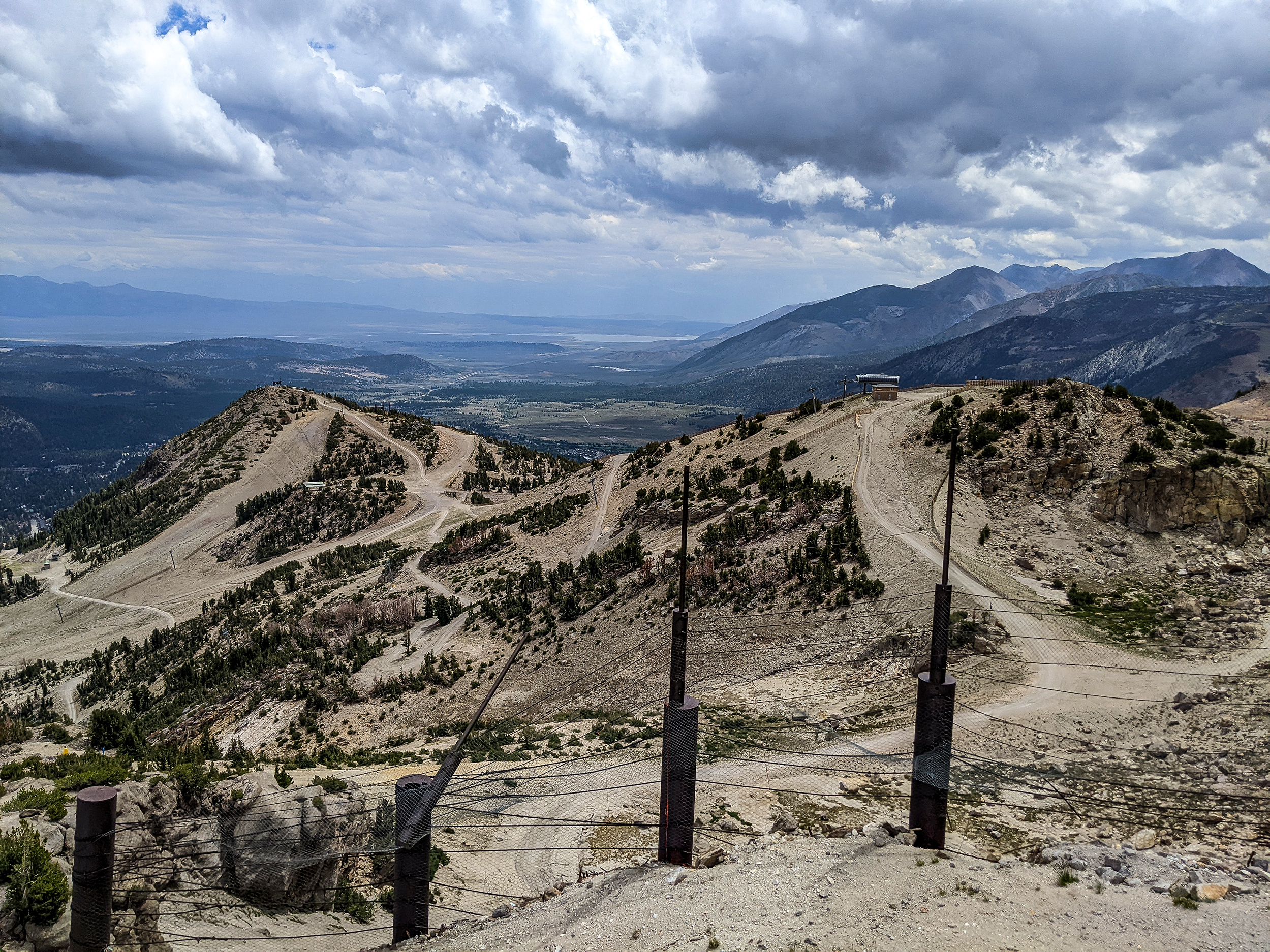
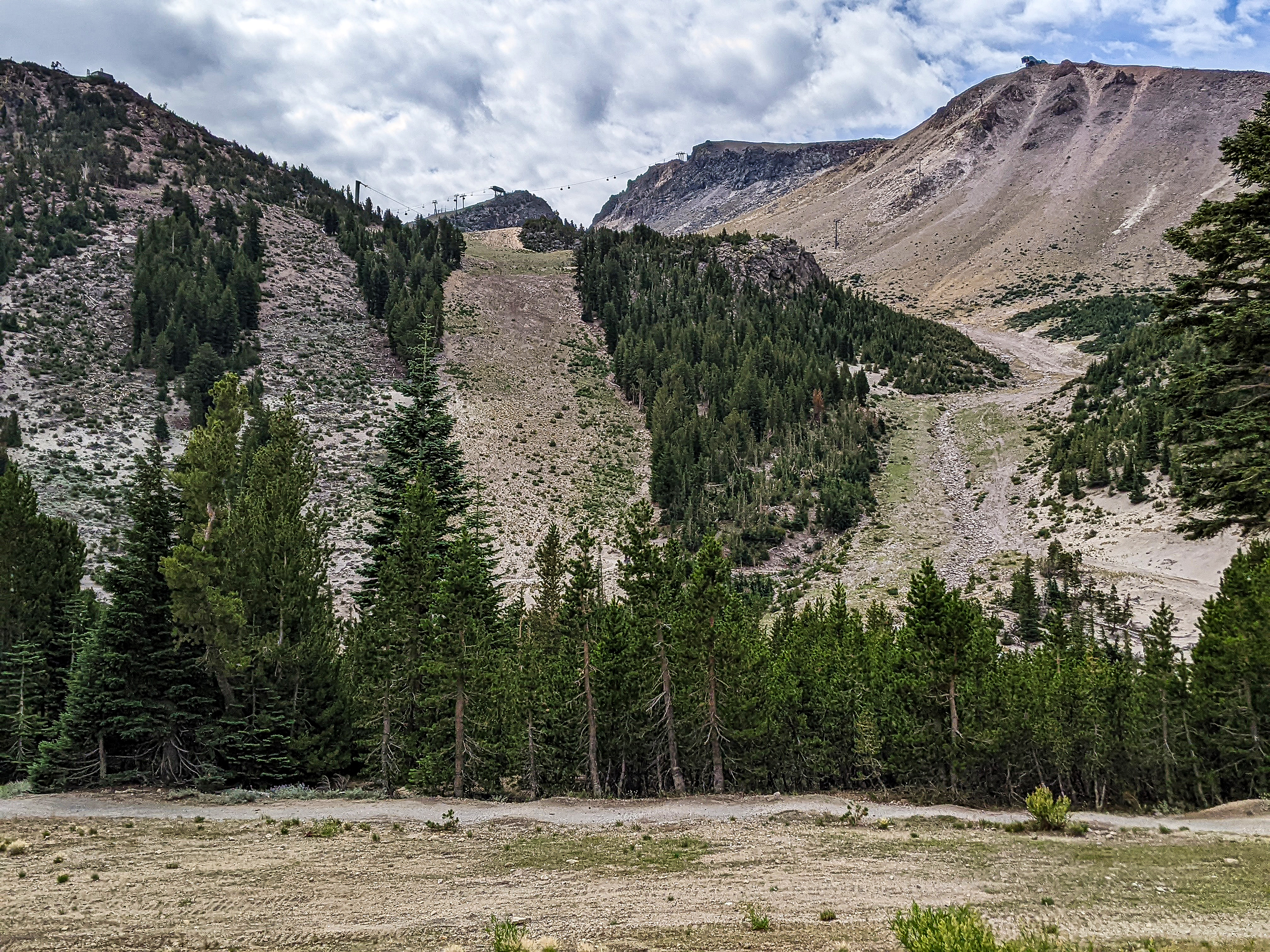
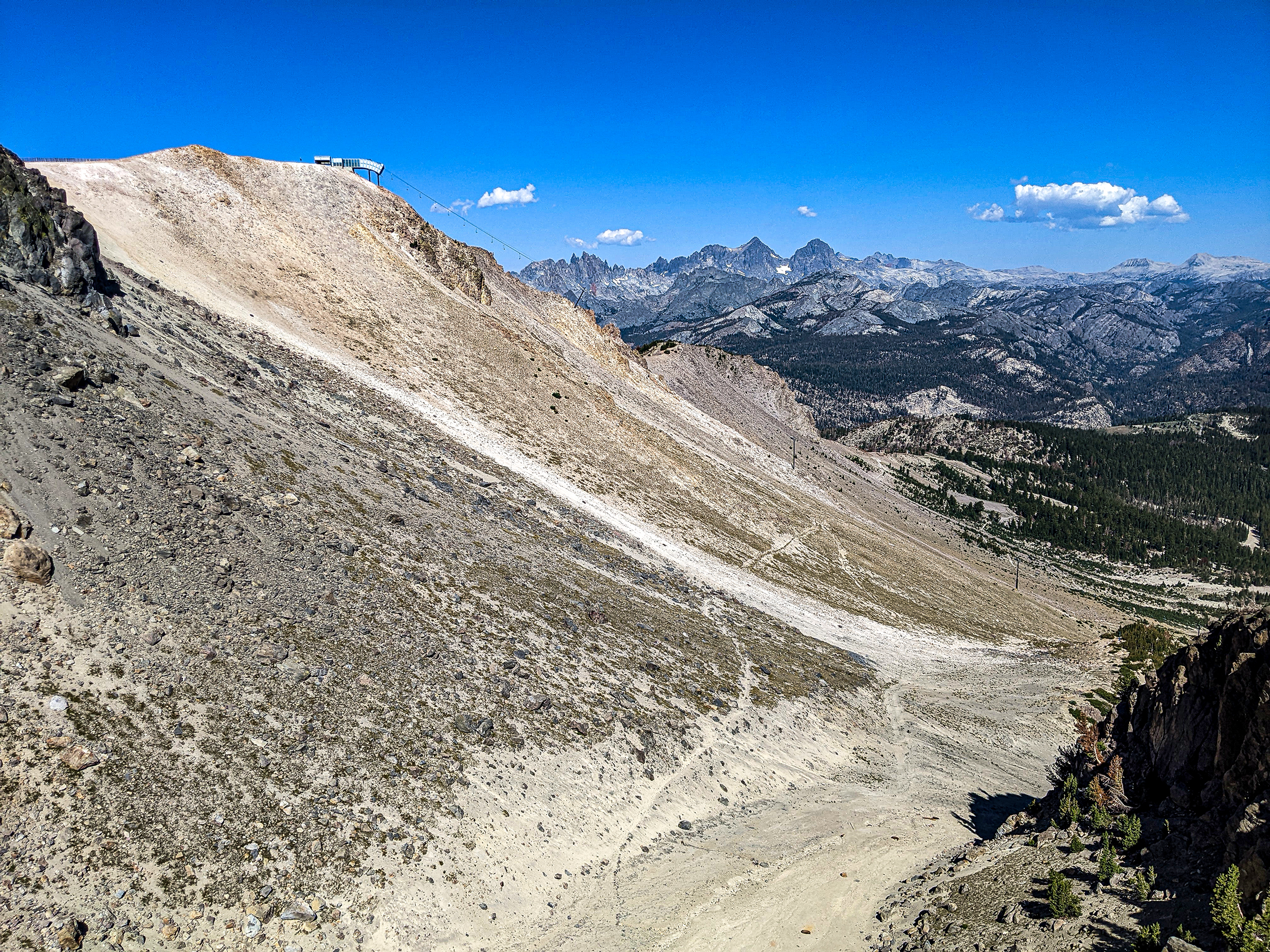
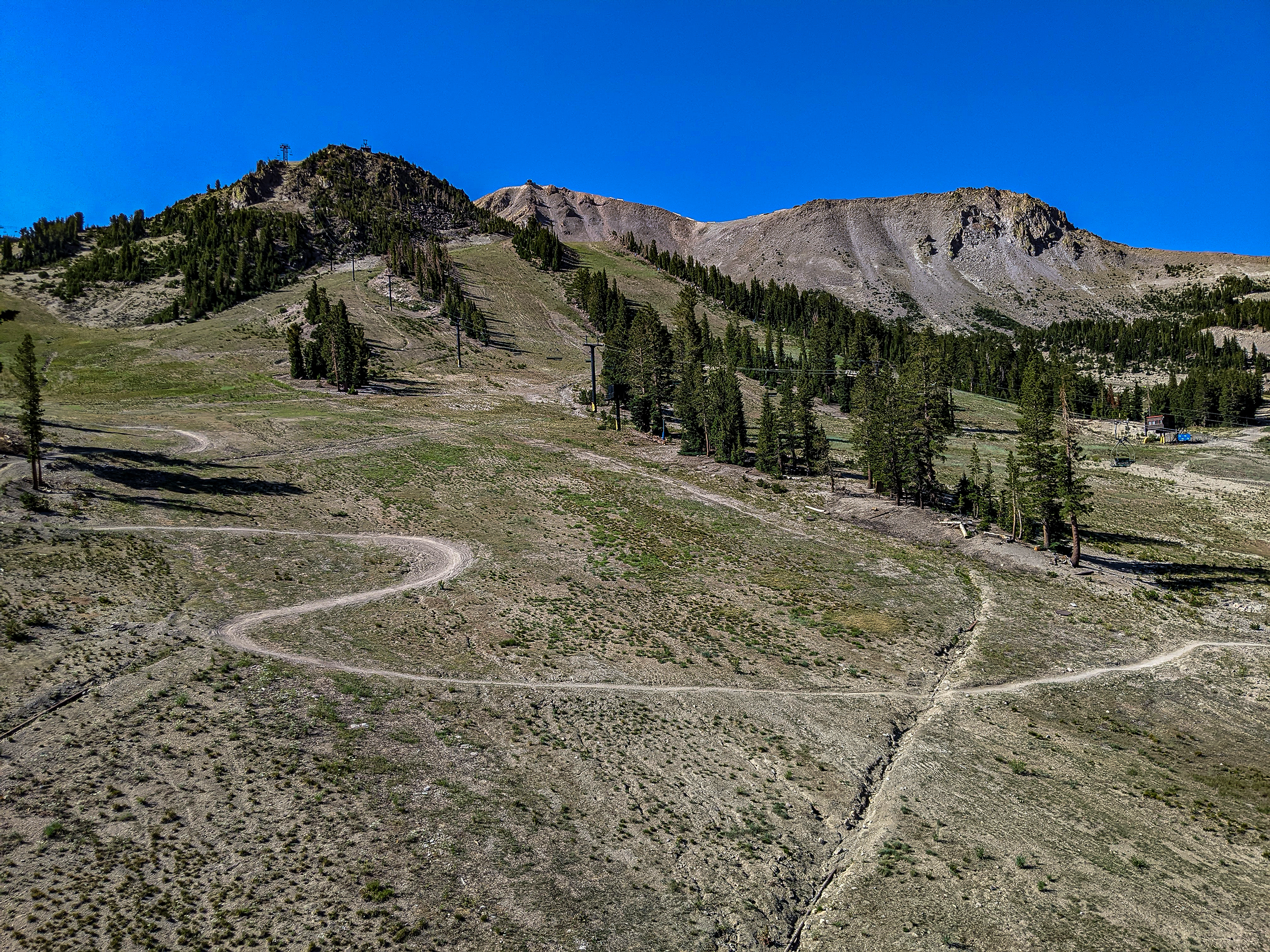
Upper Cliffs behing Mc Coy Station
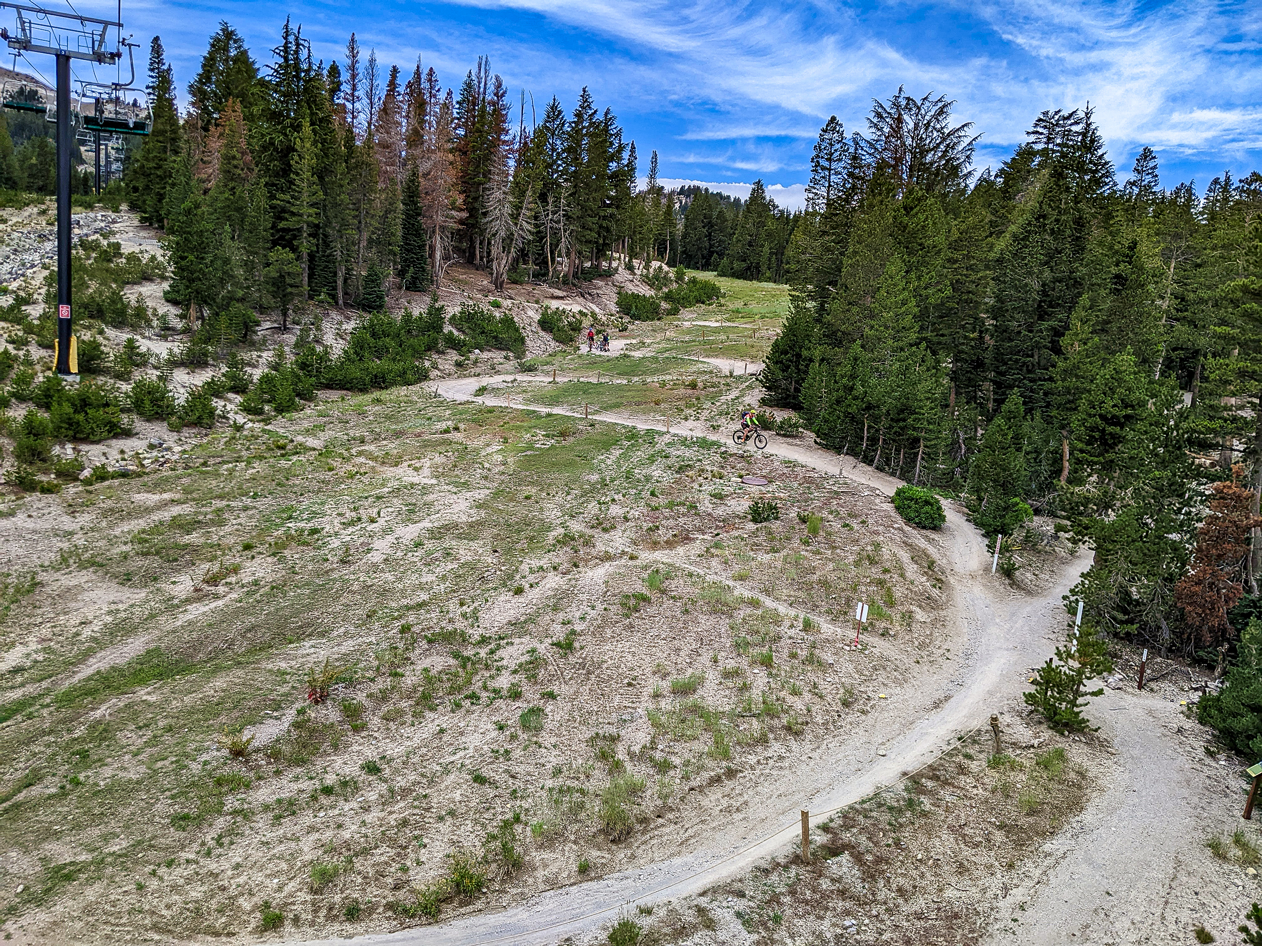
Midtown Trail Views – Mammoth Mountain Bike Park
Midtown Trail Cross Country Section as it crosses Middle Broadway
Midtown Mountain Bike Trail at Lower Broadway
Midtown Trail Rider – Roller Coaster Section
Hiking around Lake Sabrina in the rain last week. Photo from Shannon Taylor
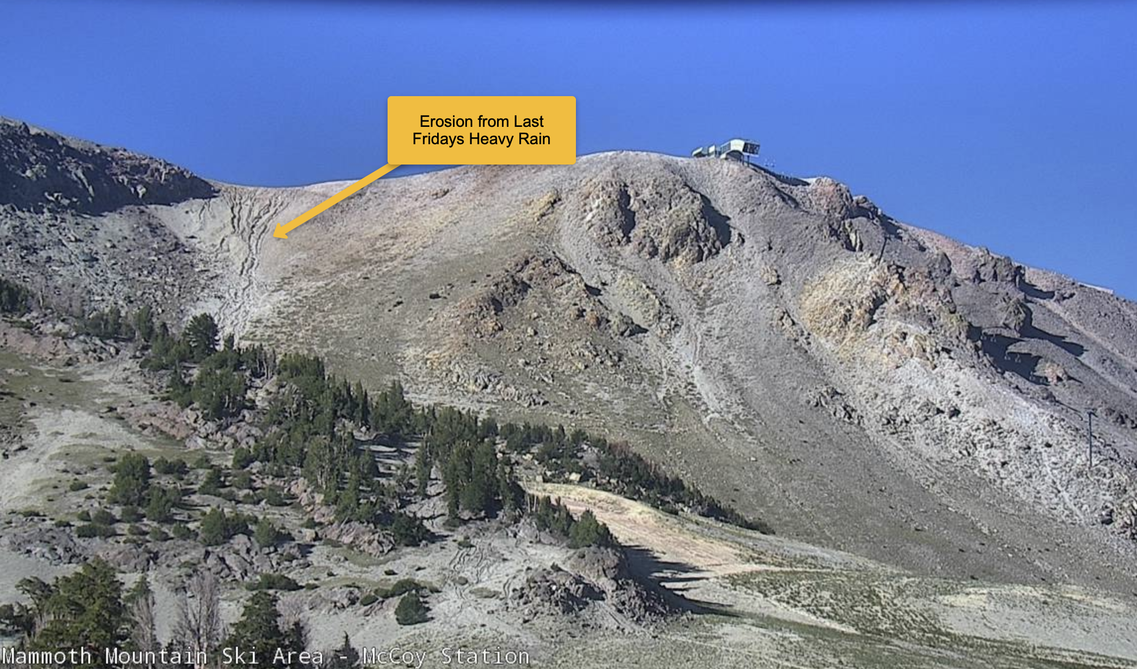
Erosion Lines on Cornice Bowl
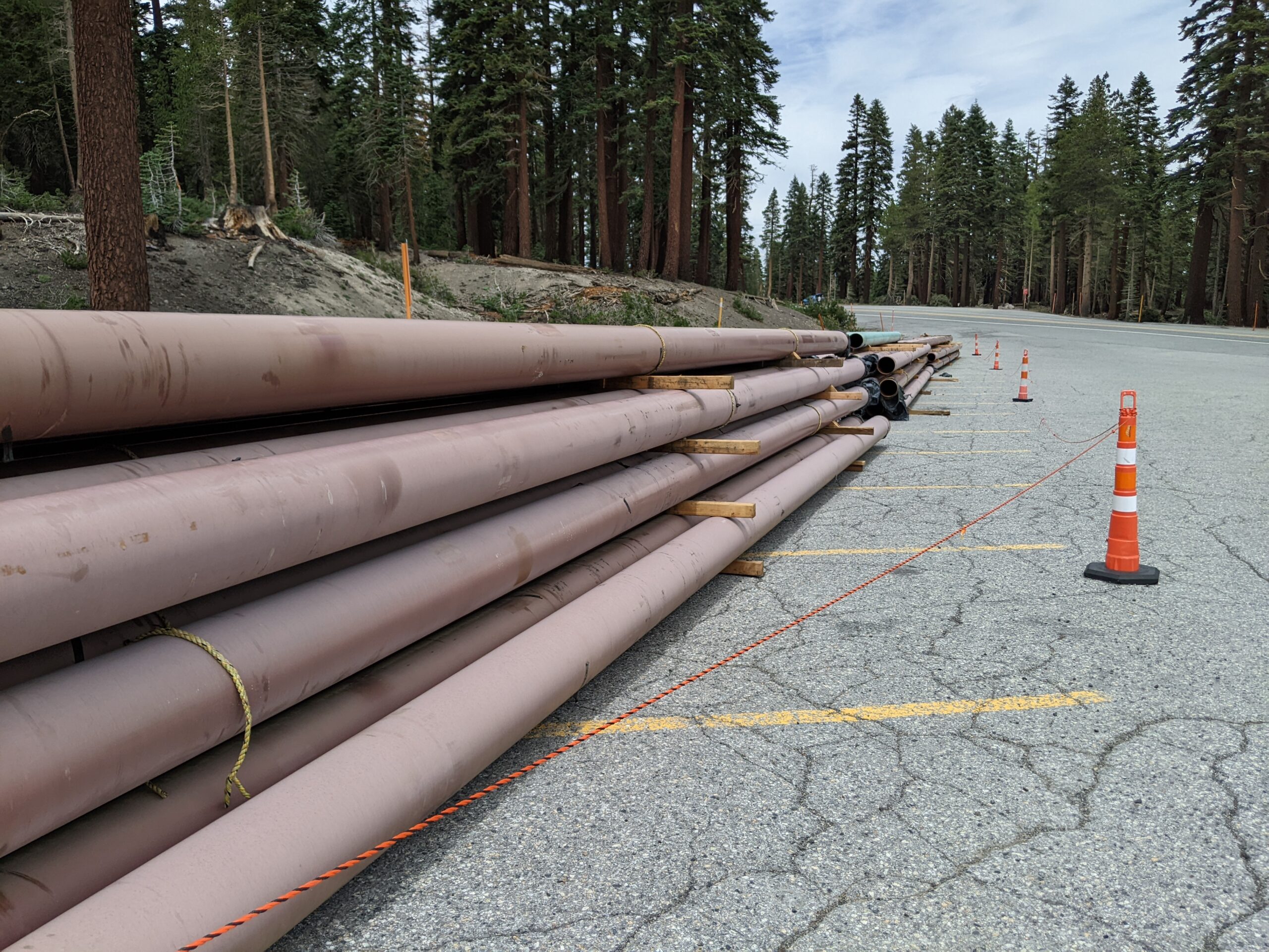
New Snow Making Piping at the Stump Alley Parking Lot
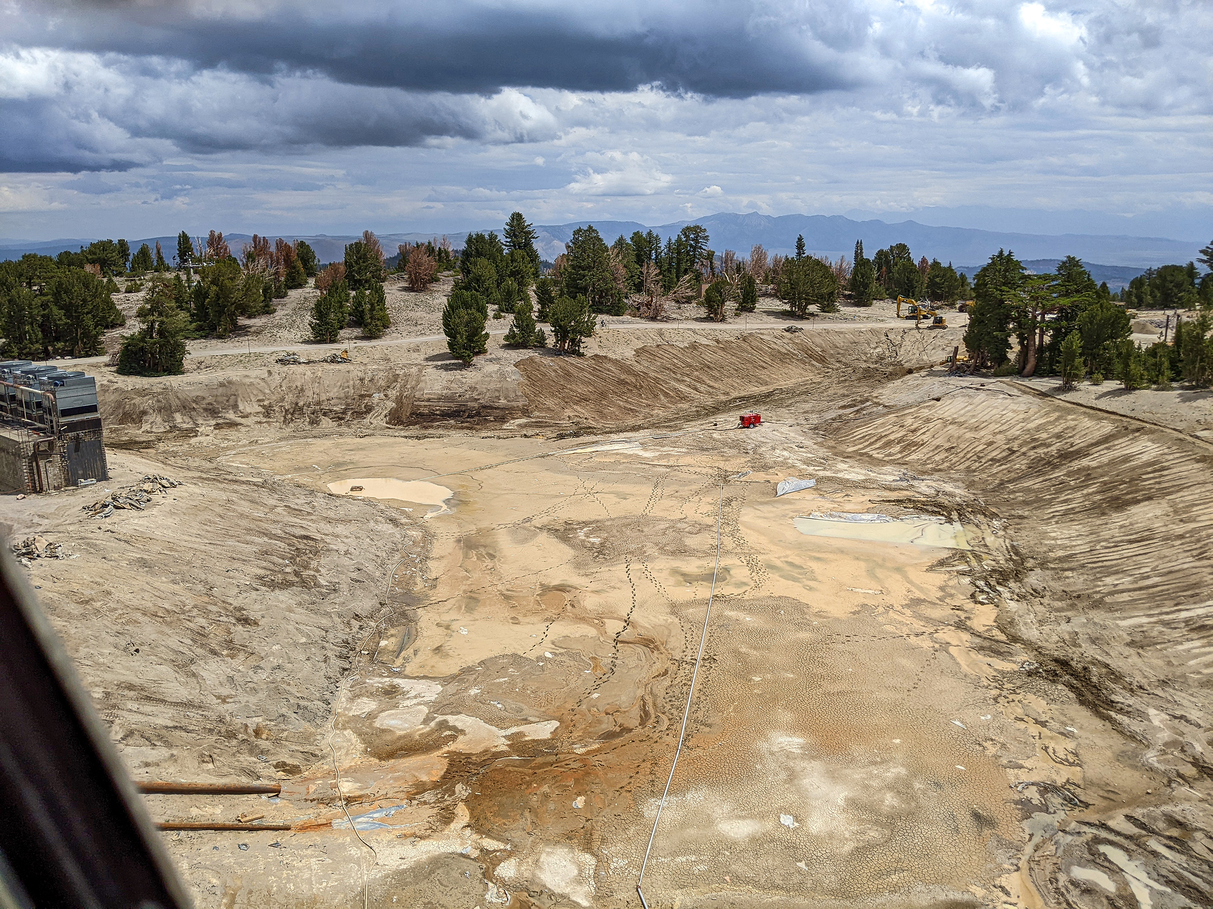
Upgrading the Snow making Pond at MC Coy Station.
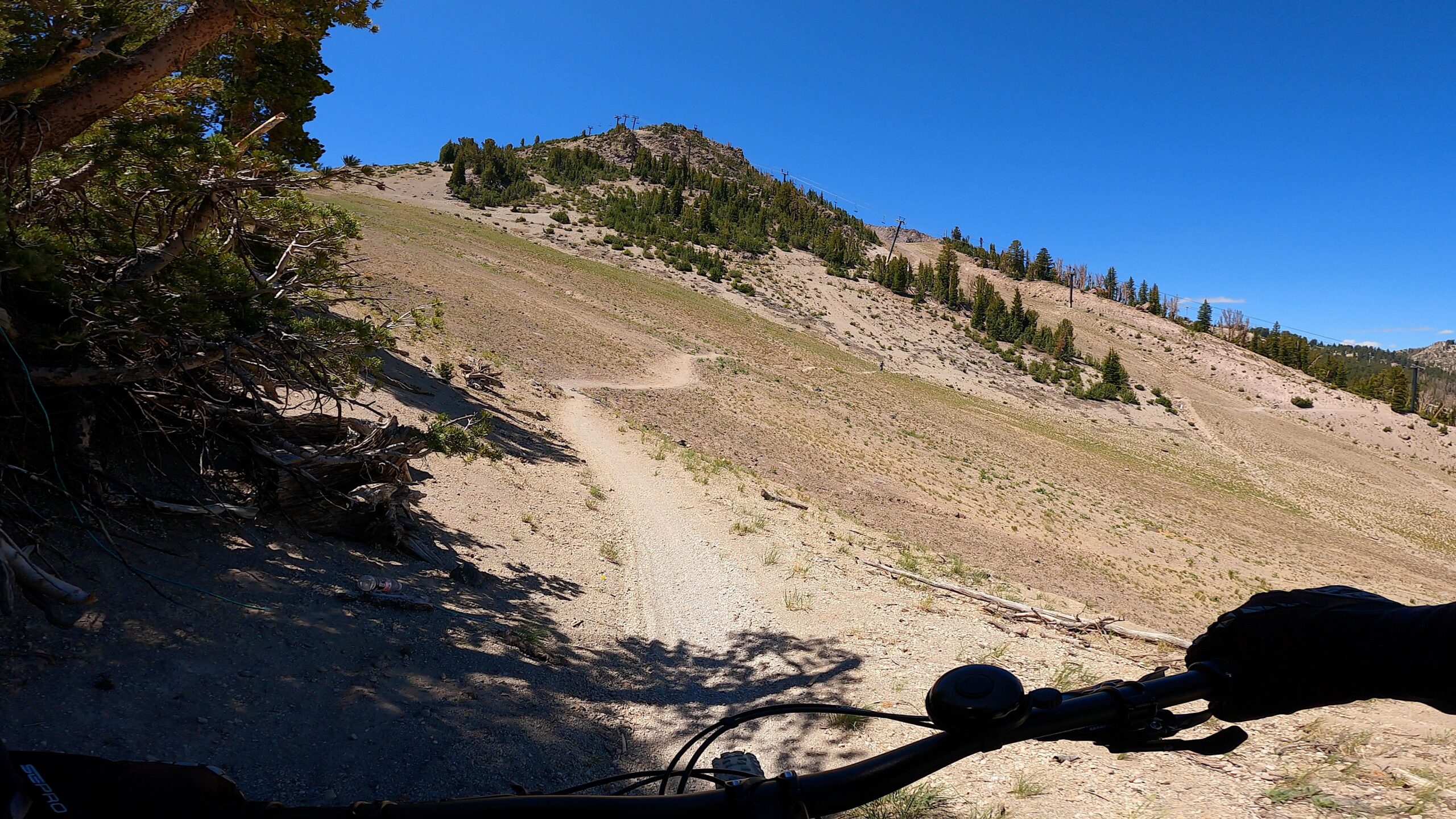
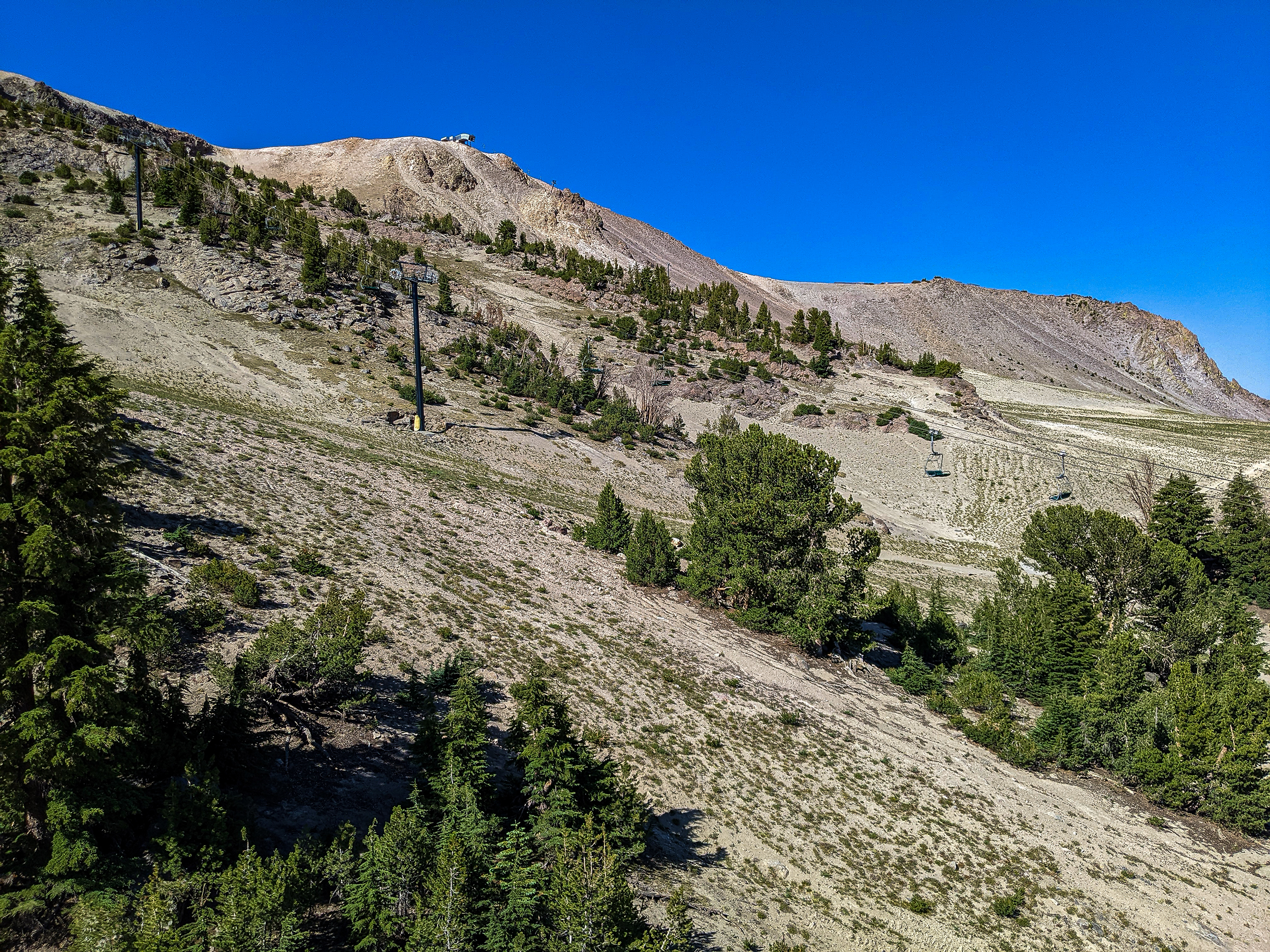
Downhill from off of Chair 11
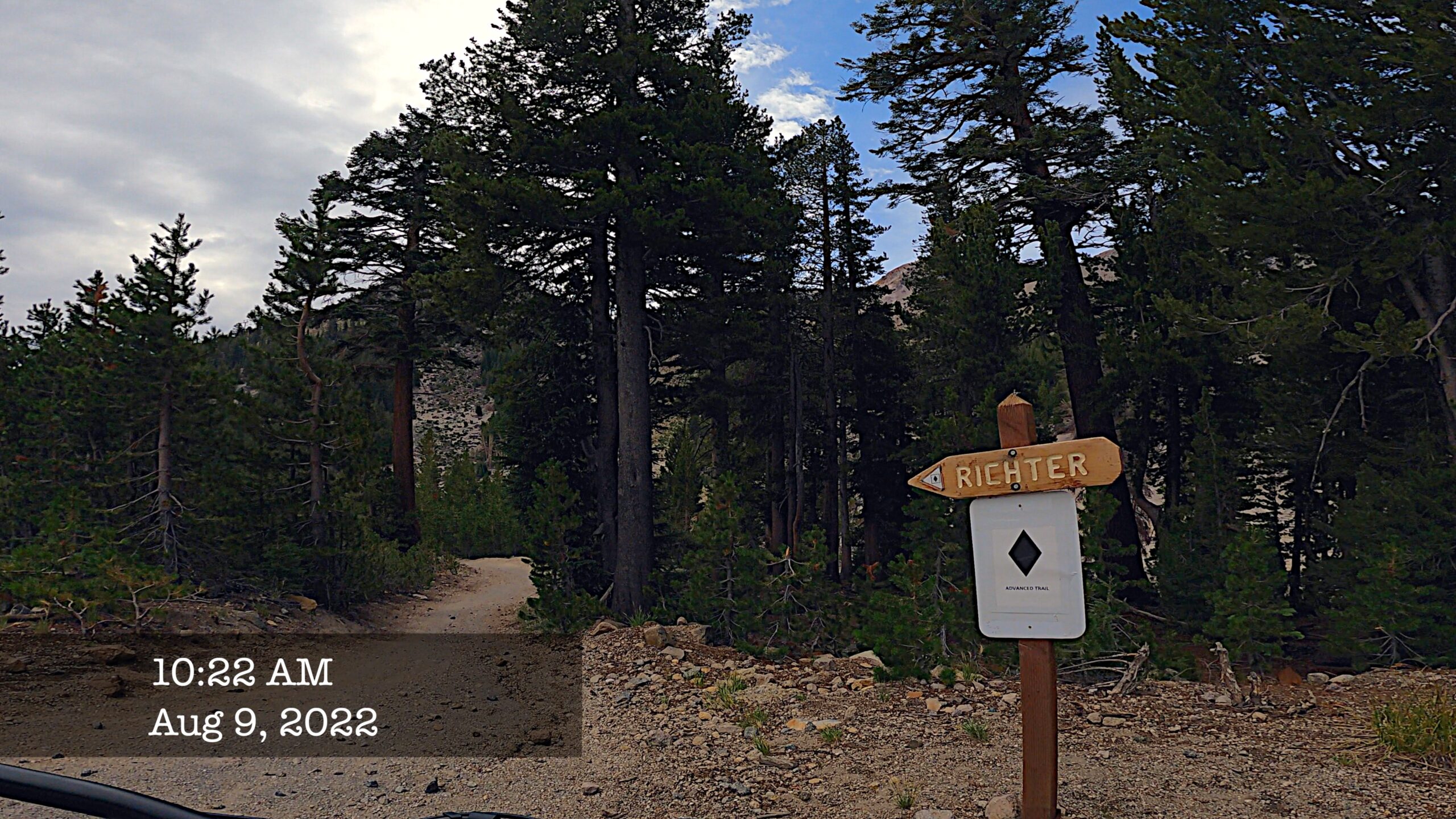
Riding up discovery chair for ride down DiscoTech. This is a great warm up run for the kids and adults as well. After a couple laps jump right into Richter and you will know if you’re ready to ride down from MC Coy Station on Mid Town. #mammothsnowman #discovermammoth #mammothmountain
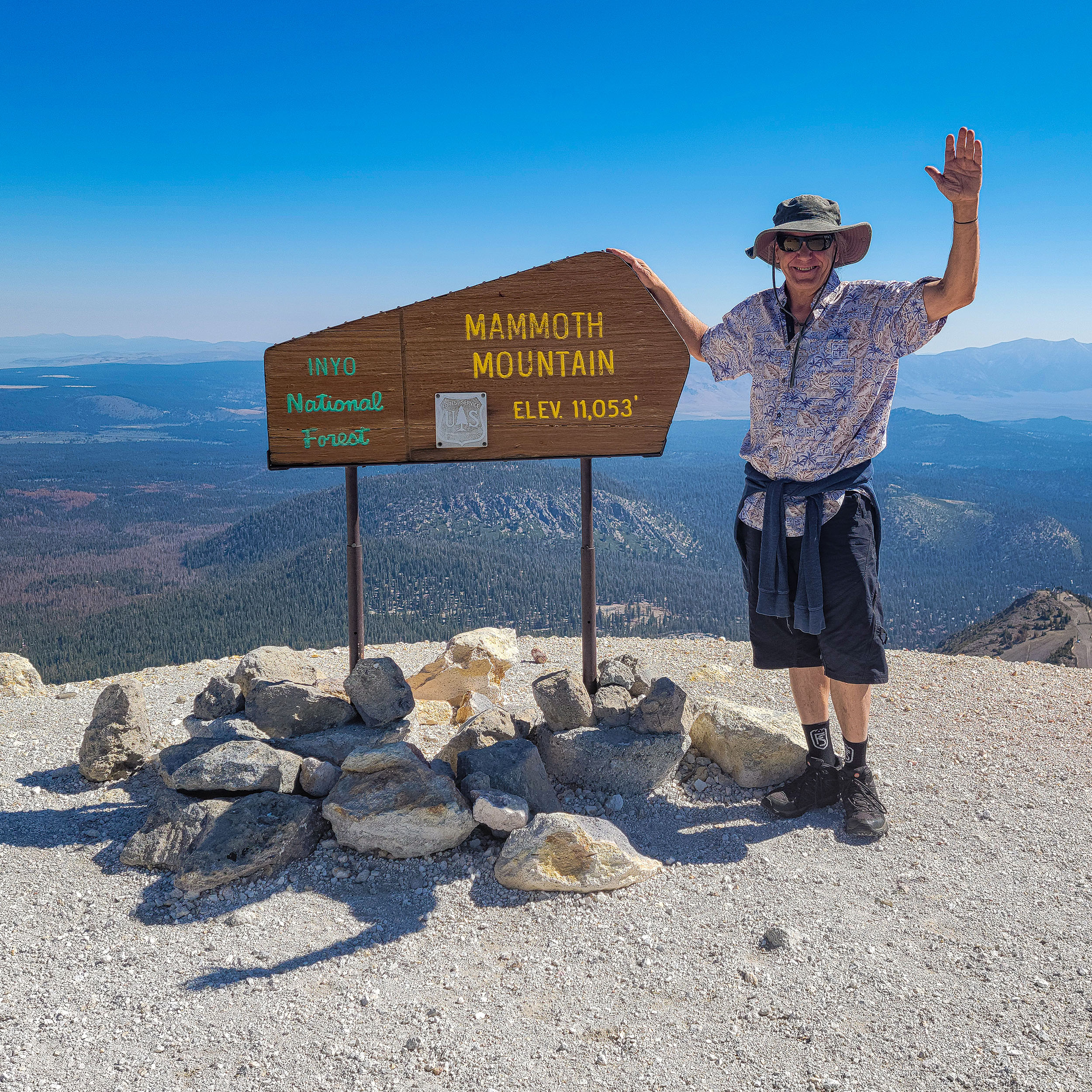
The original Mammoth Mountain sign still sits smack dab at the top at 11,053 Feet. You will find this sign just behind the top station. To reach the sign head to the back door and deck at the interpretive center once you reach the summit. #mammothsnowman #discovermammoth #mammothmountain
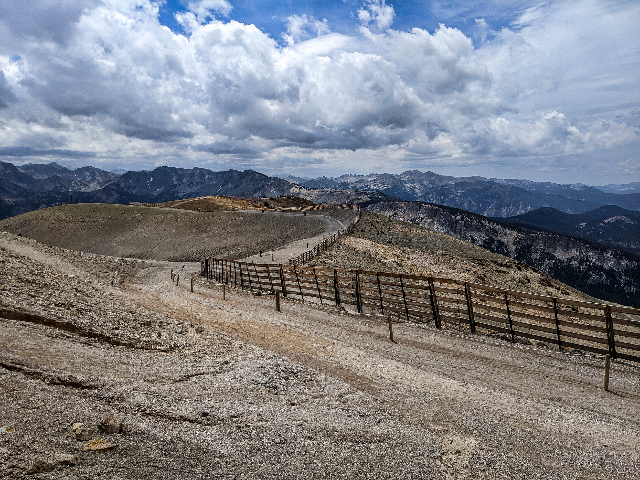
Top of the World Cliff Lines at 11,053 feet. During a big winter you can jump off these rock Cliff faces. In the Summer they offer up colors of beauty under the monsoonal skies. Right at the top you can see the original top of Mammoth sign. #mammothsnowman #discovermammoth #mammothmountain
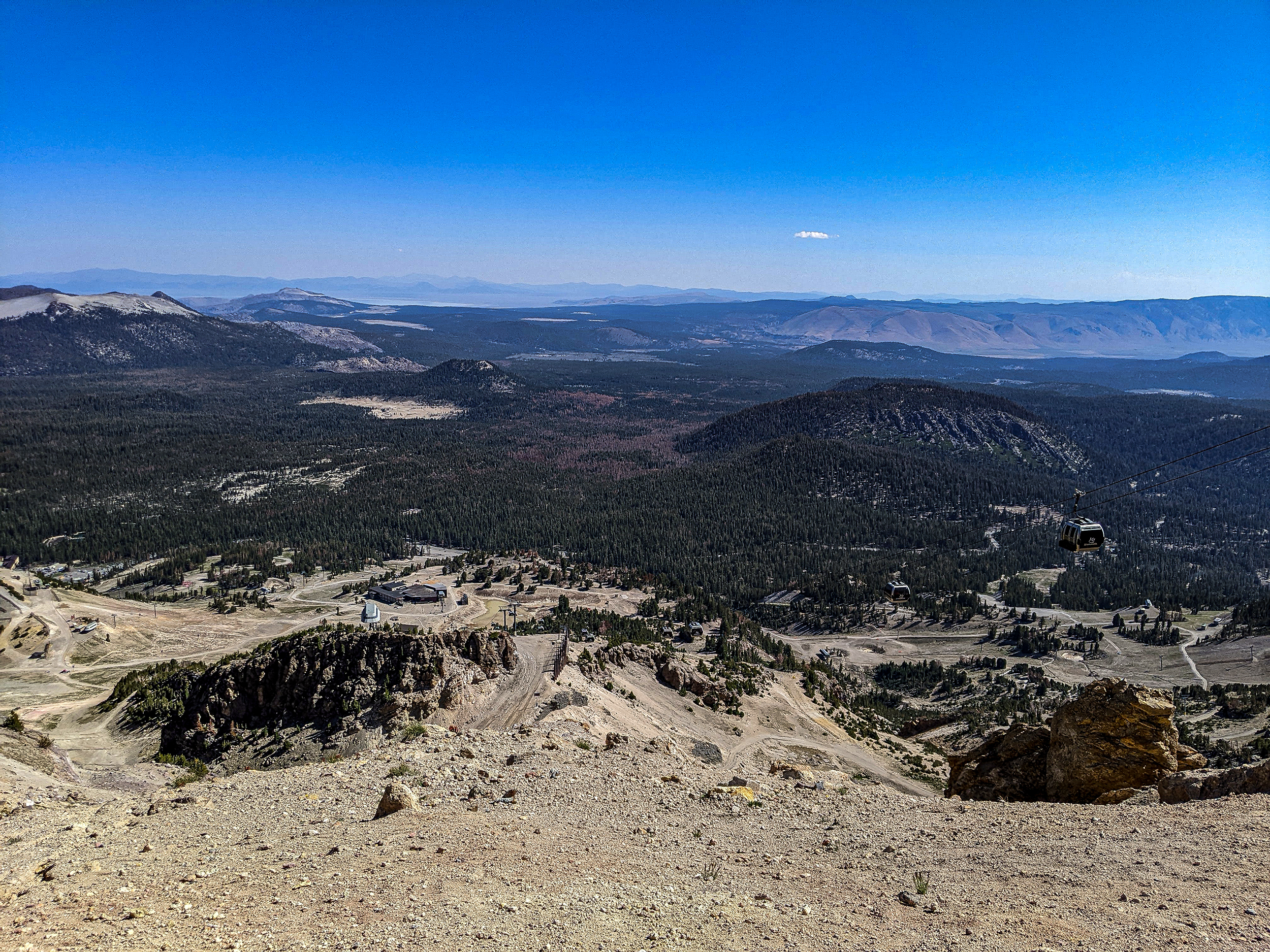
This photo is from the very top of Mammoth Mountain, you can see the Mammoth Lakes Basin, the Sherwins and the Central Sierra Back Country. Up closer the road you see take you to off the top, skid marks and during the Winter Daves Run to the left in the photo. #mammothsnowman #discovermammoth #mammothmountain
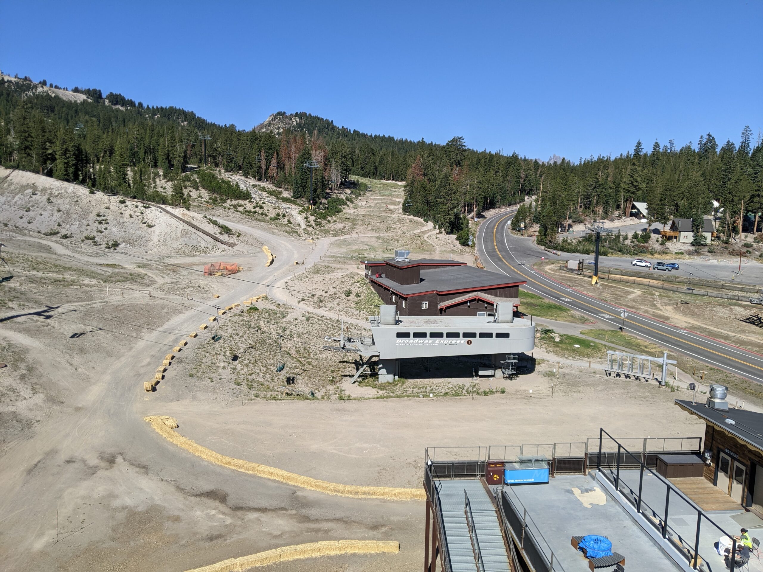
Take the Scenic Gondola ride on the down hill side. You can see the top of Chair 5 and all the way down to the town of Mammoth Lakes. Way off in the back is Crowley. #mammothsnowman #discovermammoth #mammothmountain
Woolly’s Tube Park is getting an upgrade with a massive expansion. Look for more sledding lanes that run much longer then in the past. Eventually this will be the new home of the adventure center and all the fun mountain games they have up at Main Lodge. #mammothsnowman #discovermammoth #mammothmountain
A view of Lincoln Mountain from Davidson St
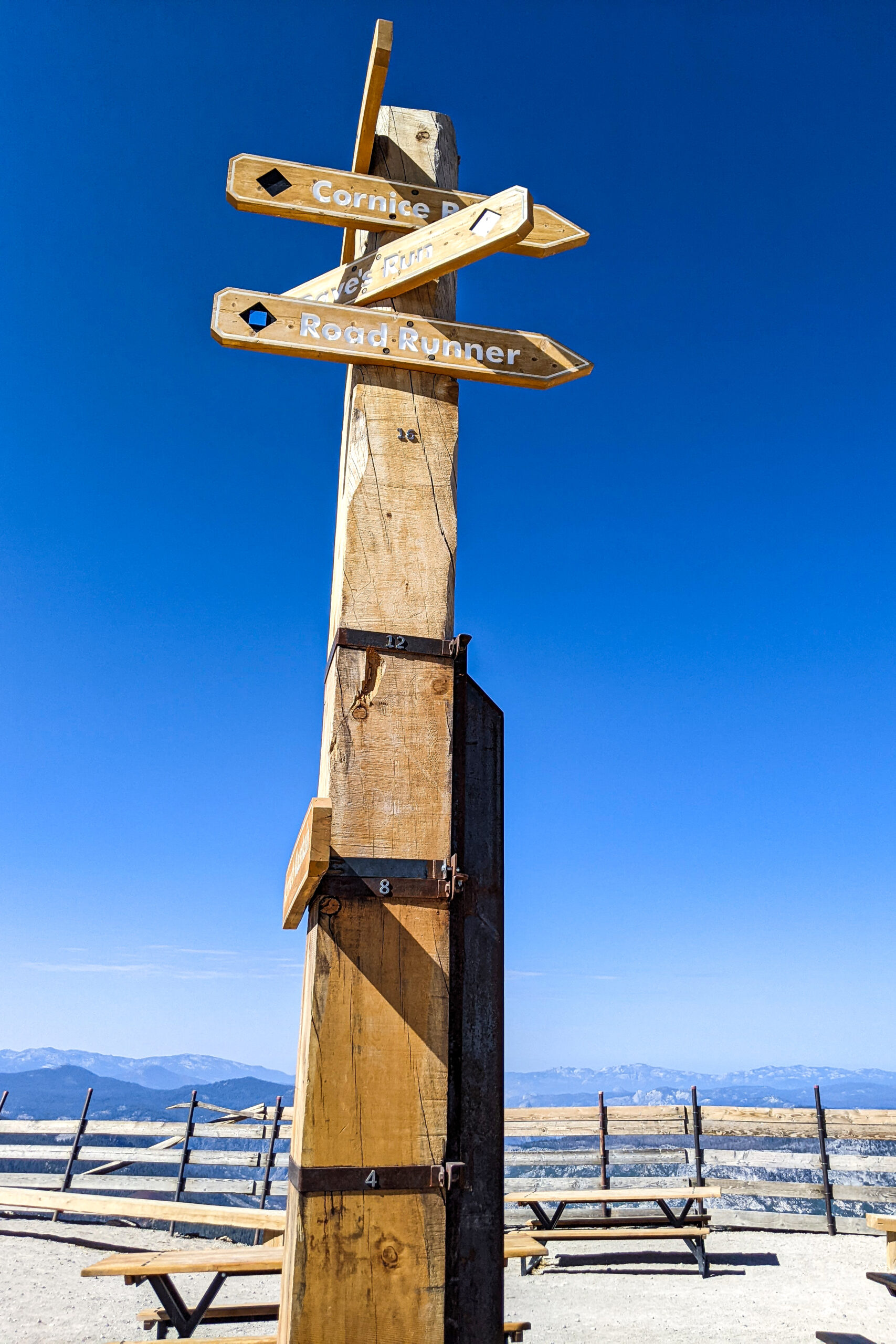
Road to Daves Run
From from the Upper Cliffs
Terrys Winter Run on August
The Mountain is looking green early August of 2022
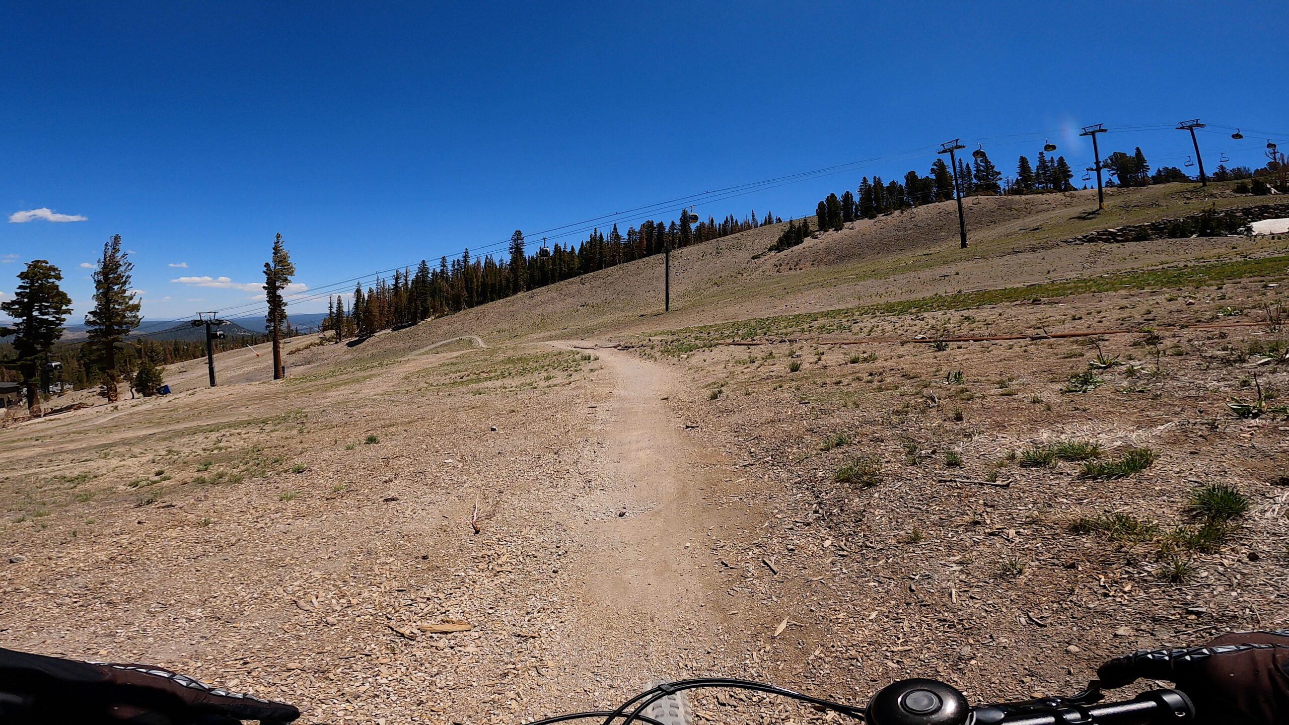
Lodgepole Run by Chair 12
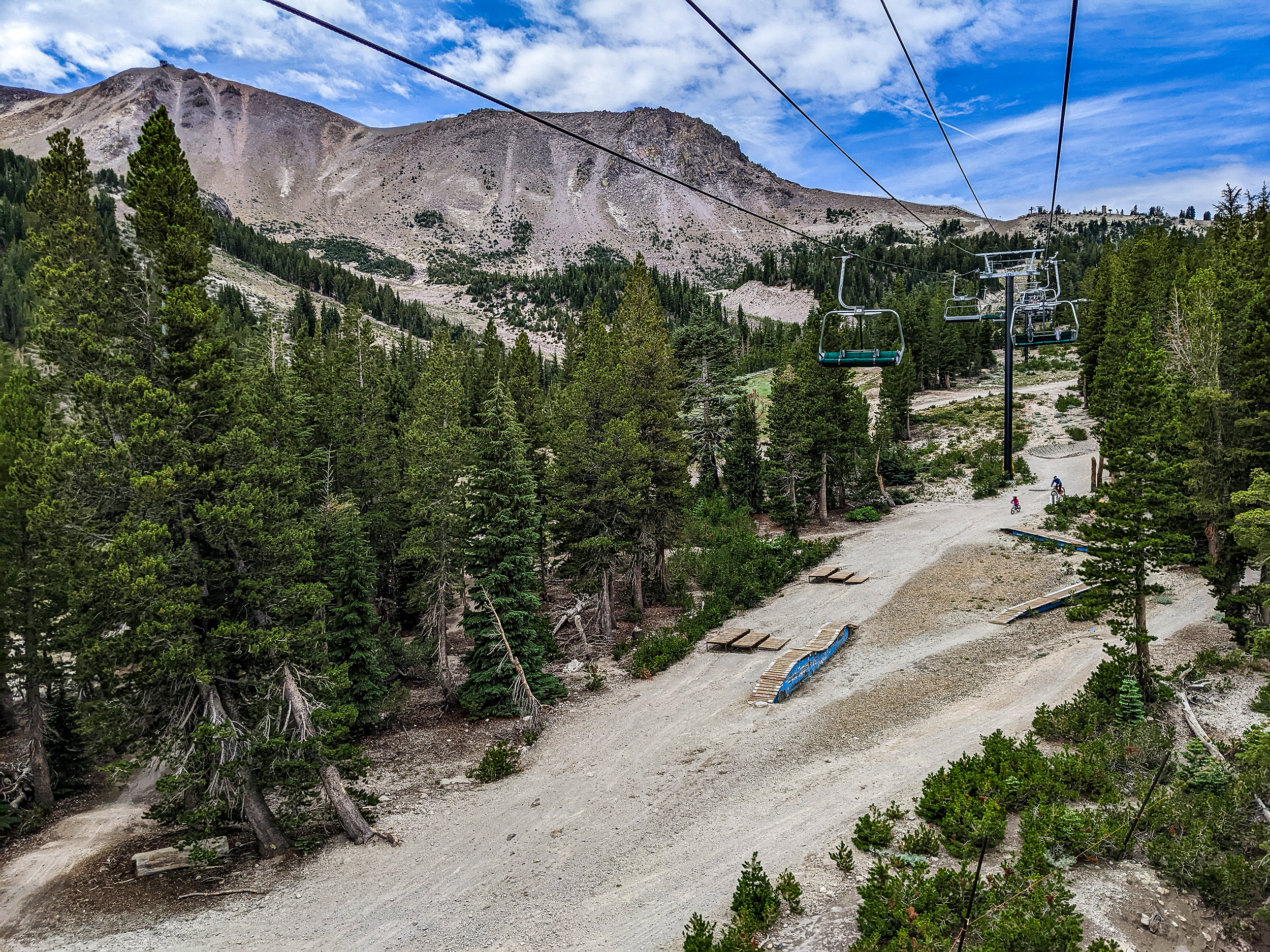
Lower Discotech Mammoth Mountain
Updating the Snowmaking Pond
Discovery Chair
Reds Lake
Looking out at chair 23 while on a Scenic Gondolla Ride.
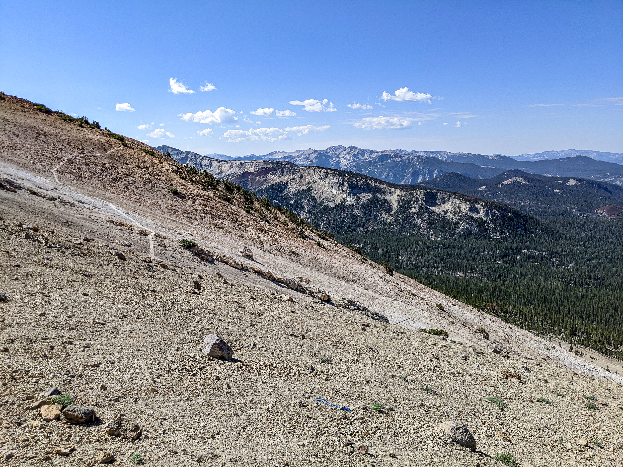
A view off the Summit of Mammoth Mountain Looking East
The Backcountry behind Mammoth Mountain
Off the Top
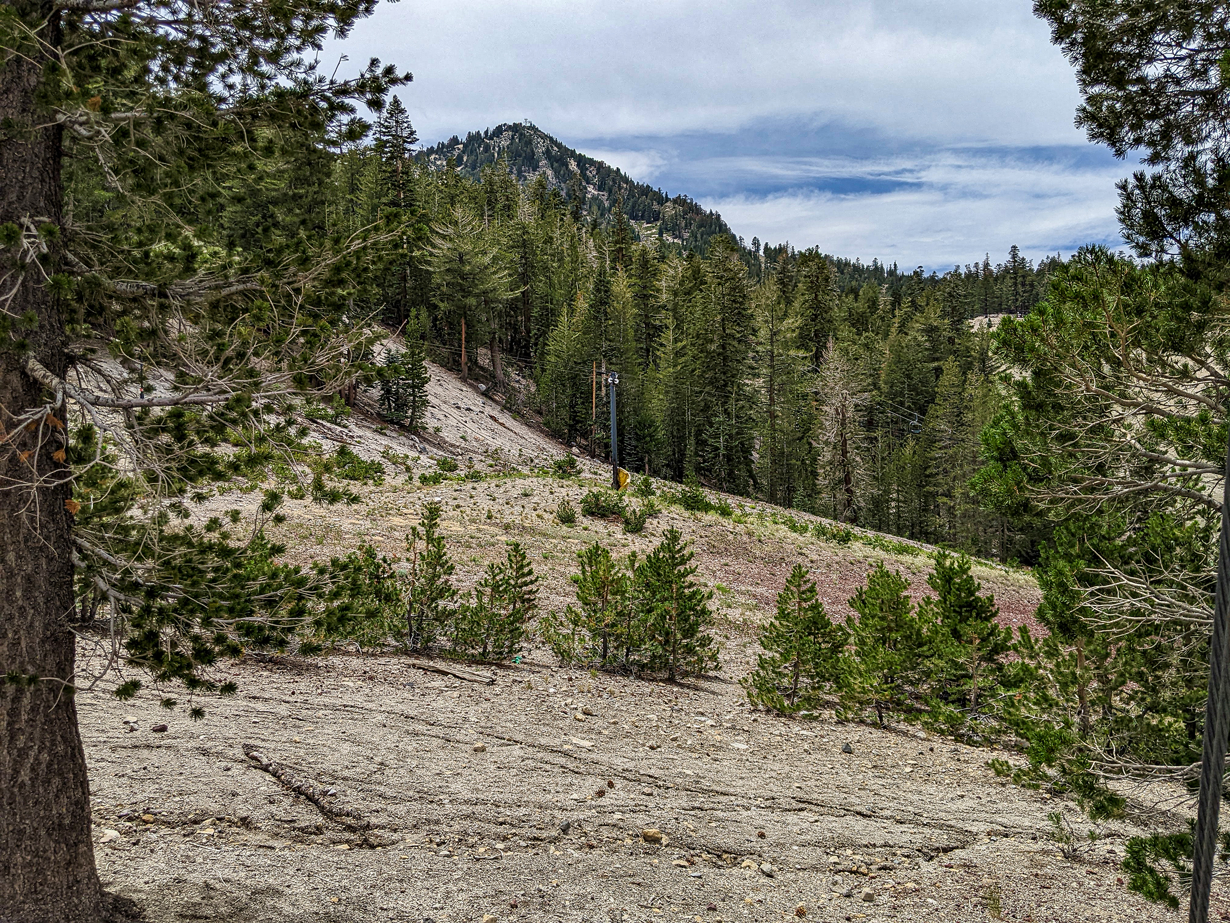
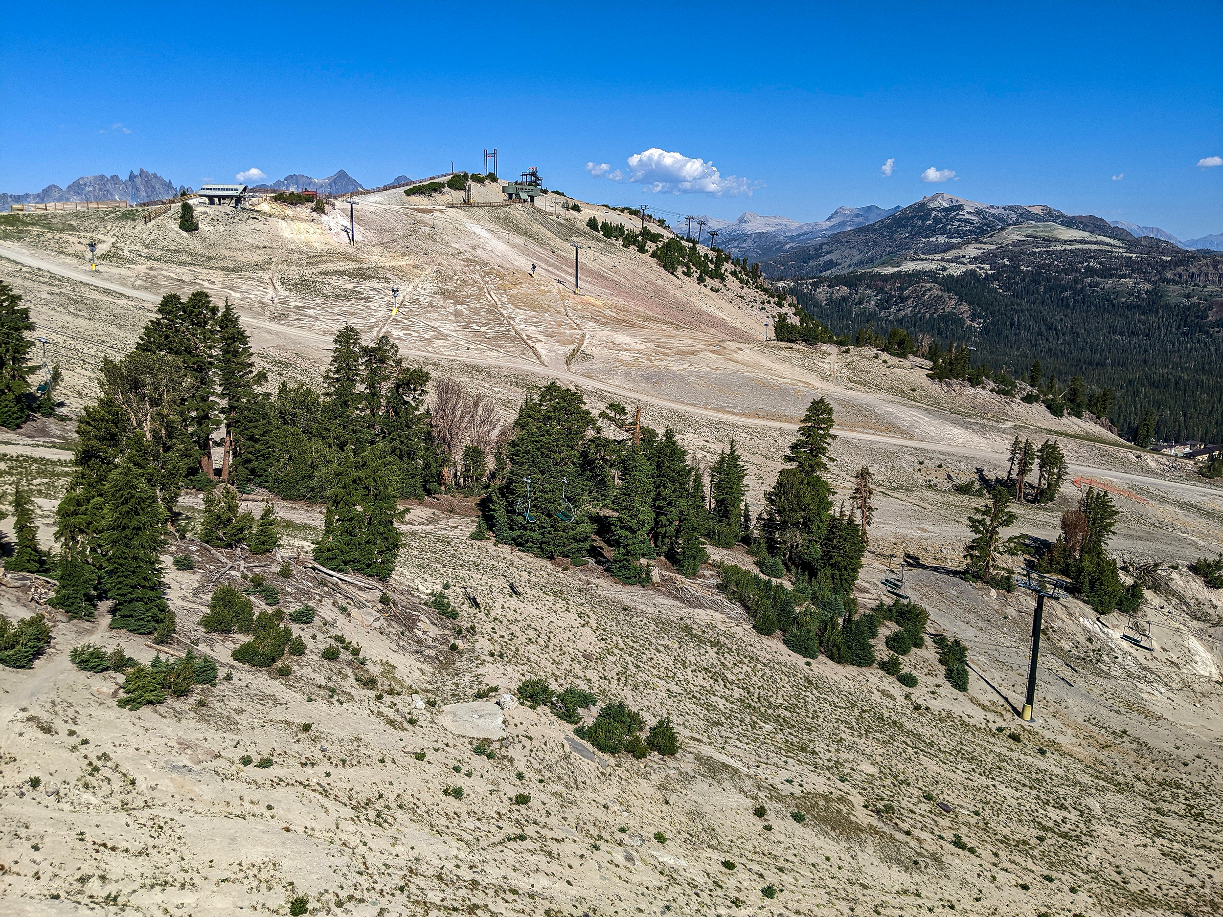
Chair 14 Summer Time View
Lower Arriba near the bottom by the Outpost and Chairs 13 and 14.
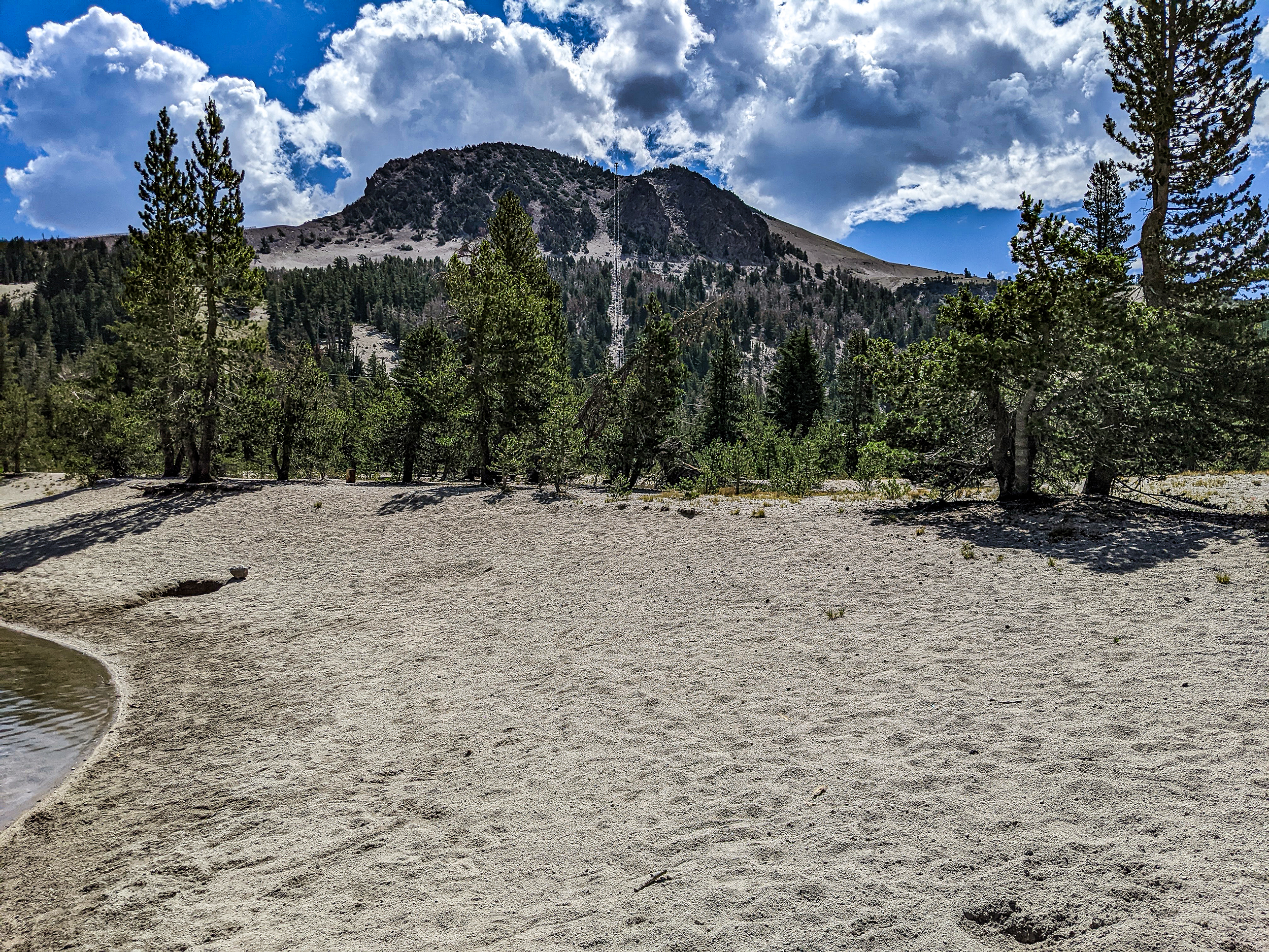
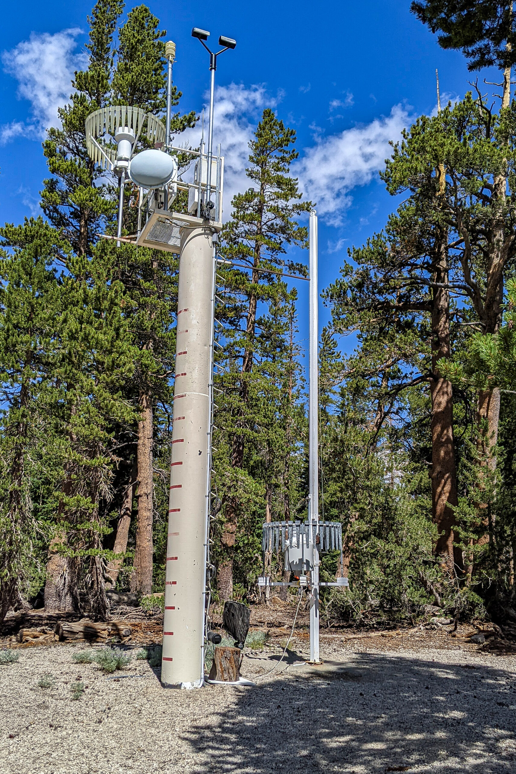
Mammoth Ski Patrol Snow Study Site at 9000 Feet
The Mammoth Mountain Ski Patrol Snow Study Site is at the 9000-foot elevation. This is official location to measure snow and report the amounts back to the public. #mammothsnowman #mammothmountain #discovermammoth
Off the Top as it winds thru the Chair 14 area.
Chair 3 and West Bowl behind. Off in the distance is the top of chair 23.
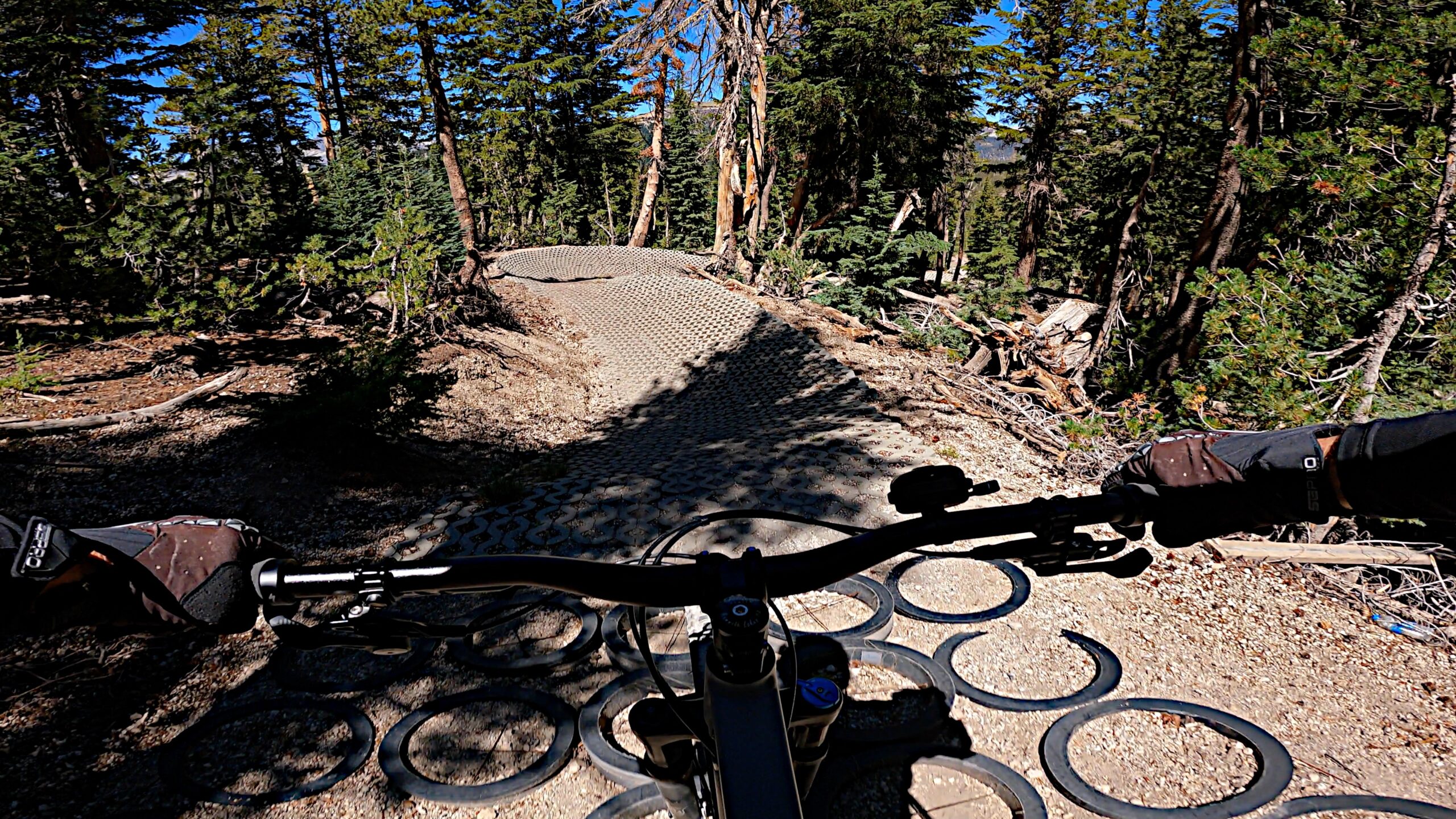
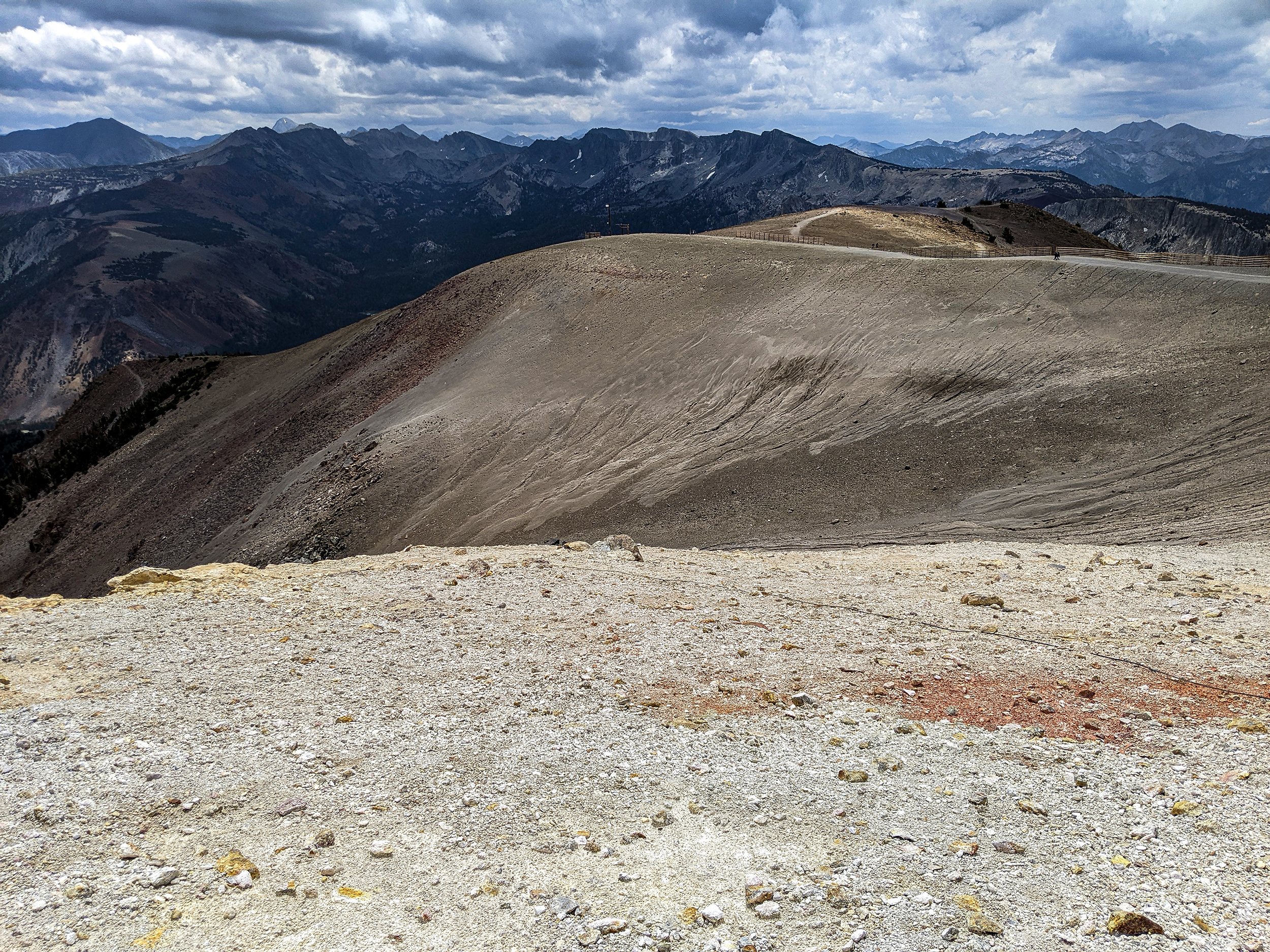
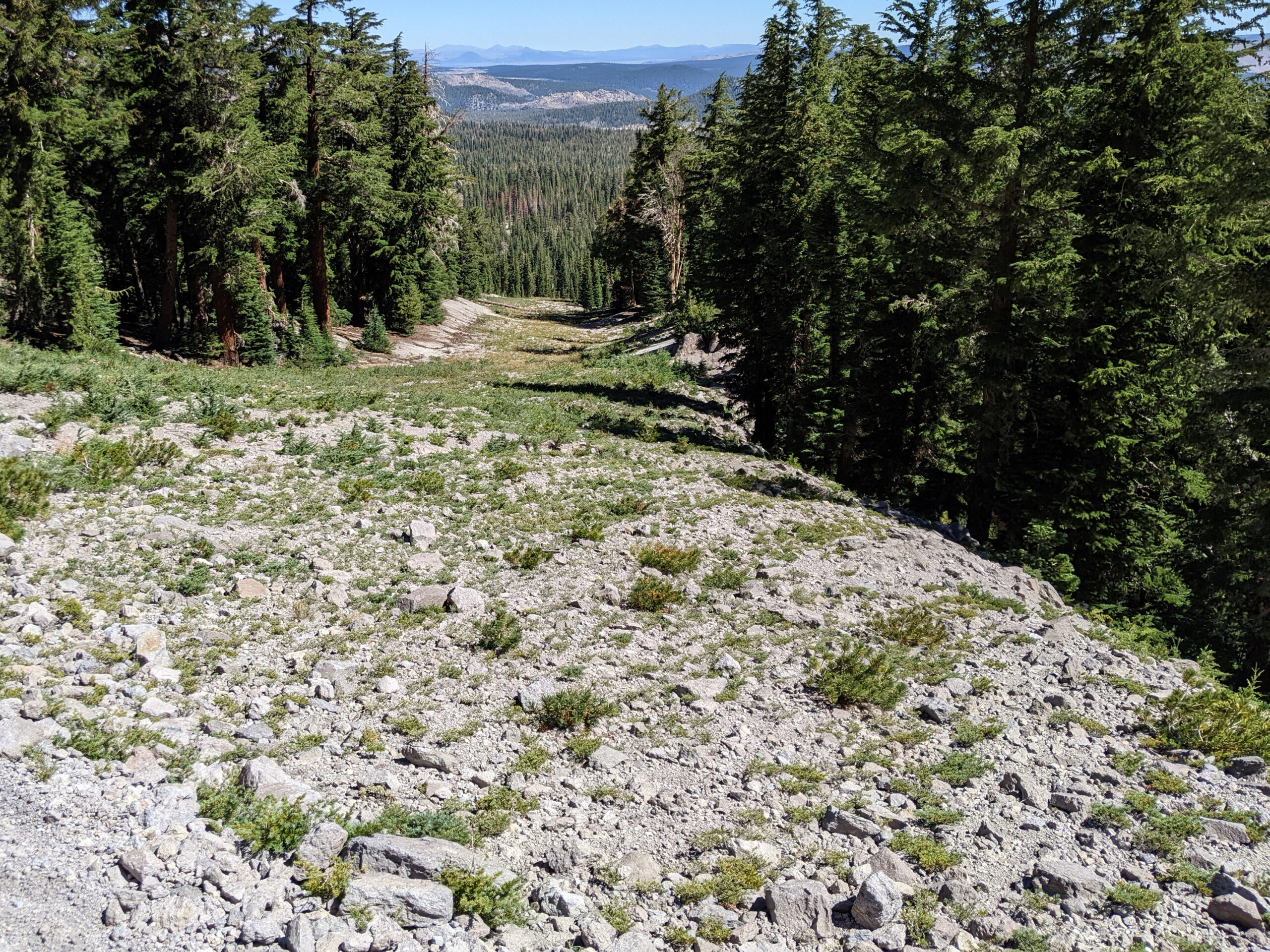
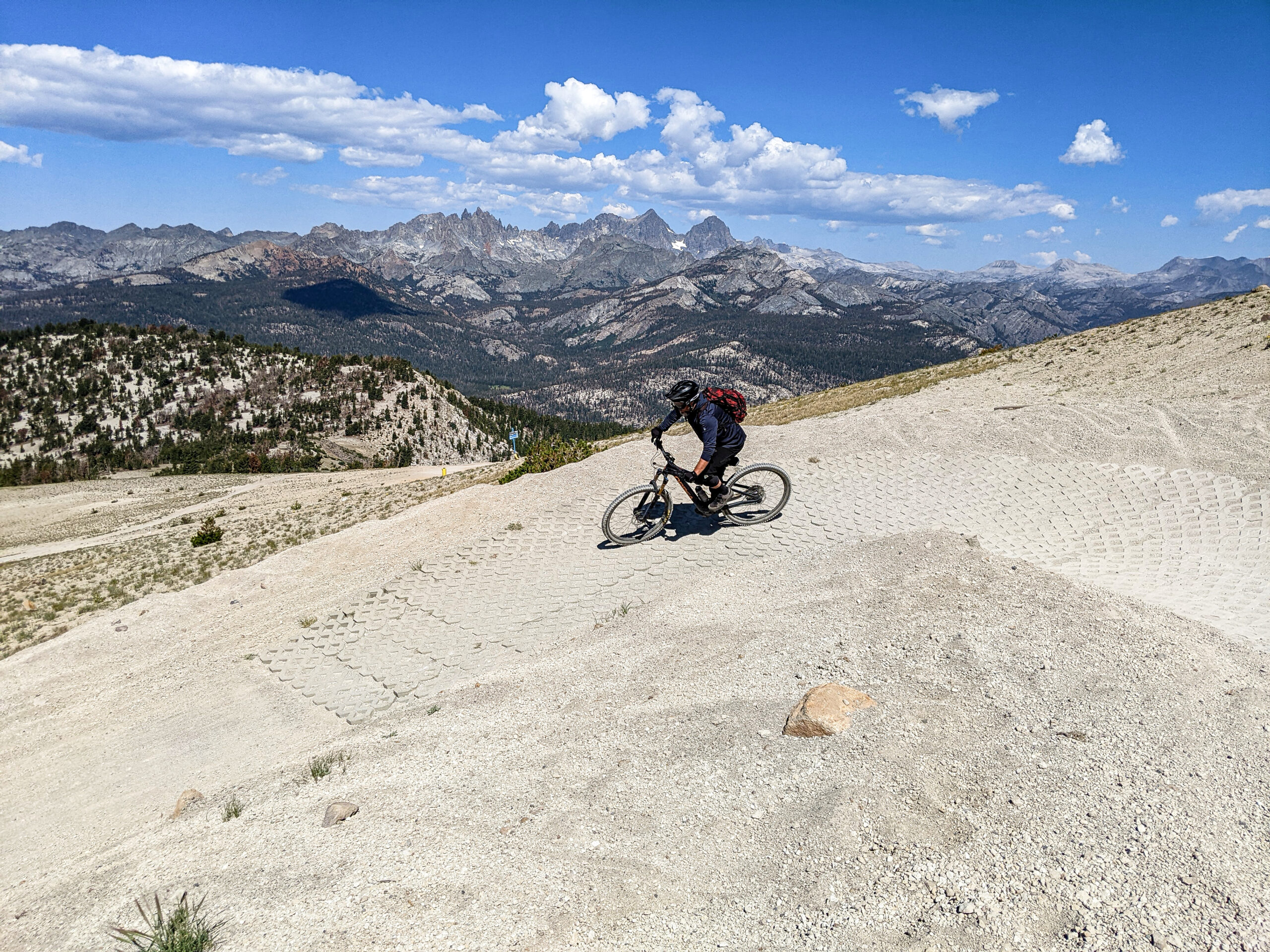
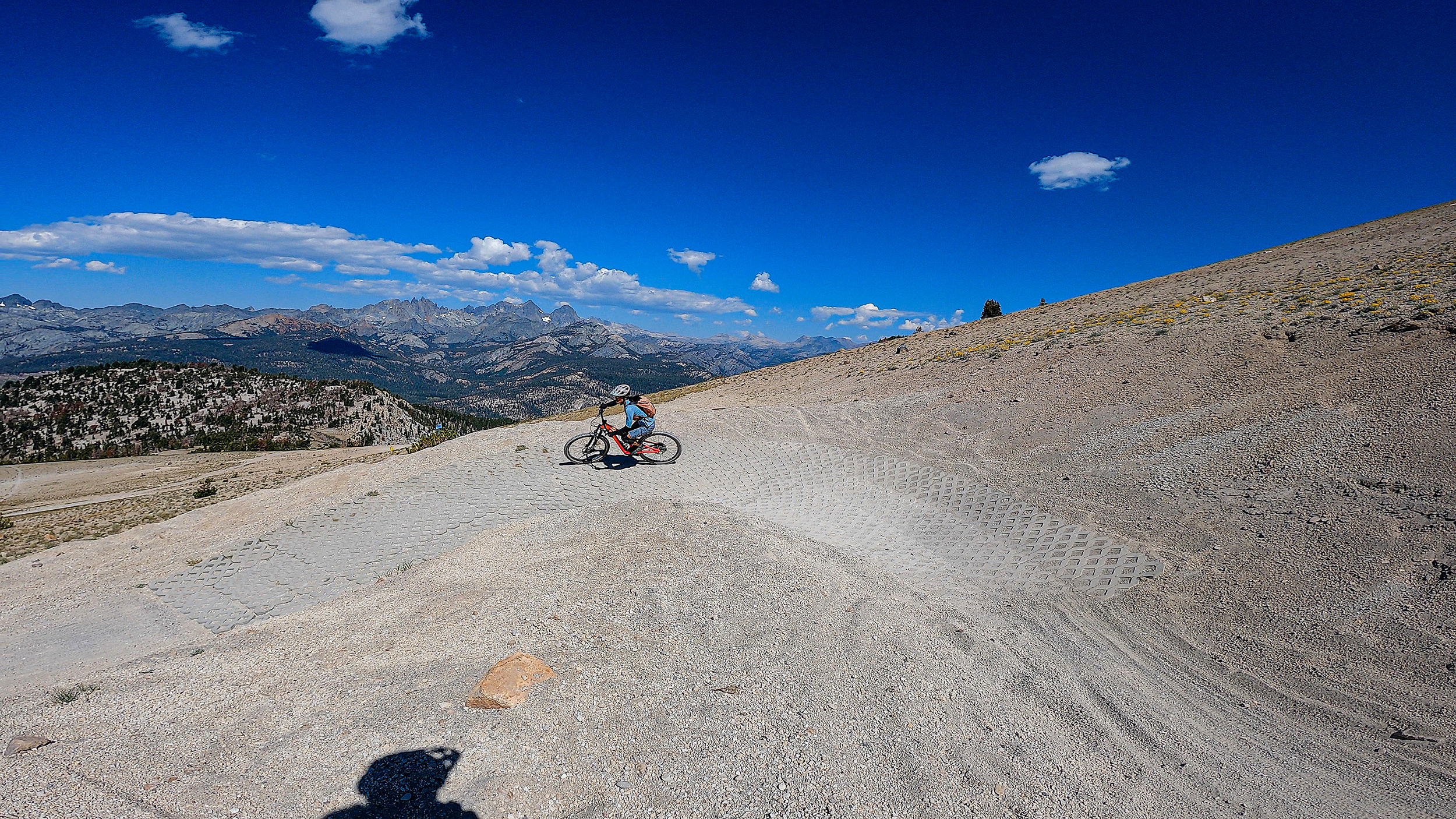
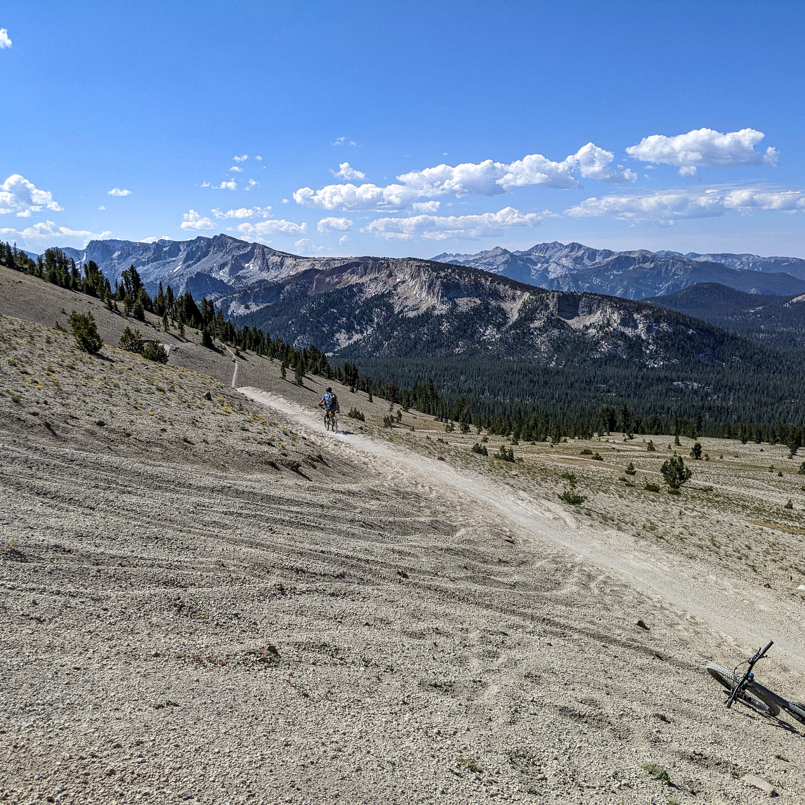
Off the Top Mountain Bike Trail – About a mile from the Summit you will find this paver turn and some really great views if you stop and look around. The elevation at this spot is estimated to be around 10,600 feet.
The Outpost at Chairs 13 and 14 with Reds Lake behind and the Minarets, Banner and Ritter in the Back Ground. The Mountain Bike Trail is the very lower section of Off the Top. #mammothsnowman #mammothmountain #discovermammoth
Got to love this view from the Off the Top Mountain Bike Trail at the Mammoth Mountain Bike Park. Beyond you can see the Mammoth Crest and then well into the Central Sierra Back Country. #mammothsnowman #mammothmountain #discovermammoth
The iconic Sign at the Top of Mammoth Mountain sits at the 11,053-foot level. At 24 feet high this second addition sign gets repeatedly buried during the windy winter snow cycles. #mammothsnowman #mammothmountain #discovermammoth
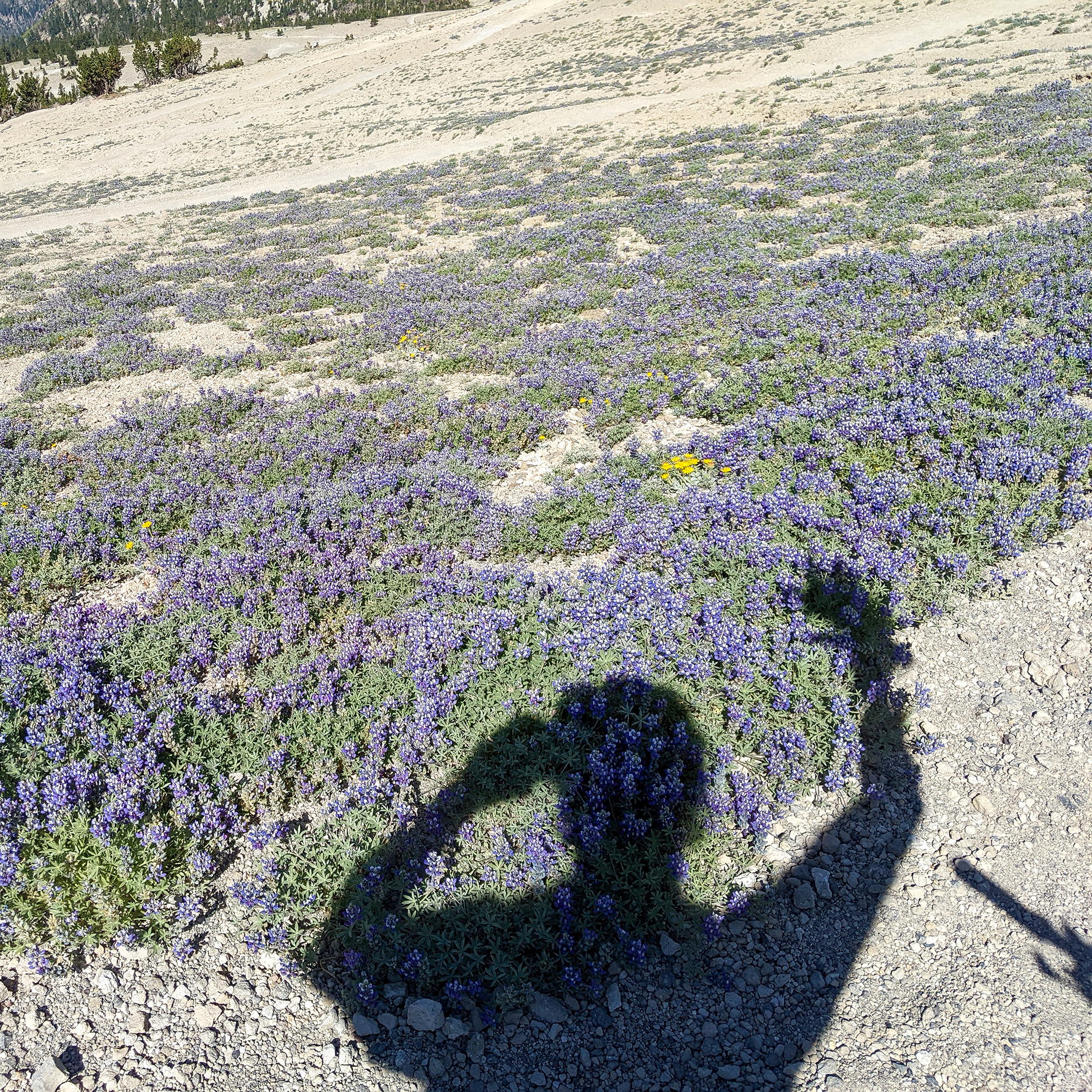
Lupine at 10,500 feet on the back side of Mammoth Mountain. Found this field of flowers right smack in the middle of the Off the Top Mountain Bike Trail. These flowers are about 1/2 to 3/4 quarters of a mile from the start of the trail head. Lupinus polyphyllus is a species in the Fabaceae (Legume) family that is native to a large part of western North America. In California it is found primarily in the Sierras and other northern mountains.
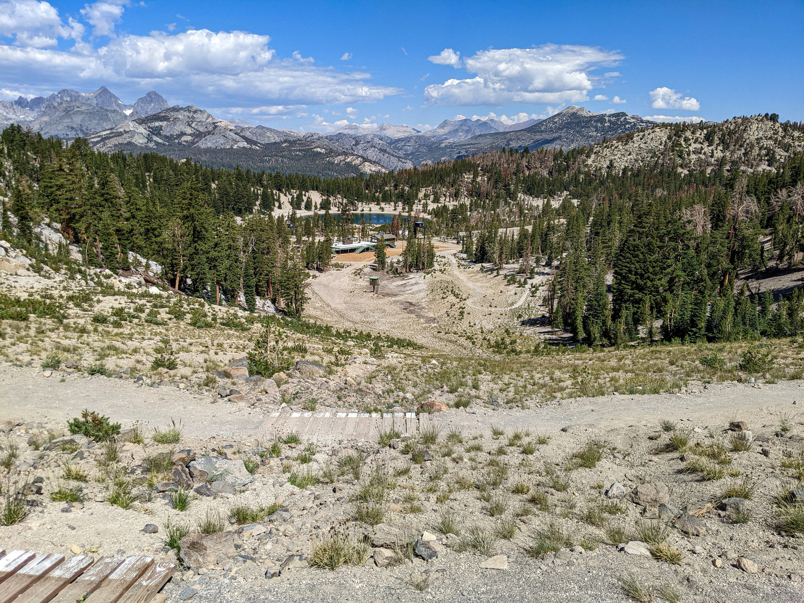
Always love this view from the Gondola Car riding up to MC Coy Station. Nothing like a early Summer morning in the Mammoth Mountain Bike Park.
Snowman at the the Top