Powder Forecast – Friday December 16th, 2022
Ted Schlaepfer CCM —- Mammoth Mountain WeatherGuy
Snowfall forecasts are valid at the Sesame snow course (Main Lodge) for the prior 24 hours as reported in the 6-7 AM morning snow report.
**Snowfall forecast confidence ranges from very low (1) to very high (5)
Sat 12/17 = 0”
Sun 12/18 = 0”
Mon 12/19 = 0”
Tue 12/20 = 0”
Wed 12/21 = 0 – 1”
Thu 12/22 = 0”
Fri 12/23 = 0”
Sat – Mon 12/24 – 12/26 = 0”
December Snowfall = 77”
December Forecast = 77 – 90”
Detailed 4-day Snowfall Forecast:
Sat 12/17 through Tue 12/20 – No snowfall expected all days except for a chance for light snowfall on Tuesday, maybe an inch accumulation.
Forecast Summary:
Short Term (Days 1 – 4):
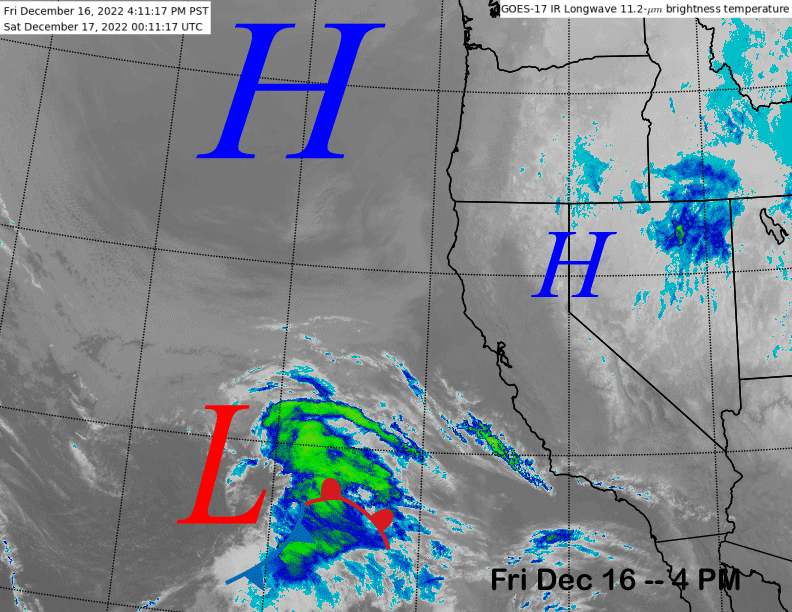
The current infrared satellite image (below) shows weak high pressure over CA and a stronger ridge off the PacNW coast. The low-pressure system well off the coast will move into SoCal tomorrow and into Sunday and well south of Mammoth.
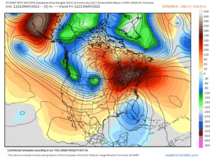
Weak high pressure will then build back into the state on Sunday and Monday for continued dry weather before a weak weather system moves through CA on Tuesday (image below) says the ECM model.
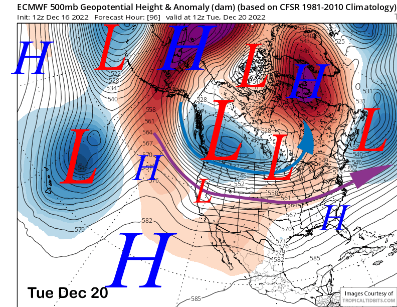
The Canadian model is the strongest with the low and the GFS the weakest. But all models keep the precipitation north of Mammoth for the most part with the ECM and Canadian models only showing very light amounts. So there could be some light snow on Tuesday, but probably a better chance for just passing clouds and continued dry weather.
Long Range (Days 5+)
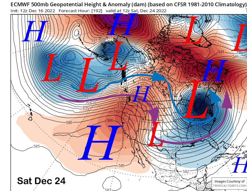
The longer-range guidance is generally in agreement that a long-wave ridge of high pressure will set-up along the West Coast for an extended period of dry weather that may last into 2023.
The ECM model (image below) and others build a very strong ridge over CA just before Christmas. That means not just dry weather, just unseasonably warm temperatures are possible too over the holiday period.
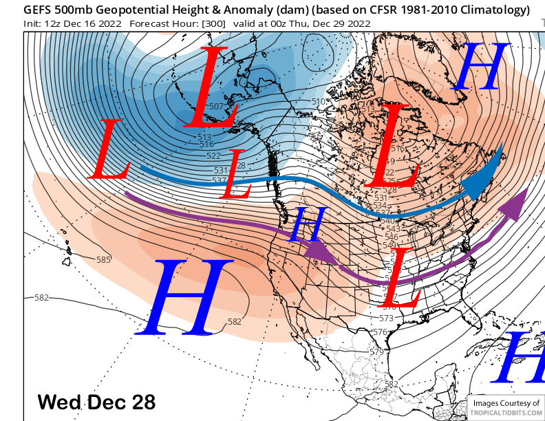
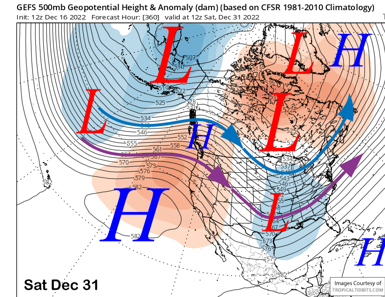
The fantasy range of the numerical guidance favors this ridge to remain in place for the most part through the extended time frame (images below). This pattern is very reminiscent of last winter during the long dry spell that occurred during January and February.
As far as when snowfall will return? I am not exactly sure. According to the climate models, the dry pattern could last into the second week of January. This was expected, so I am not too concerned. Pow days will be back, no worries. WG