Powder Forecast – Friday December 23rd, 2022
Ted Schlaepfer CCM —- Mammoth Mountain WeatherGuy
Snowfall forecasts are valid at the Sesame snow course (Main Lodge) for the prior 24 hours as reported in the 6-7 AM morning snow report.
**Snowfall forecast confidence ranges from very low (1) to very high (5)
Sat 12/24 = 0”
Sun 12/25 = 0”
Mon 12/26 = 0”
Tue 12/27 = 2 – 4”
Wed 12/28 = 10 – 20”
Thu 12/29 = 0 – 6”
Fri 12/30 = 6 – 12”
Sat – Mon 12/31 – 1/2 = 12 – 24”
December Snowfall = 77”
December Forecast = 95 – 115”
Detailed 4-day Snowfall Forecast:
Sat 12/24 and Sun 12/25 – No snowfall expected both days.
Mon 12/26 – Dry during the day, then rain/snow develops overnight. Accumulations 2 – 4” by Tuesday AM, up to 6” up top.
Tue 12/27 – Snow or rain, heavy at times during the morning, tapering in intensity during the afternoon, and continuing overnight. Accumulations 10 – 20” by Wednesday AM.
Forecast Summary:
Short Term (Days 1 – 4):
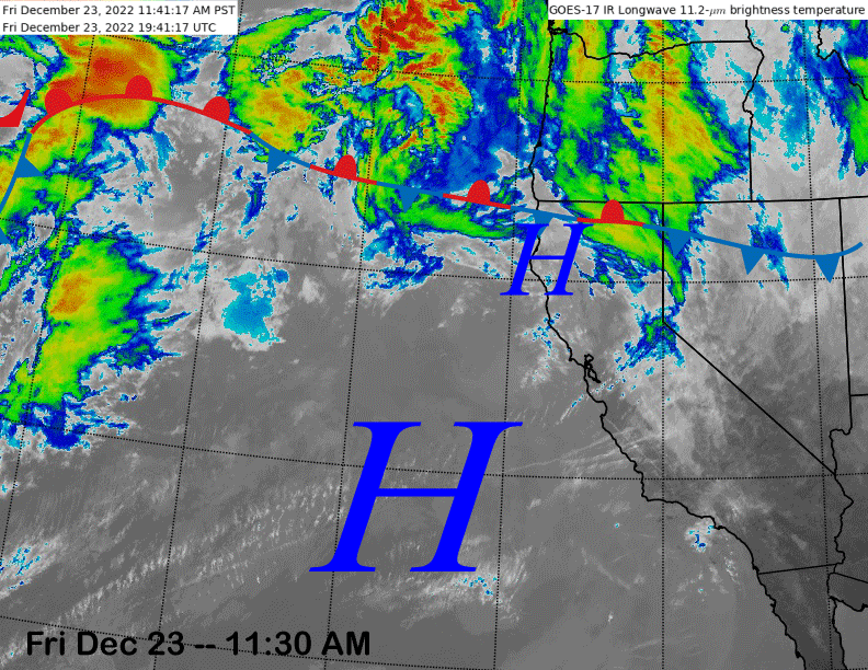
The current infrared satellite image (below) shows high pressure off the coast and a stationary front across NorCal and Oregon. High pressure will continue to build into the state tomorrow and Christmas for fair and warmer weather before a pattern change starts next week.
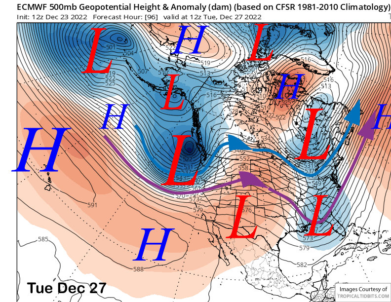
Dry weather will continue into Monday, then all of the models are showing a potent full-latitude short-wave trough moving into the state on Tuesday (image below). The GFS is slightly faster with the short-wave by about 6 hours and starts the precipitation late Monday evening while the ECM holds off until late at night.
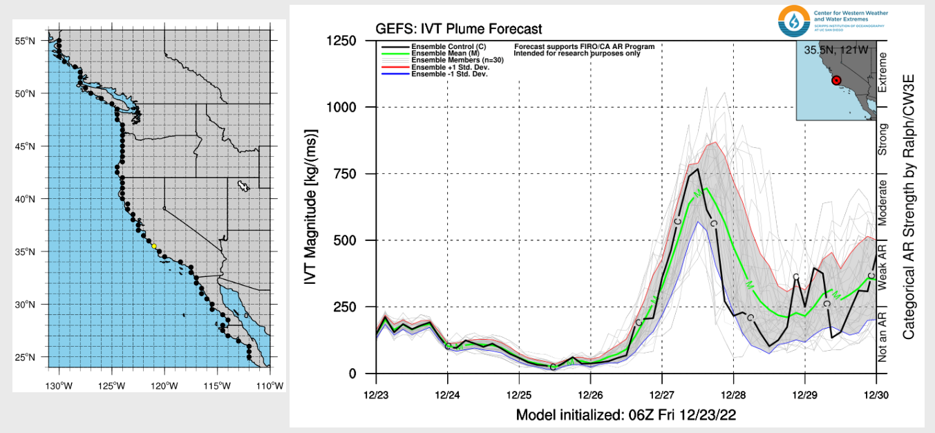
The storm system looks like it will contain an Atmospheric River (AR) of moderate strength (image below), although the relatively fast movement of the plume will limit it effectiveness. Nonetheless, due to the subtropical nature of the air mass and the fairly mild air mass that will be in place with the ridge ahead of the pattern change, snow levels may start out rather high with a decent chance for rain on the lower part of the mountain and a chance at Main too.
The saving grace may be the dry eastern Sierra air that will allow for evaporative cooling when the precipitation starts and may keep snow levels near 8000-8500 feet, although I would not be surprised if they rise to 9K or slightly higher when the core of the AR arrives. But that is a tough call four days in advance and will likely be a factor in overall snow amounts.
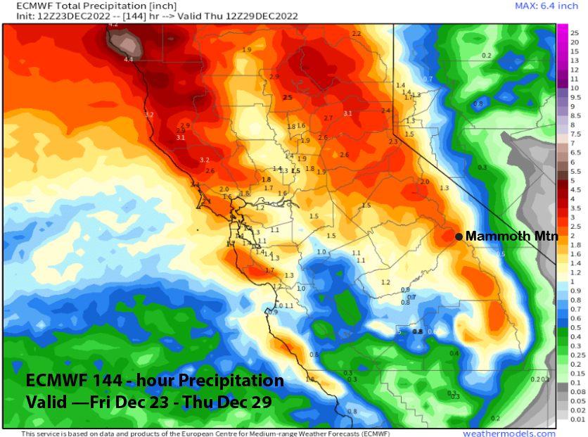
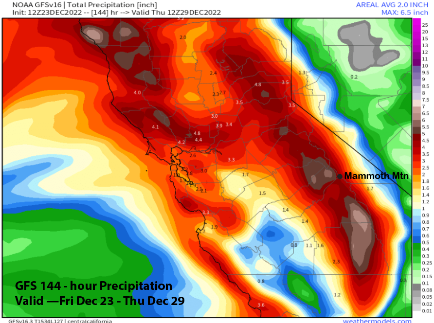
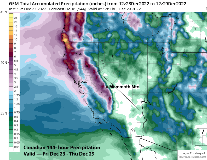
QPF from the models vary from about 2.5” from the ECM (image below) to around 4.5” for the GFS (two images below) with the Canadian showing about 3.5” (three images below). Forecast follows a blend of the ECM EPS mean and the GFS/Canadian for about 3.5” liquid. That may equate up to 2 feet of snowfall at Main, depending upon those initial snow levels with a foot looking good. The top will probably get around 2-3 feet where it should be snow the whole time.
Long Range (Days 5+)
The longer-range guidance is still looking good with the models favoring successive storms to move into the state through possibly the first week of January or longer.
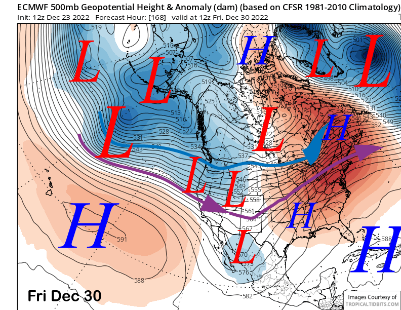
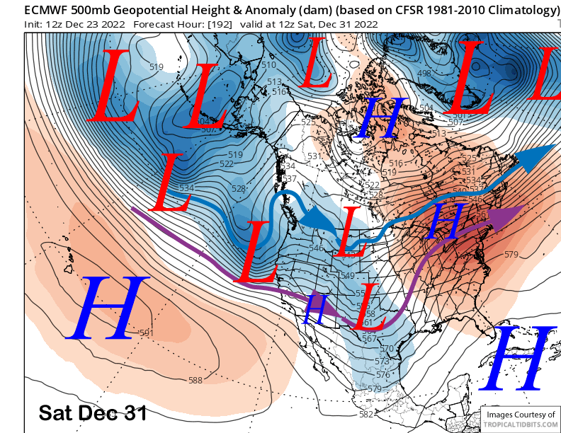
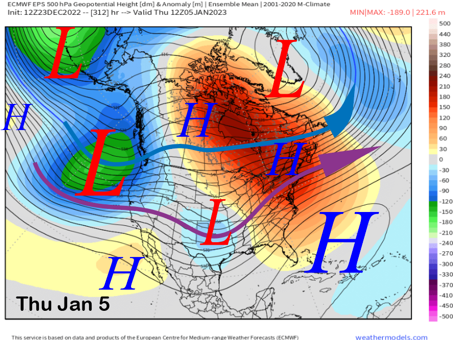
The ECM model moves the next storm into the state in the zonal jet stream flow on Friday (image below) followed by another one on New Year’s Eve (two images below). These would bring more rounds of base-type snowfall to Mammoth for the end of the week and into the weekend.
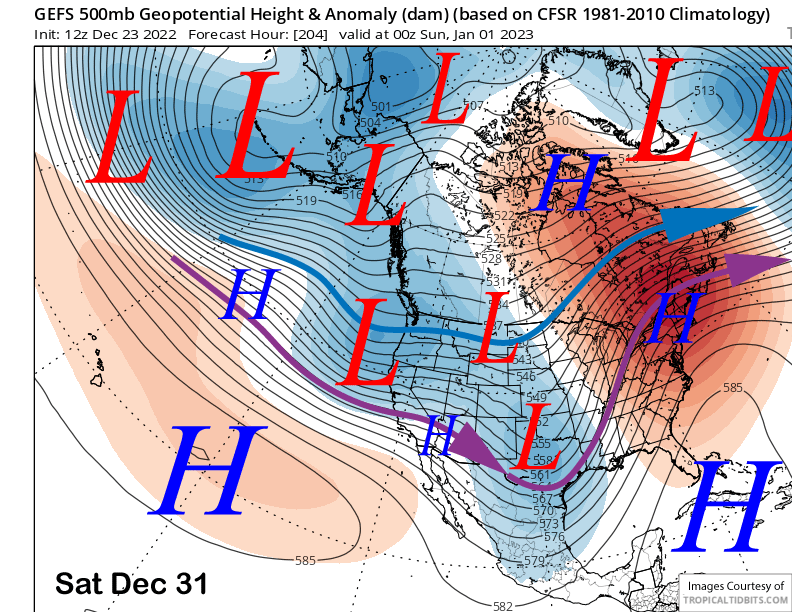
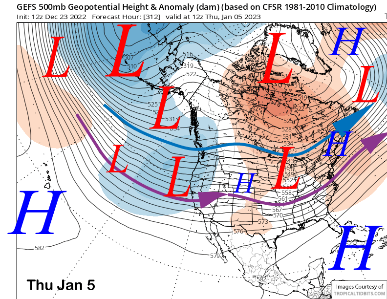
The GEFS also shows a similar pattern (image below), so confidence in a continued storm pattern is high for the extended period. Timing of the storms will change as we get closer and the details become more apparent.
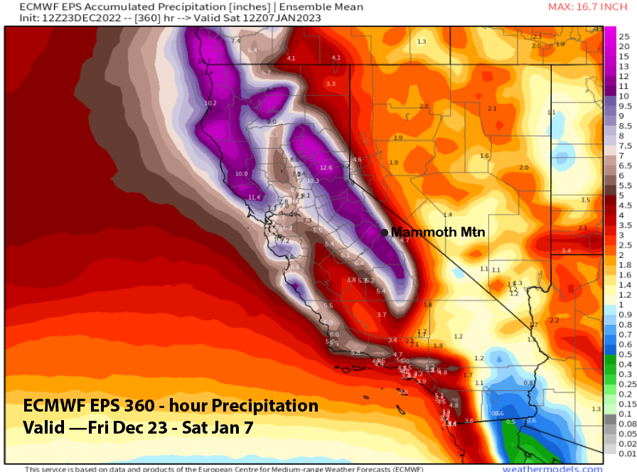
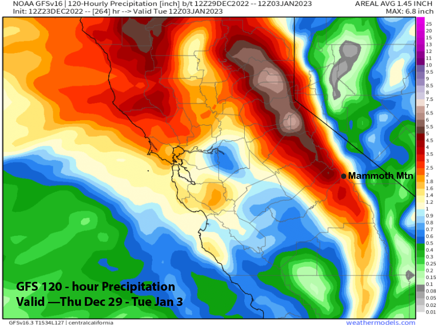
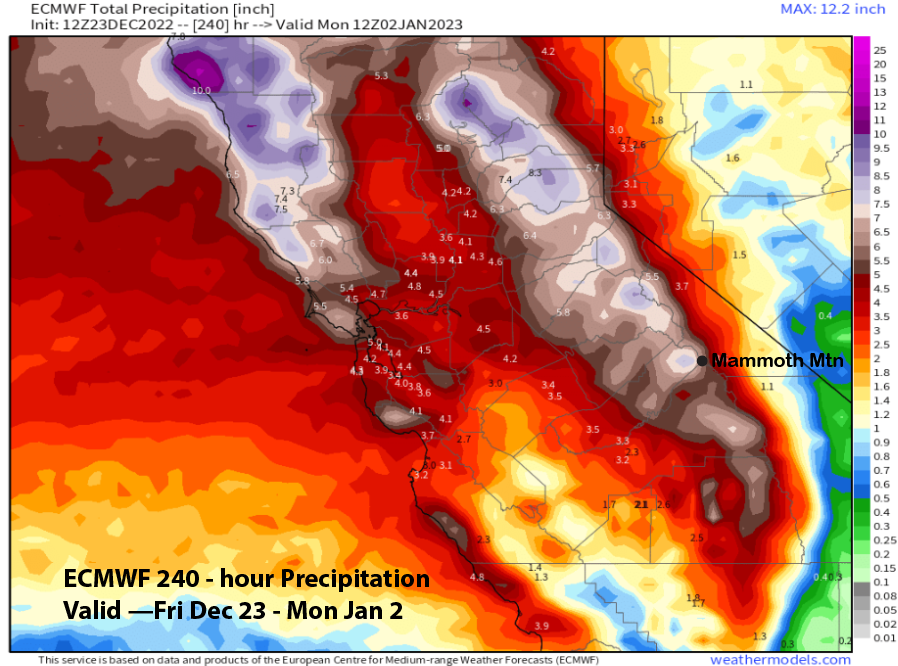
Overall, there could be significant snowfall toward the latter part of next week as the GFS (image below) is showing another 3” liquid and the ECM even more with a 10-day total of about 6” liquid (two images below).
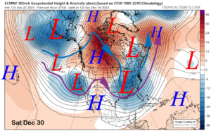
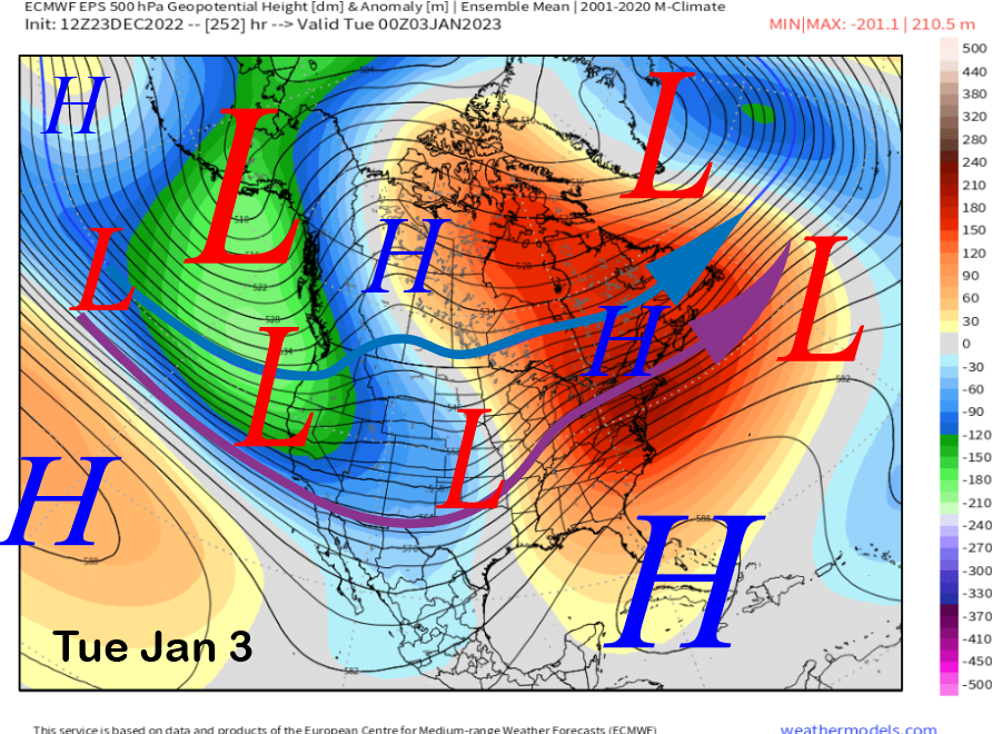
According to the ECM EPS, the pattern may amplify further in the fantasy period. That model is showing basically a full extension of the east Asian jet stream across the Pacific (image below) into a very deep upper-level long-wave trough in the Gulf of Alaska.
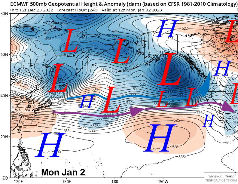
It then moves that trough and strong jet stream ashore into CA over the first few days of 2023 (image below) for what could be the biggest storm system of the series. That forecast pattern is reminiscent of a smaller version of the big storm pattern from January 2017.
Both the GEFS (image below) and ECM EPS (two images below) keep the storm track into CA through the end of that week. That would allow additional storms to move into the state and Mammoth.
So the big picture is looking good for a lot of base snow over the next two weeks in addition to storm/powder days. The latest ECM EPS (image below) is showing around 10” liquid for Mammoth and that will go a long way toward helping the mountain achieve a 4th of July closing date. WG