

Mammoth Mountain Weather Forecast & Discussion
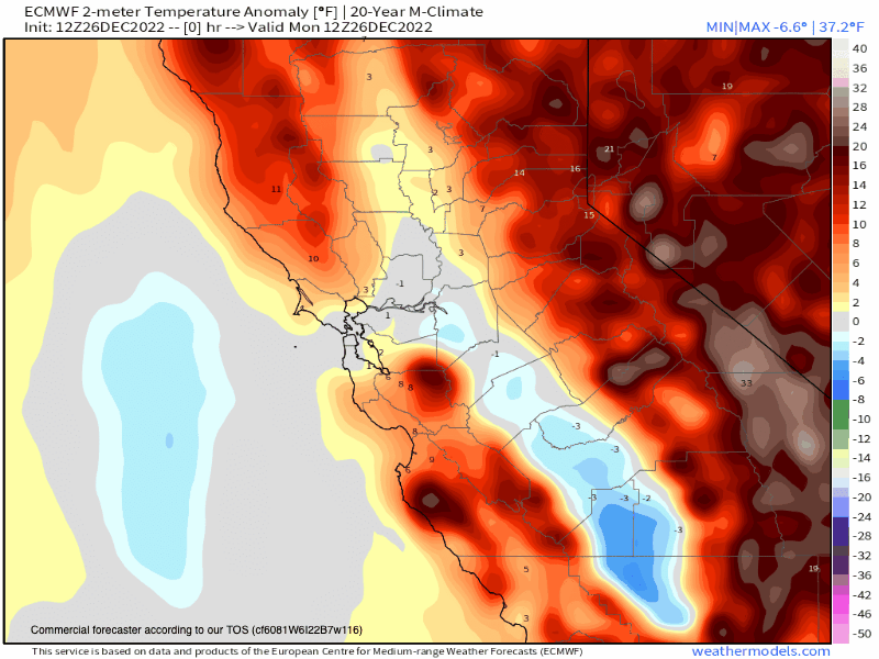
December, 26th 2022 @ 4:02 PM – The Mango connection is on the way and ahead of it, temperatures have warmed up big time on Mammoth Mountain just as was forecasted. When I left little eagle at noon the car gauge was at 48 degrees.
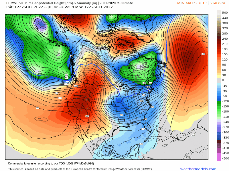
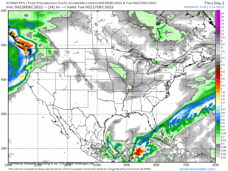
What you can expect over the next 48 hours in Mammoth will be a wet wild ride. Mid Latitude storms are warm and this first system of several on the way will have some very high snow levels by Tuesday morning.
The action should start late this evening with snowfall all the way down to 7500 feet. Sometime after midnight, the snow line is forecast to be up above 9000 feet. By Tuesday snow levels jump up to around the 9600-foot level before falling to Canyon Lodge by late in the day. Tuesday night snow levels are expected down to around 7000 feet. Winds will be gusting 35 to 45 mph with gusts up to 90 mph along the ridges.
As of now, this first system looks to bring around 20-30 inches of snow to the mid and upper mountain sections of Mammoth Mountain. The rain we get at the start should be absorbed by the current snow pack and not cause any damage.
The snow that does fall is going to be heavy and wet snow don’t expect any light and dry Alta powder from this system or any of the upcoming systems in the next 6-10 days.
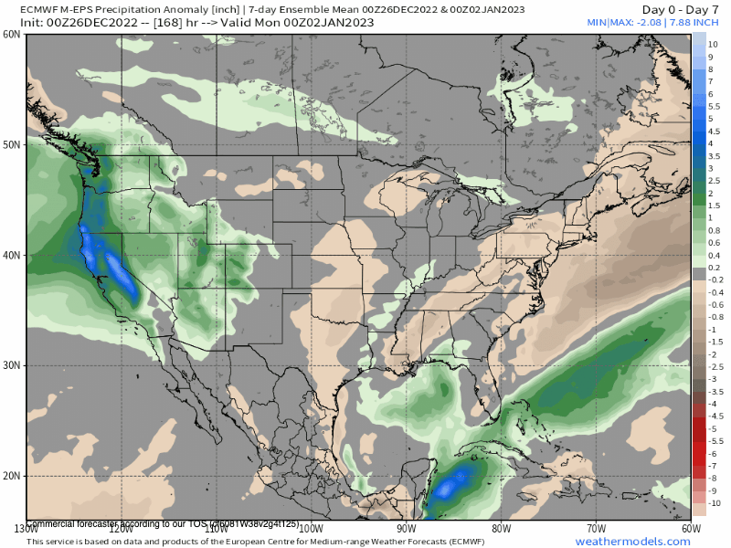
Beyond the next 48 hours, there will be a short break later Wednesday into early Thursday before the next wave of heavy wet snow moves into the area. That second wave of snow looks to be in the area into early Sunday.
It does appear that more snow will be possible in the 6-10 day fantasy outlook period with a break looking likely beyond day 10.
Snowman


Who Are We?
 Steve Taylor – Mammoth Snowman – Over the last 30+ years, Snowman has spent countless hours studying and learning about Mammoth Mountain Weather and Snow Conditions first hand. He has been skiing around the hill with marked ski poles since March of 1991 so he can measure the fresh snowfall amounts out on the hill.
Snowman started blogging this information back in 1990 on the old Mammoth BBS system, then the RSN Forums and then on to MammothSnowman.com in 2004 with Video & Photo Blog report. (No YouTube back then). Facebook got added to the fold back in 2008 and then the Facebook Group in 2016.
Reports, videos, and photos from the website have been featured on both local TV Stations here in Mammoth, along with AP, Fox, ABC, CBS, and NBC News.
 Ted Schlaepfer – Mammoth WeatherGuy – The Powder Forecast – Posted Tuesday and Fridays at 5 PM November into Mid May. These forecasts are now responsible for many people getting multiple powder days on Mammoth Mountain over the years.
Ted’s Bio: Ted has been a full-time Meteorologist (CCM) for the past 25+ years. He has always been fascinated with the weather,” skiing was just a natural extension of my love for snow and rain. I started skiing at age 5, first discovered Mammoth in 1979 as a youth, and have been a regular visitor since the late ’80s.”.
Here is the link to The WeatherGuys Powder Forecast Page.
Click Here to Learn More About the People Who Make MammothSnowman.com a Reality


