Powder Forecast – Tuesday January 3rd, 2023
Ted Schlaepfer CCM —- Mammoth Mountain WeatherGuy
Snowfall forecasts are valid at the Sesame snow course (Main Lodge) for the prior 24 hours as reported in the 6-7 AM morning snow report.
**Snowfall forecast confidence ranges from very low (1) to very high (5)
Wed 1/4 = 0”
Thu 1/5 = = 17– 24” (H20 = 2.00” – 2.50”) **3
Fri 1/6 = 6– 9” (H20 = 0.75” – 1.00”) **3
Sat 1/7 = 0”
Sun 1/8 = 3– 6”
Mon 1/9 = 6– 9”
Tue 1/10 =9– 15”
Wed – Fri 1/11 – 1/13 = 15 – 30”
January Snowfall = 42”
January Forecast = 120 – 150”
Detailed 4-day Snowfall Forecast
Wed 1/4 –Light to moderate snowfall during the morning, then light snow showers or flurries during the afternoon. Heavy snowfall then develops overnight. Strong winds by the afternoon continue overnight. Accumulations 17– 24” by Thursday AM, 24”+ up top
Thu 1/5 – Heavy snowfall during the morning, lightens up by the afternoon, ends overnight. Accumulations 6 – 9” by Friday AM, 12”+ up top
Fri 1/6 – No snowfall expected
Sat 1/7 – No snowfall expected during the morning, then snowfall develops during the afternoon and continues overnight. Accumulations 3 – 6” by Sunday AM, 6”+ up top
Forecast Summary:
Short Term (Days 1 – 4):
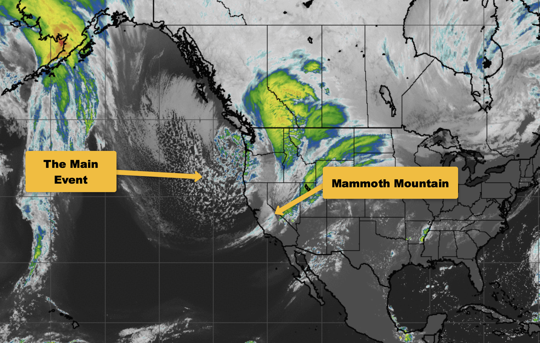
The current infrared satellite image (below) shows a developing bomb cyclone moving into the eastern Pacific as the GFS model is forecasting a 29-mb 24-hour pressure drop by tomorrow morning (definition of bomb cyclone is minimum drop of 24mb in 24 hours).
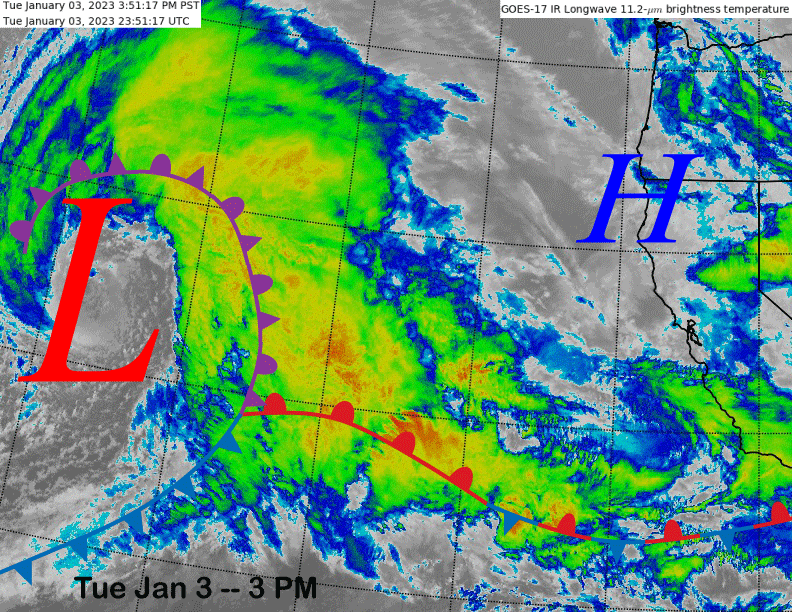
The storm system will weaken when it moves into the central and southern Sierra early Thursday (image below), but should still be potent enough to produce a good amount of snowfall.
The warm front will move through the Mammoth area during the morning tomorrow with light to moderate snowfall before the main front moves through tomorrow night and Thursday morning. That is when the heaviest snowfall will occur. There should still be enough accumulation by tomorrow afternoon for fun turns if you plan on storm riding.
Winds could be an issue by tomorrow afternoon though, as they are forecast to crank up out ahead of the trough passage. Strong winds are also expected through Thursday morning. So, it could be another slow opener on Thursday as the storm will keep going through the morning.
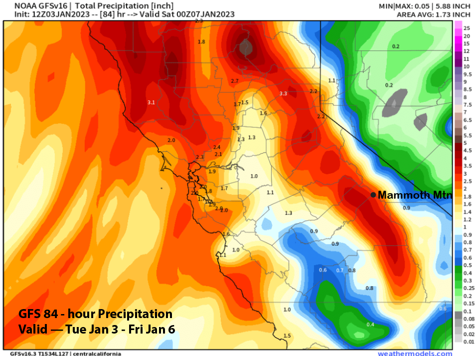
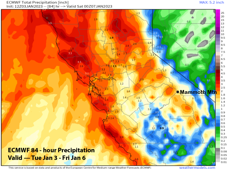
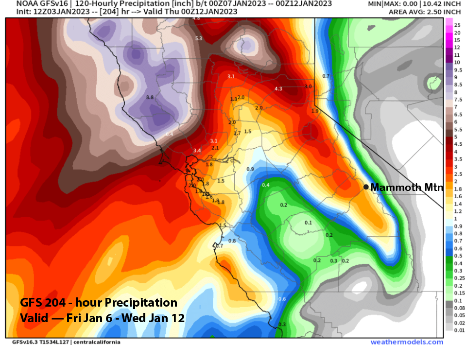
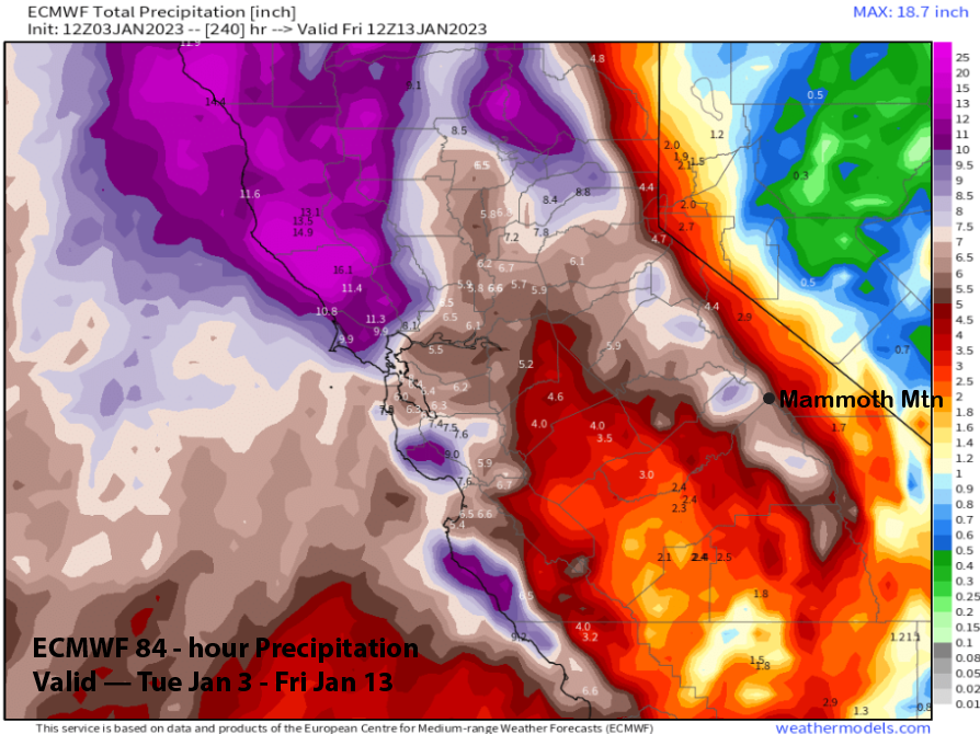
Model QPF for the storm is about 3.5” per the GFS (image below) and about 2.5” liquid from the ECM model (two images below). The Canadian is the wettest at almost 4” liquid. Snow ratios will be closer to 8-10:1” this time and the forecast follows a little closer to the GFS model.
Thus, another couple feet of snowfall is forecast for Main and around 30” up top. The snowfall should end overnight Thursday followed by a bluebird morning Friday. Dry weather should then continue through most of Saturday morning before the next storm system moves into the area Saturday afternoon and night.
Long Range (Days 5+)
The longer-range guidance is showing the storm cycle continuing next week and possibly through mid-month now. It looks like there will be more snowy days over the next two weeks versus dry days.
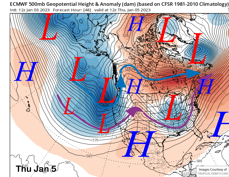
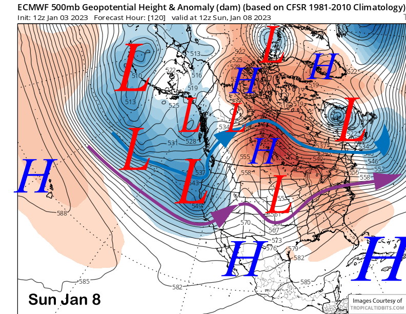
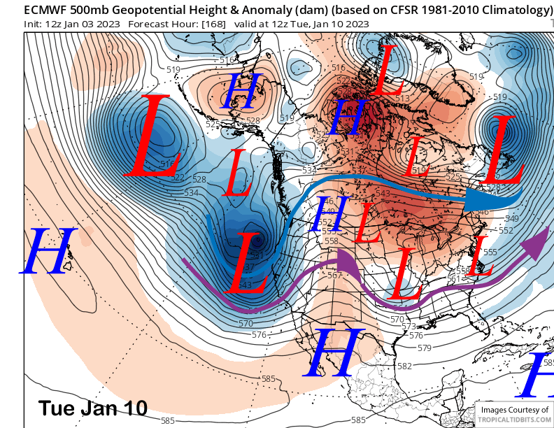
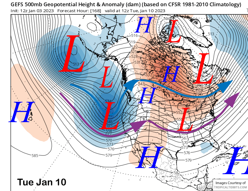
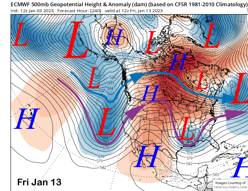
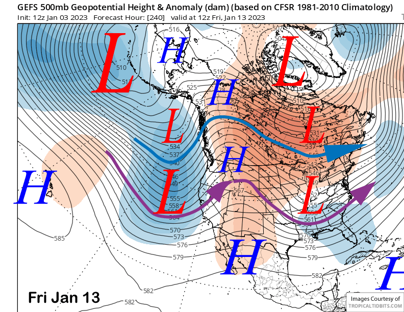
The ECM model and others move the next storm system into Central CA and the Mammoth area by early Sunday (image below) and follow that one, without much of a break, with a bigger storm on Monday and next Tuesday (two images below). This strong pattern is well supported by the GFS (three images below) and ECM EPS ensembles.
The Quantitative Precipitation Forecast (QPF) from the guidance is different this time with the ECM the wetter model and the GFS (image below) not showing a lot of liquid precipitation on the 12z run. The Canadian model is again the wettest model.
Current forecast follows the ECM mean that shows moderate amounts with the Sunday storm followed by larger snowfall amounts with the Monday/Tuesday storm. It favors at least 2-3 feet of new snow at Main Sunday through Tuesday. More storm riding and powder days. ECM is showing almost 5 inches liquid for the 10-day (image below)
A brief break from the snowy weather is certainly possible around mid-week before the next storm system moves into the state toward the end of next week and/or over the MLK Holiday weekend. Current run of the ECM is showing a fairly weak storm (image below) and the GFS ensemble is not that deep either (two images below). But more powder is never a bad thing (unless you have to shovel it, I guess).
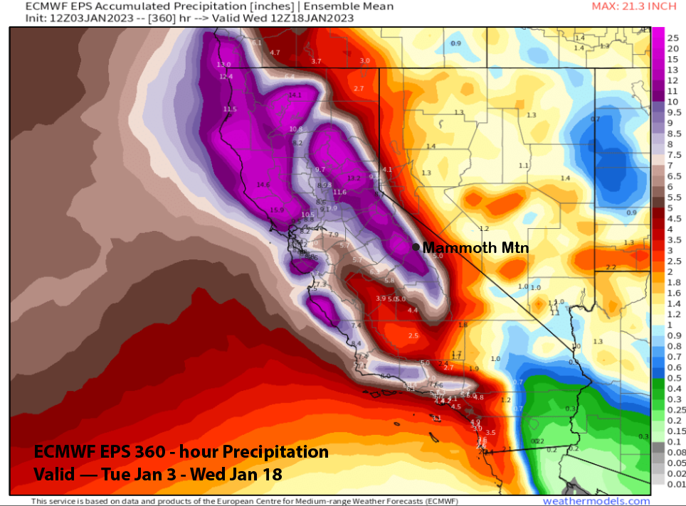
The fantasy range guidance now keeps the long-wave trough in place over the West Coast through mid-month, a flip in the guidance from a dry forecast in the last post. The pattern is similar between the models with the ECM EPS (image below) only a little deeper versus the GFS ensemble (two images below). Overall, the ECM EPS has around 12″ liquid in the 15-day pattern (three images below)
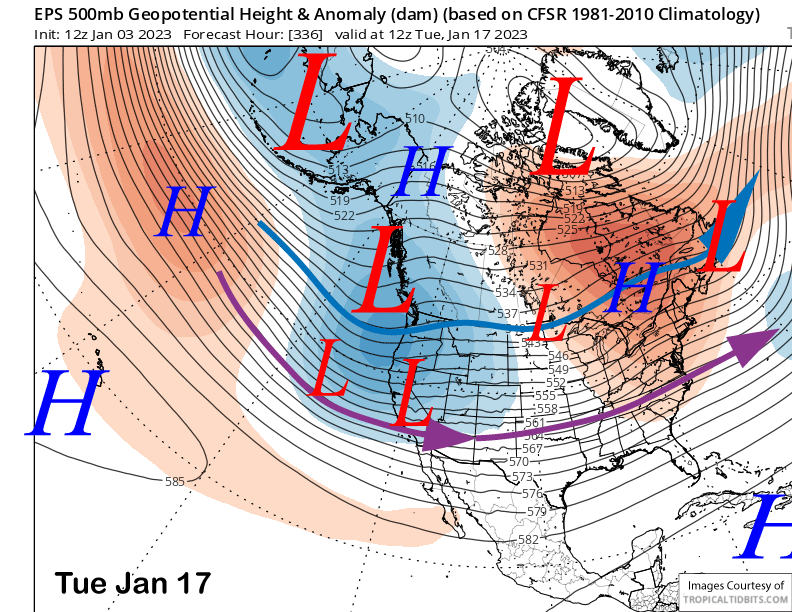
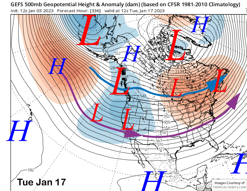
That means that storms may keep rolling through the Mammoth area for the next two weeks or longer. One potential difference with the mid-month pattern is that the storms may be moving into the state from the Gulf of Alaska, as opposed to off the Pacific, like the current pattern. The result would be colder type storms with lower snow levels and drier/fluffier powder. So just when you thought things couldn’t get better. WG