Powder Forecast – Friday January 6th, 2023
Ted Schlaepfer CCM —- Mammoth Mountain WeatherGuy
Snowfall forecasts are valid at the Sesame snow course (Main Lodge) for the prior 24 hours as reported in the 6-7 AM morning snow report.
**Snowfall forecast confidence ranges from very low (1) to very high (5)
Sat 1/7 = 0”
Sun 1/8 = 7 – 9” (H20 = 0.70” – 0.90”) **4
Mon 1/9 = 4 – 6” (H20 = 0.40” – 0.60”) **3
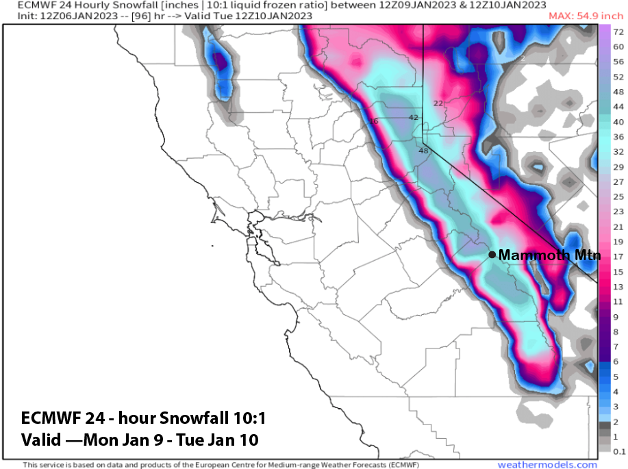
Tue 1/10 = 28 – 36” (H20 = 3.50” – 4.00”) **3
Wed 1/11 = 15 – 20” (H20 = 1.50” – 2.00”) **3
Thu 1/12 = 0”
Fri 1/13 = 0 – 3”
Sat – Mon 1/14 – 1/16 = 20 – 36”
January Snowfall = 70”
January Forecast = 150 – 180”
Detailed 4-day Snowfall Forecast
Sat 1/7 – No snowfall expected during the day, then snowfall develops during the evening and continues overnight. Windy during the afternoon/night. Accumulations 7 – 9” by Sunday AM, ~10” up top
Sun 1/8 – Snow during the morning, ending midday. Then snowfall re-develops late at night. Accumulations 4 – 6” by Monday AM, 6”+ up top
Mon 1/9 – Snowfall increases during the day, becoming heavy during the afternoon and night when blizzard conditions are possible. Very strong winds by the afternoon and at night. Accumulations 28 – 36” by Tuesday AM, 40”+ up top
Tue 1/10 – Blizzard conditions continue during the morning, then snowfall and winds decrease during the afternoon, snowfall ends overnight. Accumulations 15 – 20” by Wednesday AM, 24”+ up top
Forecast Summary:
Short Term (Days 1 – 4):
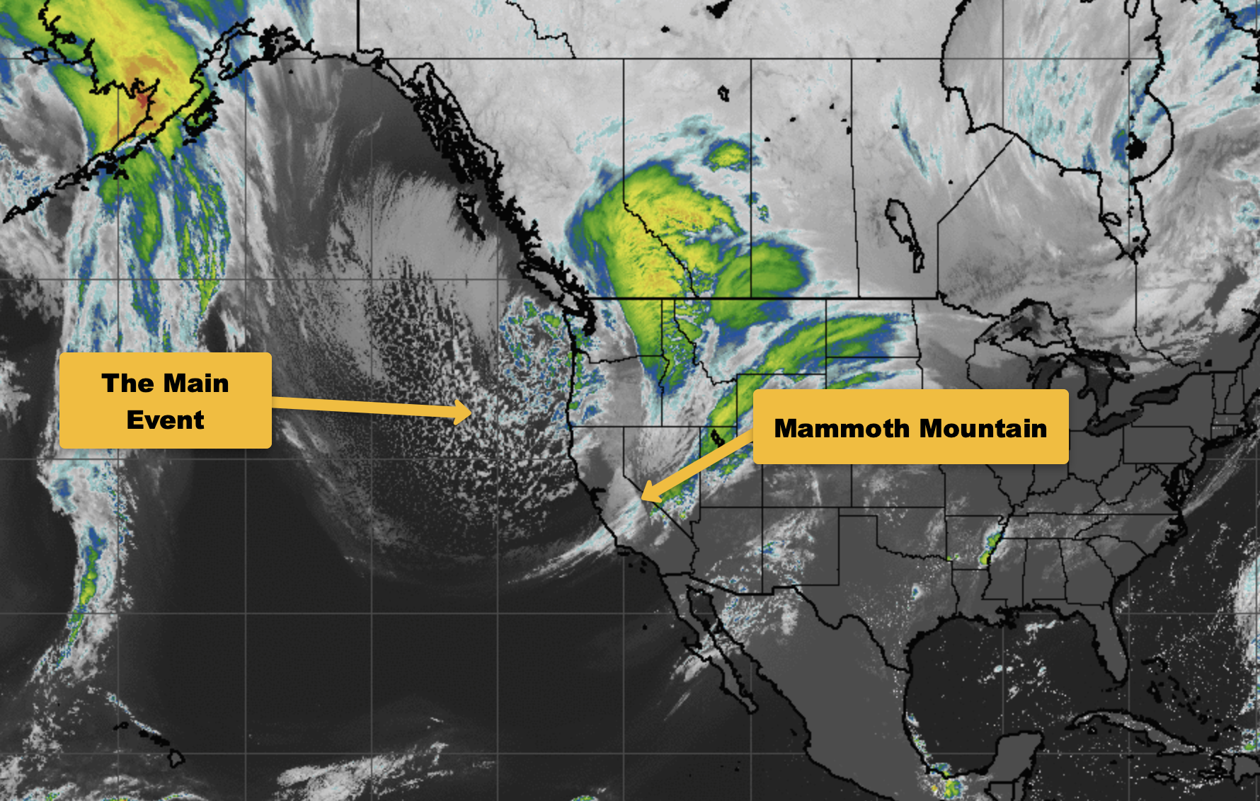
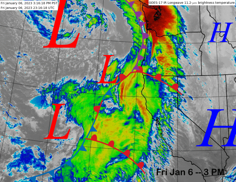
The current infrared satellite image (below) shows a weather system in the eastern Pacific Ocean now moving into NorCal. The low pressure system west of CA is the one that will move through Mammoth tomorrow afternoon/night and into Sunday for the next round of snowfall.
The ECM model moves the trough axis through the spine of the Sierra on Sunday morning (image below) and snowfall should end after its passage during the afternoon. It will be a relatively quick mover with maybe up to a foot at Main. Regardless, it should be nice powder conditions on Sunday with Ch 22 probably the place to be.
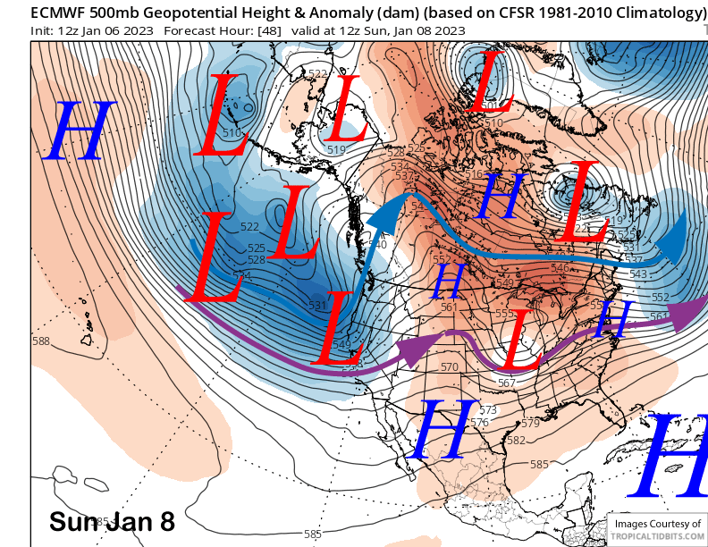
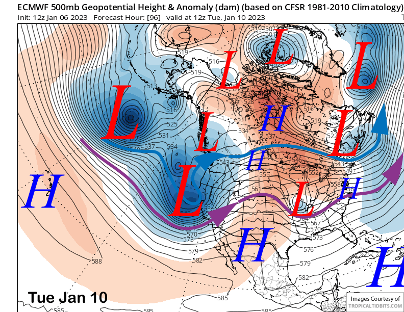
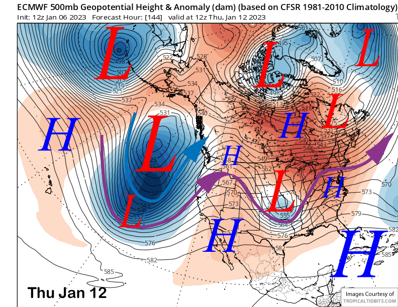
The models move the next and stronger storm quickly into the area on late Sunday night and early Monday with the ECM model moving the deep short-wave trough through the state on Tuesday (image below). With both the polar and southern branches of the jet stream aimed into Central CA (blue and purple arrows), there will be great jet stream support for a big snowfall event.
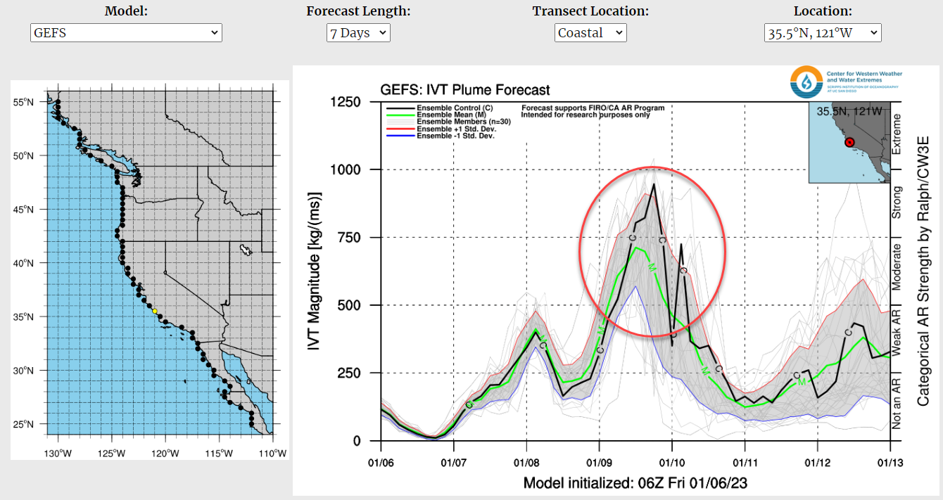
The other question is always the moisture source/amounts. This storm is also expected to contain a moderate to strong Atmospheric River (AR) during is passage (image below-red circle). Thus, moisture supply is not going to be an issue with this storm.
The other issue when an AR is involved is snow levels. All the models currently keep snow levels at town elevation or lower for the event with the peak rise on Monday afternoon to around 7500 feet. However, I would not be surprised if they rise to around 8000 feet. But overall, it looks like all snow for Canyon and Main.
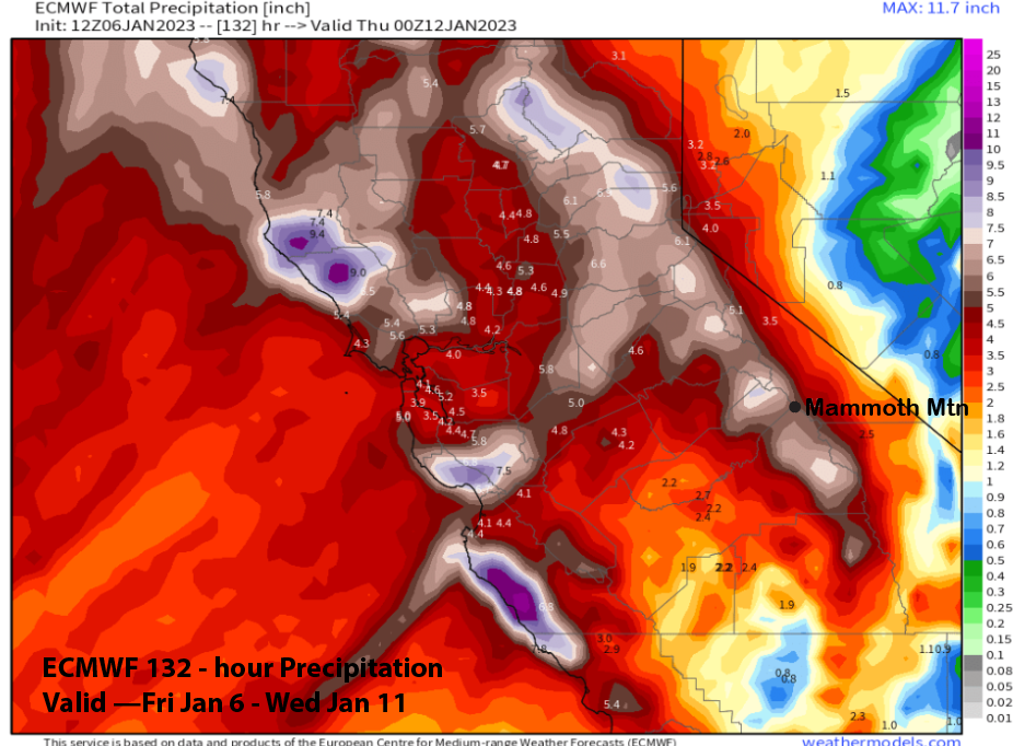
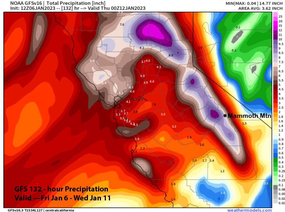
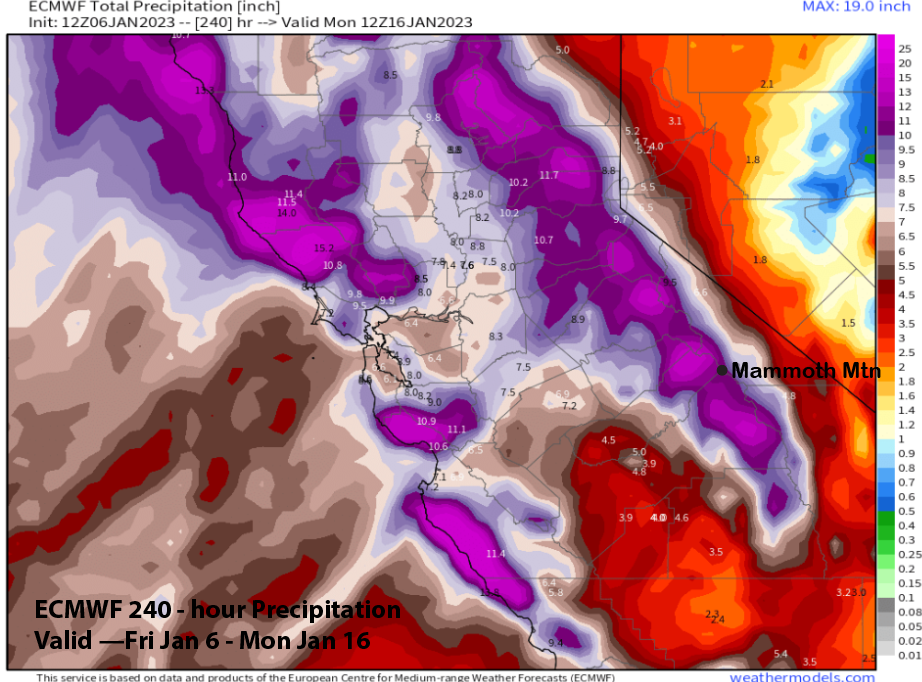
Model QPF for the event is impressive with the ECM model showing about 6” (image below) for the weekend and early next week and the GFS showing more at around 8” (two images below). Most of that is expected with the Monday/Tuesday (three images below) storm when maybe 4 feet of snowfall falls at Main and 5-6 feet up top. This will be more Sierra cement type snowfall. Snowfall ends Tuesday night with a bluebird morning possible on Wednesday.
Long Range (Days 5+)
The longer-range guidance is still showing the storm cycle continuing next week and likely through mid-month. There are hints it may end by the last ten days or week of the month.
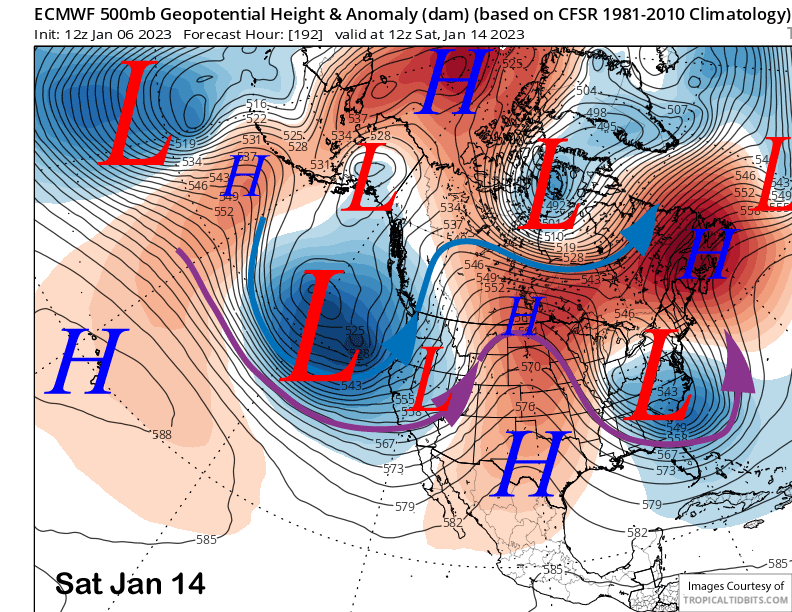
Dry weather is expected Wednesday and next Thursday (image below) as short-wave ridging moves overhead out ahead of the next storm. The ECM model moves the first one onshore on Friday night and Saturday (two images below).
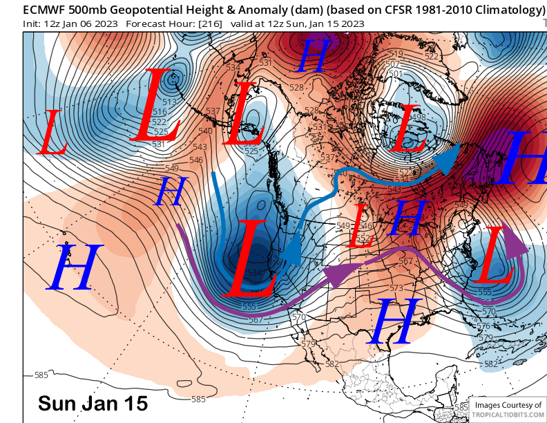
That model then moves a very deep trough into the state over the weekend (image below) that would result in another big snowstorm. However, the other models are different with the GFS weaker and the Canadian showing a different pattern of a re-developing strong zonal jet stream (two images below) that would also produce heavy snowfall, but with higher snow levels.
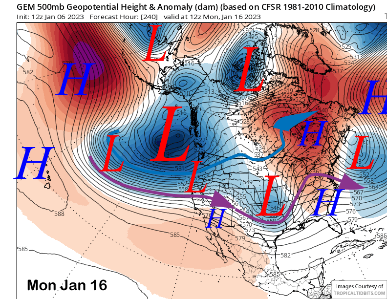
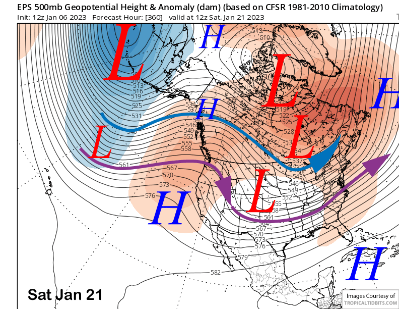
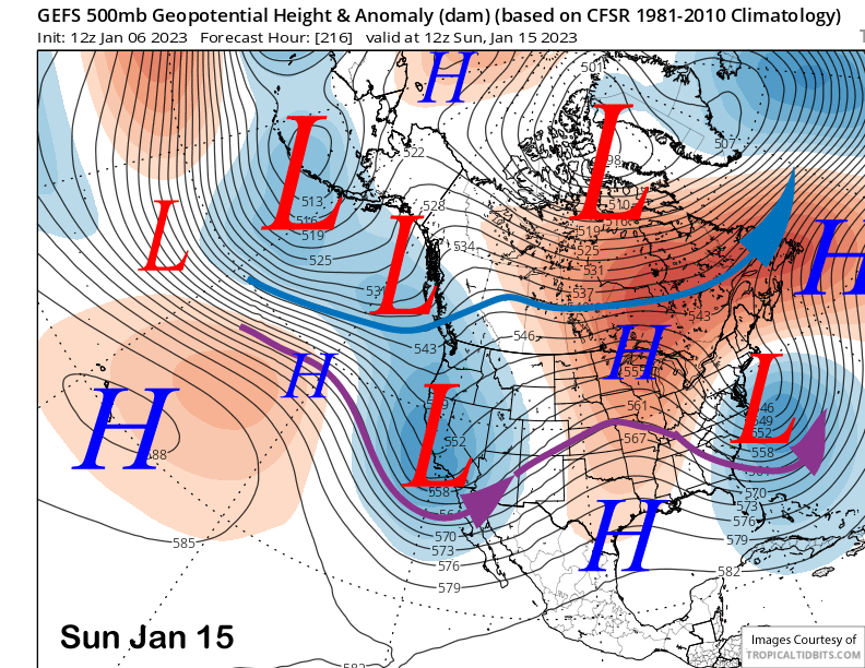
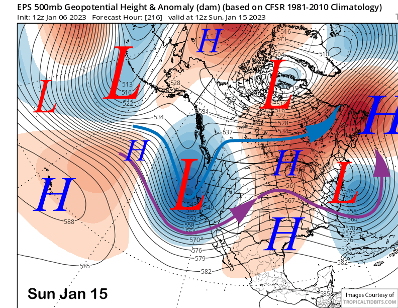
The GFS ensemble is more bullish about a deeper trough though (image below) and the ECM EPS is even deeper with the trough along the CA coast (two images below). Thus, the forecast leans towards another significant snowstorm for that weekend and follows the ECM mean that is showing around 2-3” liquid or 20-30” of snowfall. The ECM 10-day is showing almost 12” liquid (three images below)
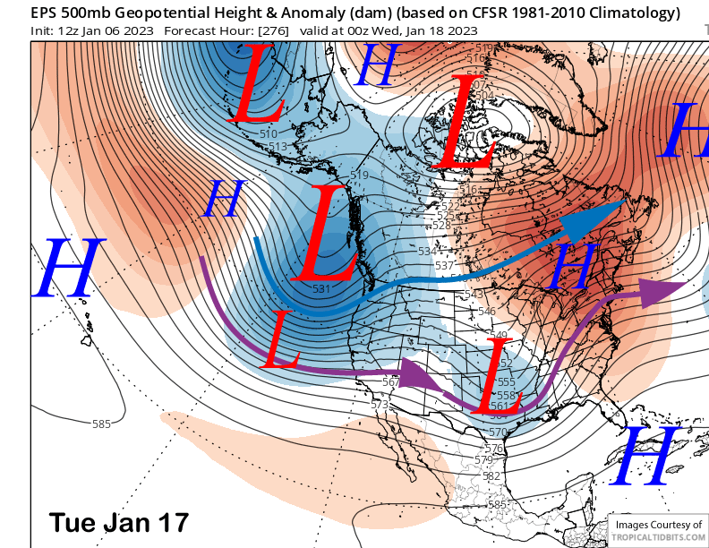
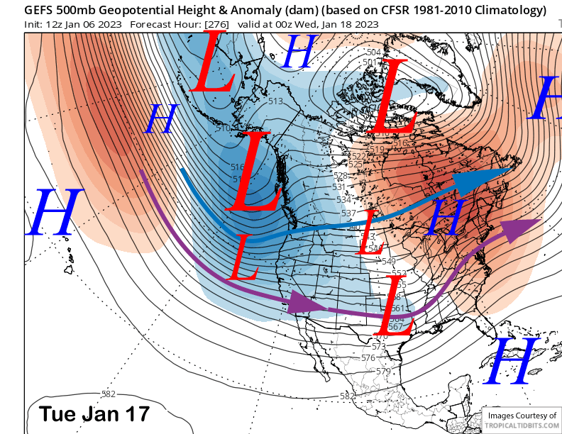
The fantasy range guidance keeps the trough in place over CA with both the ECM EPS (image below) and GFS ensemble (two images below) showing a similar pattern. Only the ECM model is deeper with the trough again. These would probably be colder type storms containing drier powder if that pattern verifies.
Models are then hinting that the storm cycle may end at the back end of the forecast period (image below) with the long-wave trough shifting eastward and a ridge building over the state. It will probably be a good thing if it happens as the town/mountain will likely be buried in snowfall by then and needing a break. WG