Mammoth Mountain Weather Forecast & Discussion

January 9th @ 4 PM Good afternoon, 18 inches of new heavy wet snow today at the Main Lodge. Today’s total brings the 2 day snowfall storm total to 39 inches at the 9000 foot level.

Snow continues to fall moderate to heavy at times, but is expected to turn to light snow showers soon as the main air band slips south of the area over the next couple hours.

However the AR band has seemed to stall on it way south and at last look it appears the band edge is now moving a bit north again, if that holds true there could be more then the 12-18 inches that is in the forecast tonight. If the band does go south over the next couple hours snowfall totals will be less tonight.

On Tuesday the next wave of snowfall will move thru the area along with some thunder storms added to the mix. New snowfall amounts look to be in the 10-20 inch range from 9000 feet up. The snow will be in the 10-1 range so not the heavy wet flakes we saw today. 

There will be moderate to strong winds 25 to 35 mph, with gusts as high as 55 mph. Temperatures will be into the mid to upper 20s with SW winds @ 25-35 MPH with gusts in excess of 55-65 MPH over the higher elevations.

Overall while this is a big event the excessive snowfall rates that can cripple travel for days have not shown up in our area.

For Wednesday snow showers are back in the forecast along with gusty SW winds and highs in the 20s.

Thursday and Friday now look to be pt cloud with no snowfall. There will be increasing clouds and SW winds on Friday to what degree it to still be determined.

The Martin Luther King Weekend Outlook is calling for more snowfall. The storms will be colder and will be measured in inches not feet. More on the weekend with the next update.

Next week the snow continues with the next big break coming around the 20th of this month when a ridge of high pressure will be over Mammoth Mountain and the Eastern Sierra.

Snowman

NWS-Mammoth_Mountain_9000feet
NWS Forecast for the Main Lodge
Mammoth Mountain Summit Webcam View
Mammoth Mountain Webcam from the Summit at 11,053 Feet
Mammoth Mountain Radar Images

Mammoth Mountain Weather Synopsis / Forecast & Data

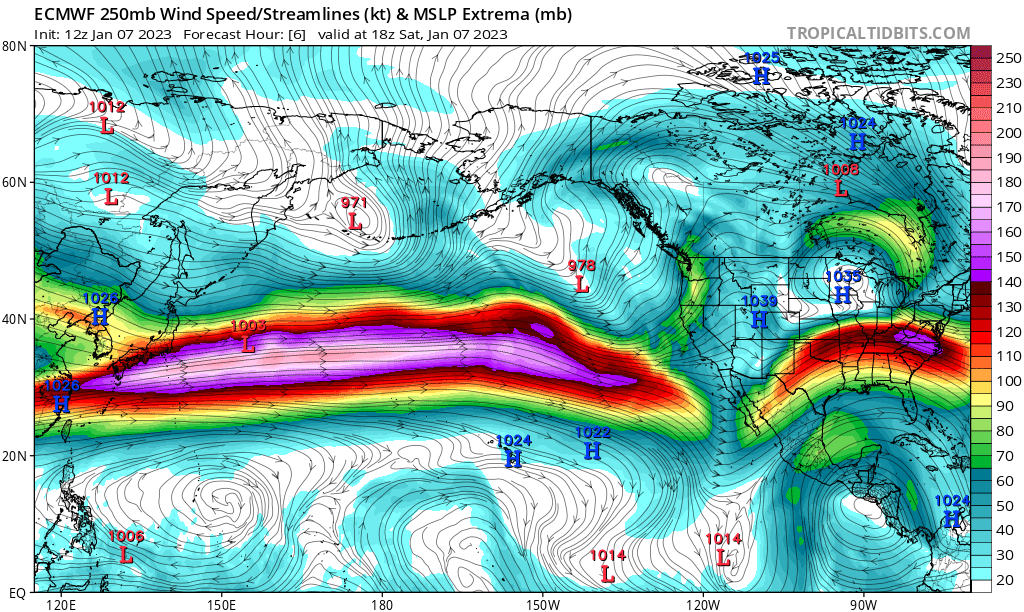
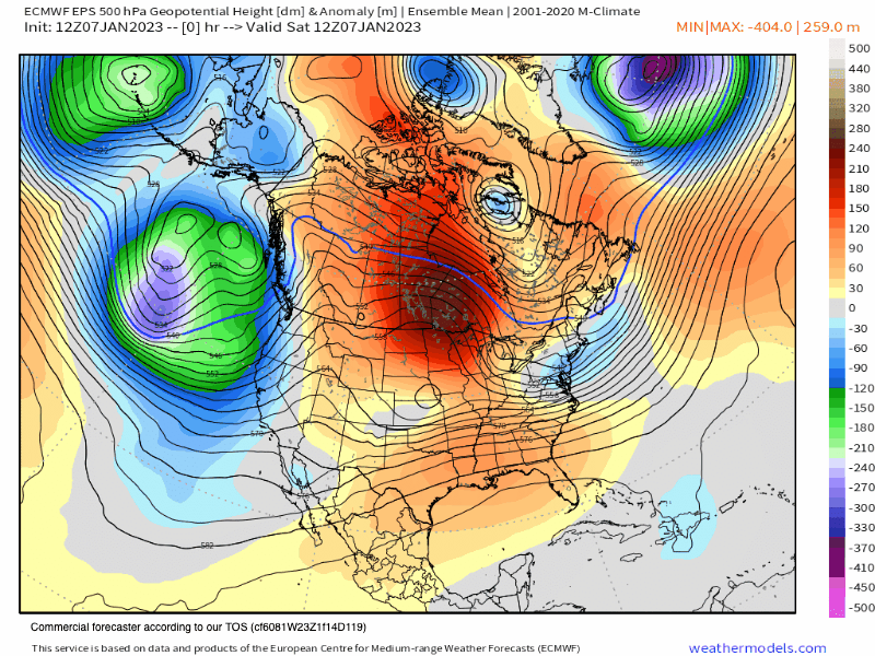
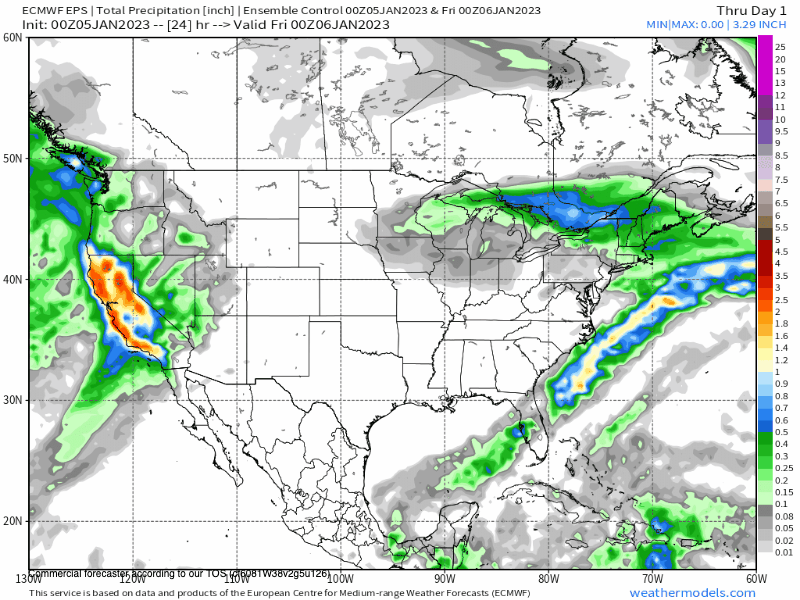
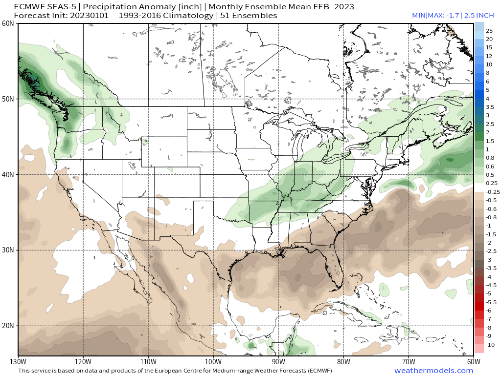
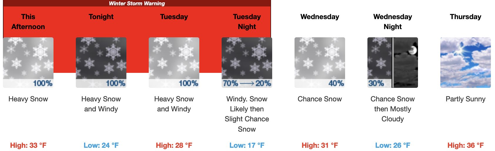
January 7th, 2023 @ 2:38 PM – The mid-latitude storm door remains open as the next two systems move in Tonight / Sunday and then Monday into early Wednesday morning. In the process storm one, comes thru with 7-9 inches possible tonight and 3-5 inches of additional snow through the early morning hours after sunrise.

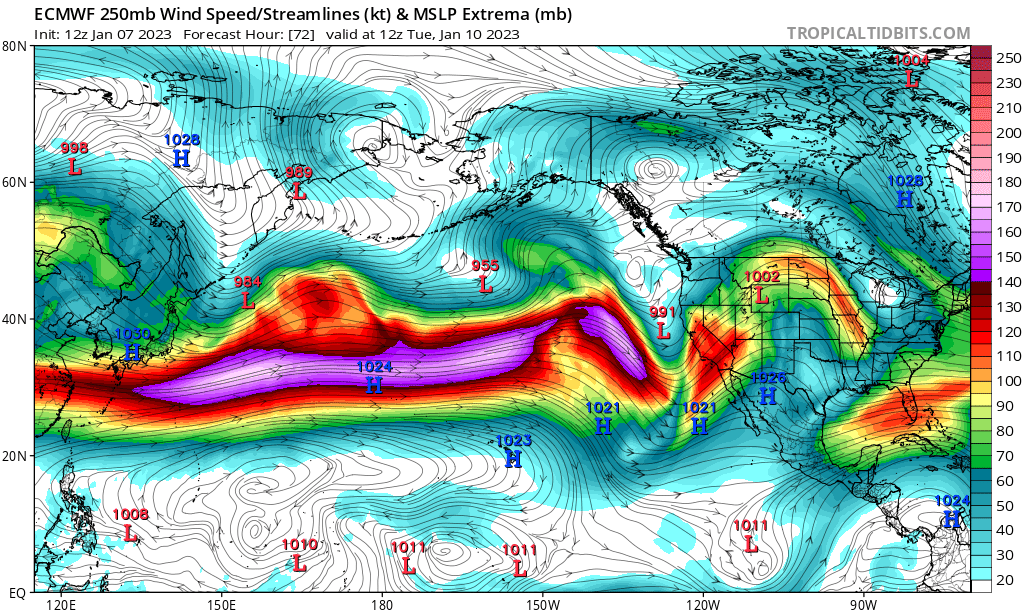
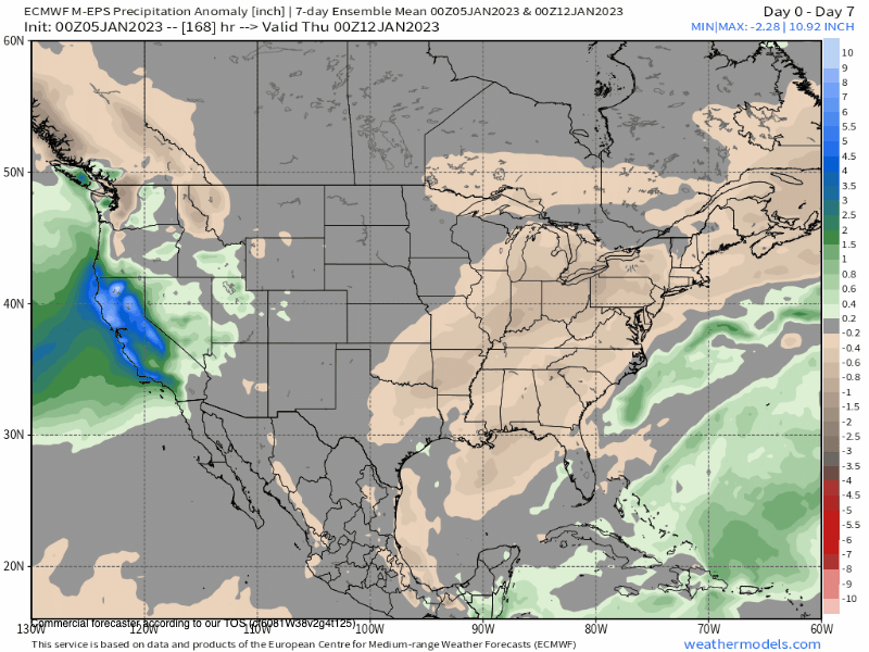
For Monday into Tuesday the next full-on Pineapple connection comes in with possibly 6-8 inches of water content for the higher elevations. As of now, models have the AR band moving right over Mammoth Mountain and the Eastern Sierra.

That setup would bring excessive snowfall rates to not only the mountain but down into town and onto 395 by late Monday / early Tuesday. The forecast for the AR band will most likely waver a bit but you should be prepared to see big snowfall numbers into early Wednesday.

Snow levels tonight into Sunday will be down to around 5500 feet or halfway down the Sherwin Grade with an accumulation of snow on the road expected from Toms Place north.

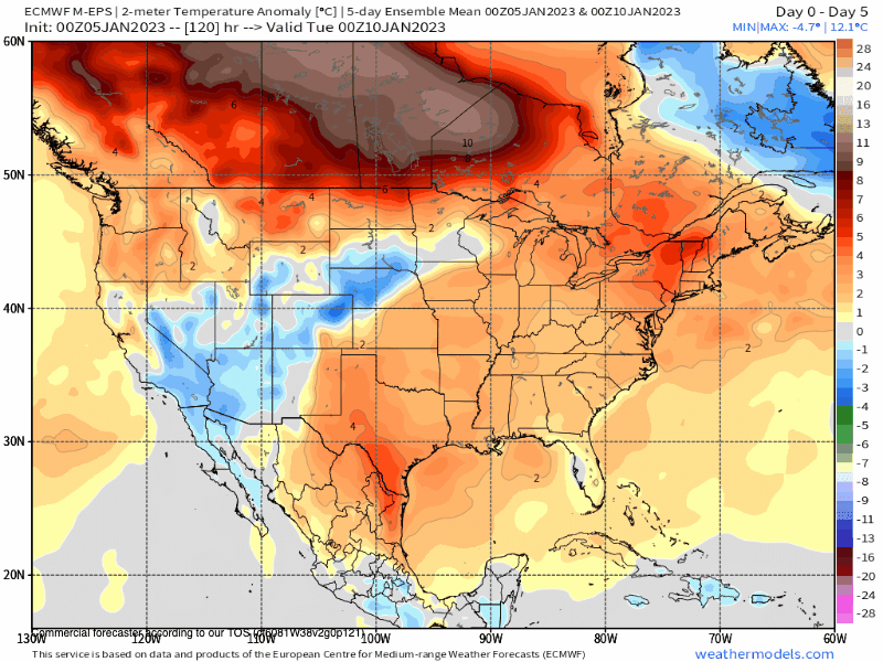
Snow levels will come up on Monday to around 7500 to 8000 feet, so a mix of snow and rain in town with all snow from Canyon Lodge up. By Monday night into very early Tuesday snow levels will come all the way down to Tom’s place and possibly down the Sherwin grade a bit at the end of the event.

ECM Snowfall Forecast for Mammoth Mountain and Mammoth Lakes - Mammoth Weather
ECM Snowfall Forecast for Mammoth Mountain and Mammoth Lakes – Mammoth Weather

Below is an image of the Current Strong Jet Stream that’s driving the AR Train into the West Coast.

Below is an image of the Strong Jet Stream as it’s plowing into the West Coast on Tuesday with a very strong low and a high level AR plume that is right over Mammoth Mountain.

The gif below shows the total column water or what you hear as the AR rivers of water flowing out in the ocean. You can see California gets several more hits over the next week.

This pattern looks to last up until around the 20th of January when a ridge will move into the area for the first big break in the action. At that time the mid latitude jet look like it will come to an end. That would complete the classic 21-day wet cycles we have seen over the years here in Mammoth. 

Way off in the ultra Fantasy Outlook period the Eastern Sierra looks to enter a period of cooler than normal weather with snowfall returning to a none Sierra cement version.

That pattern could bring a bonanza of powder with very low snow levels, however it could also bring colder and drier systems as they slide in the great basin. Fun to look at the longer range but it can change fast like the forecasted dry spell for the holidays that went ultra wet over night just a couple weeks back now.


EPS Weeklies Precipitation Anomaly out 31 Days

EPS Weeklies Precipitation out 31 Days

EPS Weeklies Temperature Anomaly out 31 Days

1-7-2022 – The new run of the EPS Seasonal is out and it continues to show the trend of an average to above-average winter for snowfall. So good vibes moving forward as we continue with this snow season.

See you out on the hill, Snowman

Mammoth Mountain and Eastern Sierra Weather Posts