Mammoth Mountain Weather Forecast & Discussion

January 14th @ 3:51 PM –  Winter Storm Warning Tonight through Monday Night

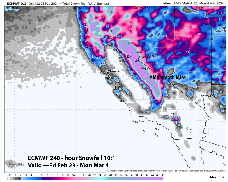
Today’s system over preformed from what was forecast on yesterdays update. With 22-27 inches of new snow and there is still light to moderate snowfall at times out on the hill. Looks like there could be 8-12+ more inches by the morning.

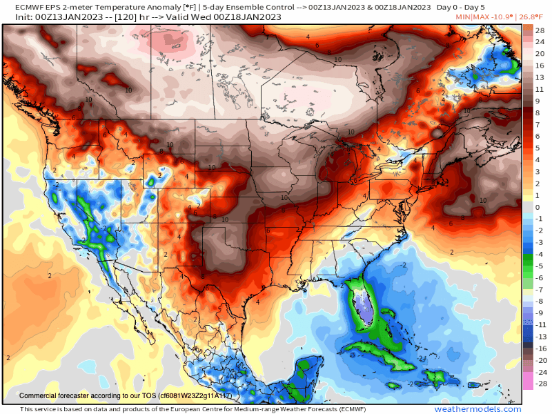
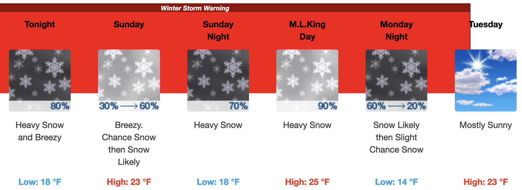
By Sunday AM snow showers will be likely early on with colder air will settling into the area with highs in the low to mid-20s with SW winds of 10-20 MPH and gusts up to 35-45 MPH.

One more system then moves thru on Martin Luther King Day into the overnight hours with an additional 1-2 feet of snow possible out on the hill.

For you, travelers down on 395, the forecast calls for 3-5 inches of wet accumulating snow on Saturday night. For those departing on Monday, there will be more snowfall also expected in the 3-5 inch range.

Take it easy in the wet snow as it’s extremely slippery. I have seen way too many cars that have flipped over the last 3 weeks, slow down and make it safely in or out of the area.

Snowman

For the Powder Outlook updated Tuesdays and Fridays at 5 PM, use this link.

Weather Videos: On the playlist below you will find a more in-depth general weather forecast. We are working on a format so we can post a specific Mammoth Mountain Weather video forecast soon. There are also some ski patrol videos of Avy control on the playlist and some other fun weather and snowfall-related stuff.

Mammoth Mountain Weather Radar Image Live Feed from Intelicast
Mammoth Mountain Weather Satellite View Live Feed from W.U.
Mammoth Mountain Weather Satellite Image Live Feed

Fantasy Longer Range Outlook: 1-14-23 – The end of the mid-latitude storm track will hit on Tuesday. The current weather pattern Mammoth is in all started back on December 26th. 

The next pattern that sets up will have ridging off the coast with inside slider-type weather systems that drop into the great basin. This is a much drier weather pattern that brings with it cold air via a north-to-northeast flow.

Near the end of January into early February the ridge retrogrades enough that the sliders might move to the west of the Sierra. If and when that happens there would be some sweet Alta-type powder to ski and ride on.

Snowman

EPS Ensemble 16 Day
GEFS Ensemble 16 Day
Snowfall Outlook
Temperature Anomaly

Extra Long Fantasy Range Outlook

1-14-2023 – Below you will see both the long range EPS and GEFS runs. Both have more snowfall starting around January 27th with off and on systems for a couple weeks. These systems if they do happen will not have the heavy wet Sierra Cement snow.

There is the potential for some great Alta Powder, “Riders of the Storm” Days by the first week of February if this data verifies. ( This in not a forecast just a fantasy outlook based on the data. )

EPS Ensemble Control to Mid February
GEFS Ensemble Mean out to Mid February

EPS Seasonal Weather Data for Mammoth Mountain – 1-7-2022 – The new run of the EPS Seasonal is out and it continues to show the trend of an average to above-average winter for snowfall. So good vibes moving forward as we continue with this snow season.

See you out on the hill, Snowman

ENSO Outlook

Mammoth Mountain and Eastern Sierra Weather Posts