Powder Forecast – Tuesday January 17th, 2023
Ted Schlaepfer CCM —- Mammoth Mountain WeatherGuy
Snowfall forecasts are valid at the Sesame snow course (Main Lodge) for the prior 24 hours as reported in the 6-7 AM morning snow report.
**Snowfall forecast confidence ranges from very low (1) to very high (5)
Wed 1/18 = 0”
Thu 1/19 = 3 – 5” (H20 = 0.30” – 0.40”) **4
Fri 1/20 = 0”
Sat 1/21 = 0”
Sun 1/22 = 0”
Mon 1/23 = 0”
Tue 1/24 = 0”
Wed – Fri 1/25 – 1/27 = 0”
January Snowfall = 183”
January Forecast = 185 – 200”
Detailed 4-day Snowfall Forecast
Wed 1/18 – Dry during the day with increasing clouds PM, then light to moderate snowfall develops overnight. Accumulations 3 – 5” by Thursday AM, up to 6” up top
Thu 1/19 – Light snow showers or flurries during the morning, then dry by PM. No accumulation expected.
Fri 1/20 and Sat 1/21 – No snowfall expected both days
Forecast Summary:
Short Term (Days 1 – 4):
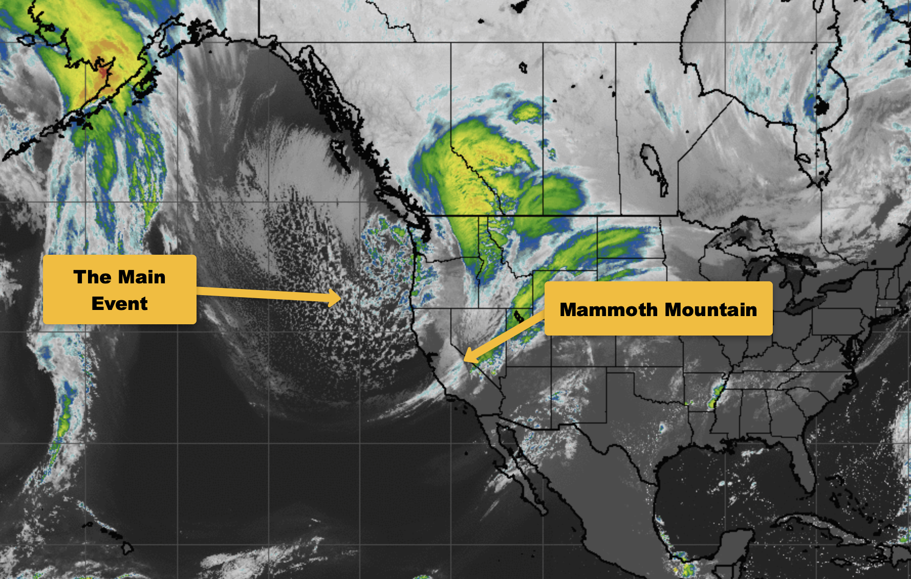
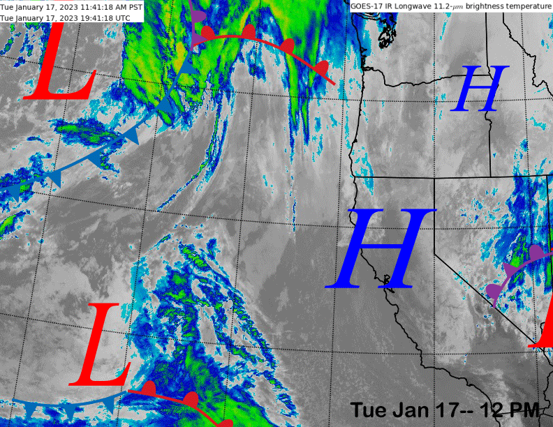
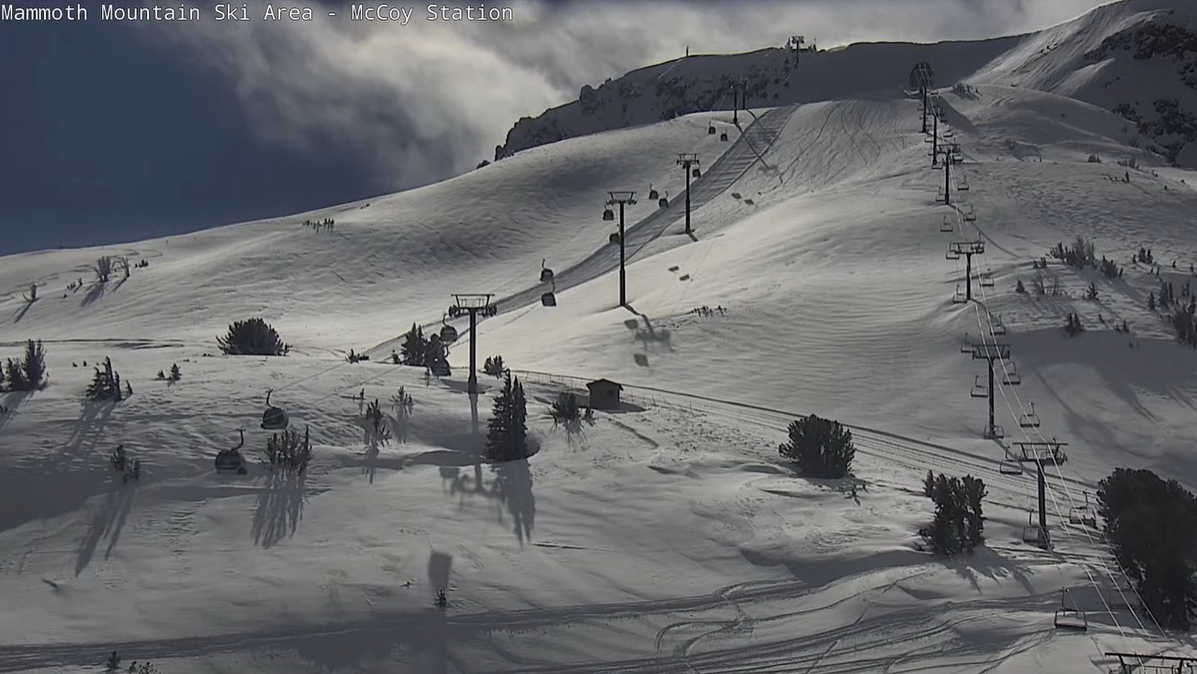
The current infrared satellite image (below) shows that the wrap-around flow associated with the previous storm has moved eastward and high pressure will build into the region through most of tomorrow. Looks like the sun finally came out to expose well-covered Ch. 3 runs on the cams (two images below).
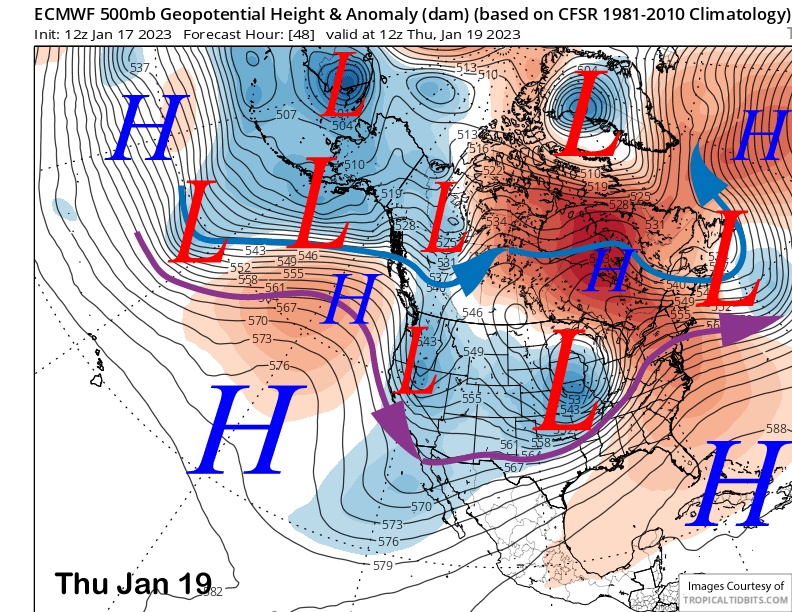
After a break from snowfall through most of tomorrow, the models move the last short-wave trough of the extensive storm cycle through the area on Wednesday night and early Thursday (image below). And it will be the weakest of the previous storms as it is taking an inside slider type trajectory.
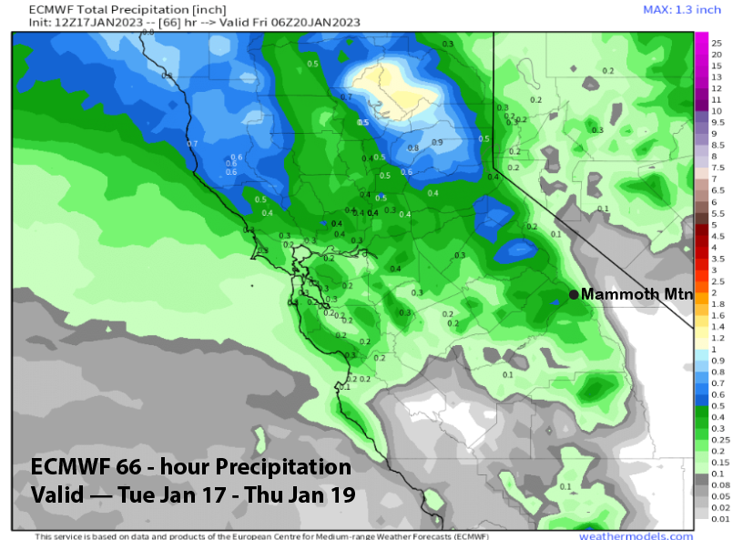
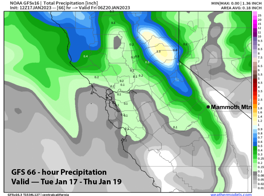
Nonetheless, the latest run of the ECM model produces about a third of a inch of liquid (image below) while the GFS is showing slightly less (two images below). ECM snowfall output (three images below) is showing around 3-4 inches and enough for at least low-end powder conditions, especially given the powder conditions already in place.
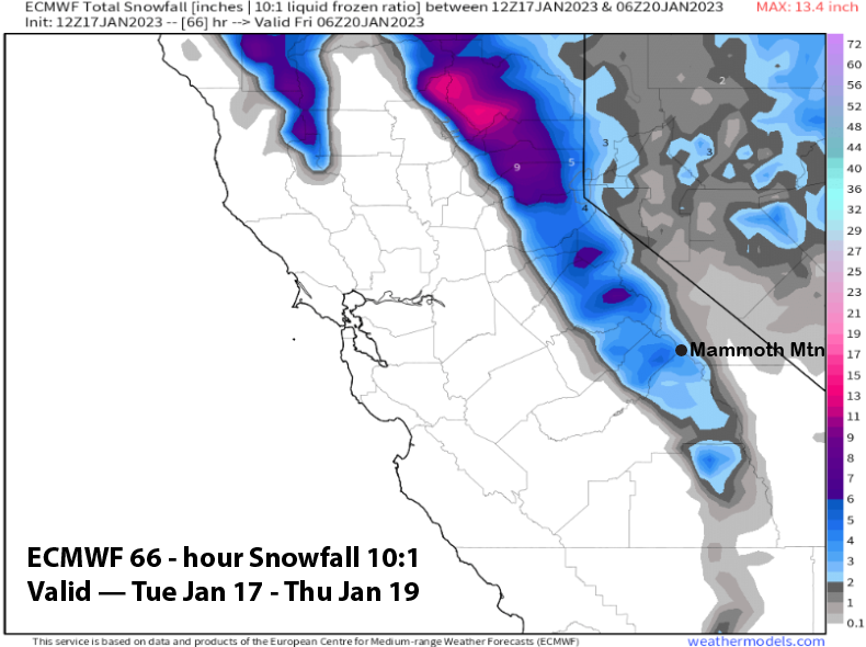
It will be a cold storm with snow levels around 3500 feet, so the powder will not be cement, but rather light and fluffy. Should be fun out there on the mountain on Thursday.
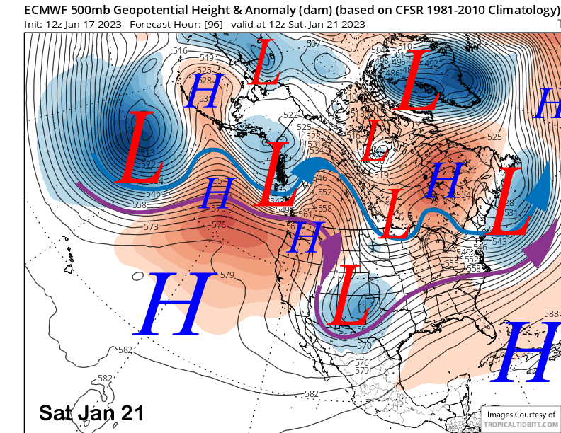
High pressure will then build into the state on Friday and hold through the weekend (image below) for the start of an extended stretch of fair and dry weather.
Long Range (Days 5+)
The longer-range guidance hasn’t changed much, favoring dry weather until possibly the last part of the month or early February.
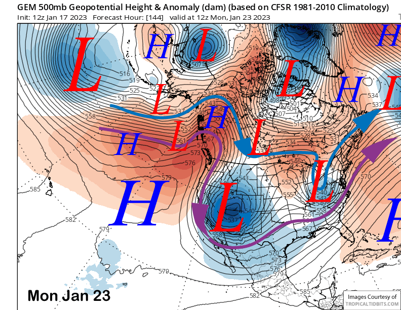
The only real dilemma with the forecast over the next week or so is whether an inside slider trough will move southward into southeast California early next week. The Canadian model is the strongest with the low (image below) while the GFS has a weaker version (two images below). Both models would produce colder temperatures and northeast winds with the Canadian more robust.
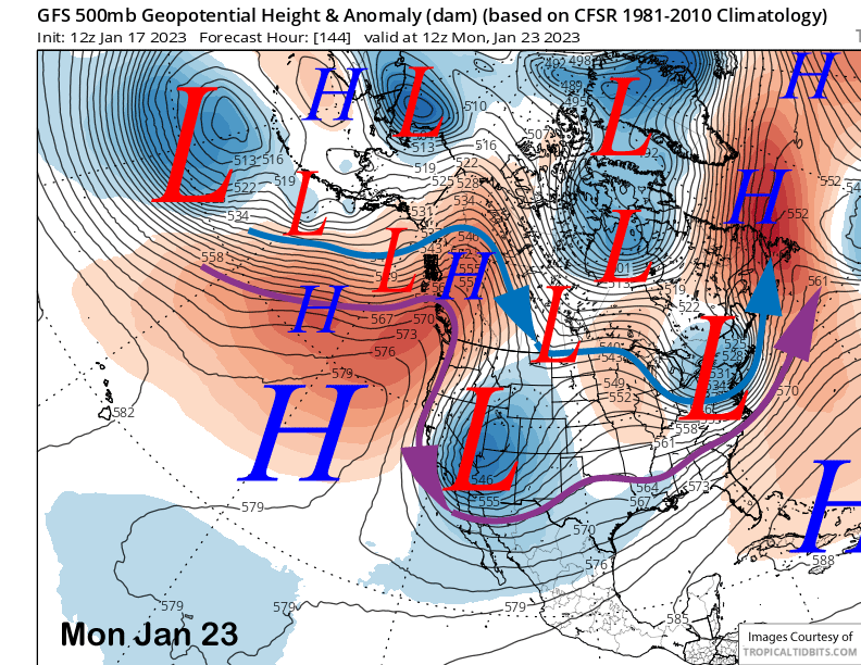
The ECM model (image below) has the upper-low much farther eastward and keeps high pressure closer to CA. That would mean warmer temperatures and less wind. Forecast follows a blend of the GFS and ECM and favors only a weak slider east of CA, resulting in continued dry weather and only seasonably cool temperatures, in addition to not super strong winds.
The ECM ensemble is forecasting a ridge to remain in place off the West Coast through the 10-day period (image below). Also favors the passage of a weak slider every couple of days. Thus, conditions should be good with all the new snowfall and temperatures remaining near normal.
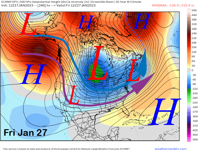
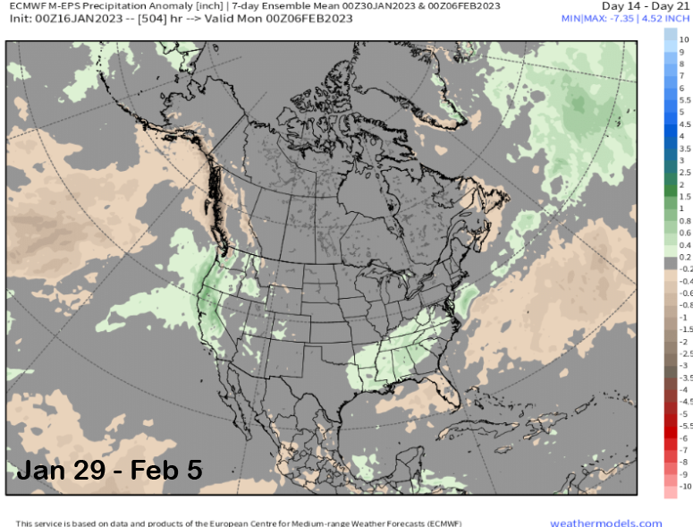
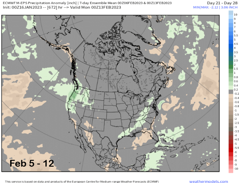
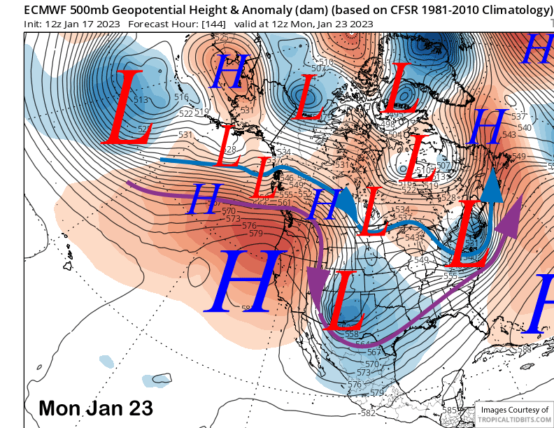
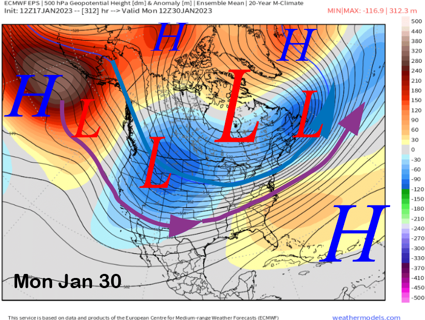
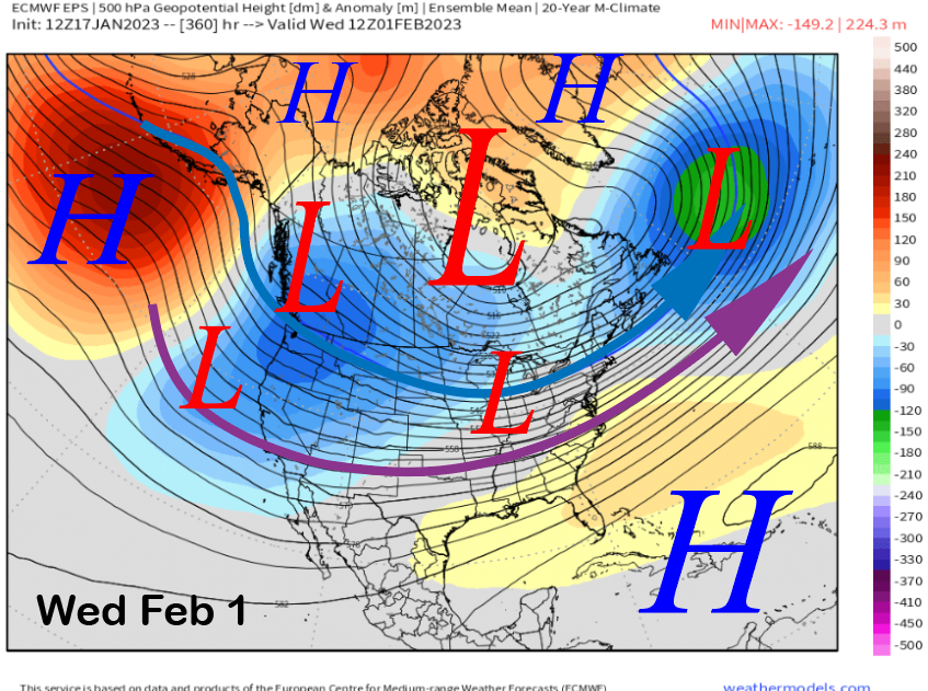
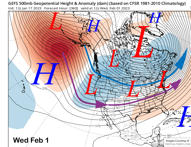
The fantasy range guidance is still favoring discontinuous retrogression (ECM EPS images below) westward of the long-wave trough that is expected to be in the middle of the US next week. That would allow colder type storms to start moving into CA toward the end of the month or early February. The GFS ensemble is also showing this scenario (three images below).
That could potentially lead into the next storm cycle and the Monday run of the 45-day ECM EPS is still showing slightly above normal precipitation in week 3 (image below) and average precipitation in week 4 (two images below). And hopefully they will be colder storms with drier powder now that we have an enormous base. WG