Powder Forecast – Friday January 27th, 2023
Ted Schlaepfer CCM —- Mammoth Mountain WeatherGuy
Snowfall forecasts are valid at the Sesame snow course (Main Lodge) for the prior 24 hours as reported in the 6-7 AM morning snow report.
**Snowfall forecast confidence ranges from very low (1) to very high (5)
Sat 1/28 = 0”
Sun 1/29 = 0”
Mon 1/30 = 5 – 8” (H20 = 0.30” – 0.50”)**2
Tue 1/31 = 0”
Wed 2/1 = 0”
Thu 2/2 = 0”
Fri 2/3 = 0”
Sat – Mon 2/4 – 2/6 = 3 – 9”
January Snowfall = 186”
January Forecast = 190” – 195”
Detailed 4-day Snowfall Forecast
Sat 1/28 – No snowfall expected
Sun 1/29 – Light to moderate snowfall develops during the day and continues overnight before ending around dawn Monday. Accumulations 5 – 8” by Monday AM, 8”+ in spots up top
Mon 1/30 and Tue 1/31 – No snowfall expected both days
Forecast Summary:
Short Term (Days 1 – 4):
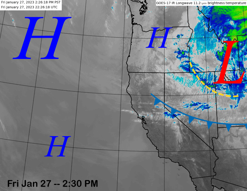
The current infrared satellite image (below) shows a weather system east of CA and a trailing cold front clipping northeast CA. That system will just produce slightly colder temps Saturday on the hill.
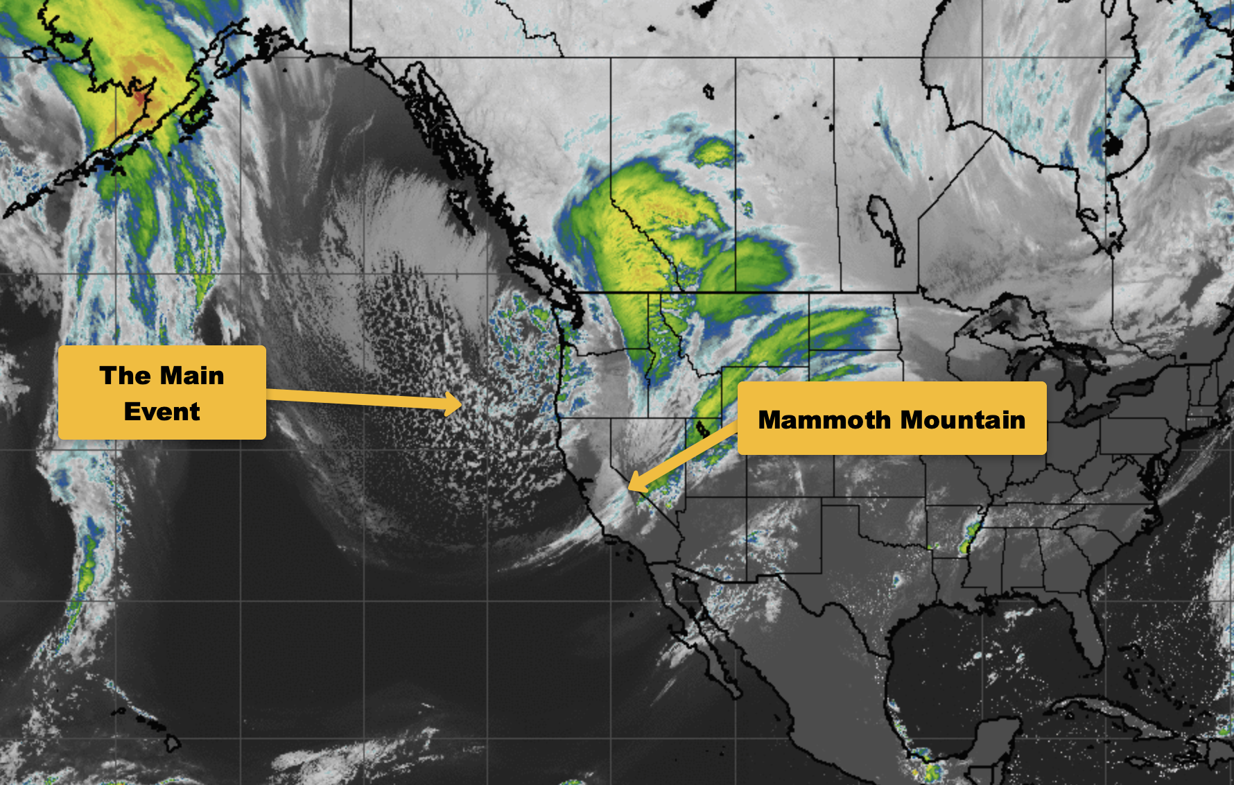
A more impactful low-pressure system is forecast to move southwestward through CA on Sunday and into Monday (images below).
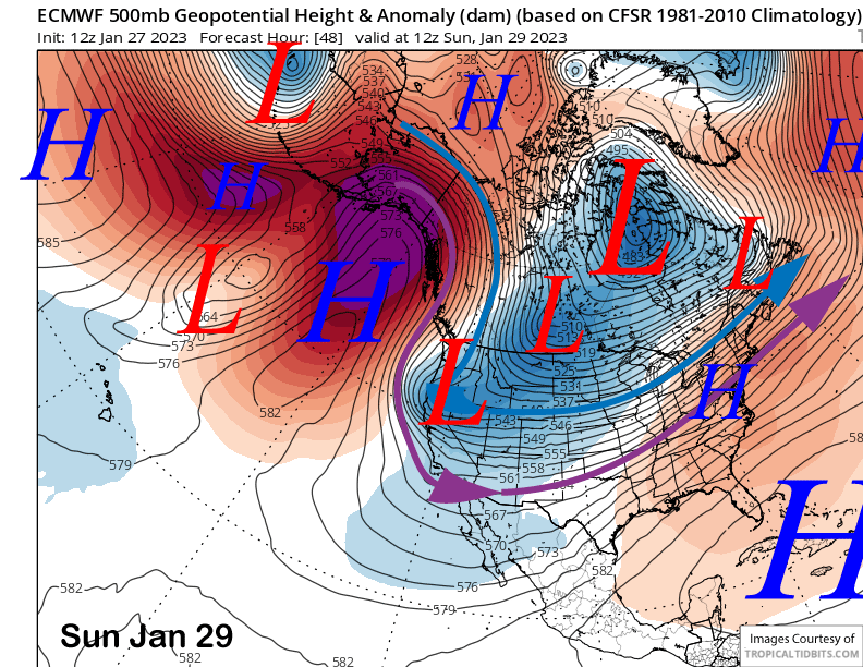
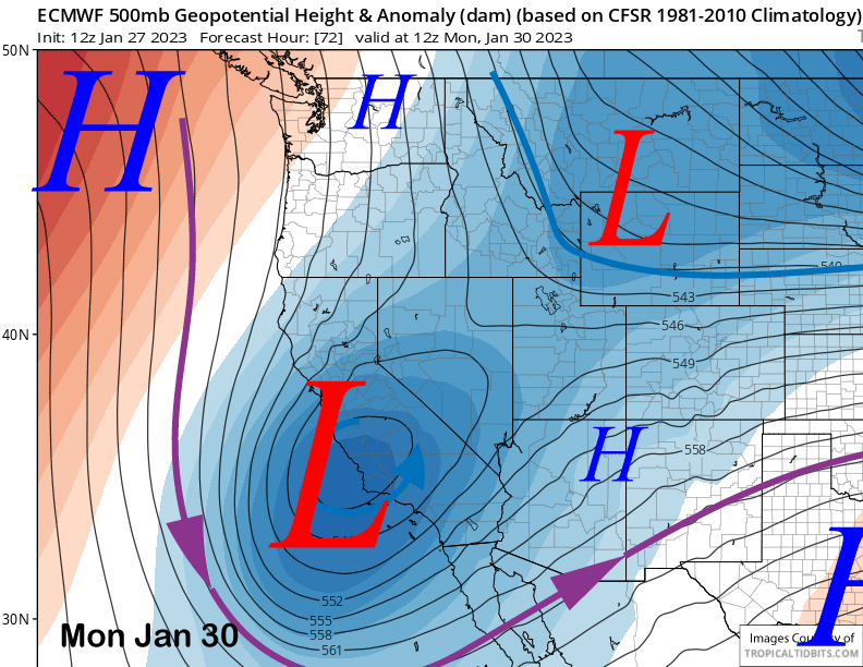
The cold front will move through Sunday afternoon and that is when snowfall will increase after starting late morning or midday. The ECM then cuts off the upper-low over central CA on early Monday (image above) and that will produce some northeast upslope snowfall on the back end of the event late Sunday night. Snowfall should end around or just after dawn on Monday followed by dry weather on Tuesday.
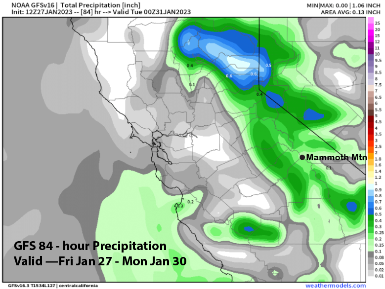
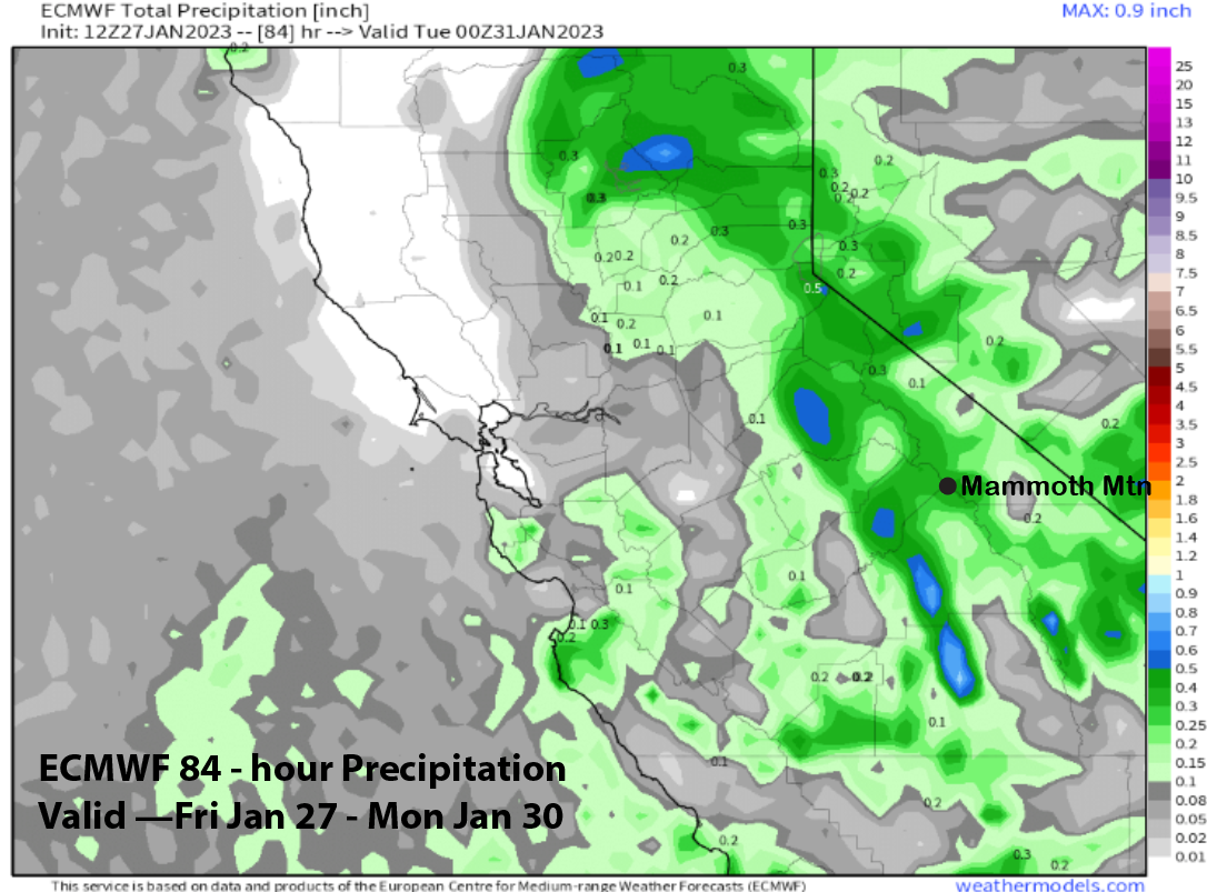
Amounts with the system vary from very little per the GFS (image below) to around 0.40” from the ECM (two images below). It will be a cold storm and snow ratios high at around 15-25”:1” and that could add up to 6” plus at Main and maybe up to 9” up top if the ECM is correct. GFS would be half those amounts. Regardless, it will probably be enough for at least low-end powder conditions on Monday.
Long Range (Days 5+)
The longer-range guidance has continued to trend mostly drier after looking somewhat promising in the extended forecast period and is a reminder why we often call it the fantasy range. It also reminds me a bit of the last couple dry seasons when every storm chance fizzled when it got inside the 10-day forecast range.
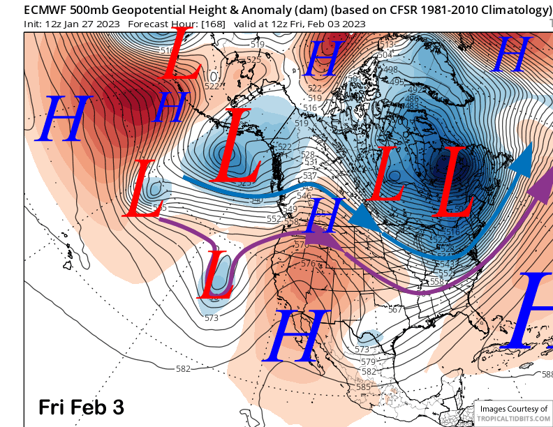
High pressure will hold through mid-week next week for dry weather with the GFS and ECM models at odds with the potential weather pattern for the end of the week. The ECM (image below) keeps the ridge in place over CA through Friday for continued dry weather.
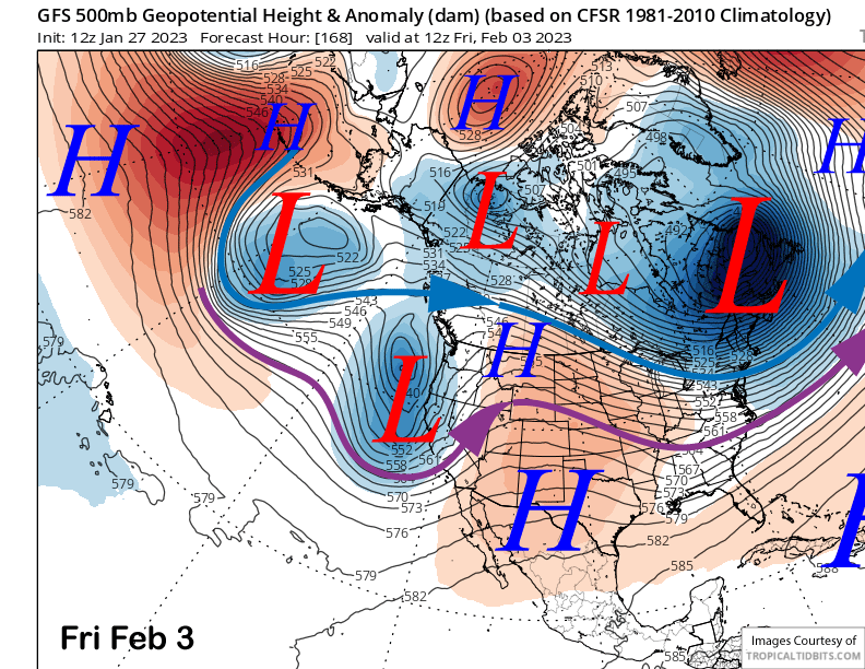
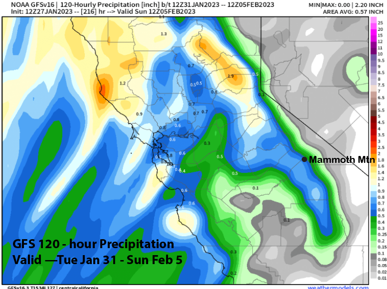
The GFS, on the other hand, moves a short-wave trough into the state (image below) resulting in enough snowfall for powder conditions at around 0.65” liquid (two images below). The Canadian model is closer to the GFS, but weaker and a bit farther northward. Current forecast favors some snowfall, but not a major storm, and hopefully enough for powder conditions.
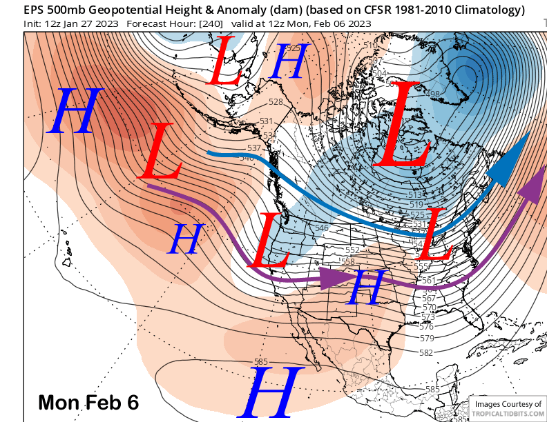
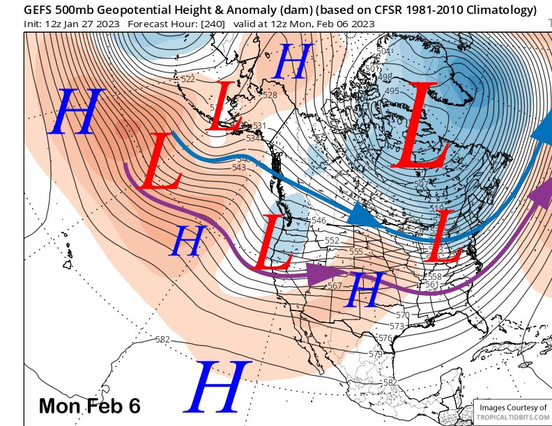
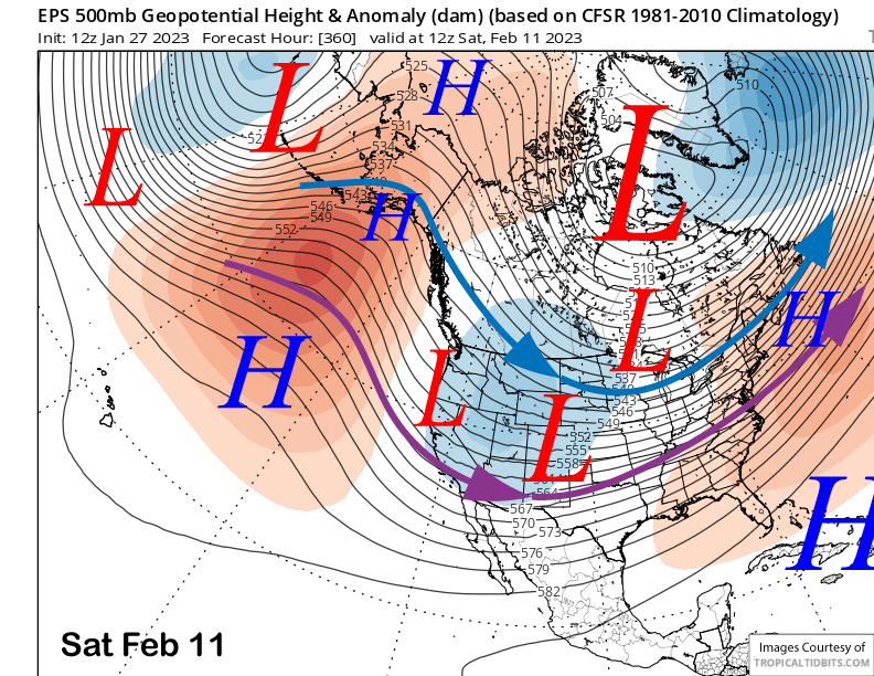
The longer-range guidance is in better agreement with a short-wave trough passage around the following Monday with both the ECM EPS (image below) and GFS ensemble (two images below) fairly similar in their respective output. Again, this one also doesn’t appear to be a big storm with probably only low-end powder conditions.
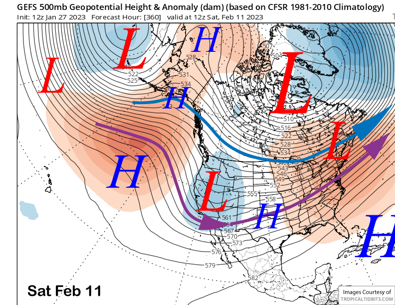
Fantasy range guidance between the ECM and GFS is fairly similar. Both models (images below) move the long-wave trough east of CA and into the Rockies with a chance for weak short-waves to move through CA in northwest flow on the back side of the trough.
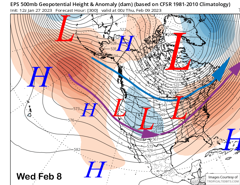
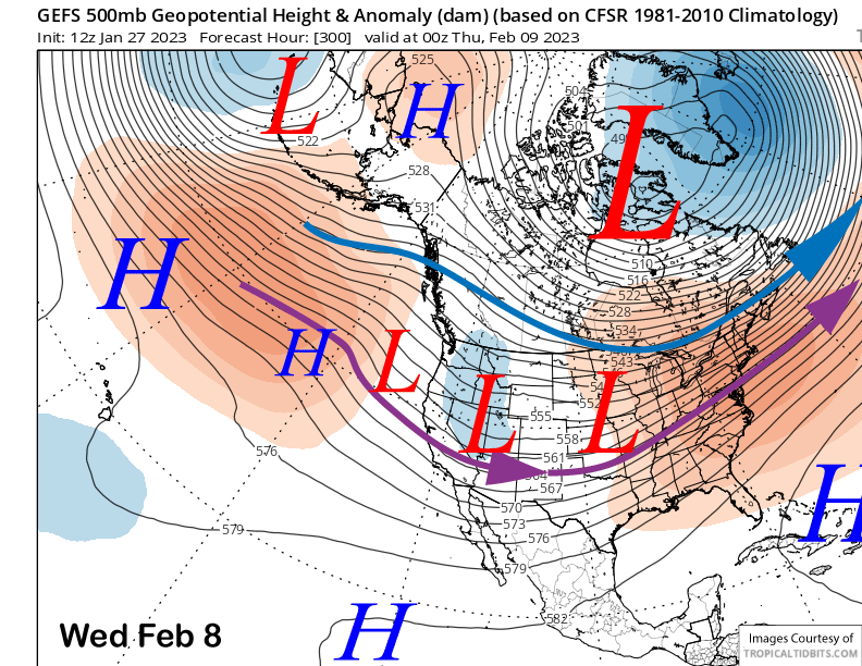
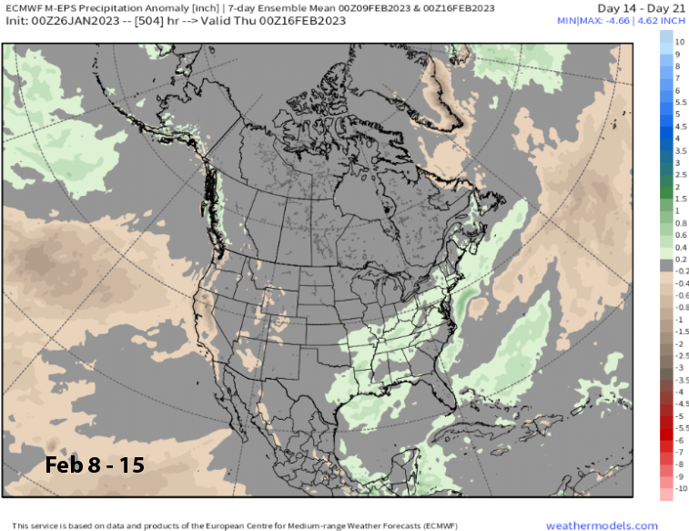
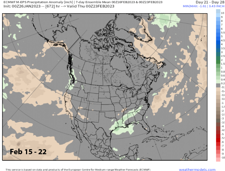
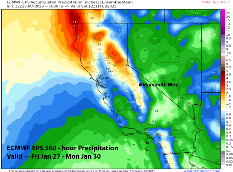
The models keep this basic pattern in place (images below) through the end of the forecast period. That means there could be a weak/cold storm every few days for a chance of at least low-end powder days, but likely no big storms that would produce deep powder days. ECM EPS precipitation forecast (three images below) is only showing around 1” liquid for the 15-day period, not a lot.
 The climate models are also looking rather bleak with the latest ECM EPS 45-day outlook favoring below normal precipitation through 3rd week of next month (images below). February snowfall overall is also appearing that it may end up below normal. The models have been wrong before. WG