Powder Forecast – Tuesday January 31st, 2023
Ted Schlaepfer CCM —- Mammoth Mountain WeatherGuy
Snowfall forecasts are valid at the Sesame snow course (Main Lodge) for the prior 24 hours as reported in the 6-7 AM morning snow report.
**Snowfall forecast confidence ranges from very low (1) to very high (5)
Wed 2/1 = 0”
Thu 2/2 = 0”
Fri 2/3 = 0”
Sat 2/4 = 0 – 1”
Sun 2/5 = 3 – 6”
Mon 2/6 = 3 – 6”
Tue 2/7 = 0”
Wed – Fri 2/8 – 2/10 = 0 – 3”
January Snowfall = 190”
January Forecast = 190”
Detailed 4-day Snowfall Forecast
Wed 2/1 and Thu 2/2 – No snowfall expected.
Fri 2/3– Chance for flurries or light snow showers during the day. No accumulation expected.
Sat 2/4 – No snowfall expected during the day, then snowfall likely develops overnight. Accumulations 3 – 6” by Sunday AM, 6”+ up top.
Forecast Summary:
Short Term (Days 1 – 4):
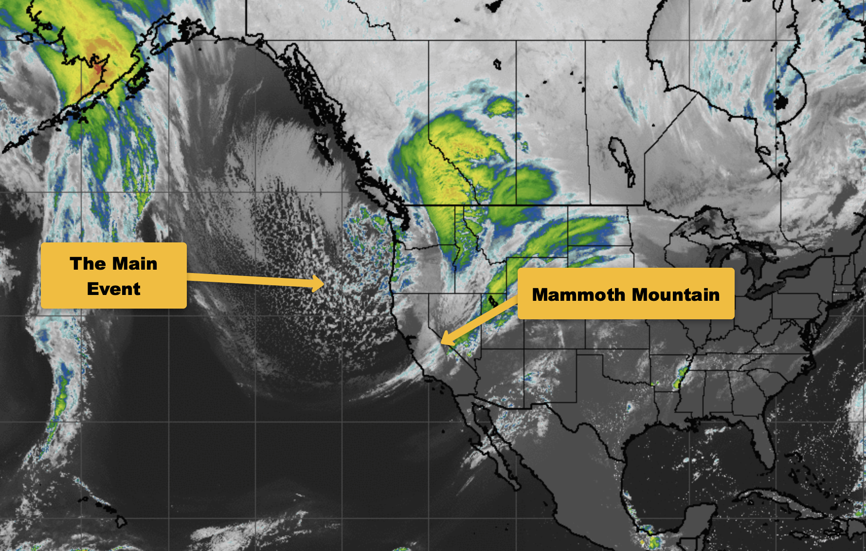
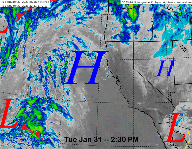
The current infrared satellite image (below) shows clears skies over the state thanks to high pressure off the coast with a couple of weak systems about to spit some high cloudiness over CA over the next couple of days.
Models move a short-wave onto the North Coast by early Friday (image below) and the front is expected to weaken rapidly south/east of the Bay Area as the system lifts off to the northeast. There will be passing clouds Friday along with breezy/gusty winds, but any snowfall will likely be just flurries or light snow showers during the day as the operational models are dry.
A few ensembles are showing very light amounts though, so an inch is not out of the realm of possibility. Overall, powder conditions are not expected. Fair weather with lighter winds is forecast for Saturday with increasing clouds Saturday evening and night.
Long Range (Days 5+)
The longer-range guidance is about the same versus the last update with another decent chance for powder on Sunday followed by minor chances through mid-month. Still no clear signs of a notable storm cycle.
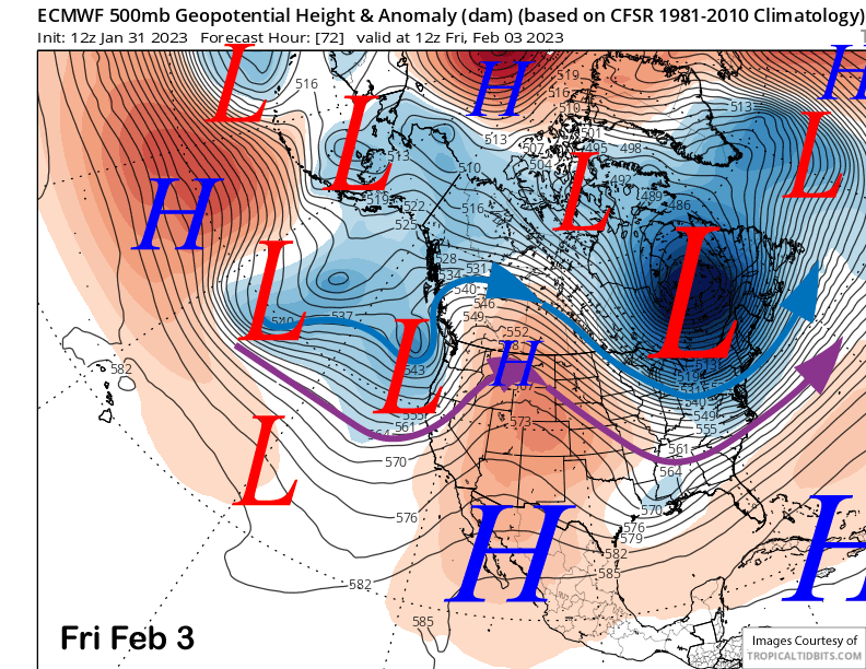
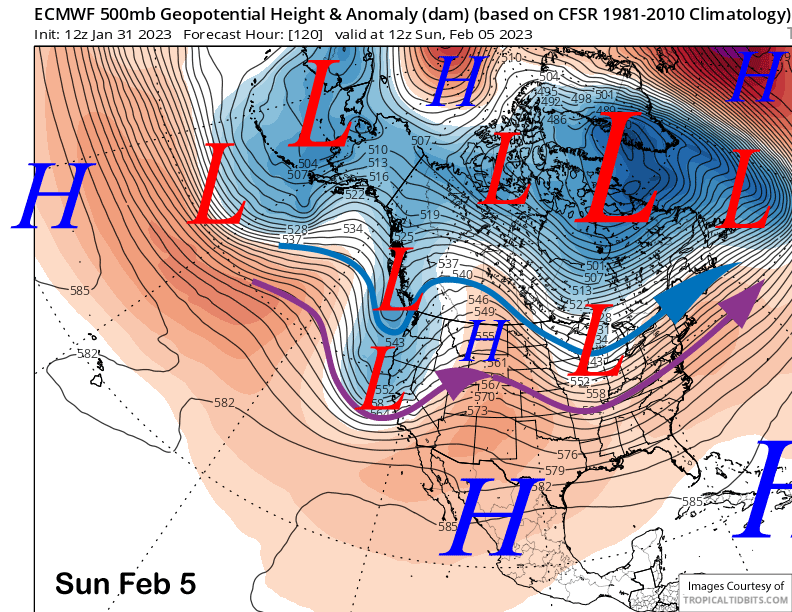
The ECM and other models move a moderate strength short-wave trough into CA on Sunday (image below) as the weaker portion splits off into the PacNW. The jet stream (purple arrow) will be father southward this time and should drive a cold front southward along the Sierra overnight Saturday and into Sunday.
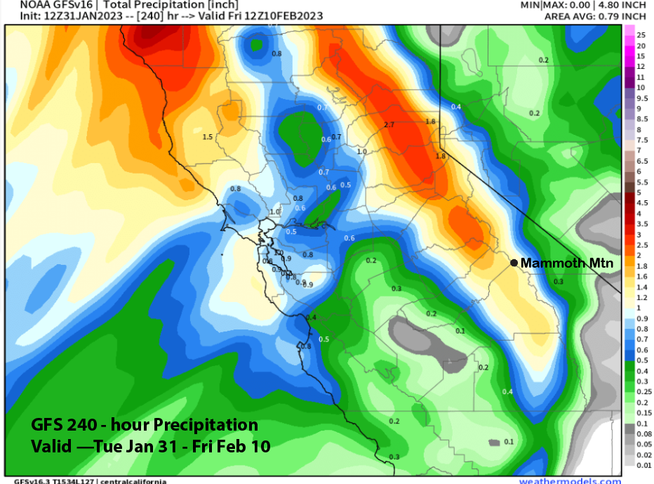
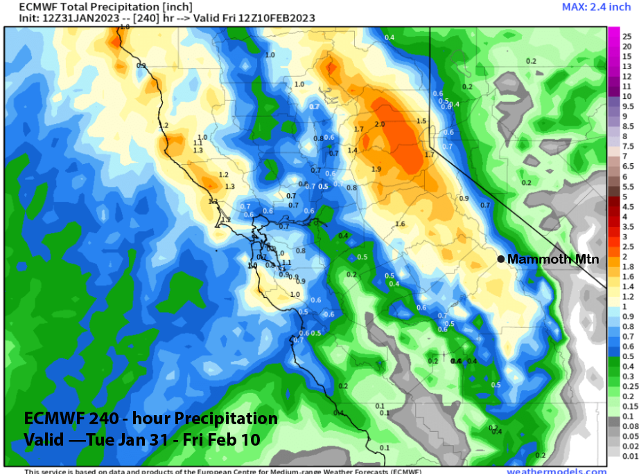
The latest deterministic runs of the GFS (image below) and ECM (two images below) show well over an inch of liquid with the passage of the storm that would equate to about a foot of snowfall at Main. Current snow levels are forecast to be in the 5000-6000 foot range for the most part, so it won’t be a super cold or warm type storm with the snow type probably on the drier side.
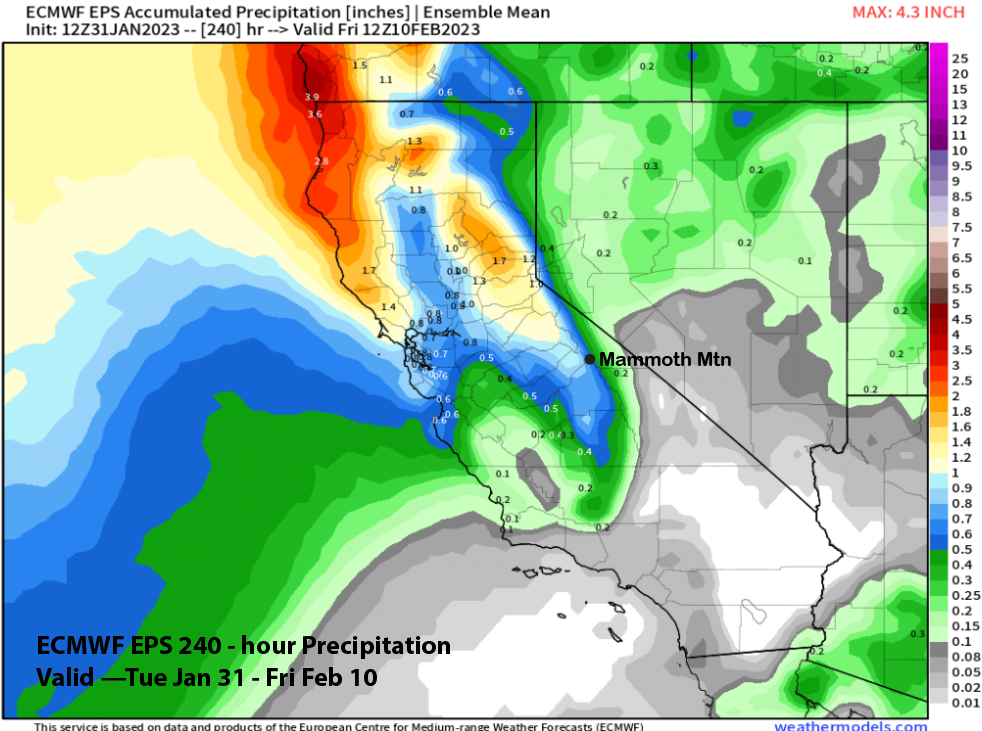
Current forecast follows a blend of the wetter operational models and the ECM EPS (image below) that is only showing about half the amounts of the latest operational model runs. There is uncertainty at 5 days out, and the forecast will likely fluctuate, hopefully in the higher direction.
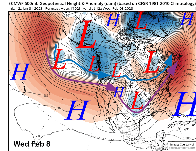
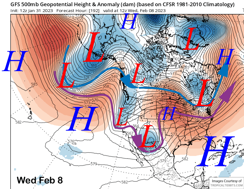
The ECM builds a ridge into the state in the wake of the system early next week and holds it through mid-week (image below) for fair and warmer weather. The GFS on the other hand, busts a weak short-wave though the ridge mid-week (two images below) and produces some light snowfall in Mammoth Wednesday night. The solution is rather odd and not well supported by the ensembles and the forecast leans drier for the middle part of next week.
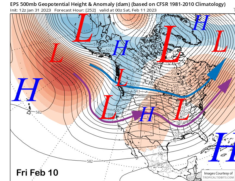
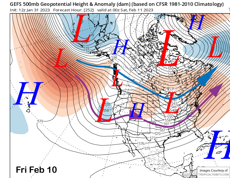
There is a better chance for a weak storm toward the end of next week as both the ECM EPS (image below) and GFS ensemble (two images below) show a weak trough along the coast. Current guidance favors a low-end event, if it happens.
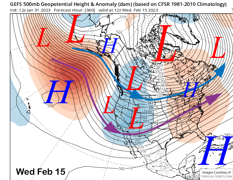
The fantasy range guidance is mixed with the GFS ensemble favoring a trough along the West Coast (image below) and short-waves moving southeastward into CA under northwest jet stream flow. Those would be colder and relatively drier type storms, but there certainly could be a deep Gulf of Alaska type trough too.
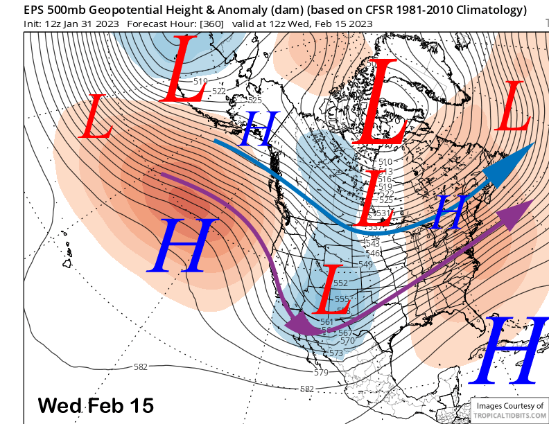
The ECM EPS (image below) is different though, and keeps the trough narrower and farther eastward versus the GFS. That is a mostly dry pattern with only inside slider type storms favored that produce more wind versus snowfall.
Overall, we will have to see how the mid-month pattern plays out. The differences could be related to the MJO as the GFS is favoring a more coherent signal as it moves across the Maritime Continent and into the Western Pacific where it stalls.
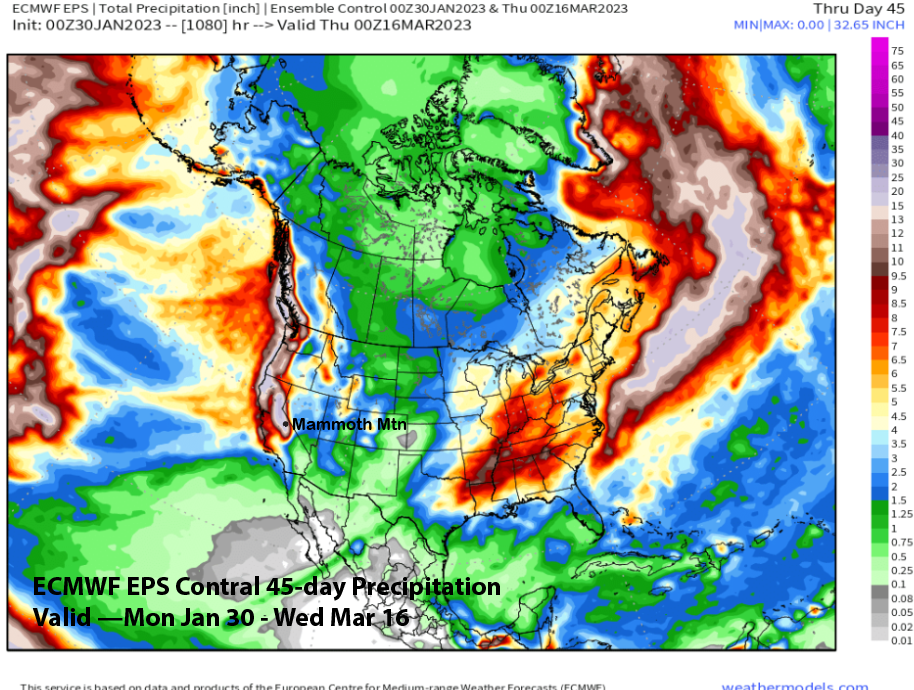
The MJO was in the Western Pacific when the most recent big storm cycle occurred, so maybe it could happen again. The ECM EPS 45-day control run from yesterday picked up on something big for the latter part of the month and early March when the MJO is forecast to be in that spot again. It is showing around 15-20” inches (image below). Fingers crossed for Part II. WG