Powder Forecast – Friday February 3rd, 2023
Ted Schlaepfer CCM —- Mammoth Mountain WeatherGuy
Snowfall forecasts are valid at the Sesame snow course (Main Lodge) for the prior 24 hours as reported in the 6-7 AM morning snow report.
**Snowfall forecast confidence ranges from very low (1) to very high (5)
Sat 2/4 = 0”
Sun 2/5 = 12 – 14” (H20 = 1.20” – 1.40”)**3
Mon 2/6 = 4 – 5” (H20 = 0.35” – 0.45”)**3
Tue 2/7 = 0”
Wed 2/8 = 0”
Thu 2/9 = 0”
Fri 2/10 = 0”
Sat – Mon 2/11 – 2/13 = 6 – 15”
February Snowfall = 0”
February Forecast = 65 – 90”
Detailed 4-day Snowfall Forecast
Sat 2/4 – No snowfall expected during the day, then snowfall, heavy at times, develops overnight along with strong winds. Accumulations 12 – 14” by Sunday AM, 15”+ up top.
Sat 2/4 – Light to moderate snowfall continues during the day, ending evening. Winds decrease during the morning, but remain breezy. Accumulations 4 – 5” by Monday AM, 6”+ up top.
Mon 2/6 and Tue 2/7 – No snowfall expected both days.
Forecast Summary:
Short Term (Days 1 – 4):
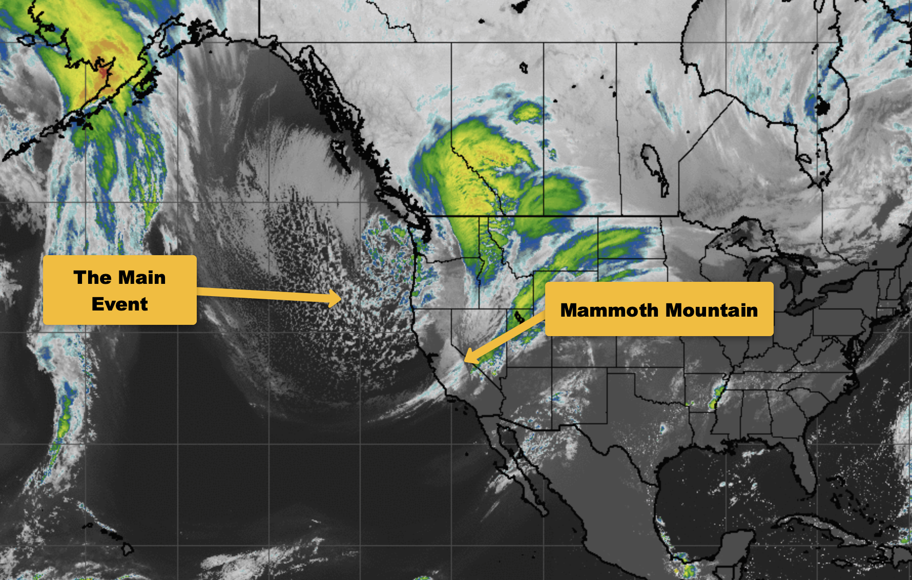
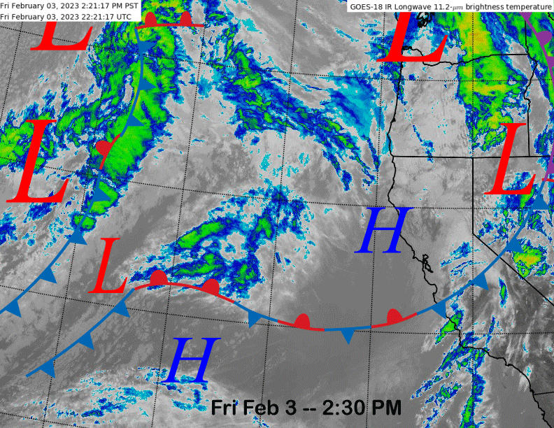
The current infrared satellite image (below) shows a weak front dissipating over Central CA resulting in just passing clouds and breezy winds for Mammoth. High pressure off the coast will build into the area tonight/tomorrow for more dry weather before the storm systems off the coast move into CA over the weekend.
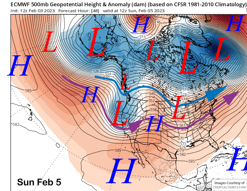
The ECM model (image below) moves the short-wave trough ashore early Sunday and that will drive a moderately strong cold front through Mammoth overnight Saturday. Snow should start before mid-night and become heavy during the middle of the night hours along with strong winds before tapering in intensity toward dawn.
Light to moderate snowfall should then continue during the day for good storm riding/skiing as a trailing sub-synoptic trough will keep the precipitation ongoing into the early evening. Model QPF is decent with the GFS (image below) and ECM (two images below) both showing around 1.5” liquid for the storm.
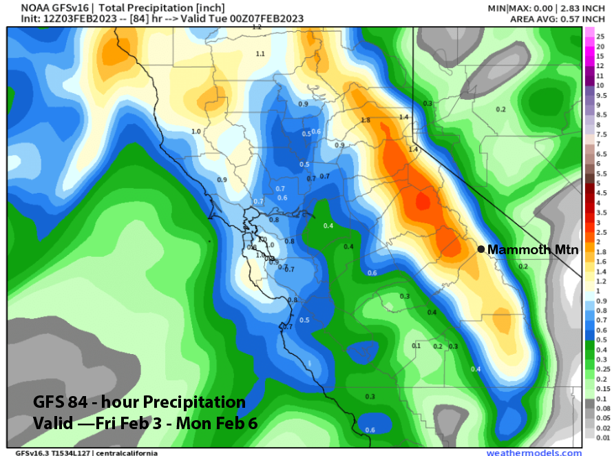
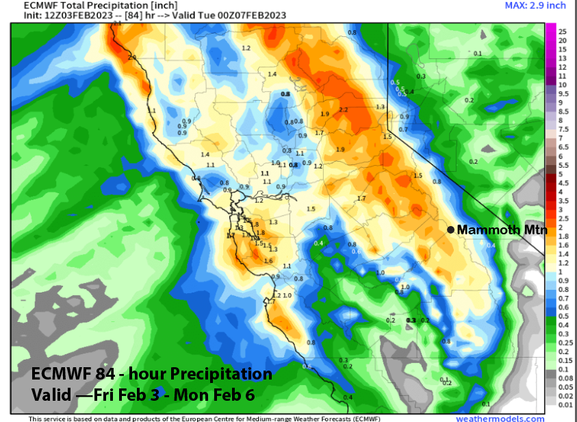
That should result in a least a foot of snowfall at Main and maybe up to 20” up top for the powder day there on Monday (top will be closed Sunday) which will probably start with a bluebird morning. High pressure builds back into the state on Monday and Tuesday for fair and dry weather.
Long Range (Days 5+)
The longer-range guidance has trended more favorably since the last update. It now suggests there will not be a sustained dry period this month with at least a storm per week including a chance for a storm cycle later in the month that could lead to epic powder days.
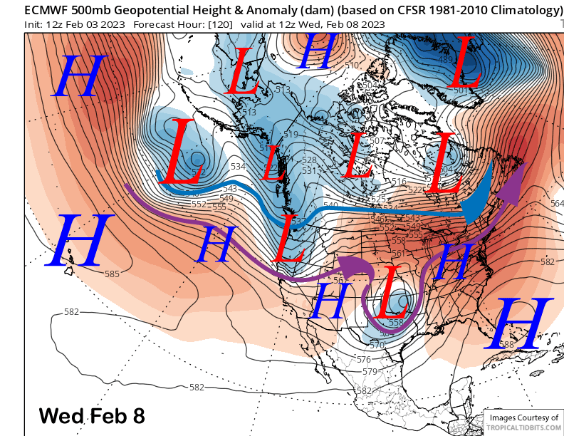
The latest ECM trended closer to the GFS solution from the last post for the middle part of next week and now shows a short-wave moving into NorCal (image below). All the ensembles currently keep the precipitation north of Mammoth with the main effect from its passage likely being gusty winds.
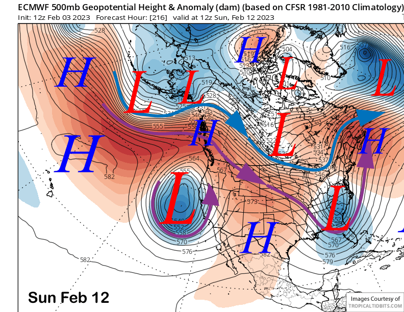
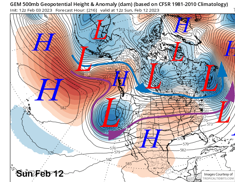
The longer-range guidance then moves another weather system toward the state toward the end of next week and/or the following weekend with the 12z ECM run developing a fairly deep closed low off the coast by early Sunday (image below). The Canadian model (two images below) keeps it as an open wave and is faster versus the ECM model with moving the storm ashore. The latest 18z GFS is more in line with the Canadian model.
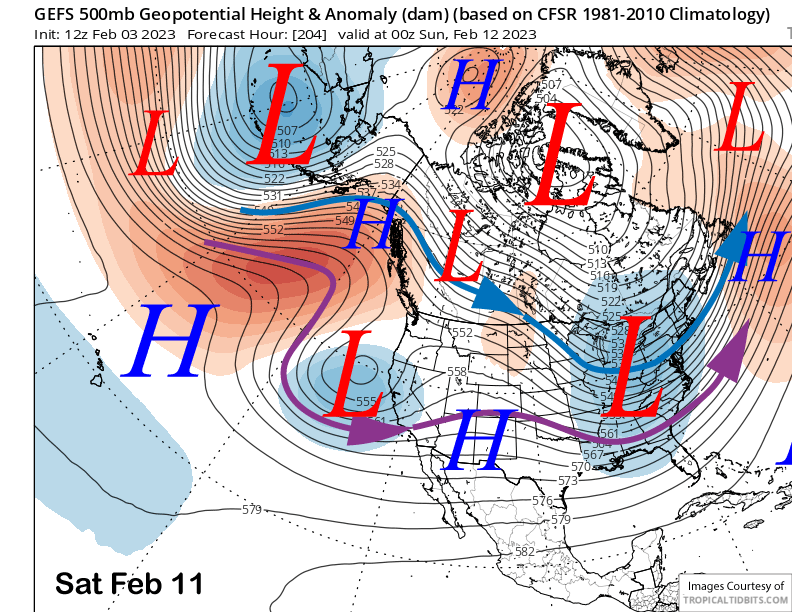
The GFS ensemble (image below) is not as deep as the operational models and favors the potential system to be just off the coast Saturday afternoon. The ECM EPS is a bit deeper, but similar overall. Current forecast favors snowfall to start Saturday afternoon/night and possibly continue on Super Bowl Sunday. It doesn’t look like a huge storm at this point, but another foot is not out of the question.
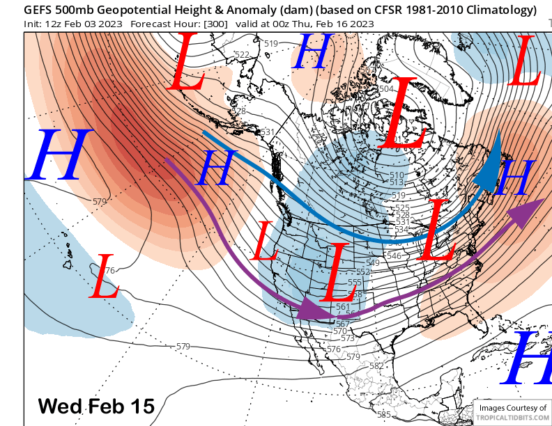
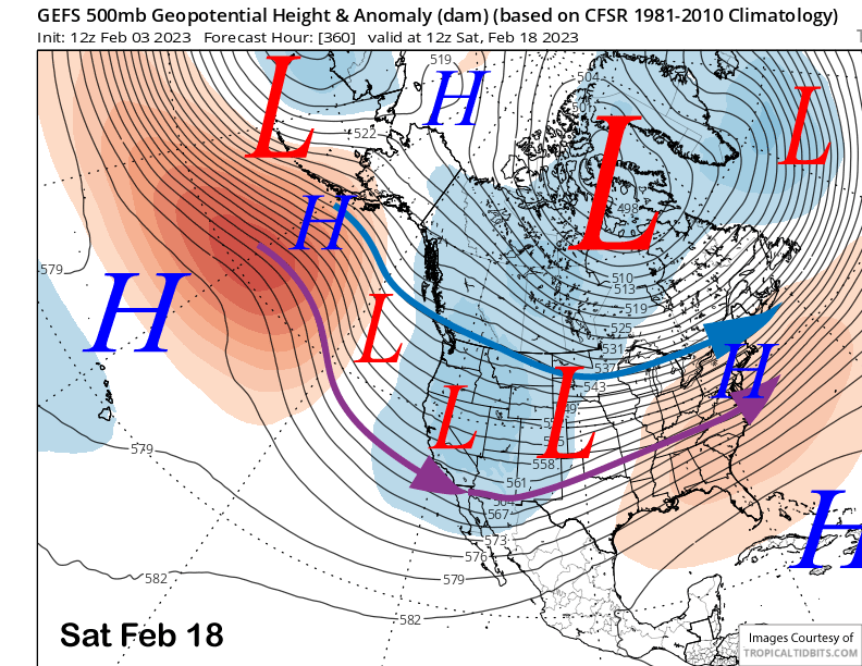
In the fantasy range, the guidance is favoring the long-wave trough to be established along the interior West (image below) and that would allow storms to move into the state under northwest jet stream flow. These types of storms are usually colder with light to moderate snowfall amounts.
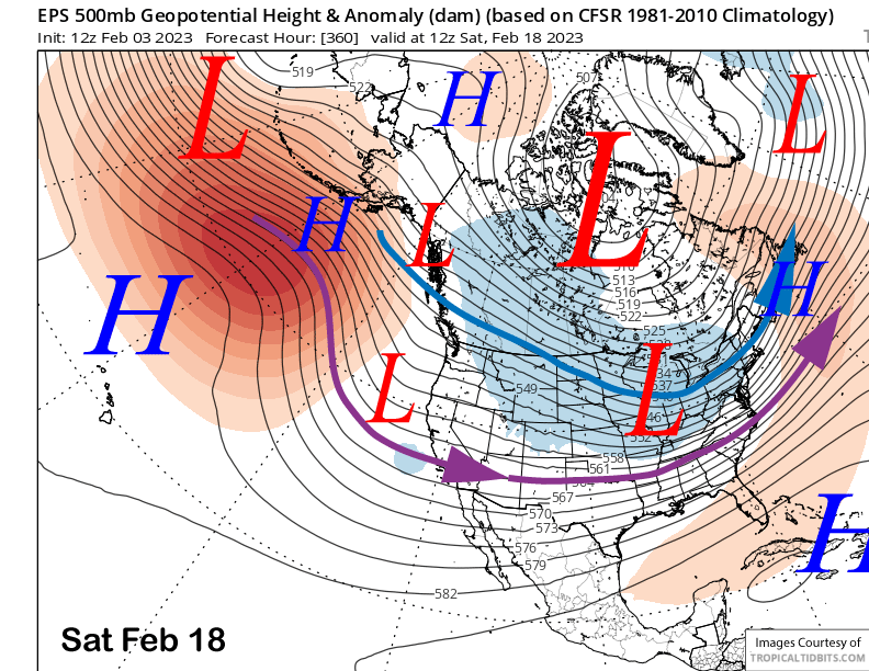
The GFS ensemble guidance (image below) is then suggesting that the trough will retrograde westward over the Presidents Day weekend allowing storms to move into the state from the Gulf of Alaska. Those storms are still cold, but with more over-trajectory before landfall, often produce moderate to heavy snowfall amounts. The ECM EPS (two images below) is similar, just slightly weaker with the long-wave trough.
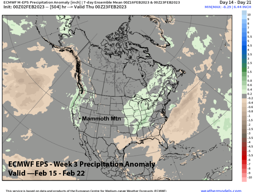
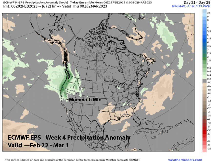
The latest runs of the ECM EPS 45-day forecast from yesterday has trended wetter for third week of the month (image below) and also the last week into early March (two images below). It also favors storms moving out of the Gulf of Alaska and into the state over that two-week period. If that happens, then conditions will be epic with periods of deep, cold and dry powder, as opposed to the Sierra cement from the last storm cycle. Fingers crossed. WG