Powder Forecast – Tuesday February 7th, 2023
Ted Schlaepfer CCM —- Mammoth Mountain WeatherGuy
Snowfall forecasts are valid at the Sesame snow course (Main Lodge) for the prior 24 hours as reported in the 6-7 AM morning snow report.
**Snowfall forecast confidence ranges from very low (1) to very high (5)
Wed 2/8 = 0”
Thu 2/9 = 0”
Fri 2/10 = 0”
Sat 2/11 = 1 – 2” (H20 = 0.10” – 0.20”)**1
Sun 2/12 = 2 – 3” (H20 = 0.20” – 0.30”)**1
Mon 2/13 = 0”
Tue 2/14 = 0”
Wed – Fri 2/15 – 2/17 = 3 – 10”
February Snowfall = 14”
February Forecast = 55 – 80”
Detailed 4-day Snowfall Forecast
Wed 2/8 through Fri 2/10 – No snowfall all days except for a chance for light snowfall to develop late Friday night, accumulations 1 – 2” by Saturday AM
Sat 2/11 – Light to moderate snowfall is possible during the day, ending at night. Accumulations 2 – 4” by Sunday AM, up to 6” up top.
Forecast Summary:
Short Term (Days 1 – 4):
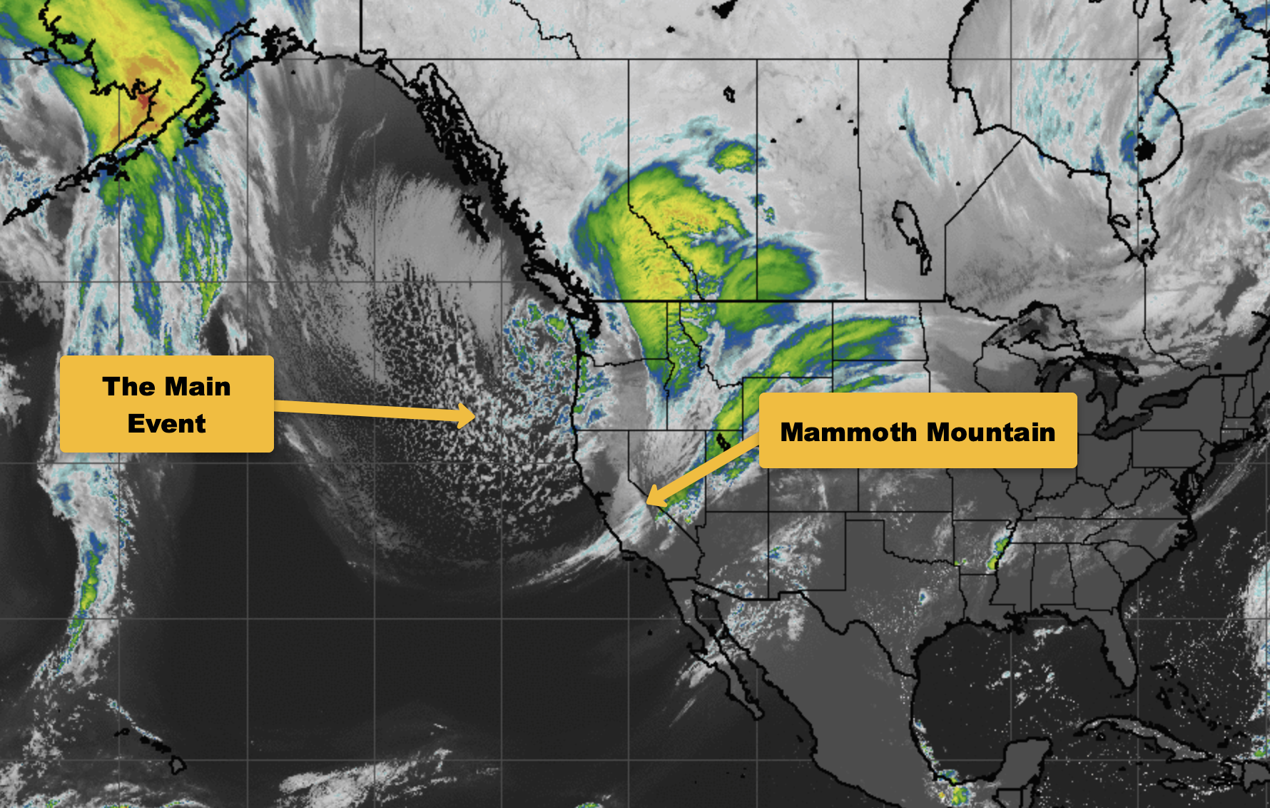
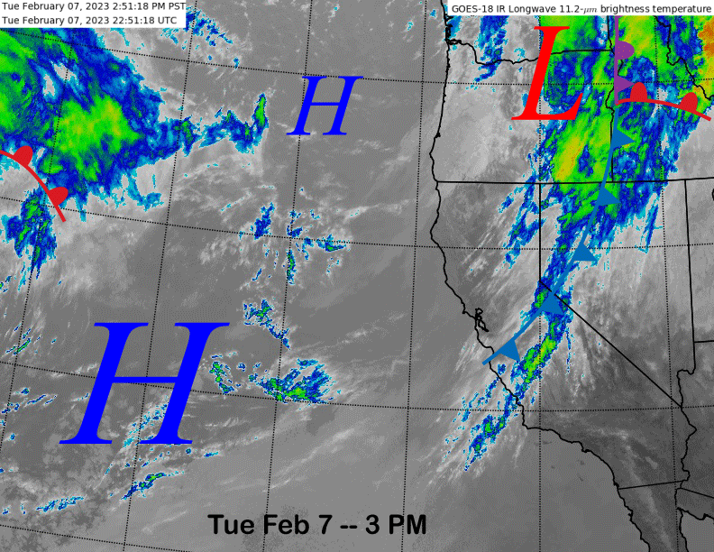
The current infrared satellite image (below) shows a weak front dissipating over Central CA resulting in just passing clouds for Mammoth. High pressure off the coast will build into the area tonight/tomorrow for more dry weather that will last for the rest of the work week.
The ECM model (image below) and others then move a short-wave trough into CA on Friday and into Saturday resulting in the next chance for snowfall. There is uncertainty about the exact track of the weather system with the latest run of the ECM slightly weaker versus the GFS model. The Canadian is similar in strength to the ECM, but father eastward and more “inside slider-like”.
Model QPF reflects these differences with the GFS model the wettest (image below) at just over half an inch and the ECM (two images below) showing only about a tenth of an inch as it keeps the heavier precipitation on the west side of the range. The ECM ensemble has less than a quarter inch.
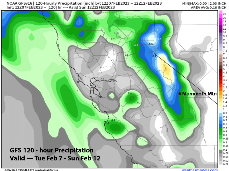
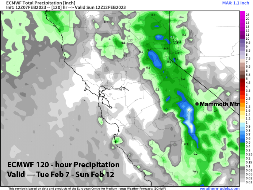
The current forecast is only favoring a few inches and is generally low confidence as these type of patterns (cut-off lows) are not well predicted four days out by the models. Fifty miles west or east could mean the difference between no snowfall or a surprise six inches. Hopefully enough will fall for at least low-end powder conditions.
Long Range (Days 5+)
The longer-range guidance is generally low confidence other than it looks like it will get colder by the middle part of next week. It looks like there will be powder chances as well, although that is where the guidance is split.
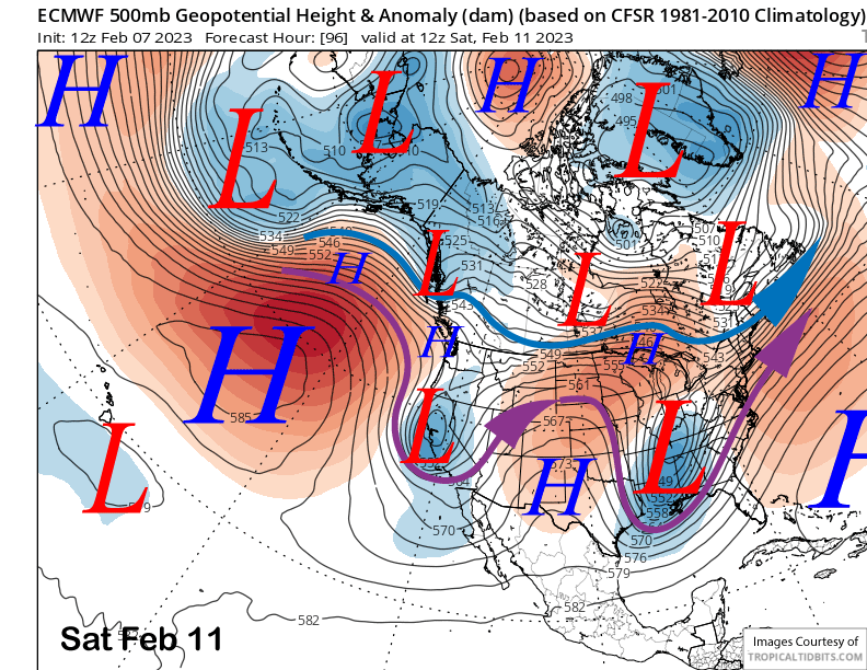
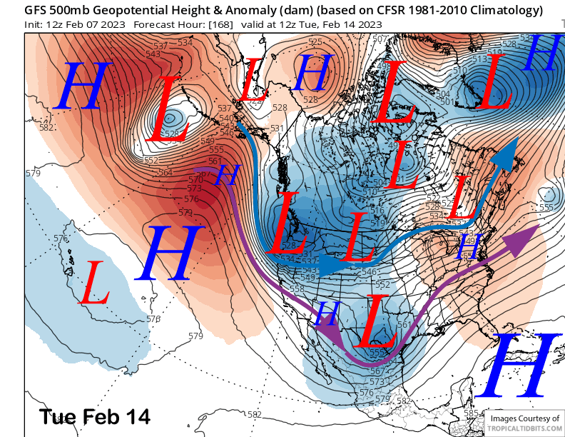
The models are in general agreement that a deep high-latitude type trough and low pressure system will move southward from the eastern part of the Gulf of Alaska and into CA on Tuesday next week (ECM below). The GFS (two images below) also shows a deep trough moving southward into CA and that is why it will get colder by Tuesday and especially Wednesday.
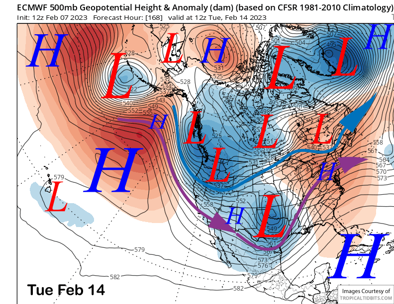
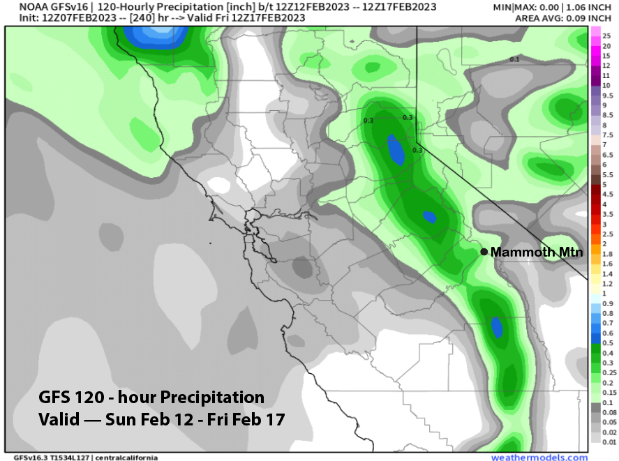
The models are also projecting some snowfall with its passage with the GFS showing a couple tenths (image below) and the ECM is similar. There are a few ECM ensemble members that dig the trough southward with more over-water trajectory and higher snowfall amounts, but most members are showing only light amounts of precipitation and under a quarter inch. Thus, a few inches of snowfall is the best forecast at this time.
The guidance is then showing the next trough to approach the state toward the end of next week with the GFS ensemble (image below) much deeper with the trough versus the ECM EPS (two images below). The ECM solution would be just a couple inches while the GFS solution could be up to two feet if one of the stronger ensembles were to verify (see cover image/18z GFS run). Current forecast favors a blend of the solutions and not a big storm.
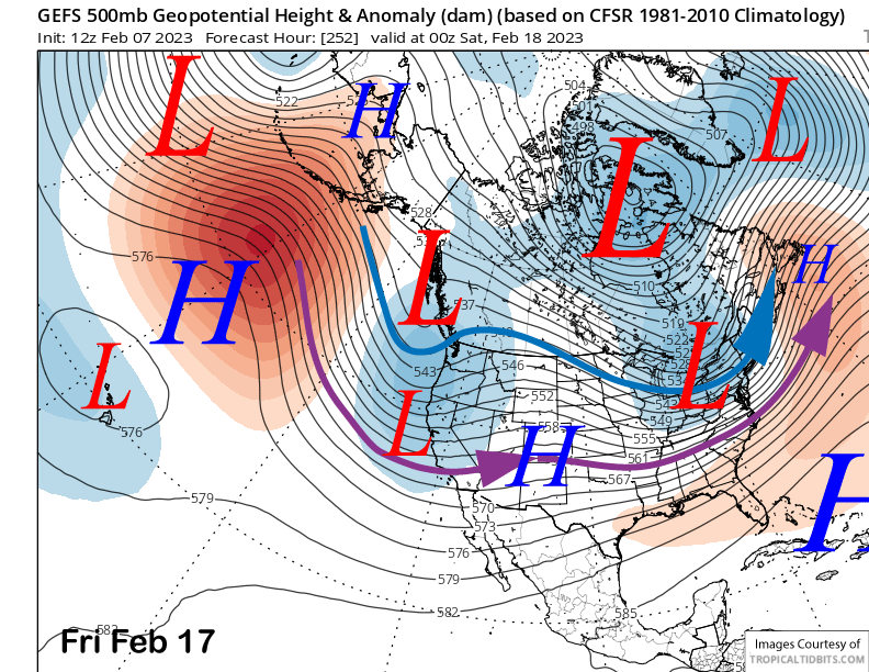
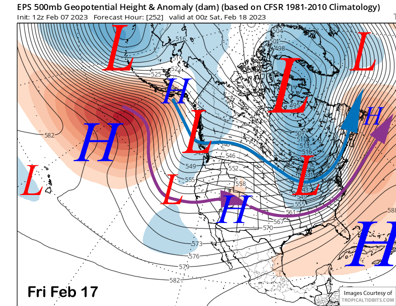
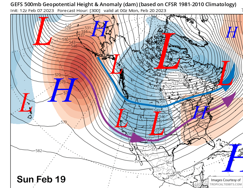
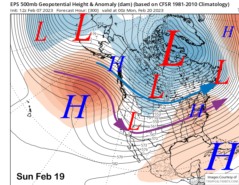
The models then start to differ more noticably in the fantasy range over the Presidents Day Holiday weekend. The GFS ensemble (image below) keeps a moderately deep trough across the interior West and extends it farther westward versus the ECM EPS (two images below) that keeps it confined to the SouthWest deserts. The difference would be no snowfall per the ECM versus cold systems dropping southward from the Gulf of Alaska with light/moderate amounts of dry powder.
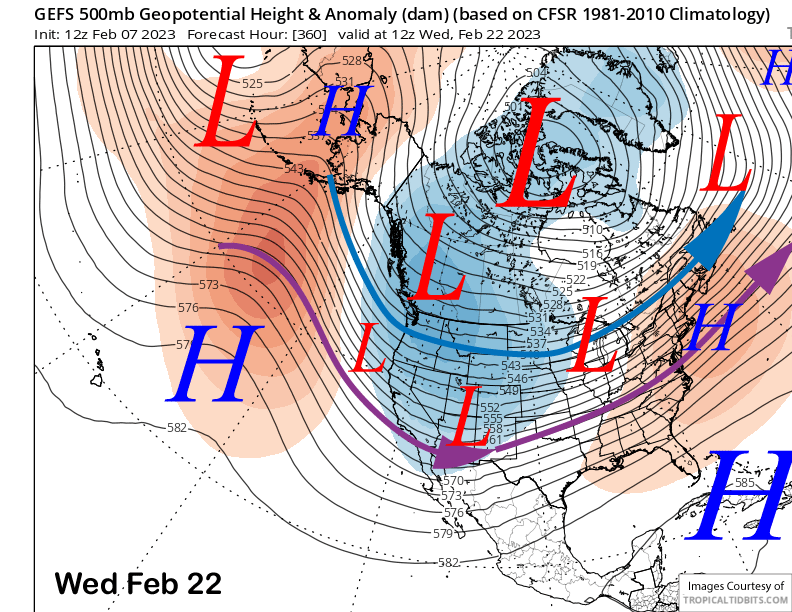
That difference is even more exacerbated in the very back end of the forecast as the GFS keeps the trough over the West (image below) while the ECM now has ridging (two images below). This is probably due to the ECM moving the MJO faster through the W. Pacific (phases 6 and 7) and into the W. Hemisphere (phases 8 and 1) versus the slower GFS. The GFS has done better lately with that forecast.
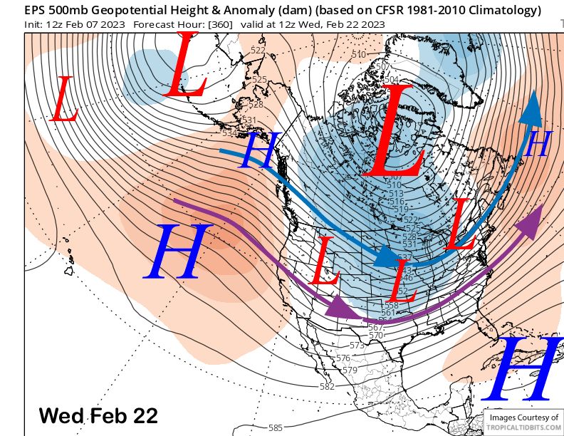
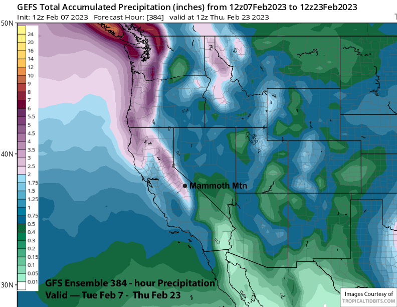
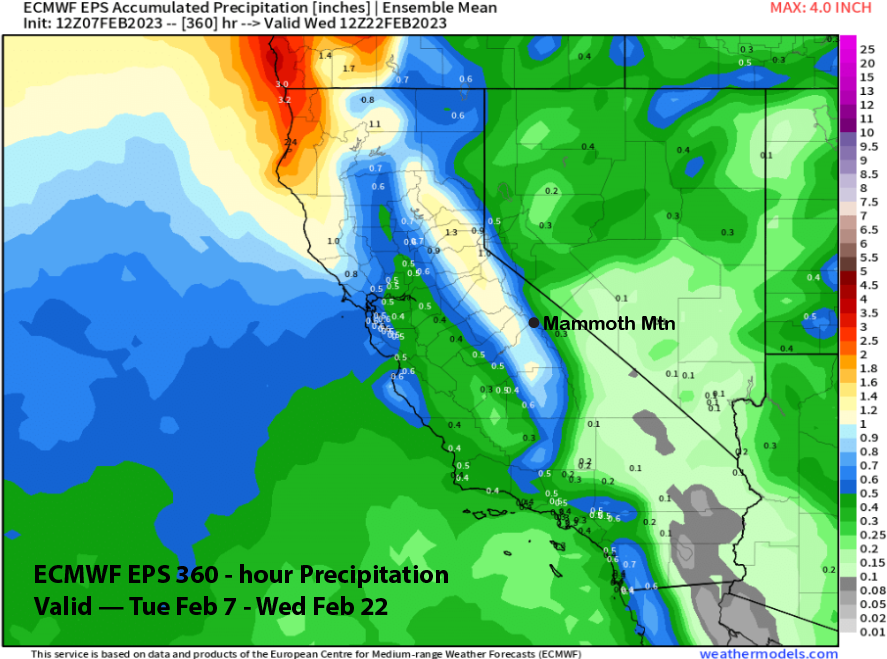
Overall, the GFS ensemble is showing almost 3” liquid for the period (image below) as opposed to the ECM that has only 0.75” (two images below), big differences. Hoping “American Made” is the better product this time. WG