
Powder Forecast – Friday February 10th, 2023
Ted Schlaepfer CCM —- Mammoth Mountain WeatherGuy
Snowfall forecasts are valid at the Sesame snow course (Main Lodge) for the prior 24 hours as reported in the 6-7 AM morning snow report.
**Snowfall forecast confidence ranges from very low (1) to very high (5)
Sat 2/11 = 0”
Sun 2/12 = 1 – 2” (H20 = 0.05” – 0.15”)**3
Mon 2/13 = 0”
Tue 2/14 = 0 – 1”
Wed 2/15 = 2 – 4”
Thu 2/16 = 0”
Fri 2/17 = 0”
Sat – Mon 2/18 – 2/20 = 0 – 6”
February Snowfall = 14”
February Forecast = 50 – 80”
Detailed 4-day Snowfall Forecast
Sat 2/11 – Light snow showers are possible during the day, ending evening. Accumulations 1 – 2” by Sunday AM, ~2” up top.
Sun 2/12 and Mon 2/13 – No snowfall expected both days.
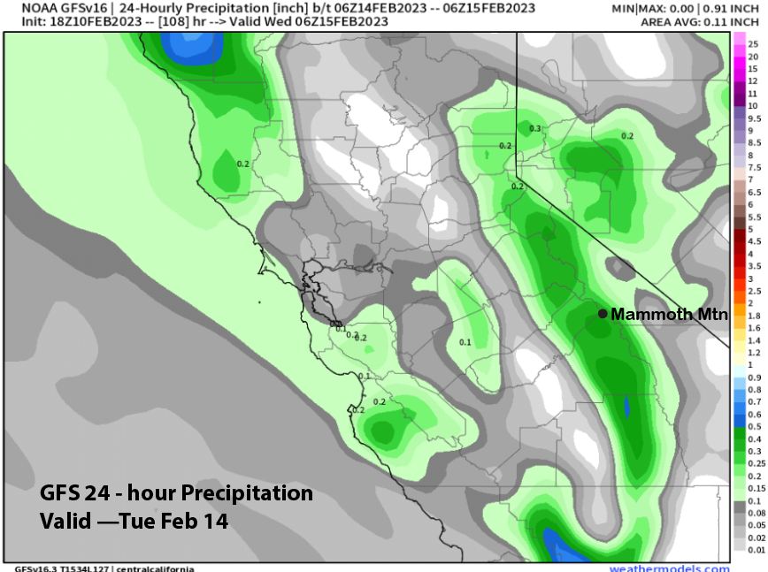
Tue 2/14 – Light/moderate snowfall is expected during the day, ending evening or at night. Accumulations 2 – 4” by Wednesday AM, up to 6” up top
Forecast Summary:
Short Term (Days 1 – 4):
The current infrared satellite image (below) shows a weak weather system positioned off the NorCal coast. It is a “coastal hugger” and will move southward over the next 36 hours along the Central Coast and SoCal coastlines before exiting eastward through northern Baja.
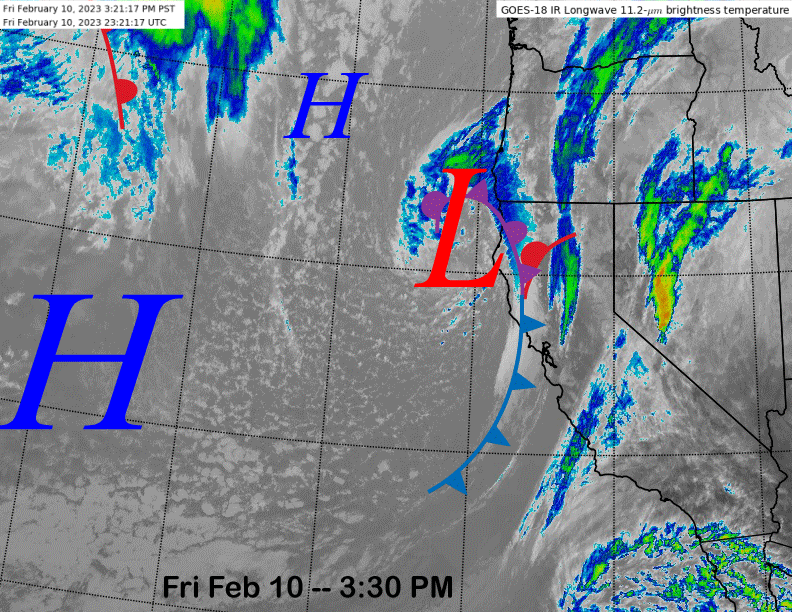
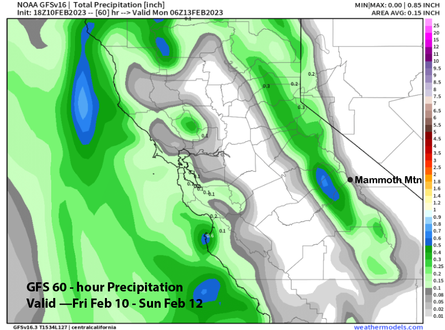
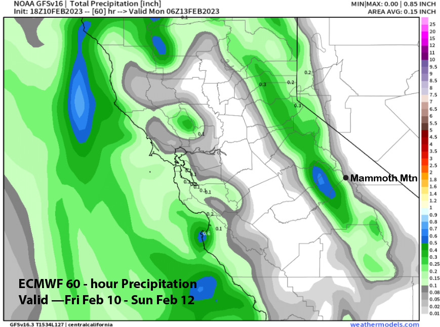
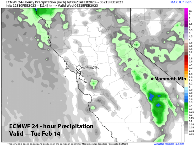
Due its coastal position, the front will have a hard time making it over the range and into the eastern Sierra. The latest GFS (image below) has come in line with the ECM (two images below) in only showing very light amounts around a tenth of an inch liquid. Thus, the forecast is calling for only a inch or two at best with the snow falling during the day Saturday.
High pressure will build back into the area Sunday and Monday for fair and dry weather with gusty east or northeast winds possible on Sunday, especially up top. Temps will be seasonable, warming up slightly on Monday.
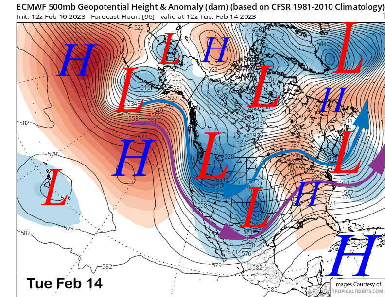
Models then move a high latitude type upper low southward into the state on Tuesday (ECM below). The GFS model is the farthest westward with the upper low and the 18z run is keeping with that trend (two images below) and is also the coldest, with temps on Wednesday morning getting quite chilly.
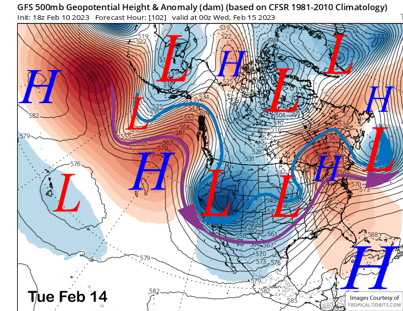
Model QPF also differs with the GFS showing a healthy third of an inch liquid (image below), but the ECM only about a healthy tenth (two images below). Thus, GFS says maybe up to 6”, while the ECM says an inch or two. GFS ensemble is close to the latest deterministic run and the Canadian is also similar. Forecast is only favoring a couple to a few inches at Main, maybe up to 6” up top where the strong winds push it around and into the bowls.
Long Range (Days 5+)
The longer-range guidance is a bit more settled with mostly dry weather favored through the Presidents Day Holiday weekend before storm chances return over the latter part of the month. Hopefully that chance will come through this time.
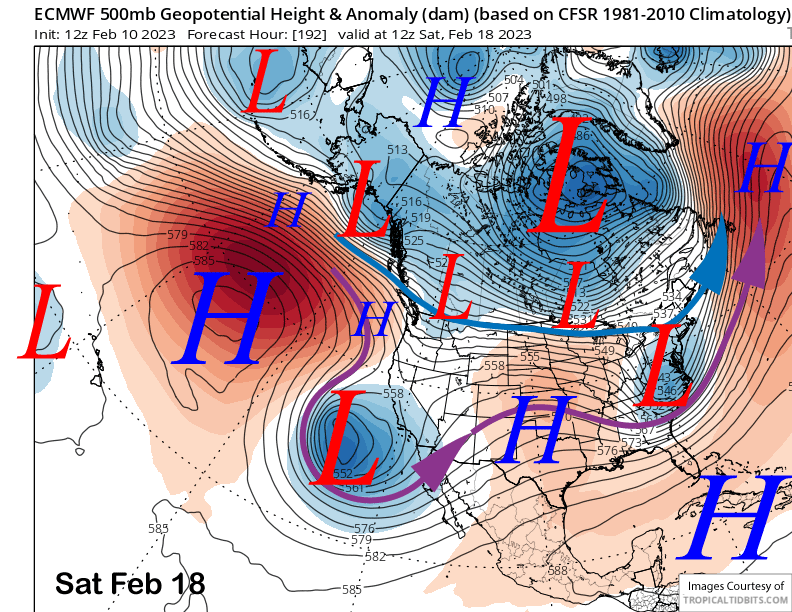
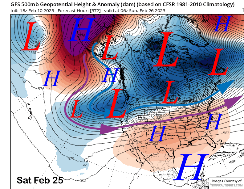
The models have mostly now come into agreement that the upper low for next week will move into the southern part of the state and generally south of Mammoth (image below). It is still 7-8 days out, so that forecast could change as the guidance has not done particularly well beyond about 5 days lately.
The GFS ensemble (image below) then suggests the next chance for a storm will be over the last week of February as it moves the longwave trough back westward after displacing it into the mid-section of the US late over the holiday weekend. The ECM EPS (two images below) is not as far west with the trough as the GFS as only suggests colder/drier storms from the North, like the one for next Tuesday.
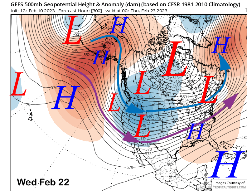
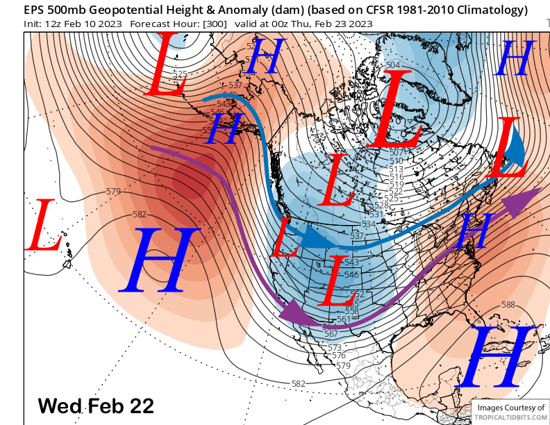
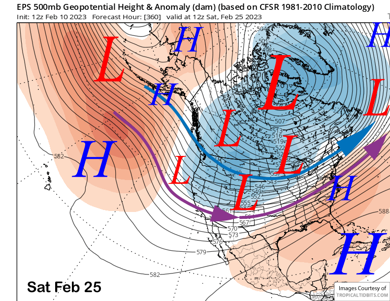
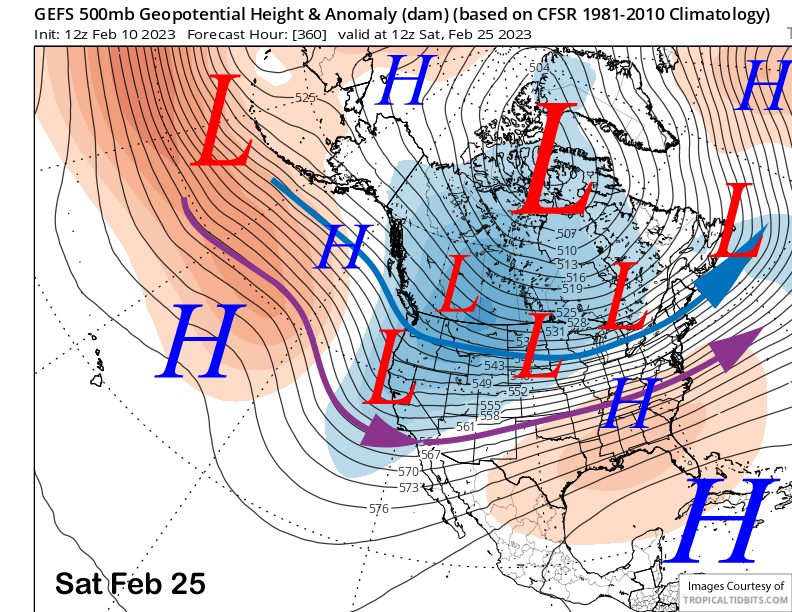
The ECM EPS does shift the trough westward enough for a better storm alignment in the fantasy range (image below) and the GFS ensemble (two images below) favors a sharper/deeper trough into CA that would supper a better storm.
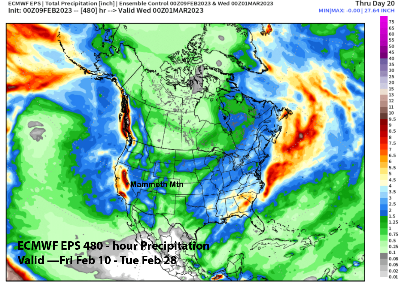
Interestingly, the GFS operational run has now for 4 runs in a row forecast a rather anomalous trough/storm along the West Coast into CA in the fantasy range and the 18z run is no exception (image below). The ECM EPS 45-day control run also picked up on something for the latter part of the month and now shows about 8” liquid by the end of the month (two images below) with most of that falling over the last week.
It could be that the models are adjusting to a Sudden Stratospheric Event SSW (image below- upper green box) that is forecast to mix/drip into the troposphere around February 21-22nd (lower green box). That could displace the polar vortex under a high latitude blocking scenario. Exactly where that displacement occurs is usually not handled well by the models in the long term. Hopefully the GFS is onto something. WG


