Powder Forecast – Tuesday February 14th, 2023
Ted Schlaepfer CCM —- Mammoth Mountain WeatherGuy
Snowfall forecasts are valid at the Sesame snow course (Main Lodge) for the prior 24 hours as reported in the 6-7 AM morning snow report.
**Snowfall forecast confidence ranges from very low (1) to very high (5)
Wed 2/15 = 1 – 2”
Thu 2/16 = 0”
Fri 2/17 = 0”
Sat 2/18 = 0”
Sun 2/19 = 0”
Mon 2/20 = 0”
Tue 2/21 = 0”
Wed – Fri 2/22 – 2/24 = 6 – 15”
February Snowfall = 16”
February Forecast = 45 – 75”
Detailed 4-day Snowfall Forecast
Wed 2/15 through Sat 2/18 – No snowfall expected all days.
Forecast Summary:
Short Term (Days 1 – 4):
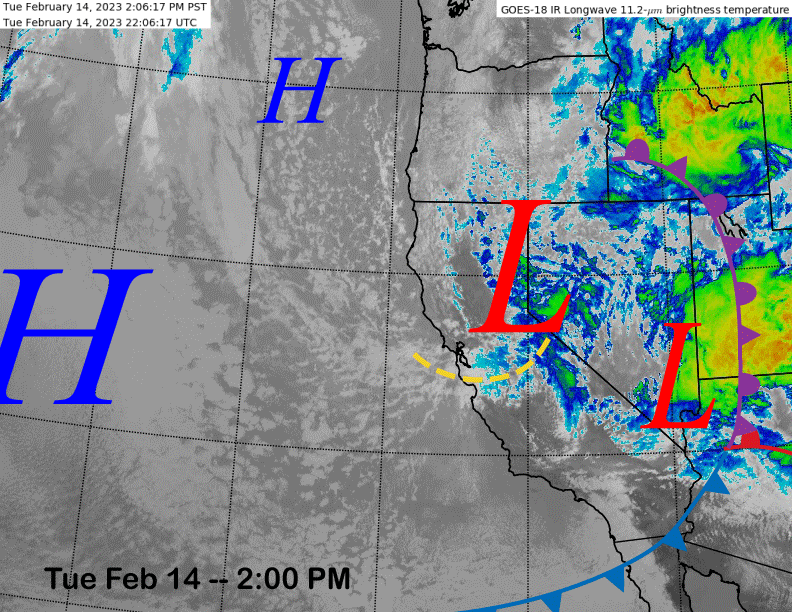
The current infrared satellite image (below) shows an upper-level low pressure system sliding southward through eastern California and an associated sub-synoptic surface trough. High pressure off the coast will build into the state tomorrow and Thursday for dry weather.
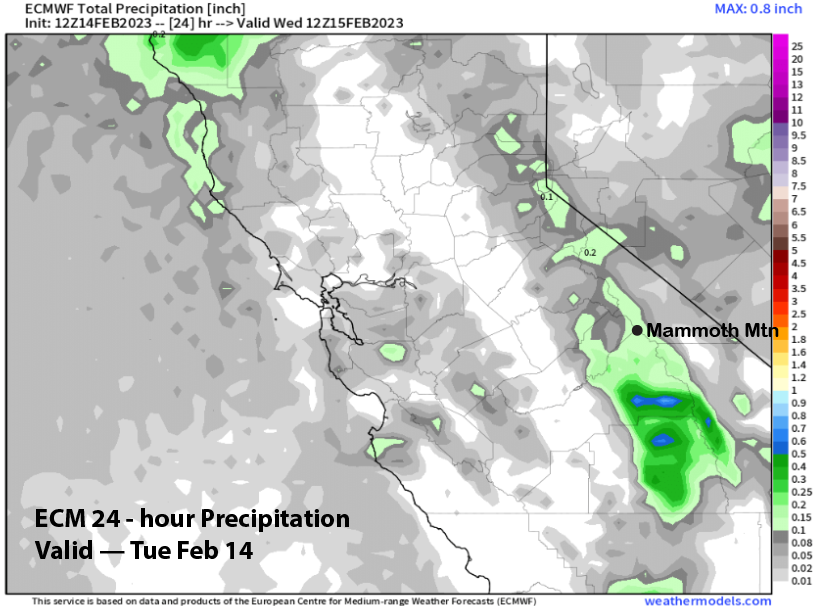
The weather system will produce some light snowfall late this afternoon and evening before ending overnight. The ECM model (image below) is only showing very light liquid amounts around a tenth of an inch and only an inch or two is expected, not enough for powder conditions.
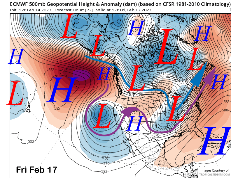
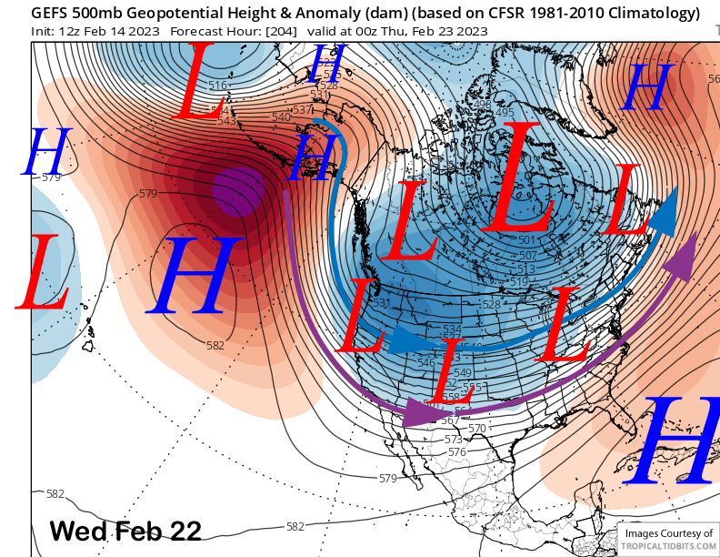
A weather system will approach the CA coast on Friday (image below) before turning southward and possibly even moving away from the coast for a couple days. It will spit some clouds over Mammoth on Thursday and Friday, otherwise dry weather continues into the Holiday weekend.
Long Range (Days 5+)
The longer-range guidance for the rest of the month is now coming into focus and the outlook is looking pretty good, if not possibly excellent. A potential storm cycle has now made it inside the 10-day window. Let’s hope it makes it into the 5-day forecast period.
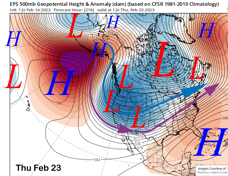
Dry weather should continue through the Holiday weekend and likely into Tuesday as well. Changes start around Wednesday next week per the GFS (image below) and Canadian models that move a very deep upper-level trough into the West around the middle part of next week. The latest ECM model has it too, just around a day later (two images below) and also a bit farther westward.
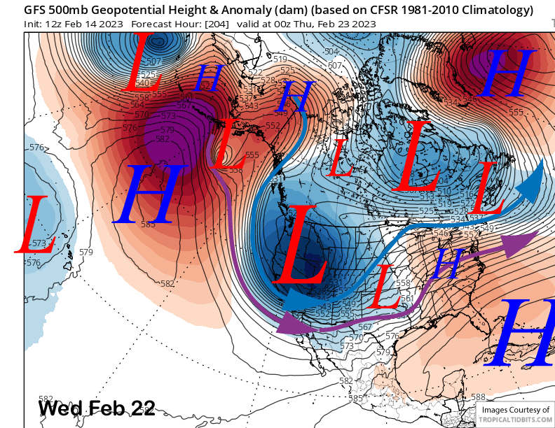
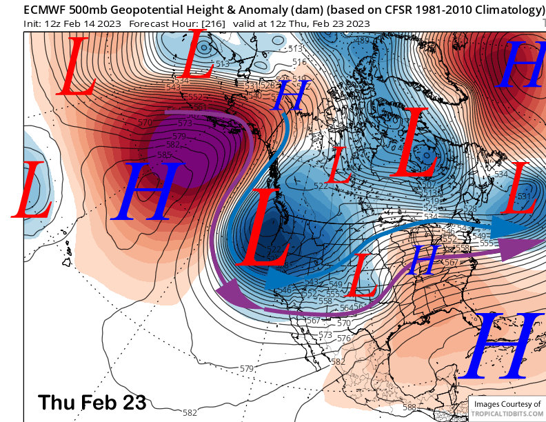
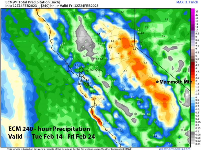
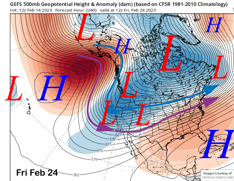
The ECM model is showing pretty good amounts at almost 2” liquid (image below) that would equate to around 20” at Main. The GFS is showing about 0.75” liquid for a solid 6” with both models showing enough for powder conditions.
However, both the ensemble means of both models (GFS top, ECM below) favor the position of the trough to be farther eastward, although the ECM is a bit farther westward than the GFS. That would mean that weather systems dropping into the state would have less over-water trajectory.
The GFS (image below) and ECM do dig the trough off the coast by the end of the week and that is when the better chance for deeper powder will happen. The current forecast is a bit conservative and follows the ECM ensemble mean for the most part, still enough for powder conditions though by Thursday or Friday.
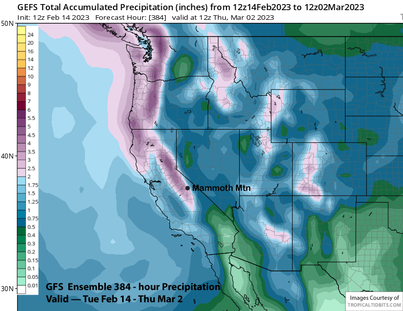
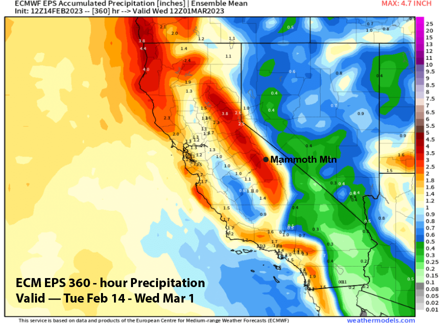
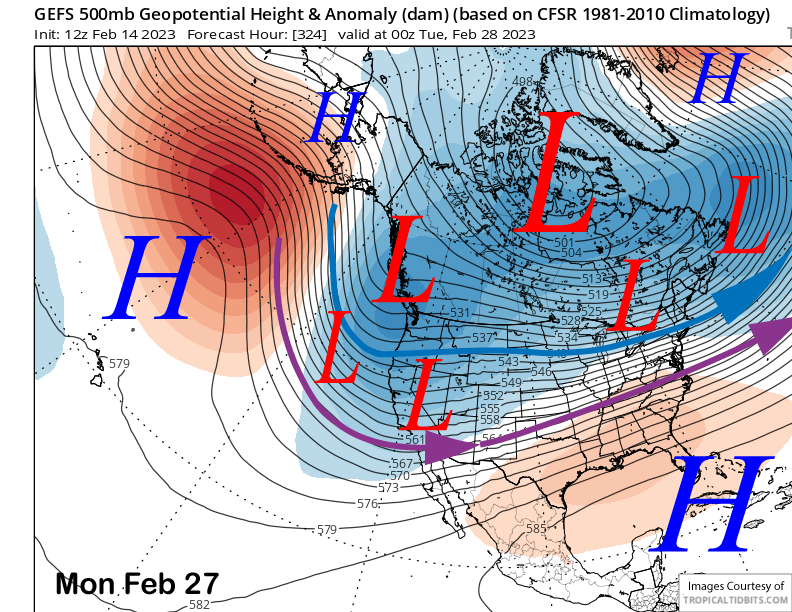
The fantasy range guidance keeps the long-wave trough over CA for the rest of the month and into early March with both the GFS ensemble (image below) and ECM EPS (two images below) in fairly good agreement.
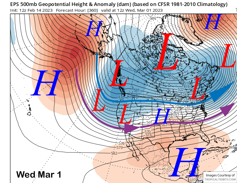
Model QPF from the ensemble means for the period is around 3” liquid as both the GFS (image below) and ECM EPS (two images below) are in fairly good agreement. So it looks like powder days chances will increase over the last week of the month and into the first part of March. Winter is not over. WG