Mammoth Mountain Weather Forecast & Discussion

February 16th, 2023 @ 11:15 AM – The bitter cold temperatures in the area will start to slowly moderate today into the holiday weekend as the cold inside slider moves off the east.

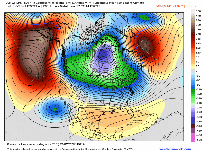
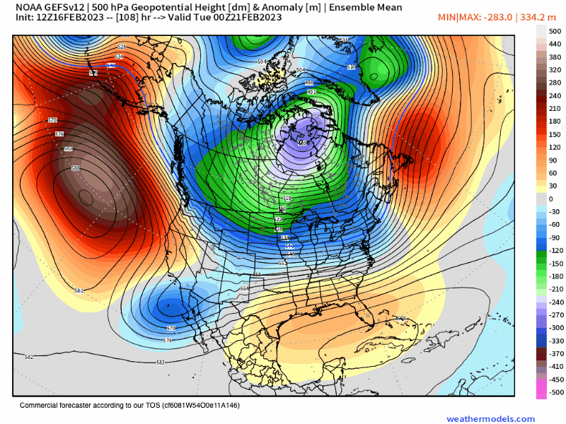
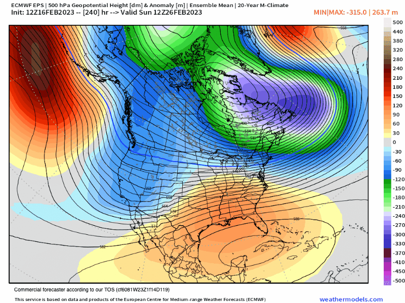
In its place, a new cut-off low is dropping south well of the California coast. The effects of that low will be an SW flow later today along with increasing clouds. That low is now too far to the west of Mammoth Mountain to bring any snow showers tonight or on Friday. As the low moves south over the next 24 hours the wind flow will return to the NE on Friday.

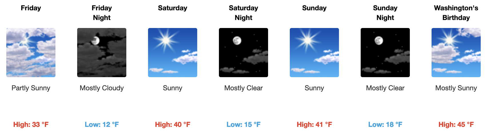
The Holiday weekend should be a good one with much warmer daytime highs along with pt cloudy skies and a light SW wind flow.

If you’re going to be out on the hill on Friday, expect pt sunny skies with temperatures at 8:30 AM in the upper teens to low 20s. By mid-day temperatures will be up into the low to mid-30s. The wind forecast has the wind out of the NE with wind speeds on the lower hill at 5-10 MPH with mid and upper mountain winds in the 10-15 MPH range with gusts to 20-25 over top ridges.

For Saturday and Sunday expect mostly sunny skies with temperatures at 8:30 AM in the lower 20s. By mid-day temperatures will be up into the upper 30s to lower 40s. The wind forecast has the wind out of the NE with wind speeds on the lower hill at 5-10 MPH with mid and upper mountain winds in the 10-15 MPH range with gusts to 20-25 over top ridges.

Presidents Day also looks great with sunny skies and highs jumping into the mid-40s around Main Lodge.

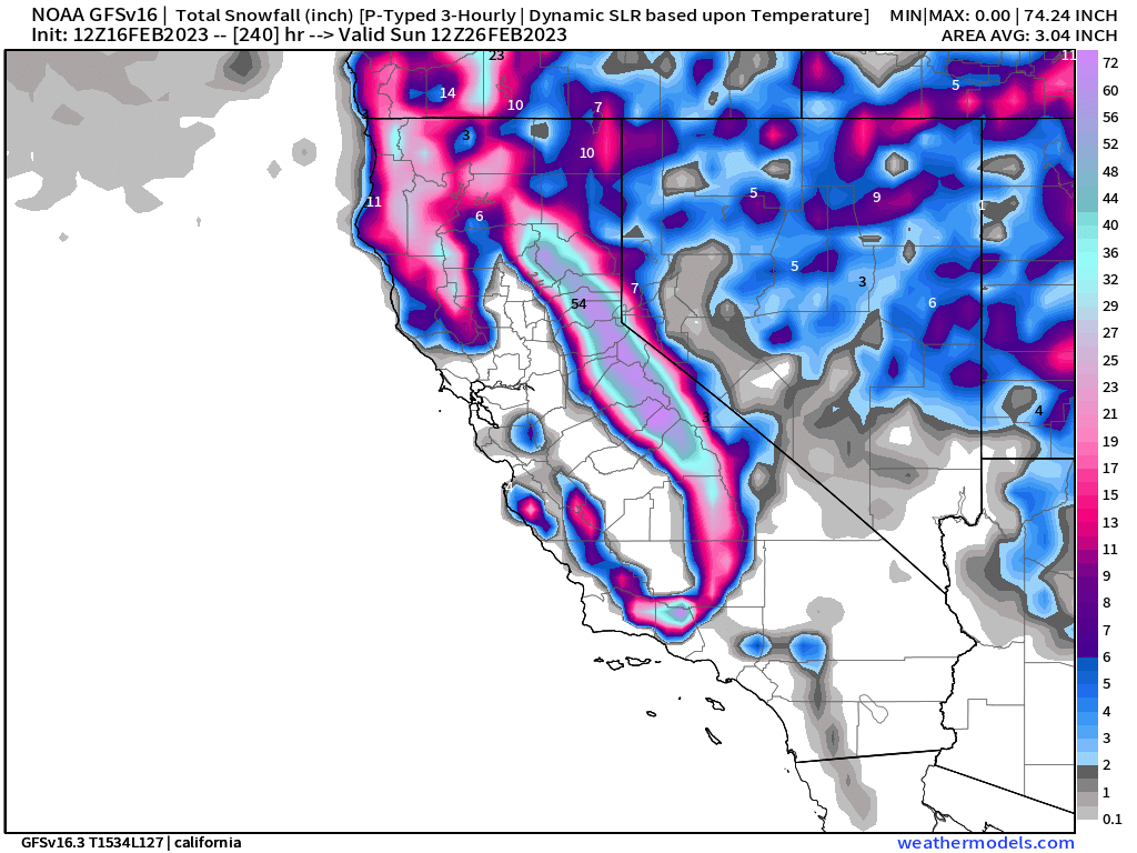
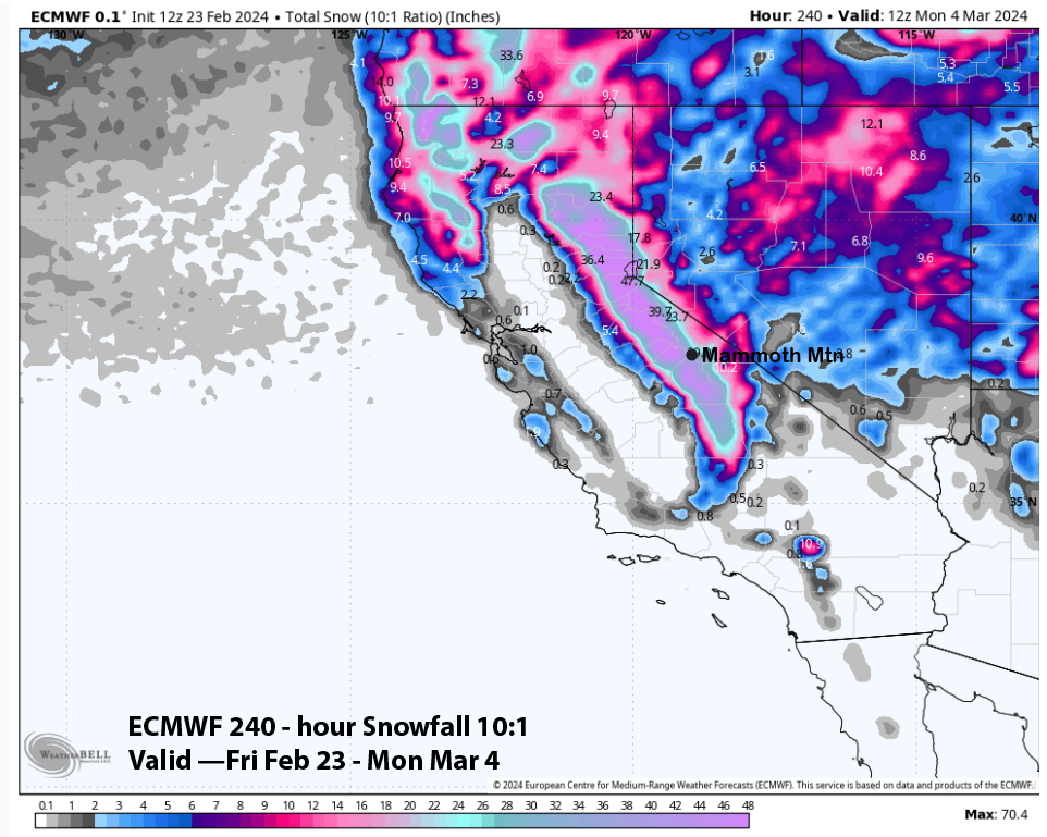
Beyond Monday, the Next Storm Cycle will slowly start ramping up, read down the page for the extended outlook.

Snowman


Mammoth Mountain 5-10-Day Extended Outlook

2-16-23 – A major pattern change is now being confirmed by all the operational and ensemble weather models at this time. As of now, you can expect a new series of storms to be moving through the Mammoth Mountain area starting late next Tuesday and lasting possibly into early March.

Looking at the newest data this morning this new weather pattern looks to be capable of bringing in some epic light and dry powder up on Mammoth Mountain.

Snowfall levels will possibly fall all the way down into the 1500-2000 foot range. Heck, you might even see snow on the ground from the foothills of LA to Palmdale and up to Mammoth Lakes.

The EPS and GEFS ensemble runs are showing 5-6 inches of water content while the GFS operational model is the outliner with 10-12 inches of water in its fantasy outlook.

The best news is this new series of weather systems will not be a warm AR event so get those fat skis and boards ready for some fantastic powder days coming up next week on possibly beyond.

5-10 Day - ECMWF EPS 500 Height Anomaly
5-10 Day Snowfall Outlook from the ECMWF Operational Model
5-10 Day GEFS 500 Height Anomaly
5-10 Day Snowfall Outlook from the GFS

11-16 Day Super Fantasy Long-Range Discussion

The troughing off the west coast continues to show up right through day 16 on the EPS model below. More cold powder chance’s would be in the offering. Yes it’s way to FAR out to nail down the details and any amounts. 

11-16 Day ECMWF EPS 500 Height Anomaly

Extreme Fantasy Outlook Model Data

Taking a look at the super long range GEFS Ensemble Mean it continues to show a wet cycle lasting right up until the last days of winter 3-21-22. Who knows if that will verify, it sure beats seeing dry data so let’s pray the wet outcome pans out.

The newest long range 45 day EPS comes on on Friday so it will be interesting to see what that models take is for this period of time. That run has been wavering from very wet to moderately wet the last few runs.

11-16 Day ECMWF EPS 500 Height Anomaly
ENSO Outlook

Mammoth Mountain and Eastern Sierra Weather Posts