Powder Forecast – Tuesday February 21st, 2023
Ted Schlaepfer CCM —- Mammoth Mountain WeatherGuy
Snowfall forecasts are valid at the Sesame snow course (Main Lodge) for the prior 24 hours as reported in the 6-7 AM morning snow report.
**Snowfall forecast confidence ranges from very low (1) to very high (5)
Wed 2/22 = 4 – 6” (H20 = 0.30” – 0.40”)**4
Thu 2/23 = 8 – 14” (H20 = 0.40” – 0.60”)**3
Fri 2/24 = 5 – 8” (H20 = 0.25” – 0.35”)**3
Sat 2/25 = 20 – 30” (H20 = 1.75” – 2.25”)**3
Sun 2/26 = 9 – 15”
Mon 2/27 = 4 – 6”
Tue 2/28 = 6 – 12”
Wed – Fri 3/1 – 3/3 = 12 – 24”
February Snowfall = 18”
February Forecast = 70 – 95”
Detailed 4-day Snowfall Forecast
Wed 2/22 – Light to moderate snowfall during the day, continues overnight, very cold daytime temps. Accumulations 8 – 14” by Thursday AM and 15”+ up top
Thu 2/23 – Mostly light snowfall during the day, continues overnight, very cold daytime temps. Accumulations 5 – 8” by Friday AM and 12”+ up top
Fri 2/23 – Heavy snowfall during the day and into the evening, with snowfall continuing overnight. Accumulations 20 – 30” by Saturday AM and 30”+ up top
Sat 2/24 –Snowfall continues during the day, tapering off overnight into Sunday. Accumulations 9 – 15” by Sunday AM and 15”+ up top
Forecast Summary:
Short Term (Days 1 – 4):
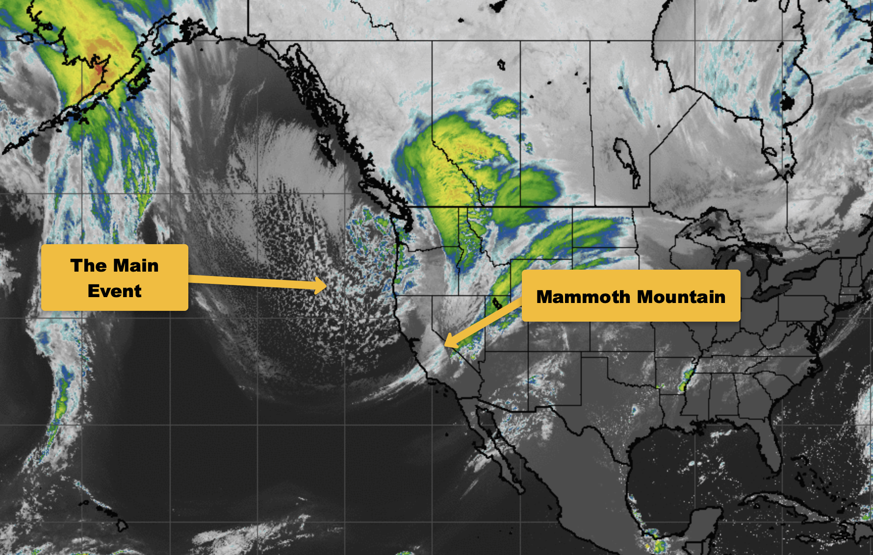
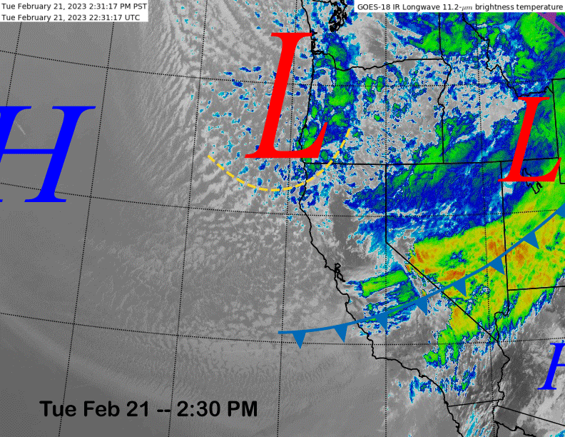
The current infrared satellite image (below) this afternoon shows a cold front is moving through the Central Sierra and a trailing deep upper-level low pressure system and sub-synoptic trough along the CA/Oregon border.
The upper-level trough will move southward overnight and a band of light to moderate snowfall will develop by this evening and continue overnight. Six inches of snowfall is possible at main by when the lifts open with continued light to moderate snowfall expected during the day that will continue overnight and Thursday as well.
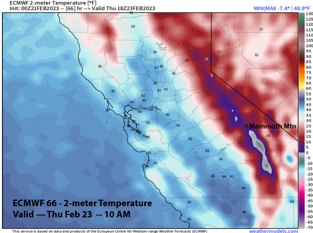
It will get quite cold as well with temps for tomorrow and Thursday (image below) expected to remain in the single digits to the mid-teens at Canyon. Winds tomorrow will be breezy to gusty, but not super strong per Mammoth standards with a decent chance that Ch. 22 will run at times both days.
The snowfall under the very cold temperatures and low snow levels around 1500-2500 feet will result in very fluffy snowfall over the next couple of days with snow ratios forecast to be in the 20”:1” range or even higher. Storm riding should be epic tomorrow and Thursday if you can handle the cold temps.
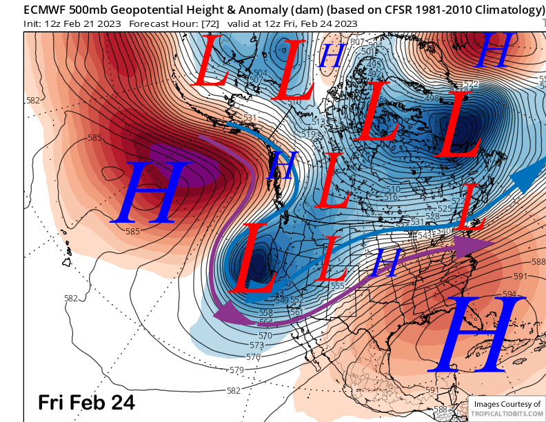
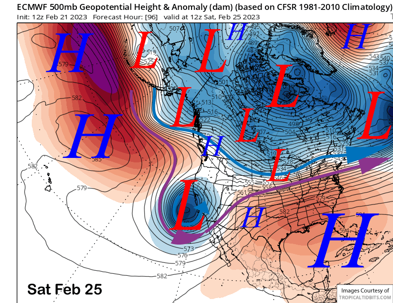
Models are now in agreement that a trailing deep upper-level low pressure system will drop southward on Thursday and Friday (image below) and this time, retrograde off the coast and pull in extra moisture. Models keeps the low off the coast into Saturday (two images below) with moist southwest flow into the Sierra strongest on Friday.
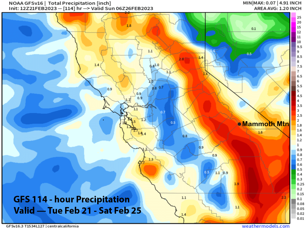
The ECM is showing around two inches liquid with this storm under higher, but still quite low snow levels on Friday, around 3500-4000 feet, with continue snowfall on Saturday when snow levels may rise to near 4500 feet. Total QPF through Saturday by the ECM model is around 3” liquid (image below) and the GFS is only slightly less (two images below).
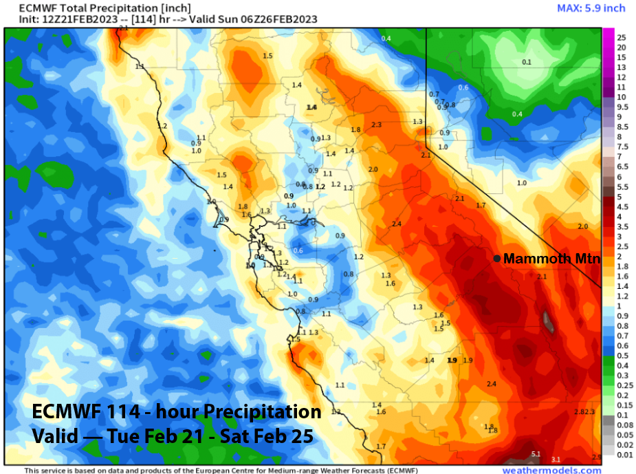
Current forecast follows mostly the ECM model and that favors about 3-4 feet of snowfall at Main and around 5 feet plus up top by Sunday morning. Powder days are expected every day this week and this weekend with Saturday morning likely seeing the largest previous 24-hour amounts for those seeking deeper stashes.
Long Range (Days 5+)
The longer-range guidance for the rest of the month has shifted in the same direction as the shorter-range guidance, snowier. It looks like that a good storm cycle that we need to make it well into summer may happen over the next two weeks. Current snowpack is now behind the 2016-17 snow year.
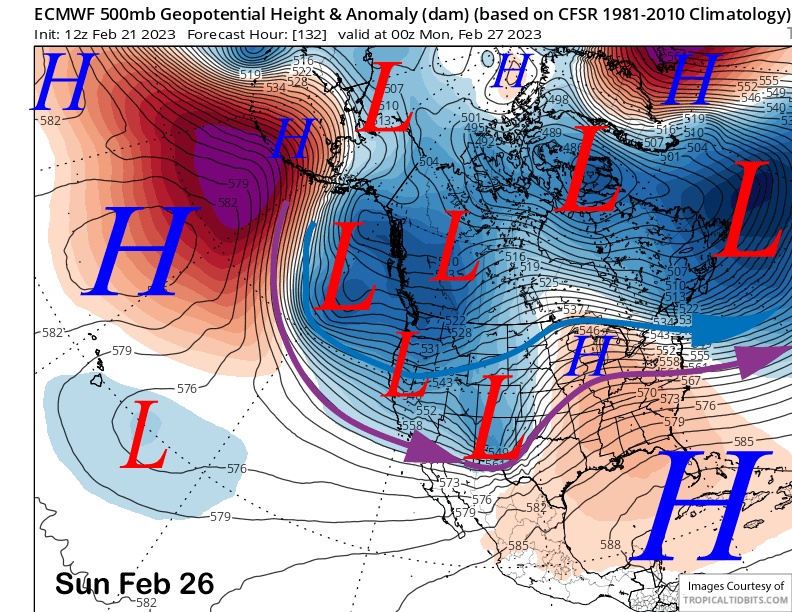
The ECM model moves a weaker short-wave trough through CA on Sunday (image below) and the trailing front will probably produce a few inches to maybe six on Sunday and Sunday night. The ECM model never ends the snowfall from the previous storm Saturday night before this one moves in on Sunday.
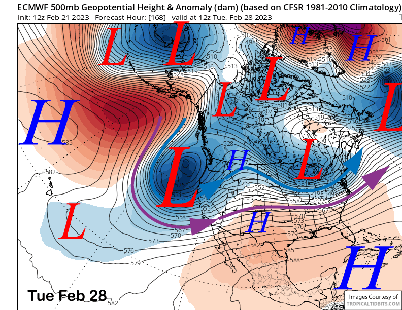
The main story for next week, though, will be a stronger storm for around late Monday and into Wednesday next week (image below) time frame. The ECM model develops strong moist southwest flow over the period and is forecasting heavy snowfall amounts with over 4” liquid. That could mean another 3-4 feet at Main and possibly 4 plus feet up top.
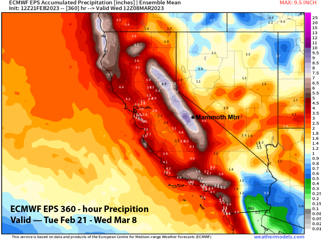
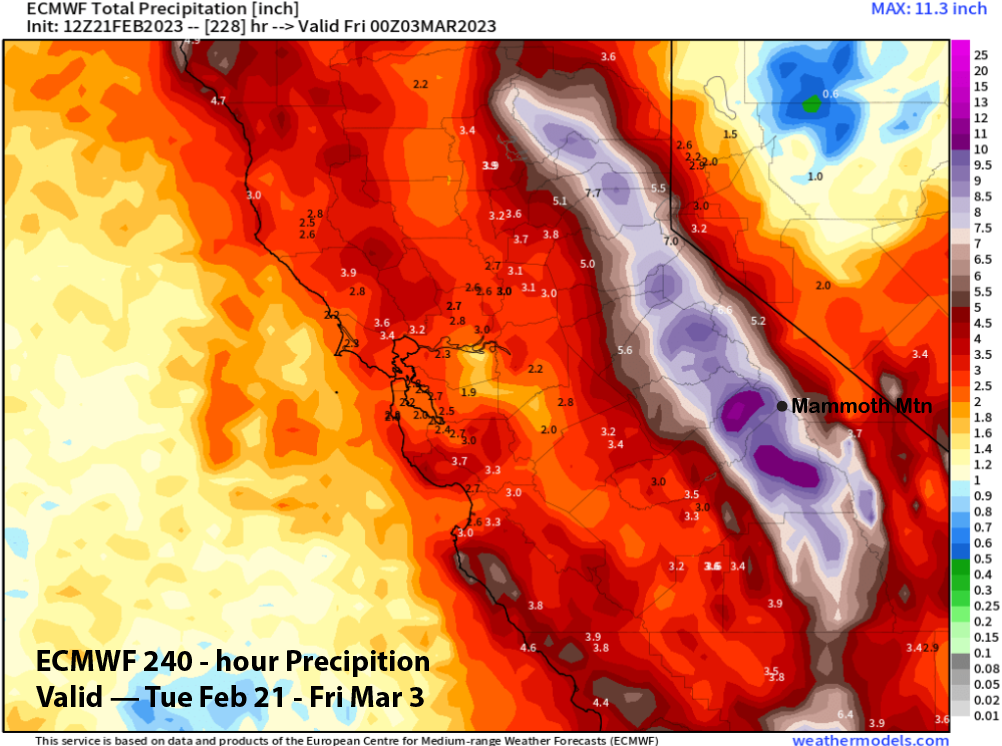
It is way out there still, but these stronger solutions have good support from the ensembles. Current forecast is calling for another 2-3 feet. Overall, the ECM model has around 9” liquid (image below) for the 10-day period which could translate to over 100” of snowfall for the 10-day period due to the high liquid snow ratios this week.
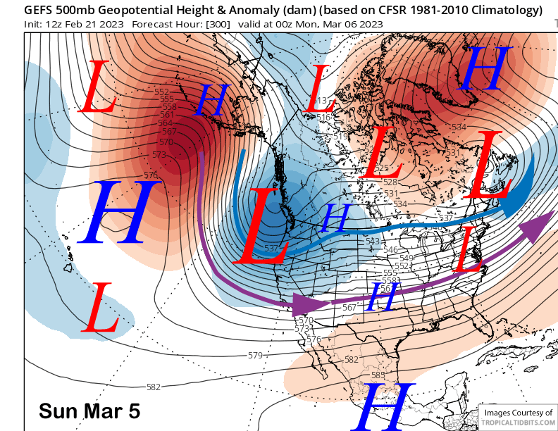
There may be a break from the snowfall toward the end of next week before the next storm system(s) may roll into the state over following weekend or first weekend in March. There are some differences between the models with the GFS ensemble (image below) showing more over-water trajectory and deeper with the long-wave trough versus the ECM model (two images below).
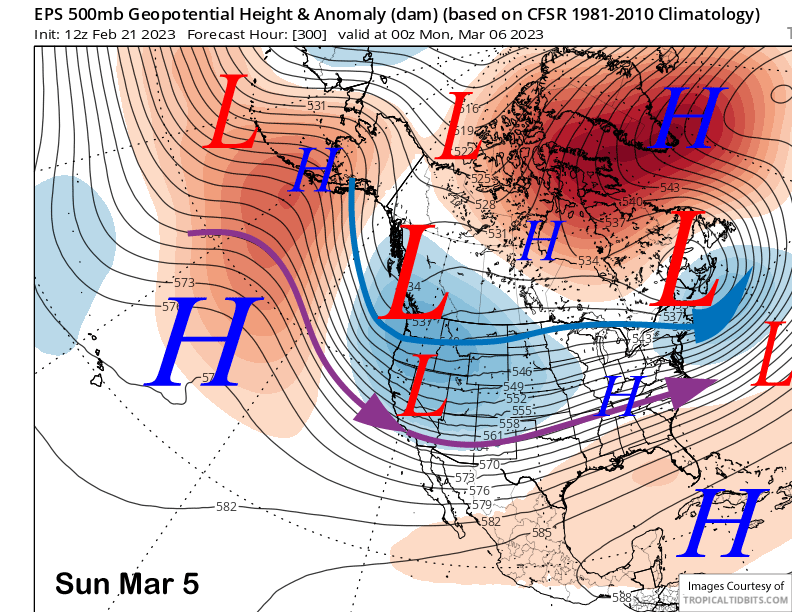
The trough may weaken or slide a bit eastward over the second week of March with less storm chances. We shall see as the ECM weekly forecast keeps the trough mostly over the West Coast into mid-March. The latest ECM EPS (image below) has about 8” through the period and that ECM EPS 45-day forecast from yesterday has about 20” liquid through March and into April. That would be enough to finish covering up that big rock that sits between Drop Out 1 and Drop Out 2, just like what happened in 2017. WG