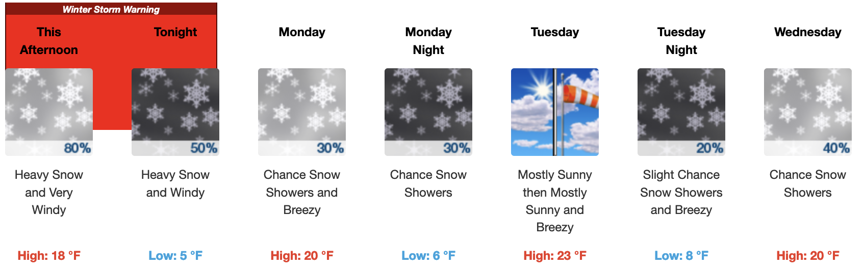
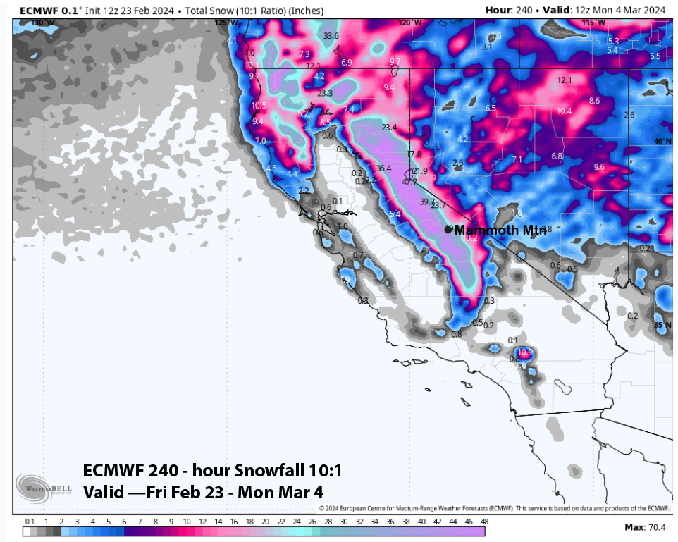
March 5th, 2023 @ 12:38 PM – Moderate to heavy snowfall will continue for the high country and areas to the north of Mammoth Lakes today and into tonight.
Expect blizzard conditions at times into the morning hours on Monday. The heaviest snowfall should end well before 4 AM with 8-16 inches of additional snow by Monday morning expected. As the low presure system moves south it will leave Mammoth Mountain with snow showery weather into late Monday.
There will be a break in the action on Tuesday and then a quick-hitting weaker system will bring some light snow showers are more cold air with it on Wednesday, with Thursday offering another rest day from the snowfall.
It would be nice to get a break from the heavy snowfall for a week but the forecast next Friday into Sunday is now calling for more snow. How much Mammoth Mountain gets is uncertain at this time.
Beyond next weekend through the 16-day fantasy outlook period conditions look to be very wet at times with more heavy snowfall possible in the high country.
Both the ensemble models are also showing a weak to moderate break through of the westeries after the 12th of March. Over all both models have 8-9 inches of additional water coming over the next 16 days. All that moisture should be snow above around 7500 feet.
8-9 inches of water would add up to an additional 100+ inches, with the latter half of the period bringing with it heavy wet snow. Confidence is moderate that it will be wet off and on over the next couple of weeks, however, patterns can change quickly.
The longer-range dream runs have some weak to moderate systems all the way out into early April before we get the first taste of spring.
If you’re going to be out on the hill Monday, expect cloudy skies with a 30% chance of snow showers with light accumulations possible during the morning hours. The day will start out cold with single-digit highs and then temperatures in the mid-teens by mid-day.
The wind forecast is for a southwest wind at 15 to 20 mph, with gusts as high as 30 – 40 mph along with wind chills in the -10 to -20 range. Bundle up and enjoy the fresh powder day that will be awaiting you.
Snowman