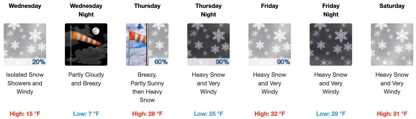
March 7th, 2023 @ 10 AM – A break in the heavy snowfall has arrived today with pt cloudy skies. On Wednesday there will be a few snow showers possible from a weaker system moving to the north. If the next front drops a bit more south there will be a better chance for a dusting of snow with 1-3 inches of snow possible.
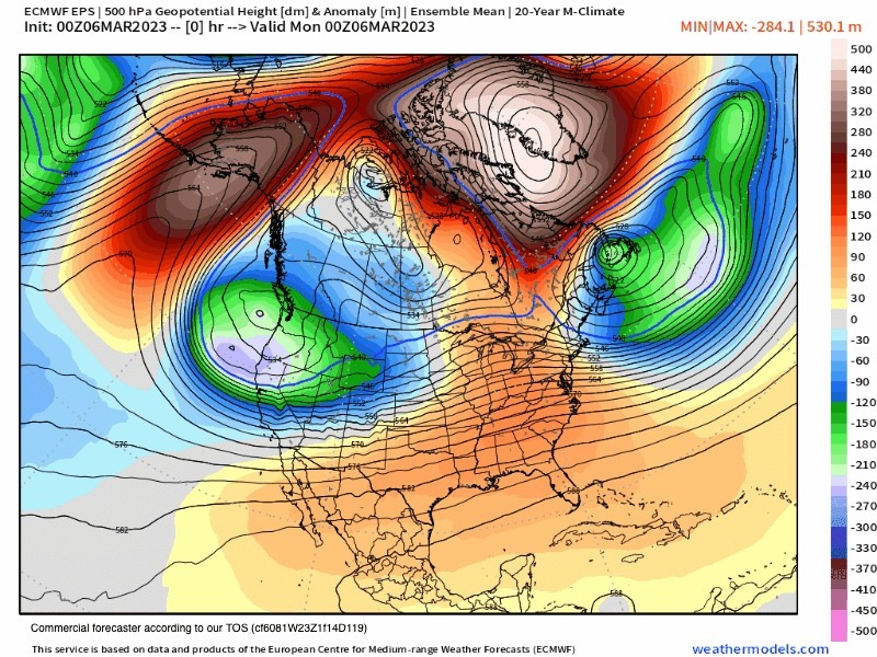
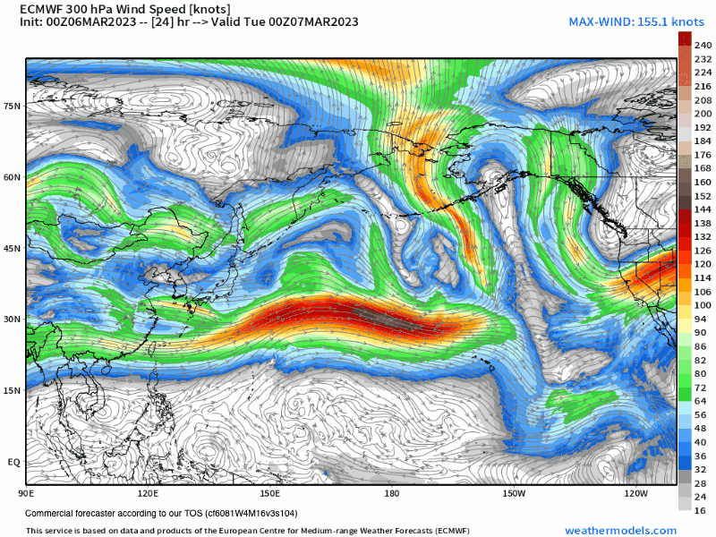
By Thursday a big change in the weather will take place as the jet stream will cease to drop from the north and instead will be coming over Mammoth Mountain from the mid-latitudes.
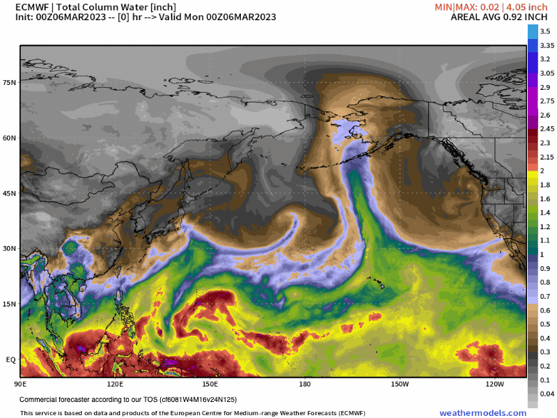
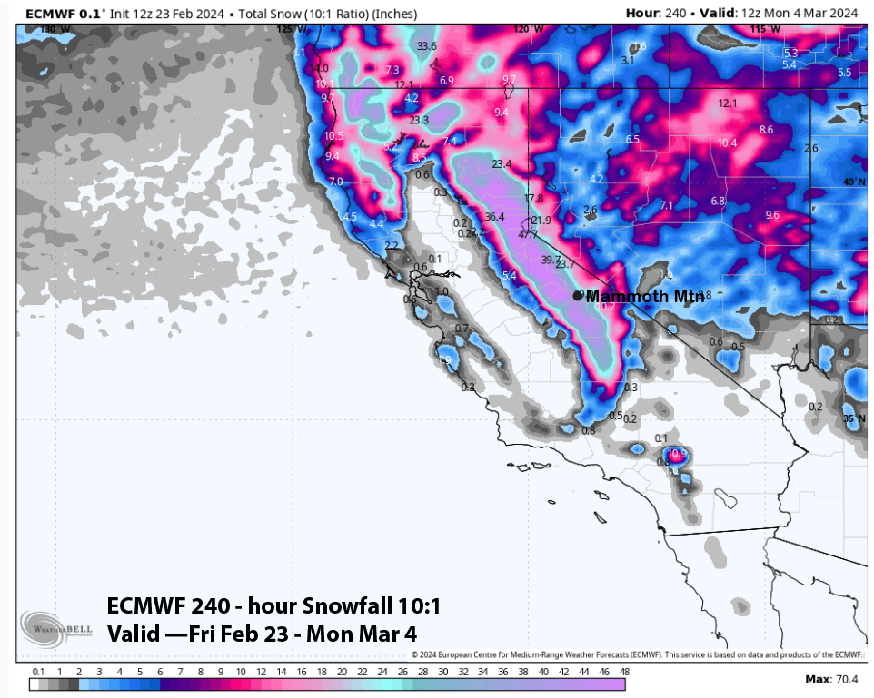
This strong mid-latitude jet will bring in much warmer air with a ton of subtropical moisture, the so-called atmospheric river (AR). Snow levels start out around 7000 feet late Thursday and then jump up to 8500 – 9000 feet during the morning on Friday.
By Friday night snow levels slowly lower from 8500 feet down to 7800 feet around midnight. Then mid-morning on Saturday snow levels should lower down to 7500 feet and down to around 7000 feet Saturday afternoon.
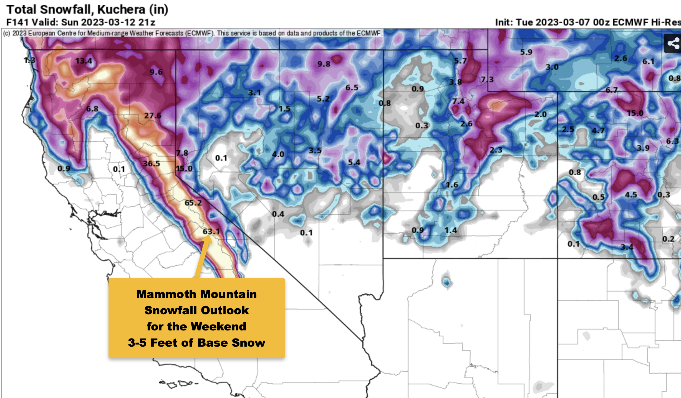
Snow ratios will be down in the 6-1 range for a while on Friday but will be back around 10-1 on Saturday. Elevations above 9500 feet could see 3-5 feet of new snowfall by the time this system moves out during the day on Sunday.
For travelers, 395 and the snowpack along the road will get some heavy rain and that will limit blowing snow real quick at the start of the event. Once we get to Saturday the heavy snow might or might not create a road closure.
Cal Trans has more crews and more plows in the area so maybe they can keep the road open this time around. I would not count on that and be prepared for possible delays into Sunday or longer.
The fantasy extended outlook for next week has a second system moving in from the west with snow levels looking to be in the 7000-8500+ foot range. Models this morning continue to show 7-10 inches of water falling over the crest over the next 10 days.
That would add up to 70-100+ inches of mostly base snow falling on top of the large base that is on Mammoth Mountain and along the entire crest of the Sierra north and south.
Out in the Neverland 10-16 day outlook, there is a possible third system with a subtropical hook-up that the EPS ensemble is advertising
If you’re going to be out on the hill on Wednesday, expect pt cloudy skies with a chance of snow showers and possibly a dusting or an inch or two of snow.
Temperatures will start off in the teens and then rise into the mid-20s with SW winds in the 15-25 Range with gusts in the 35-50 MPH range.
Talk about endless winter… O Boy you will be able to ski and ride all Summer this year. 🙂
Snowman