March 8th, 2023 @ 8:54 AM Good Morning, it’s a snowy day cloudy day in the high country from just south of Mammoth and northward. From the Mammoth Airport down to Bishop you will find sunny skies at this time. The current snow line is right as you enter Bishop at the 4100-foot elevation level.
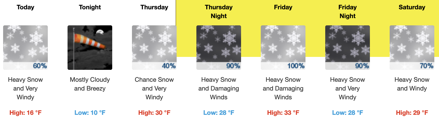
Current Weather Alerts: WINTER STORM WARNING FROM THURSDAY AFTERNOON THROUGH SUNDAY MORNING ABOVE 6500 FEET WITH A FLOOD WATCH BELOW 6500 IN INYO & MONO COUNTIES…
Discussion for Wednesday morning: A weak system has slid a bit further south than expected bringing with it mostly cloudy skies to Mammoth Mountain with some light snowfall this morning. Accumulations should be light in the 1-3 inch range.
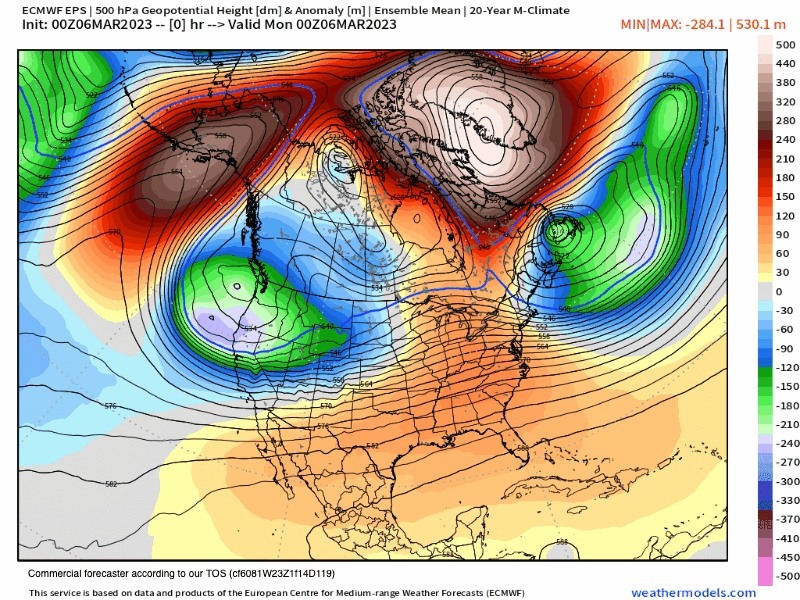
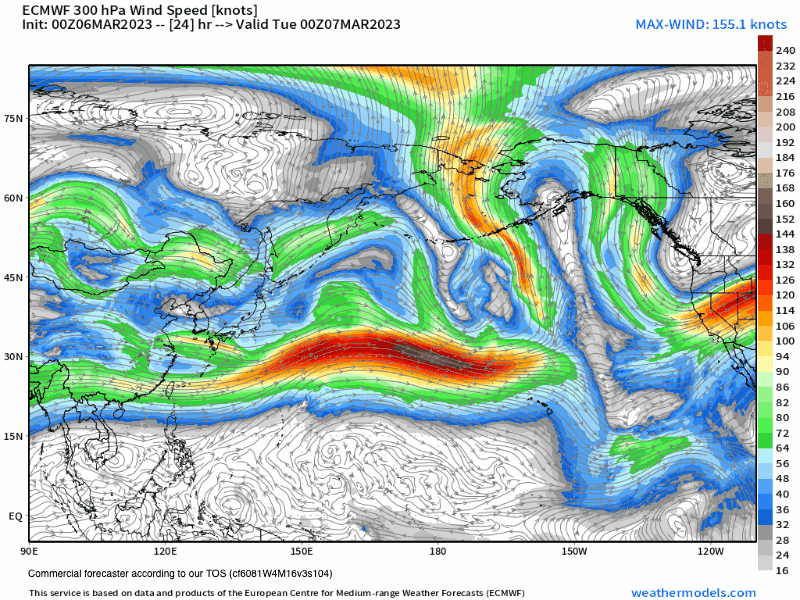
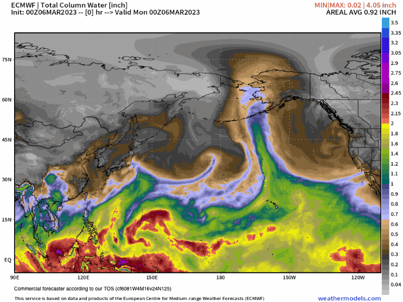
A major change in the pattern is on the way Thursday as a strong mid-latitude jet stream undercuts the current north pacific ridge. That ridge has been sending us a cold weather system for the last 3 weeks. With the new pattern, the flow will be from the west with the strong jet steam picking up lots of warm sub-tropical moisture.
That type of pattern will bring Mammoth Mountain and the Eastern Sierra a mix of rain and snow as it gets started later Thursday into Friday with all snow in the forecast Friday night into Sunday.
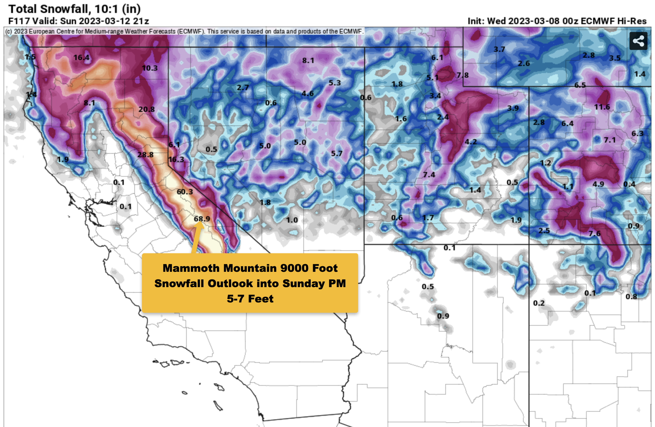
The snow that does fall with be heavy wet base snow with 2-3 feet in the upper parts of Mammoth Lakes and 3-5+ feet possibly out on Mammoth Mountain. Overall expect the snow ratios to be in the 8-1 – 10-1 range from this event.
Also to note that weather models are trending wetter for this next system so don’t be surprised if the snowfall forecast amounts go up a couple more feet into the 5-7 foot range. We just need to see a couple more runs on the data to be sure.
Snow levels are a bit tricking with this system. The main data shows the snow levels will start out around 7000-7500 feet on Thursday and then possibly come all the way up to 8000-8500+ feet on Friday morning and through the daytime hours.
Over the night on Friday snow levels will slowly come down to the 7000-7500 level and on Saturday there should be snow falling down to Tom Places.
There is a chance that on Friday with the very heavy precipitation that the snow levels might get dragged down to below 8000 feet or even a bit lower.
This next weather system and the embedded AR flow are complex so we will really have to wait until Friday to see how the snow levels pan out.
If you’re going to be out on Mammoth Mountain today, expect snow showers with 1-3 inches of new snow possible with snow ratios in the 15-1 range. Temperatures will be in the upper teens to low twenties today with SW winds 15-25 with gusts in the 35-55 MPH range over the higher elevations.
On Thursday expect increasing clouds and winds leading to a chance of snow showers during the afternoon hours. Temperatures will be in the upper twenties to low 30s with SW winds 25-40 with gusts in the 50-65 MPH range over the higher elevations.
Friday will be when the main AR band comes right over us dropping heavy wet base snow on Mammoth Mountain from Canyon Lodge up. Highs will be in the upper 20s to lower 30s along with very strong SW winds.
Most if not all lifts will be closed on Friday and into Saturday. The heavy wet snowfall on top of the second largest base ever will create snow removal issues at all lifts.
The wet nature of the snow and if it’s mixed with any rain will also create icing issues.
My advice to everyone is to sit this next storm out! The town is in a State of Emergency and road plowing will be reduced with many side streets only getting down every 24 hours or so.
Local Snow Removal Operators are also telling customers now there will be no set schedule they will get there when they can.
In some locations, you can expect to be snowed in and possibly even without power at times if you do come up to Mammoth Lakes. Do bring your own food supplies and some snow shovels.
Got to love this endless winter. 🙂
Pray for Spring to pop on 3-21… Ski Ya Later Snowman