March 13th, 2023 @ 10 AM – Good morning, the high country remains clouded over with light snow showers from a westerly flow. Lower elevations such as Bishop are in the clear at this time.
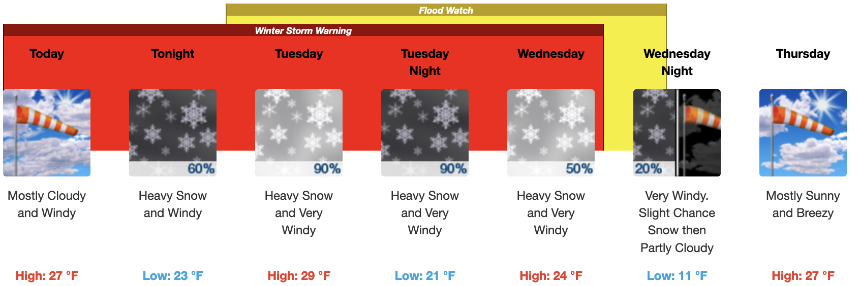
Current Weather Alerts: WINTER STORM WARNING UNTIL WEDNESDAY MORNING FOR AREAS ABOVE 7000 Feet…BEWARE OF EXTREME AVALANCHE DANGER.
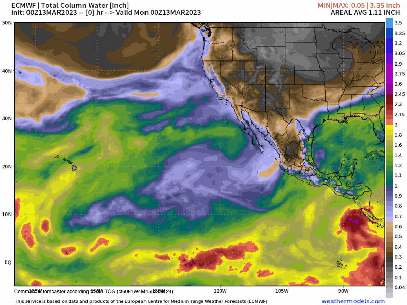
Discussion for Wednesday morning: Good Monday morning, the next system from the west will be moving into the Mammoth and Eastern Sierra areas tonight into early Wednesday.
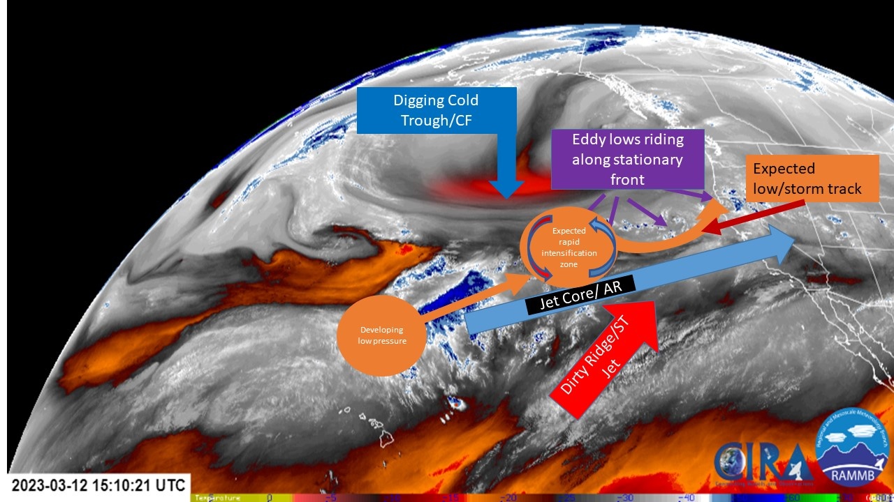
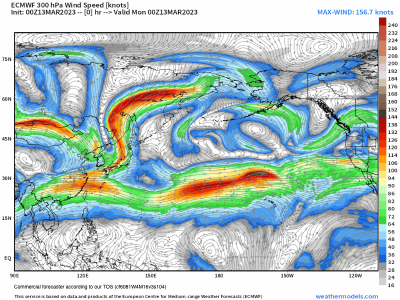
There will be a moderate AR or Pineapple connection with this system just like the last one. Snow levels look to start out around 7500 feet and then come up to 8000 feet before slowly lowering down to 7000 feet on Tuesday night. Snowfall amounts for the high country above 9000 feet look to be in the 2-3+ foot range.
Snowfall rations will be in the 8-1 to range then climbing to the 10-1 Tuesday afternoon. By Wednesday, more snow showers are likely before there is a break from the snowfall on Thursday.
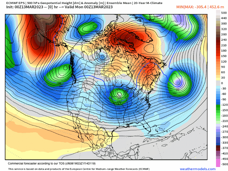
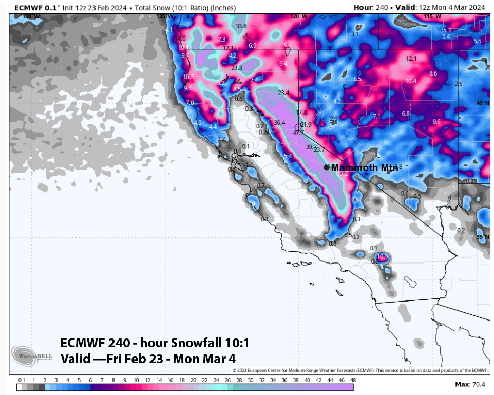
A weaker low will move through on Friday with a moderate system possible for Saturday night and Sunday. Way off in the 7-10 Day forecast the flow looks to turn back to the NW, so the weather systems coming in will have less moisture with much drier snow falling again. Check out the weather images posted down to the page for more details.
If you’re going to be out on Mammoth Mountain today expect snow showers with 1-3 inches of new snow possible. Temperatures will be in the low to mid-30s with SW winds 15-25 MPH with gusts in the 45-80 MPH range over the higher elevations.
On Tuesday expect heavy snow, strong winds along with blizzard conditions above 8000 feet, with very limited lift access. Temperatures will be in the upper 20s to low 30s out on the hill.
For Wednesday snow showers will be numerous and then the high country will clear out during the overnight hours. Temperatures will be in the upper 20s to low 30s out on the hill with moderate to strong SW winds still possible.
By Thursday there will be a full break in the snowfall with snow showers then possibly returning Friday and through out the weekend.
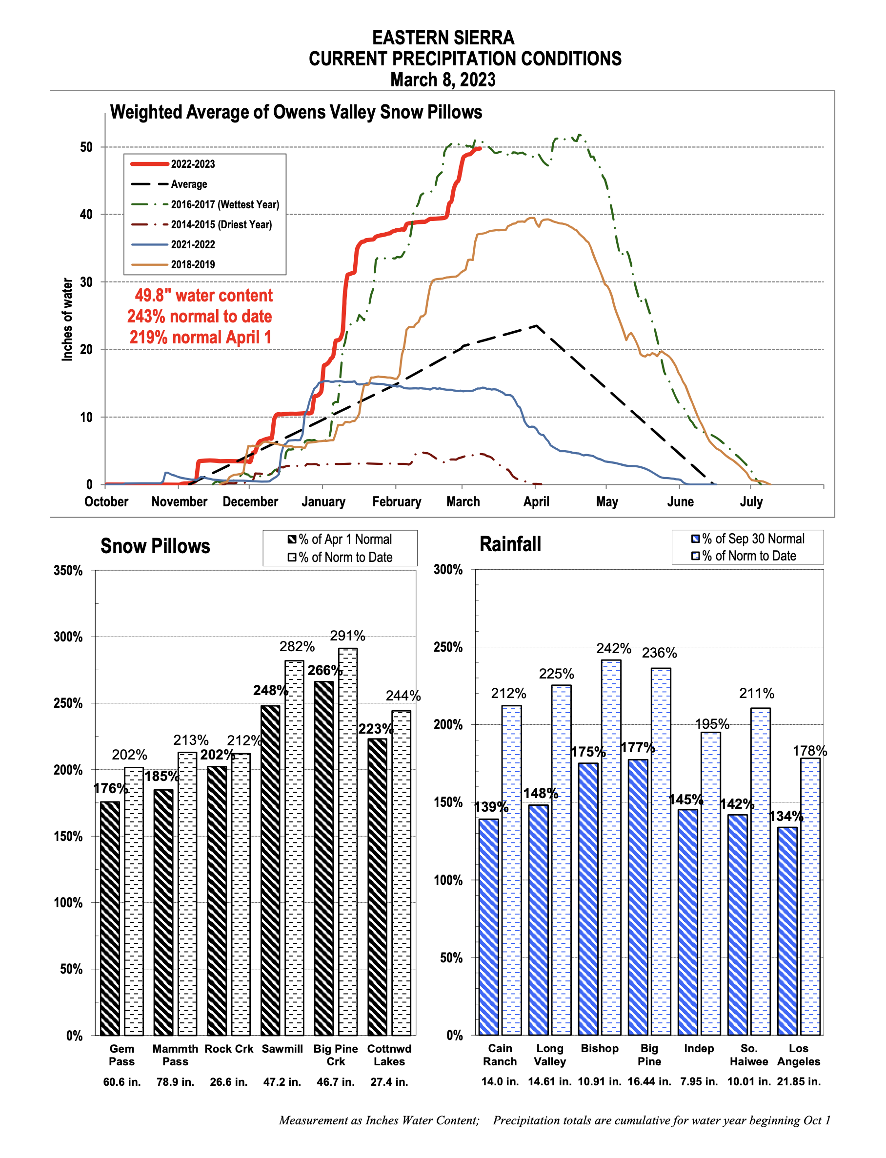
Also to note, the first system with the big AR tap brought in 8-10 inches of water and an estimated 48-60 inches of heavy wet snow from 9000 feet up to the top and along the Sierra Crest.
DWP will have to confirm but it does look like the snow pack is now greater then the great winter of 1969. Nobody ever thought that would happen again and boom a La Nina winter breaks it in 2023. The EU Seasonal Model from October had us getting normal to above normal snowfall for the winter, but nothing predicted this massive snow pack.
Ski Ya Later Snowman