
Powder Forecast – Tuesday March 28th, 2023
Ted Schlaepfer CCM —- Mammoth Mountain WeatherGuy
Snowfall forecasts are valid at the Sesame snow course (Main Lodge) for the prior 24 hours as reported in the 6-7 AM morning snow report.
**Snowfall forecast confidence ranges from very low (1) to very high (5)
Wed 3/29 = 18 – 24” (H20 = 1.80” – 2.00”)**4
Thu 3/30 = 3 – 5” (H20 = 0.30” – 0.40”)**3
Fri 3/31 = ~1” (H20 = 0.05” – 0.10”)**2
Sat 4/1 = 0”
Sun 4/2 = 0”
Mon 4/3 = 6 – 9”
Tue 4/4 = 0 – 1”
Wed – Fri 4/5 – 4/7 = 3 – 12”
March Snowfall = 157”
March Forecast = 175 – 185”
Detailed 4-day Snowfall Forecast
Wed 3/29 – Light to moderate snow showers continue during the day before ending overnight. Accumulations 3 – 5” by Thursday AM
Thu 3/30 – Dry during the morning hours, then afternoon snow showers likely, around an inch accumulation by Friday AM.
Fri 3/31 and Sat 4/1 – No snowfall expected both days.
Forecast Summary:
Short Term (Days 1 – 4):
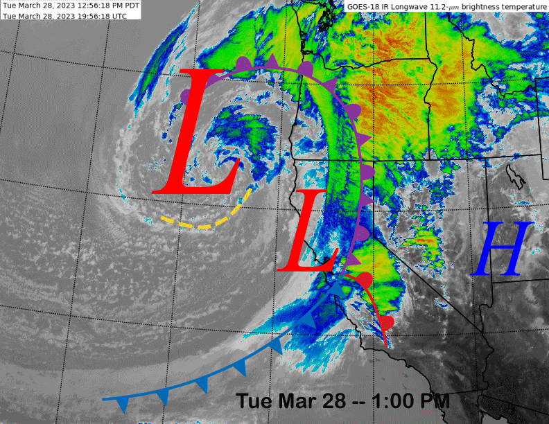
The current infrared satellite image (below) this afternoon shows a strong frontal system moving into the Sierra this afternoon with increasing winds and snowfall for Mammoth. The front will move through tonight with heavy snowfall before exiting southward tomorrow morning.
The upper-low currently positioned off the CA/Oregon coast will move southward over the next couple of days into SoCal and continued snow shower are expected Wednesday before snow ends Wednesday night. Thursday should be mostly dry other than some afternoon snow showers.
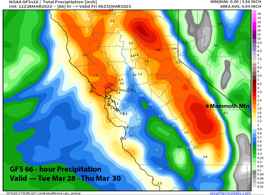
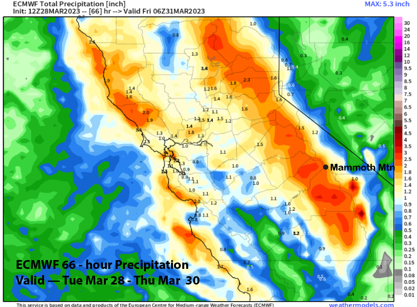
The GFS is the slightly wetter model (image below) with over 2” liquid while the ECM model (two images below) is showing around 2” total. Snow levels will get down to 3K overnight and the snowfall tomorrow will be light and fluffy on top of the snow from overnight that will not be Sierra cement, but not fluffy either.
Snowfall totals with the storm will probably be in the 2 foot range at Main with over 2 feet excepted up top. It will stay seasonably cold tomorrow and Thursday and conditions on the mountain should be epic once again.
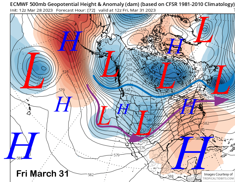
The storm moves eastward by Friday (image below) and weak high pressure builds into the state under cool northwesterly flow. Temps will warm up a bit Friday, but should stay winter-like. Saturday will be similar, but with more wind that will probably produce wind buff up top.
Long Range (Days 5+)
The longer-range guidance hasn’t changed too much with continued winter conditions next week including more powder day chances. Then spring may finally show up with a period of dry weather and seasonable temperatures through mid-month.
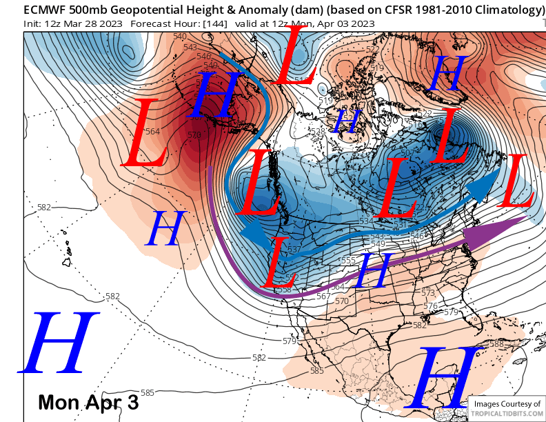
Sunday is forecast to be mostly dry until Sunday night when the next storm system swings through Central CA by early Monday (image below). Current guidance is not favoring a strong storm with about 0.50”-1.00” total liquid, although the latest GFS run is showing less. Current forecast follows the ECM mean that has about 0.75” liquid or 6-9” of snowfall.
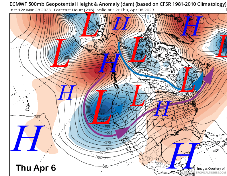
The longer-range ECM then moves another storm system into CA toward the middle/latter part of next week (image below). There is still lots of uncertainty with timing and strength, but the potential storm is well supported by the ECM mean and another powder day is possible for the Wednesday through Friday timeframe.
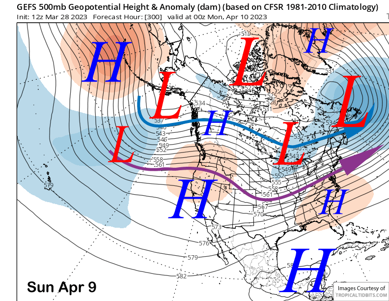
And that might be the last powder day for a while as the fantasy range guidance is favoring a ridge to build into the state (image below) over the following weekend. Both the ECM and GFS ensembles favor keeping that ridge in place through mid-month for a stretch of dry weather and probably spring conditions.
The ECM 45-day forecast does bring a trough back to the state over the last week of April for a return of colder weather and maybe some snowfall. The cool weather may be welcome to slow the melt of the massive record breaking snowpack on the mountain as there is not stopping the melt once the calendar hits May and June. WG


