Mammoth Mountain Weather Forecast & Discussion

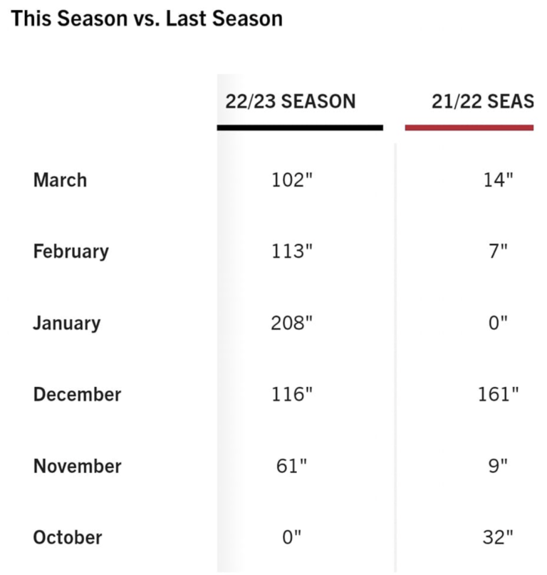
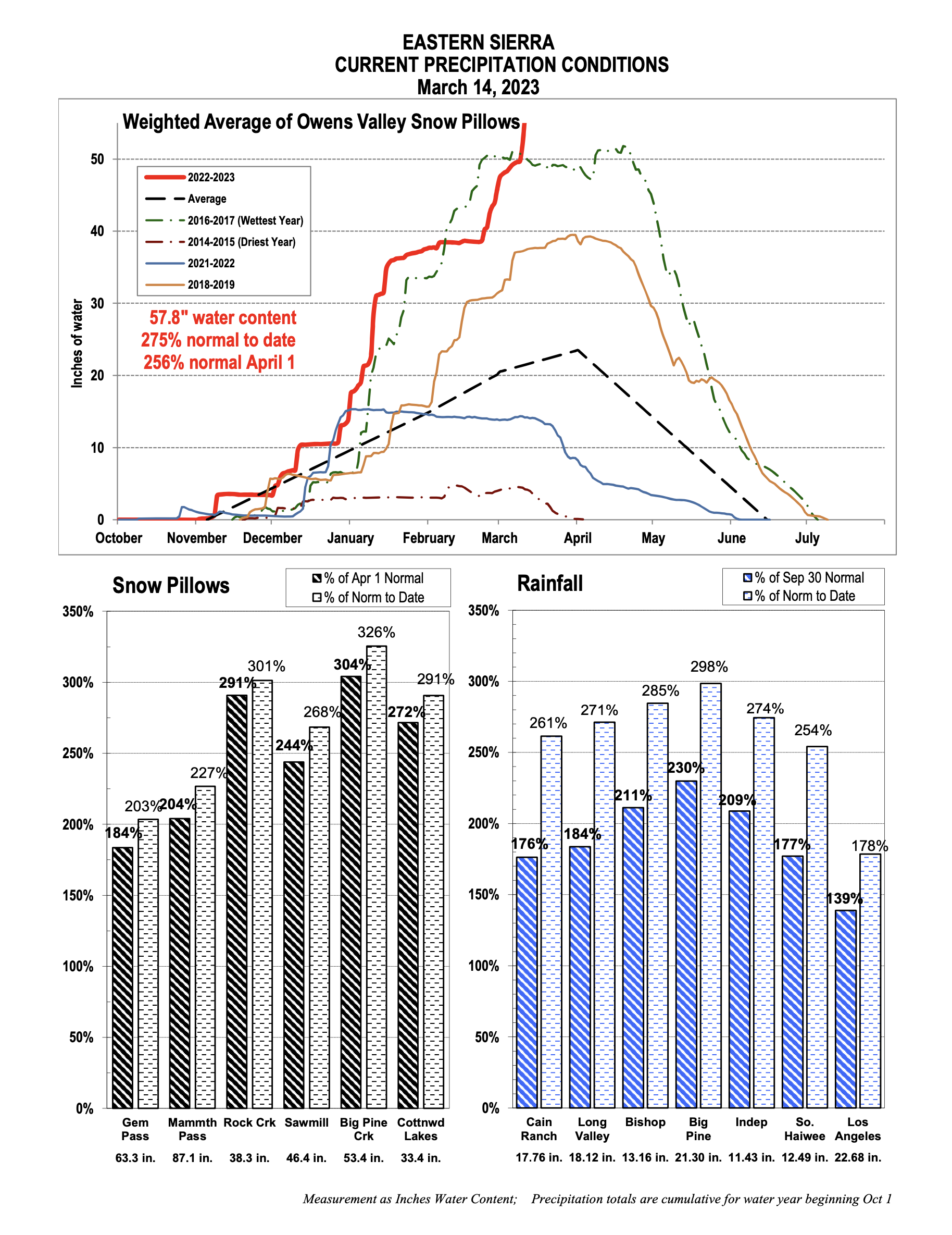
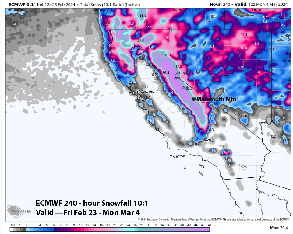
Wednesday, March 29th, 2023 @ 1:30 PM – Forecast Summary: Snow Showers will be possible today into Thursday from the low-pressure system that is off the Central California coast at this time. Once that system moves south and then east the area will get a 3-day break from the snowfall from Friday into Sunday.

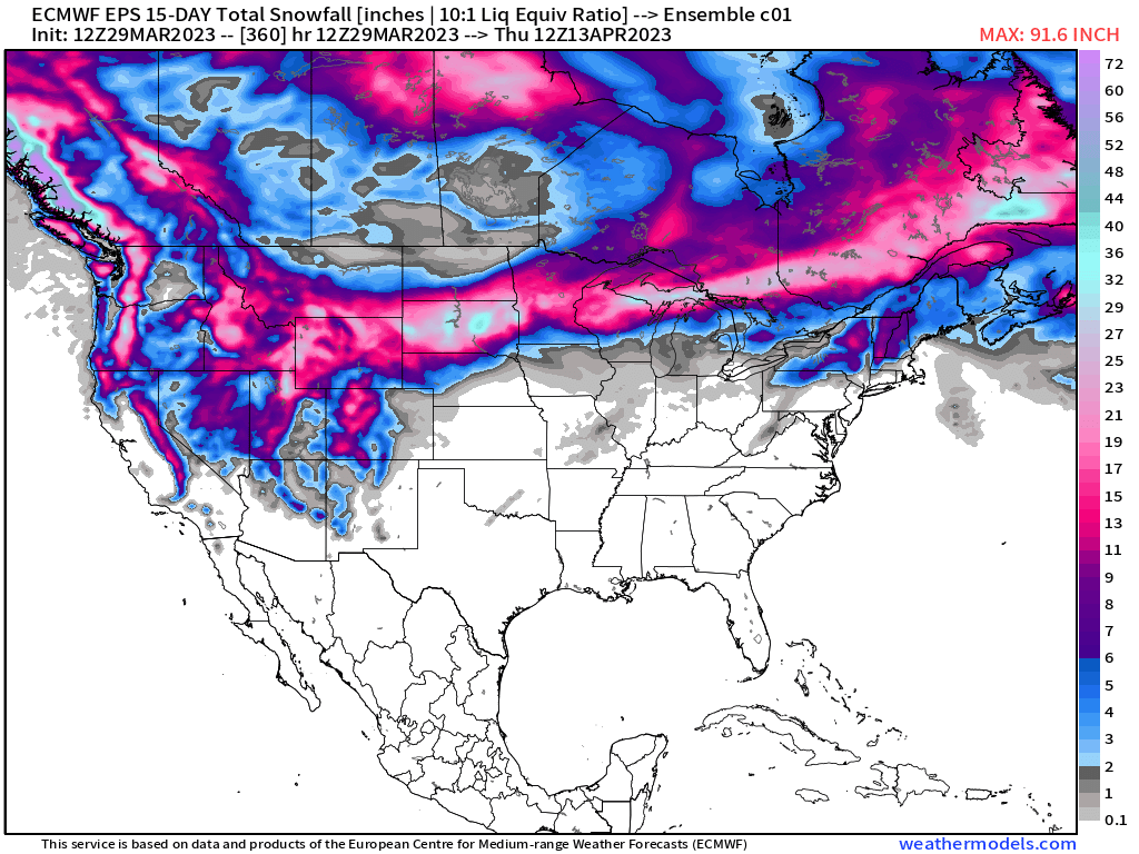
Then early next week Monday into early Wednesday a much weaker system will come thru with maybe 5-10 inches of snow up on Mammoth Mountain with much less over Mammoth Lakes and areas at the 8000-foot level.

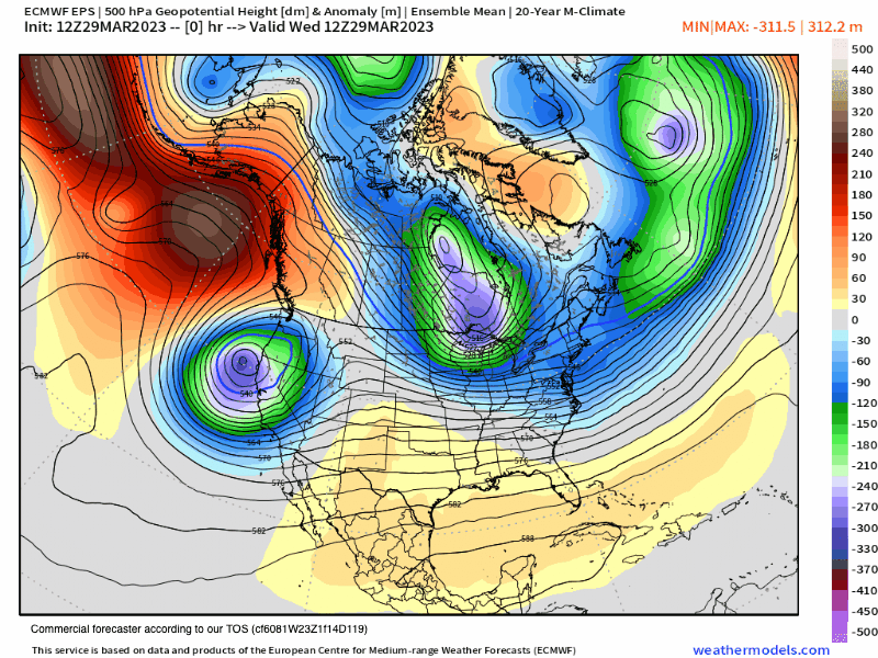
Beyond that time frame, there looks to be a change in the pattern with a ridge of high pressure that will be peaking in the Pacific North West.

That type of pattern will warm up the daytime highs a bit with the N flow keeping things cooler and preserving the snow in a winter snowpack state up top. It’s a bit far out to forecast but both the EPS and GEFS ensemble runs are showing this outcome in their data.

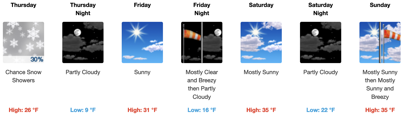
If you’re going to be out on Mammoth Mountain Thursday, expect pt cloudy skies with a chance of snow showers, especially during the PM hours. Temperatures will be in the mid to upper 20s with SW winds in the 15-25 MPH range with gusts @ 25-35 MPH over the higher elevations.

Skies will return to mostly sunny on Friday into Sunday with temperatures coming up into the low to mid-30s around Main Lodge and mid to upper 30s down at Little Eagle and Canyon Lodge. SW winds will be light on Friday and Saturday.

Now that spring is here make sure to break out the sunscreen on exposed skin.

Ski Ya Later, Snowman

West Coast and Eastern Pacific Satellite View

3-29-23 @ 1:55  PM – 10-Day Fantasy Outlook Summary and Long-Range Summer / Fall and Winter 2024 Outlooks.

After Thursday skies will return to mostly clear with dry conditions expected Friday – Sunday. Early next week, an inside slider will be moving into the area with much cooler air and a chance of a dusting to several inches of snow.

As of now, the EPS has the slider early next week riding down close to the spine of the Sierra crest. That type of setup could usher in about 5-10 inches of lighter winter-type powder snow along with the very cold air and gusty winds. Yep, more winter weather for you in the high country.

By days 8 into 10 a ridge of high pressure will be building into the area for what looks like at least a week or longer of clear weather for Mammoth Mountain and the Eastern High Sierra. The ridge initially sets up with a North to North West flow and that will limit how much warming the area gets.

Longer-range models do continue with some weaker troughing for the west coast, which will be good as the result will be a slow snow melt. At some point, that type of pattern could also allow a spring storm or two to make its way thru the area.

Overall I think that the spring and especially the summer will end up being cooler than normal… why you ask? A moderate to strong Eastern-based El Nino will be growing and in play and that tends to bring cooler summers.

By the Fall, El Nino according to the CFSv2 will be in the 1.5+ range, and with it being eastern-based California could be headed for back-to-back well above-normal winters.

Some of the models have the event in Super El Nino Strength. And before you call foul on El Nino, the last super El Nino was centrally based and for those who read my weather stuff, I stated that the season would be a total bust the summer before.

This El Nino pattern would be eastern-based, so watch out and be ready for a possible second extremely wet winter in 23/2024.

For those who have been around a while, this setup for El Nino reminds me of 1983 and 1998. And for those who don’t know 1983 had around 85 inches of precipitation up on Mammoth Pass, this year the pass is at 94 inches and growing.

Snowman…

PS: Yes this is all in the fantasy outlook period so things could change, until they do this is my story and I am sticking to it. 🙂

0- 16 Day - EPS 500 Height Anomaly
Jet Stream Wind Speeds at 300 hPa
GEFS High Anopmply Chart February 27th to March 21st
An Eastern Based El Nino Event is on the Way - If this data is right it will be a strong one.

Long Range Seasonal ECM Model from Early March – Next run on this Model is April 3rd

GEFS High Anopmply Chart February 27th to March 21st
ENSO Outlook – Updated on February 20th

Mammoth Mountain and Eastern Sierra Weather Posts