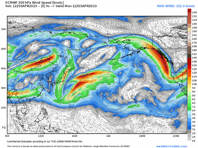
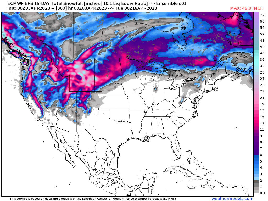
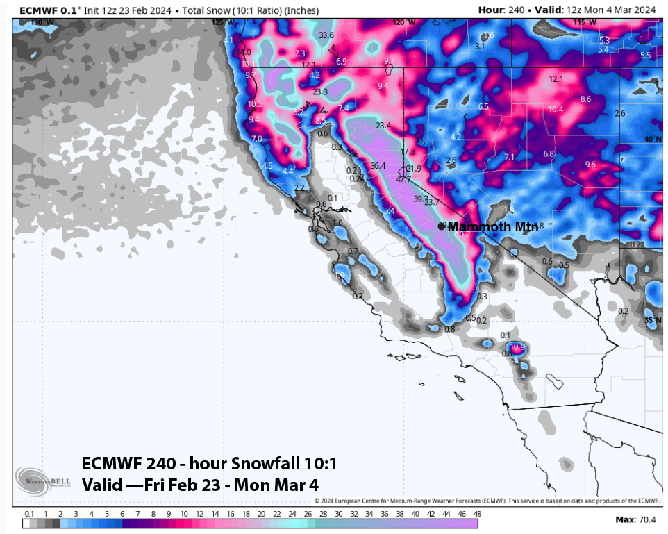
Monday, April 3rd, 2023 @ 10 AM – Good morning, an inside slider-type low-pressure system is moving down the east side of the Sierra Crest today. These types of systems have limited moisture with lots of cold air along with very windy conditions.
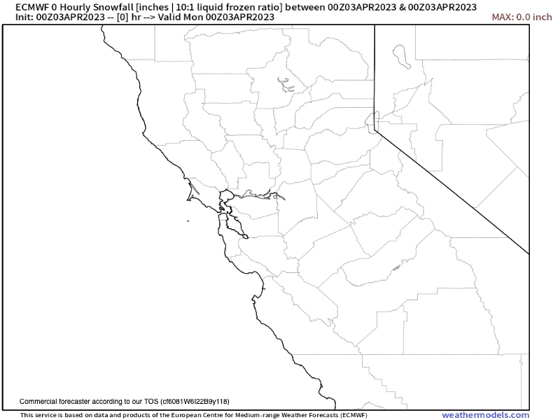
Snowfall amounts so far have been in the 2-3 inch range and there could be an inch or two of additional snowfall today. This will be the last of the snowfall for about a week to 10 days.
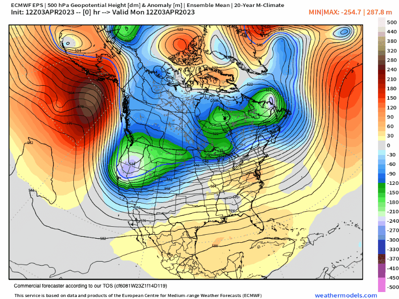
Once this low-pressure system moves to the south and east of the area there will be a ridge of high pressure that will set up to the north and east of Mammoth Mountain.
The position of the ridge has changed since the update I did on Saturday with the high a bit more to the east than it was forecasted before. The result of that change will mean that instead of a North to NE flow it looks like Mammoth will come under a South to SW flow.
That type of pattern will allow a spring thaw in sun-exposed locations all the way up to MC Coy Station by next weekend.
Temperatures in the area today have dropped 20-30 degrees and will slowly start to rebound this Tuesday and Wednesday. Temperatures at the 9000-foot level by Friday will be into the upper 30s to low 40s and by Sunday temperatures will have climbed into the upper 40s to low 50s at Main Lodge.
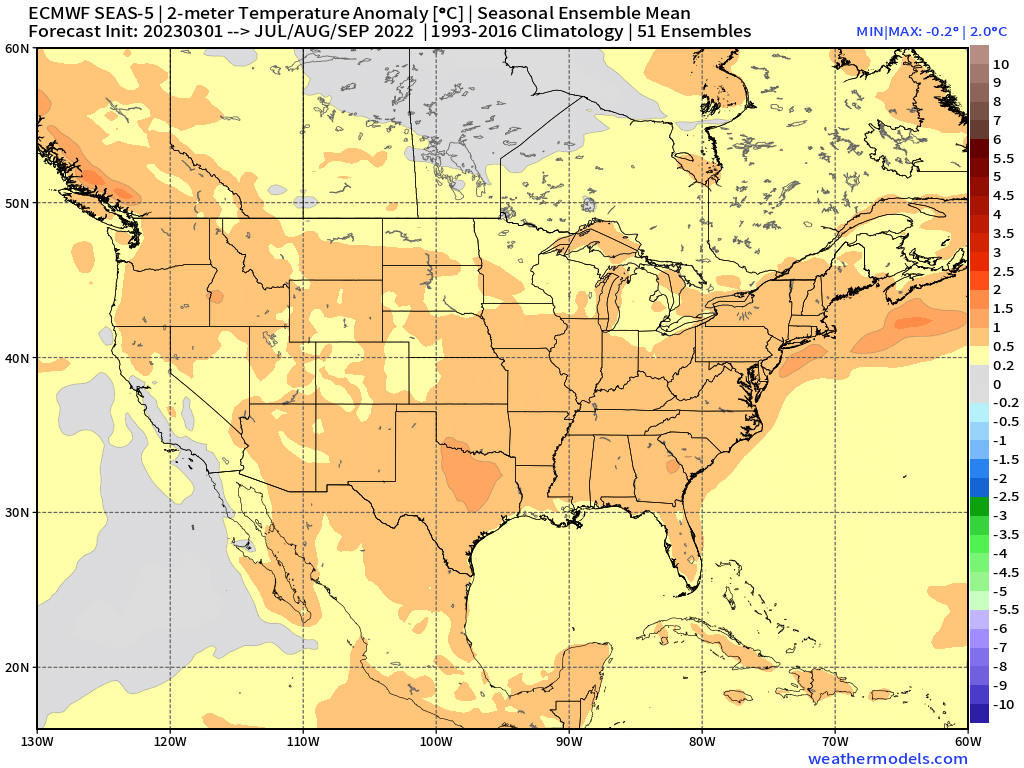
In the Extended Outlook period, this taste of spring will come to a quick end at day 10 as the ensemble models have troughing starting to set up again for California and the Eastern Sierra. That would mean colder wintery weather and a chance for some additional light to moderate snowfall.
I will update the extended data down the page today, so check back in a couple of hours if you happen to be reading this line…
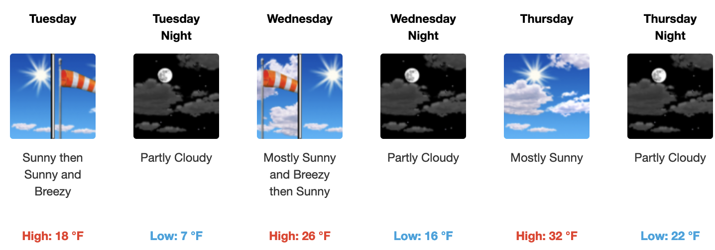
If you’re going to be out on Mammoth Mountain on Tuesday expect pt cloudy skies with breezy conditions. Temperatures will be in the low to mid-20s by mid-morning with West winds in the 15-30 MPH range with gusts @ 35-40 MPH over the higher elevations and in wind-prone locations.
By Wednesday skies will be mostly sunny with highs in the upper 20s to lower 30s. Winds will be out of the west in the 15-30 MPH range with gusts @ 35-40 MPH over the higher elevations and in wind-prone locations.
For Thursday and Friday, the slow warming trend will continue along with decreasing winds. It will really start to feel like spring at this point with the warmer air temperatures and the snow over the lower 1/3 of the hill converting over to spring conditions in the sun-exposed spots.
For the weekend, the weather out on Mammoth Mountain looks to be great with highs in the Main Lodge area expected in the upper 40s to low 50s under sunny skies with light winds in the forecast.
Mammoth Lakes will also thaw out with temperatures into the mid to upper 50s. The Bishop area by next week should see the upper 60s to lower 70s.
Ski Ya Later, Snowman