Powder Forecast – Friday April 7th, 2023
Ted Schlaepfer CCM —- Mammoth Mountain WeatherGuy
Snowfall forecasts are valid at the Sesame snow course (Main Lodge) for the prior 24 hours as reported in the 6-7 AM morning snow report.
**Snowfall forecast confidence ranges from very low (1) to very high (5)
Sat 4/8 = ~1” (H20 = ~0.25”) **5
Sun 4/9 = 0”
Mon 4/10 = 0”
Tue 4/11 = 0”
Wed 4/12 = 0”
Thu 4/13 = 0 – 2”
Fri 4/14 = 0 – 2”
Sat – Mon 4/15 – 4/17 = 0”
April Snowfall = 2”
April Forecast = 15 – 30”
Detailed 4-day Snowfall Forecast
Sat 4/8 through Tue 4/11 – No snowfall expected all days.
Forecast Summary:
Short Term (Days 1 – 4):
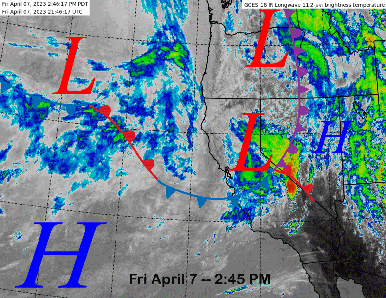
The current infrared satellite image (below) this afternoon shows a weak frontal system moving through the Sierra and light snow is currently falling at Mammoth Main Lodge and rain across the lower parts of the mountain.
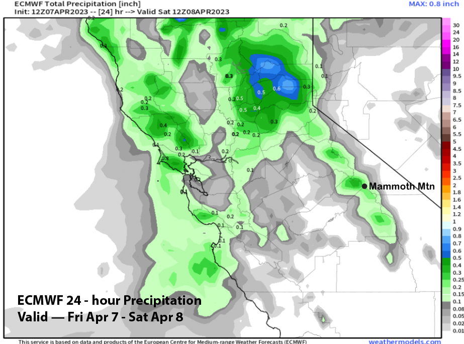
Snow/rain should end by this evening and the latest ECM model (image below) is showing about 0.25” liquid for the storm or about 1” of snowfall. Maybe there could be a few spots up top that hit low-end powder due to the wind, otherwise it will be a dust on crust event as expected.
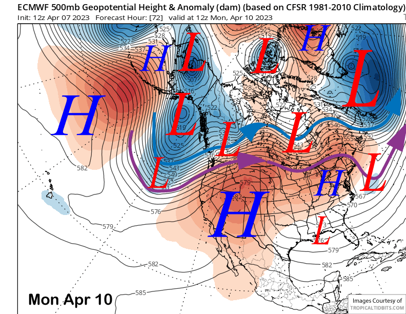
High pressure builds into the state by Sunday and will continue to hold Monday (image below) for fair and warmer weather. Freezing levels should get up to 11K by Sunday and Monday resulting in spring conditions across the majority of the mountain. Only little change or slightly cooler temps is expected Tuesday in addition to a bit more breeze.
Long Range (Days 5+)
The longer-range guidance has now shifted a bit drier and warmer through mid-month with less overall storm chances. There is a still a chance that storms could return over the last third of the month, but climatology doesn’t favor significant precipitation by then.
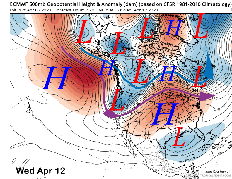
The guidance is favoring an upper-level trough to move southward into the state around the middle part of next week (image below). The system will be moisture-starved and the main effect will be colder temps and an increase in winds.
The latest run of the ECM model is completely dry for Mammoth and the 12z GFS is showing only very light amounts (image below). The ECM mean has enough for a inch or two of snowfall and the current forecast favors about that amount which would just be another dust on crust event.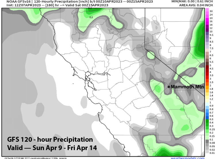
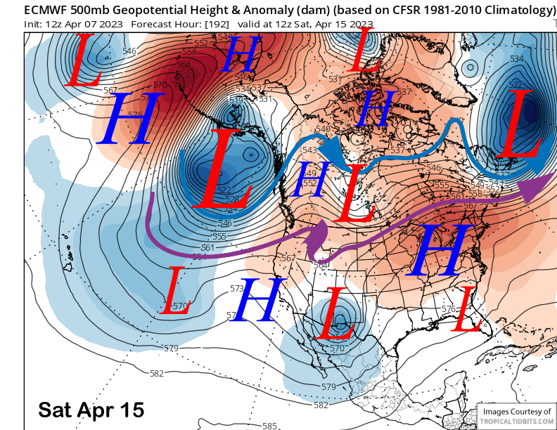
The longer-range guidance then favors ridging to rebuild over the state over the following weekend (image below) and that should continue into early the following week for more dry weather and likely spring conditions.
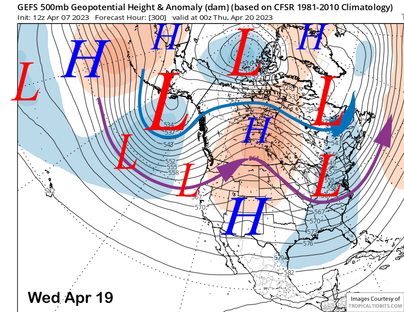
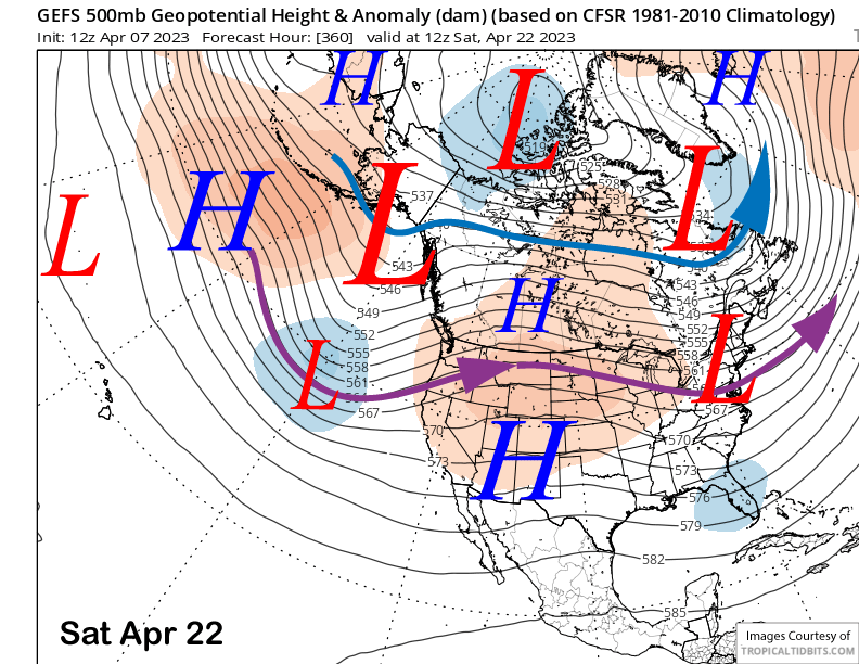
The fantasy range guidance favors the ridge to shift eastward slightly after mid-month with the GFS ensemble (image below) a bit farther northward with any trough passage versus the ECM EPS, but both models are not favoring anything significant. Ridging may then briefly rebuild (two images below).
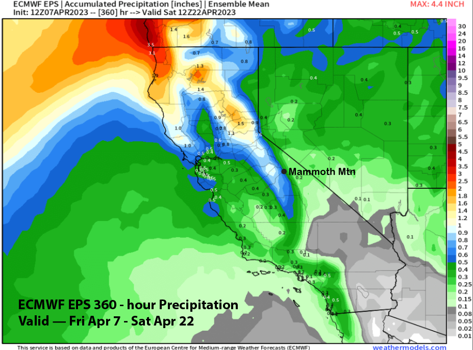
Overall, the ECM EPS is only showing about 0.65” liquid (image below) for the next two weeks and no powder days are expected right now. There are some hints that the storm track could dive a bit farther southward toward the last part of the month. We’ll see about that, but right now, current guidance says a transition to spring is underway. WG