Powder Forecast – Tuesday April 11th, 2023
Ted Schlaepfer CCM —- Mammoth Mountain WeatherGuy
Snowfall forecasts are valid at the Sesame snow course (Main Lodge) for the prior 24 hours as reported in the 6-7 AM morning snow report.
**Snowfall forecast confidence ranges from very low (1) to very high (5)
Wed 4/12 = 0”
Thu 4/13 = 0”
Fri 4/14 = 0”
Sat 4/15 = 0”
Sun 4/16 = 0”
Mon 4/17 = 0”
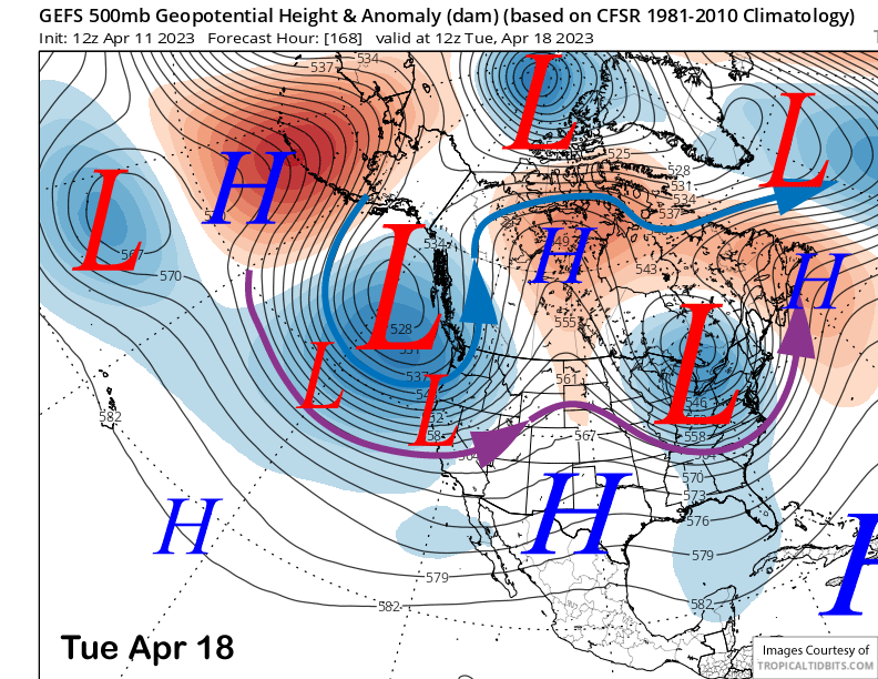
Tue 4/18 = 1 – 3”
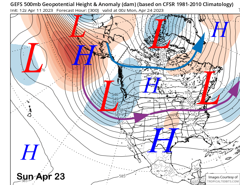
Wed – Fri 4/19 – 4/21 = 2 – 6”
April Snowfall = 3”
April Forecast = 15 – 30”
Detailed 4-day Snowfall Forecast
Wed 4/12 through Sat 4/15 – No snowfall expected all days.
Forecast Summary:
Short Term (Days 1 – 4):
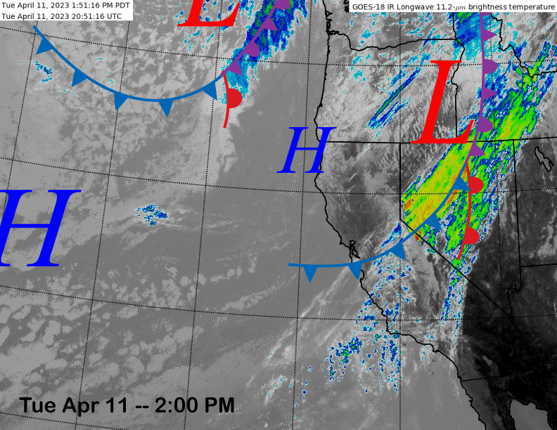
The current infrared satellite image (below) this afternoon shows a dissipating cold front moving through the Sierra with just some passing clouds and a minor increase in winds. A trailing weather system off the Oregon coast will move into the state tomorrow.
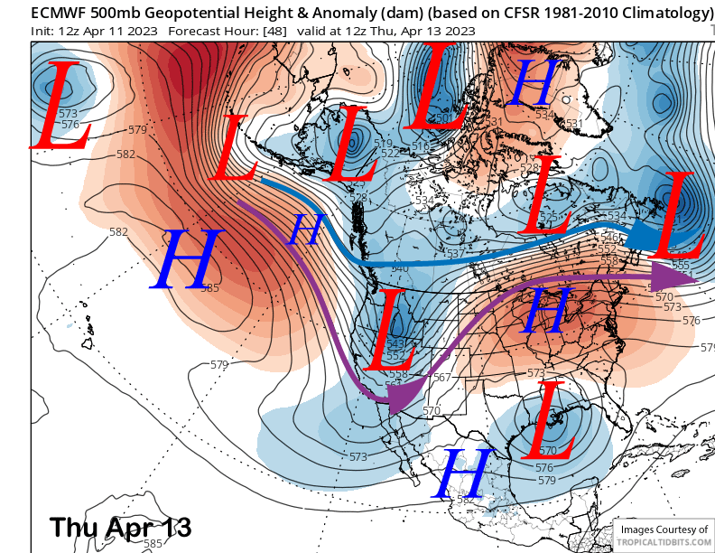
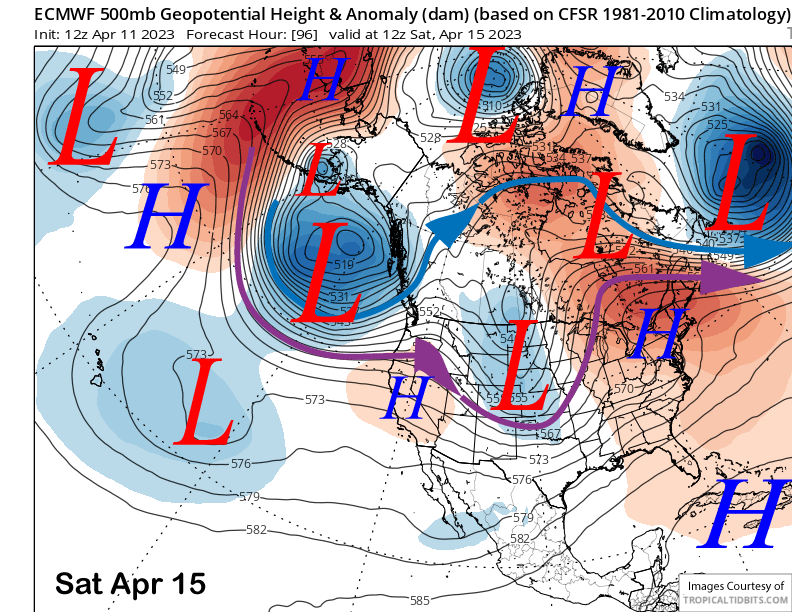
That system will produce more wind along with colder temperatures, but no snowfall. It will exit eastward on Thursday morning (image below) with high pressure to build through Saturday (two images below) for fair and warmer weather, but not as warm as last weekend.
Long Range (Days 5+)
The longer-range guidance has now shifted back a bit wetter for the last part of the month with storm chances possibly returning as early as the end of next week/following weekend. We will see if the storms happen, but the models are bullish that temperatures will stay seasonable or seasonably cool through the remainder of the month.
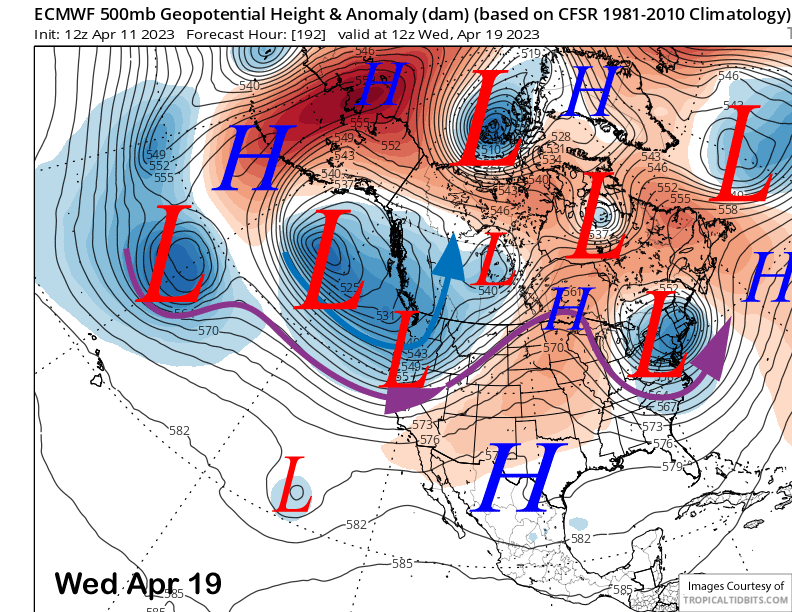
Dry weather will continue Sunday and likely most of Monday next week before there is a chance for some snowfall. The GFS ensemble is favoring a trough to develop along the West Coast next week (image below) and the jet stream (purple arrow) may be far enough southward for some light snowfall by mid-week. The ECM model is a bit slower by a day, and also drier (two images below).
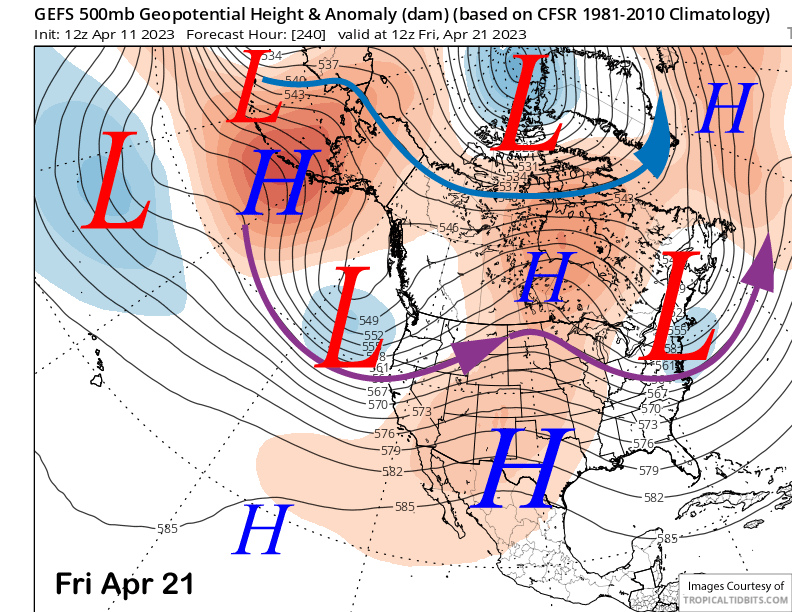
The GFS ensemble keeps the trough in place through the following weekend (images below) for additional chances for storms and snowfall if they end up moving far enough southward. That will probably be the key to the forecast and a very typical dilemma during spring as the jet stream lifts northward by summer.
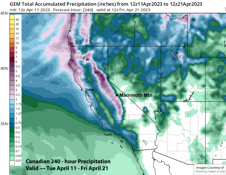
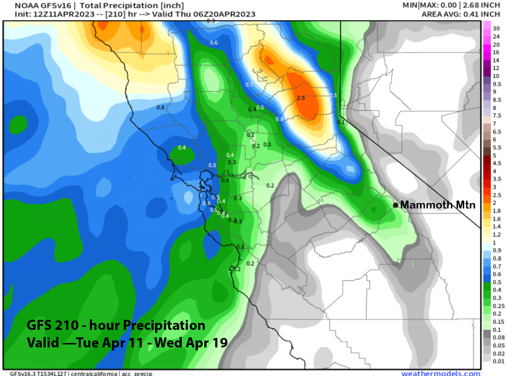
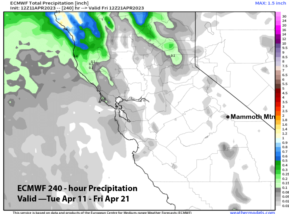
Of all the models, the latest Canadian model (image below) is the most bullish about enough snowfall for powder conditions next week with around 2” liquid. The GFS (two images below) is only showing light amounts while the 12z run of the ECM is mostly dry (three images below) for the period.
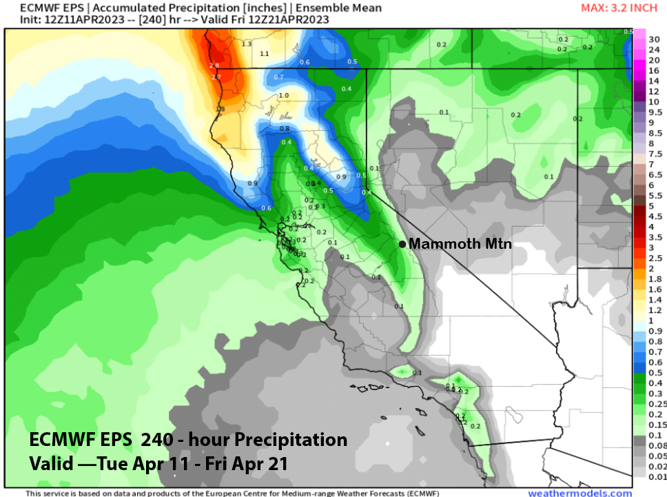
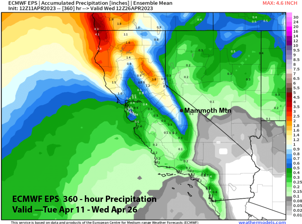
Current forecast follows the ECM EPS (image below) that is favoring only light amounts for the 10-day period. Thus, there could be a couple inches early next week and again toward the end of next week, but not a big storm right now.
Additional chance for storms will continue over the following week under continued cool spring temperatures. The GFS ensemble is showing about 1.5” for the period and is more bullish about storm chances versus the ECM EPS (two images below) that is showing about half that amount.
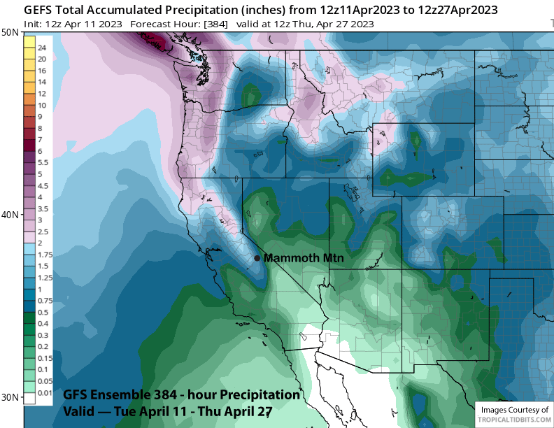
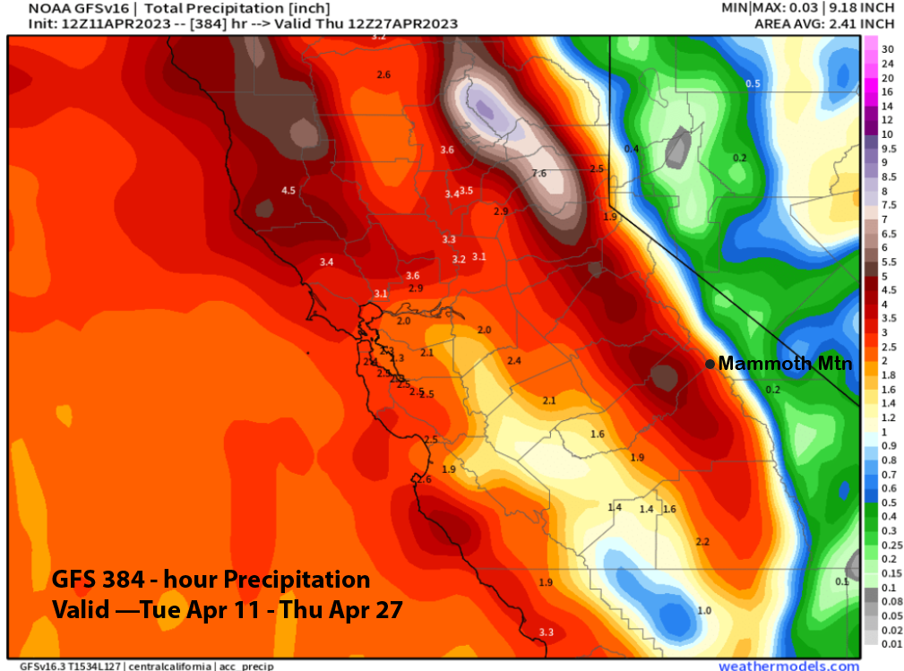
With a negative PDO still in place across the Pacific Ocean, forecast leans closer to the wetter and colder GFS. Powder days may not be over yet, especially if any of the latest GFS model runs comes to fruition showing multiple inches of liquid precipitation (12z run below). WG