Powder Forecast – Friday April 14th, 2023
Ted Schlaepfer CCM —- Mammoth Mountain WeatherGuy
Snowfall forecasts are valid at the Sesame snow course (Main Lodge) for the prior 24 hours as reported in the 6-7 AM morning snow report.
**Snowfall forecast confidence ranges from very low (1) to very high (5)
Sat 4/15 = 0”
Sun 4/16 = 0”
Mon 4/17 = 0”
Tue 4/18 = 2 – 3”
Wed 4/19 = 1 – 2”
Thu 4/20 = 0– 2”
Fri 4/21 = 0”
Sat – Mon 4/22 – 4/24 = 0”
April Snowfall = 3”
April Forecast = 10 – 25”
Detailed 4-day Snowfall Forecast
Sat 4/15 through Mon 4/17 – No snowfall expected all days.
Tue 4/18 – Snowfall develops after midnight Monday and continues through Tuesday morning before tapering to showers during the afternoon and night. Accumulation 2 – 3” by Tuesday AM and 1 – 2” by Wednesday, 4”+ up top
Forecast Summary:
Short Term (Days 1 – 4):
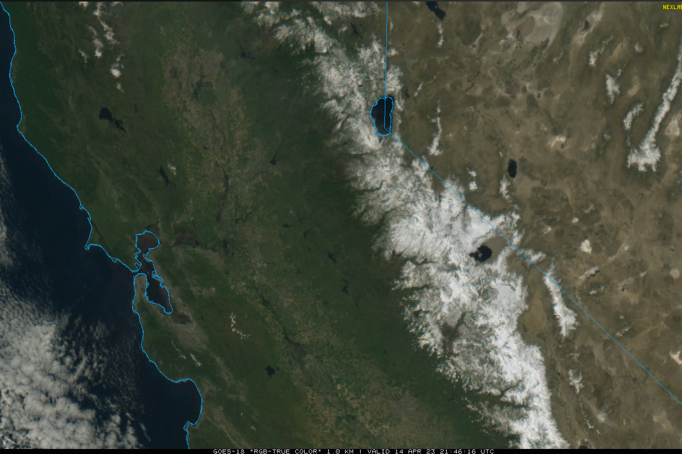
The current visible satellite image (below) this afternoon shows clear skies across central California and the massive snowpack across the Sierra and eastern Sierra basins around Mono Lake.
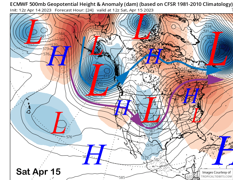
High pressure built into the state today and will continue to hold over CA tomorrow (image below) and Sunday for continued fair weather under mostly seasonable temperatures. Winds should be light Saturday followed by stronger southwest winds on Sunday.
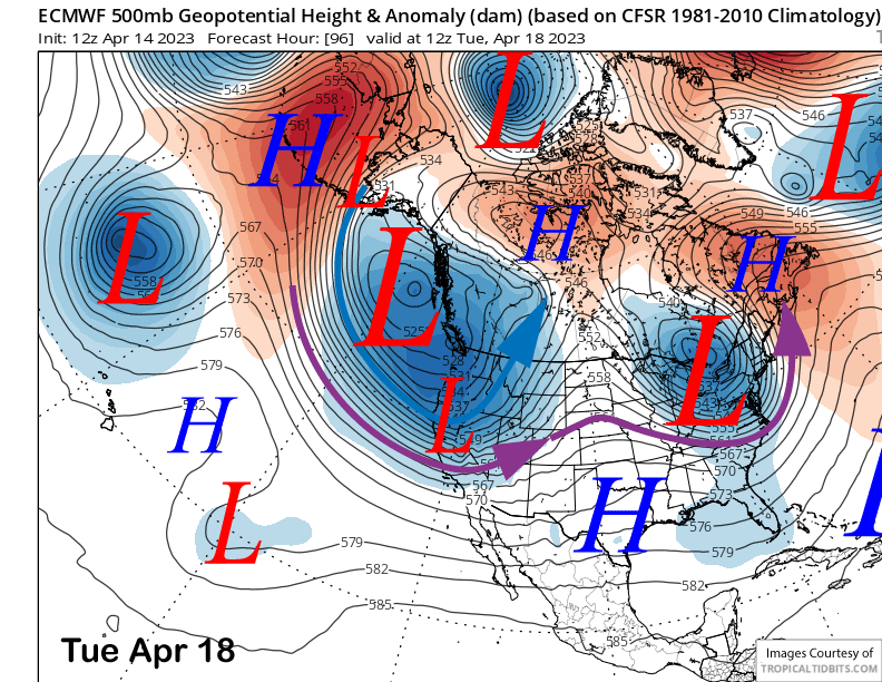
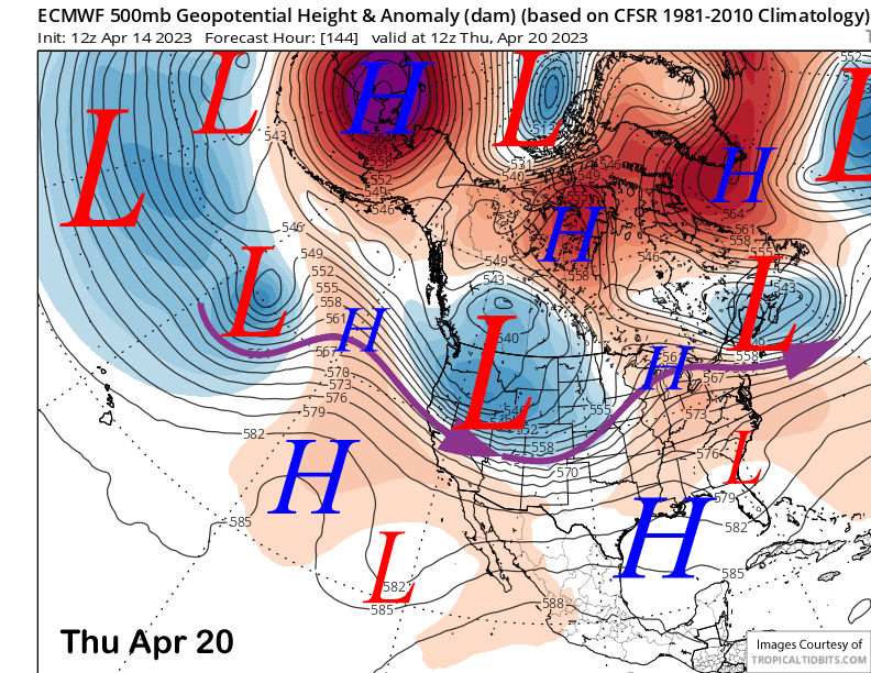
A rather deep upper-level trough will move toward the West Coast Monday and then swing southward into CA by early Tuesday (image below) with a front moving into Mammoth overnight Monday and during the morning Tuesday. The system has plenty of cold air, but only a meager moisture tap. The GFS moves a trailing trough into Central CA on Wednesday while the ECM model keeps it across NorCal. Thus there is still some disagreement about the event.
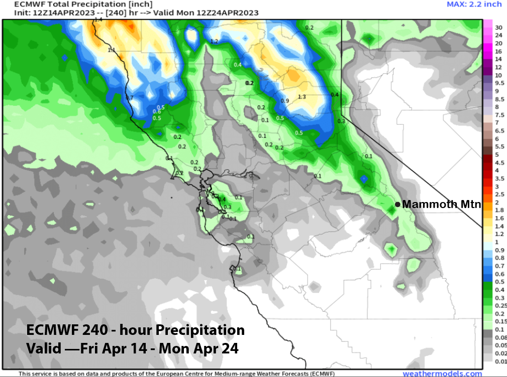
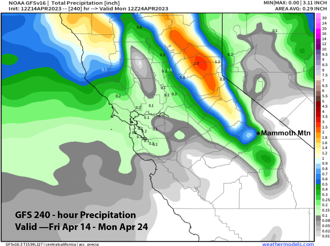
Model QPF is not impressive, especially considering how deep the trough is forecast to be. But as mentioned above, the system just doesn’t have a lot of moisture and the ECM model is only predicting about a quarter of inch of liquid (image below) while the GFS (two images below) is forecasting more and about half an inch, primarily due to the precipitation associated with the trailing trough on Wednesday.
The forecast follows a blend of the two models with a couple or three inches of snowfall by Tuesday morning and then maybe a couple more inches into Wednesday. Winds will be rather strong Monday and into early Tuesday, so some spots will be bare. It could also reach low-end powder thresholds in wind favored spots, primarily up top in the bowls.
Long Range (Days 5+)
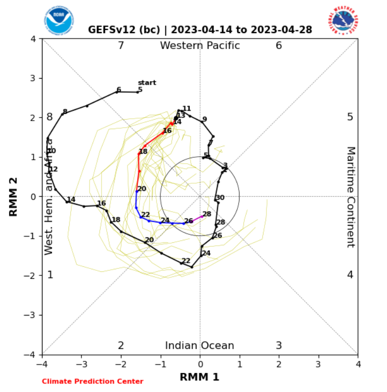
The longer-range guidance keeps flipping around between wet and drier solutions and the latest guidance has now trended back drier. It could be due to issues resolving the ongoing MJO event (image below) and whether it will remain persistent into phase 2 or move back into toward the western Pacific. Phase 2 is wet for Mammoth during the last part of April and the W. Pacific dry.
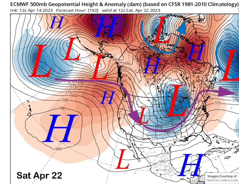
The guidance is favoring the trough for early next week to move eastward by Thursday (image below) with high pressure building into CA into the following weekend (two images below). That would mean a return of fair and dry weather.
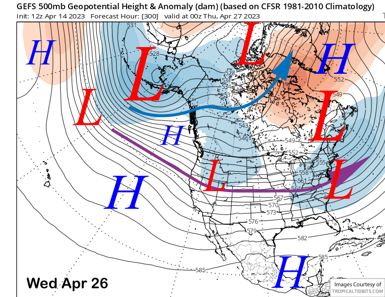
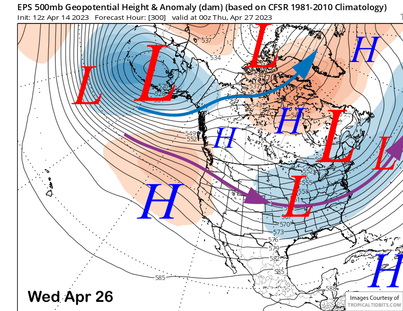
The fantasy range guidance for the latter part of the month has now shifted away from a trough re-developing along the West Coast. Either weak zonal flow and a weak trough just east of CA per the GFS ensemble (image below) or a flat ridge per the ECM EPS (two images below) is now favored. Neither solution favors any storms to move into CA.
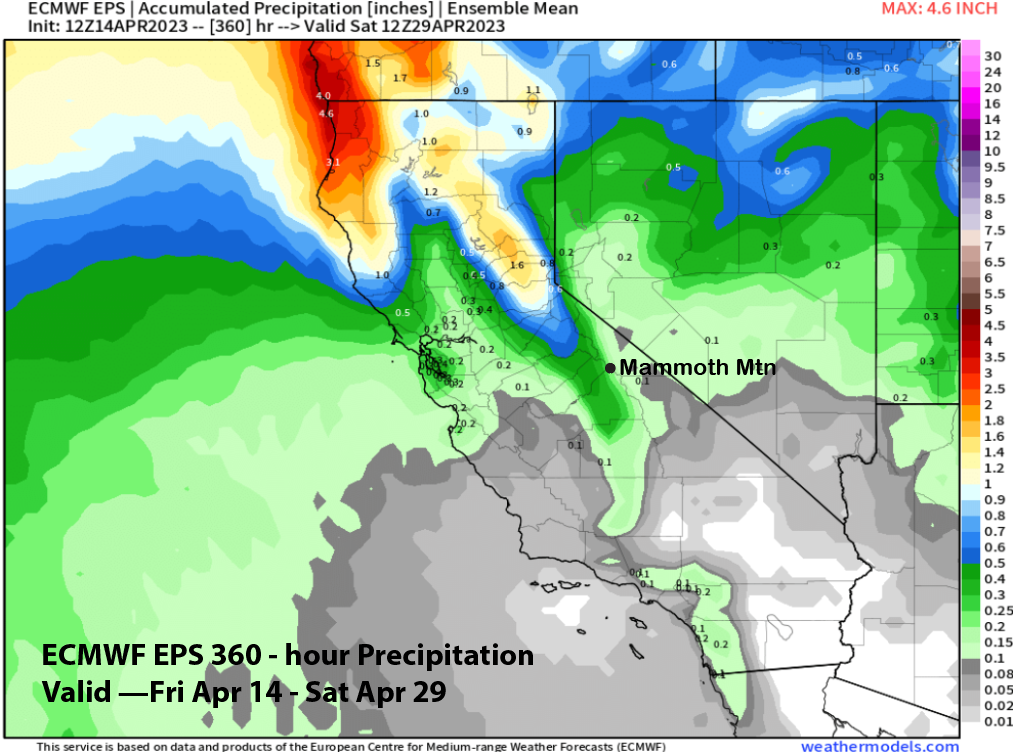
The drier solutions are also reflected in the total period QPF from the ECM EPS (image below) that has only about a quarter inch liquid for the entire two week period. So, unless we get a flip back to wetter from the guidance which certainly could happen during spring when the model guidance is usually not as reliable as mid-winter, deeper powder days could be over for the month. WG