Mammoth Mountain / Eastern Sierra Weather Forecast & Discussion

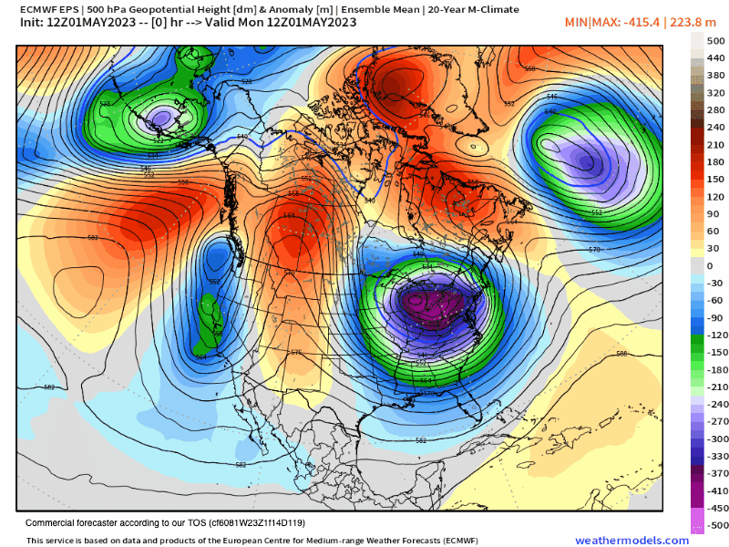
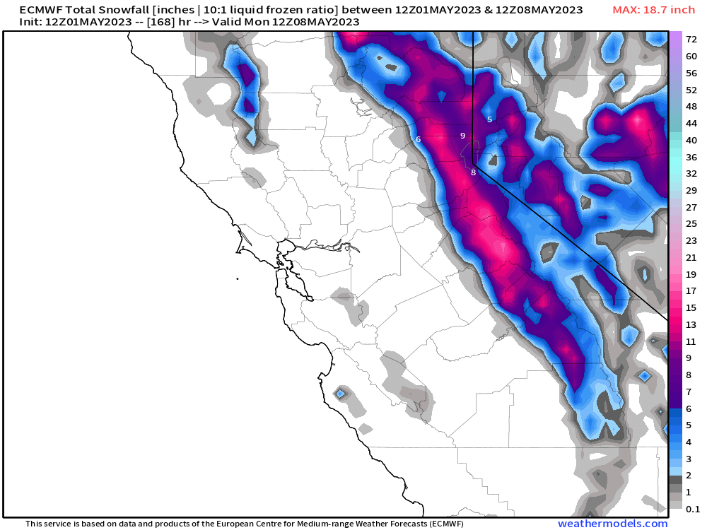
Monday, May 1st, 2023 @ 3:40 PM – Winter in Spring is in the cards this week with several waves of light precipitation expected. Above the 8000-foot level that precip will be all snow with 4-8 inches possible this week. there is also a chance that the snowfall just adds up to a dusting.

Along with the snow will come much cooler temperatures with highs into the low to mid-30s at the 9000-foot levels. Overnight lows at that elevation will be down into the low to mid-20s. The snowpack should freeze hard through and that will stop the excess snowmelt that we saw over the last 5 days.

For the lower elevations from Mammoth Lakes to Toms Place there will be a mix of pt cloudy to mostly cloudy skies with light snow or rain showers possible at times through the week with highs in the upper 30s to low 40s and overnight lows in the low to mid-20s.

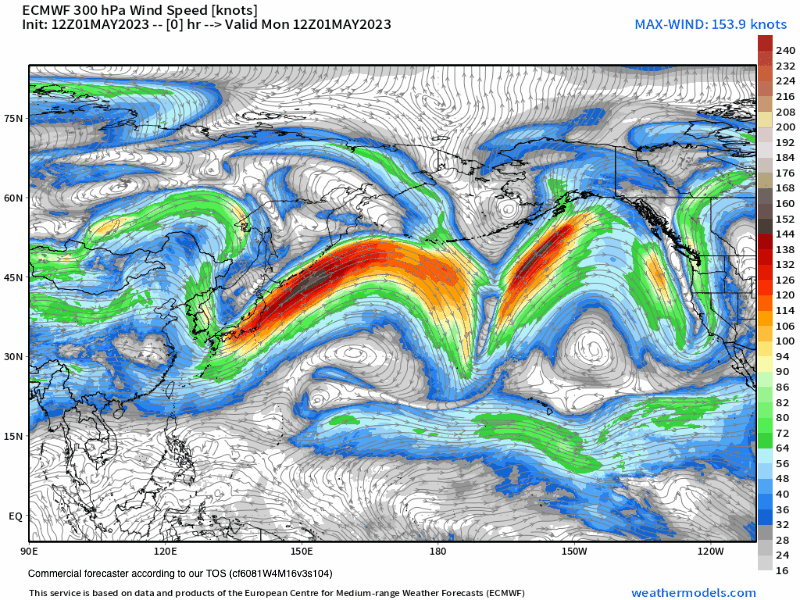
Down in the Bishop and Mill Pond Areas temperatures will be dropping into the 60s with overnight lows in the mid to upper 30s once again. Tuesday is looking very windy in this area with gusts to 45 MPH expected. 

The cooler windy weather will be with possible showers will be in the area for the next week and possibly out beyond day 10. Models show a return to Spring-like weather by mid-month, so if you’re looking for corn snow that’s when you can expect it to return to the slopes of Mammoth Mountain.

Snowman

May 1st, 2024 @ 4 PM – Over the next couple weeks expect much cooler weather with chances of showers this week and possibly again next week. THe next chance for spring on the EPS model below is around May 13th.

The GEFS however continues troughing over the west and Mammoth Mountain. So for now the warm days of spring skiing and riding will come to an end. If you’re looking to harvest corn snow I would check back here in a week and we should have a better idea when the next window for spring corn will be.

Snowman

0- 16 Day - EPS 500 Height Anomaly
Jet Stream Wind Speeds at 300 hPa

Snowfall Totals and the Base: Main Lodge is at 705 inches for the season. The base at the snow study site is now sitting at 245 inches.

As of April 8th at Mammoth Pass, there were 104.5 inches of water for the season. That amount of precipitation breaks the old top 2 years by 19 inches. 1969 had 85.5 on April 1st of that year. During the big snow year of 1983, the amount was 85 inches.

With that amount of water in the snow pack and all the heavy wet snow that has fallen, you can bank off a long run-off season. Skiing and Snowboarding could last well into August if there is a cooler summer.

The Seasonal Snowfall total comes from the Ski Patrols Snow Study site located at the 9000-foot level. The measuring station is located near chair 11.

To get an idea of how much has fallen over the top add 30% to the seasonal total that is being reported at the snow study site. I have measured around the hill for years after storms and found this to normally be an accurate formula to follow.

Long Range Seasonal ECM Model from Early March – Next run on this Model is May 3rd

ENSO Outlook – Updated on April 3rd
El Nino Forecast - Mammoth Weather

Mammoth Mountain and Eastern Sierra Weather Posts