
Powder Forecast – Tuesday May 2nd, 2023
Ted Schlaepfer CCM —- Mammoth Mountain WeatherGuy
Snowfall forecasts are valid at the Sesame snow course (Main Lodge) for the prior 24 hours as reported in the 6-7 AM morning snow report.
**Snowfall forecast confidence ranges from very low (1) to very high (5)
Forecast cadence now switching to once per week on Tuesdays
Wed 5/3 = 2 – 3” (H20 = 0.25” – 0.35”)**3
Thu 5/4 = ~ 1” (H20 = 0.05” – 0.10”)**3
Fri 5/5 = 3 – 4” (H20 = 0.30” – 0.40”)**2
Sat 5/6 = 0 – 1”
Sun 5/7 = 1 – 2” (H20 = 0.10” – 0.20”)**2
Mon 5/8 = 0”
Tue 5/9 = 0”
Wed – Fri 5/10 – 5/12 = 0”
May Snowfall = 4”
May Forecast = 10 – 15”
Detailed 4-day Snowfall Forecast
Wed 5/3 – Dry during the morning, then a chance for light snow showers during the late afternoon and evening followed by light snowfall developing overnight. Accumulations around an inch, up to 2” up top.
Thu 5/4 – Light snowfall during the morning becomes a bit heavier during the afternoon before tapering off evening and ending overnight. Accumulations 3 – 4” by Friday AM, up to 6” up top.
Fri 5/5 – Dry during the morning, then a chance for light snow showers during the late afternoon and evening, an inch or no accumulation expected by Saturday AM.
Sat 5/6 – Light snow during the morning continues during the day, ending Saturday night. Accumulations 1 – 2” by Sunday AM, up to 3” up top.
Forecast Summary:
Short Term (Days 1 – 4):
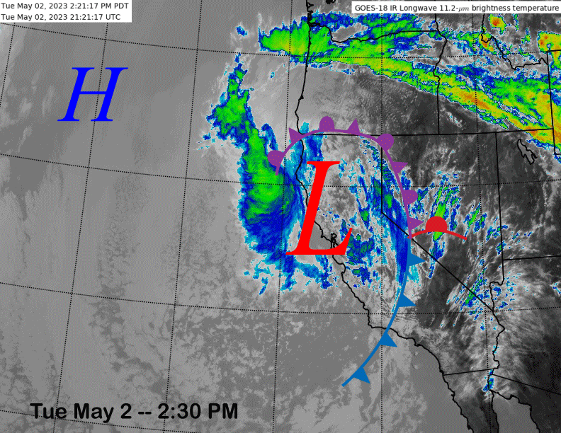
The current infrared satellite image (below) this afternoon shows a cold core low pressure system centered just off the Bay Area coast with an associated frontal system stretching through eastern California.
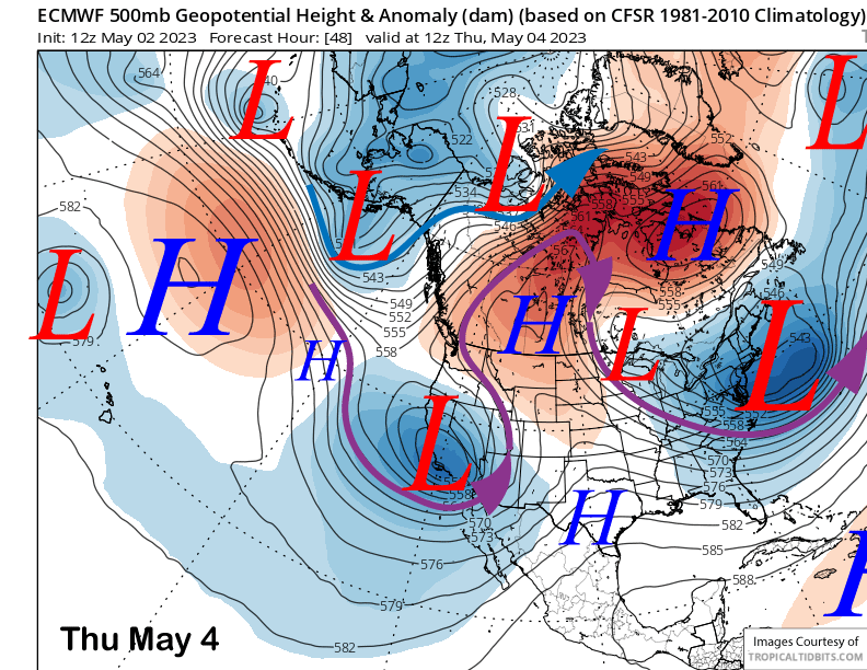
The weather system will slowly drift southward over the next day or so before shifting inland across the Central Coast and San Joaquin Valley on Thursday (image below) resulting in snow at times. Snow levels will mostly stay around 6000 feet, although they could drop at times to near 5K. Snow will be of a wetter type typical of spring storms.
Snowfall with the fronts will increase this evening and tonight before ending very early tomorrow. It will then increase again tomorrow overnight and Thursday when the low-pressure system shifts eastward into the Sierra. That will probably be the period when the most snow accumulates this week. Snowfall should end on Thursday night.
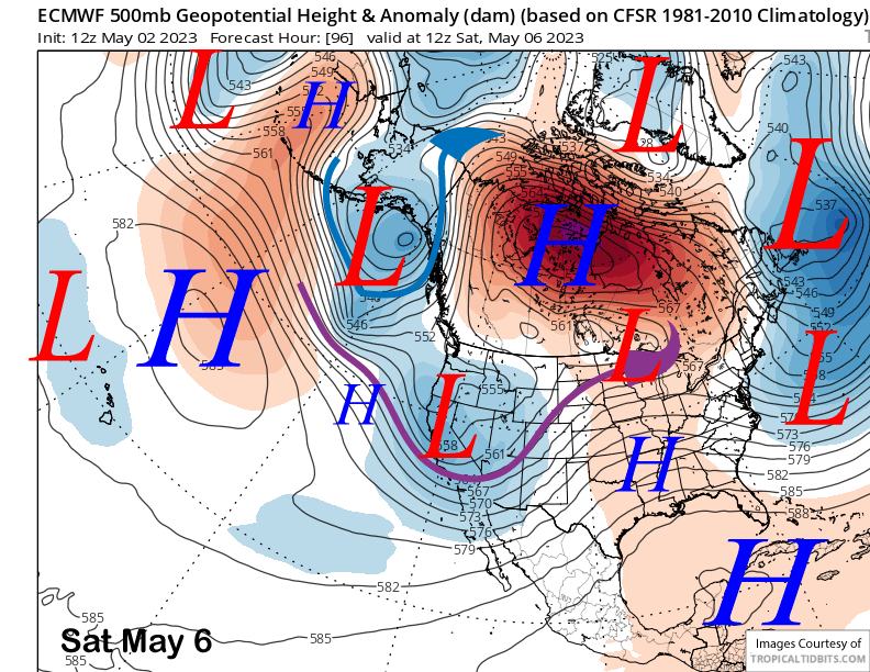
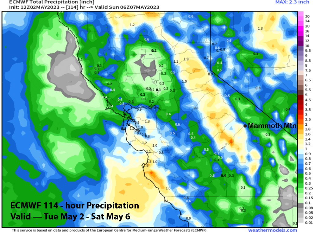
Other than a chance for lingering snow showers, Friday should be mostly dry until a trailing weak low-pressure system slides through Central California on Saturday (image below). That will probably produce some light snowfall during the day that should end Saturday night.
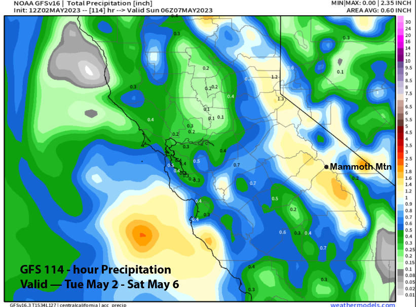
Amounts for the period are almost 1.5” liquid per the GFS (image below) and about an inch per the ECM (two images below). That could mean up to a foot more snowfall is possible at Main through Saturday and a good chance for six inches.
Overall, low-end powder conditions should continue tomorrow from the snow today/tonight with more low-end powder on Thursday and Friday (up top). The system on Saturday should keep the fresh powder or packed powder conditions in place through the weekend as temps will stay winter-like through at least Sunday. Given it is early May, this sure could be last call for powder conditions this season.
Long Range (Days 5+)
The longer-range guidance is trending back to more typical May weather next week with spring conditions probably returning by the end of the week/following weekend. There are no clear signs of any more late season storminess.
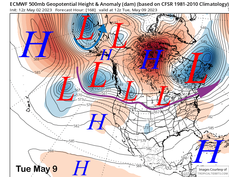
Another short-wave trough is expected to move into NorCal on Sunday/Monday and too far north of Mammoth for any snowfall before ridging builds into the state around next Tuesday (image below). Snowfall could linger into early Sunday from the previous low before dry weather likely returns by early next week along with warming temperatures.
Longer range guidance for the 11-15 day pattern (image below) is favoring a strong high pressure ridge to build from Alaska southward through British Columbia with a baggy trough positioned over SoCal. That is a typical spring pattern resulting in dry weather, seasonable temperatures, and lots of low overcast in SoCal.
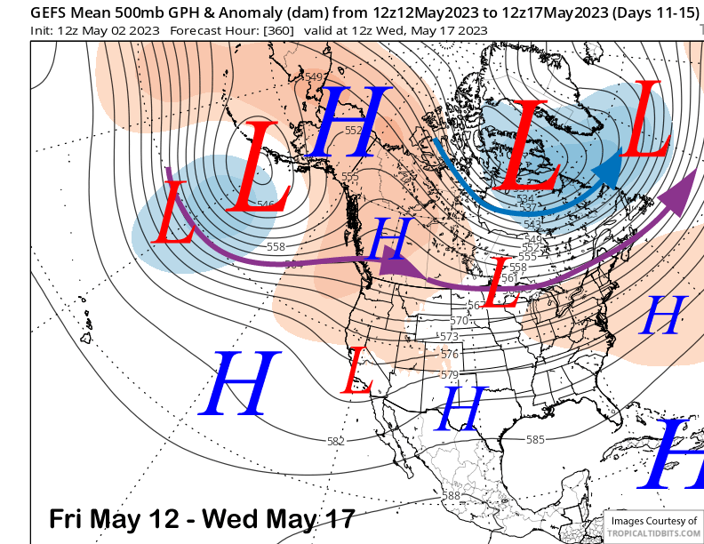
This pattern should last through the third week of the month before troughing may become a bit deeper over CA. Probably not deep enough for any storminess, but probably just cooler temps to slow down the melt as spring transitions into summer in June. WG


