Powder Forecast – Tuesday, December 31st, 2019
Ted Schlaepfer CCM —- Mammoth Mountain WeatherGuy
Snowfall forecasts are valid at the Sesame snow course (Main Lodge) for the prior 24 hours as reported in the 6-7 AM morning snow report.
**Snowfall forecast confidence ranges from very low (1) to very high (5)
Wed 1/1 = 0”
Thu 1/2 = 0”
Fri 1/3 = 0”
Sat 1/4 = 0”
Sun 1/5 = 0”
Mon 1/6 = 0 – 2”
Tue 1/7 = 0”
Wed – Fri 1/8– 1/10 = 0 – 3”
December Snowfall = 71”
December Forecast = 71”
January Forecast = 30 – 50″
Detailed 4-day Snowfall Forecast:
Wednesday 1/1 through Saturday 1/4 —No snowfall expected all days.
Forecast Summary:
Short Term (Days 1 – 4)
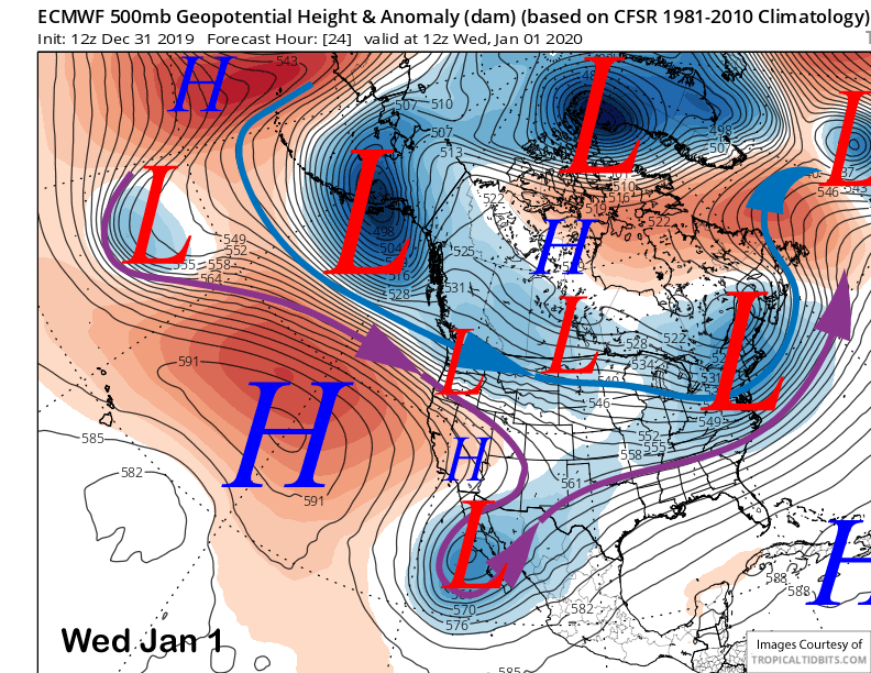
A weather system will move across far NorCal on New Year’s Day (image below) as the jet stream punches into the PacNW resulting in some passing cloudiness and breezy winds, but no snowfall.
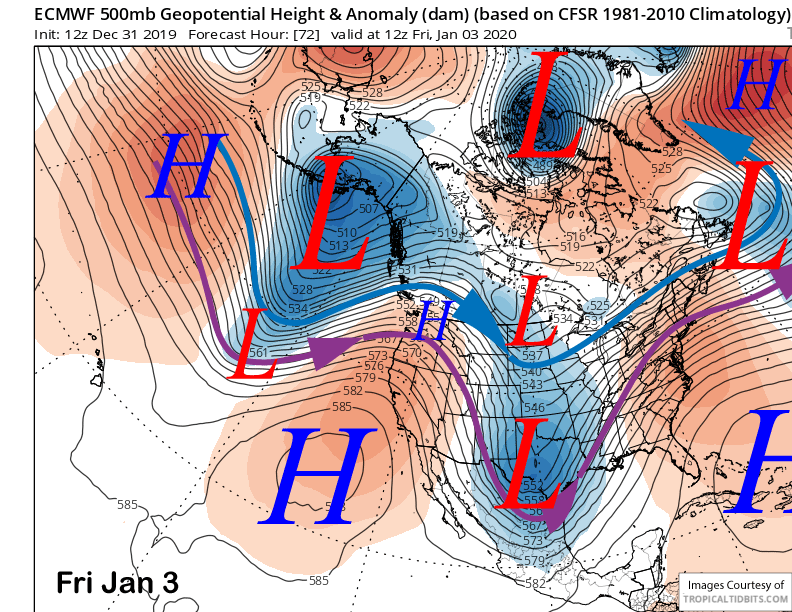
High pressure will then rebuild back into the state Thursday and Friday (image below) for fair weather and seasonably mild temperatures into the upper 20s to low 40s. The dry weather should last through Saturday under colder temperatures and breezy winds again.
Long Range (Days 5+):
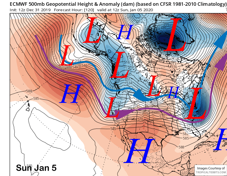
The ECM model then splits a passing upper level trough and moves a piece of energy through the Sierra on Sunday (image below) for a chance for light snowfall. The model is only showing about a tenth of an inch of liquid for maybe an inch of snowfall, thus, powder conditions are not anticipated.
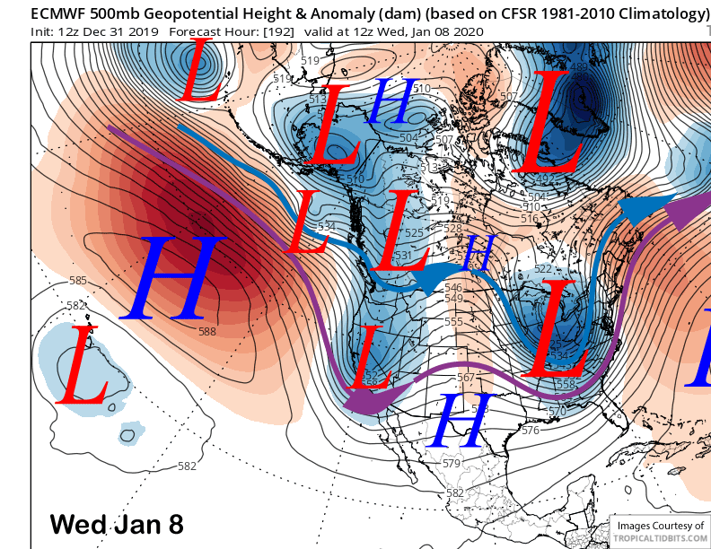
After a dry couple of days early next week, the ECM model then moves another splitting trough into the Sierra around mid-week next week (image below). That one is a bit stronger, but the model is still only showing light snowfall amounts of only a couple or few inches.
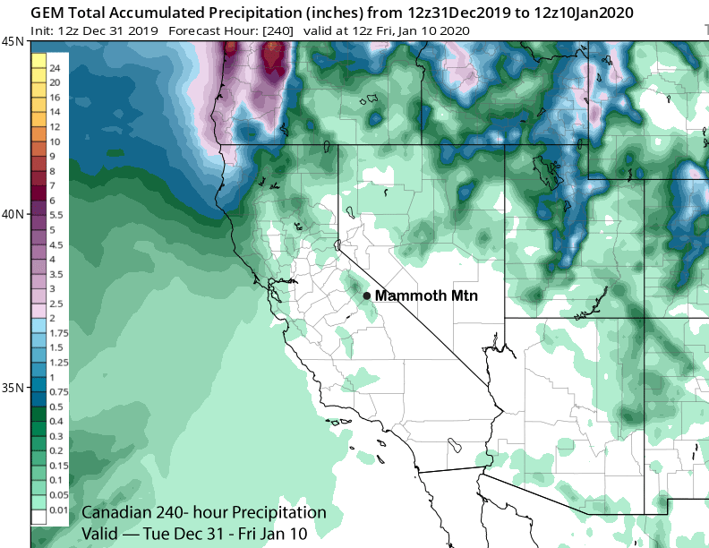
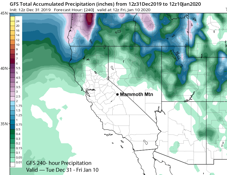
The other models though are essentially dry. Neither the Canadian or GFS have the trough for Sunday and only the Canadian is showing the trough for the middle part of next week. That model has about tenth of an inch liquid (image below) for the 10-day period while the GFS (two images below) is completely dry.
Overall, it appears that 2020 will start out basically dry with only a couple chances for light snowfall over the first week to ten days and likely no powder days.
The next chance for significant snowfall appears to be over the second weekend of January and into mid-month.
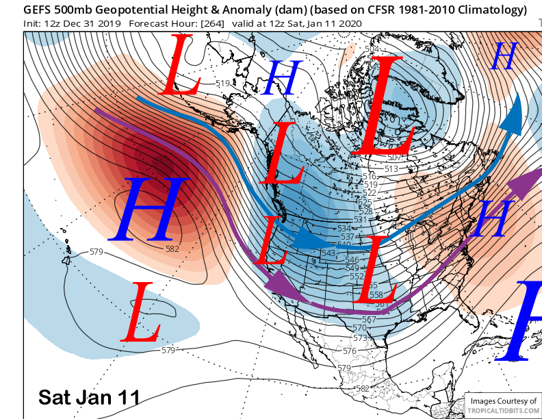
The longer-range guidance is suggesting it could be colder type storms from the North (image below) that produces the nicest powder. Let’s hope it happens. Happy New Year. WG
 Ted Schlaepfer – The Mammoth WeatherGuy – Powder Forecast – These forecasts are now responsible for many people getting multiple powder days on Mammoth Mountain over the years. People email us saying they plan their days off around The Mammoth WeatherGuy Powder Forecasts.
Ted’s Bio: Ted has been a full-time Meteorologist (CCM) for the past 25+ years. He has always been fascinated with the weather,” skiing was just a natural extension of my love for snow and rain. I started skiing at age 5, first discovered Mammoth in 1979 as a youth, and have been a regular visitor since the late ’80s.”.
Here is the link to The WeatherGuy Page with all his great insights on the weather, updates happen every Tuesday and Friday by 5 PM during the ski season.