Powder Forecast – Tuesday April 23rd, 2024
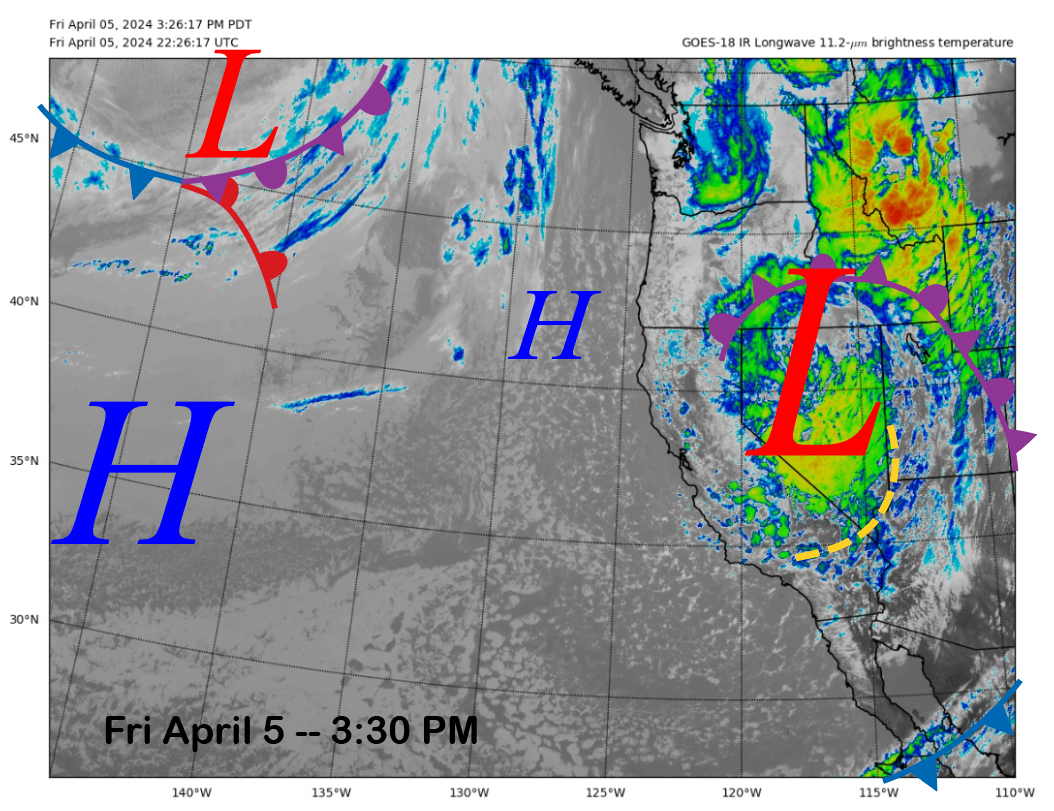
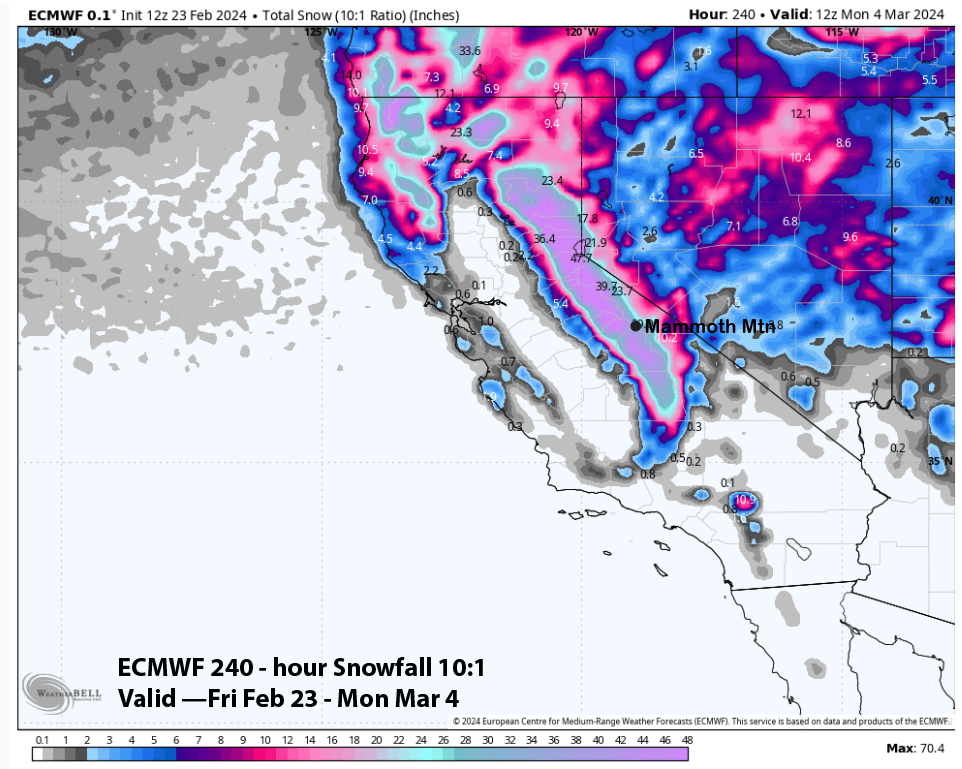
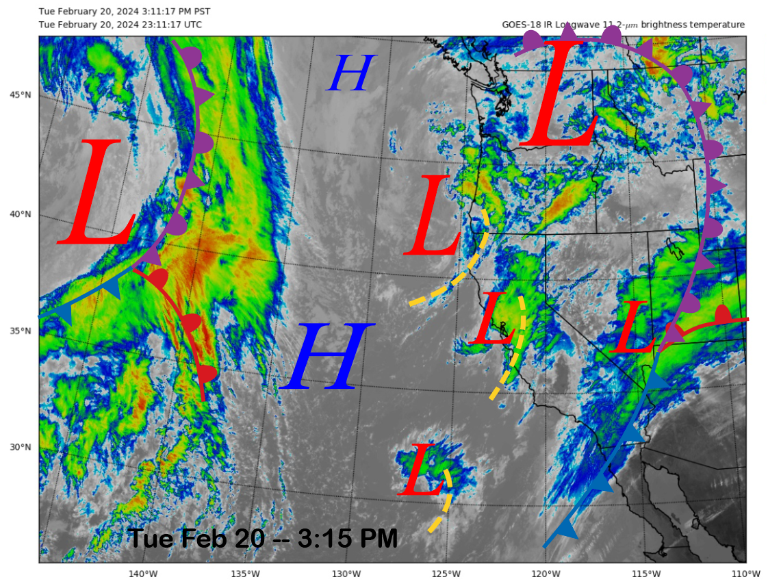
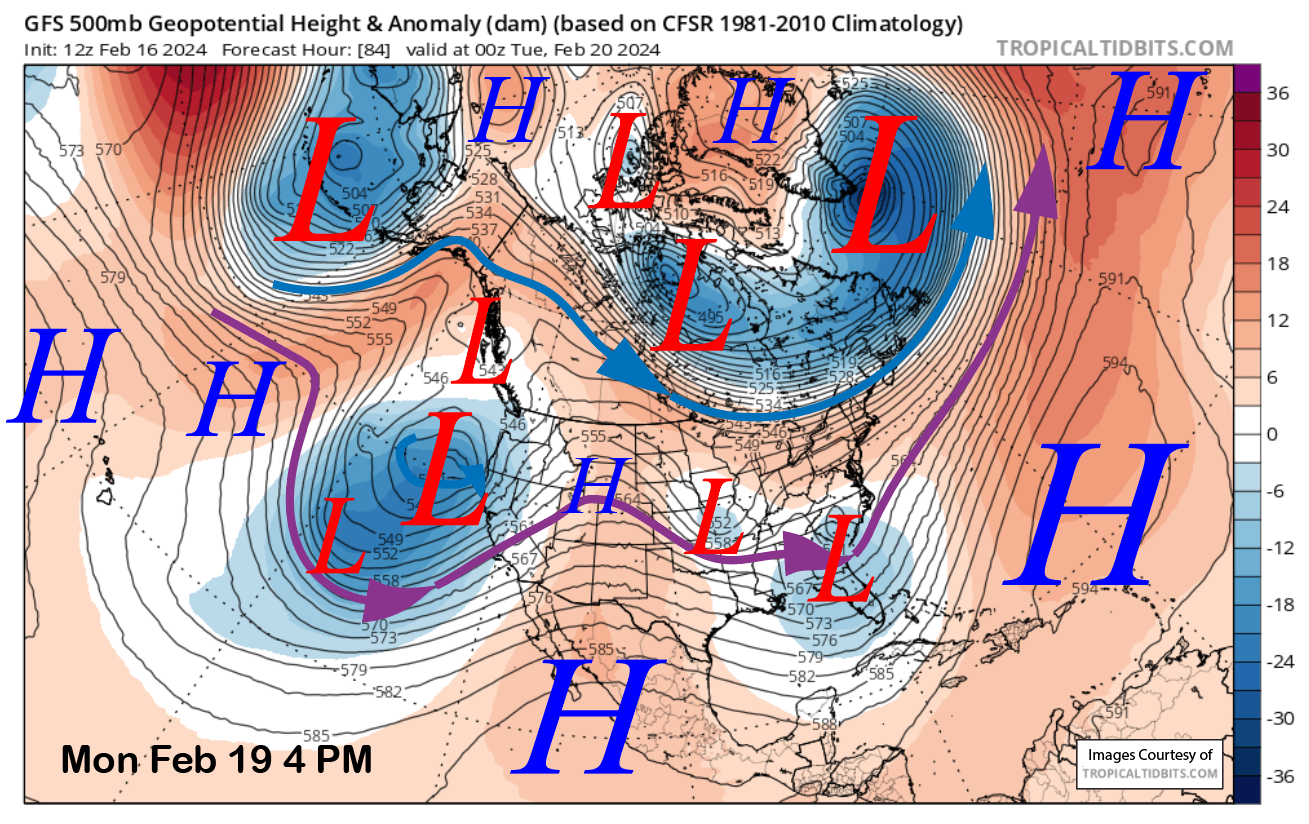
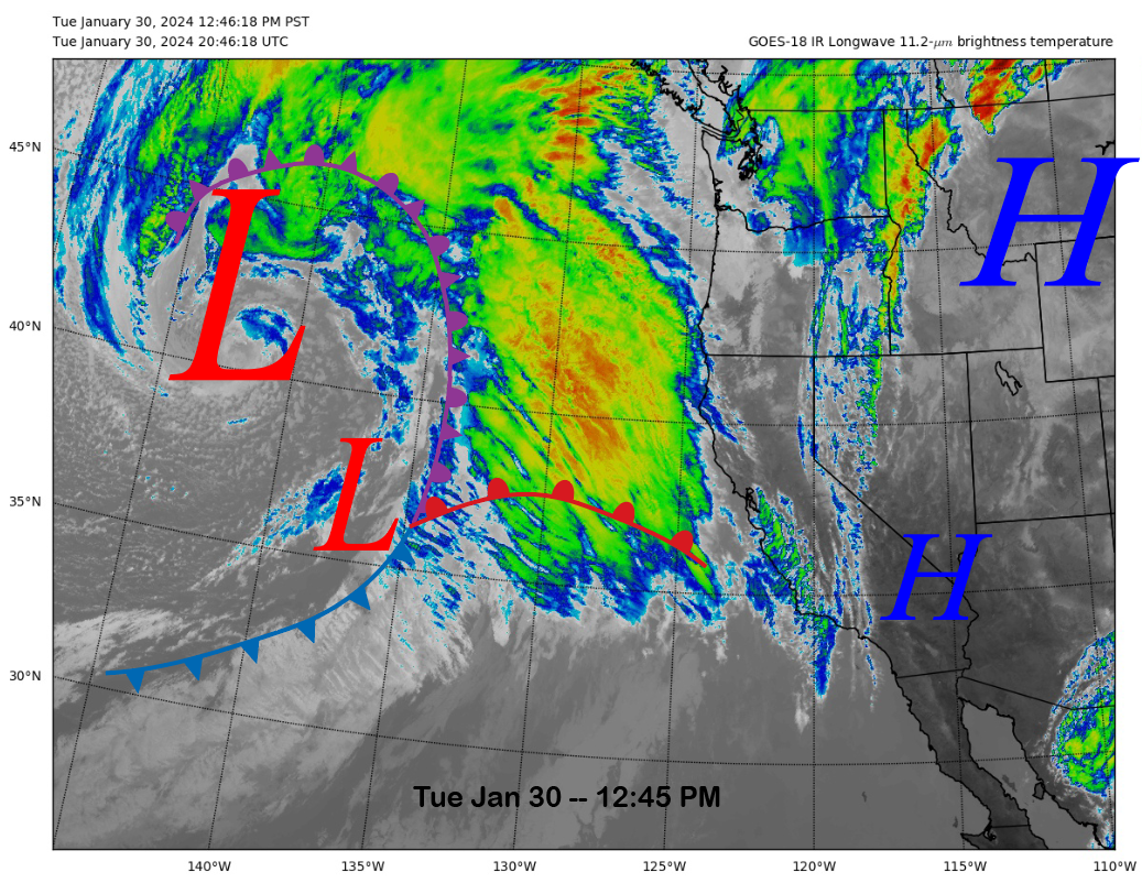
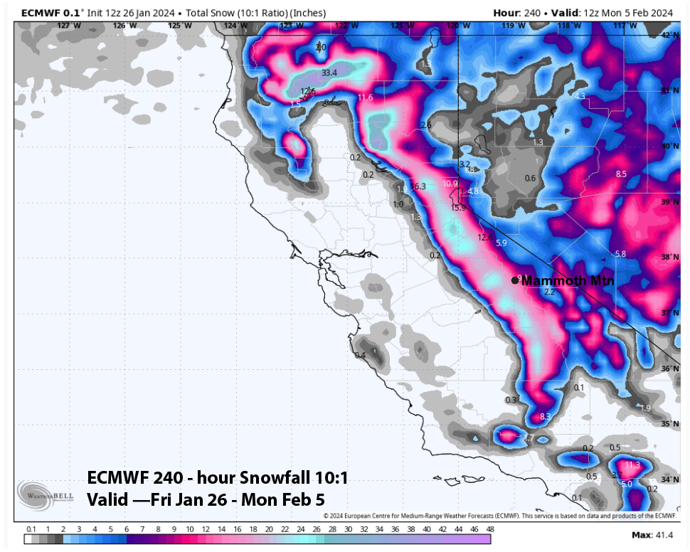
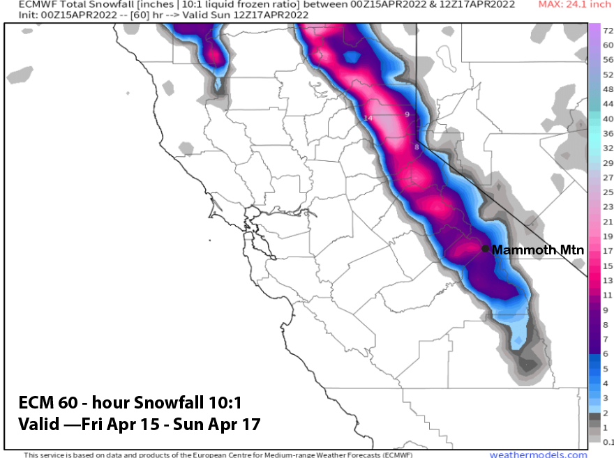
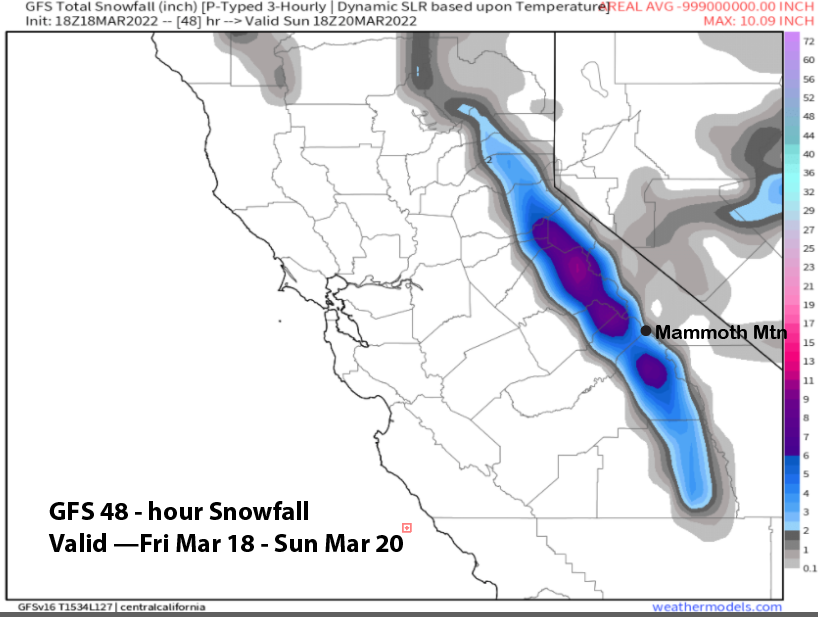
Powder Forecast – Tuesday, April 23rd, 2024 Ted Schlaepfer CCM—- Mammoth Mountain WeatherGuy Snowfall forecasts are valid at the Sesame snow course (Main Lodge) for the prior 24 hours, as reported in the 6-7 AM morning snow report. Sesame Snow Course **Snowfall forecast confidence ranges from very low (1) to very high (5) Wed 4/24 = 0” Thu 4/25 = 0 – 1” Fri 4/26 = ~ 1” Sat 4/27 = 1 – 2” Sun