Powder Forecast –Friday, January 12th, 2024
Ted Schlaepfer CCM —- Mammoth Mountain WeatherGuy
Snowfall forecasts are valid at the Sesame snow course (Main Lodge) for the prior 24 hours, as reported in the 6-7 AM morning snow report.
**Snowfall forecast confidence ranges from very low (1) to very high (5)
Sat 1/13 = 0”
Sun 1/14 = 6 – 9” (H20 = 0.60” – 0.85”)**3
Mon 1/15 = 0”
Tue 1/16 = 0”
Wed 1/17 = 0”
Thu 1/18 = 0 – 2”
Fri 1/19 = 0”
Sat – Mon 1/20 – 1/22 = 6 – 12”
January Snowfall = 39”
January Forecast = 55 – 70”
Detailed 4-day Snowfall Forecast:
Sat 1/13 – Light to moderate snowfall develops after dawn and continues into Saturday night before tapering off late at night. Accumulations 6 – 9”, ~12” up top
Sun 1/14 – Light snowfall may continue into mid-morning before ending by midday. Little or no accumulation is expected.
Mon 1/15 and Tue 1/16 – No snowfall expected on both days.
Forecast Summary:
Short Term (Days 1 – 4):
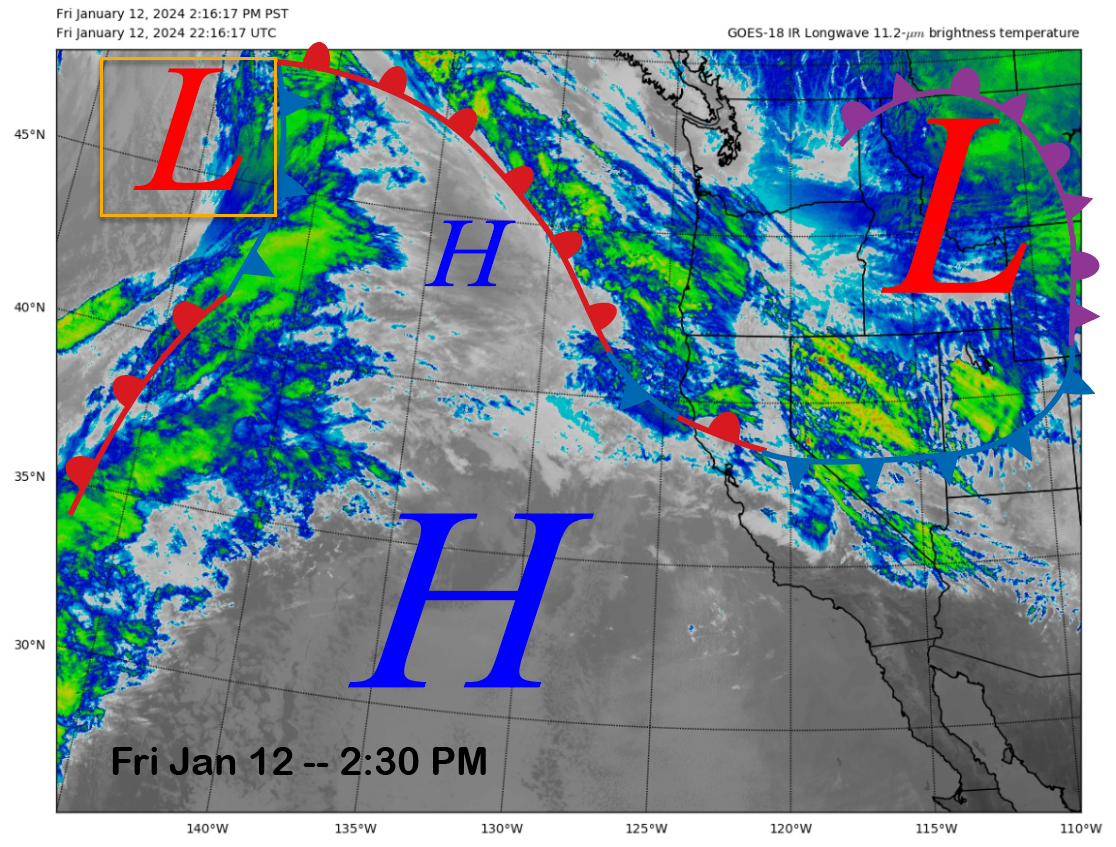
The current infrared satellite image (below) this afternoon shows a deep and cold low-pressure system centered over the interior West and a warm front draped near the PacNW coastline. There is also a developing area of low pressure (yellow box) just entering the eastern Pacific Ocean that will move quickly into NorCal early tomorrow while strengthening.
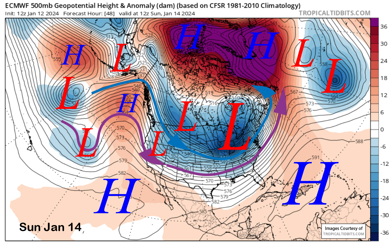
Unfortunately, it is not going to dig too far southward before it moves quickly eastward by Sunday morning (image below) into the Great Basin. It will also only be backed by a moderate strength northwesterly oriented jet stream that is not conducive to orographic enhancement or good spillover. However, the storm will have a weak Atmospheric River (AR) along warm frontal boundary during landfall and generally will not be moisture starved as it weakens moving southward into the Mammoth area.
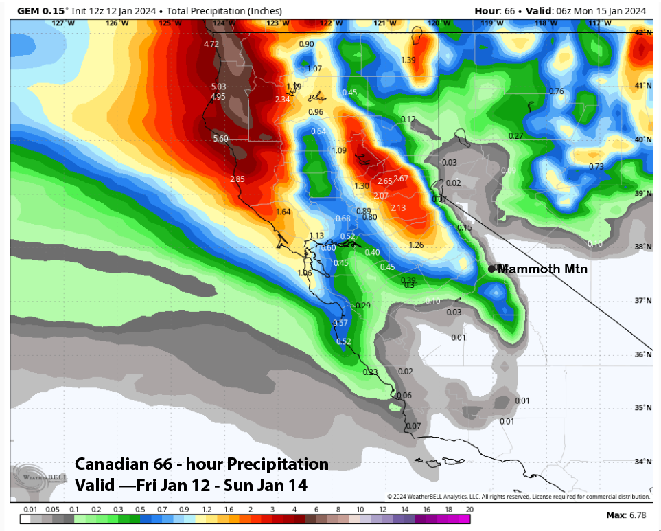
Models are still all over the place with their respective Quantitative Precipitation Forecast (QPF), with the ECM and GFS basically switching positions since the last post. The GFS model (image below) is now the wettest at around an inch, with the ECM (two images below) showing less than half that amount, while the Canadian model (three images below) is basically dry for Mammoth at around a tenth.
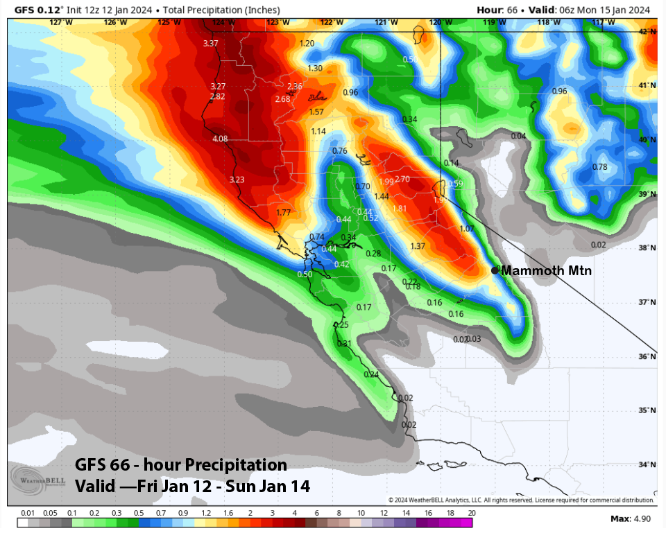
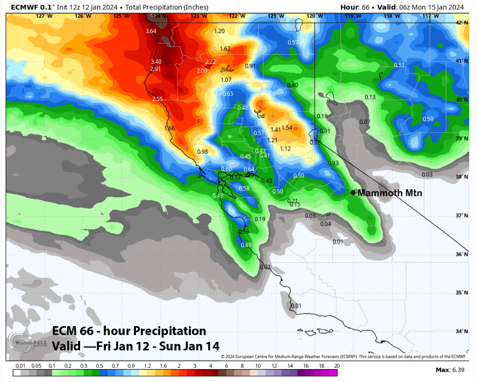
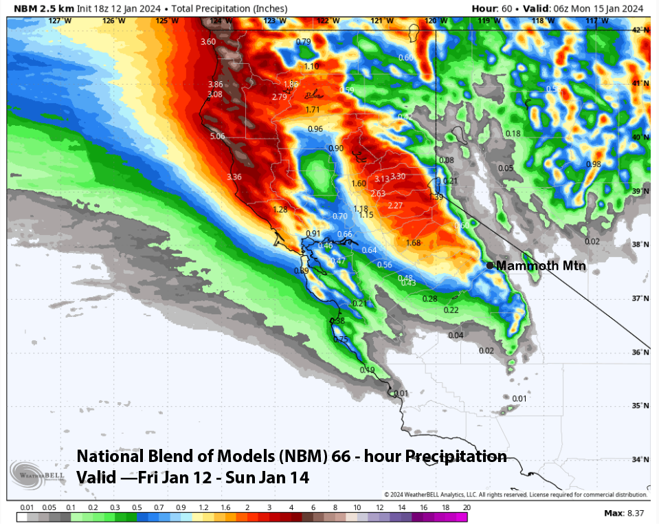
The drier solutions are not favored due to the good precipitable water tap and the Forecast follows a blend of the National Blend of Models NBM (image below) that has about 0.85” as a higher end solution and a GFS/ECM blend for the lower end of possibilities. It will be a warmer storm with snow levels in the 5500–6000-foot range, and the snow will be more Sierra cement-like. The forecast calls for about 6-9” at Main and up to a foot up top. Dry weather then returns during the day on Sunday and continues through Tuesday.
Long Range (Days 5+):
The longer-range guidance is a mixed bag is a mixed bag of possibilities, with the numerical guidance generally not in agreement. But a major snowfall pattern is not looking likely for the rest of January, to put it bluntly.
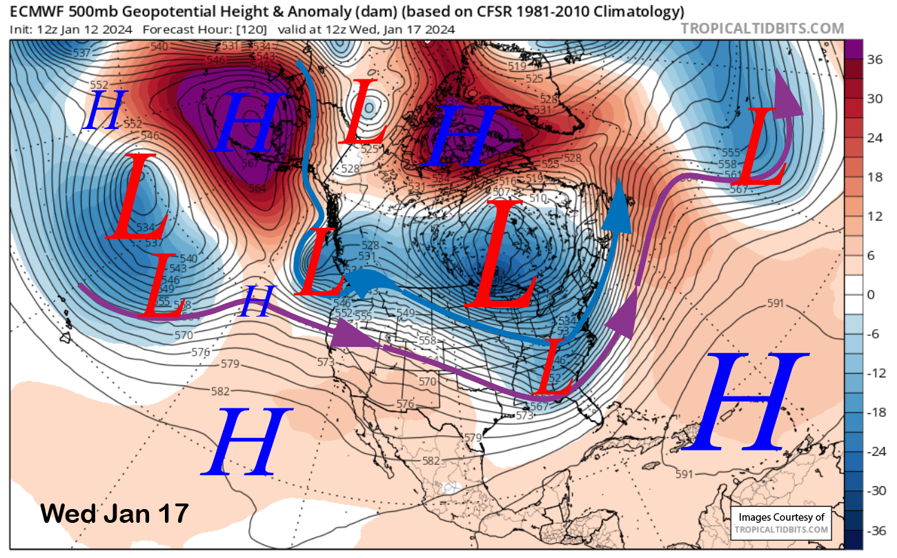
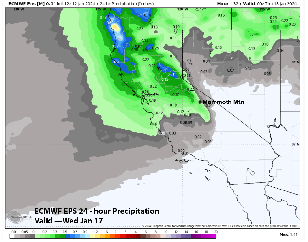
The ECM (image below) and Canada bring a moisture-laden weather system into CA around Wednesday next week. The GFS model does not really show this weather feature at all. The ECM EPS suggests it will mostly stay north of Mammoth and will also be rather mild, with snow levels around 8000”. It also favors only light amounts of precipitation (two images below), and thus, any snowfall will likely be light and not enough for powder conditions.
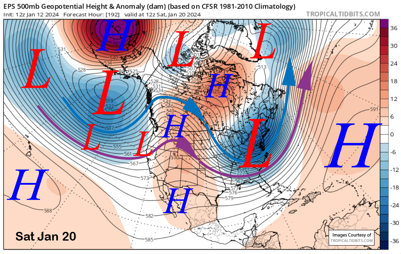
The end of next week and the following weekend are also toss-ups. The latest ECM model (image below) moves a zonal jet from the Central Pacific into the Eastern Pacific toward the end of next week, with the first short wave moving ashore around late Friday or Saturday. That has the potential to produce base type storm, although probably not a lot since the jet weakens considerably and splits upon landfall.
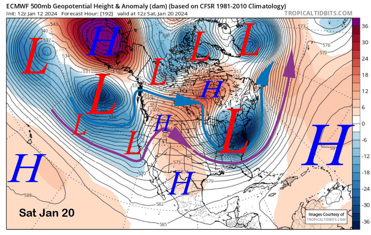
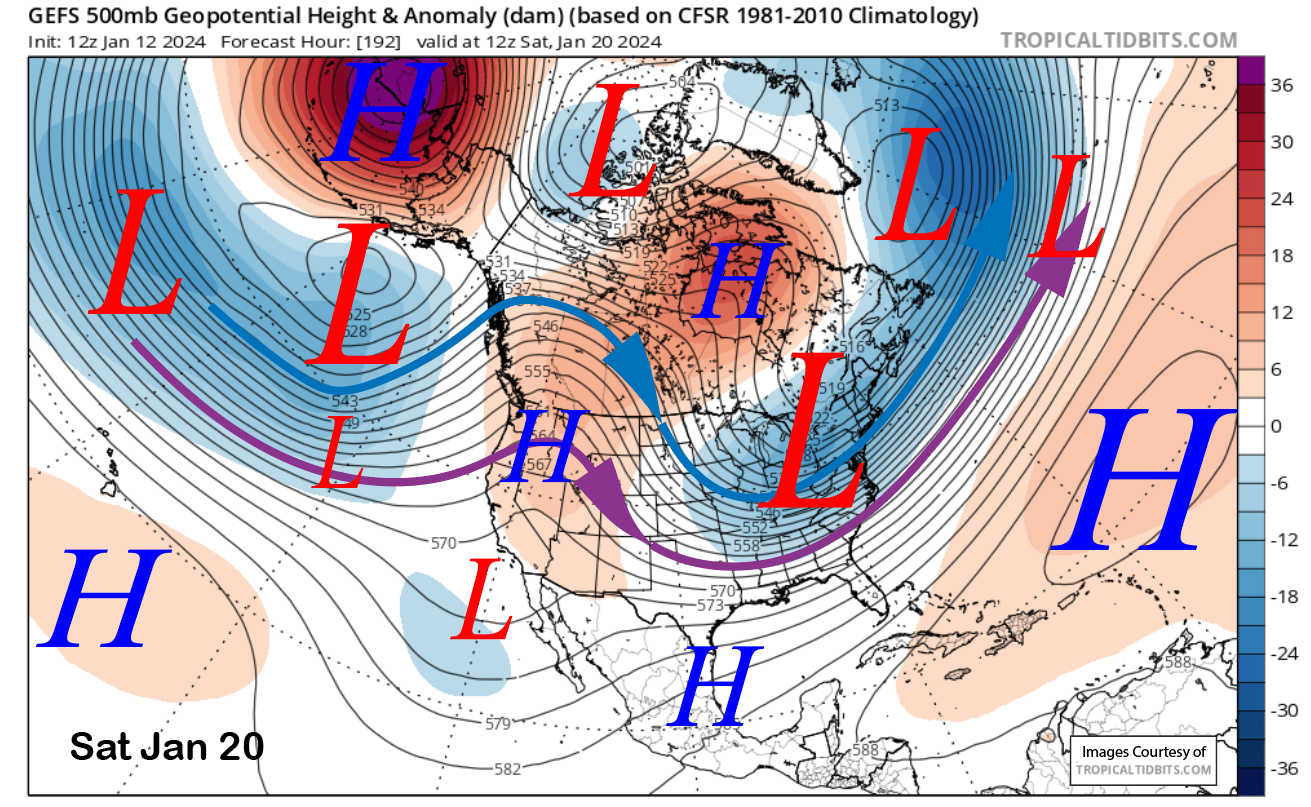
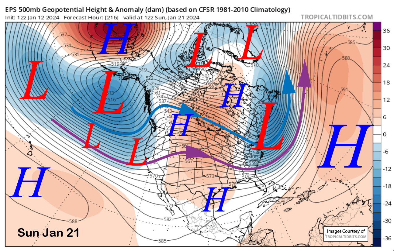
The GFS ensemble (image below) does not support that solution at all. It has the jet farther westward without the extension to the coast and weak ridging over CA. The ECM EPS (two images below) has better support for the deterministic run but suggests it will make landfall farther northward.
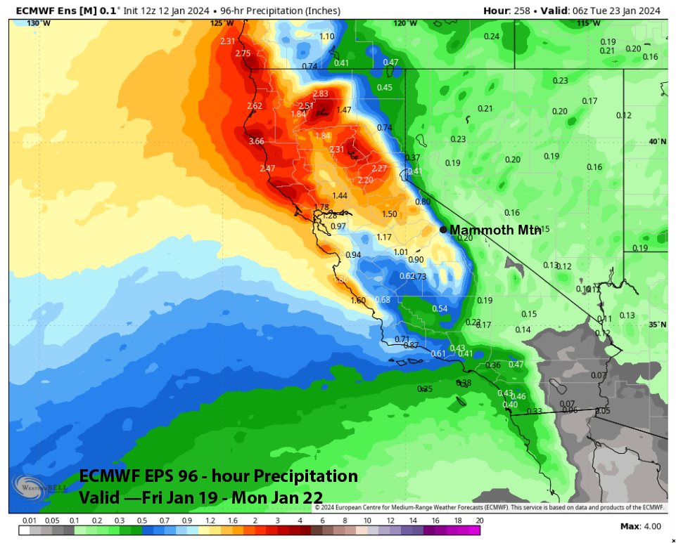
It does bring another short-wave into CA on the following day (image below) with a better aligned jet stream into the Central Sierra. That would produce a decent storm of base type snow and the model QPF (two images below) is showing around one inch liquid for the weekend period. That would mean maybe up to a foot of base snow at Main. It is over a week out, so hopefully the dry GFS will trend toward the ECM, similar to what occurred with the upcoming storm Saturday.
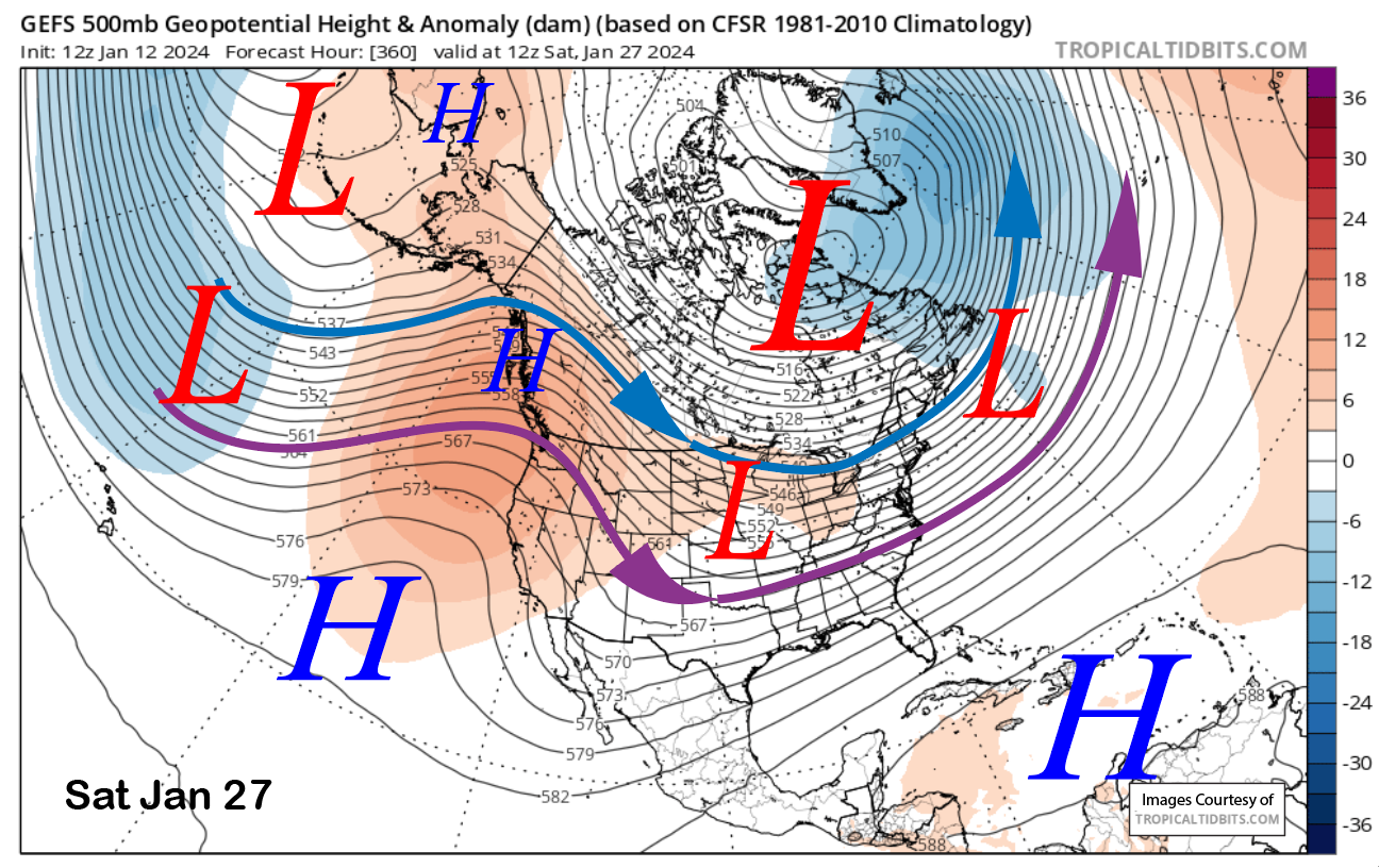
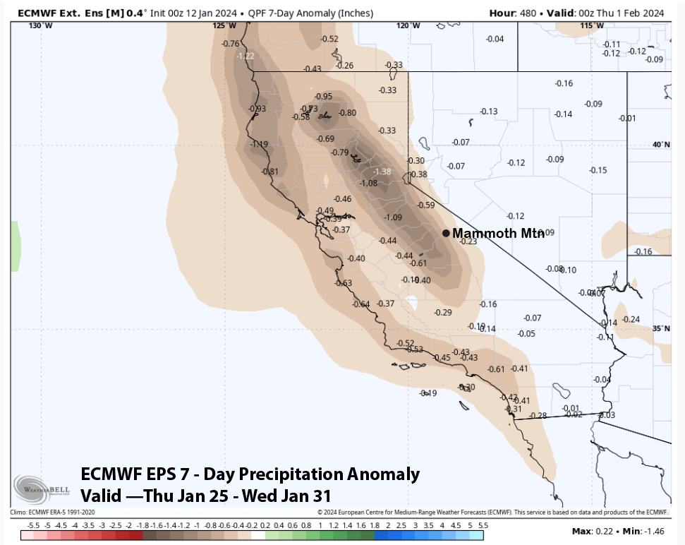
We need to hope that happens because the super long-range models all agree that ridging (image below) and dry weather will return for the last part of January. The ECM EPS 45-day forecast is favoring below normal precipitation (two images below) for the last week of the month.
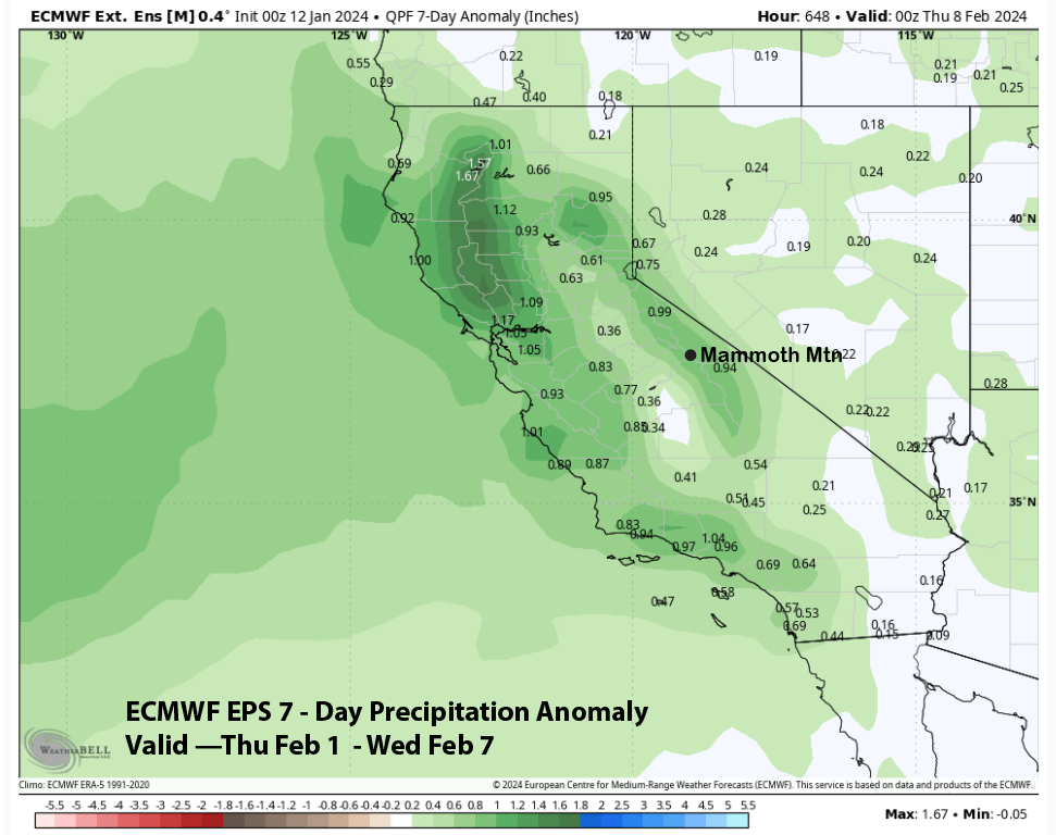
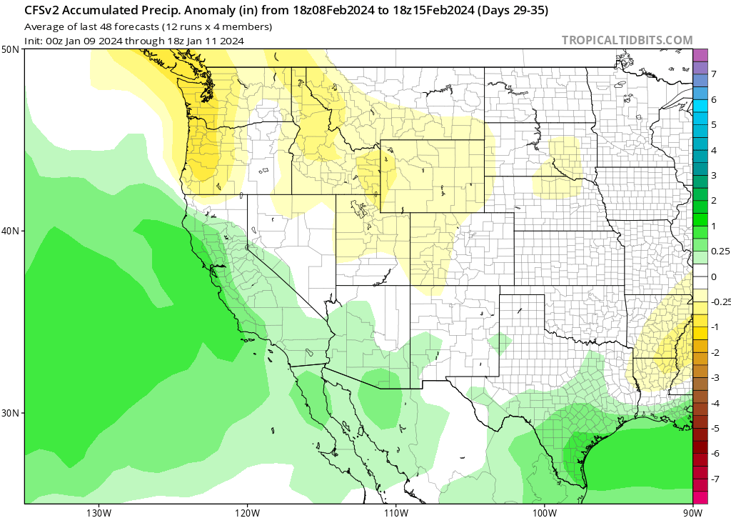
The next chance for a storm period may not be until the first week of February as the ECM EPS 45-day forecast is favoring above normal precipitation (image below). However, the CFS climate model is not showing anything substantial until the second week of February (two images below). At least they are both showing something for the first half of February. WG