Powder Forecast –Monday, December 11th, 2023
Ted Schlaepfer CCM —- Mammoth Mountain WeatherGuy
Snowfall forecasts are valid at the Sesame snow course (Main Lodge) for the prior 24 hours, as reported in the 6-7 AM morning snow report.
**Snowfall forecast confidence ranges from very low (1) to very high (5)
Tue 12/12 = 0”
Wed 12/13 = 0”
Thu 12/14 = 0”
Fri 12/15 = 0”
Sat 12/16 = 0”
Sun 12/17 = 0”
Mon 12/18 = 0 – 2”
Tue – Fri 12/19 – 12/21 = 3 – 9”
December Snowfall = 3”
December Forecast = 20 – 35”
Detailed 4-day Snowfall Forecast:
Tue 12/12 through Fri 12/15– No snowfall expected all days.
Forecast Summary:
Short Term (Days 1 – 4):
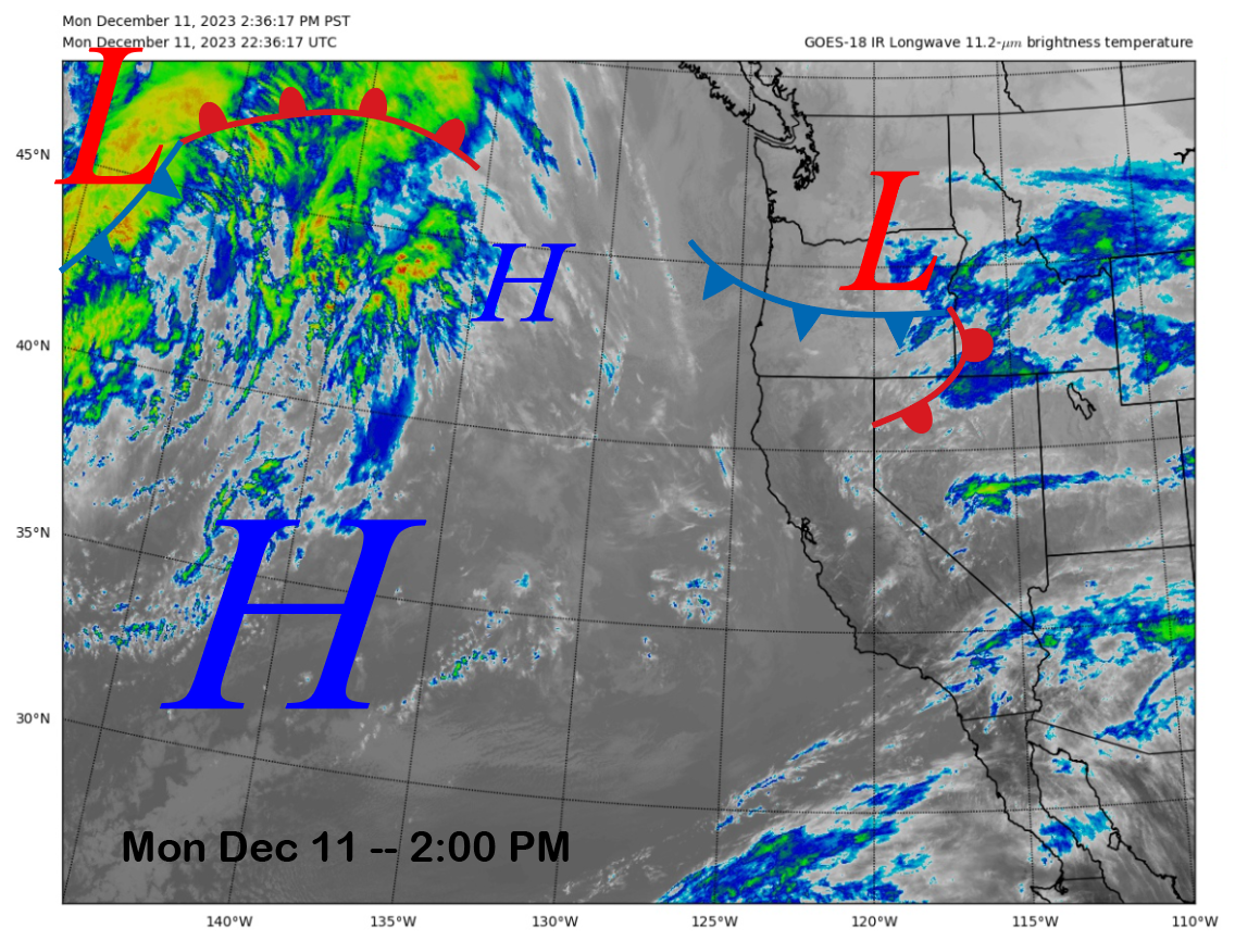
This afternoon, the current infrared satellite image (below) shows a weak low-pressure system over central Oregon and high pressure well off the coast. That low will move southward through Nevada and into Arizona over the next couple of days before the high pressure builds into the state toward the end of the week. It will bring in colder air on Tuesday and Wednesday for better snowmaking conditions and a slight increase in NE winds.
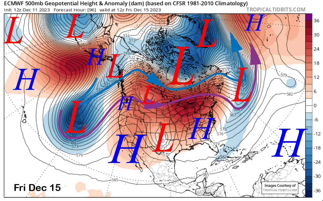
The high-pressure ridge will peak in strength on Friday (image below) and into Saturday, and snow making conditions will likely become marginal overnight.
Long Range (Days 5+):
The longer-range guidance has not changed too much, with the next expected chance for snowfall next week. Then hopefully we will finally see that needed base storm sometime around the Christmas holiday.
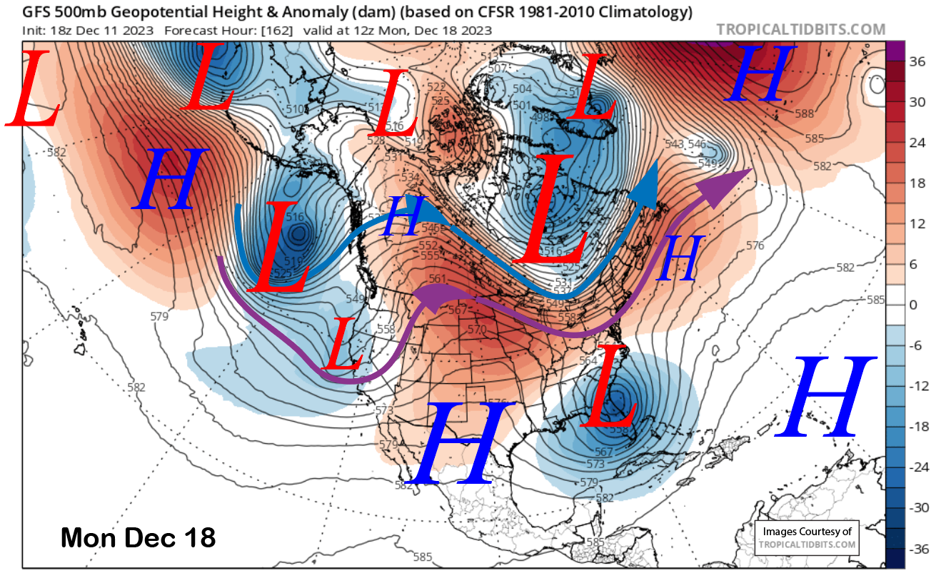
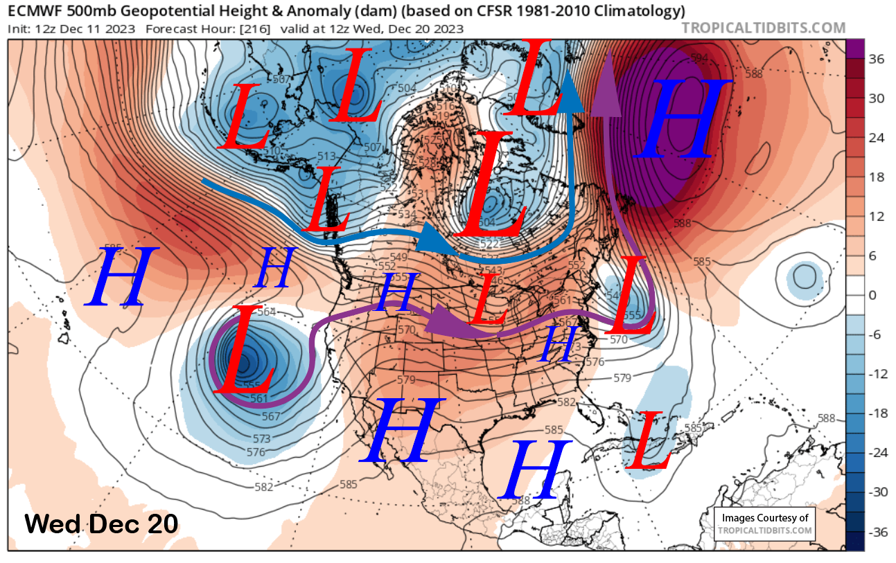
The latest 18z GFS run moves a weak short-wave into the state around Monday next week, with the jet stream (purple arrow) far enough southward for some light snowfall in Mammoth. It then moves a stronger low pressure upstream through CA on Tuesday and early Wednesday next week. That is similar to the Canadian solution, but the ECM is weaker and much farther northward with the low.
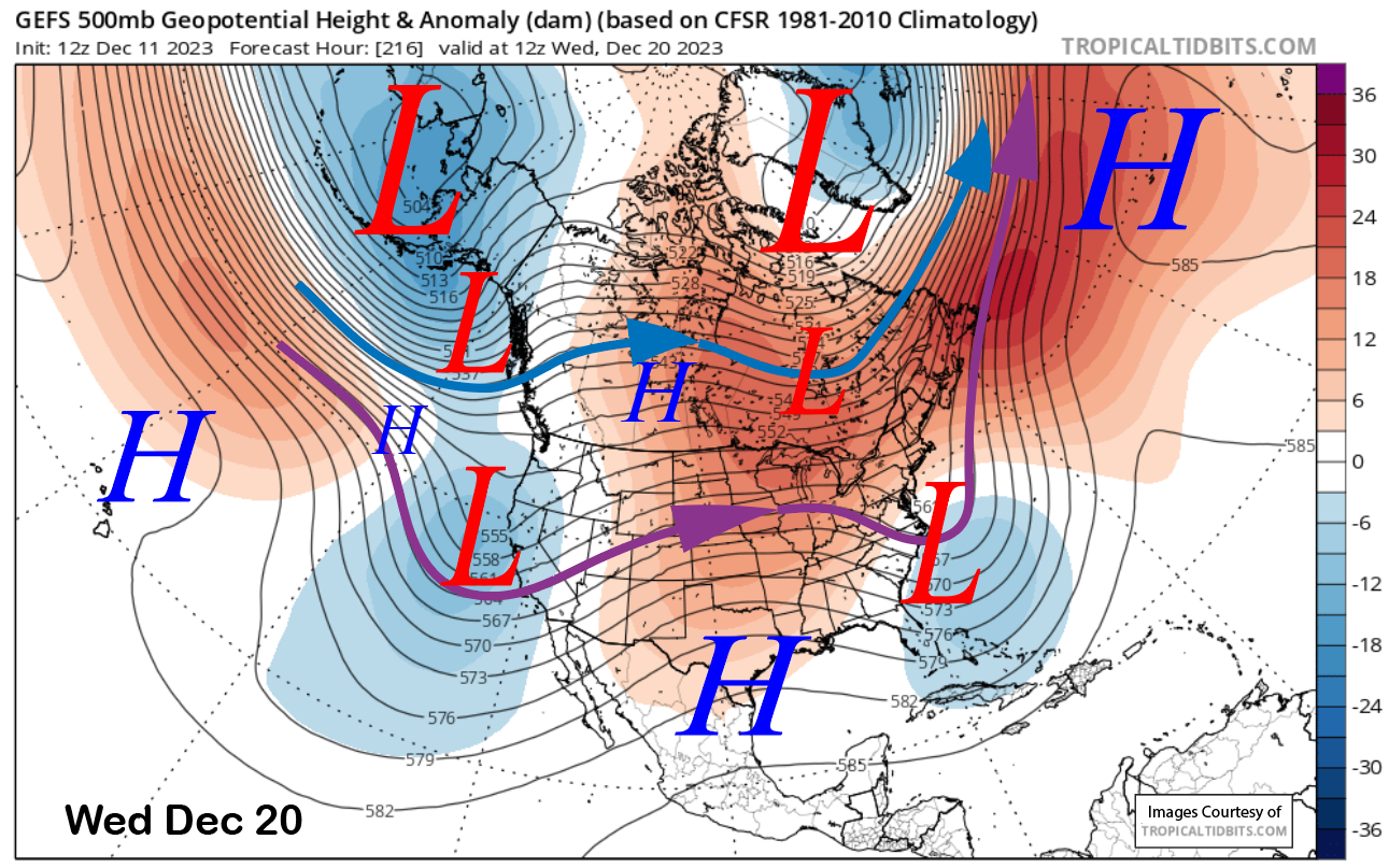
The ECM then moves another cut-off into the eastern Pacific toward the middle part of next week (image below). The ECM ensemble then moves it ashore toward the end of next week. The GFS ensemble (two photos below) is more progressive and moves the upper trough through the state earlier on Wednesday and early Thursday.
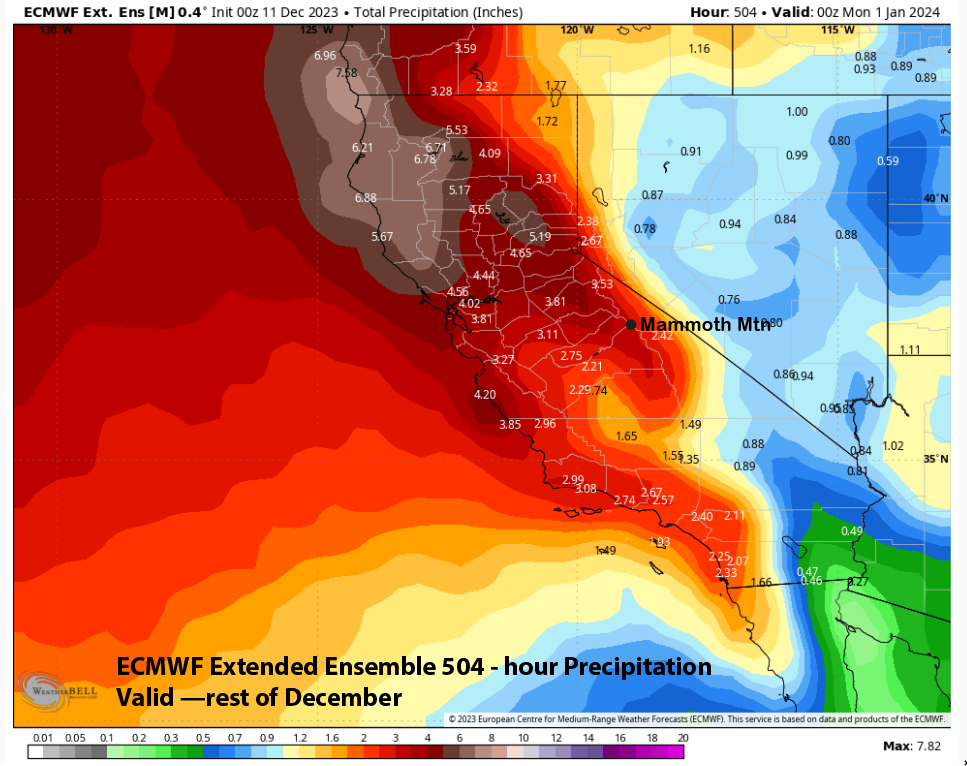
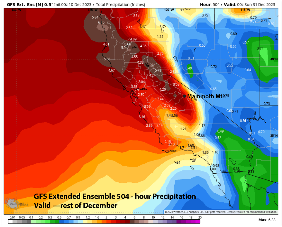
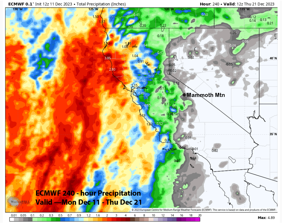
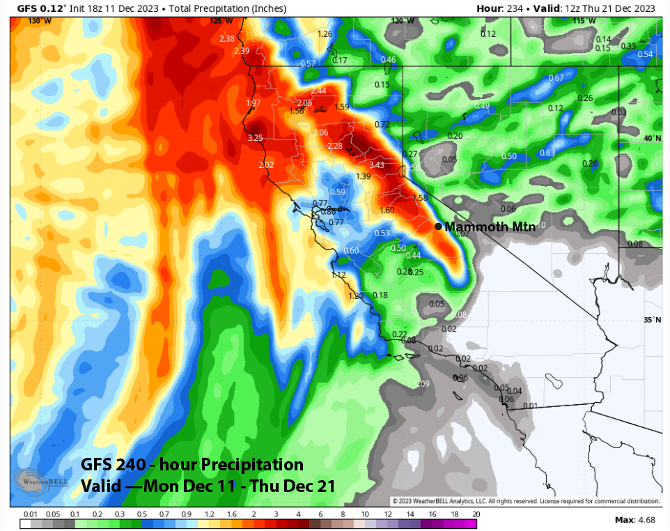
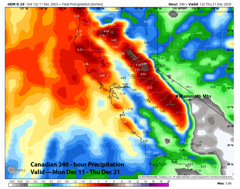
The QPF from the models varies with the ECM currently the driest solution (image below) with almost nothing, the 18z GFS now wetter at around a hefty inch liquid (two photos below), and the Canadian (three images below) the wettest at close to 2” liquid and 3”+ west of the Sierra crest.
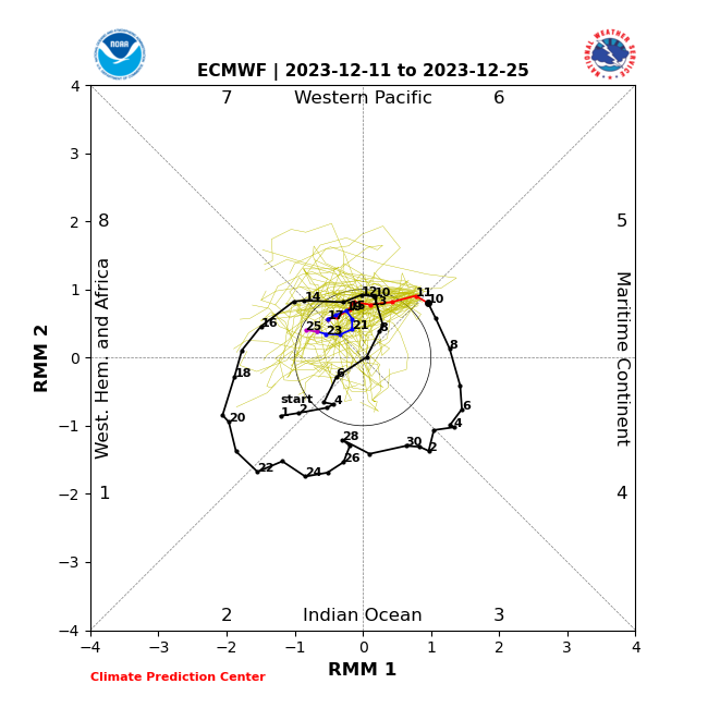
The models seem to struggle with exactly where the trough will set up and whether it will be progressive or quasi-stationary. The MJO forcing that was predicted for phase 7 (image below) is now weaker, with the signal remaining inside the unit circle; thus, it seems like a slower solution may be better. With all the uncertainty, the forecast follows the ECM mean for the early and middle part of next week with light to moderate snowfall of around 6” and not a big storm.
The next chance for snowfall will then be around the Christmas Holiday and the longer range fantasy guidance is surprisingly bullish about a potential more significant storm pattern. The GFS ensemble develops a deep trough and zonal jet (image below) into the West Coast and CA and the ECM ensemble is similar or only slightly faster.
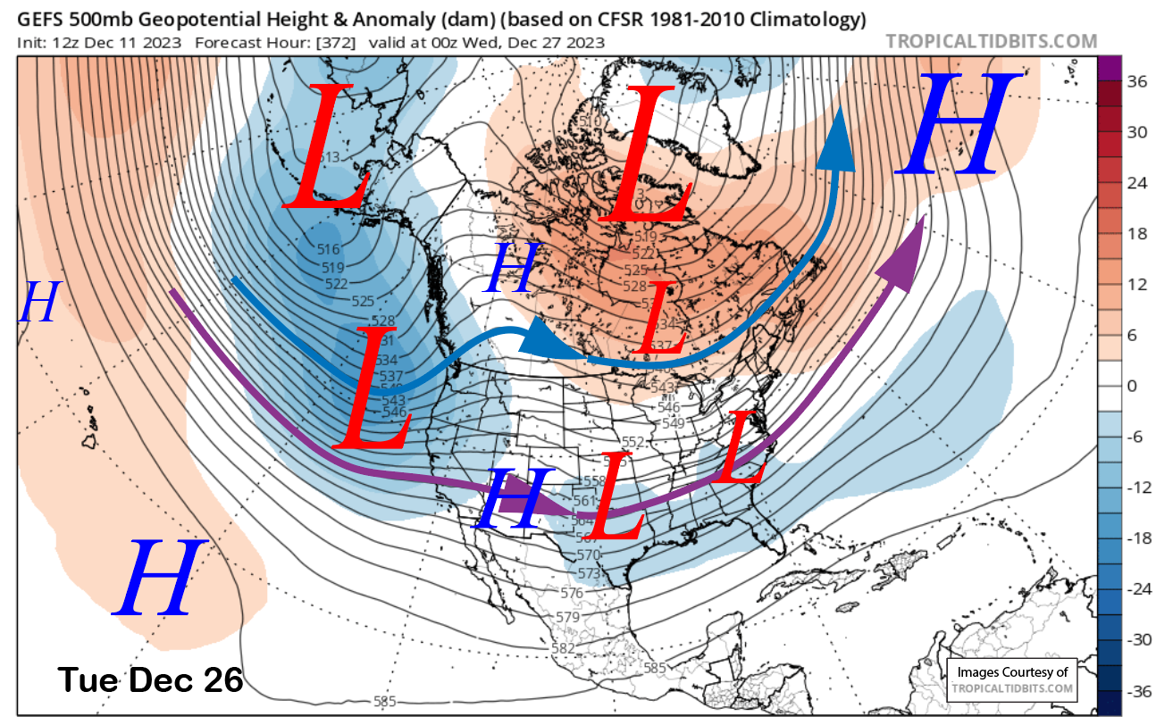
This type of zonal flow pattern or breakthrough of the westerlies can support a big storm or two of base-type snowfall. It is still a bit too far out to get excited about yet with the recent disappointments; nonetheless, hopefully, it will come to fruition, and the powder season can finally start.
Since it is on the back end of the guidance, QPF amounts are still not that huge, with both models (images below) in the 1-2.5” range liquid or around 1-2 feet of snowfall. If the pattern verifies, then amounts will likely be double that or more by mid-week after Christmas.
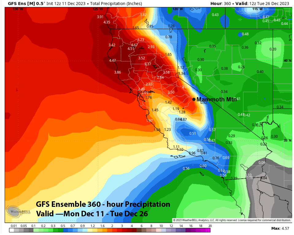
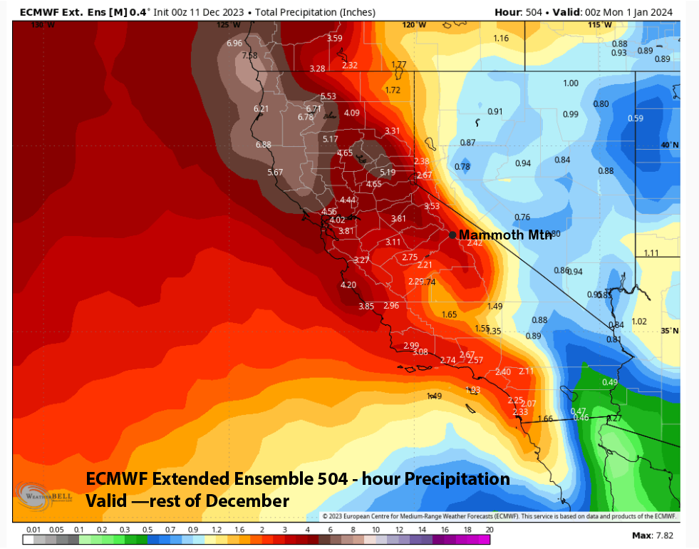
There is a suggestion that the pattern may stay active through the rest of the year. Hopefully, there will be a bigger storm embedded as the ensemble means are only showing about 3-4” liquid (images below) for the rest of the month or about 3 feet. While 3-4” liquid or even 4”+ liquid would be nice. Feast or famine. WG