Powder Forecast – Friday, November 24th, 2022
Ted Schlaepfer CCM —- Mammoth Mountain WeatherGuy
Snowfall forecasts are valid at the Sesame snow course (Main Lodge) for the prior 24 hours, as reported in the 6-7 AM morning snow report.
**Snowfall forecast confidence ranges from very low (1) to very high (5)
Sat 11/25 = 0”
Sun 11/26 = 0”
Mon 11/27 = 0”
Tue 11/28 = 0”
Wed 11/29 = 0”
Thu 11/30 = 0 – 2”
Fri 12/1 = 0 – 2”
Sat – Mon 12/2 – 12/4 = 0 – 3”
November Snowfall = 14”
November Forecast = 14 – 20”
Detailed 4-day Snowfall Forecast:
Sat 11/25 through Tue 11/28 – No snowfall is expected on any day.
Forecast Summary:
Short Term (Days 1 – 4):
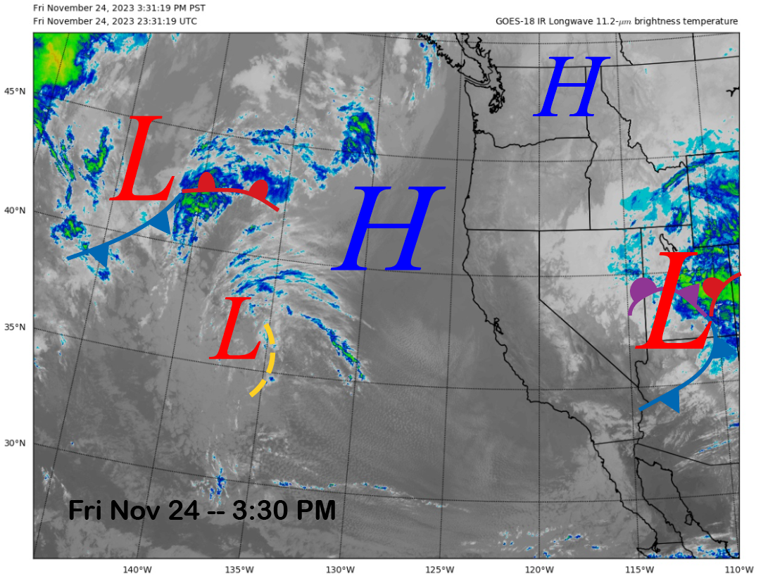
The current infrared satellite image (below) this afternoon shows clear skies over most of CA with some afternoon clouds building over the high Sierra. That will lead to a slight chance for an evening flurry; otherwise, the dry weather will continue.
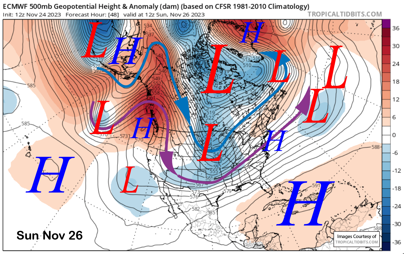
The pattern won’t change much tomorrow or Monday with a high-pressure ridge well north of Mammoth in the PacNW and a weak trough of low pressure off the SoCal coast (image below). Not much change is expected Tuesday either, with continued dry weather and slightly warmer temps. Temps will remain seasonably cool before warming up a bit early next week for generally good snowmaking.
Long Range (Days 5+):
The longer-range guidance has not trended in a favorable direction since the last post, and the base-building storm we need is still not on the horizon.
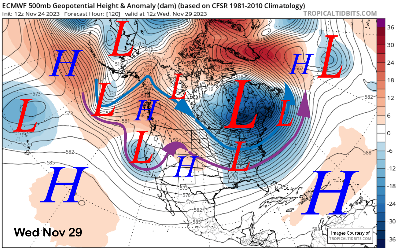
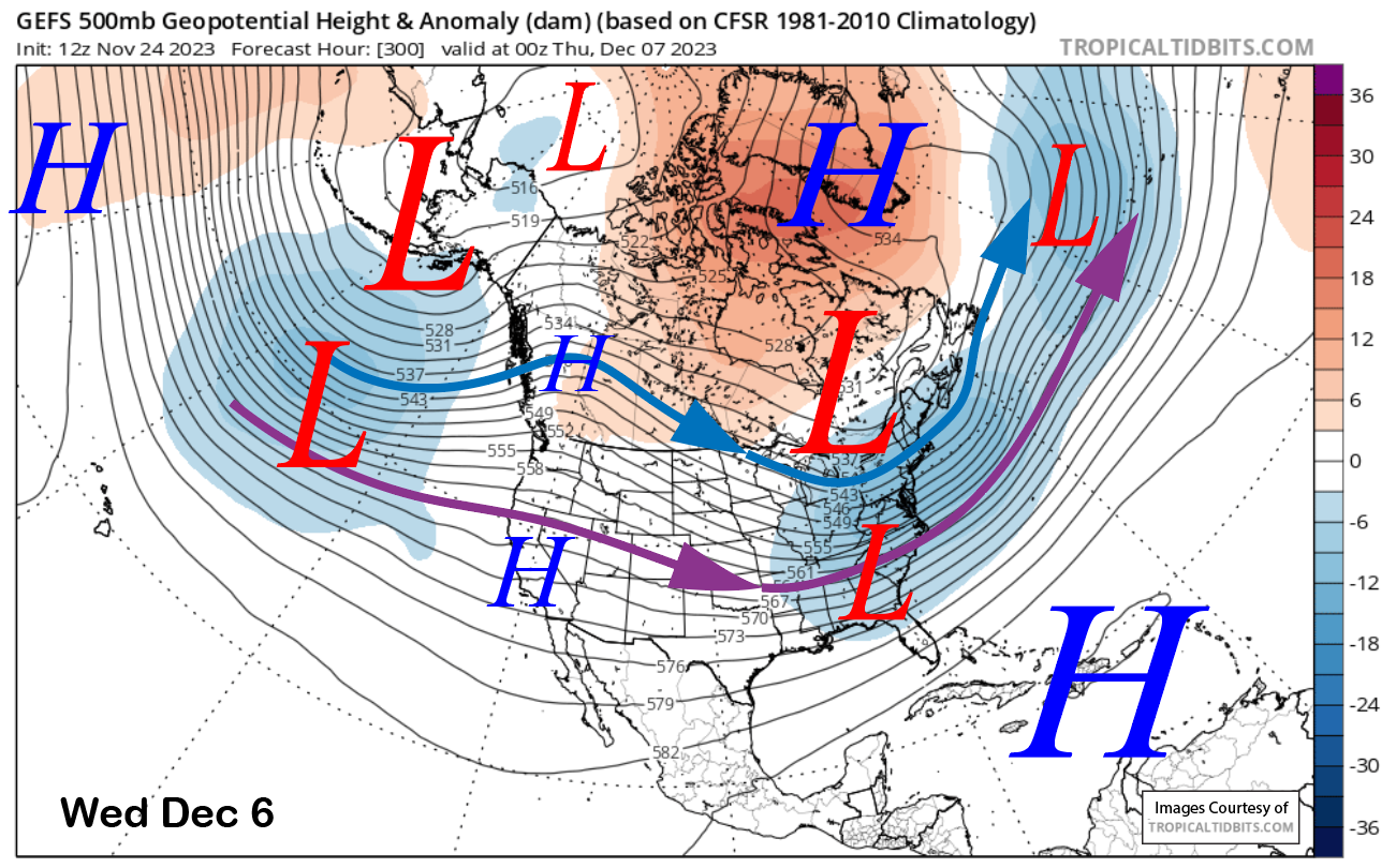
The models move a low-pressure system toward the coast Wednesday (image below) and inland overnight into Thursday. The ECM had some very light snowfall Wednesday PM as it washed it out and moved through the state. The Canadian is similar, and the GFS is completely dry.
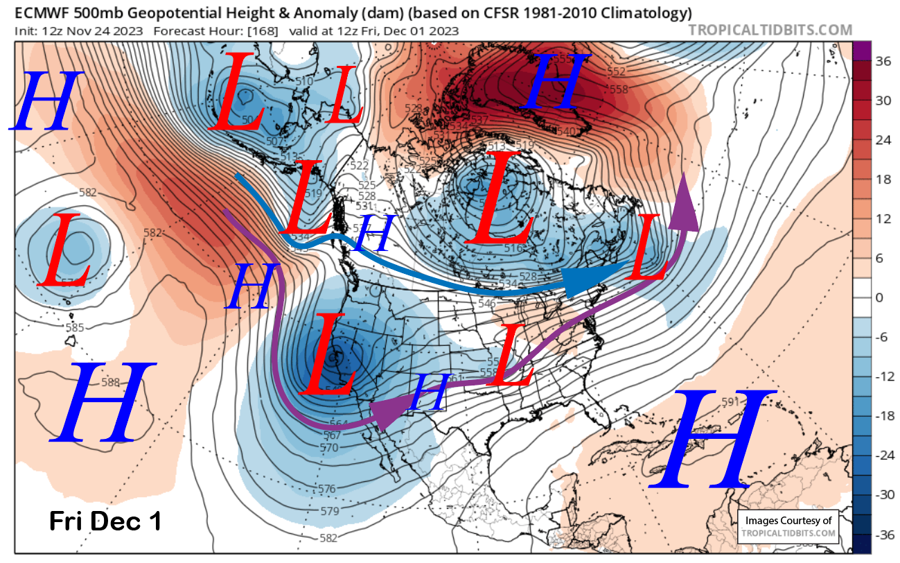
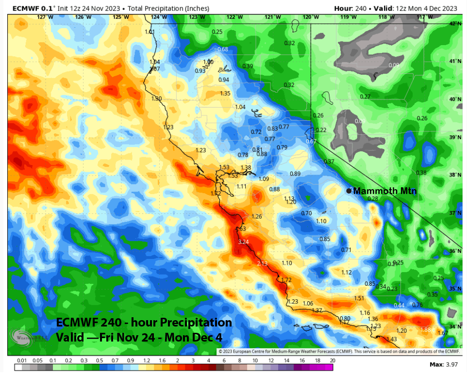
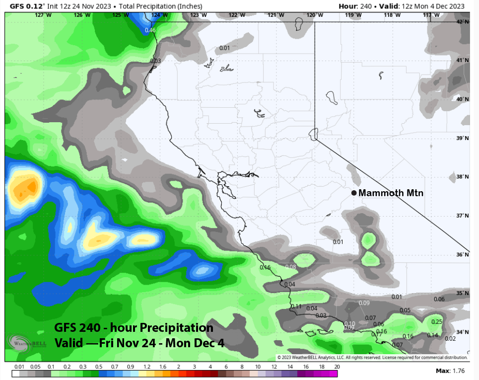
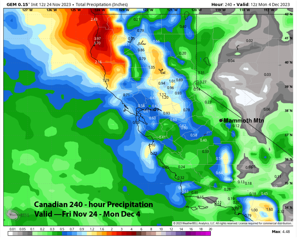
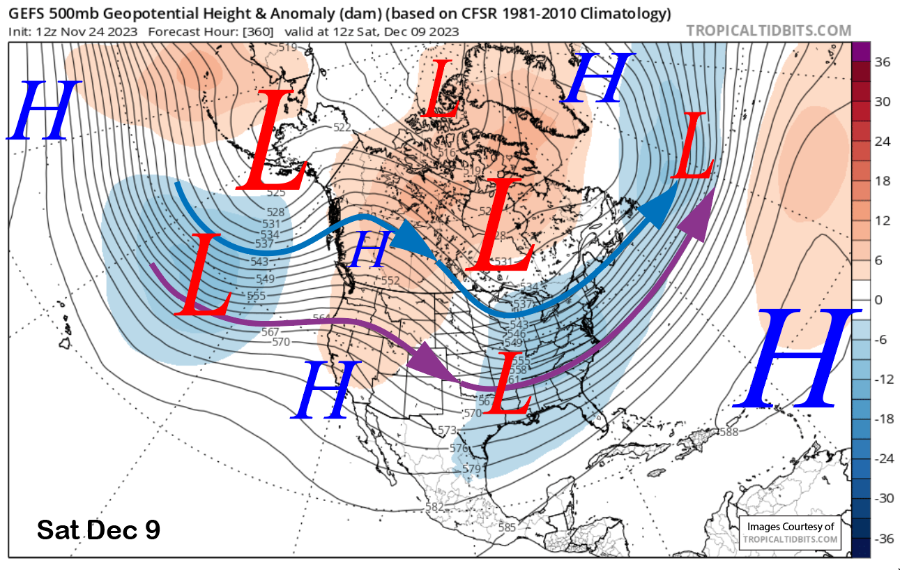
The ECM (image below) and Canadian models then move a stronger kicker short-wave trough southward into CA toward the end of next week. The ECM has good snowfall with it, while the Canadian takes most of the energy southward into SoCal. The GFS model (image below) is weaker with the wave and has more like an inside slider. That model is dry.
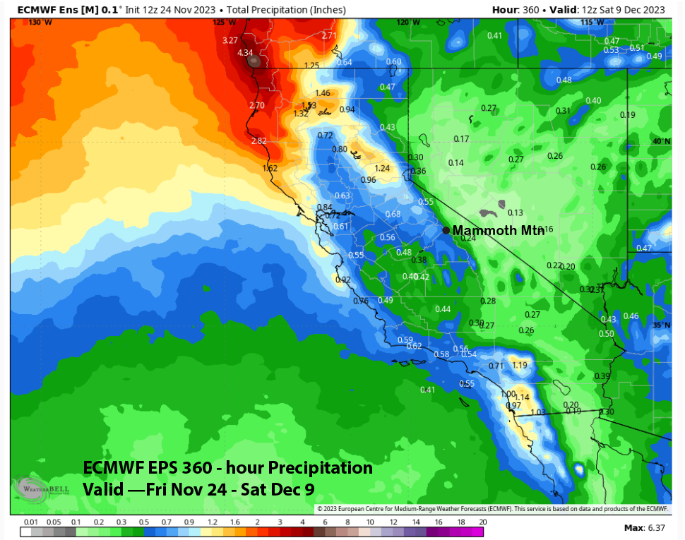
Overall, there is a lot of uncertainty with the forecast for the end of next week, but the current thinking is that the ECM solution is an outlier. The nearly 1” liquid forecast (image below) is probably not likely, and the GFS forecast of nothing (two images below) is probably also not likely. The Canadian solution (three images below) matches up better with the ECM mean of around a quarter-inch liquid or just a few inches of snowfall.
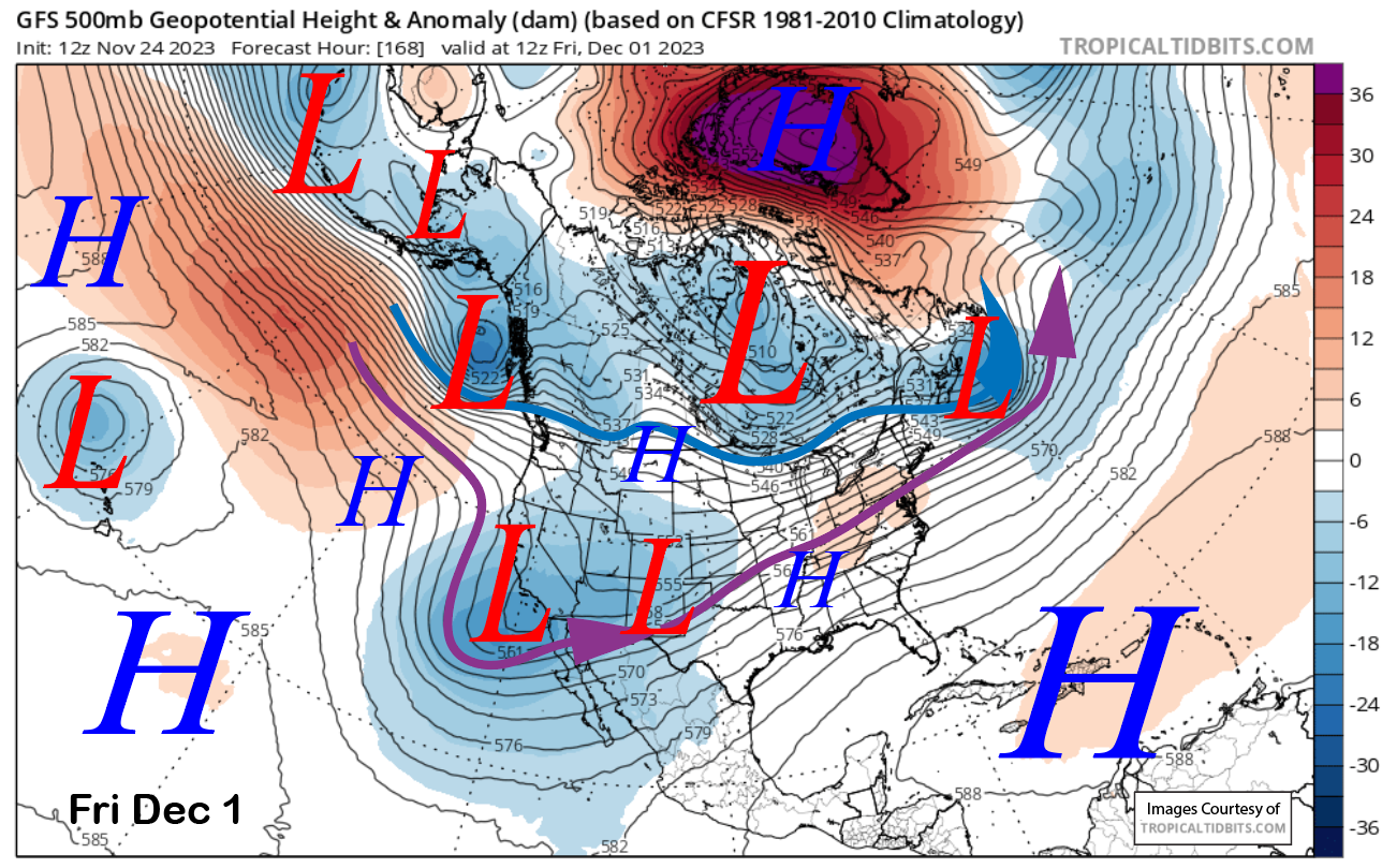
The longer-range fantasy guidance has trended drier for CA with a flat ridge now forecasted by the models (image below), with the dominant feature being a blocking ridge over Greenland forcing a deep trough into the East Coast. The ECM EPS is similar.
The models keep this pattern (image below) in place through the first week of December for continued mostly dry weather. The ECM EPS 15-day forecast shows a bit more than half an inch of liquid for the entire period. That won’t build a base. WG

Powder Forecast – Friday November 24th, 2022
Ted Schlaepfer CCM —- Mammoth Mountain WeatherGuy
Snowfall forecasts are valid at the Sesame snow course (Main Lodge) for the prior 24 hours as reported in the 6-7 AM morning snow report.
Sesame Snow Course
**Snowfall forecast confidence ranges from very low (1) to very high (5)
Sat 11/25 = 0”
Sun 11/26 = 0”
Mon 11/27 = 0”
Tue 11/28 = 0”
Wed 11/29 = 0”
Thu 11/30 = 0 – 2”
Fri 12/1 = 0 – 2”
Sat – Mon 12/2 – 12/4 = 0 – 3”
November Snowfall = 14”
November Forecast = 14 – 20”
Detailed 4-day Snowfall Forecast:
Sat 11/25 through Tue 11/28 – No snowfall expected all days.
Forecast Summary:
Short Term (Days 1 – 4):
The current infrared satellite image (below) this afternoon shows clear skies over most of CA with some afternoon clouds building over the high Sierra. That will lead to a slight chance for an evening flurry, otherwise, dry weather continues.
The pattern won’t change much tomorrow or Monday with a high-pressure ridge well north of Mammoth in the PacNW and a weak trough of low pressure off the SoCal coast (image below). Not much change is expected Tuesday either with continued dry weather and slightly warmer temps. Temps will remain seasonably cool before warming up a bit early next week for generally good snow making.
Long Range (Days 5+):
The longer-range guidance did not trend in a favorable direction since the last post and a base building storm we need is still not on the horizon. Waiting continues.
The models move a low-pressure system toward the coast Wednesday (image below) and inland overnight into Thursday. The ECM has some very light snowfall Wednesday PM as it washes it out as it moves through the state. The Canadian is similar and the GFS completely dry.
The ECM (image below) and Canadian models then move a stronger kicker short-wave trough southward into CA toward the end of next week. The ECM has good snowfall with it while the Canadian takes most of the energy southward into SoCal. The GFS model (image below) is weaker with the wave and has it more like an inside slider. That model is dry.
Overall, a lot of uncertainty with the forecast for the end of next week, but current thinking is the ECM solution is an outlier. The nearly 1” liquid forecast (image below) is probably not likely and the GFS forecast of nothing (two images below) is probably also not likely. The Canadian solution (three images below) matches up better with the ECM mean of around a quarter inch liquid or just a few inches of snowfall.
The longer range fantasy guidance has trended drier for CA with a flat ridge now forecast by the models (image below) with the dominant feature a blocking ridge over Greenland forcing a deep trough into the East Coast. The ECM EPS is similar.
The models keep this pattern (image below) in place through the first week of December for continued mostly dry weather. The ECM EPS 15-day forecast is showing a bit more than a half of an inch liquid for the entire period. That won’t build a base. WG


