Powder Forecast –Friday January 7th, 2022
Ted Schlaepfer CCM —- Mammoth Mountain WeatherGuy
Snowfall forecasts are valid at the Sesame snow course (Main Lodge) for the prior 24 hours as reported in the 6-7 AM morning snow report.
**Snowfall forecast confidence ranges from very low (1) to very high (5)
Sat 1/8 = trace
Sun 1/9 = 0”
Mon 1/10 = 0”
Tue 1/11 = 0”
Wed 1/12 = 0”
Thu 1/13 = 0 – 1”
Fri 1/14 = 0”
Sat – Mon 1/15 – 1/17 = 0”
January Snowfall = 0”
January Forecast = 15 – 35”
Detailed 4-day Snowfall Forecast:
Sat 1/8 through Tue 1/11 – No snowfall expected all days.
Forecast Summary:
Short Term (Days 1 – 4):
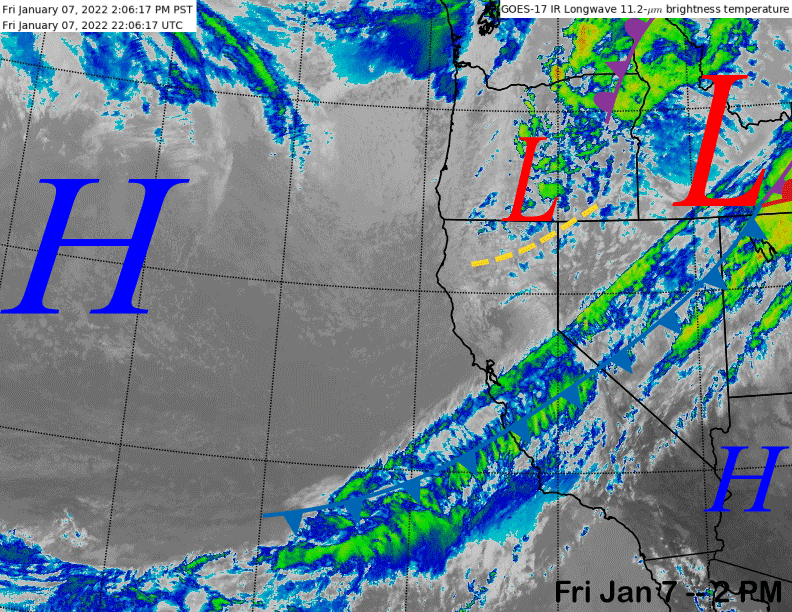
The infrared satellite image (below) this afternoon shows a dissipating frontal system moving through Central CA that will produce some flurries or light snow showers this evening.
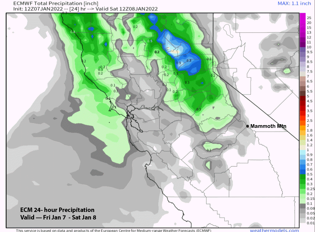
The ECM model (image below) is only showing 0.02” and the GFS about a hundredth. So, not even an inch of accumulation is expected and probably just a trace amount.
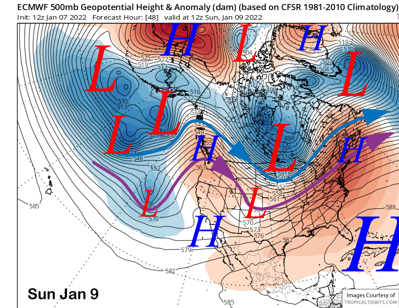
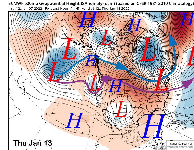
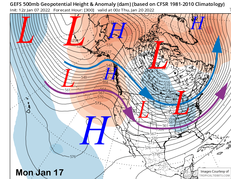
High pressure will build into Mammoth this weekend (image below) for fair weather, light winds by Sunday, and seasonable temperatures.
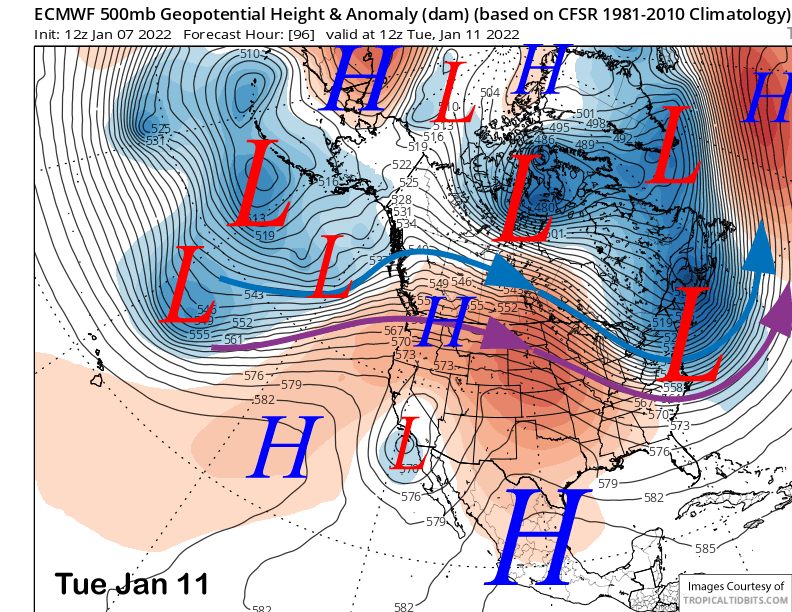
A weak cut-off low will then move southward along the coast into SoCal or Baja on Monday and Tuesday (image below). It will only produce slightly colder temperatures and some clouds for the mountain with dry weather expected to continue through early next week.
Long Range (Days 5+):
The longer-range guidance is still looking abysmal for snowfall until possibly the last week of the month or longer.
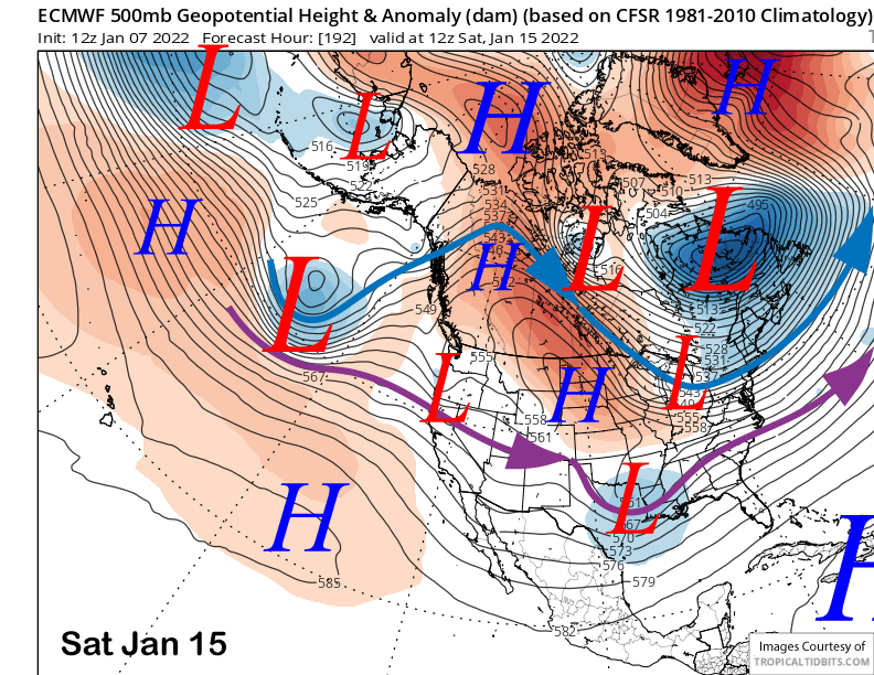
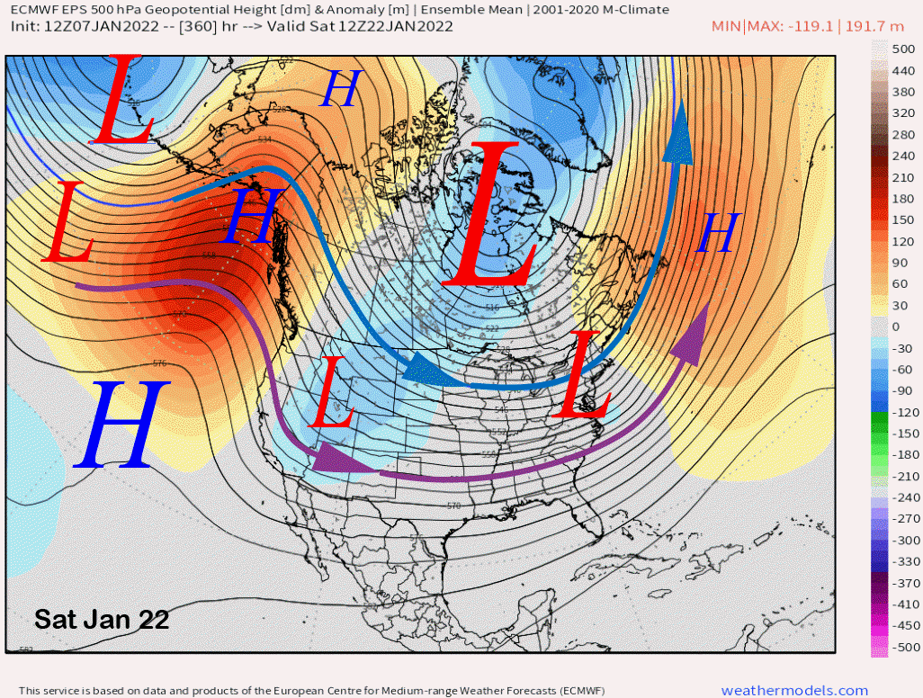
The ECM (image below) and Canadian models do move a closed upper-level low pressure system into NorCal around late Wednesday or Thursday next week. Currently, both of the models keep most of the precipitation north of Mammoth.
The latest ECM model is rather progressive with two more weak upper-level lows (images below) moving into the PacNW and NorCal over the following weekend and into the next week. The Canadian is similar while the GFS is a farther southward and has some snow showers.
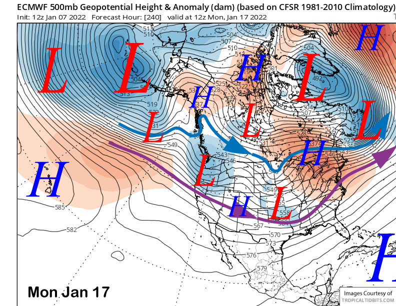
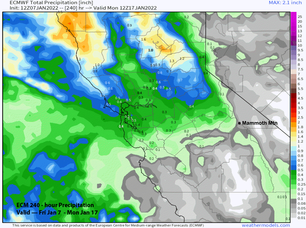
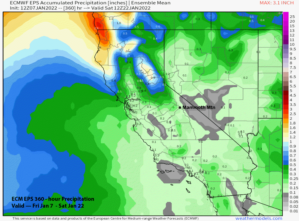
Overall, the ECM model is not showing much precipitation in the 10-day period (image below) and no powder days. The GFS is basically dry too, as is the Canadian model. The only good news is each of those passing lows to the North toward end of next week/following weekend could get the wind buff machine going for the top half of the mountain.
The longer range GFS ensemble (image below) keeps a ridge in place just off the West Coast through mid-month for continued mostly dry weather. The ECM ensemble is similar and then starts to retrograde that ridge/trough set-up westward around the end of that week or following weekend (image below)
That is not exactly a wet pattern with any storms still moving into the state from interior Canada and likely not having sufficient over-water trajectory to pull in needed moisture to produce big snowfalls. The ECM ensemble 15-day precipitation forecast reflect this and only shows light amounts for the period, mostly in the back end (image below).
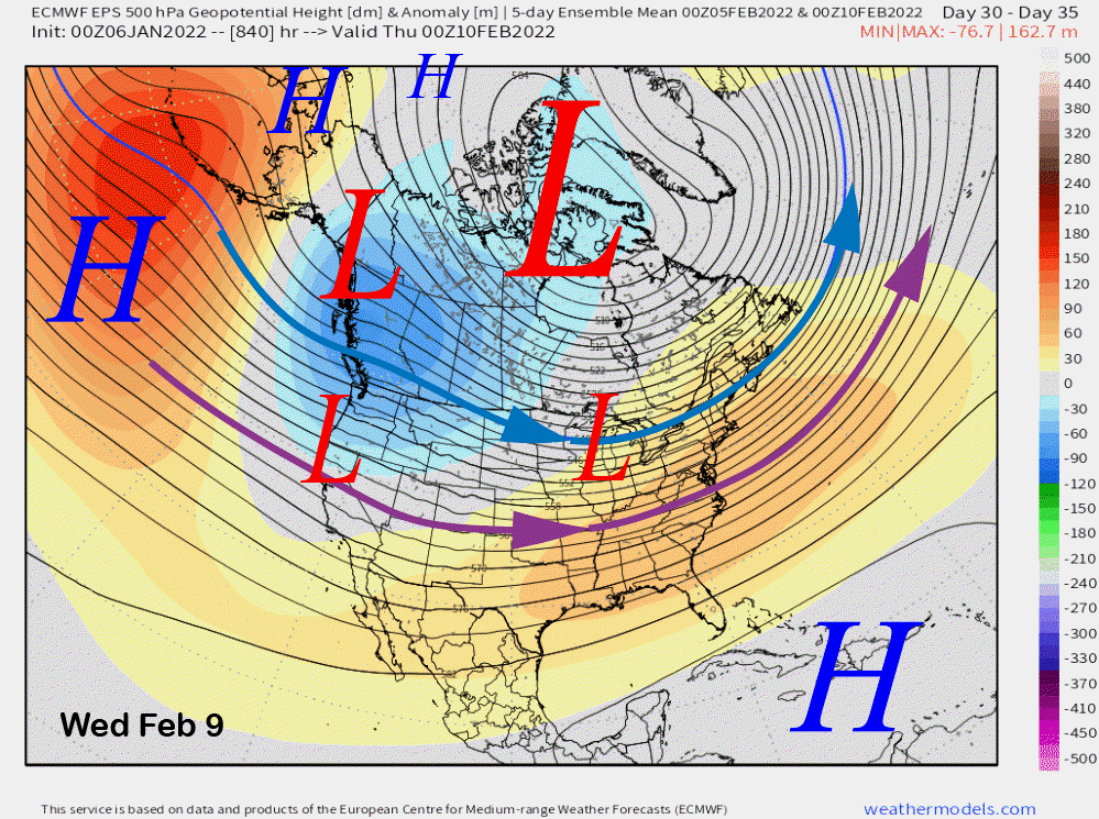
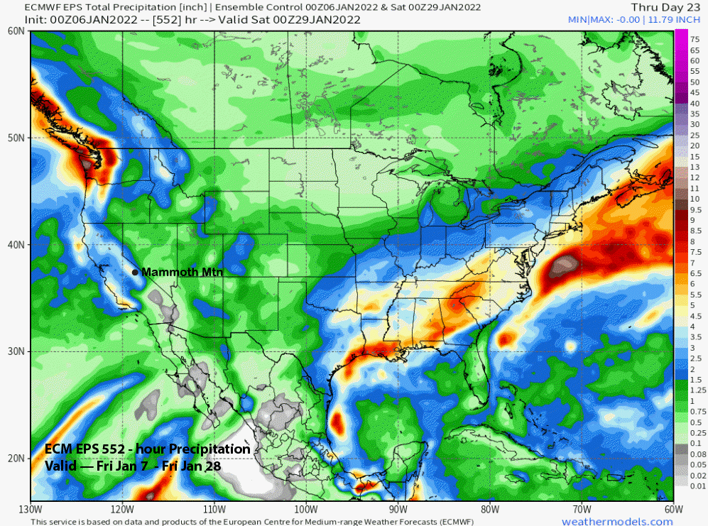
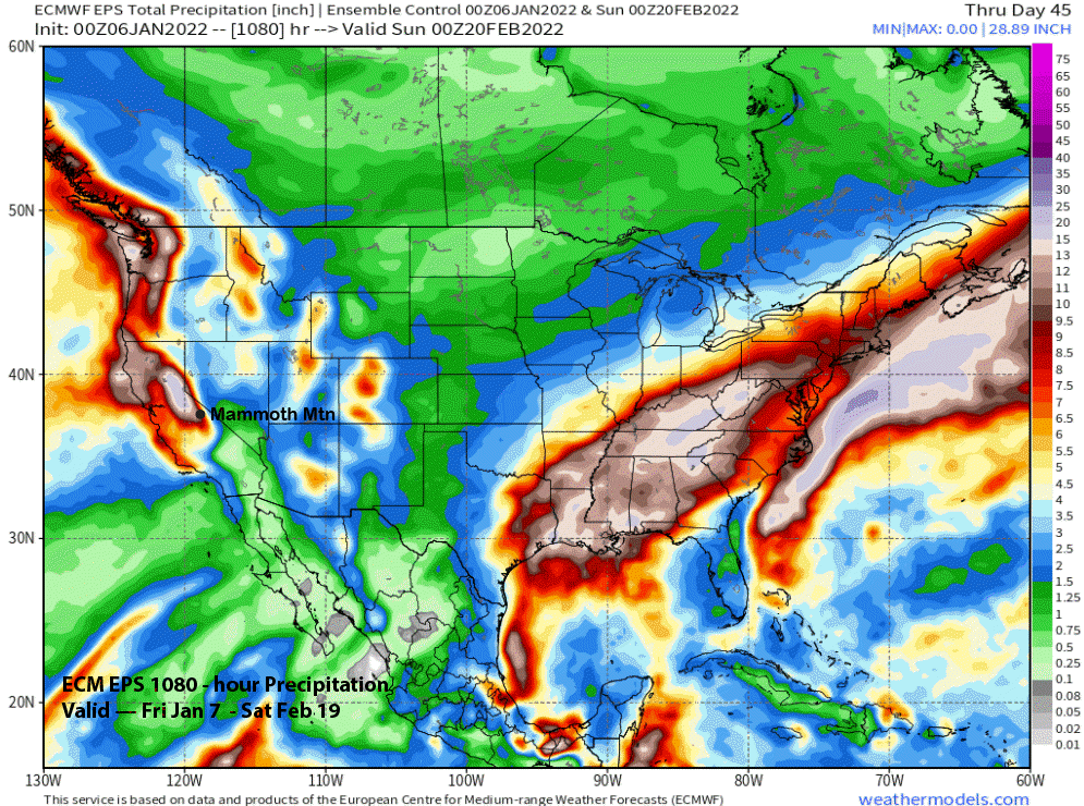
The latest run of the twice weekly ECM 45-day product continues the same theme as the previous runs of continuing to retrograde the longwave trough westward to well off the West Coast through early February (image below). That pattern would increase the storminess for CA and Mammoth.
The model doesn’t really get the potential snowfall increasing until the middle/latter part of the last week of January (Jan 26 – 28th ) (image below) when 4” liquid has accumulated. That timing of course, is fantasy period, and the overall good news is that the model is still predicting another round of significant snowfall during early/middle February with over 10” liquid (two images below).
Overall, having a dry month after a big one is quite common. La Nina year 2010-11 is a great example when the biggest December on record (209”) was followed by a 29” January. But the storms came back with February (92”) big and March (177.5”) huge. Fingers crossed. WG


