Powder Forecast – Friday, March 1st, 2024
Ted Schlaepfer CCM —- Mammoth Mountain WeatherGuy
Snowfall forecasts are valid at the Sesame snow course (Main Lodge) for the prior 24 hours, as reported in the 6-7 AM morning snow report.
**Snowfall forecast confidence ranges from very low (1) to very high (5)
Sat 3/2 = 26 – 32” (H20 = 2.75” – 3.25”)**4
Sun 3/3 = 25 – 30” (H20 = 1.75” – 2.00”)**3
Mon 3/4 = 1 – 3”
Tue 3/5 = 0”
Wed 3/6 = 2 – 6”
Thu 3/7 = 2 – 6”
Fri 3/8 = 0”
Sat – Mon 3/9 – 3/11 = 0 – 6”
March Snowfall: 4”
Marc Forecast = 80 – 100”
Detailed 4-day Snowfall Forecast:
Sat 3/2 – Heavy snowfall during the morning decreases in intensity around midday before becoming heavy again Saturday night, tapering near dawn. Accumulations 25 – 30” at Main by Sunday AM, 36”+ up top
Sun 3/3 – Light snowfall during the morning turns to snow showers during the afternoon before ending during the evening. Accumulations 1 –3” by Monday AM.
Mon 3/4 – No snowfall expected.
Tue 3/5 – Likely dry through the morning, then a chance for snowfall during the afternoon and overnight. Accumulations 2 – 6” by Wednesday AM
Forecast Summary:
Short Term (Days 1 – 4):
The current infrared satellite image (below) today shows a cold front that is mostly stationary over Central CA and a developing low-pressure system and comma cloud off the NorCal coast. The parent upper-level low is still off the PacNW coast and moving southeast as well.

The models drive the developing comma cloud into CA overnight and into early tomorrow (image below), backed by a strong polar and southern branch of the jet stream. That will increase snowfall in Mammoth overnight, with blizzard conditions expected late tonight and tomorrow morning. Snow levels will be around 5500 feet and then lower to around 3000 feet tomorrow morning, so this first round won’t be dry/cold powder.
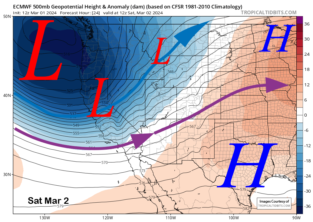
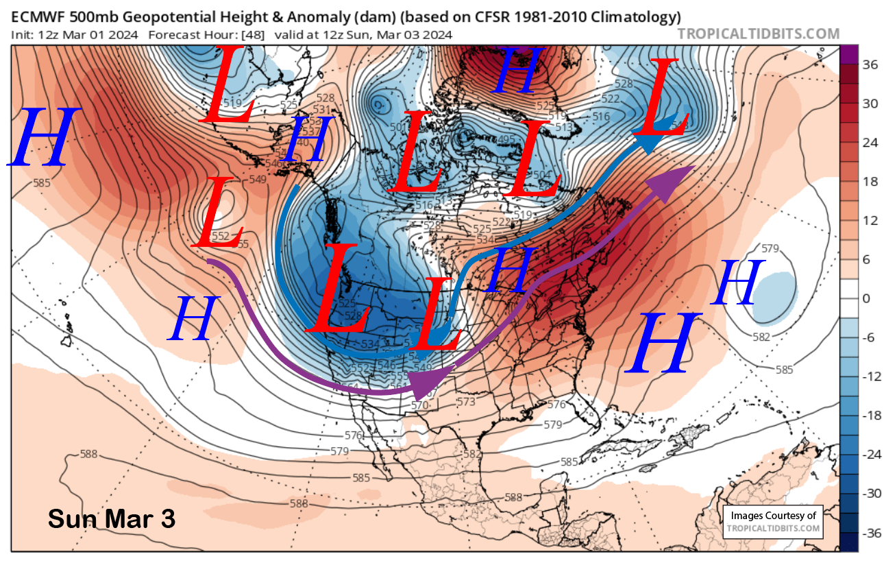
The models then drive the parent upper low through the Sierra Saturday night and early Sunday (image below) for another round of heavy snowfall. Snowfall should then taper off Sunday morning with only light snow showers during the day.
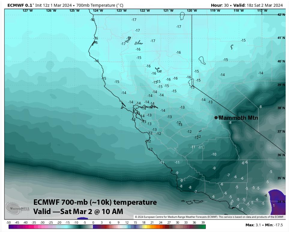
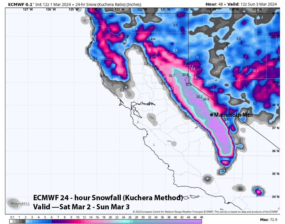
With cold air already in place Saturday AM from the first low as 700-mb (image below) or 10k elevation temps are expected to be in the low teens, the snowfall with the second round should be fluffy and dry with snow ratios around 15”:1”. However, liquid amounts won’t be as high as the first pulse tonight/early tomorrow.
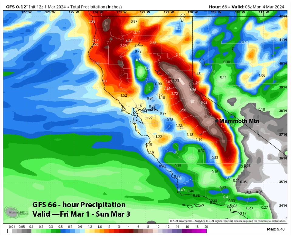
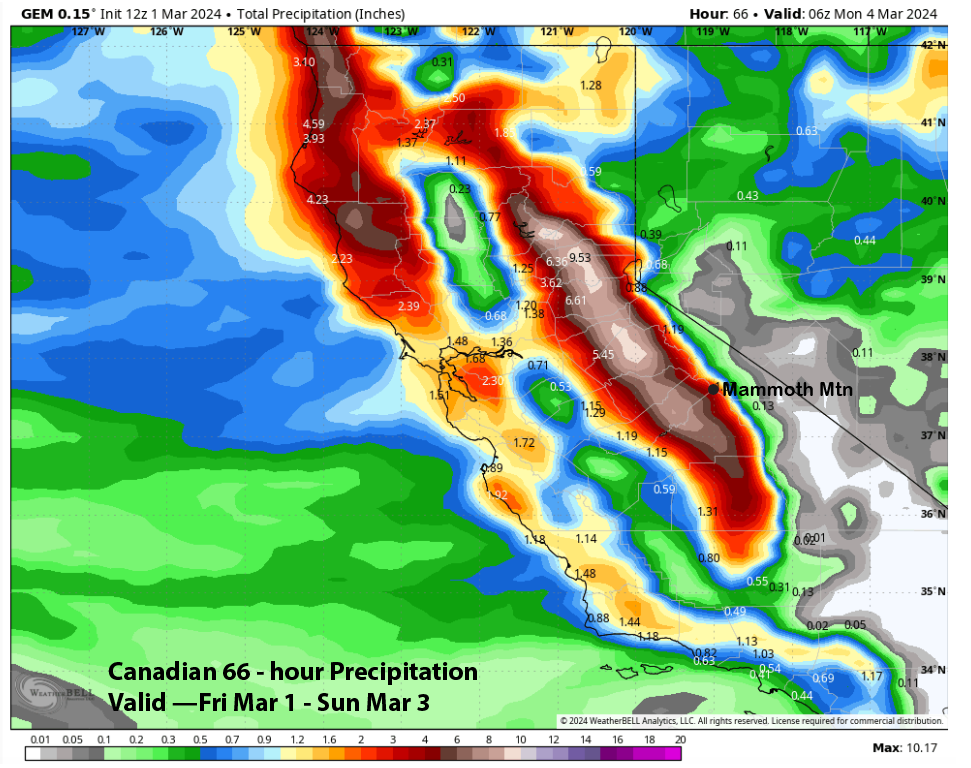
QPF from the guidance is mostly in the 4-5” liquid range with the GFS once again the wettest at almost 6” (image below) and the Canadian the driest at around 3” (two images below), although it does have a lot west of the crest.
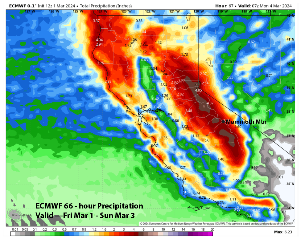
The ECM shows about 4” (image below), and the National Blend of Models has about 5” liquid (two images below). Based on the strong jet dynamics, the forecast leans toward the NBM model and slightly above the ECM.
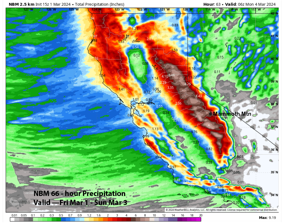
The forecast is calling for about 4-5 feet at Main and about six feet up top by Sunday morning. ECM snowfall on Saturday and into early Sunday using the Kuchera method (image below) is showing 35-40”, so it’ll definitely be deep on Sunday morning. But don’t believe the hype about 10-12 feet of snowfall.
Dry weather returns Monday and likely continues into Tuesday. There is a chance that snowfall could return on Tuesday PM and night, but the model guidance is not in great agreement, and confidence is low in the forecast for the middle part of next week.
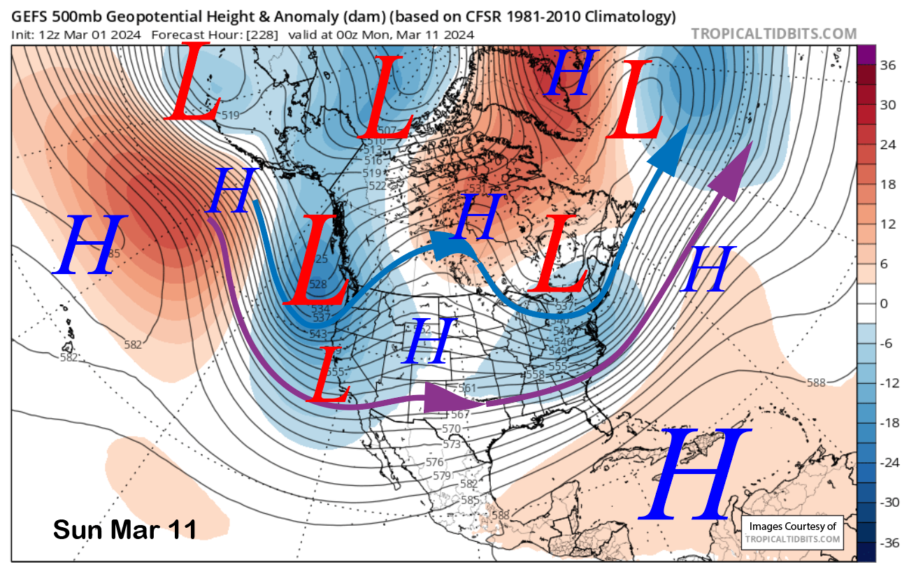
Long Range (Days 5+):
The longer-range guidance suggests that storm chances may continue late over the following weekend and/or the next week before favoring drier weather to develop around mid-month and beyond. So get those powder turns in now.
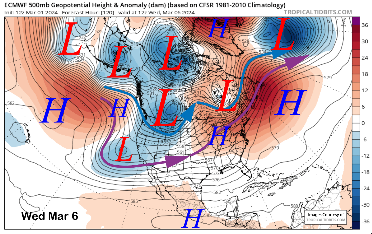
The models were suggesting another decent storm a couple of runs ago for the middle part of next week. Now the ECM (image below) and GFS don’t merge the upper low with a short-wave moving into the eastern Pacific, but develop a split flow with the precipitation staying north of the area.
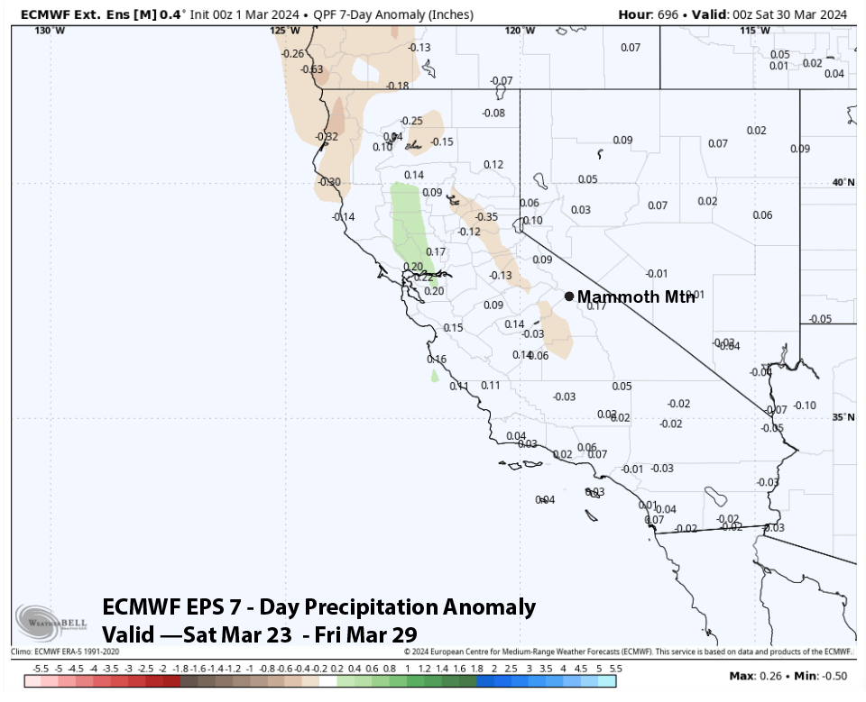
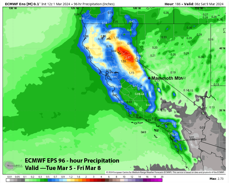
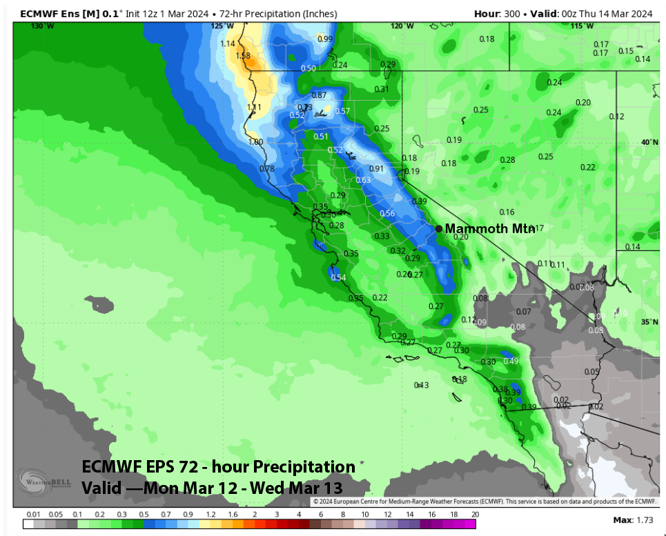
Forecast follows the latest run of the ECM EPS (image below) that also backed off on the precipitation forecast and is showing around half an inch liquid. So hopefully about six inches of snow will fall and enough for powder turns again.
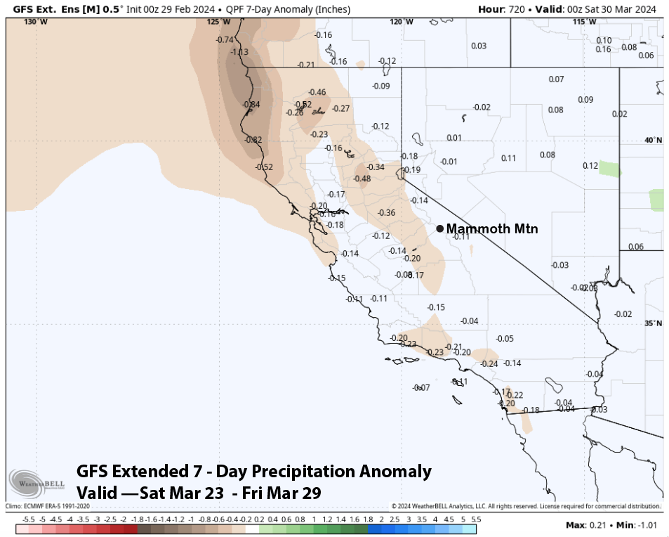
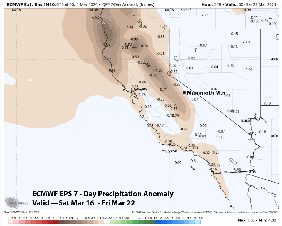
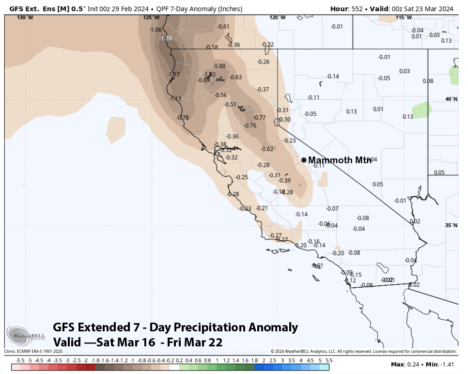
Dry weather is then favored for Thursday and into next Saturday, with the GFS ensemble (image below) showing another trough developing over CA by Sunday that weekend, although it is now weaker versus previous runs. The ECM EPS has it too, but later by a day. That model is showing modest QPF for that time period (image below), and enough for powder turns, just not a big storm.
The fantasy range guidance is then favoring dry weather to develop after mid-month for about a week or so. Both the ECM EPS (image below) and GFS (two images below) are showing below-normal precipitation that week.
Those models are then suggesting that snowfall may return over the last part of March with both models (images below) showing average precipitation. Let us hope, cause April and spring will be right around the corner by then. WG