Powder Forecast – Tuesday, February 20th, 2024
Ted Schlaepfer CCM —- Mammoth Mountain WeatherGuy
Snowfall forecasts are valid at the Sesame snow course (Main Lodge) for the prior 24 hours as reported in the 6-7 AM morning snow report.
**Snowfall forecast confidence ranges from very low (1) to very high (5)
Wed 2/21 = 4 – 6” (H20 = 0.40” – 0.60”)**4
Thu 2/22 = 0 – 1”
Fri 2/23 = 0”
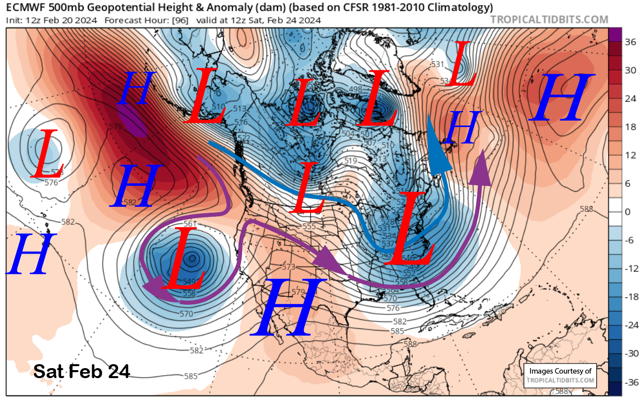
Sat 2/24 = 0”
Sun 2/25 = 0”
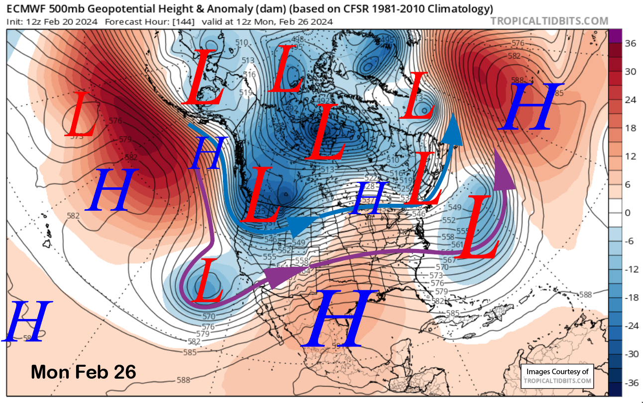
Mon 2/26 = 1 – 3”
Tue 2/27 = 1 – 3”
Wed – Fri 2/28 – 3/1 = 3 – 9”
February Snowfall: 123”
February Forecast = 130 – 135”
Detailed 4-day Snowfall Forecast:
Wed 2/21 – Snowfall should end by dawn, then snow showers are possible during the day, ending evening. Little or no accumulation is expected.
Thu 2/23 through Sat 2/24– No snowfall expected all days.
Forecast Summary:
Short Term (Days 1 – 4):
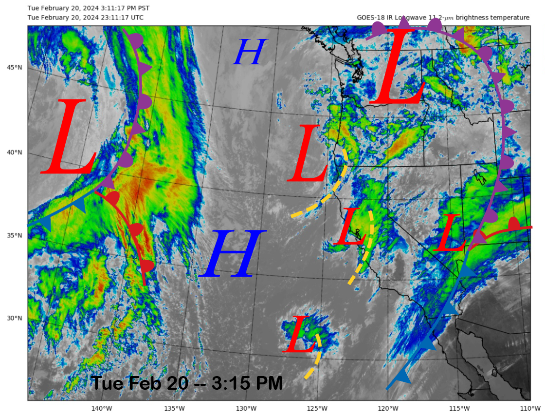
The current infrared satellite image (below) today shows a few weak areas of low pressure situated off the CA coast with one area now moving inland into central and northern CA with clouds and rain.
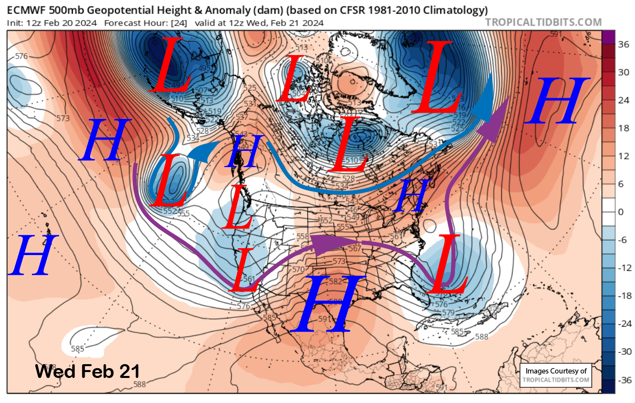
The models shift this trough inland by early tomorrow (image below) and one last round of snowfall is expected overnight with its passage. Snowfall should end around dawn on Wednesday.
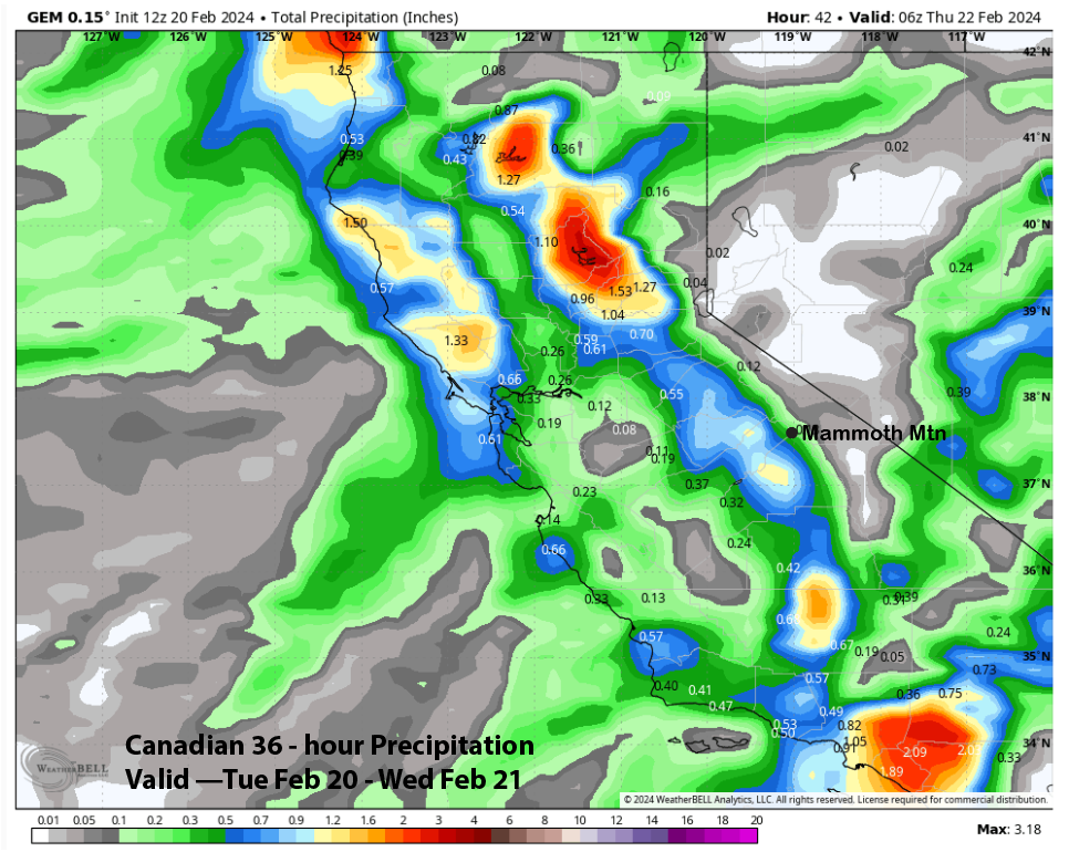
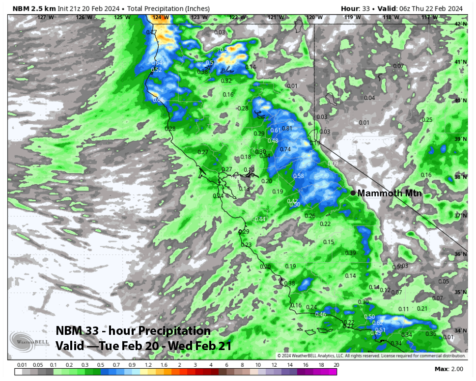
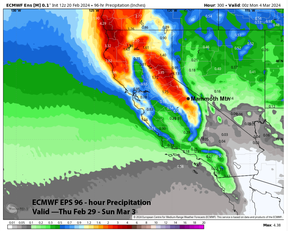
QPF from the models does vary a bit overnight. The GFS has been a bit too wet lately and again it is the wettest model (image below) with just under an inch. The ECM (two images below) is showing about half that amount and the Canadian (three images below) and NBM (four images below) are only forecasting about a third of an inch of liquid.
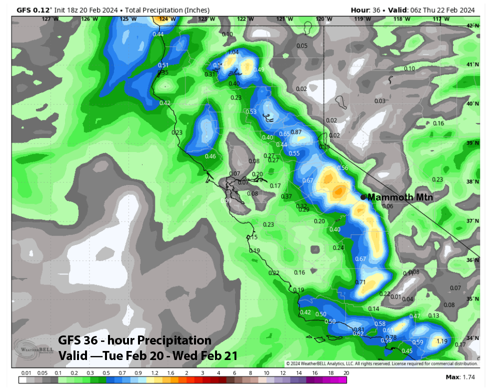
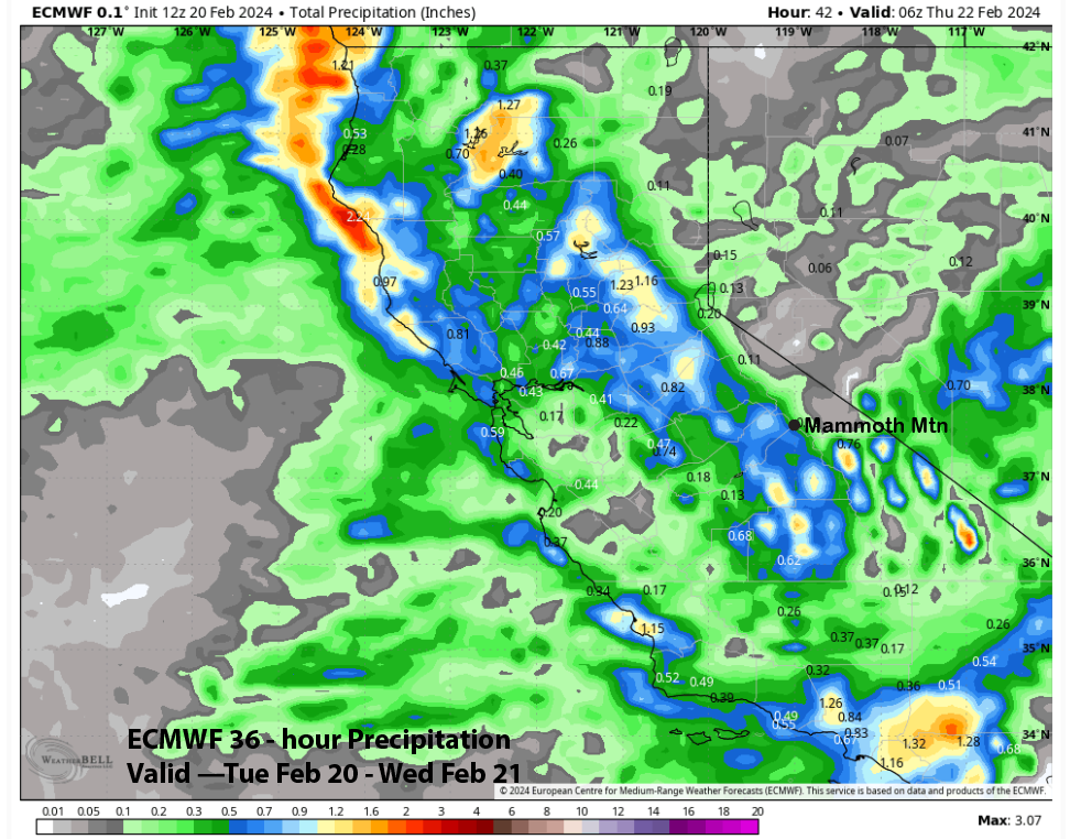
The forecast leans toward the ECM with about half an inch liquid or almost 6” of snowfall at Main by Wednesday AM. Only flurries or light snow showers are expected during the day with any lingering snowfall ending at dusk. Snow levels will be around 5000 feet. It should be a fun powder day on the hill.
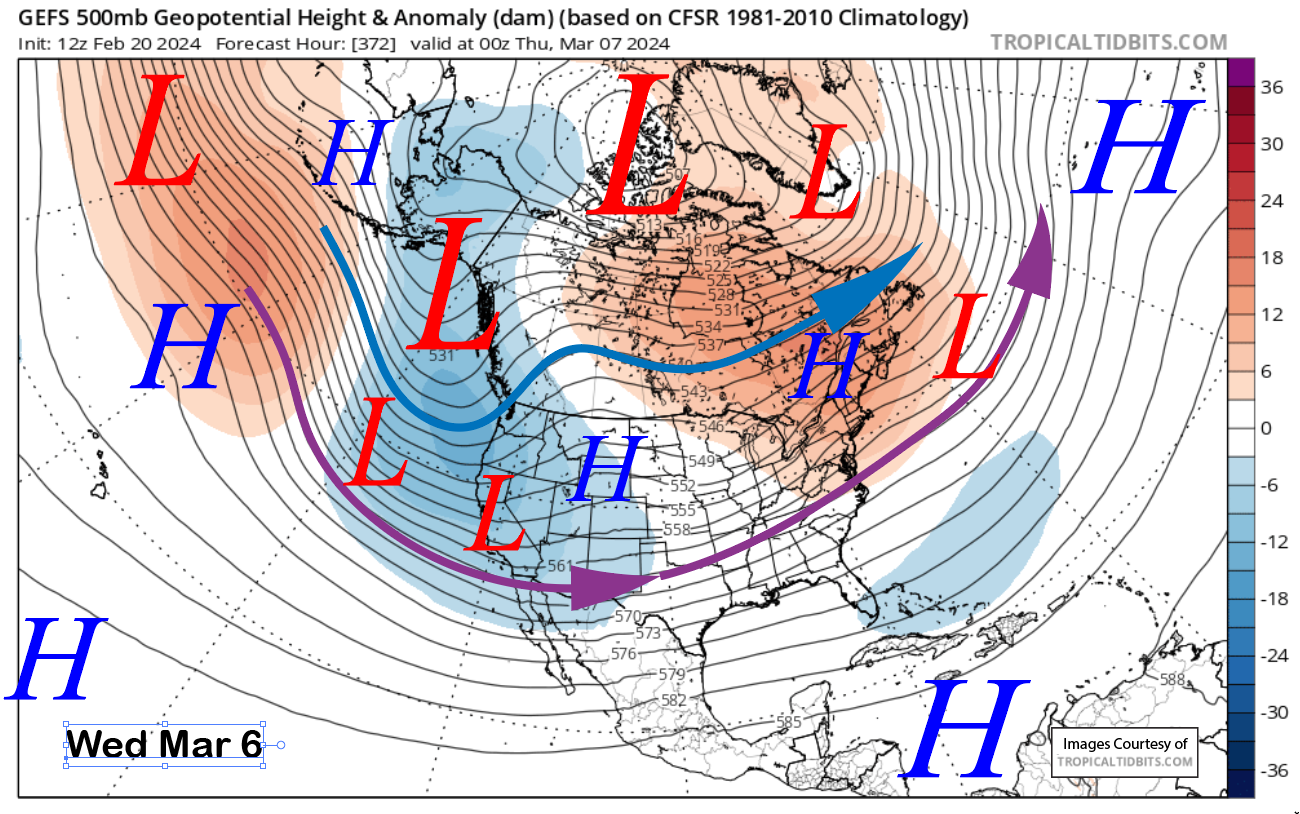
High pressure will build into the state in the wake of the passage of the storm Thursday and generally hold through Saturday (image below). Temperatures will generally remain seasonable and conditions should be great.
Long Range (Days 5+):
The longer-range guidance has solidified a bit and is a bit more bullish about storms returning as early as the last part of the month and more likely during early March. They are now also suggesting the unsettled pattern could last through the first week of March or longer.
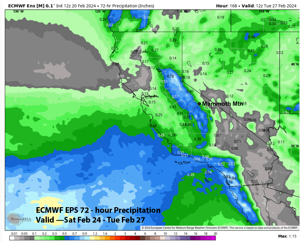
There is a chance for light snowfall as early as Sunday PM or Monday next week when an inside slider-type storm merges with a low-pressure system that will meander off the CA coast over the latter part of this week (image below). Model QPF per the ECM EPS only suggests light amounts (two images below) as it only shows about a third of an inch of liquid or about 3 inches of snowfall.
High pressure will then likely rebuild into the middle part of next week. The guidance is then favoring a deep trough to form along the West Coast by the end of the week (ECM below) but differs on the timing and strength.
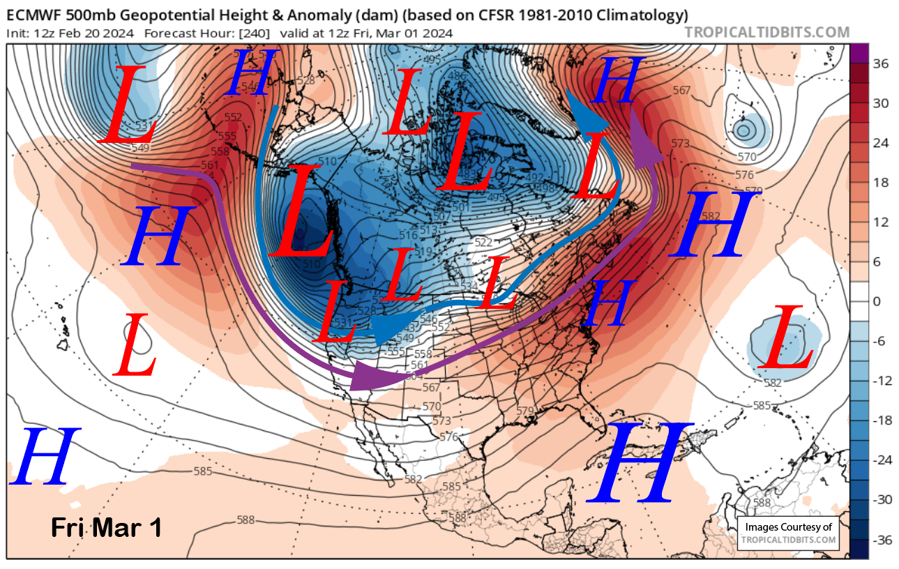
The ECM EPS (image below) is deeper and faster versus the GFS ensemble (two images below) and has snowfall arriving by the end of the week with a frontal passage. The latest 18z GFS holds off until Saturday.
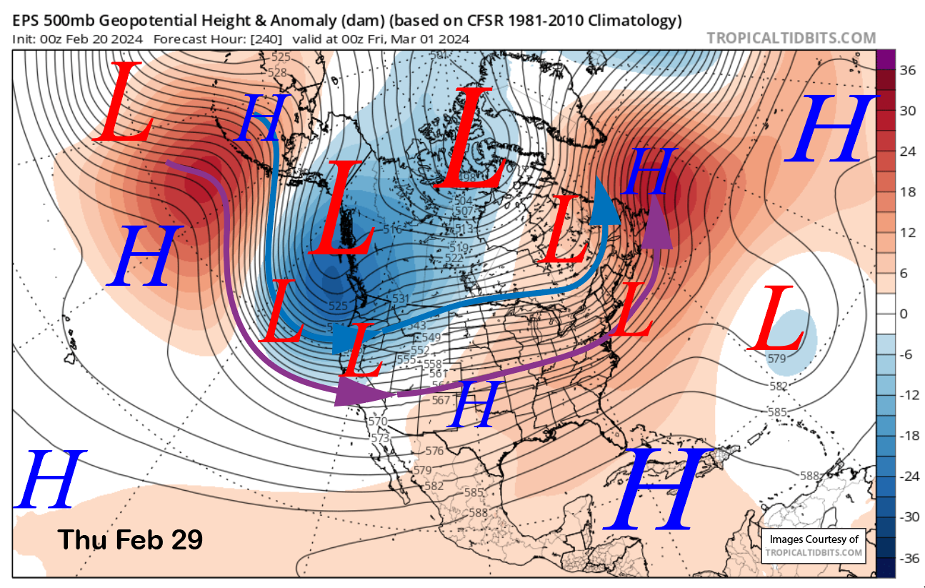
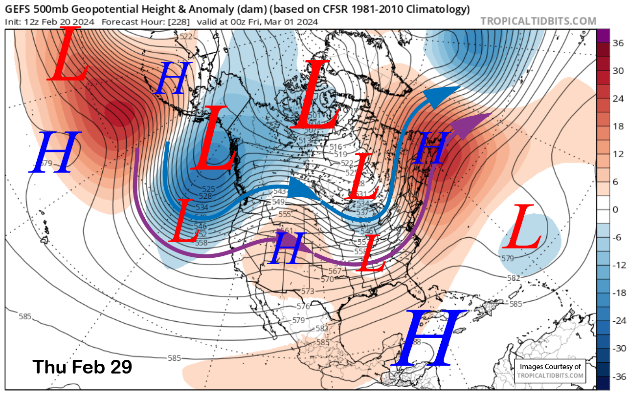
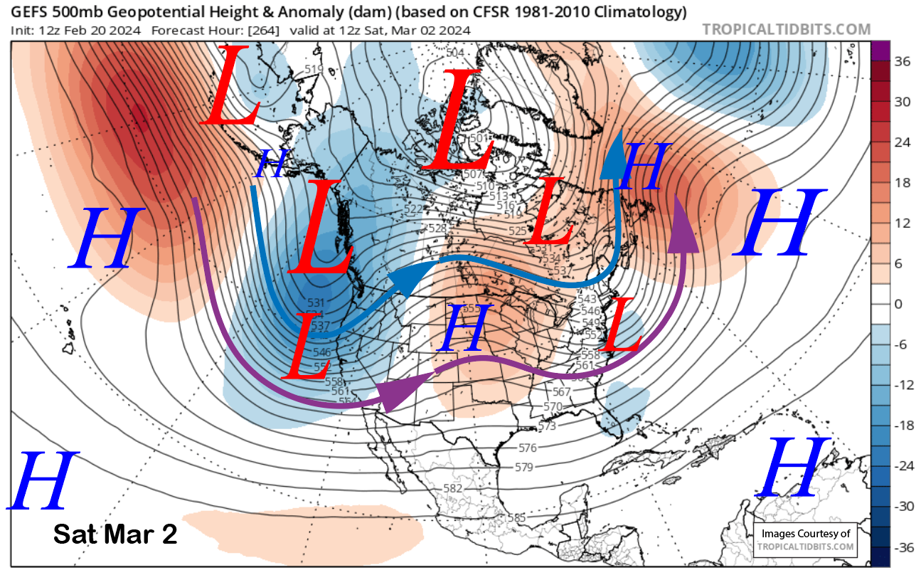
That may be a good bet as both ensemble systems show a deep trough along the West Coast and into CA by then (images below) with only slight differences. The GFS solution has a better over-water trajectory and would result in more snowfall, but that detail will likely change.
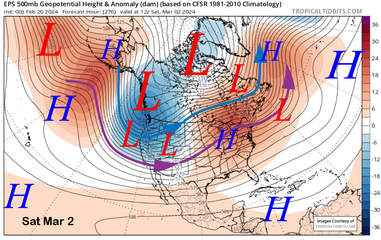
The ECM EPS QPF is showing almost two inches of liquid for the end of next week and through the weekend (image below). That could result in close to two feet of snowfall as these systems would be colder-type storms from the Gulf of Alaska and not from the central Pacific like the current event.
The fantasy range guidance keeps the longwave trough in place along the West Coast southward into CA through the first week of March (image below) or longer. That would result in continued storms at times and moderate to heavy snowfall.
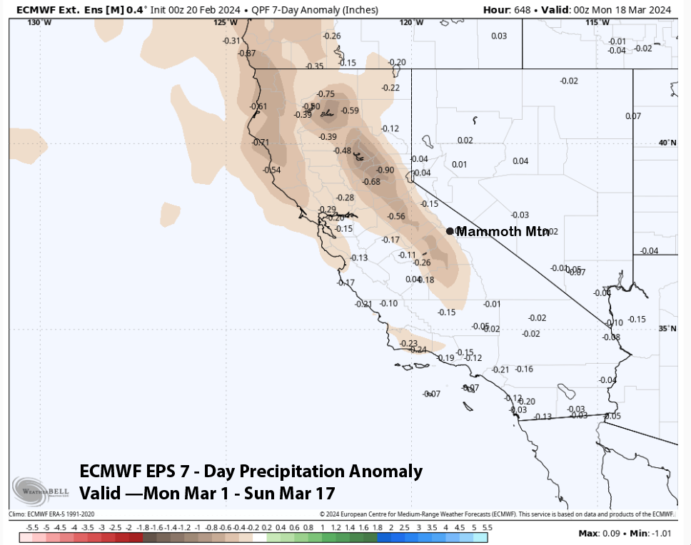
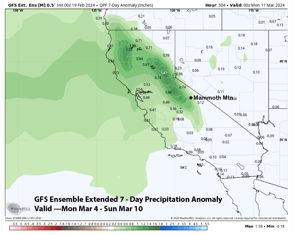
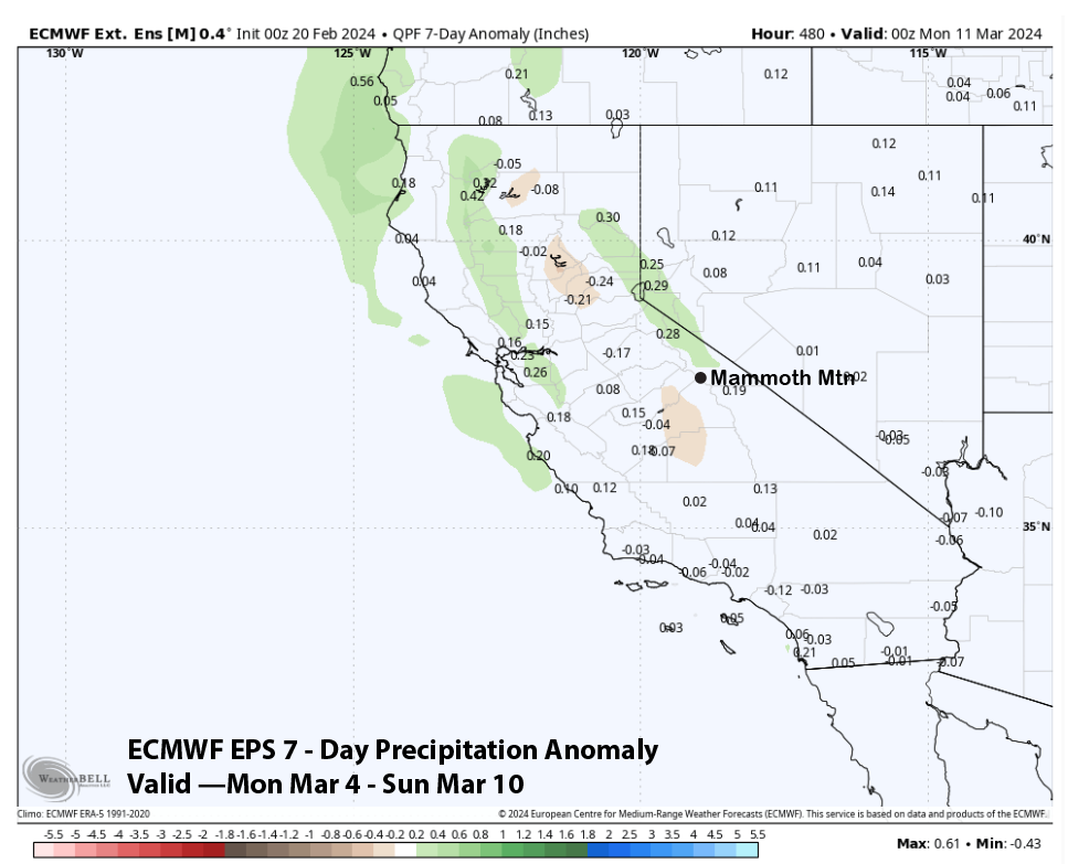
This is reflected in the GFS ensemble extended forecast of above-normal precipitation from March 4-10th (image below). The ECM EPS (two images below) is not quite as bullish but does show average precipitation that is around a foot for that climatological time period.
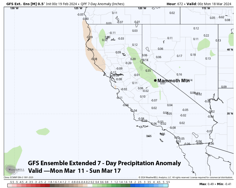
The GFS extended keeps it active through mid-March (image below) with average or slightly above normal precipitation while the ECM EPS returns dry weather (two images below). Regardless if the ECM is right, March does look like it will be off to a good start with potentially many powder and/or riders of the storm days. WG