Powder Forecast –Tuesday, January 2nd, 2024
Ted Schlaepfer CCM —- Mammoth Mountain WeatherGuy
Snowfall forecasts are valid at the Sesame snow course (Main Lodge) for the prior 24 hours, as reported in the 6-7 AM morning snow report.
**Snowfall forecast confidence ranges from very low (1) to very high (5)
Wed 1/3 = 8 – 11” (H20 = 0.75” – 1.00”)*4
Thu 1/4 = 0 – 1”
Fri 1/5 = 0”
Sat 1/6 = 0”
Sun 1/7 = 5 – 7”
Mon 1/8 = 0 – 1”
Tue 1/9 = 0”
Wed – Fri 1/10 – 1/12 = 2 – 6”
January Snowfall = 0”
January Forecast = 35 – 50”
Detailed 4-day Snowfall Forecast:
Wed 1/3 – Flurries or light snow showers are possible during the day, ending by evening. Little or no accumulation is expected.
Thu 1/4 through Sat 1/6 – No snowfall expected all days except for moderate snowfall developing Saturday overnight and into Sunday. Accumulations 4 – 7” by Sunday AM.
Forecast Summary:
Short Term (Days 1 – 4):
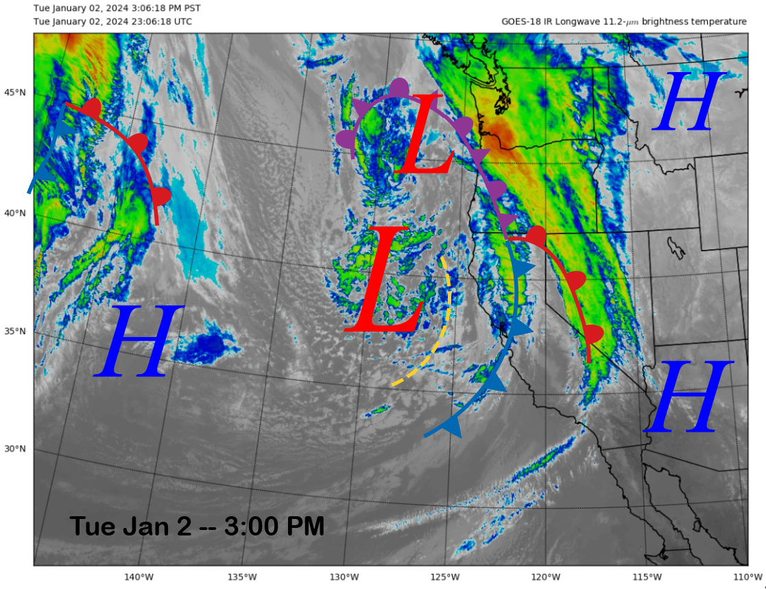
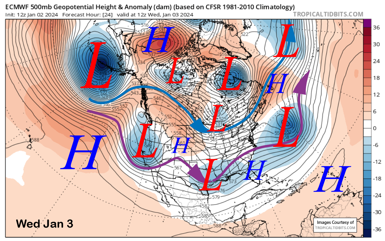
This afternoon, the current infrared satellite image (below) shows a weather system in the eastern Pacific moving into NorCal. The front associated with the upper-low that is currently well offshore will move into Mammoth tonight with a round of moderate to heavy snowfall. Unfortunately, it will only snow for about 9 hours before decreasing early tomorrow.
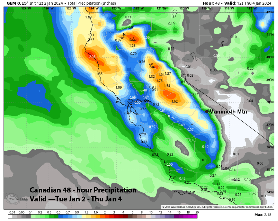
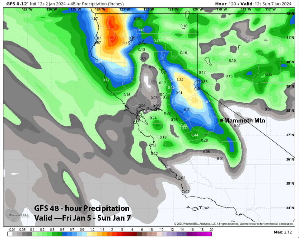
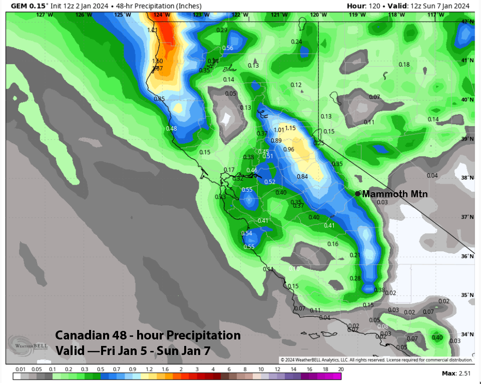
Quantitative Precipitation Forecast (QPF) from the model guidance is mostly in line for at least 6” of snowfall at the Main, with the upper end of the guidance suggesting maybe 10” and a foot up top. The ECM (image below) and GFS (two photos below) are forecasting around 0.75” with around an inch west of the crest. The Canadian is the driest at around 0.50” liquid (image below).
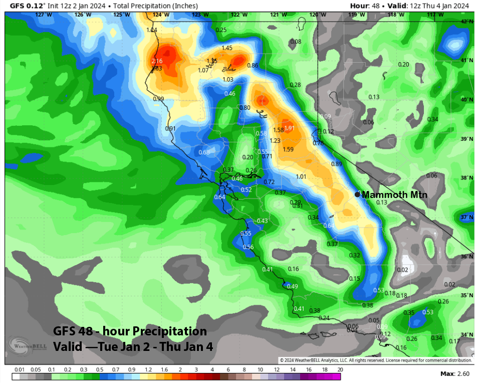
This is not a warm storm, with snow levels around 5000 feet tonight before lowering to around 4K when the snowfall ends; thus, snow ratios should be in the 10-12” range per inch of liquid water. Forecast is calling for 8-11” at Main and around 12”+ up top and enough for powder conditions where there is adequate base.
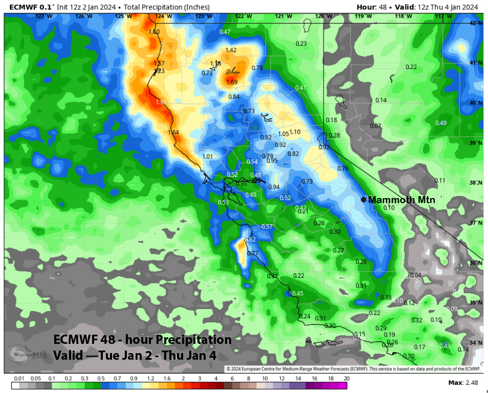
Snowfall ends around dawn tomorrow with the trough passage (image below), and only light snow showers or flurries are expected during the day before ending by Wednesday evening. Dry weather is then forecasted for Thursday through Saturday during the day, with clouds increasing Saturday afternoon/evening.
Long Range (Days 5+):
The longer-range guidance shows an active pattern into mid-month but, unfortunately, does not favor any significant storms. It looks like colder type storms that we want AFTER we have a deep base. Hopefully, the second half of the month will finally bring the first big (>2 feet at Main) storm of the season, but the unreliable guidance is not favoring it.
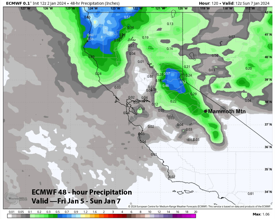
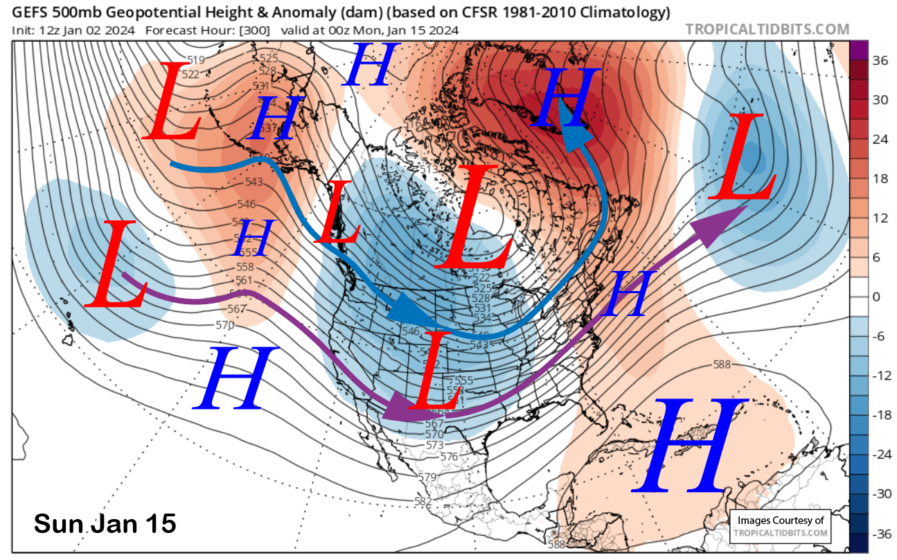
The next storm moves into Mammoth overnight on Saturday and into Sunday (image below), and it will be coming from the North so moisture availability will be limited. Most snowfall will be associated with orographically induced upslope flow with the cold-core jet (blue arrow) pushing cold air into the eastern Sierra Sunday PM and into Monday.

QPF from the models is generally light, with the models (images below) keeping liquid amounts under half an inch and about a third. The GFS and Canadian models are a bit farther westward with the storm’s passage and have more significant amounts west of the crest, but with a northwest-oriented jet, they may not make it to the east side. Snow ratios will probably be around 15”:1”; thus, a third of an inch of liquid could equate to almost 6” of fluffy snowfall.
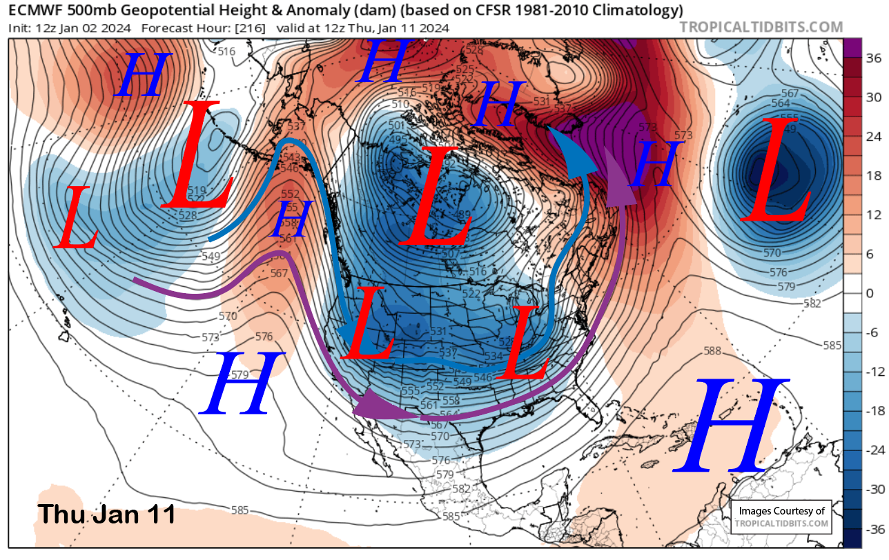
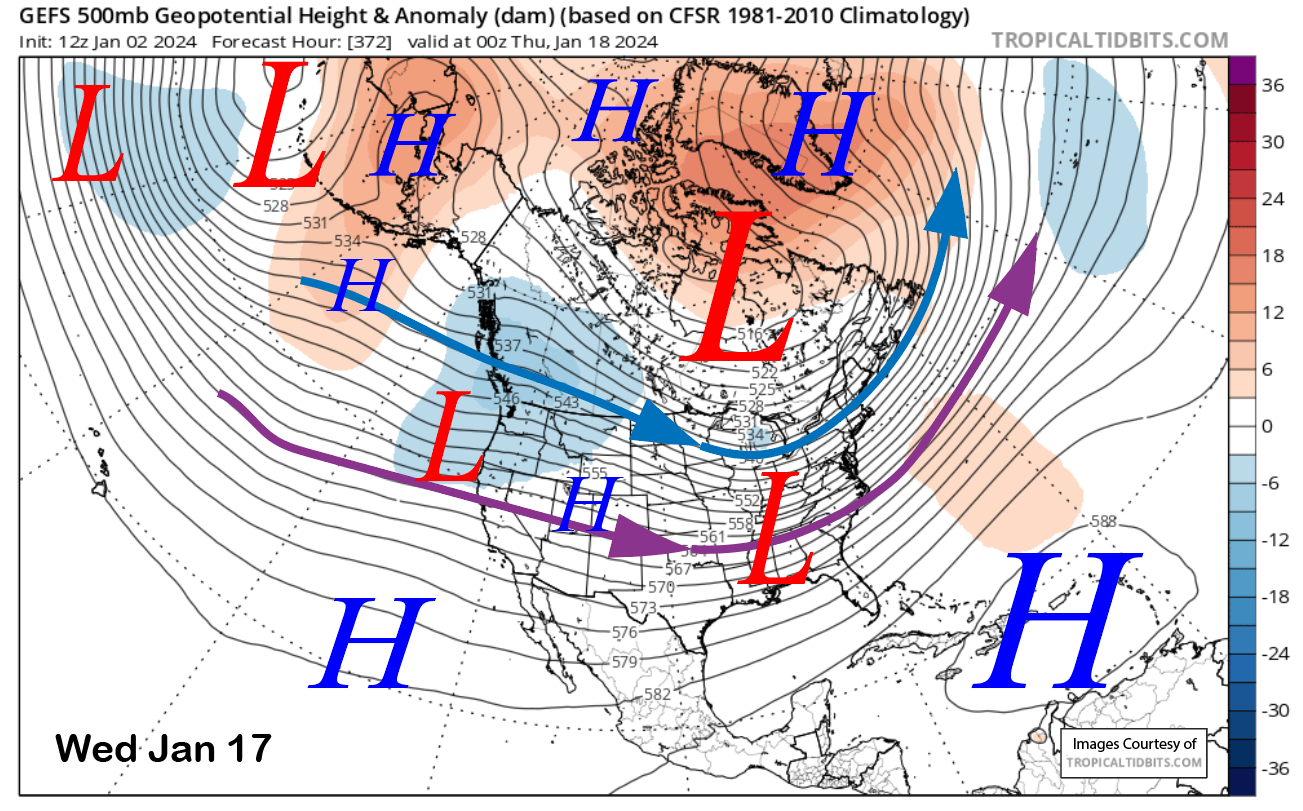
Dry northwest flow followed by weak ridging will return early next week with the guidance favoring the passage of another trough toward the middle or latter part of next week. The ECM (image below) forecasts a slider-type storm, while the GFS has a more over-water trajectory (two photos below).
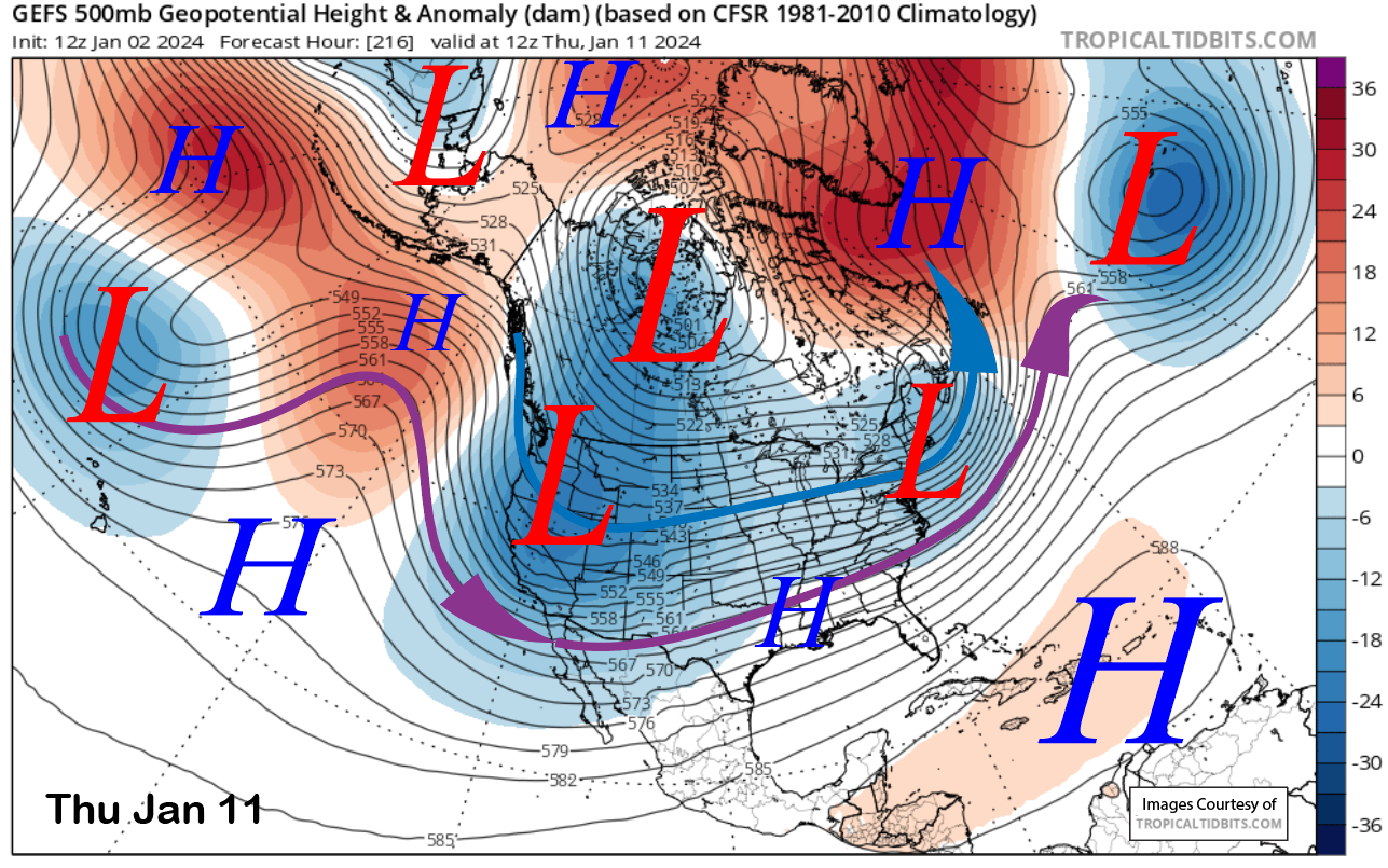
The GFS ensemble (image below) is a middle-ground forecast and generally favors a colder type of storm again with limited moisture availability, and the ECM EPS is consistent with the deterministic run. Unless the GFS is correct, it looks like light snowfall and colder temperatures. The current Forecast follows the ECM mean and only light amounts.
The longer-range fantasy guidance shows dry northwest flow (image below) into mid-month before flattening out the ridge and moving the jet back into CA just after mid-month (two photos below). That pattern could support another weak storm for Mammoth.
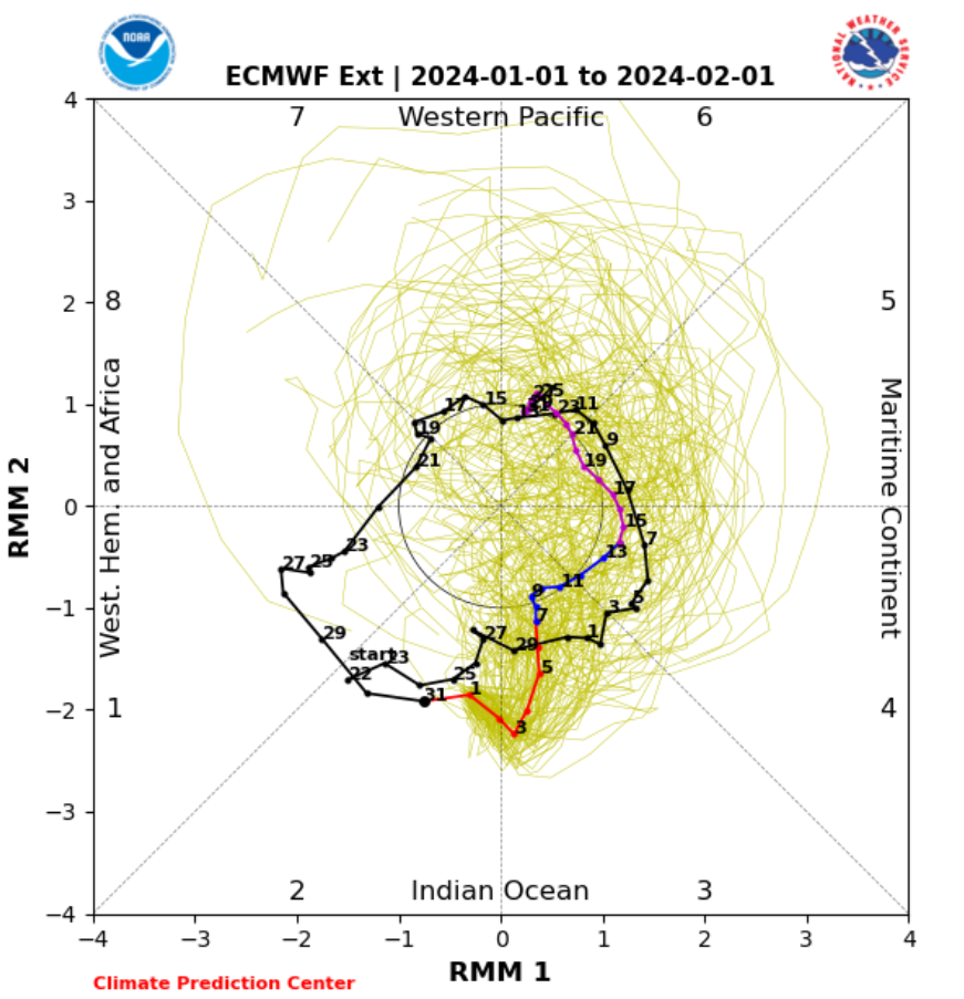
The dominant forcing for the jet stream teleconnection pattern through mid-month or longer is an ongoing MJO event. It is currently in phase 2 (image below) and is forecast by the models to weaken a bit while progressing eastward into the western Pacific (phase 6) by the end of the month.
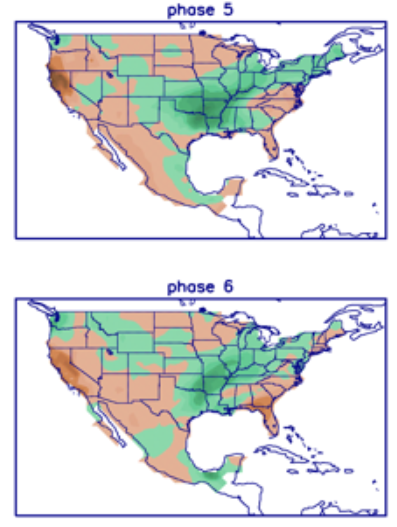
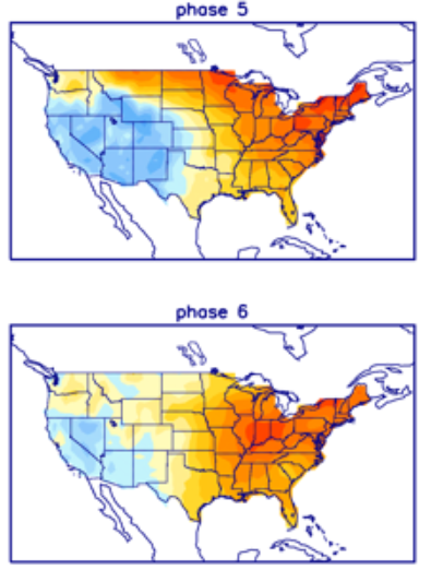
Phases 3 and 4 favor some storminess for Mammoth, while phases 5 and 6 are primarily dry, with phase 6 being the driest (image below). Phases 5 and 6 favor the cold pattern (two photos below) that the dynamical models currently forecast. Thus, the MJO suggests that the last part of January may remain dry after some continued chances into the third week of the month. This is not the pattern we want for building a base.
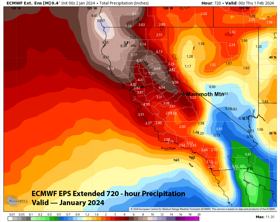
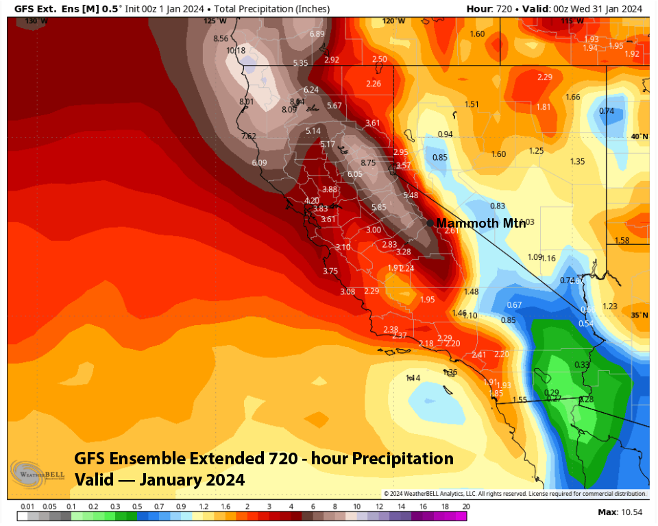
This is somewhat reflected in the super long-range Forecast from the ECM (image below) and GFS. The GFS is slightly wetter at around 5” liquid (two photos below), but both models are favoring another month of below-average precipitation and likely snowfall as well. With the MJO going into a dry phase during the last part of the month, there is no reason not to believe it. WG