Powder Forecast – Friday, December 1st, 2023
Ted Schlaepfer CCM —- Mammoth Mountain WeatherGuy
Snowfall forecasts are valid at the Sesame snow course (Main Lodge) for the prior 24 hours, as reported in the 6-7 AM morning snow report.
**Snowfall forecast confidence ranges from very low (1) to very high (5)
Sat 12/2 = 0”
Sun 12/3 = 0”
Mon 12/4 = 0”
Tue 12/5 = 0”
Wed 12/6 = 0
Thu 12/7 = 0 – 2”
Fri 12/8 = 1 – 2”
Sat – Mon 12/9 – 12/10 = 1 – 3”
December Snowfall = 1”
December Forecast = 40 – 60”
Detailed 4-day Snowfall Forecast:
Sat 12/2 through Tue 12/5 – No snowfall expected all days.
Forecast Summary:
Short Term (Days 1 – 4):
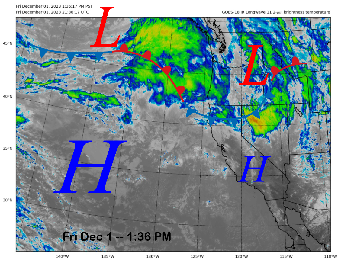
This afternoon, the current infrared satellite image shows a weather system positioned in the Interior West and a front moving through far NorCal. Another weather system off the PacNW coast will move inland tomorrow, with the front staying well north of Mammoth.
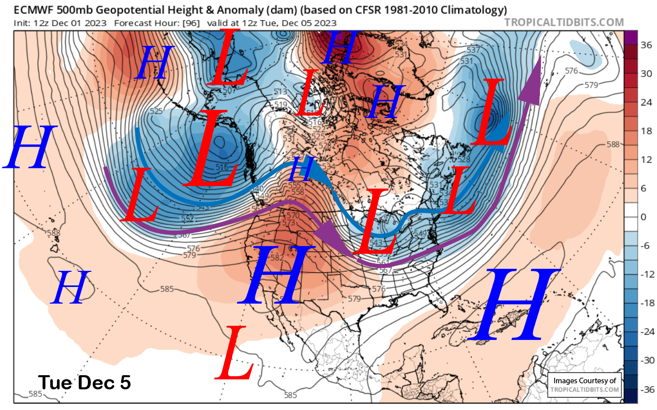
For Mammoth, it will just be passing clouds at times through the weekend and into early next week. The models strengthen the high-pressure ridge over eastern CA by next Tuesday (image below) for continued dry weather and warmer temps. Under the warmer weather, snowmaking may become limited in the early/middle of next week.
Long Range (Days 5+):
The longer-range guidance has not changed much through next week, with only a chance for a weak storm and generally dry weather. However, there are glimmers of hope in the fantasy range for an opportunity for the first good snowfall pattern for the Sierra.
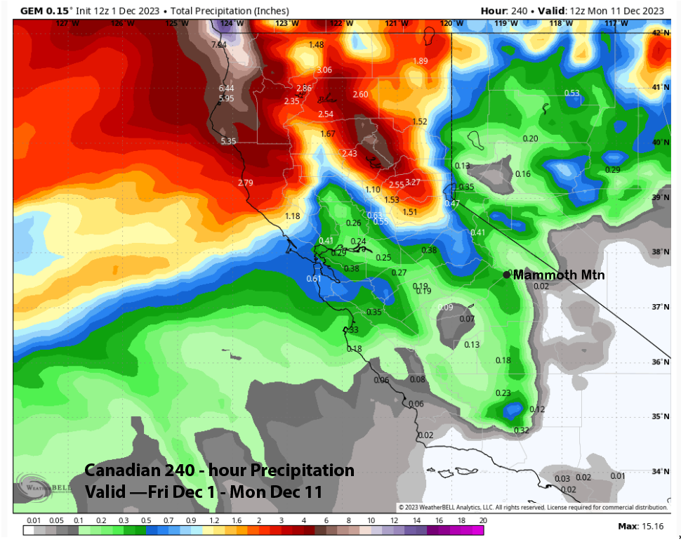
The models are in agreement about a trough passage toward the end of next week (ECM below) but are not predicting big amounts. The Canadian model (two images below) is similar to the ECM model, while the GFS model (three images below) is the weakest at the 500-mb level.
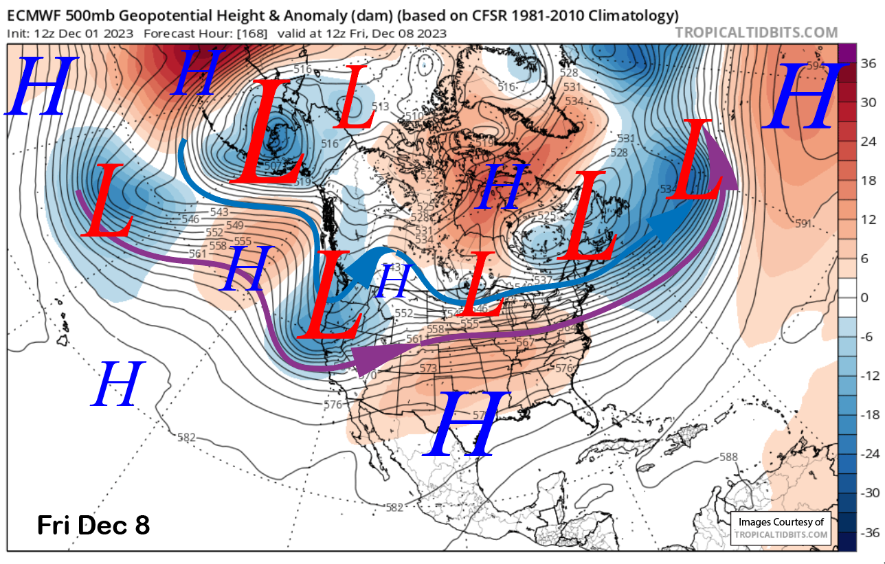
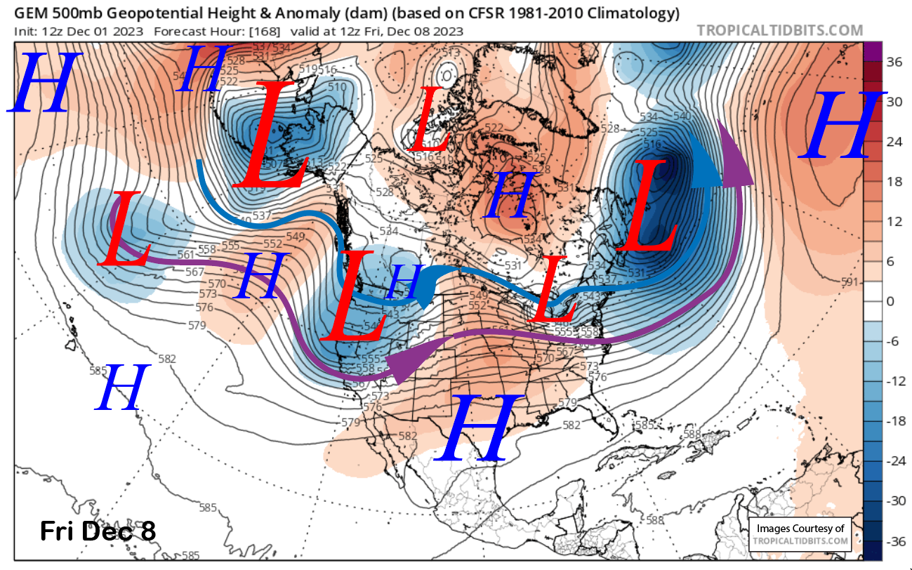
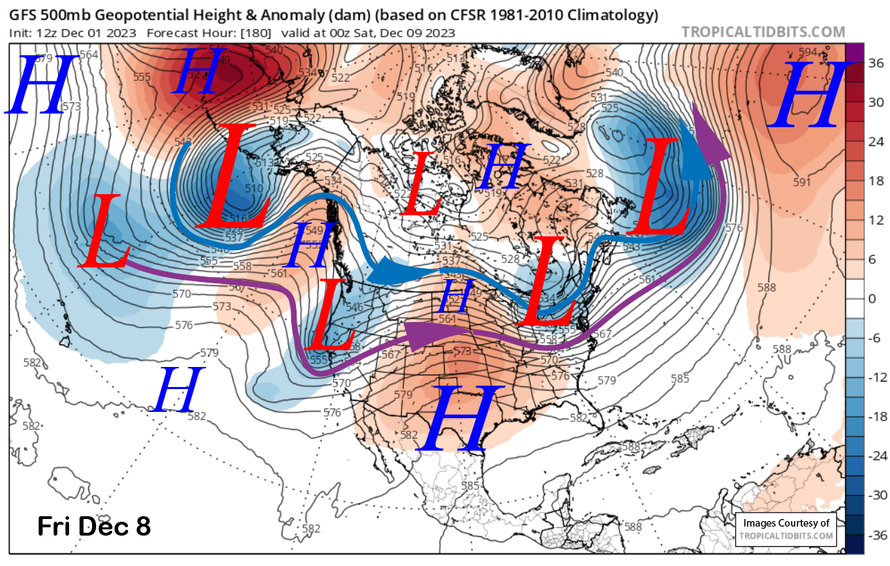
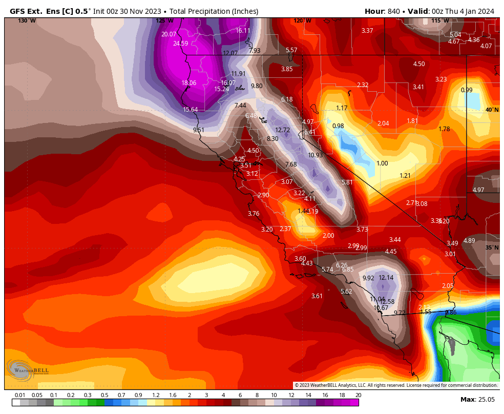
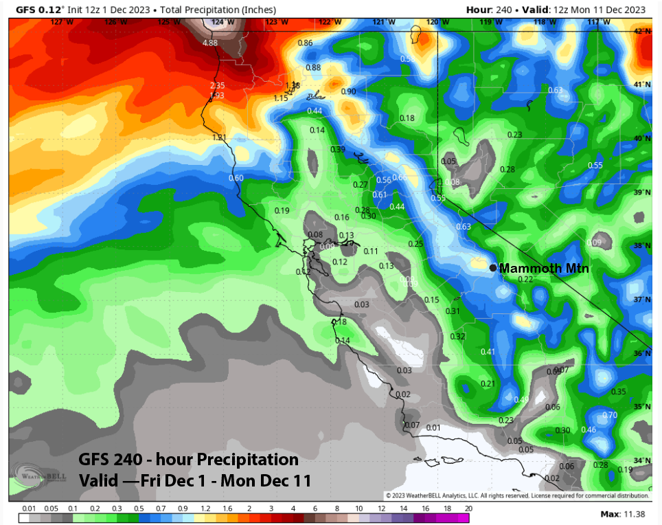
Interestingly, the GFS model is actually the wettest for the 10-day period (image below). In contrast, the Canadian (two images below) is the driest, and the ECM (three images below) is in between the two. The current forecast does not favor big amounts and follows the ECM, which shows only a few inches of snow.
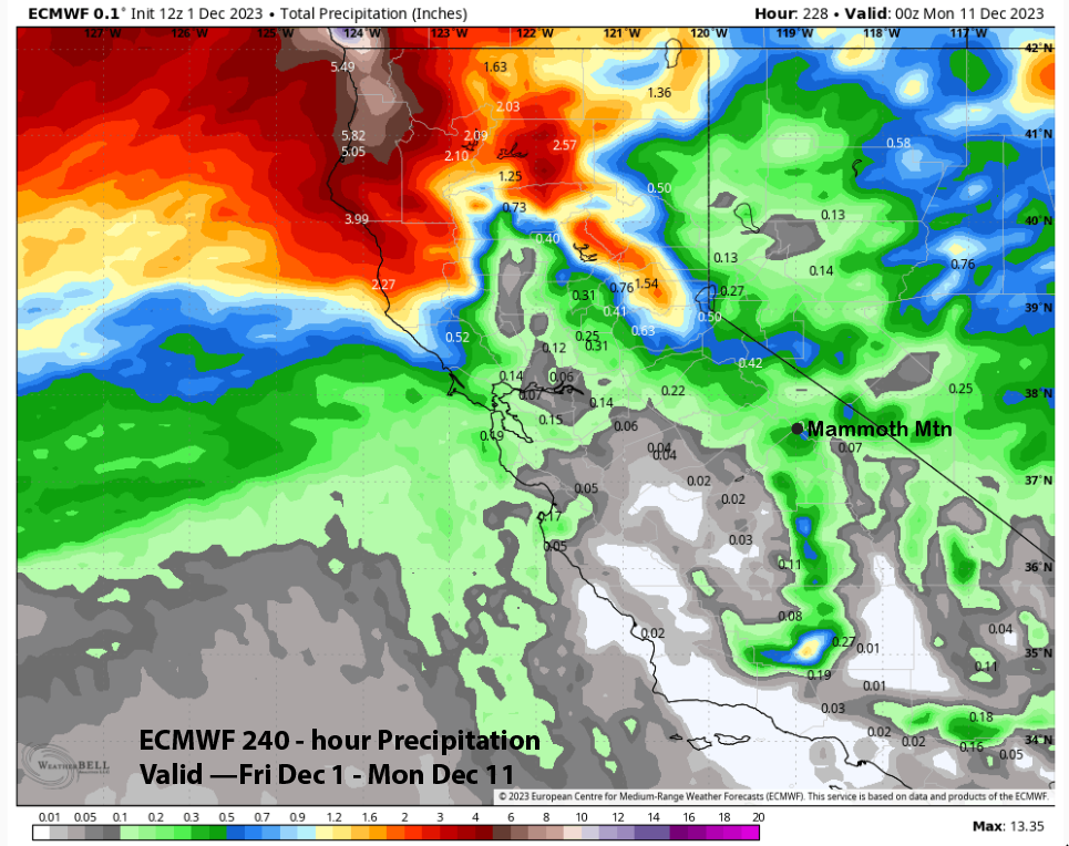
If the ECM is correct, that low may cut off over the Southwest for a couple of days with a chance for wrap-around snowfall. It is too far out to believe that a solution with the general idea of weak ridge favored instead for more dry weather and seasonable temps.
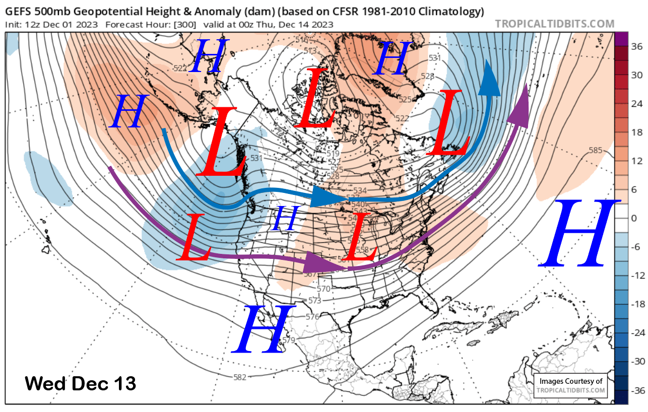
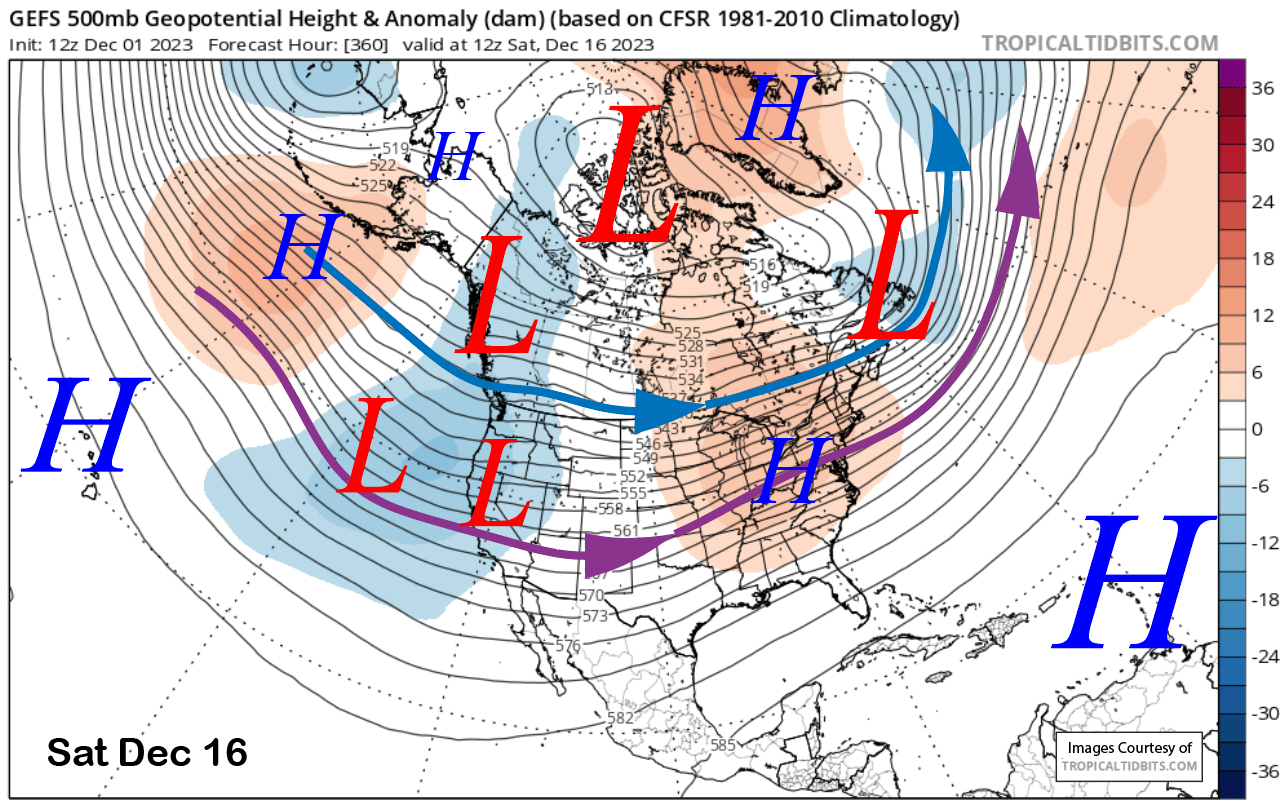
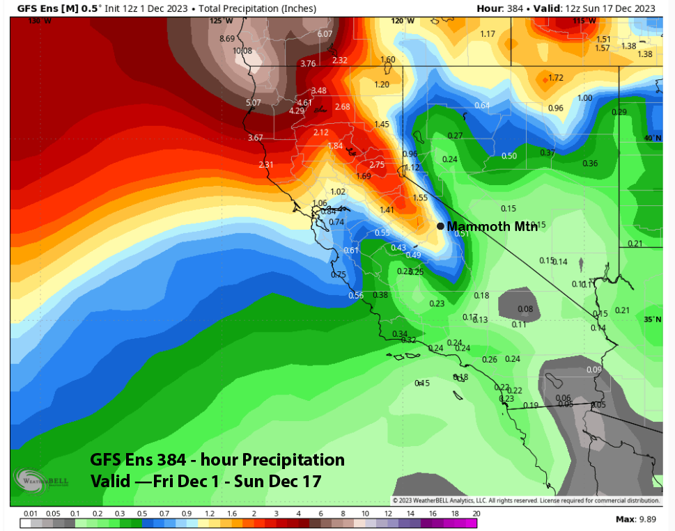
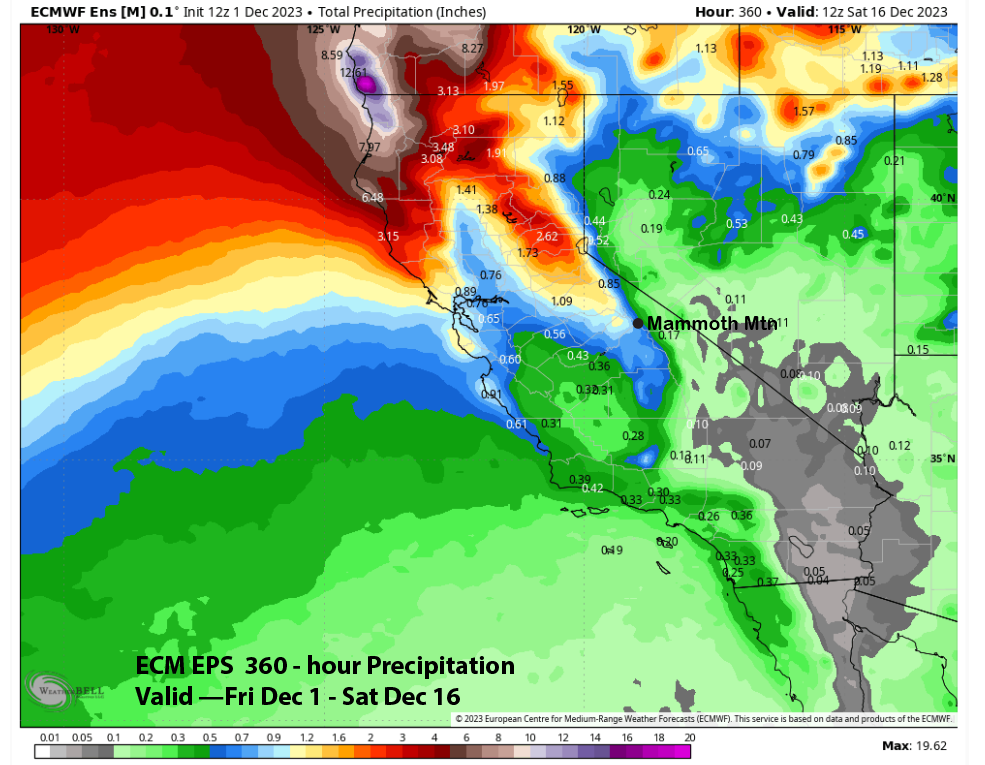
The super long-range guidance shows some hope, with the GFS ensemble developing a trough and weak zonal flow into CA around mid-month (images below). The current projection of the southern branch of the jet stream (purple arrow) would be far enough southward for storms to reach Mammoth. The ECM EPS also develops a trough, but not as deep or with the zonal flow as the GFS.
That difference is reflected in the QPF output from the ensemble means of both models, with the GFS (image below) showing over an inch of liquid but the ECM EPS showing about half that amount (two photos below). Nothing huge. But anything would help at this point.
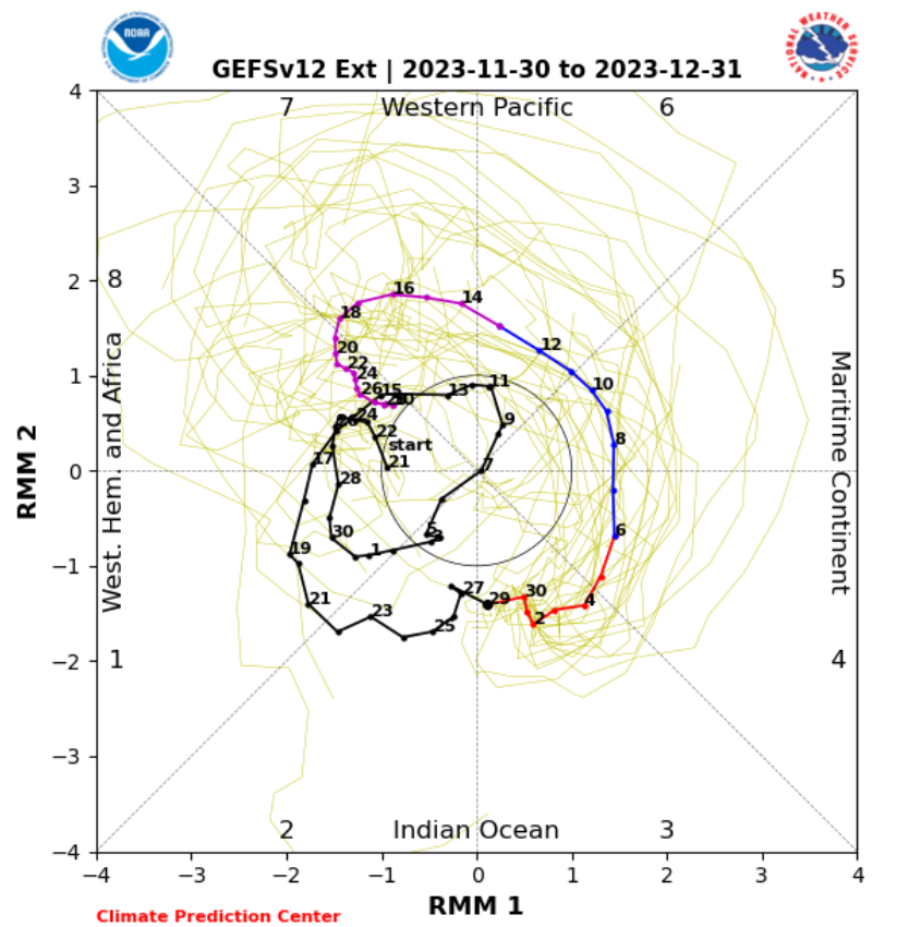
There may be a good reason to believe the wetter GFS solution, as the MJO (image below), is currently active and moving eastward from its current position in the Indian Ocean back into the Western Pacific by mid-month. Phase 7, or the Western Pacific during mid-December, is a wet phase for CA and Mammoth.
Maybe that is what the last control run of the GEFS ENS Control 800-hour forecast is picking up on. It has significantly bumped up the QPF since the last post and now shows double-digit liquid amounts for Mammoth during December (image below). Fingers crossed. WG