Powder Forecast – Tuesday, February 27th, 2024
Ted Schlaepfer CCM —- Mammoth Mountain WeatherGuy
Snowfall forecasts are valid at the Sesame snow course (Main Lodge) for the prior 24 hours as reported in the 6-7 AM morning snow report.
**Snowfall forecast confidence ranges from very low (1) to very high (5)
Wed 2/28 = 0”
Thu 2/29 = 0”
Fri 3/1 = 4 – 6” (H20 = 0.40” – 0.60”)**3
Sat 3/2 = 25 – 30” (H20 = 2.50” – 3.00”)**3
Sun 3/3 = 18 – 22” (H20 = 1.40” – 1.70”)**3
Mon 3/4 = 2 – 6”
Tue 3/5 = 0 – 3”
Wed – Fri 3/6 – 3/8 = 6 – 18”
February Snowfall: 133”
February Forecast = 133”
Detailed 4-day Snowfall Forecast:
Wed 2/28– No snowfall expected.
Thu 2/29 – Light snowfall probably develops during the afternoon and continues overnight. Accumulations 4 – 6” at Main by Friday AM, 6”+ up top
Fri 3/1– Light to moderate snowfall continues during the morning, increasing in intensity during the afternoon, before becoming heavy overnight and into early Saturday. Accumulations 25 – 30” at Main by Saturday AM, 36”+ up top
Sat 3/2– Heavy snowfall during the morning decreases in intensity around midday before becoming heavy again Saturday night, tapering near dawn. Very windy. Accumulations 18 – 22” at Main by Sunday AM, 28”+ up top
Forecast Summary:
Short Term (Days 1 – 4):
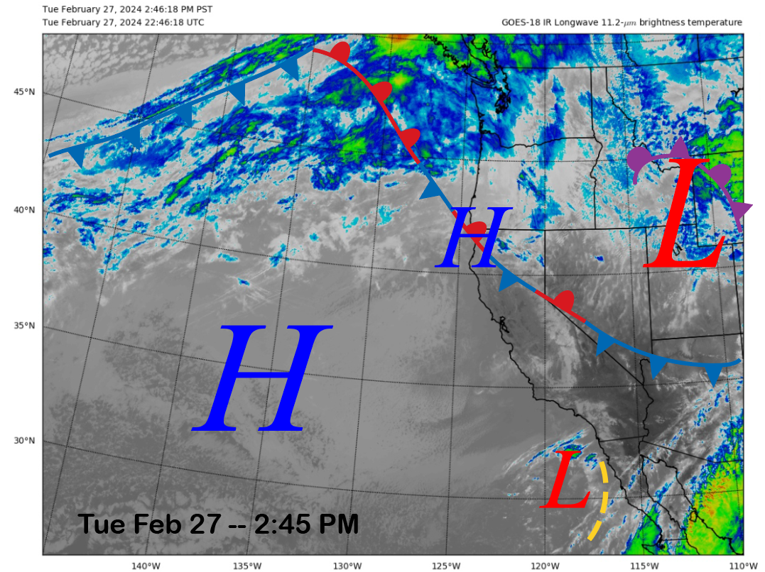
The current infrared satellite image (below) today shows generally clear skies as a short-wave ridge of high pressure is building into the state after the passage of the weak front yesterday and last night. High pressure will generally hold through tomorrow before the storm system just entering the satellite picture of the PacNW coast moves southward later this week.
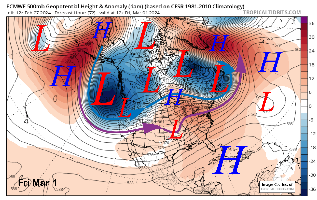
The latest 12z run of the ECM model moves a very deep upper-level trough southward from the Gulf of Alaska into the West Coast on Thursday and into Friday (image below). It will be a powerful storm and one that can be characterized as a classic Sierra snowstorm.
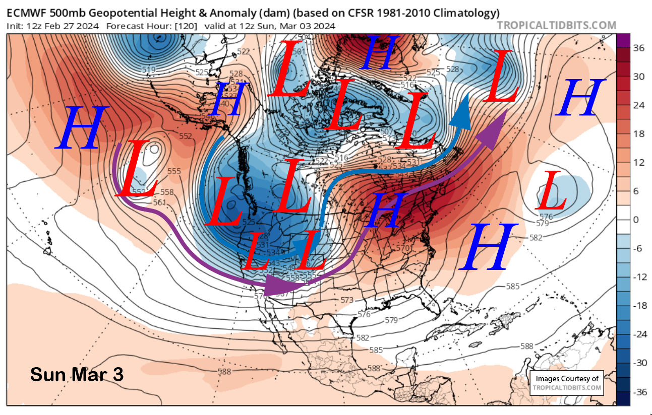
The models then move the parent upper-low into CA on Saturday (image below) with a strong polar (blue arrow) and southern branch (purple arrow) of the jet stream aimed directly into the Sierra.
This will drive a strong front southward through the range and produce strong winds that will cause orographic enhancement of the snowfall in addition to good spillover into the eastern side.
The ECM model then drives the last short wave through the range on early Sunday (two images below) and lifts the jet stream northward during the day. This storm is fairly similar to one that occurred about a year ago on Feb 27-28th that dropped almost four feet at Main.

Snowfall should start on Thursday but remain mostly light until Friday when snowfall intensifies during the afternoon and primarily overnight. That is when heavy snowfall and blizzard conditions are expected that should continue for most of Saturday, especially the morning. Snowfall will then likely become heavy again later Saturday and Saturday night before decreasing into Sunday.
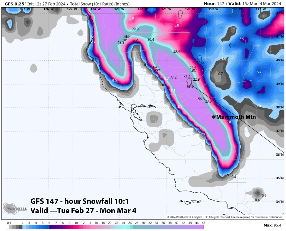
QPF from the models varies a bit with the GFS model again the wettest at almost 6” liquid for the event (image below). It produces over 5 feet of snowfall at Main and lots of snowfall in the Sierra foothills as well (two images below) as snow levels will drop to low levels by Saturday and Sunday.
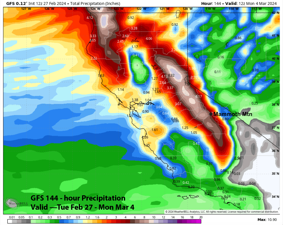
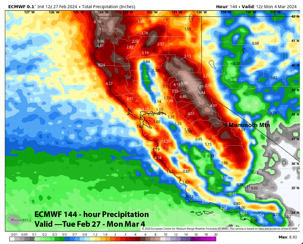
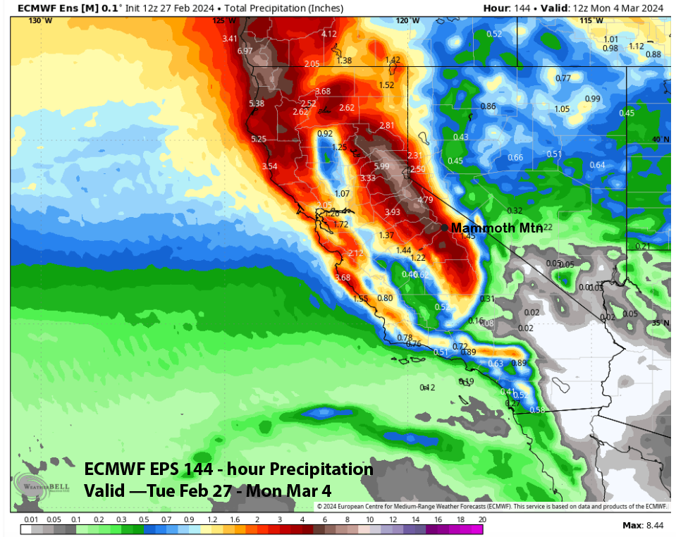
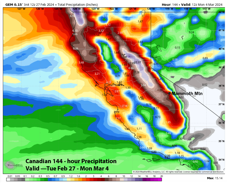
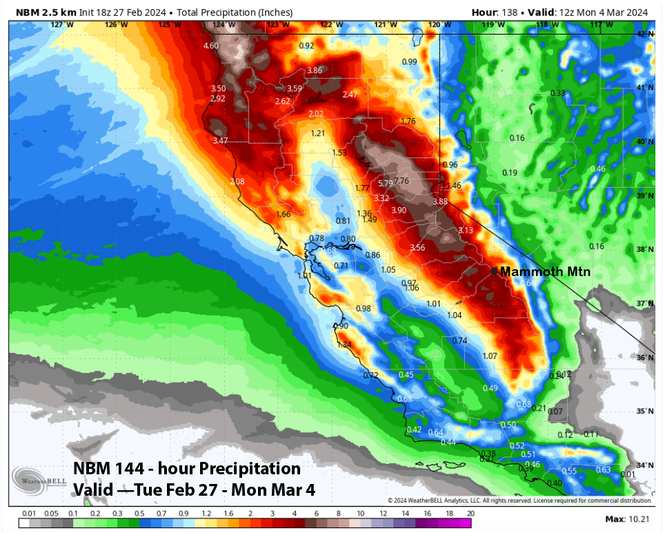
The ECM model (image below) is fairly close to the ECM mean (two images below) at around 4.5”. The Canadian model is the driest (three images below) at around 3” liquid, but does have 7” west of the crest. The NBM is similar to the ECM at 4”+ liquid (four images below). Thus, all the guidance suggests at least three feet of snowfall at Main and likely closer to four feet.
Snow levels with the storm will start around 6000 feet Thursday before lowering to around 5000 feet when the heavier snowfall starts on Friday night. Snow levels will then lower to around 3000 feet Saturday before lowering to nearly 2000 feet early Sunday. Thus, the snowfall won’t start super fluffy but should end that way by Saturday night and Sunday.
The forecast follows a blend of the ECM/EPS and GFS models with about 5” liquid for the event into Sunday. Thus, about 4 feet or slightly more is possible at Main and probably 5-6 feet up top and in the powder fields. Winds will pick up Thursday and generally remain strong through Friday. Winds look to peak on Saturday when most, if not all, of the resort, may be closed due to weather. Deep powder days are forecast for Sunday and next Monday.
Long Range (Days 5+):
The longer-range guidance has generally done well lately, having predicted the past two wet weather patterns about 10 days or more in advance. And that same guidance is suggesting that the snowy pattern may continue at times into mid-March now, although it is not forecasting any major storms at this point.
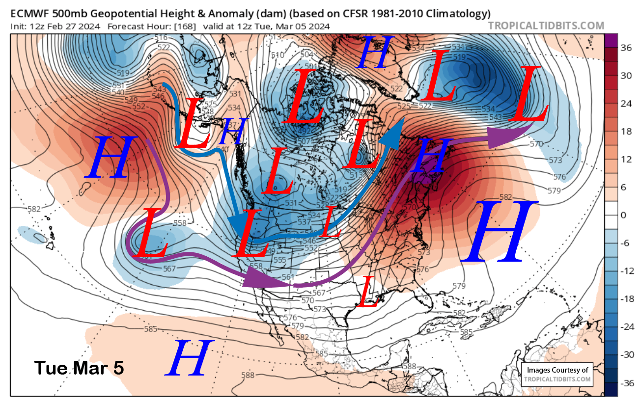
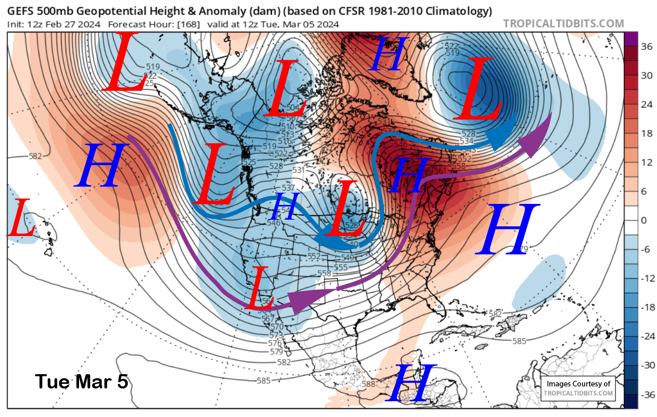
The guidance is divided about the pattern for early next week. The ECM drives another short wave southward into CA around Tuesday next week (image below) while the GFS ensemble has a split flow and a weak ridge over central CA (two images below). The Canadian model is more similar to the GFS. So it is still questionable whether there will be a storm around then.
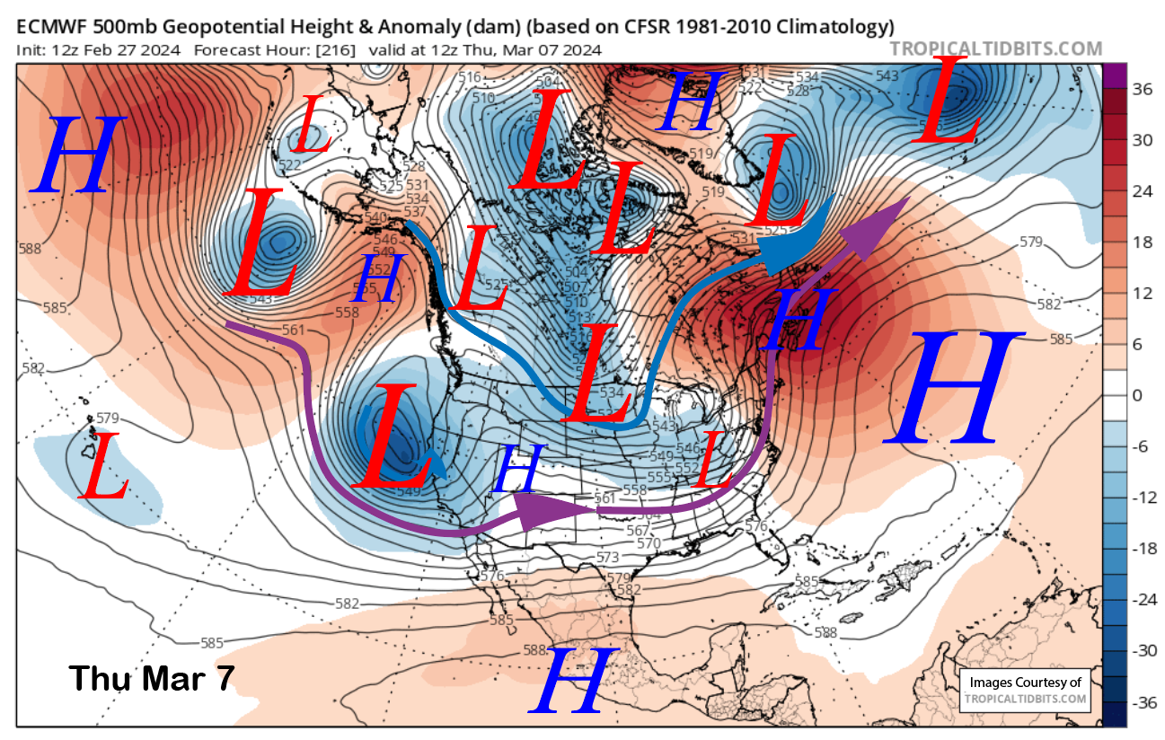
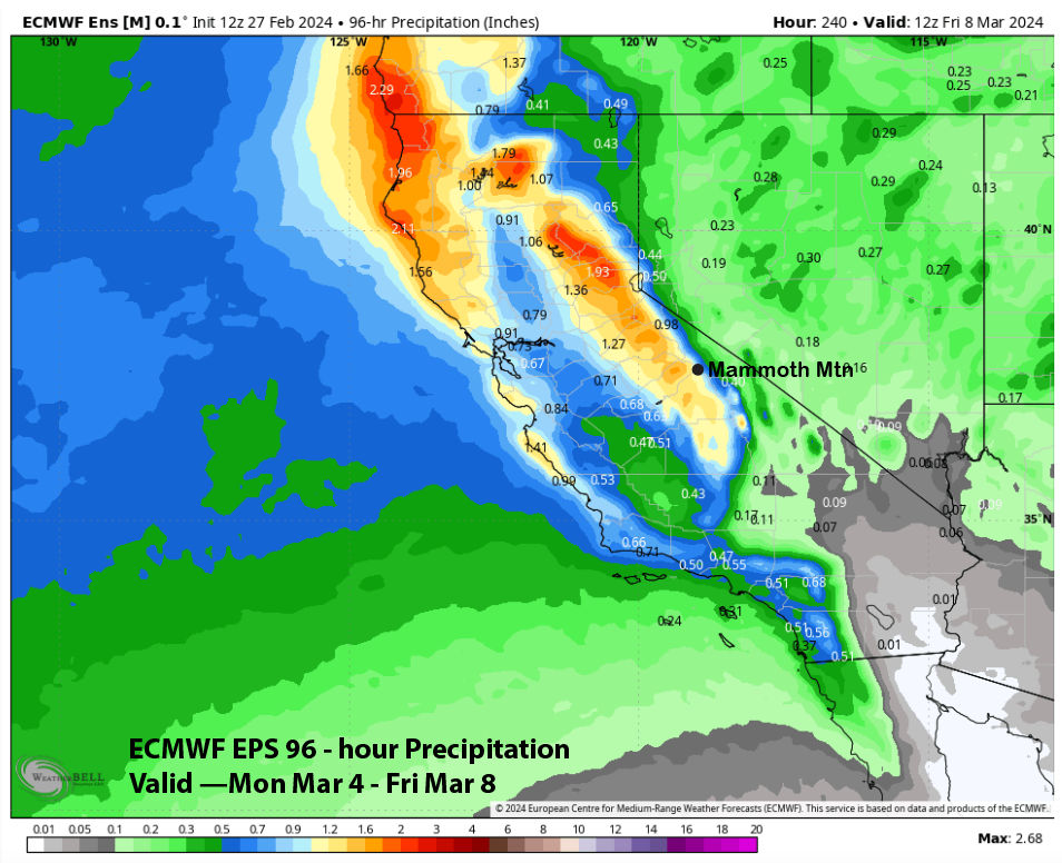
The guidance is in better agreement about a storm toward the end of next week (image below) with all the models showing an upper-level trough moving into the state. It doesn’t look super big, but certainly enough for powder with the ECM EPS (two images below) showing over 1.5” liquid or a foot. So more powder turns are possible around the middle and latter part of next week.
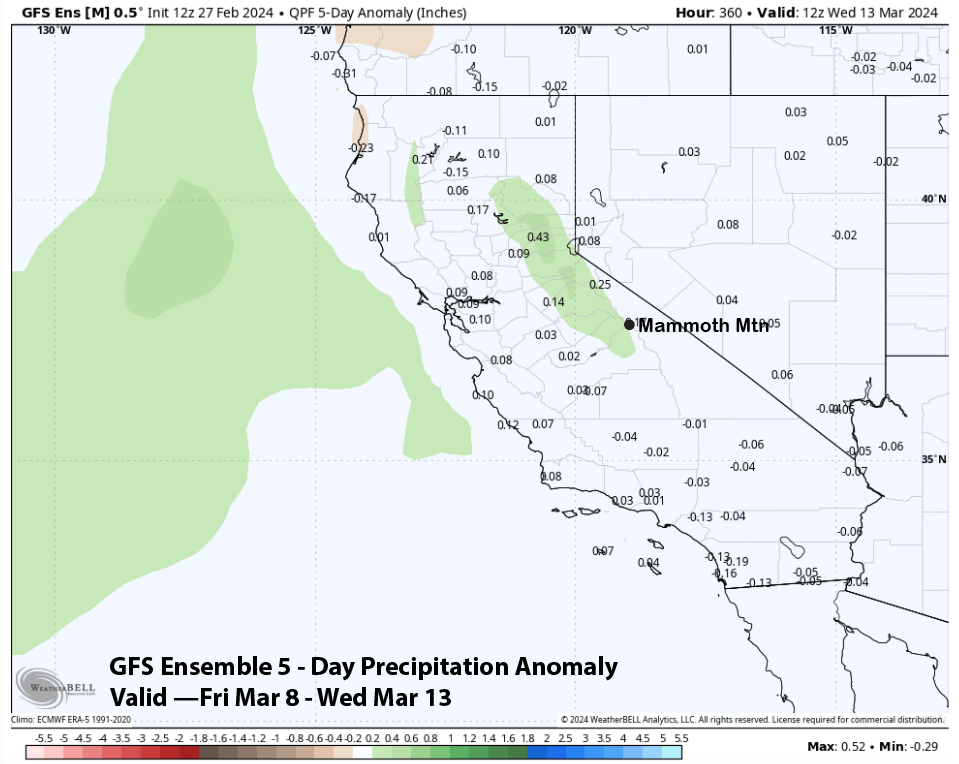
There could be a break, then the GFS ensemble reforms the longwave trough into CA heading into mid-month (image below). That model is showing slightly above normal precipitation for the 11-15 day period. The ECM EPS is only slightly drier (two images below).
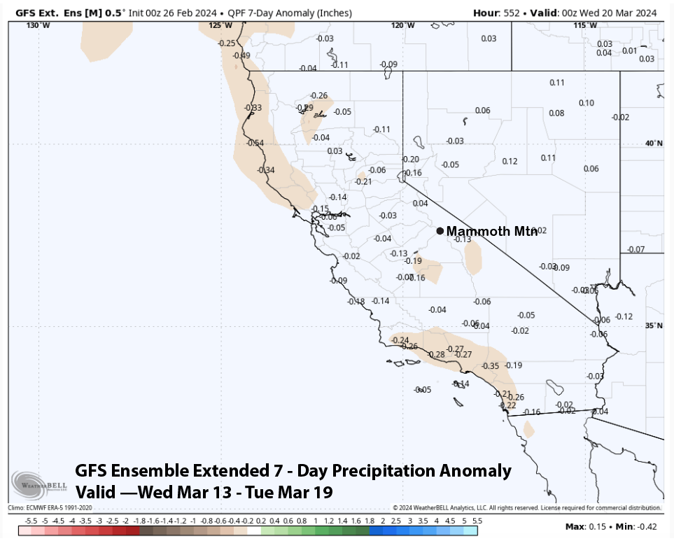
The fantasy range guidance seems to be trying to bring back drier weather over the following week with the ECM (image below) slightly drier than the GFS (two images below). But neither model is completely dry and still suggests at least some weak storms. March is looking good for lots of powder. WG