Powder Forecast – Friday, January 26th, 2024
Ted Schlaepfer CCM —- Mammoth Mountain WeatherGuy
Snowfall forecasts are valid at the Sesame snow course (Main Lodge) for the prior 24 hours, as reported in the 6-7 AM morning snow report.
**Snowfall forecast confidence ranges from very low (1) to very high (5)
Sat 1/27 = 0”
Sun 1/28 = 0”
Mon 1/29 = 0”
Tue 1/30 = 0”
Wed 1/31 = 0”
Thu 2/1 = 8 – 12”
Fri 2/2 = 6 – 9”
Sat – Mon 2/3 – 2/5 = 5 – 10”
January Snowfall = 72”
January Forecast = 72”
Detailed 4-day Snowfall Forecast:
Sat 1/27 through Tue 1/30 – No snowfall expected all days.
Forecast Summary:
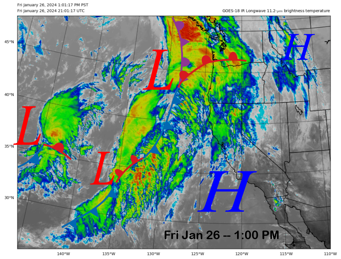
Short Term (Days 1 – 4): This afternoon, the current infrared satellite image (below) shows that a dirty ridge of high pressure has built into the state with lots of passing high cloudiness. A weather system well off the SoCal coast will ride northward over the ridge tomorrow, and continued clouds at times can be expected at Mammoth, but there will be no precipitation.
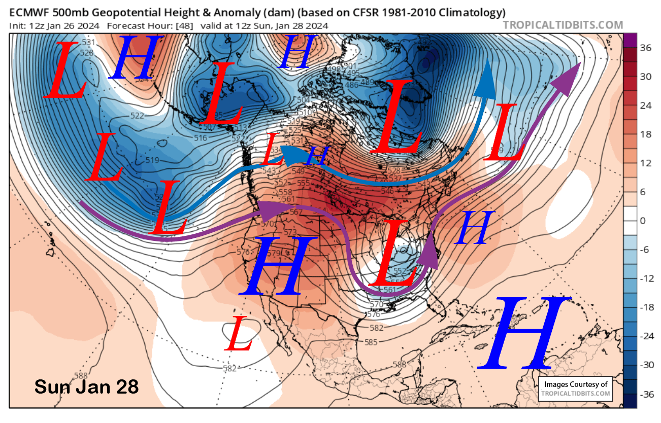
The ridge of high pressure strengthens on Sunday (image below) and into early next week for continued dry weather. It will also be strong enough for seasonably mild temperatures on the mountain as freezing levels will get above 11,000 feet. Even in January, often that leads to spring conditions on the sun-exposed Chair 9 areas by midday and other areas lower down on the mountain as temps may rise into the low/middle 50s at Canyon/Eagle lodges.
Long Range (Days 5+):
The longer-range guidance is now bullish about a storm period for the first week of February or possibly slightly longer. It looks like base-type snow to start, followed by cold/dry powder afterward. Drier weather is still favored heading into mid-month.
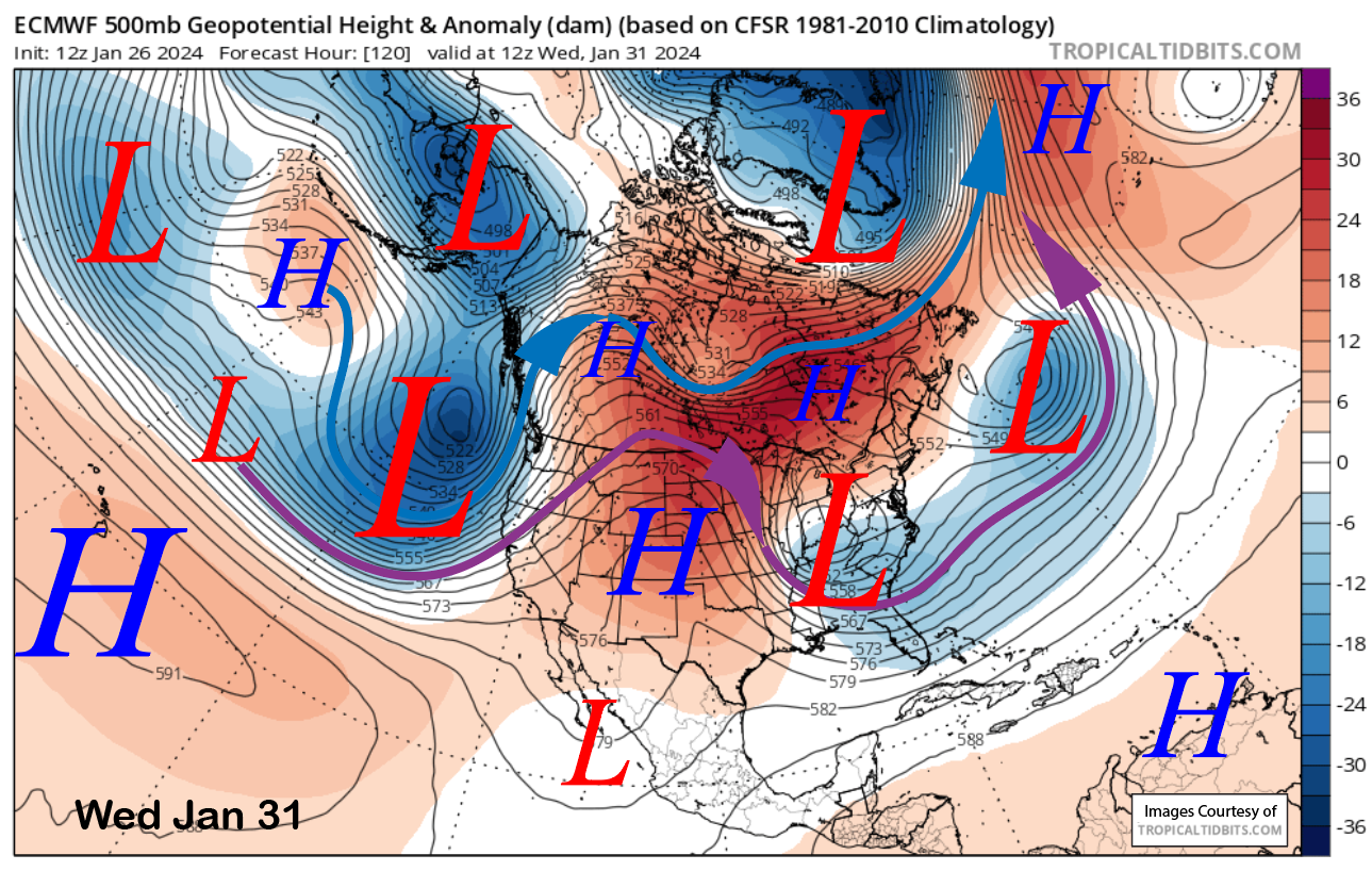
The models are still not in agreement with the details for next week, which is not surprising out 5-7 days. The ECM (images below) and Canadian models are the strongest with the incoming storm, with the ECM showing a strong polar and southern branch of the jet stream moving into the state on Wednesday and then southward by Thursday. It keeps the deep upper-level trough in place through next Friday.
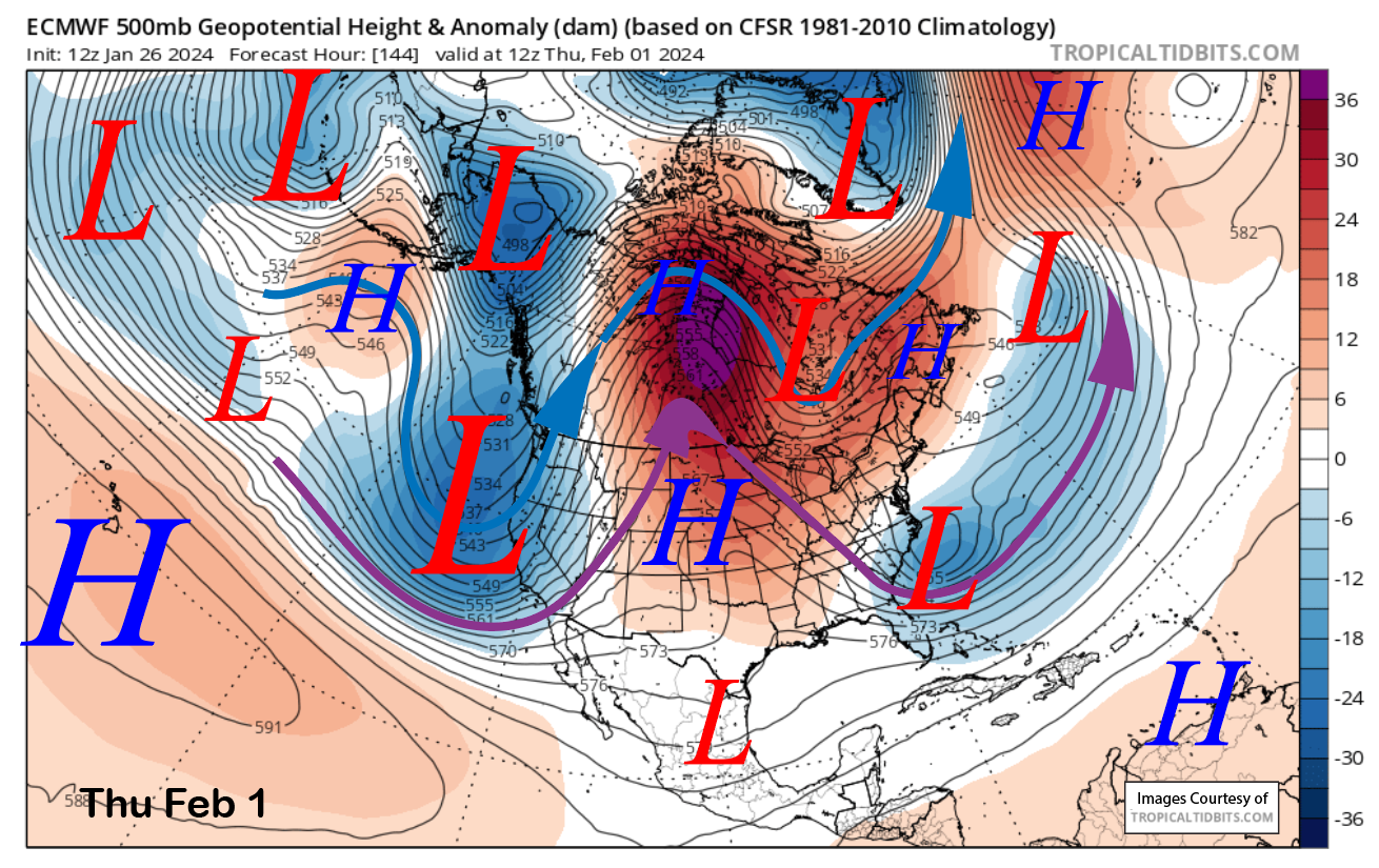
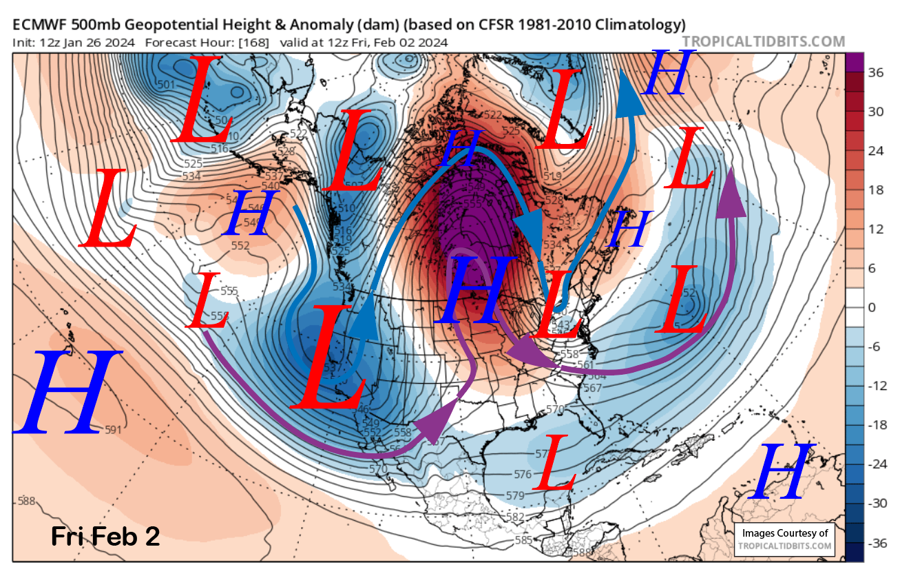
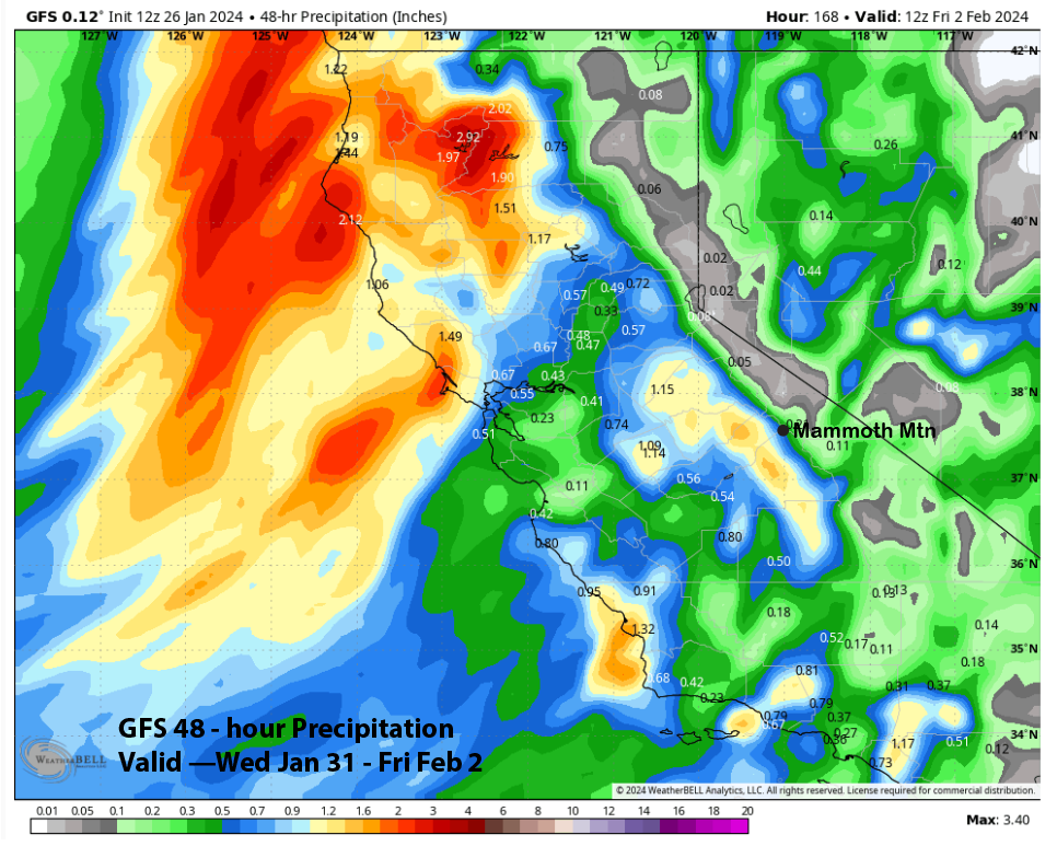
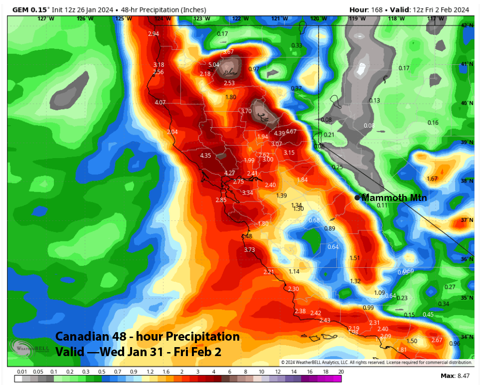
Right now, it looks like snowfall starts on Wednesday afternoon and evening before becoming heavy at times overnight and during the morning on Thursday. Snow is then expected at times through at least next Friday. The latest 12z run of the ECMWF model is the wettest (image below) at around 1.65” for the end of next week, with the GFS (two images below) the driest at only around half an inch liquid. The Canadian (three images below) rides the middle ground with about an inch of liquid but has 3″ along the Sierra crest.
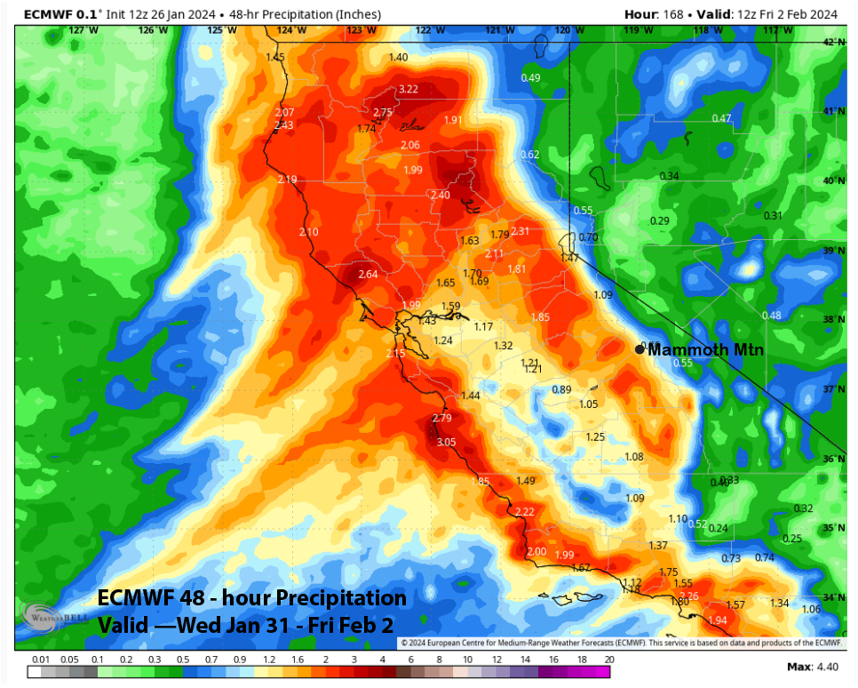
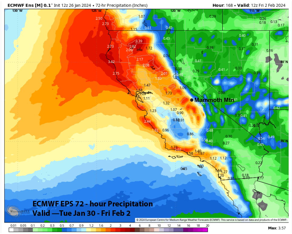
The current forecast follows a blend of the ECM EPS (image below) and the wetter ECM run above, with about 1.5-2.0” liquid expected from the storm. That should result in well over a foot of snow at Main and likely 2 feet up top in the powder fields. Snow levels will start at around 7000-7500 feet Wednesday night, dropping to about 6000-6500 feet Thursday, then down to approximately 4000-4500 feet Friday.
Overall, it will be a good storm, but it is far from historical and not really comparable to the stronger storms from last season that broke the seasonal snowfall record. But it is still seven days out, and the details will likely change. Nonetheless, there will be multiple powder days by the end of next week, although Thursday may see most of the mountain on weather holds or closed.
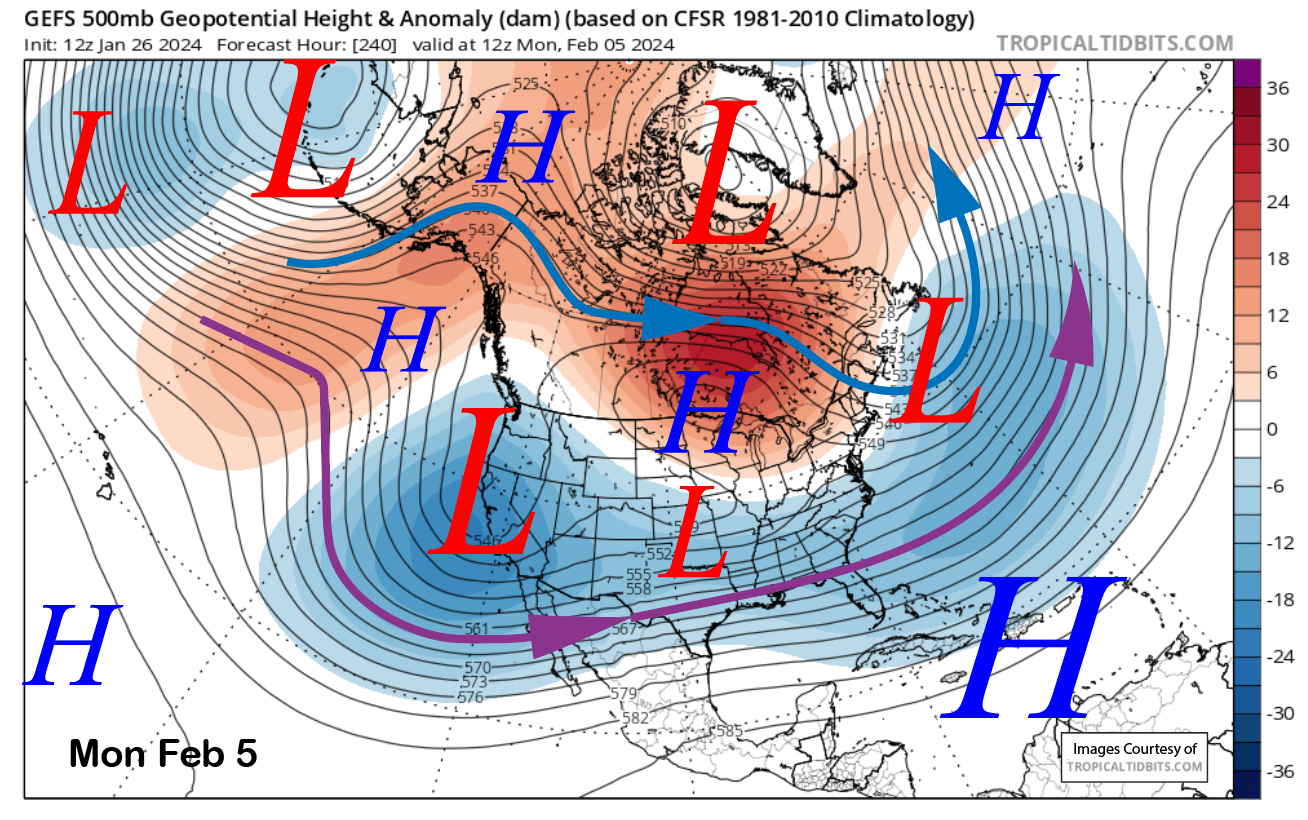
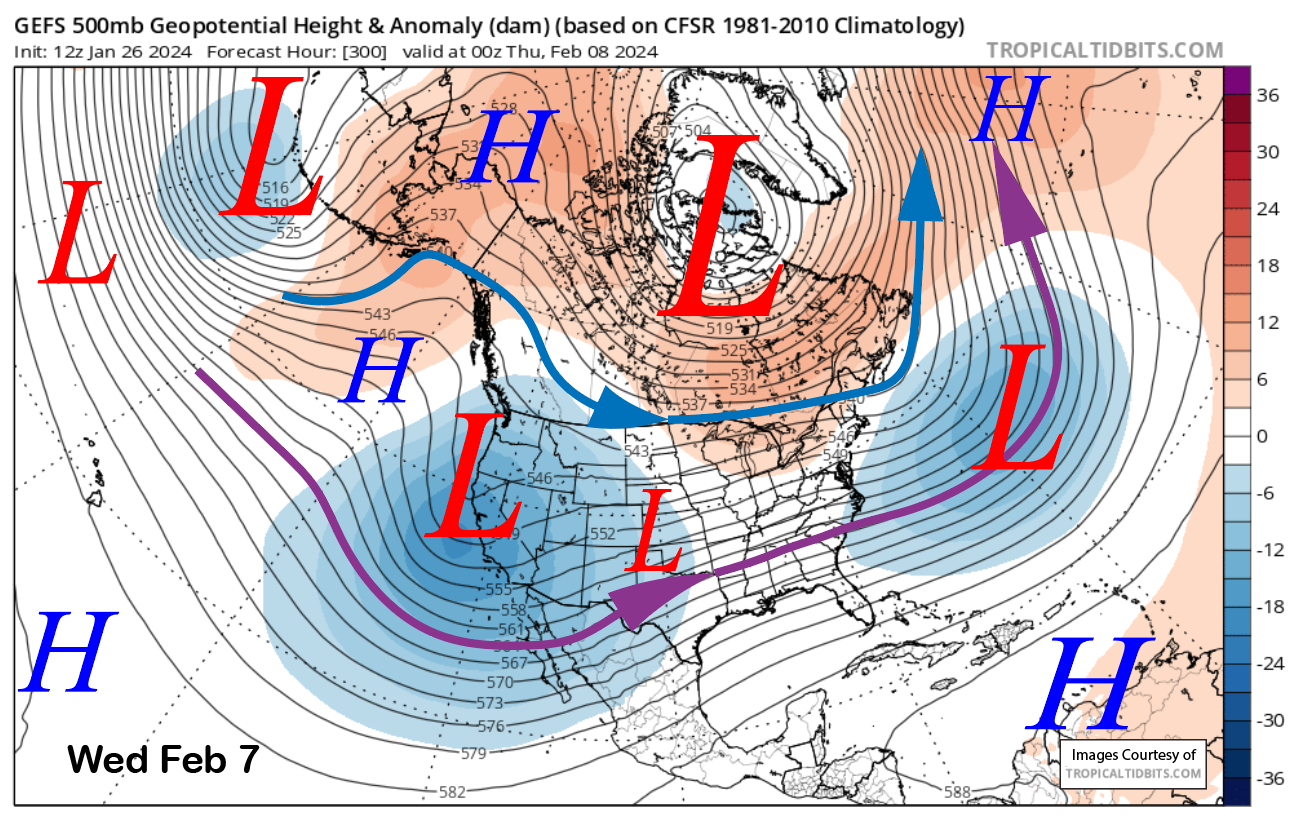
The longer-range ensemble guidance keeps a deep longwave trough in place over CA through the following weekend (images below) and into the next week. This is the classic El Nino jet stream pattern with a strong southern branch of the jet stream extending across the southern tier of the US. After being absent all winter, El Nino is finally showing up.
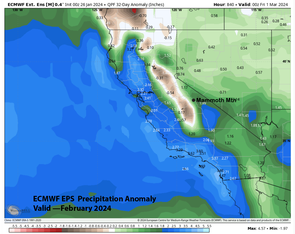
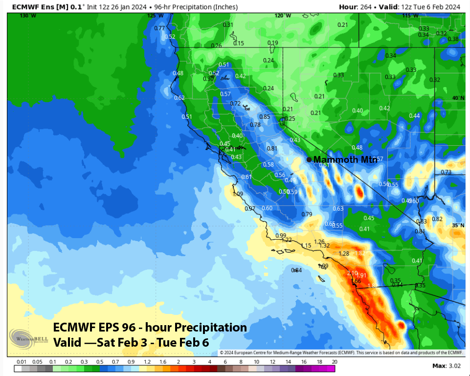
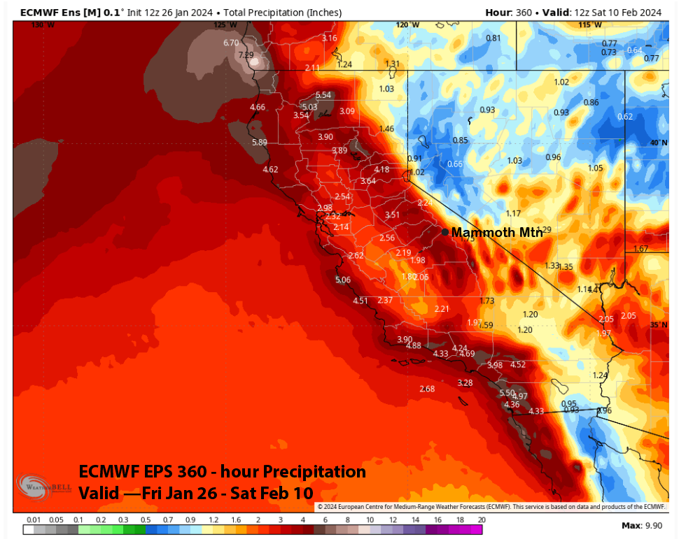
This type of pattern benefits SoCal the most, and that is reflected in the QPF (image below) from the ECMWF EPS for the rest of the weekend and into Monday. It shows the heaviest amounts occurring in SoCal, and even Baja and only about 0.65” for Mammoth. Any storms that do move into Mammoth should be colder with lighter type powder. Overall, the ECM EPS is forecasting over 3.5” liquid for the entire 15-day period (two images below), so conditions for the first part of February should be great.
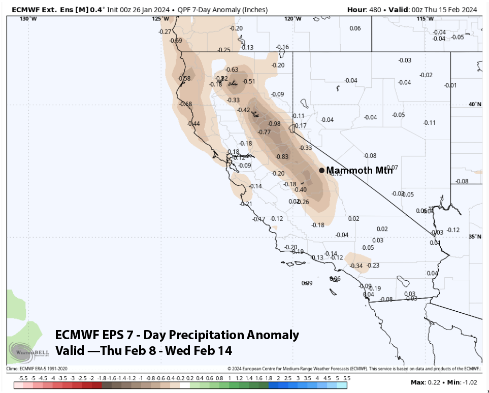
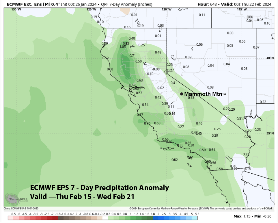
Drier weather is favored to return during the second week of February, with below-normal precipitation anomalies forecast by the EPS (image below). That model then has precipitation returning during the third week of the month (two images below).
The total precipitation anomaly forecast from the EPS for February is a bit wetter since the last look and shows about normal or maybe slightly above normal precipitation for next month. It is still showing slightly below normal for the western slopes, suggesting storms may still remain mostly along the coast. Still better than dry.
WG