Powder Forecast – Friday November 11th, 2022
Ted Schlaepfer CCM —- Mammoth Mountain WeatherGuy
Snowfall forecasts are valid at the Sesame snow course (Main Lodge) for the prior 24 hours as reported in the 6-7 AM morning snow report.
**Snowfall forecast confidence ranges from very low (1) to very high (5)
Sat 11/12 = 0”
Sun 11/13 = 1 – 2” (H20 = 0.10” – 0.20”) **3
Mon 11/14 = 0”
Tue 11/15 = 0”
Wed 11/16 = 0 – 1”
Thu 11/17 = 0”
Fri 11/18 = 0”
Sat – Mon 11/19 – 21 = 0”
November Snowfall = 60”
November Forecast = 75 – 90”
Detailed 4-day Snowfall Forecast:
Sat 11/12 – No snowfall expected during the day with light snowfall developing overnight. Accumulations 1 – 2” by Sunday AM
Sun 11/13 – Lingering flurries possible during the morning, becoming dry by PM. No accumulation expected.
Mon 11/14 – No snowfall expected.
Tue 11/15 –Flurries or light snow showers possible during the morning, becoming dry by PM. Little or no accumulation expected.
Forecast Summary:
Short Term (Days 1 – 4):
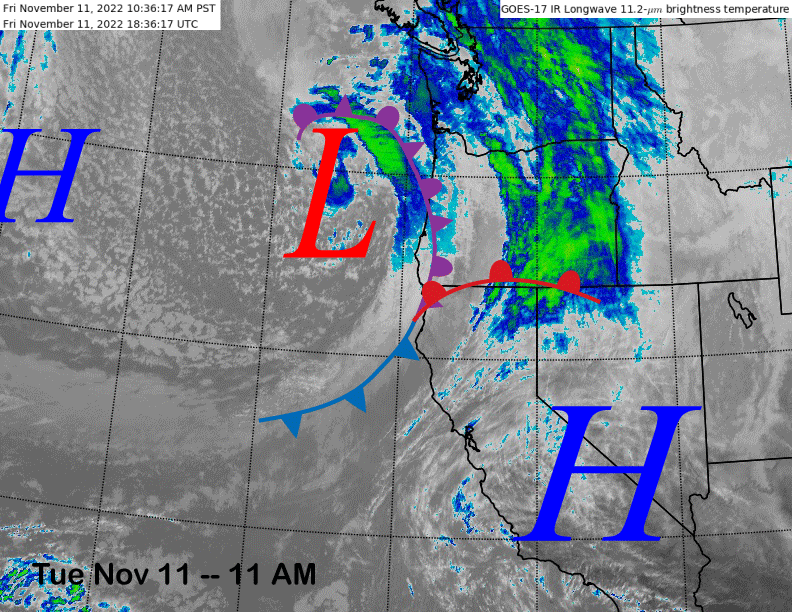
The current infrared satellite image (below) shows high pressure currently over the southern half of the state and a relatively weak weather system just off the Northern CA and Oregon coastlines. Lots of clouds over the state today, but the weather is dry.
Models move that weak weather system through CA tomorrow (image below) and into Sunday and a period of light snowfall is now expected for Mammoth during its passage through the area on tomorrow night. Snowfall should mostly be over by the time the lifts open Sunday with maybe up to 2” of accumulation, likely not enough for powder conditions.
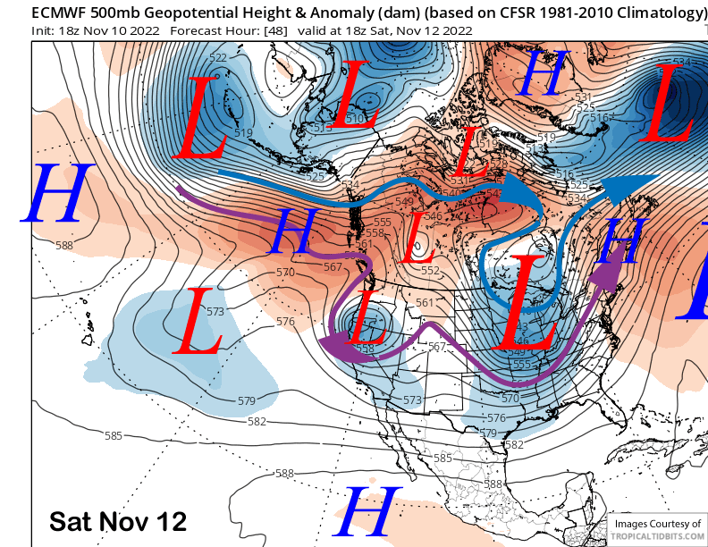
High pressure briefly builds into the state on Monday before another weaker upper low moves southward along the coast on Tuesday and a slightly farther westward track versus the Saturday night system. Thus, there will only be a chance for flurries or light snow showers Tuesday morning with a better chance for dry conditions.
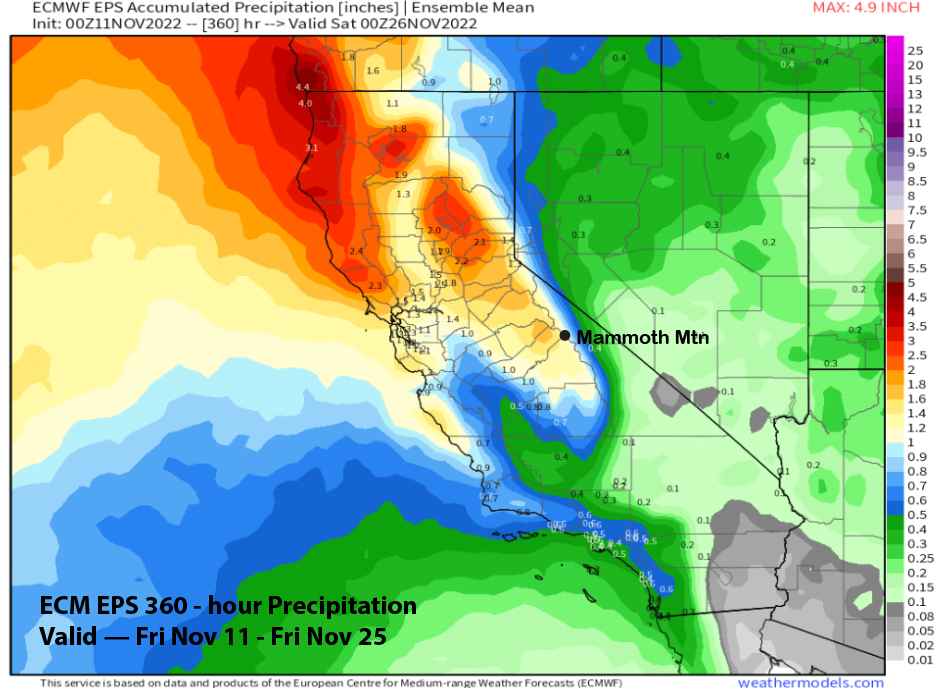
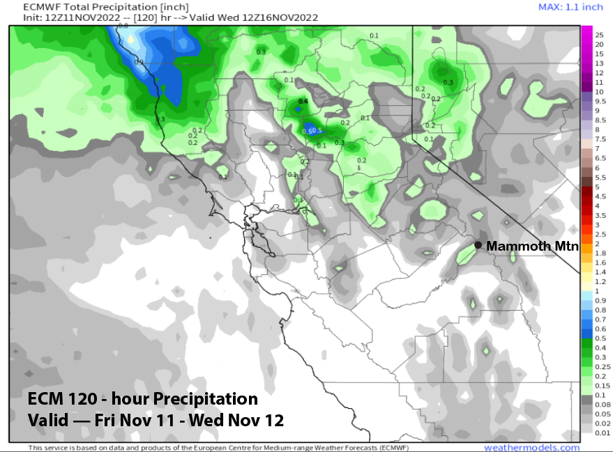
Overall, the ECM model (image below) is only showing very light precipitation amounts through early next week with almost all of it forecast for tomorrow night. An inch or two is always a nice refresher after recent heavy snowfall.
Long Range (Days 5+):
The longer-range guidance is mostly unchanged from the previous update and favors dry weather for the rest of next week and through the following weekend with the next chance for any meaningful snowfall still expected over the last part of the month.
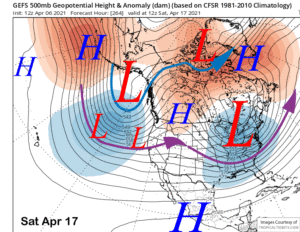
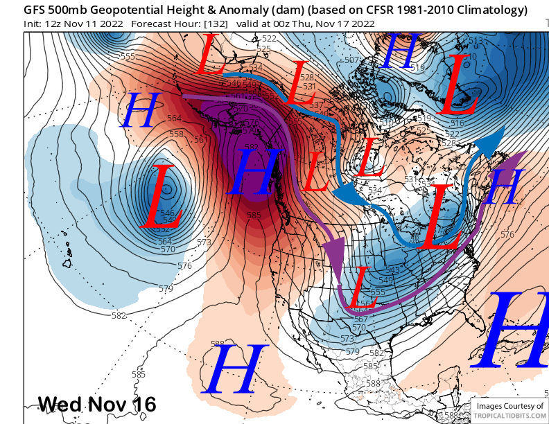
Models develop a highly amplified jet stream pattern next week (image below) with strong meridional flow producing a deep trough across the Central US and a strong ridge extending northward into the Gulf of Alaska. Weak northerly flow will keep the weather dry and temperatures mostly seasonable. Should be great conditions.
The dry period may finally come to an end according to the very long range guidance sometime over the following week with the ECM EPS model (image below) developing a long-wave trough off the CA coast faster compared to the GFS ensemble mean.
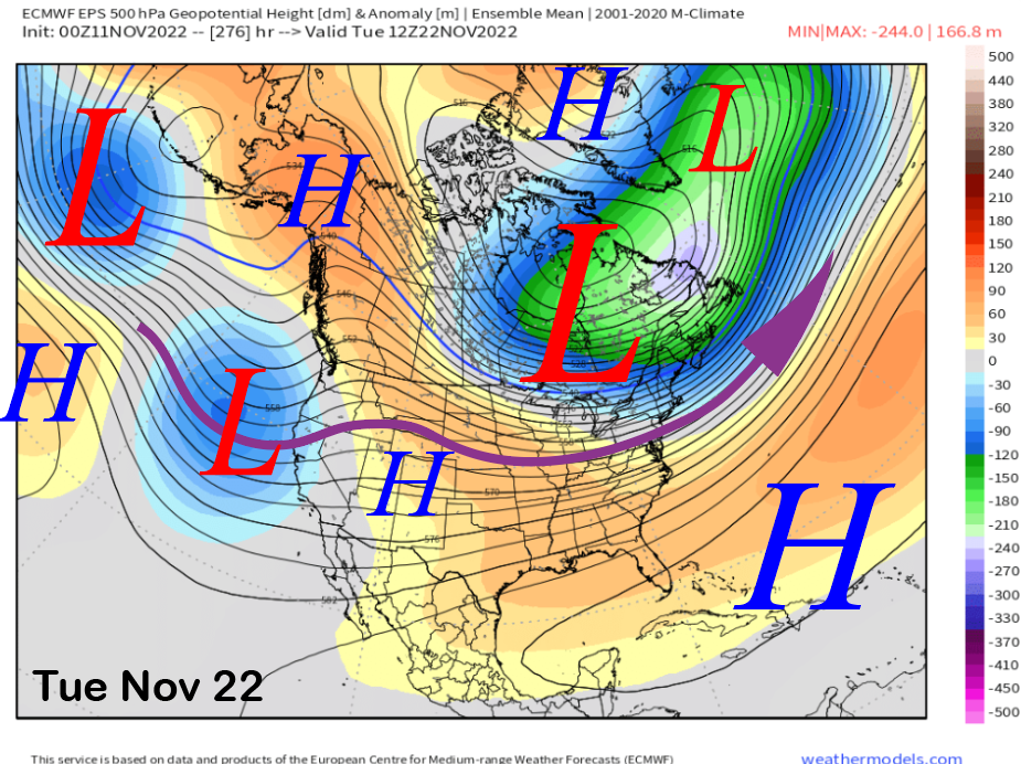
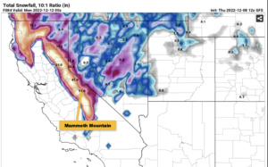
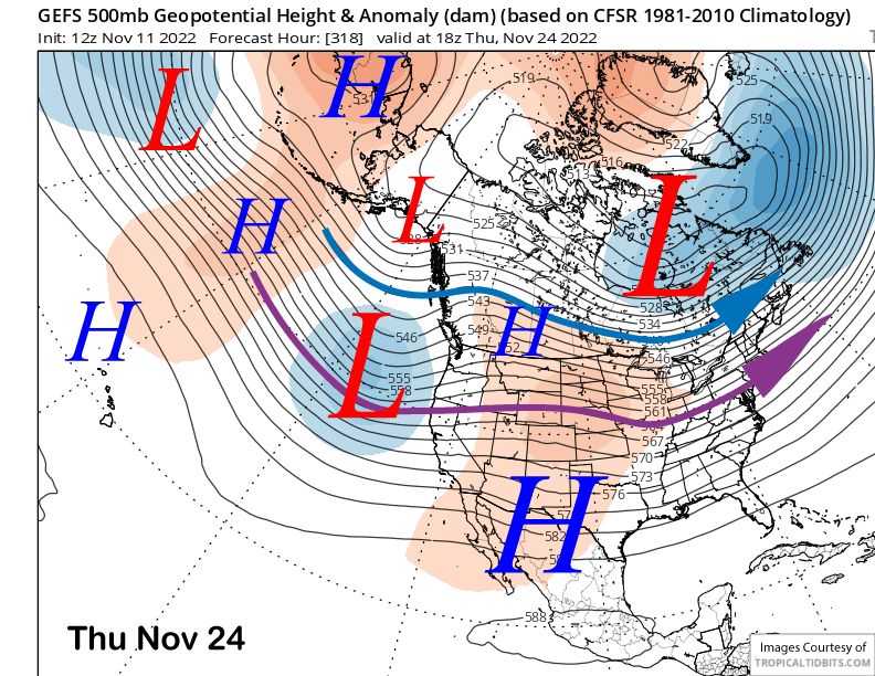
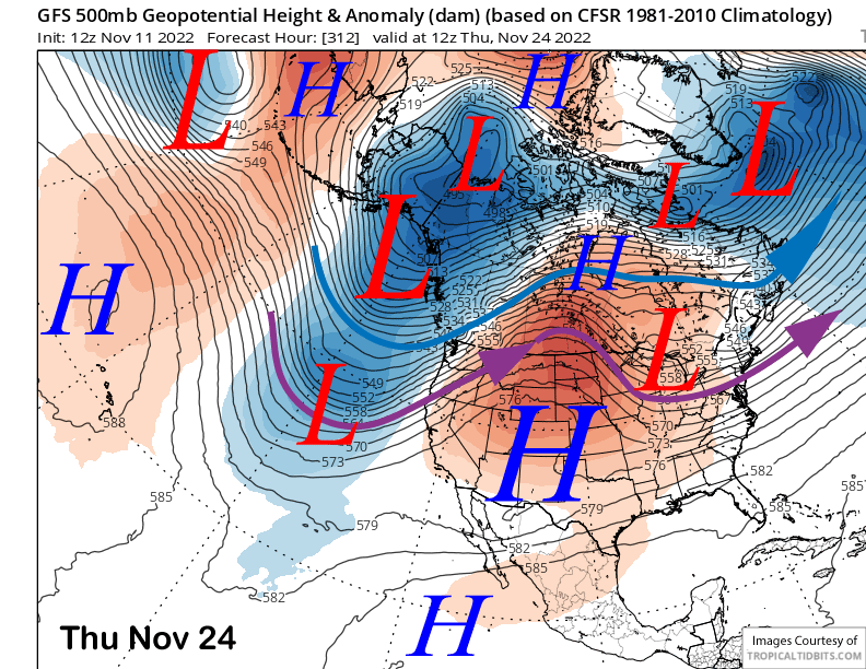
That model is slower by about two days (image below) and the GFS operational run (two images below) from this morning is showing a disorganized trough moving toward CA around the same time. So best guess for the next powder/snowfall chance will be over that week.
Overall, the ECM EPS is not bullish yet on a major storm pattern, but is showing enough precipitation (image below) at over an inch for powder conditions if that pattern materialized. WG