Powder Forecast – Friday, March 29th, 2024
Ted Schlaepfer CCM —- Mammoth Mountain WeatherGuy
Snowfall forecasts are valid at the Sesame snow course (Main Lodge) for the prior 24 hours, as reported in the 6-7 AM morning snow report.
**Snowfall forecast confidence ranges from very low (1) to very high (5)
Sat 3/30 = 15 – 18” (H20 =1.25” – 1.50”)**4
Sun 3/31 = 1 – 3” (H20 = 0.10” – 0.20”)**3
Mon 4/1 = 2 – 4” (H20 = 0.25” – 0.35”)**2
Tue 4/2 = 0”
Wed 4/3 = 0”
Thu 4/4 = 0 – 2”
Fri 4/5 = 2 – 5”
Sat – Mon 4/6 – 4/8 = 6 – 12”
March Snowfall: 75”
March Forecast = 90 – 95”
Detailed 4-day Snowfall Forecast:
Sat 3/30 – Snowfall overnight changes to snow showers during the early morning, with snow showers tapering off Saturday evening and overnight. Accumulations 1 – 3” by Sunday AM at Main Lodge, 3”+ up top.
Sun 3/31 – Light snowfall likely redevelops during the day and into Sunday evening before ending overnight. Accumulations 2 – 4” by Monday AM at Main Lodge, 6” up top.
Mon 4/1 and Tue 4/2 – No snowfall expected on both days.
Forecast Summary:
Short Term (Days 1 – 4):
The current infrared satellite image (below) shows a developing storm system and comma cloud off the California coast. The frontal system will move inland tonight and produce a period of heavier snowfall overnight. Tomorrow early morning, the snowfall will change to showers that should continue throughout the day and evening.
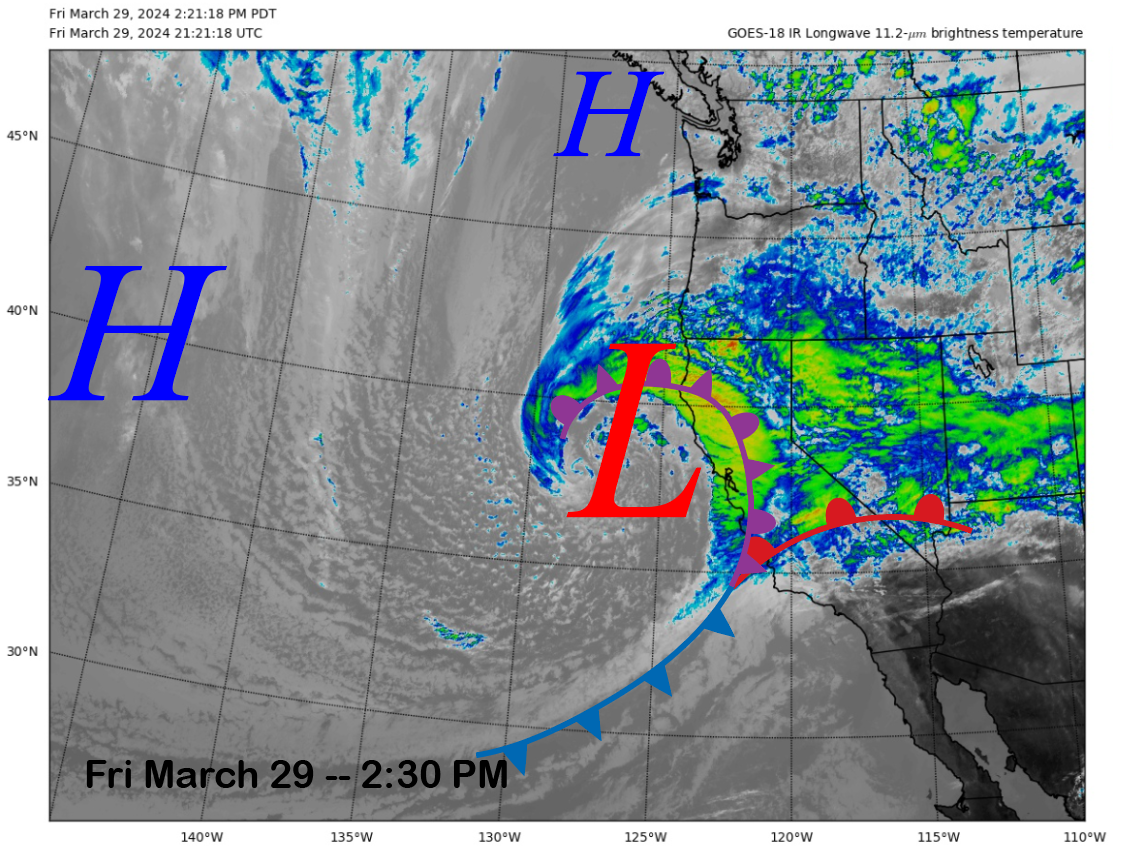
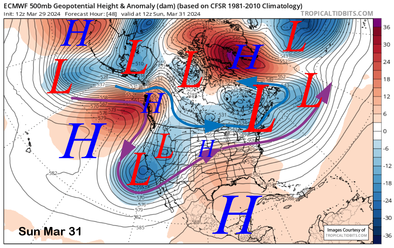
The upper-level low associated with the frontal system does not move inland but will move southward to off the SoCal coast by early Sunday morning (image below). Another weak low will move southward into eastern CA/western Nevada during the morning of Sunday. That other low should kickstart the snowfall again Sunday before it ends Sunday night.
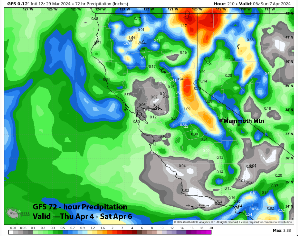
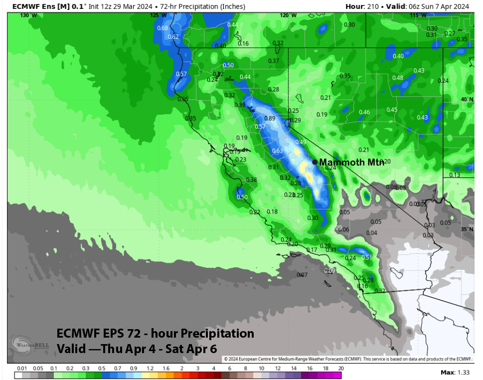
Model QPF through the weekend is generally over an inch, with the ECM model (image below) slightly wetter versus the GFS (two images below), but both models are over 1.25″ liquid. Both of those models are not as wet as the National Blend of Models, which has about two inches of liquid. Snow levels should be around 4500-5000 feet. It will be drier snow, with snow ratios 12-15”:1”

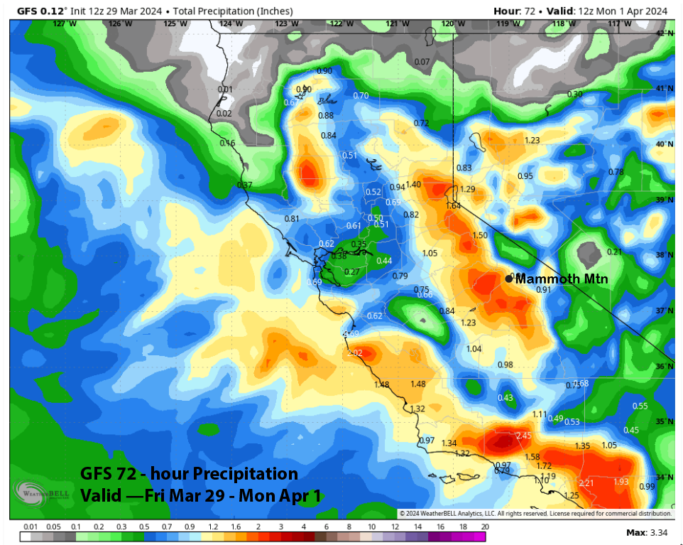
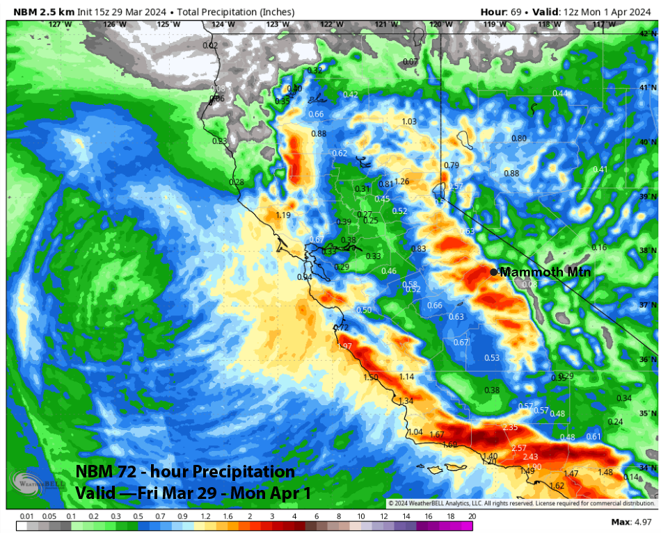
The forecast leans closer to the NBM model and favors well over a foot for tomorrow morning at Main, a couple more inches during the day on Saturday, and a few more on Sunday. The top should get two to three feet over the weekend.
Dry weather returns Monday and continues Tuesday, with spring conditions returning to the lower part of the mountain on Tuesday.
Long Range (Days 5+):
The longer-range guidance still favors the chance for storms to return by the end of next week and the following weekend. More typical spring weather may then be in the cards heading through mid-month, with only occasional chances for weak storms until April 21st, the new Canyon/Eagle closing dates.
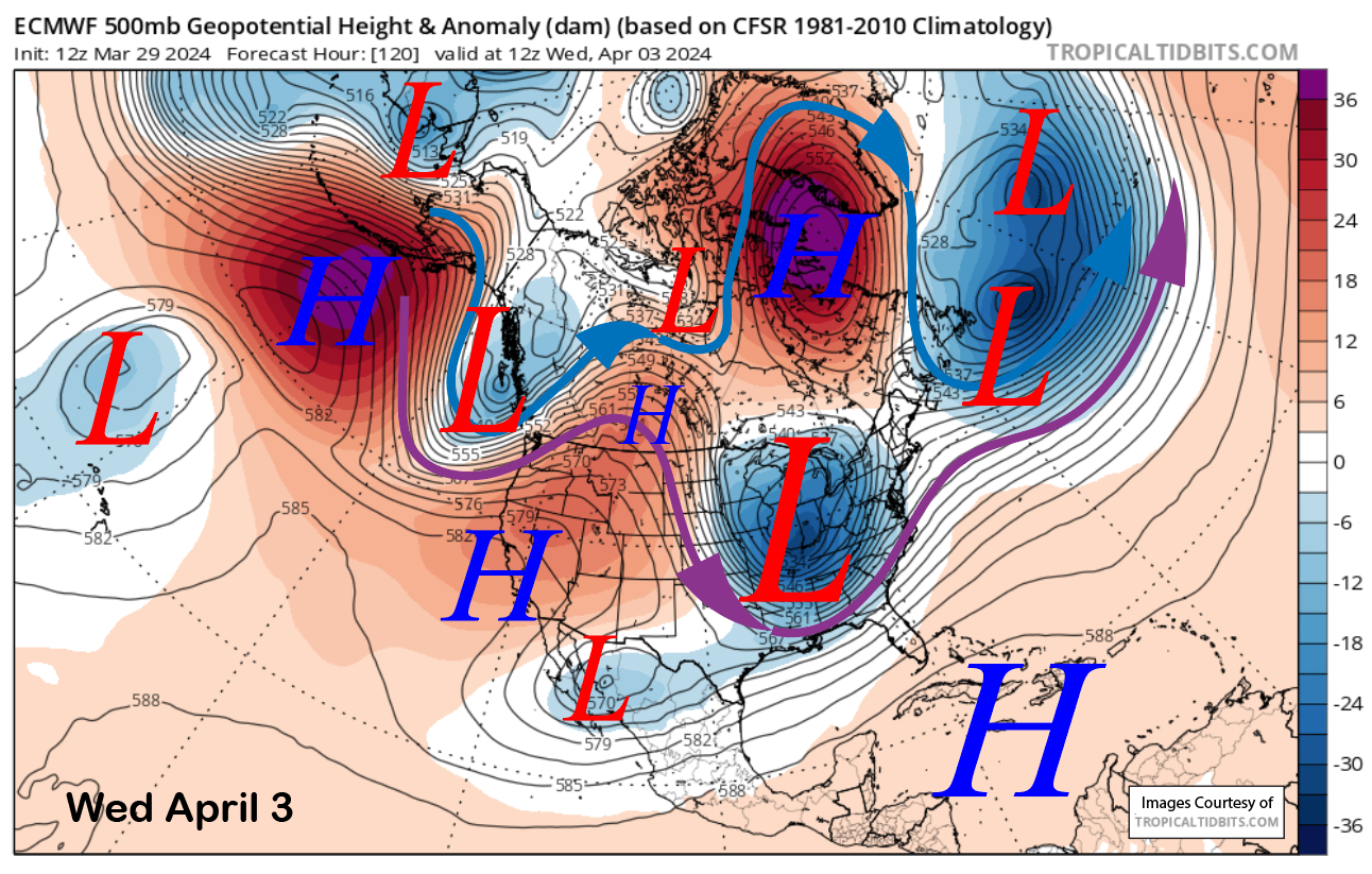
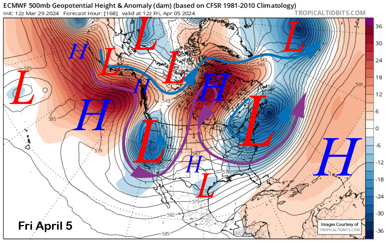
High-pressure peaks in strength over the area early Wednesday (image below) for continued fair weather and spring conditions on the lower part of the mountain. The ECM model then moves a short-wave trough into CA by the end of the week (two images below) for a chance of snowfall again.
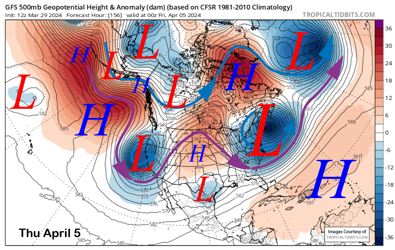
The GFS model also has the trough, but it is positioned a bit farther westward (image below). The Canadian model is similar to the GFS.
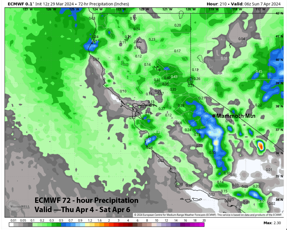
Not unsurprisingly, model QPF varies a bit over a week out. The ECM run from this morning has about a half an inch liquid (image below) and the GFS slightly less (two images below), although it has more than an inch west of the crest. The ECM EPS is the wettest at around 0.75” liquid.
Overall, it looks like enough will fall for at least low-end powder conditions. The best chance for snowfall will be on Friday and into Saturday, although confidence in the timing is quite low.
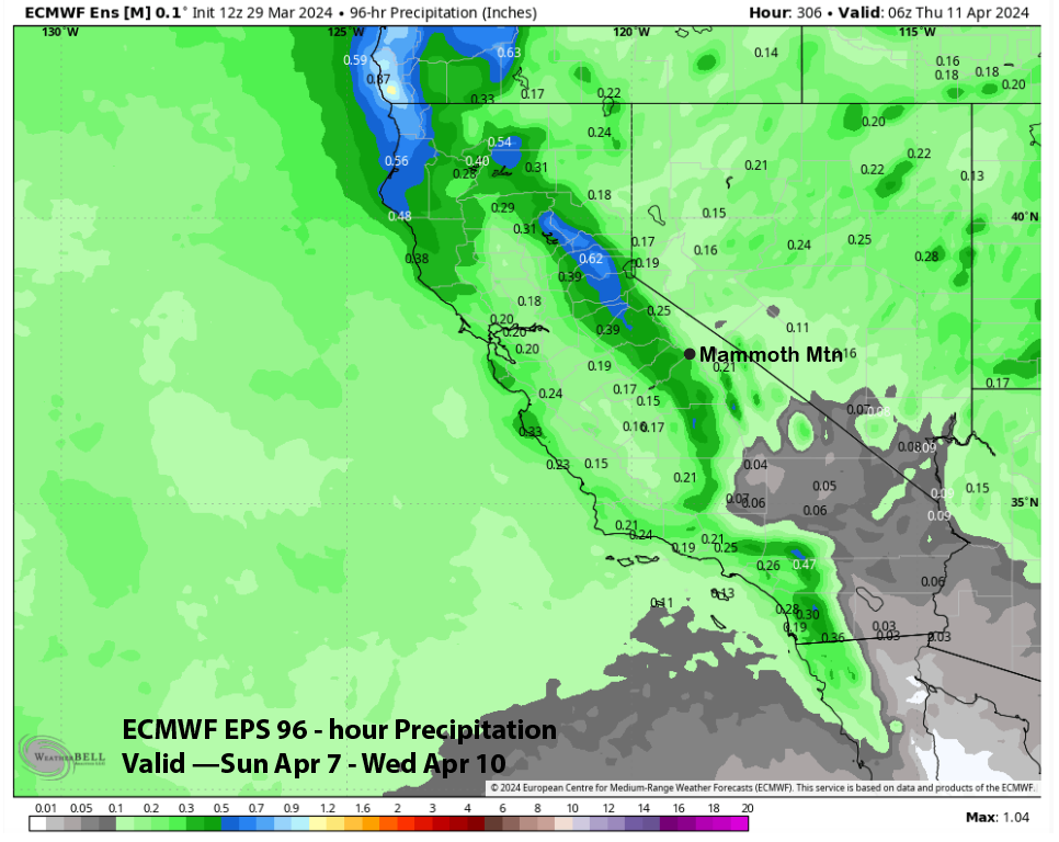
The GFS ensemble then moves another short-wave trough through the state on Sunday (image below) for another chance of snowfall. It doesn’t look like a big storm, with the ECM EPS only showing light amounts of liquid water (two images below) of around a third of an inch, but it could be enough for low-end powder.
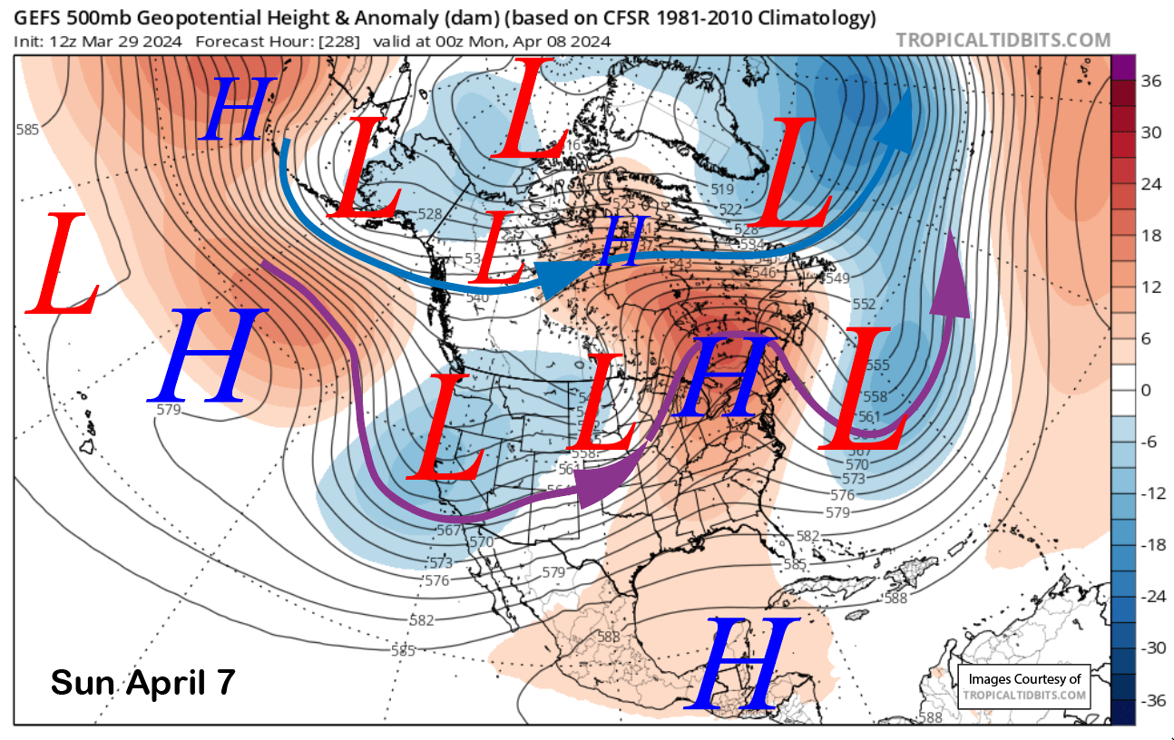
A more typical spring pattern may then develop heading into mid-April with just a weak longwave trough along the West Coast and the jet stream (purple arrow) farther northward into northern CA. That would only support a weak storm or a brushing of a cold front.
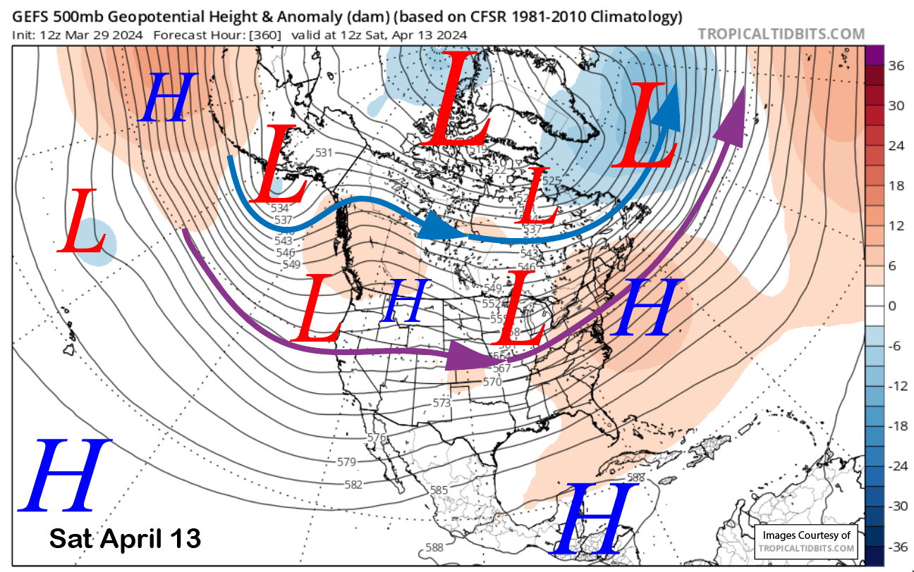
Nonetheless, there certainly could be a surprise storm embedded in this pattern, and let us hope so, with Ch. 22 (and Canyon/Eagle lodges) now to remain open through April 21st. The ECM long range has about 3” liquid forecast from now through that closing date, suggesting another 1.5” liquid to fall after the event this weekend. The last call for powder days may get extended, too.
WG
PS: If you enjoy all the content created here and would like to see more, please consider becoming a website supporter. Here is the link to learn more.


