Powder Forecast –Tuesday, December 19th, 2023
Ted Schlaepfer CCM —- Mammoth Mountain WeatherGuy
Snowfall forecasts are valid at the Sesame snow course (Main Lodge) for the prior 24 hours, as reported in the 6-7 AM morning snow report.
**Snowfall forecast confidence ranges from very low (1) to very high (5)
Wed 12/20 = 4 – 5” (H20 = 0.50” – 0.65”)**4
Thu 12/21 = 2 – 3”
Fri 12/22 = 0 –1”
Sat 12/23 = 0”
Sun 12/24 = 0”
Mon 12/25 = 0”
Tue 12/26 = 0”
Wed – Fri 12/27 – 12/29 = 6 – 12”
December Snowfall = 7”
December Forecast = 20 – 35”
Detailed 4-day Snowfall Forecast:
Wed 12/20 – A few flurries in the morning, then light snowfall develops during the afternoon and night. Accumulations 2 – 3” by Thursday AM, 3”+ up top
Thu 12/21 – Chance for flurries or light snow showers during the day. Little or no accumulation is expected.
Fri 12/22 – Dry during the morning, then a chance for PM flurries, no accumulation
Sat 12/23 – No snowfall expected.
Forecast Summary:
Short Term (Days 1 – 4):
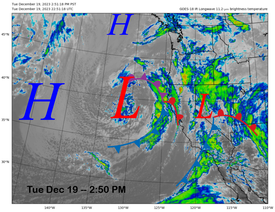
This afternoon, the current infrared satellite image (below) shows a weak frontal boundary and low pressure moving through the Sierra and a developing weather system offshore that is moving toward CA.
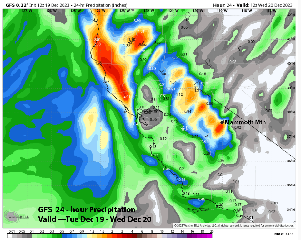
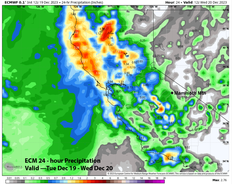
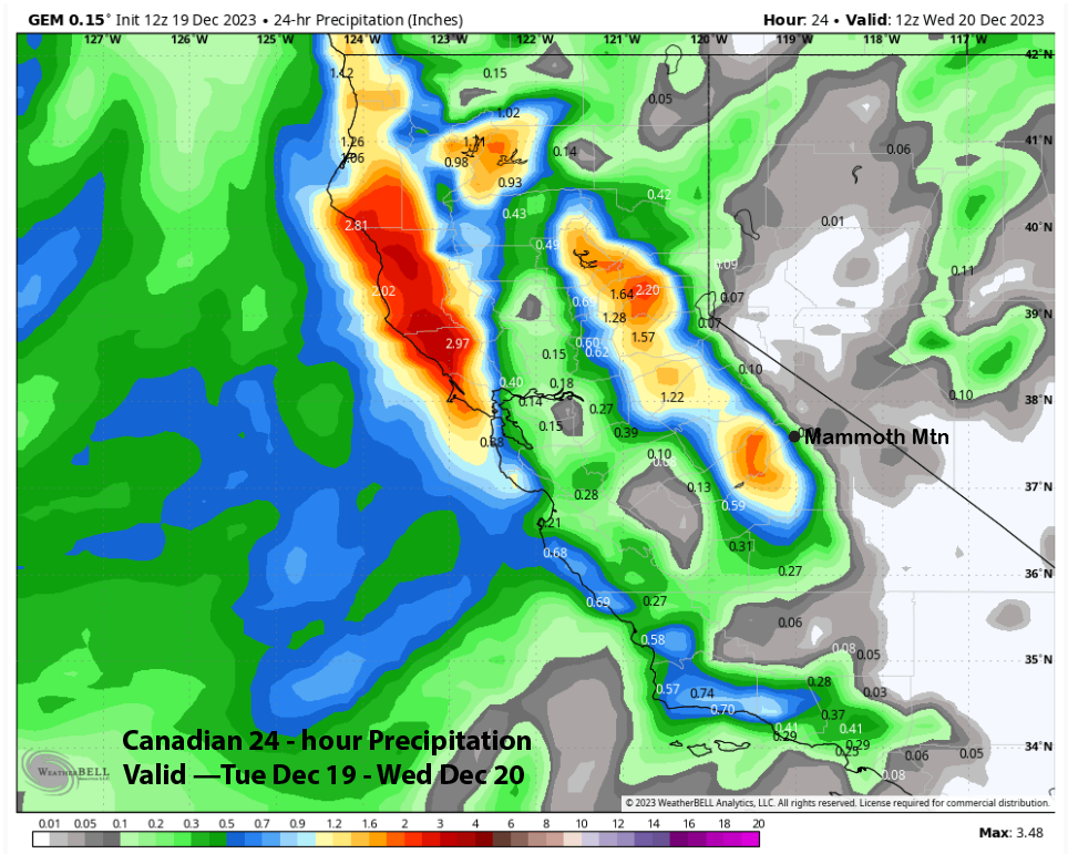
This evening, the frontal system will slide through the area, with snowfall tapering off overnight. The GFS is the wettest model with over an inch QPF (image below) for today, while the ECM (two photos below) and Canadian (three pictures below) are showing much less. Based on the weak jet dynamics to push the precipitation over the crest, the forecast leans toward the ECM/Canadian solutions with about 4-5” of new snow by tomorrow AM or about 1-2” more as of this posting.
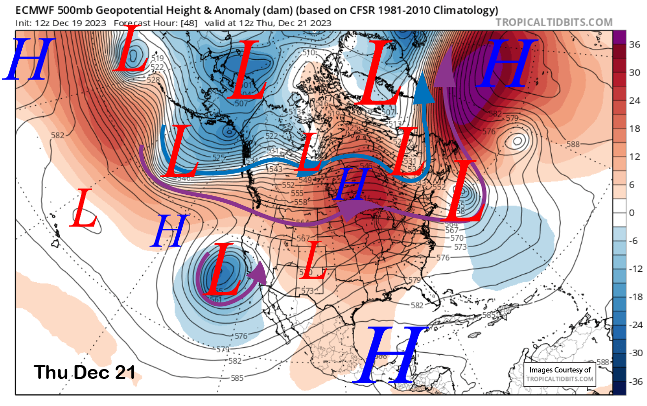
The system offshore will be a coastal hugger and move southward along the coast into SoCal by Thursday (image below) and Friday. Thus, it will take the best dynamics southward and along the coast, with Mammoth (and the rest of the Sierra) seeing only light snowfall.
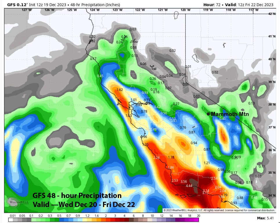
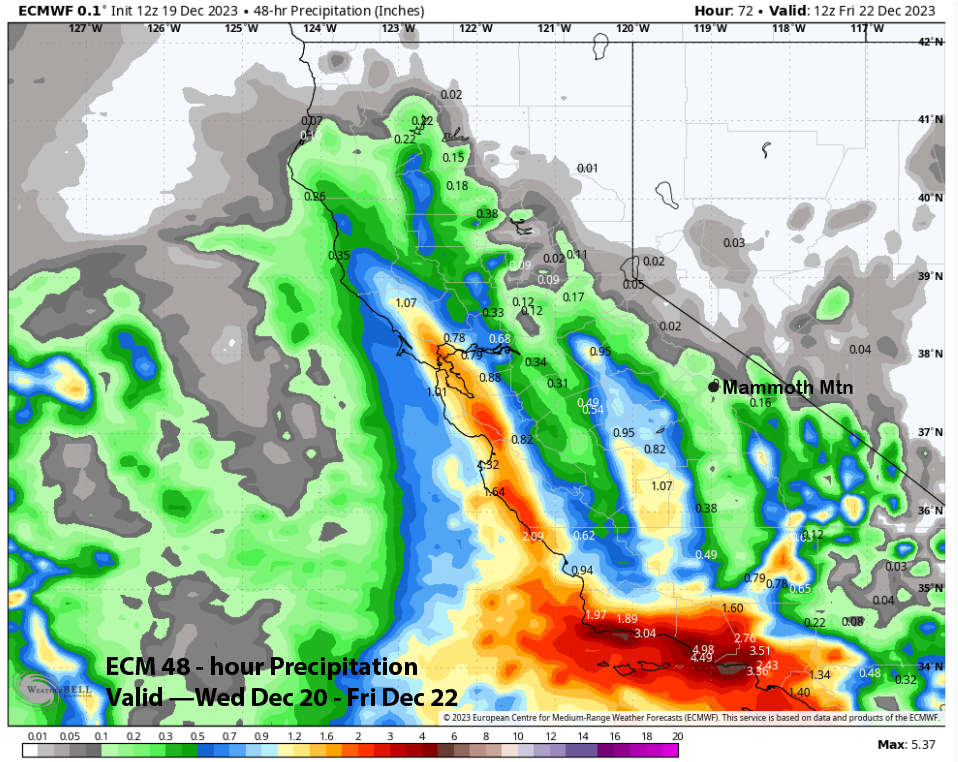
The GFS model (image below) is the wettest again, with the other models (ECM two photos below) showing less. Due to the southward trajectory, the forecast leans toward the drier solutions and only a couple of inches of snowfall. Snow levels tomorrow should be around 7000 feet.
Flurries could continue into Thursday, with any flurries on Friday likely confined to the afternoon. Fair and dry weather then returns over the weekend.
Long Range (Days 5+):
The longer-range guidance has wobbled a bit, with the hoped-for base storm just after Christmas now looking weaker on the guidance. That will be followed by another chance at the end of the month, but that is also looking weak on the ensembles, with the deterministic runs likely being overdone, as has been the case all season.
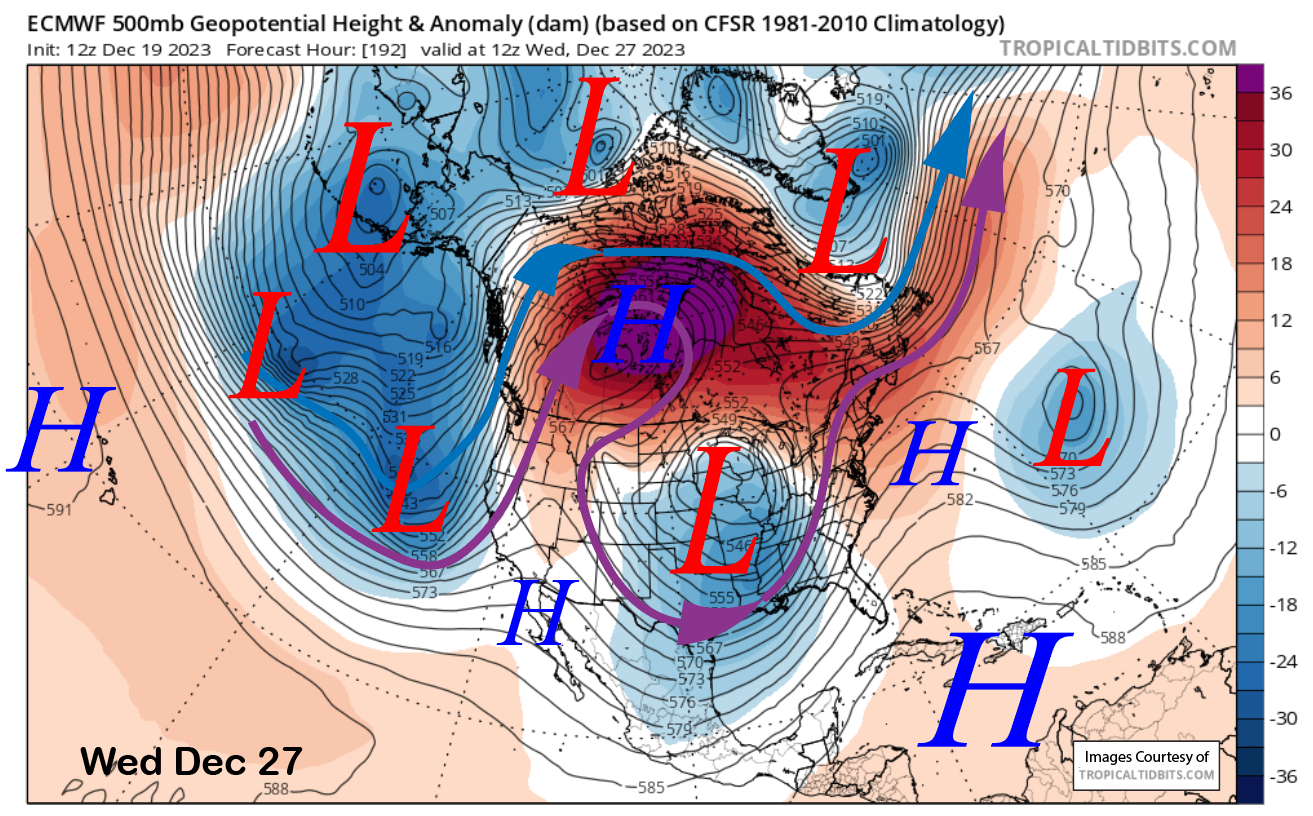
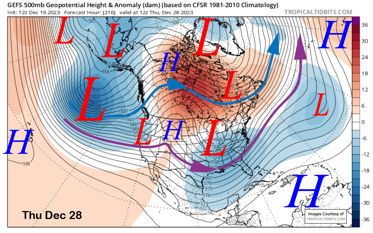
Dry weather will continue through Christmas and likely Tuesday as well. The latest run of the ECM model brings a weakening trough into CA around Wednesday next week (image below). The GFS ensemble run has the trough, too (two photos below), but is much weaker with it versus what it was forecasting in the 11-15 day range in the last two postings when it extended a strong jet steam into CA.
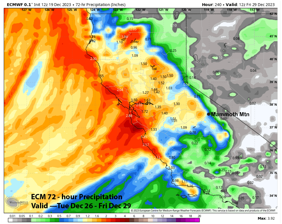
QPF from the ECM model has just under an inch of liquid (image below), translating to around 6-8+ inches. The GFS ensemble is showing similar or slightly less. Either way, it does not appear to be the significant base snowmaker that we need right now. Hopefully, the guidance will flip back wetter.
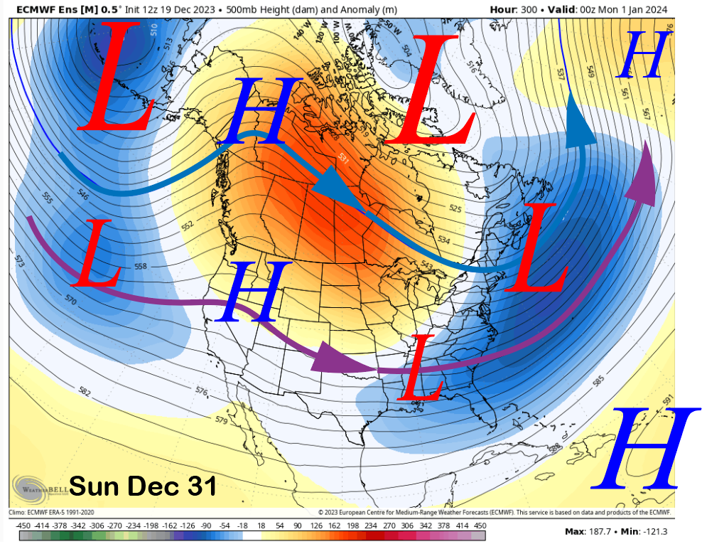
There will be one last chance before the end of the month; then, the longer range guidance shows weak ridging (image below) returning at the start of 2024.
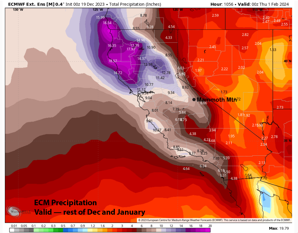
The latest ECM 45-day forecast is keeping the trend of at least an average January (image below) with about 8” liquid or 70-80” of snowfall. It has been somewhat consistent over the last many runs. That is always a good sign for the solutions to come to fruition. WG