
Powder Forecast – Friday, November 17h, 2023
Ted Schlaepfer CCM —- Mammoth Mountain WeatherGuy
Snowfall forecasts are valid at the Sesame snow course (Main Lodge) for the prior 24 hours as reported in the 6-7 AM morning snow report.
**Snowfall forecast confidence ranges from very low (1) to very high (5)
Sat 11/18 = 2 – 4” **3
Sun 11/19 = 4 – 6” **3
Mon 11/20 = 0”
Tue 11/21 = 0”
Wed 11/22 = 0”
Thu 11/23 = 0”
Fri 11/24 = 0”
Sat – Mon 11/25 – 27 = 0”
November Snowfall = 6”
November Forecast = 15 – 25”
Detailed 4-day Snowfall Forecast:
Sat 11/18 – Light snowfall expected during the day followed by moderate snowfall overnight. Accumulations 4 – 6” by Sunday AM
Sun 11/19 – Chance for lingering early morning flurries, otherwise dry with gusty northeast winds developing overnight.
Mon 11/20 and Tue 11/21 – No snowfall expected both days, breezy northeast winds, mostly Monday.
Forecast Summary:
Short Term (Days 1 – 4):
Welcome to another season of powder forecasts, and unlike last season, this blog will start out as a base forecast until we get some significant snowfall. Unfortunately, we already started out the season with a disappointing storm system that the models prognosticated as potentially significant in the longer-term window, only to have it fizzle as the window got closer.
The current infrared satellite image (below) shows what is left of that system positioned just off the Bay Area and Central Coast. The associated cold front is expected to move into the Mammoth area tonight and light snowfall should start later this evening and overnight with snow levels around 7500 feet.
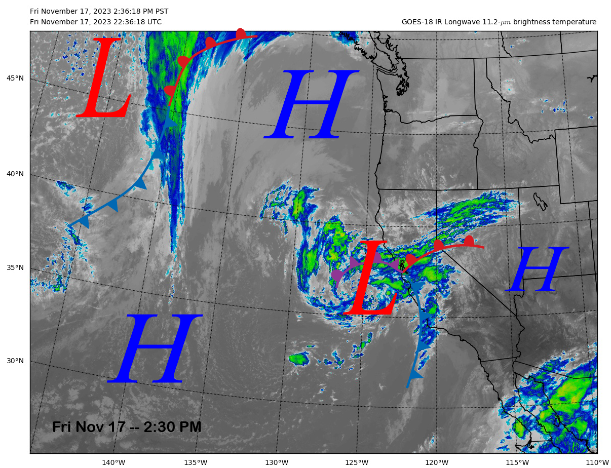
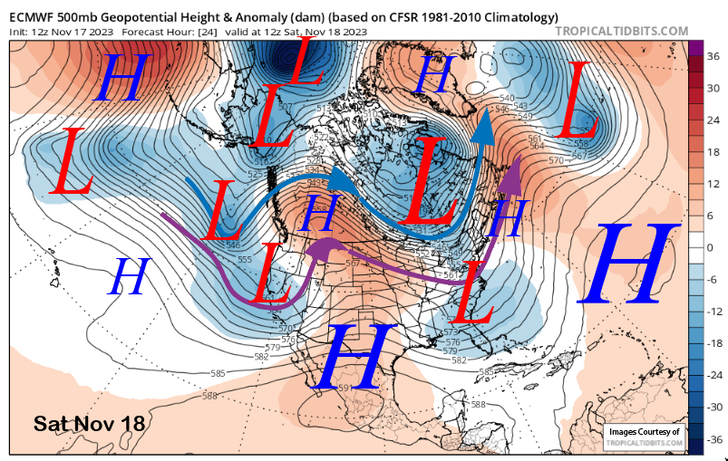
The models slowly move the cut-off low toward the coast while also transforming it into an open wave (image below) with a kicker short-wave trough off the PacNW coast expected to push the entire system eastward Saturday night and early Sunday.
Light snowfall should continue Saturday during the day before increasing a bit Saturday night when the kicker trough swings through the Sierra with the snowfall expected to end early Sunday. There could be some lingering flurries a bit past dawn, but Sunday should be dry overall.
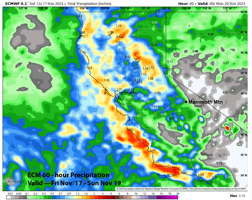
Models do differ on the Quantitative Precipitation Forecast (QPF) with the storm with the GFS model the wettest at about an inch liquid (image below) and the ECMWF (two images below) and Canadian (three images below) both showing about half that amount.
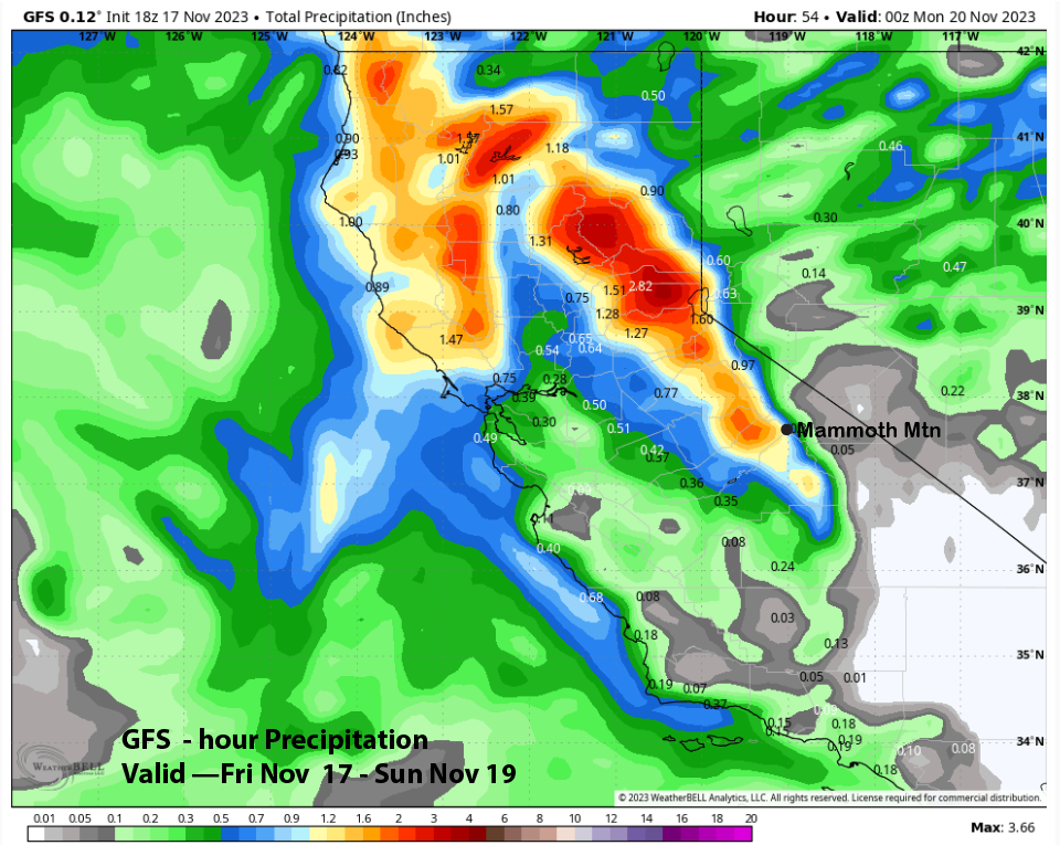
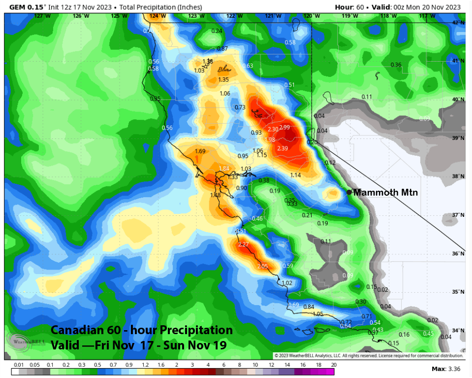
Forecast is a blend leaning slightly toward the GFS due to the generally long duration of light snowfall (about 24 hours) that should add up to at least 6”+. Probably about 9” up top and snow levels will stay in the 7500-8000 foot range until the last part of the storm when they should come down slightly. It will not be a miracle storm, but combined with snowmaking, new terrain should open up.
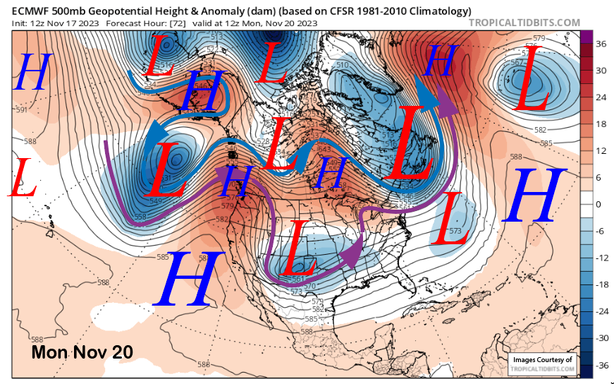
High pressure builds by Monday (image below) and will hold in place through mid-week. There could be gusty northeast winds, especially Monday, otherwise snowmaking conditions should be pretty good under the low dewpoints through at least Tuesday.
Long Range (Days 5+):
The longer-range guidance is generally dry through Thanksgiving weekend with the next chance for snowfall not until the end of the month says some of the guidance. It certainly appears that it will be a low-tide holiday weekend, unlike last season when 60” of snowfall had already fallen.
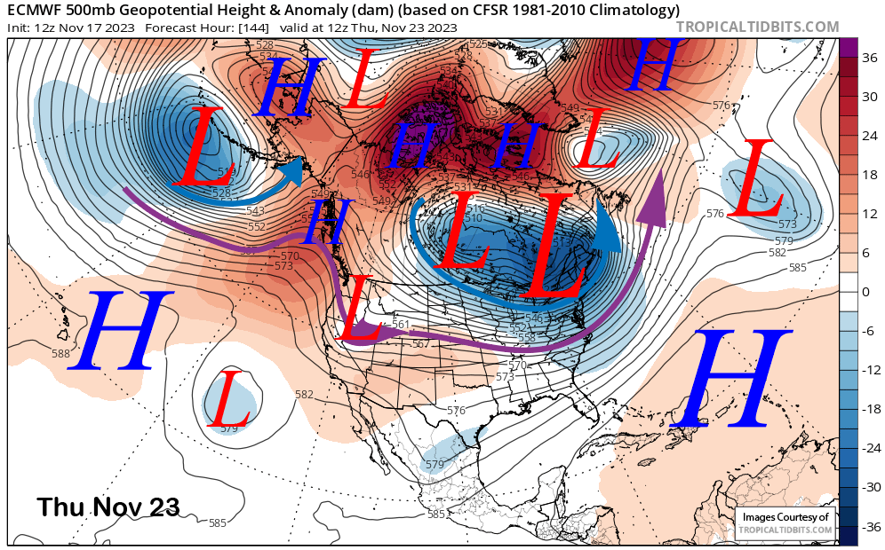
The ECM model moves a weak slider-type short-wave through the ridge on Thanksgiving (image below) and that will likely result in only breezy winds and slightly colder temperatures. The short-wave is expected to move into the Southwest where a deeper trough will develop over the weekend across the interior West. It should just mean further colder temperatures and even breezier northeast winds through the weekend.
Super long-range guidance does favor a trough to move into the state toward the middle part of the following week and just before the end of the month. The GFS ensemble (image below) is slightly deeper versus the ECM which is flatter and weaker with the potential trough passage. GFS solution could mean light snowfall while the ECM is dry.
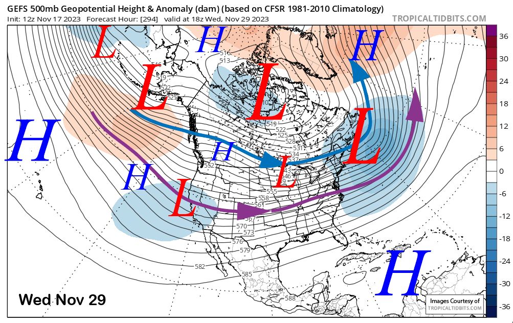
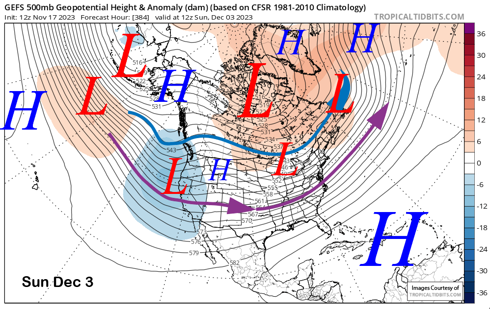
The fantasy range guidance per the GFS has the next chance in early December (image below) and that trough, even 384 hours out, is currently projected to be deeper than the previous one. The ECM model though, has a ridge, and dry conditions. Hopefully, the GFS is right.
The climate models, both the CFS and ECM 45-day, are favoring either average or slightly above normal precipitation through the first half of December. Unfortunately, those models have not been very reliable lately and rarely give a good projection in the longer term. It will be a wait-and-see game for a while. WG


