Powder Forecast –Tuesday, February 6th, 2024
Ted Schlaepfer CCM —- Mammoth Mountain WeatherGuy
Snowfall forecasts are valid at the Sesame snow course (Main Lodge) for the prior 24 hours, as reported in the 6-7 AM morning snow report.
**Snowfall forecast confidence ranges from very low (1) to very high (5)
Wed 2/7 = 2 – 3” (H20 = 0.25” – 0.35”)**4
Thu 2/8 = 6 – 8” (H20 = 0.45” – 0.65”)**3
Fri 2/9 = 0”
Sat 2/10 = 1 – 2”
Sun 2/11 = 0”
Mon 2/12 = 0”
Tue 2/13 = 0”
Wed – Fri 2/14 – 2/16 = 0 – 3”
February Snowfall = 78”
February Forecast = 120 – 150”
Detailed 4-day Snowfall Forecast:
Wed 2/7 – Light to moderate snowfall develops late AM or early PM, briefly heavy during the evening, before ending overnight. Accumulations by Thursday AM 6– 8” at Main, 9”+ up top
Thu 2/8 – Chance for a flurry or light snow shower during the morning, otherwise no snowfall expected.
Fri 2/8 – Dry during the morning, then a chance for light snowfall during the late afternoon and night. Accumulations by Saturday AM 1– 2”
Sat 2/9 – Chance for a morning flurry or light snow shower, then dry weather returns.
Forecast Summary:
Short Term (Days 1 – 4):
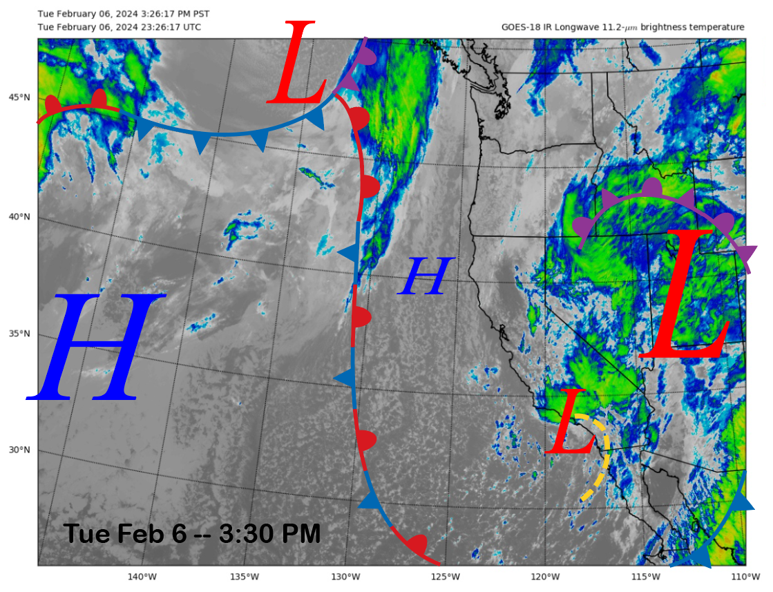
The current infrared satellite image (below) today shows a weather system moving into SoCal with clouds that stretch northward into the Sierra. Another weather system is diving southward from the Gulf of Alaska and will be in the state tomorrow.
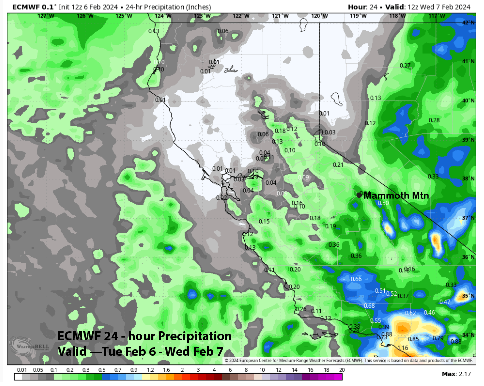
Light snowfall will continue through this evening before ending overnight. Only a couple of inches of snowfall are expected today/tonight. The ECM has about a third of an inch of liquid through tonight (image below).
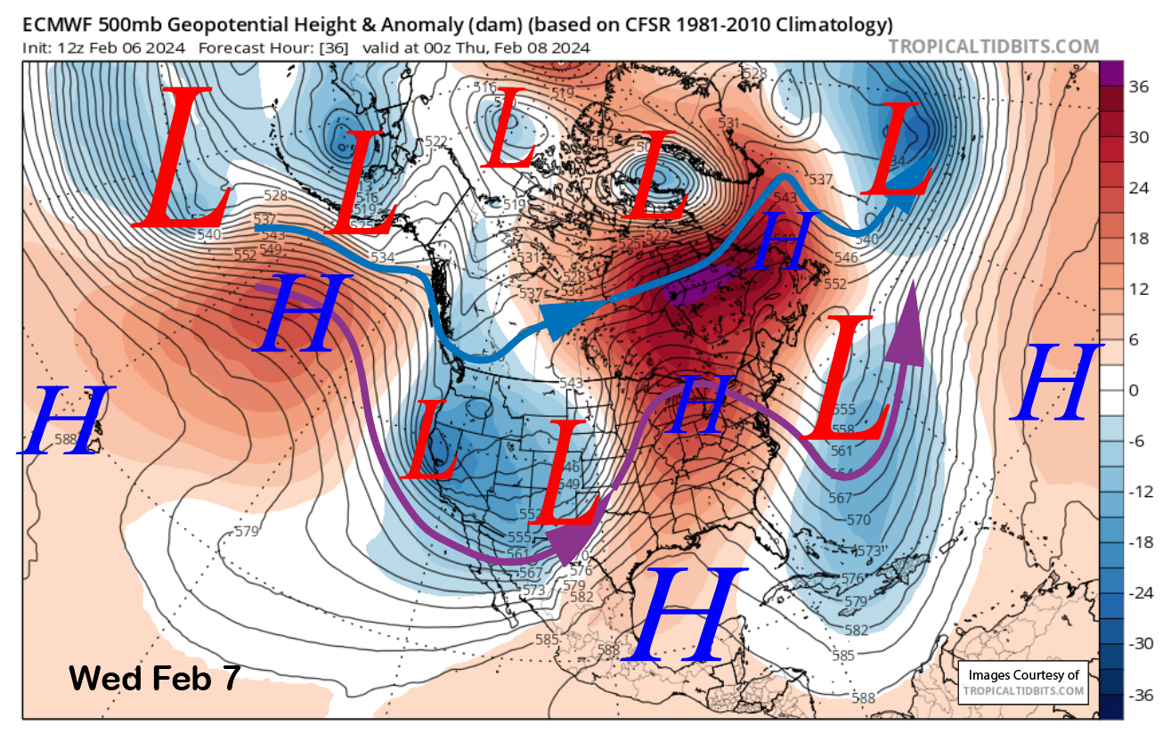
The next system will be over the state by tomorrow afternoon (image below), and it will be a high-latitude type storm. That means it won’t have a lot of moisture to work with but will be colder with 12-14”:1” snow ratios. Snowfall should start around midday and peak during the evening, when it may be heavy at times, then generally end overnight, with Thursday mostly dry.
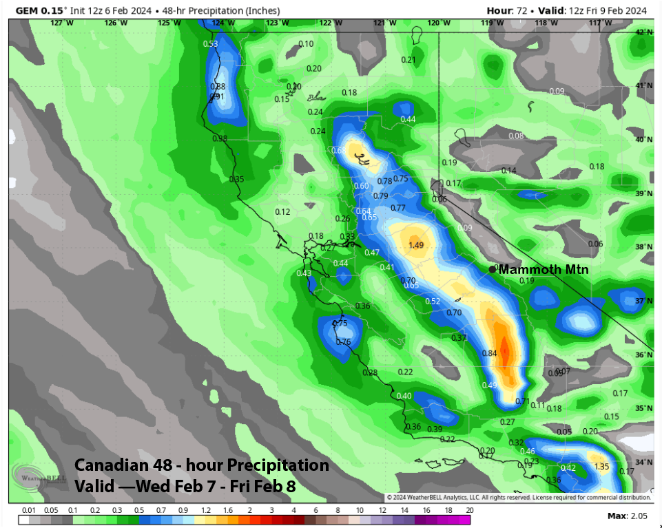
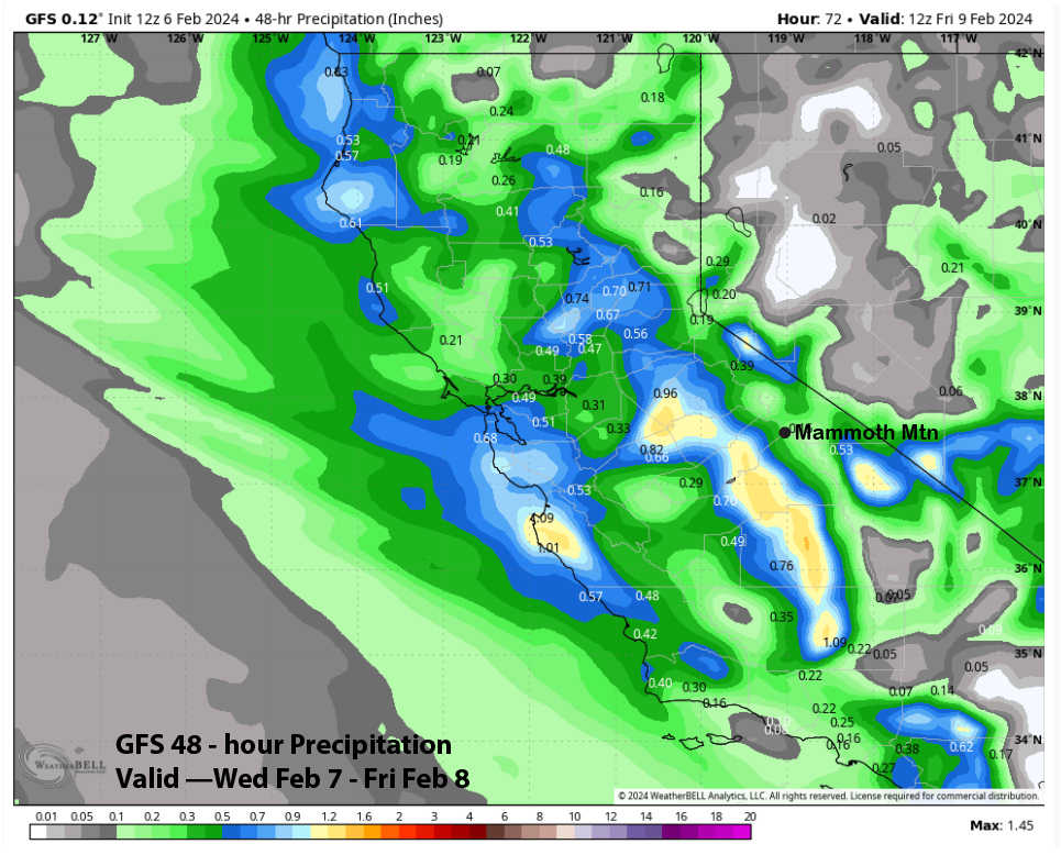
Models are not in great agreement with the forecasted amounts, with the ECM model the wettest at around 0.60” liquid (image below), the Canadian at around 0.40” (two images below), and the GFS (three images below) at about a quarter inch.
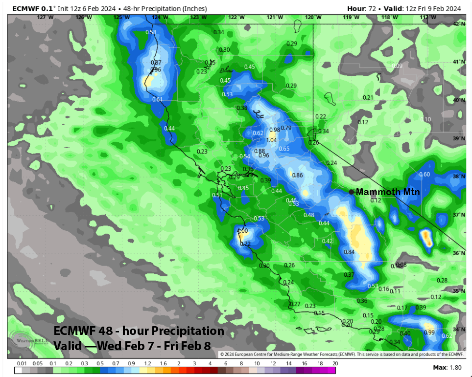
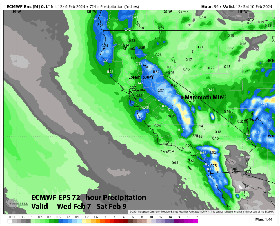
The system is rather dynamic and will likely squeeze out every ounce of moisture into snowfall. The forecast favors the wetter solutions, and the ECM EPS (image below) supports this idea as it is similar to the deterministic run. Expecting at least 6” at Main and up to 9” up top. Thursday might not be a deep powder day, but should be quite fun with the light/dry snowfall.
Another weak wave will move down the back side of the longwave trough Friday PM and night for another chance for light snowfall. Only expecting an inch or two of snowfall by Saturday when dry weather is forecast to return. There could be some breezy northeast winds on Saturday, with temperatures remaining seasonably cold for great conditions.
Long Range (Days 5+):
The longer-range guidance is favoring generally dry weather for most of next week. It is then suggesting that another “El Nino” type weather pattern will get re-established as early as the following weekend and likely by the next week. This pattern will again favor the southern half of the state (it could get very ugly in SoCal) and will also likely benefit Mammoth with periods of moderate to heavy snowfall.
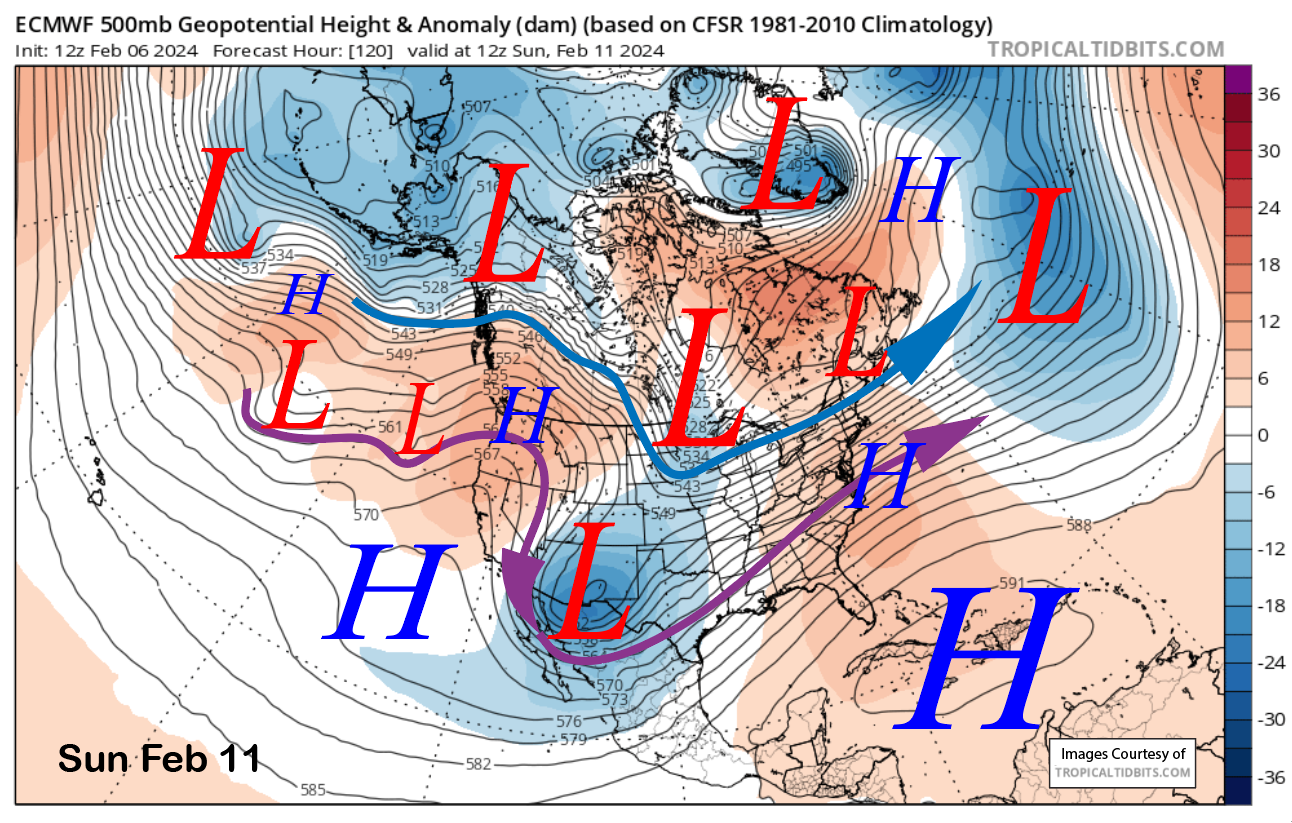
The ECM model develops a high pressure ridge over the state on Sunday (image below) that is expected to last through Thursday, although a weak wave will move through the ridge around Tuesday next week with some passing clouds only.
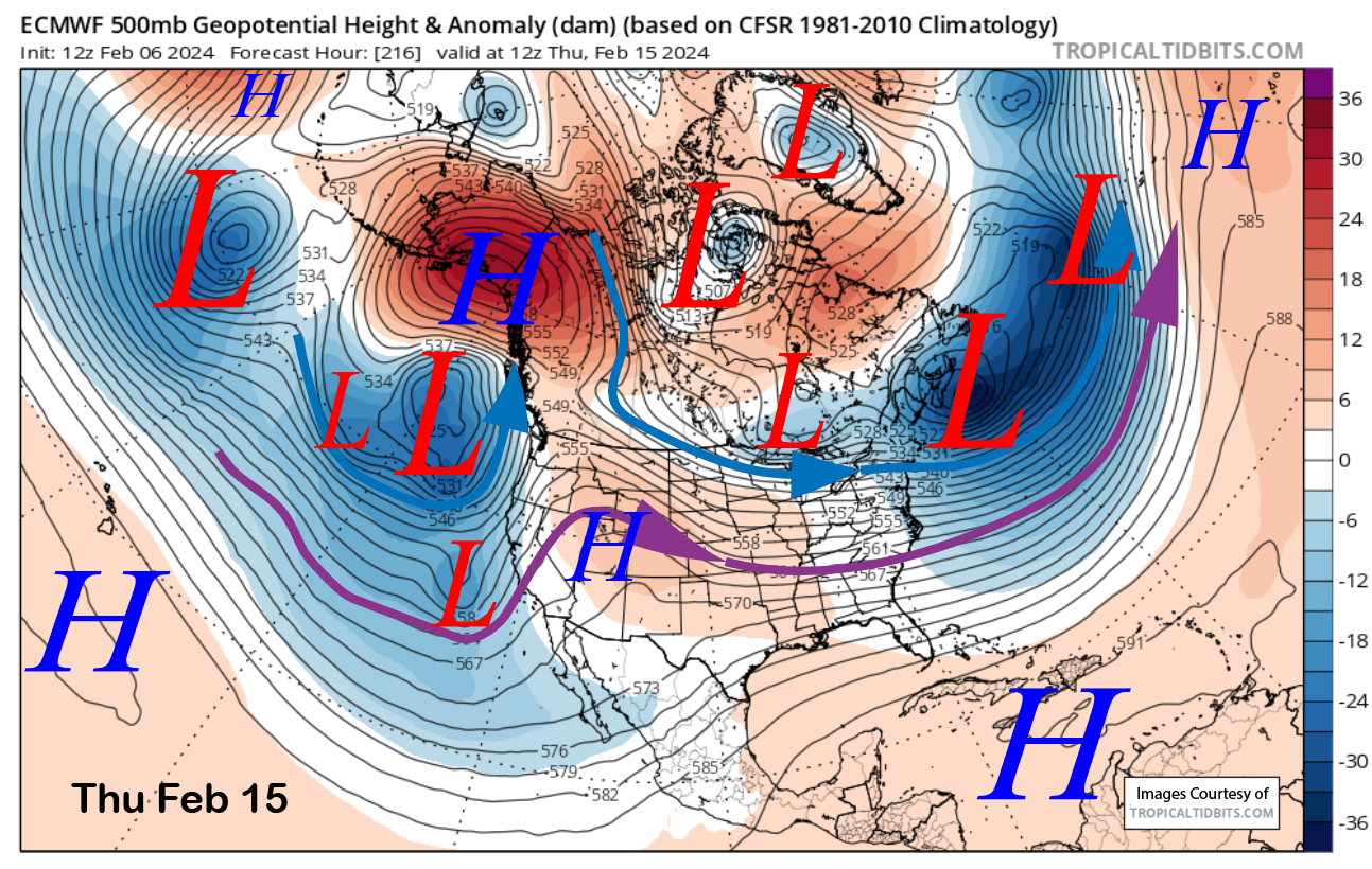
The ECM model then moves a trough toward the state by the end of the week (image below), suggesting precipitation may return by Friday night or Saturday. The other models are not showing that solution, and I suspect that dry weather will continue and that the ECM model solution is wrong.
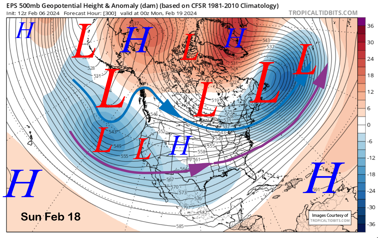
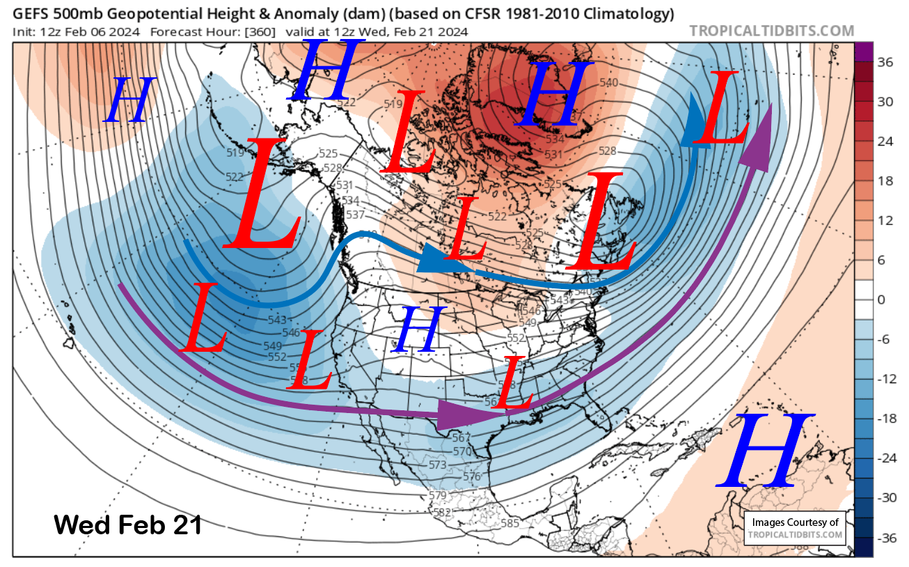
While the GFS ensemble (image below) is certainly deeper versus the ECM EPS (two images below), both fantasy range solutions favor another breakthrough of westerly and the establishment of a negatively tilted longwave trough along the West Coast.
Both models have the southern branch of the jet stream quite strong and southward in position (purple arrow), with the jet pointing into Baja. I can’t recall seeing the models so bullish about the jet stream so far southward into Baja on a 10-plus day forecast.
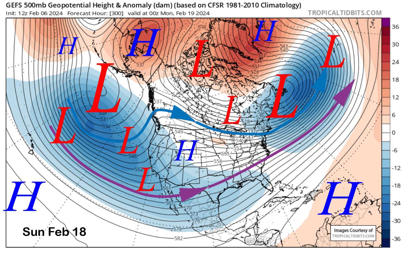
The models generally keep the longwave trough in place through the rest of the period (GEFS below), which would produce almost continuous storminess for CA, especially SoCal. Details are certainly unknown at this point, but a storm cycle is looking promising.
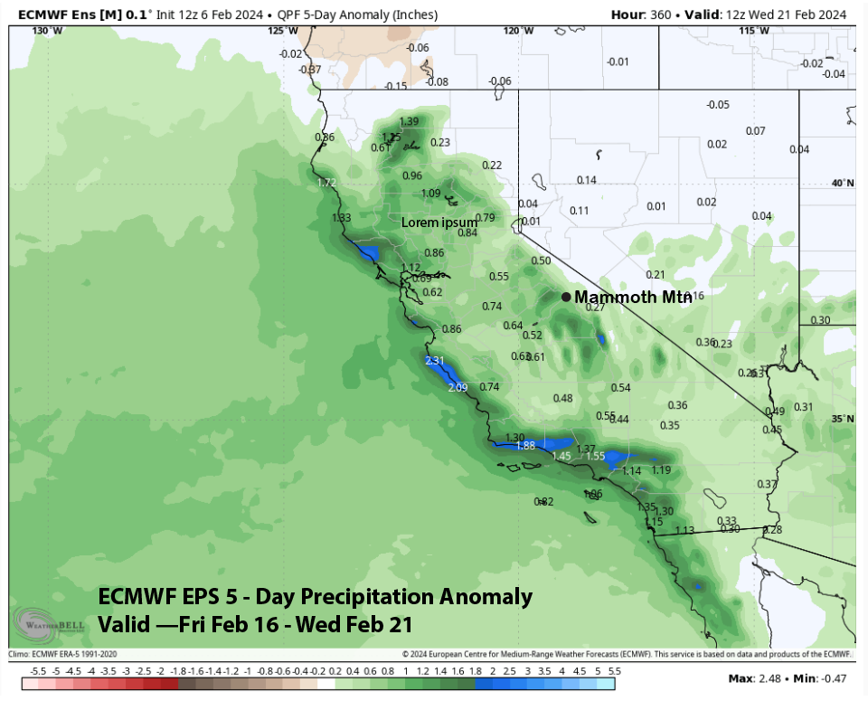
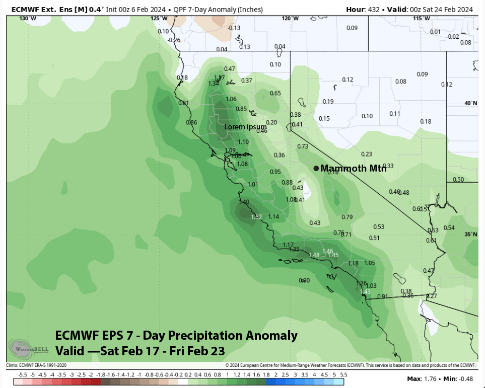
The ECM EPS guidance is showing a return of above-normal precipitation over that weekend (image below), and the 7-day anomaly extends the above normal through the next week (two images below). The CFS model is also showing above-normal precipitation. The pattern is then forecast to flip back to dry by the end of the month.
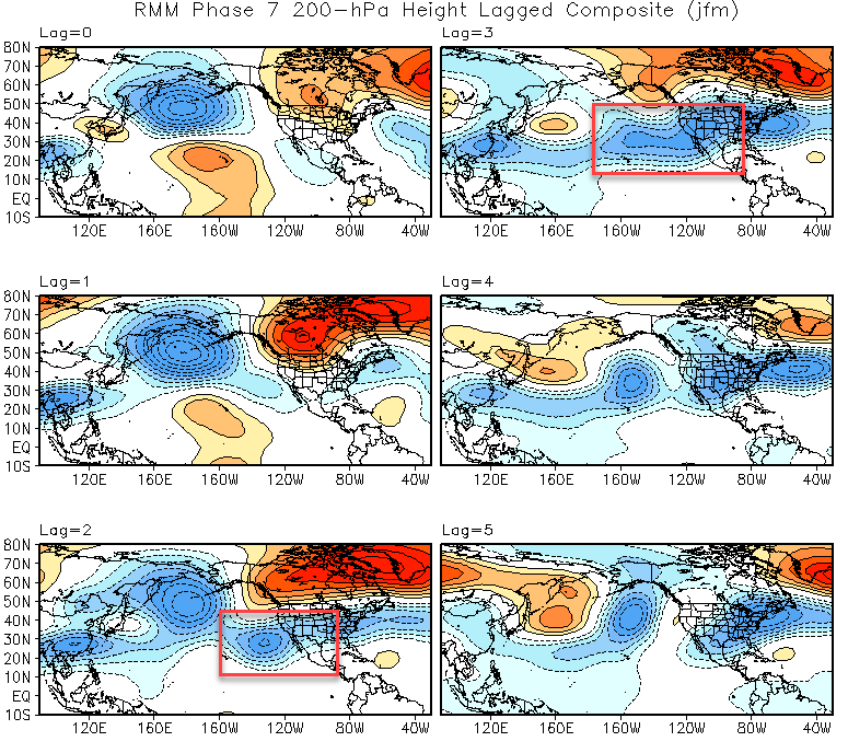
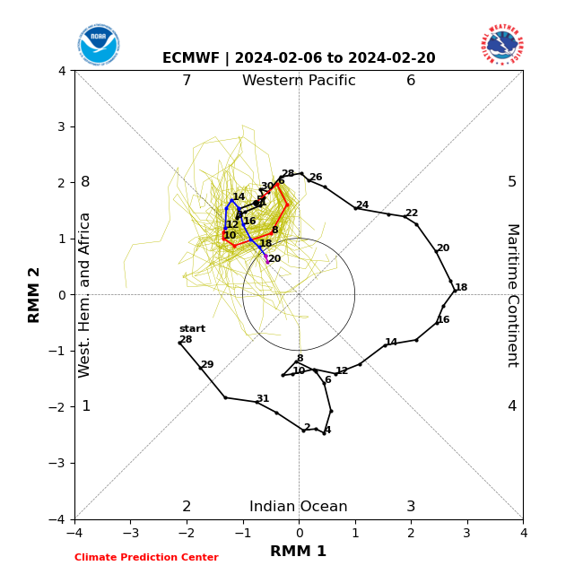
This potential wet pattern does have large-scale support from MJO forcings. The MJO is currently in phase 7 and is expected to generally remain mostly in phase 7 (image below) for the next couple of weeks. Phases 6 and 7 are associated with a lagged MJO teleconnection response, while phases 2 and 3 are more immediate.
Taking a look at the lagged 200-hPa composites for phase 7 during January/February/March (image below) shows the development of a very southerly positioned longwave trough and jet breakthrough by weeks two and three (red boxes).
This is very similar to what the longer-range models above are projecting. The timing matches up well, too, with the MJO moving into phase 7 at the end of January and remaining there through early February and the start of the wet pattern about 3 weeks later, around the 18-20th. Get ready for round 2. WG