Powder Forecast – Tuesday, January 16th, 2024
Ted Schlaepfer CCM —- Mammoth Mountain WeatherGuy
Snowfall forecasts are valid at the Sesame snow course (Main Lodge) for the prior 24 hours, as reported in the 6-7 AM morning snow report.
**Snowfall forecast confidence ranges from very low (1) to very high (5)
Wed 1/17 = 3 – 5” (H20 = 0.45” – 0.65”)**4
Thu 1/18 = 0”
Fri 1/19 = 0”
Sat 1/20 = 4 – 6” (H20 = 0.55” – 0.75”)**2
Sun 1/21 = 1 – 3”
Mon 1/22 = 8 – 12”
Tue 1/23 = 3 – 6”
Wed – Fri 1/24 – 1/28 = 0 – 3”
January Snowfall = 42”
January Forecast = 60 – 70”
Detailed 4-day Snowfall Forecast:
Wed 1/17 – A few light snow showers or flurries are possible during the morning, with dry weather returning by midday. No accumulation is expected.
Thu 1/18 – No snowfall expected.
Fri 1/19 – Dry during the day, then light to moderate snowfall develops late evening and continues overnight. Accumulations 4 – 6” by Saturday morning at Main Lodge, 6”+ up top.
Sat 1/20 – Light snow showers are possible during the day, primarily morning, and may continue into Sunday. Accumulations 1 – 3” at Main, 3”+ up top
Forecast Summary:
Short Term (Days 1 – 4):
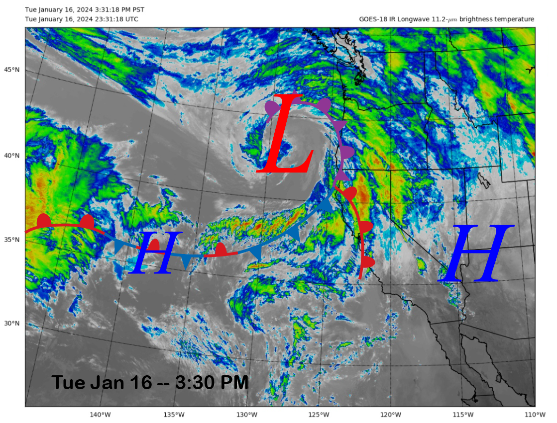
The current infrared satellite image (below) this afternoon a weather system currently moving into NorCal with clouds and rainfall. It will move southward into Mammoth tonight for a round of snowfall overnight.
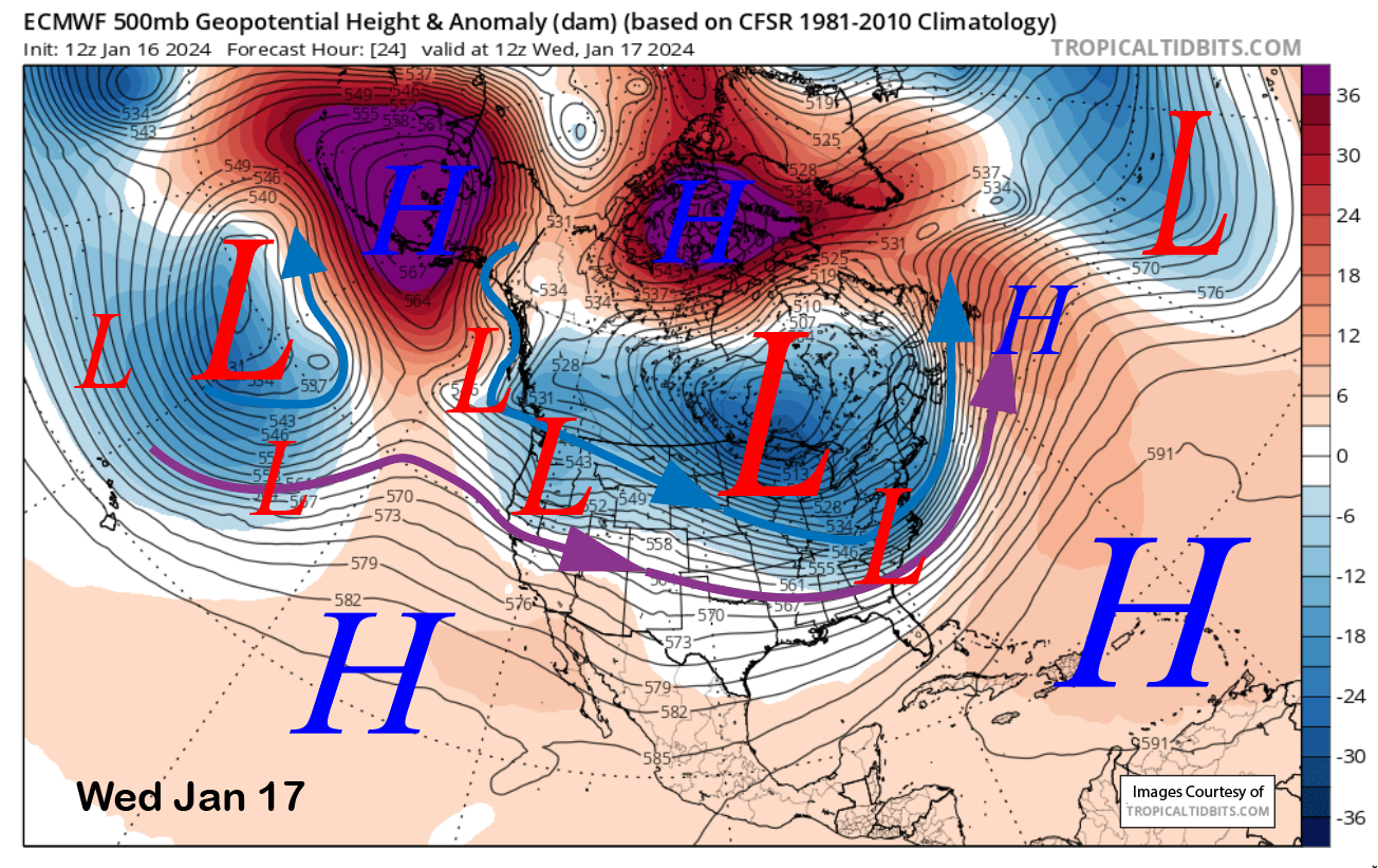
The models have the trough associated with the weather system moving into northeastern CA by early tomorrow (image below), and the snowfall should mostly end by dawn, with only a few leftover flurries during the morning. It is a warmer storm, and snow levels will be around 8000 feet before lowering to around 7500 tomorrow morning. Even though it is weak, it does have a good moisture plume associated with it.
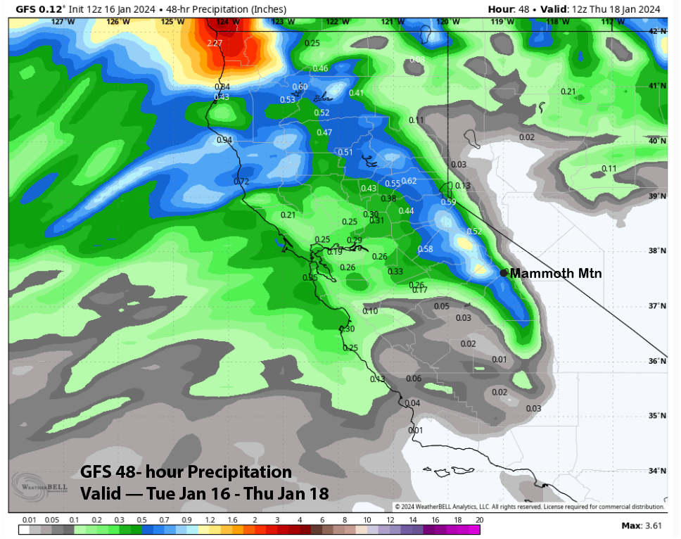
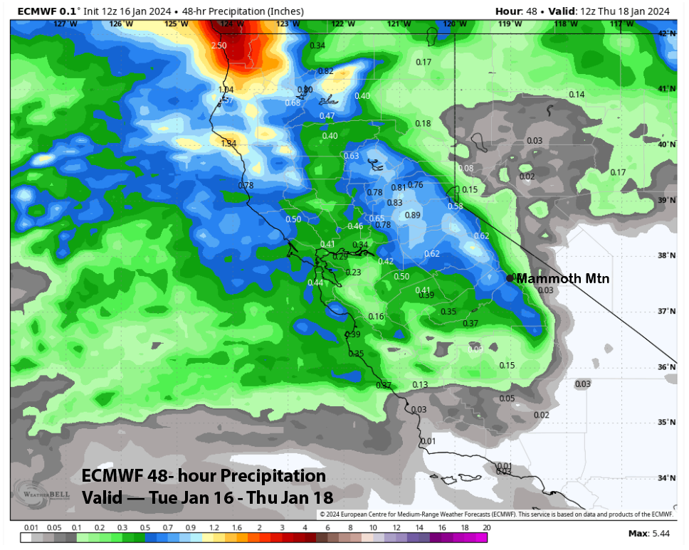
Model QPF is mostly in line with about half an inch of liquid, with the wetter GFS showing about 0.65” (image below) and the ECMWF around 0.50” (two images below). The Canadian is the driest again, with about a third of an inch (three images below). The forecast is calling for about 3-5” of snow at Main and six-plus inches up top. It should be enough for powder turns on Wednesday.

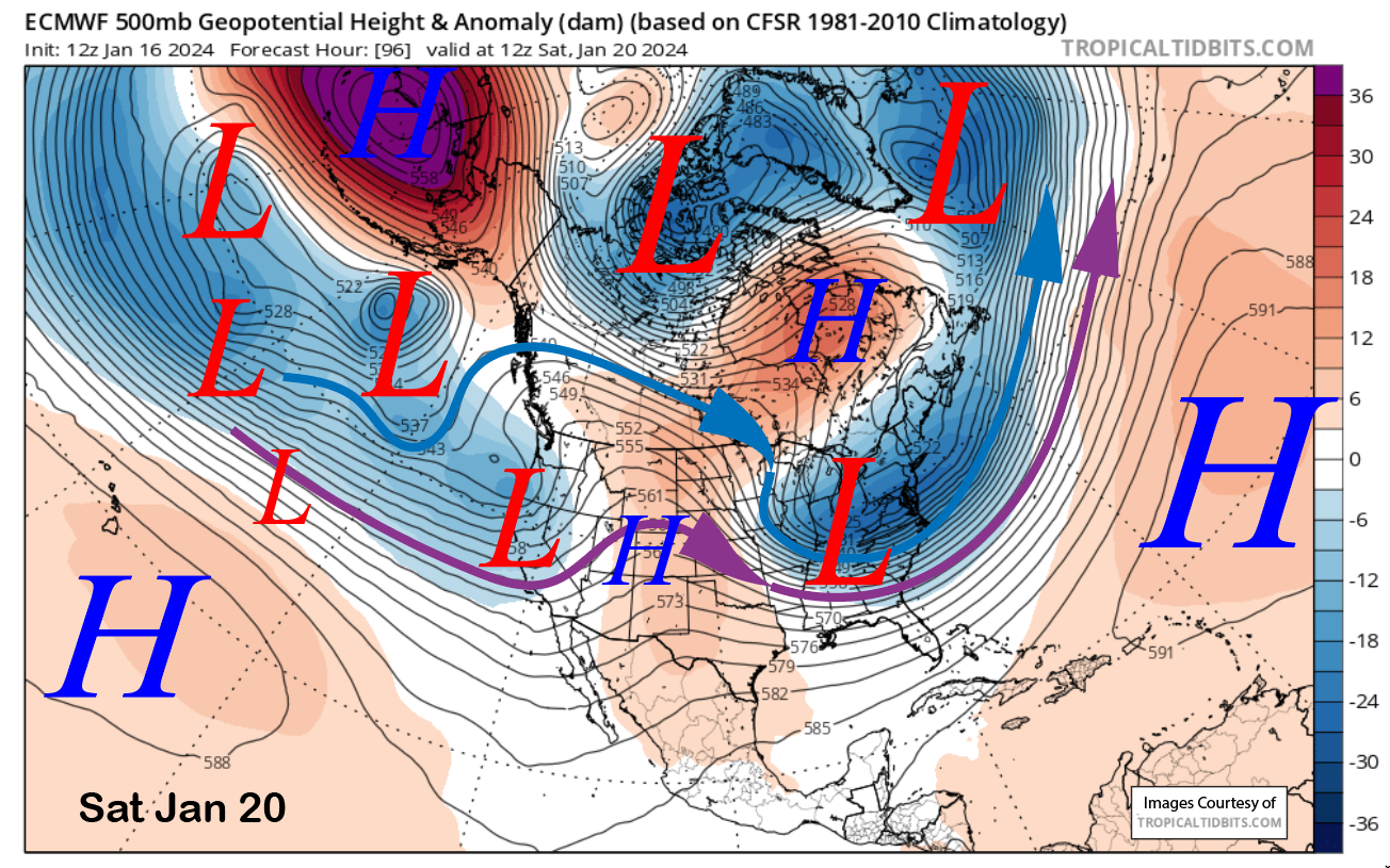
Dry weather is forecast for Thursday and most of Friday before the models move the next weather system into CA and Mammoth on Friday night and into Saturday (image below). It will again be a rather weak system with a good moisture tap with snow levels only slightly lower at around 7000 feet. The forecast is calling for up to 6” of Sierra cement at the Main and 6”+ up top. Saturday should be another powder day, with most of the snow falling overnight Friday with only light snow showers Saturday.
Long Range (Days 5+):
The longer-range guidance has come together now for the remainder of the month, and it is both good and bad. It is good because it appears we will have a base snow-type pattern into early next week, albeit not a major storm pattern. It is bad because dry weather is then favored for the rest of January.
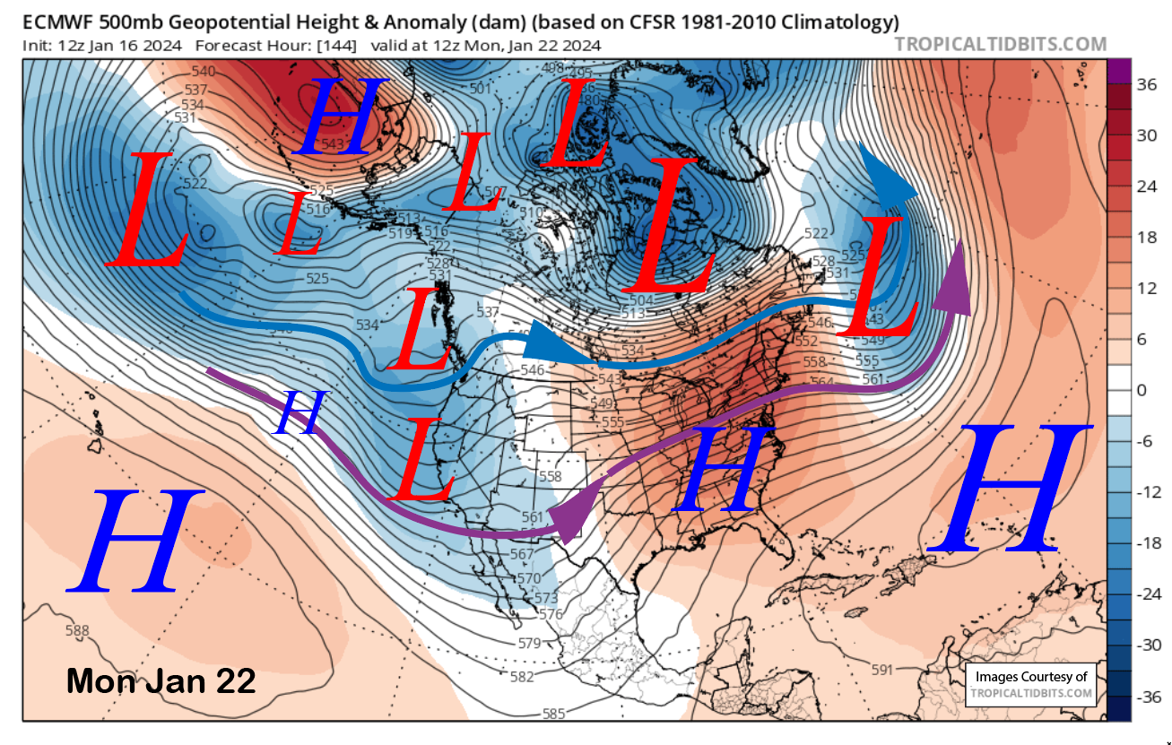
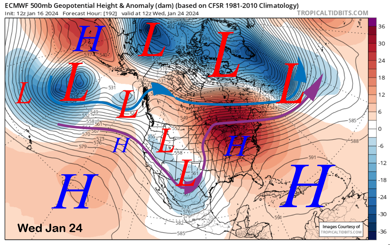
The next and strongest storm system in this series of warmer storms is forecast to move into CA and Mammoth around Sunday and into next Monday (image below). It appears to be backed by the strongest westerly jet stream of the series, although this jet stream pales in comparison to the strength of what occurred last winter. It will also have a good moisture tap, and snow levels are expected to be slightly lower again, around 6000-6500 feet. But it will still be Sierra Cement.
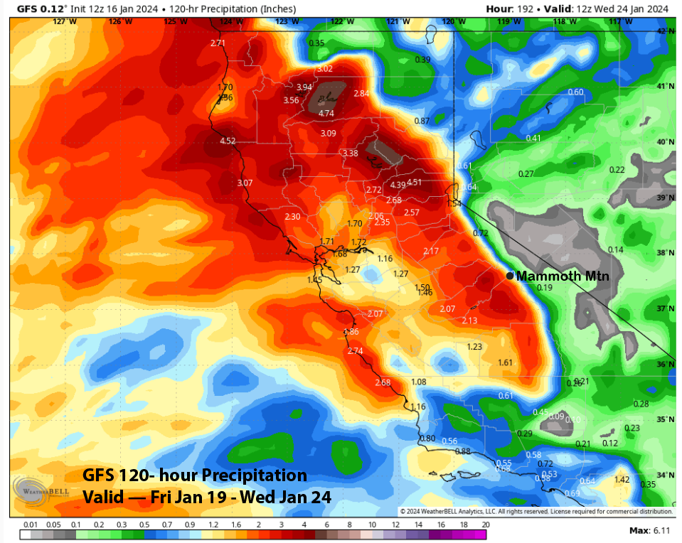
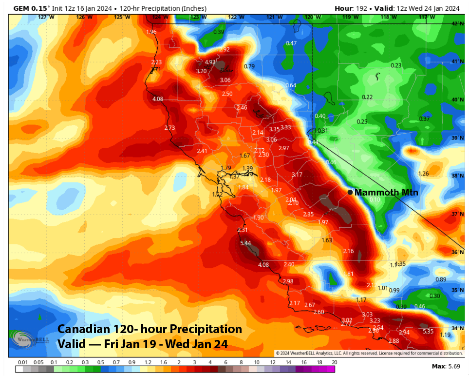
Model liquid precipitation forecast totals over the entire weekend are good, but certainly not super impressive by historical standards. The ECM model shows about 2” liquid (image below), and the GFS is similar (two images below). The Canadian (three images below) is showing slightly less, but does have 5” liquid on the westerly Sierra slopes, likely indicative of the weak jet stream not able to produce good spillover.
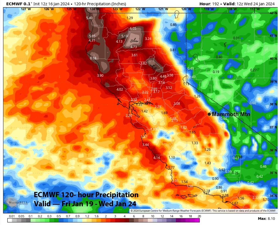
The current forecast is favoring slightly more than the models are showing and around 2.5” liquid for the weekend and into Monday. Average snow ratios will probably be 8”:1” range and thus 20” of Sierra cement looks possible at Main by Monday morning and likely 2-3 feet up top. This will certainly help with the overall coverage on the mountain, especially the upper half, and runs like Climax, which is finally open.
There is a chance that one more weak storm may move through the area around late Tuesday or Wednesday next week, but the latest ECM (image below) moves it through as a slider-type storm and no meaningful snowfall. ECM mean is showing only very light amounts or maybe an inch/two of snowfall.
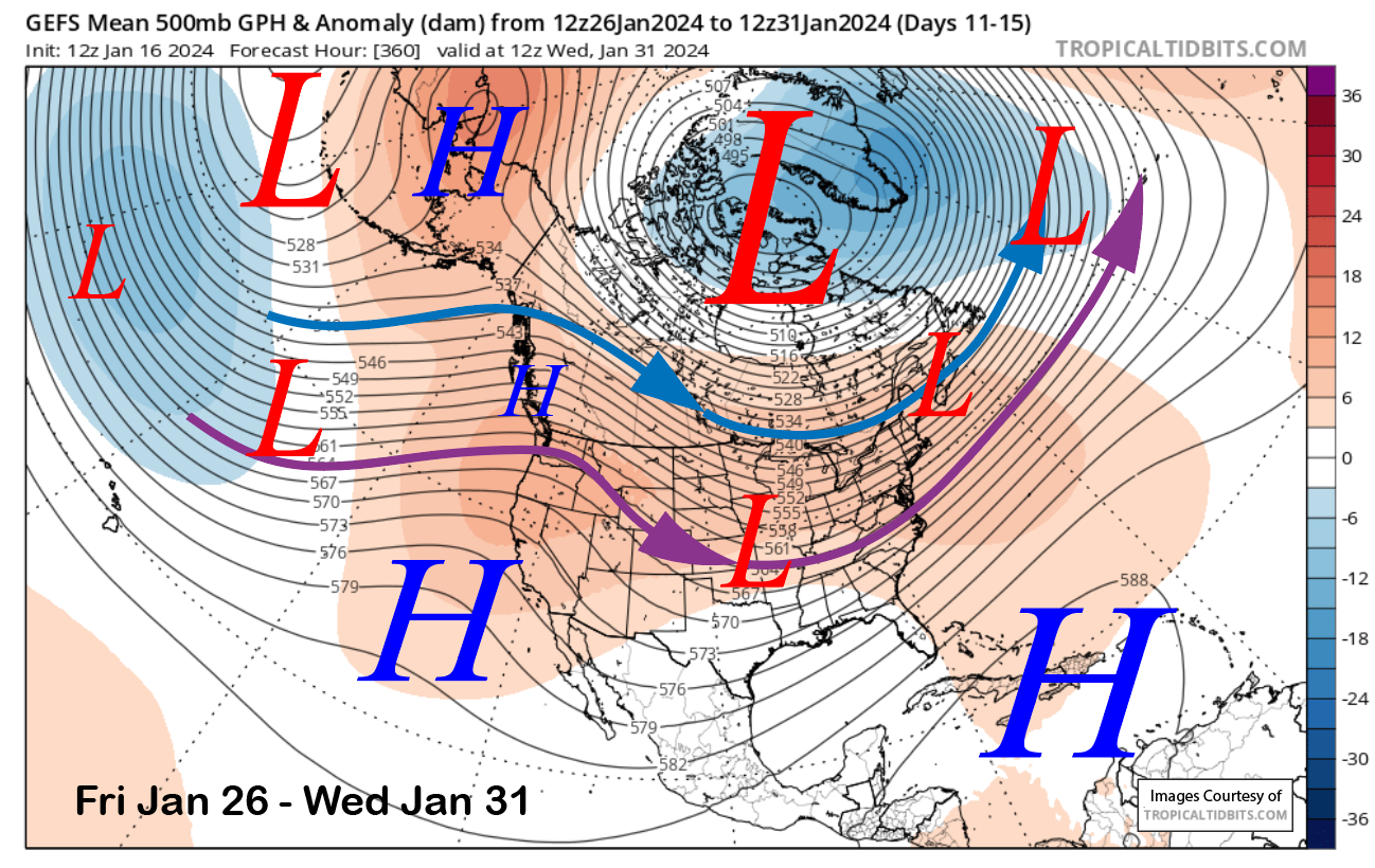
The longer-range guidance is then bullish on a high-pressure ridge building into the state (image below) and generally holding steady for the rest of the month. That would mean a stretch of dry weather and seasonable or seasonably mild temperatures.
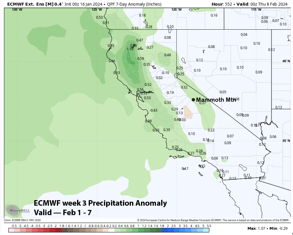
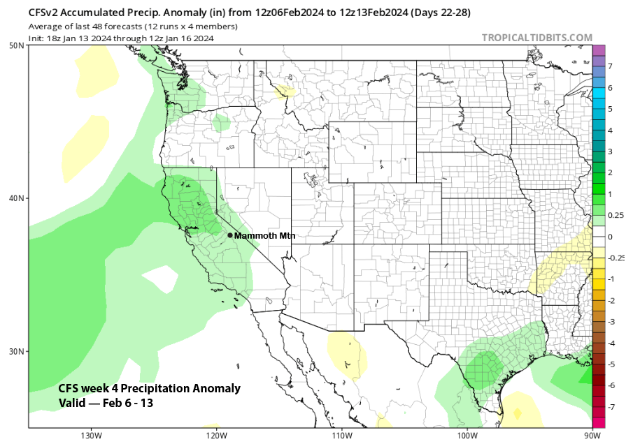
The ECM EPS 45-day forecast and the CFS still differ about when the next chance for a storm period will occur. The ECM is faster and shows average precipitation returning over the first week of February (image below). The CFS model is slower and does not show anything meaningful until the second week of the month (two images below).
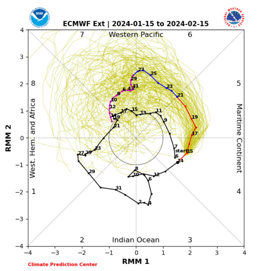
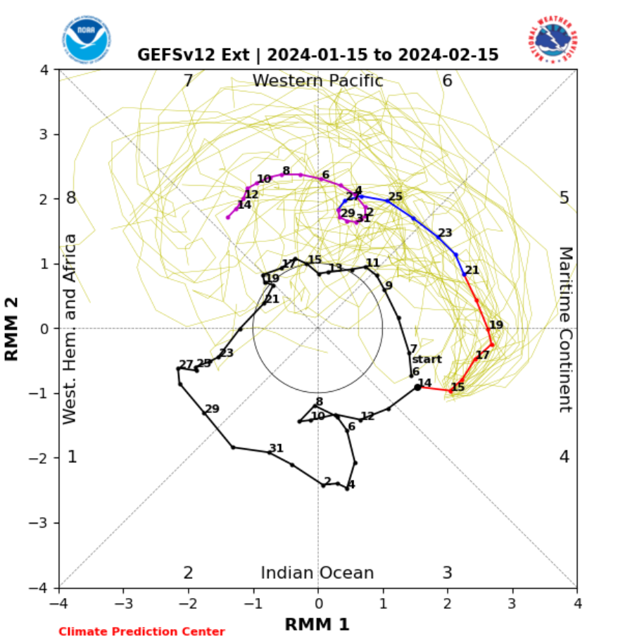
The MJO is still expected to be active through the end of the month and into early February (images below). The current forecast has it in either phases 6 or 7 during the first week of February. Phase 7 is not quite as dry as Phase 6 for that time period, but both phase analogs favor dry weather. Phase 7 or 8 during the second week of February is wetter, so it seems, based on those MJO forecasts, that the slower CFS might be the better guess for when snowfall may return. WG