Powder Forecast –Friday January 21st, 2022
Ted Schlaepfer CCM —- Mammoth Mountain WeatherGuy
Snowfall forecasts are valid at the Sesame snow course (Main Lodge) for the prior 24 hours as reported in the 6-7 AM morning snow report.
**Snowfall forecast confidence ranges from very low (1) to very high (5)
Sat 1/22 = 0”
Sun 1/23 = 0”
Mon 1/24 = 0”
Tue 1/25 = 0”
Wed 1/26 = 0”
Thu 1/27 = 0”
Fri 1/28 = 0”
Sat – Mon 1/29 – 1/31 = 0 – 10”
January Snowfall = 0”
January Forecast = 0 – 10”
Detailed 4-day Snowfall Forecast:
Sat 1/22 through Tue 1/25 – No snowfall expected all days.
Forecast Summary:
Short Term (Days 1 – 4):
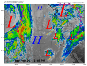
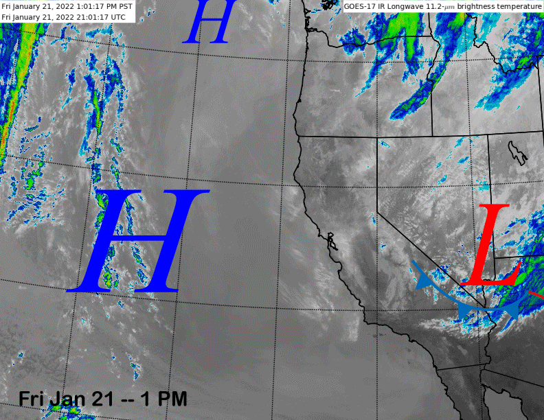
The infrared satellite image (below) today shows an inside slider type weather system moving southeastward into Arizona this afternoon with high pressure situated off the coast. That weather system is responsible for the gusty easterly winds today and tomorrow along with the colder temps.
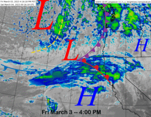
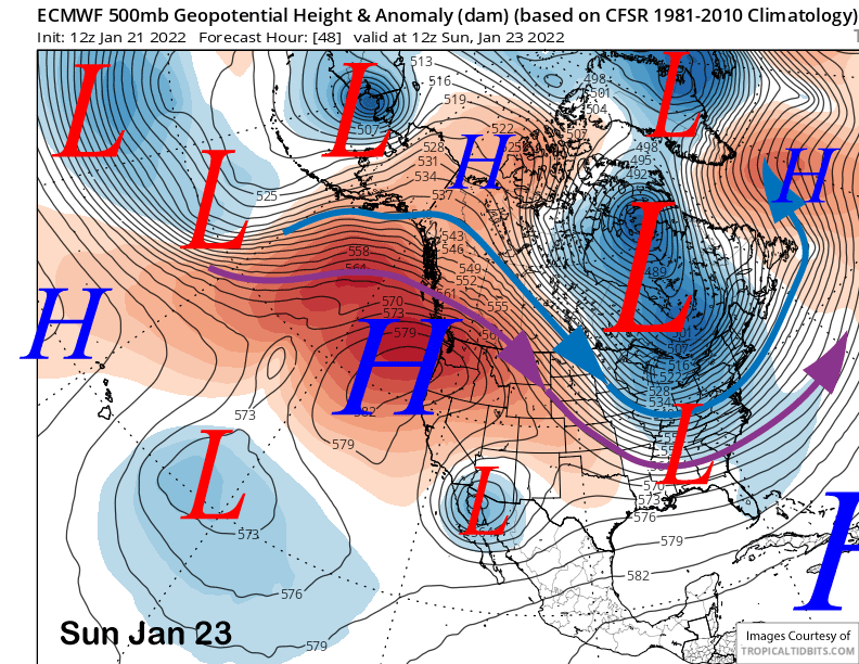
Otherwise, high pressure will build into the PacNW through Sunday (image below) with Mammoth seeing light northeast flow and mostly seasonable temperatures as the ridge will stay too far north for a big warm-up, although temps will warm a bit on Monday.
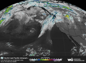
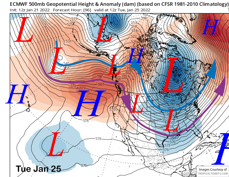
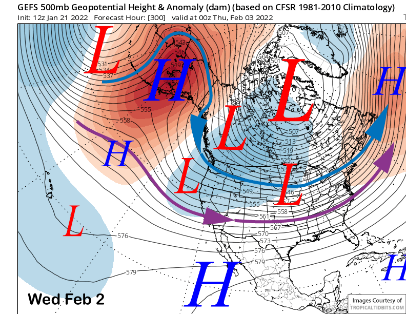
The ECM model (image below) and others move another weaker slider-type system east of Mammoth on Tuesday and there may be a dip in temperatures and slight uptick in winds, otherwise, dry weather continues through early next week.
Long Range (Days 5+):
The longer-range guidance has become a bit more bullish about a pattern transition at the end of the month and into early February, but questions remain about how long it will last.
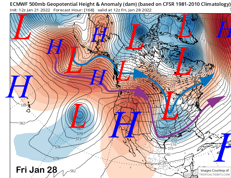
The ECM model (image below) moves the ridge over CA toward the end of the week for continued fair and dry weather. Temperatures will probably rise into the mid-30s up top and 40s/low 50s elsewhere.
A weak weather system may move into the state around late Friday or Saturday next week, but overall, changes in the pattern probably won’t happen until over the weekend or first part of February. Exact timing is still a bit uncertain.
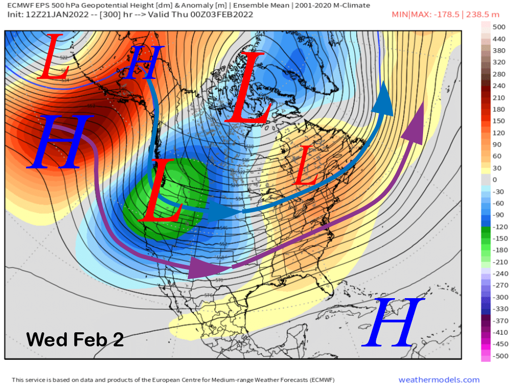
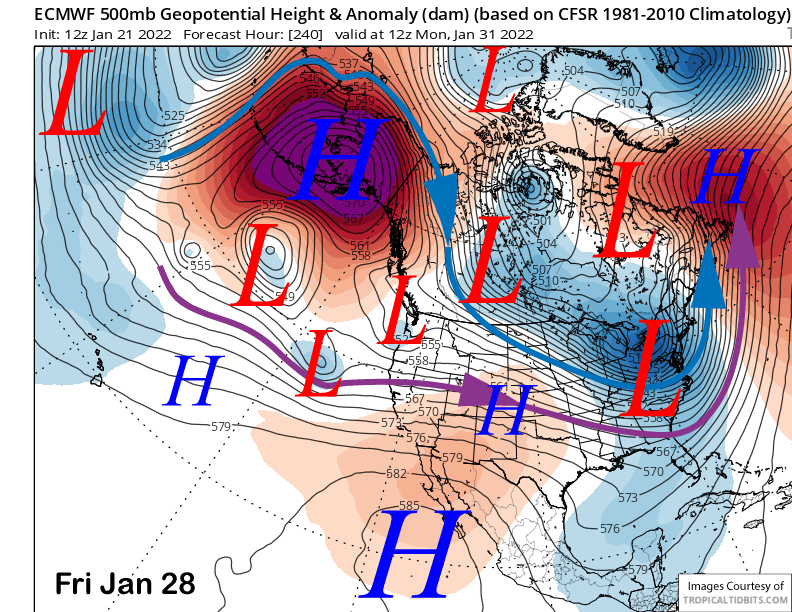
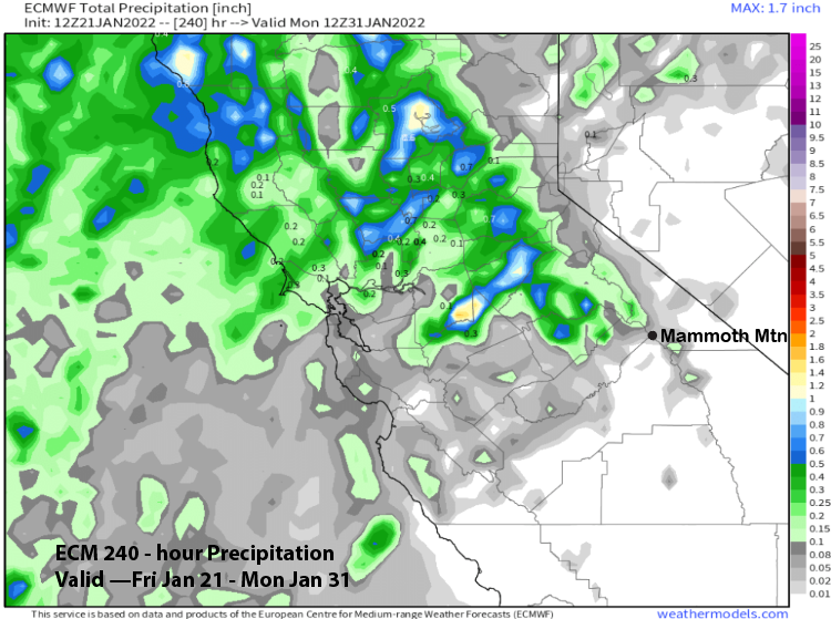
The latest ECM model (image below) develops a strong ridge over Alaska and the Aleutian island chain at the end of the period and suggests that there could be an uncut of the westerly jet stream into CA early next week. Right now, the flow is weak, and the model is not showing much precipitation for the period (two images below).
The other models are slightly different as is the ECM EPS that has a deeper trough along the West Coast at that time (image below) and no strong suggestion of an undercutting westerly jet stream. It supports storm moving southward from the Gulf of Alaska and that model brings in enough snowfall for powder conditions by Monday and a slight chance by Sunday.
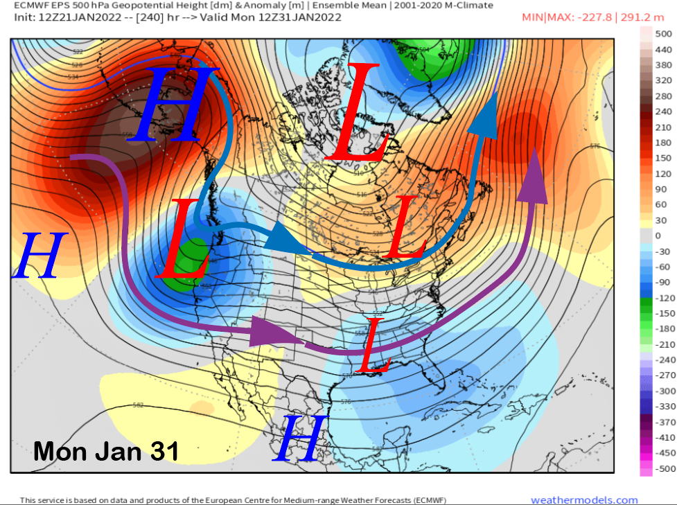
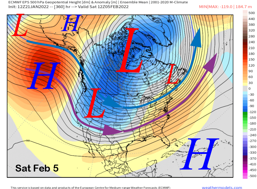
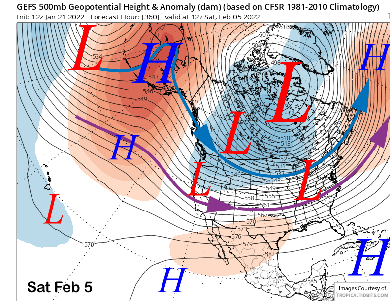
The general pattern beyond the 10-day time frame is for a deepening trough of low pressure along the West Coast and jet stream extending southward into CA. Both the ECM EPS (image below) and GFS ensemble (two images below) are rather similar with the ECM model only slightly deeper.
Both models do favor shifting the trough slightly eastward at the end of the period (images below) that would eventually shift the storm track too far eastward for continued storminess in the Sierra or support low-moisture storms moving southward from the Gulf of Alaska.
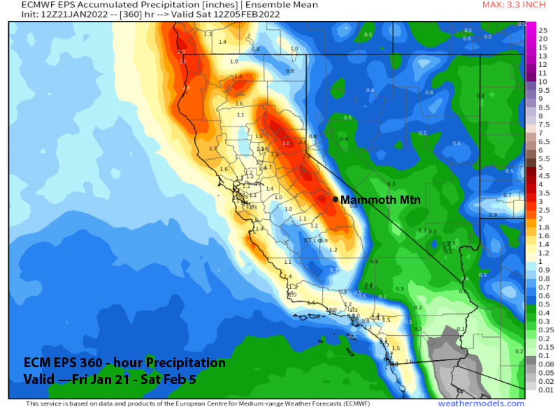
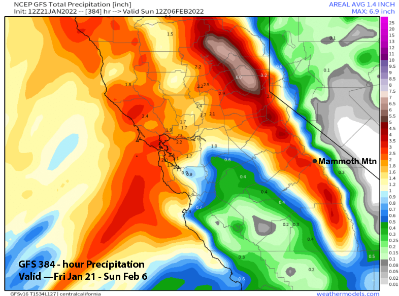
Nonetheless, the ECM EPS is showing decent amounts for the period (image below) and over 2” of liquid with pretty much all of it falling in the 11-15 day period. The GFS ensemble is showing slightly less while the morning run of the GFS operational model is showing almost 3” for the period (two images below).
Overall, there is good support from the ensembles that the dry period will end around the end of the month or early February. Beyond that time frame, it is a question mark. The models are not handling the potential evolution of the MJO well with the forecasts all over the place and any potential teleconnection forcing unknown.
Further, the stratospheric polar vortex (SPV) is forecast to remain strong and uncoupled from the troposphere into mid-February and that supports a warmer East Coast and usually colder/wetter West during the latter part of winter. Last time the SPW remained uncoupled through most of winter was 2013-14. Both February (69”) and March (57”) of that year saw average snowfall. Thus, I don’t think a very dry February and March is in the cards this year. WG