Powder Forecast –Tuesday, January 30th, 2024
Ted Schlaepfer CCM —- Mammoth Mountain WeatherGuy
Snowfall forecasts are valid at the Sesame snow course (Main Lodge) for the prior 24 hours.
**Snowfall forecast confidence ranges from very low (1) to very high (5)
Wed 1/31 = 0”
Thu 2/1 = 6 – 9” (H20 = 0.65” – 0.85”)
Fri 2/2 = 9 – 12” (H20 = 1.00” – 1.25”)
Sat 2/3 = 3 – 6” (H20 = 0.25” – 0.45”)
Sun 2/4 = 0 – 1”
Mon 2/5 = 12 – 15”
Tue 2/6 = 14 – 24”
Wed – Fri 2/7 – 2/9 = 3 – 12”
January Snowfall = 72”
January Forecast = 72”
Detailed 4-day Snowfall Forecast:
Wed 1/31 – No snowfall expected during the day with snowfall developing during the evening and then becoming heavy overnight. Accumulations by Thursday AM 6 – 9” at Main, up to 12” up top
Thu 2/1 – Heavy snowfall and strong winds during the morning, changing to snow showers during the afternoon and continuing overnight. Accumulations by Friday AM 9 – 12” at Main, 15”+ up top
Fri 2/2 – Snow showers, moderate to heavy at times, continue during the day and overnight. Accumulations by Saturday AM 3 – 6” at Main, 6”+ up top
Sat 2/3 – Any lingering snow showers end during the morning, with only flurries expected for the rest of the day and a dry Saturday night. Little or no accumulation expected
Forecast Summary:
Short Term (Days 1 – 4):
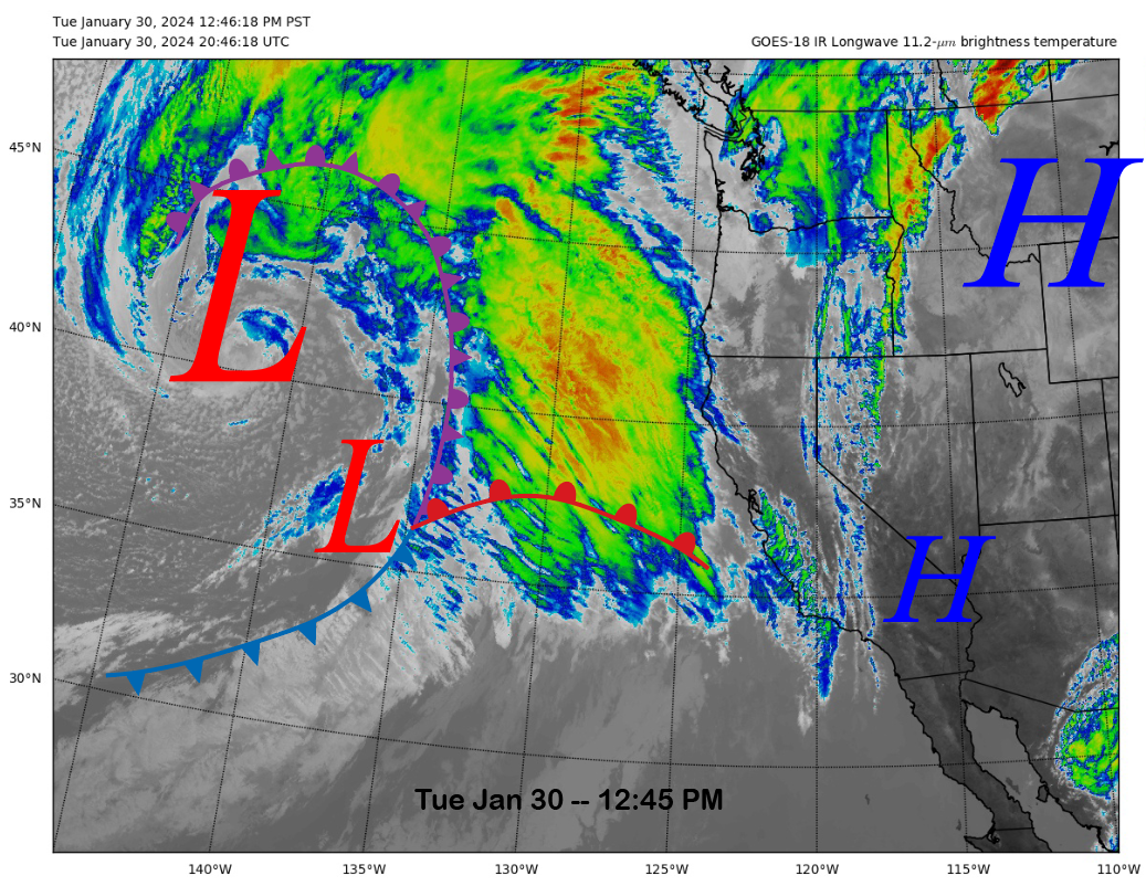
The current infrared satellite image (below) this afternoon shows a strong storm system moving into the eastern Pacific, backed by a deep low-pressure center just west of 140°W. Clouds will increase tonight as the system moves toward the coast.
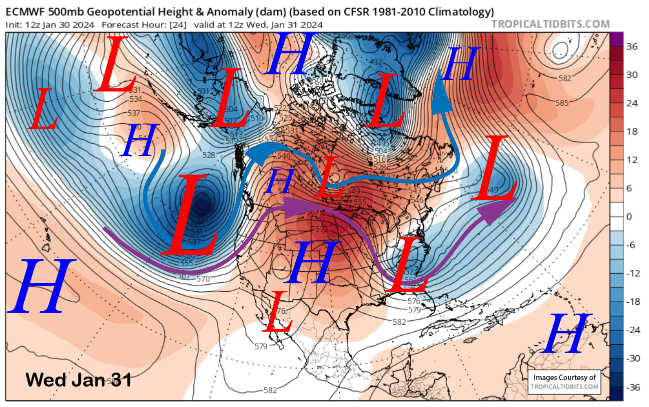
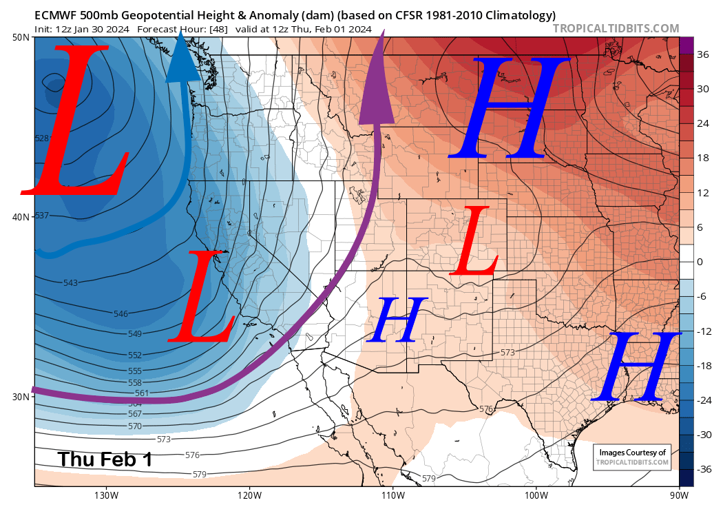
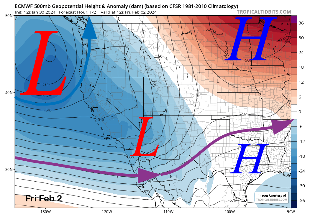
Models move the weather system onto the coast early tomorrow (image below), then southward into SoCal by early Thursday (two images below), and then out of the state by Friday (three images below). However, the upper-level low will remain just off the coast through the period, and that will keep snowfall ongoing at times into Saturday.
Snowfall should increase overnight tomorrow before becoming heavy Thursday morning and then continuing at times through Friday and into Saturday before mostly ending. Snow levels will start out around 7000 feet, lower to around 5500-6000 feet Thursday, then down to 4500-5000 feet Friday. So it will be Sierra cement to start and then lighter-type snowfall at the end.
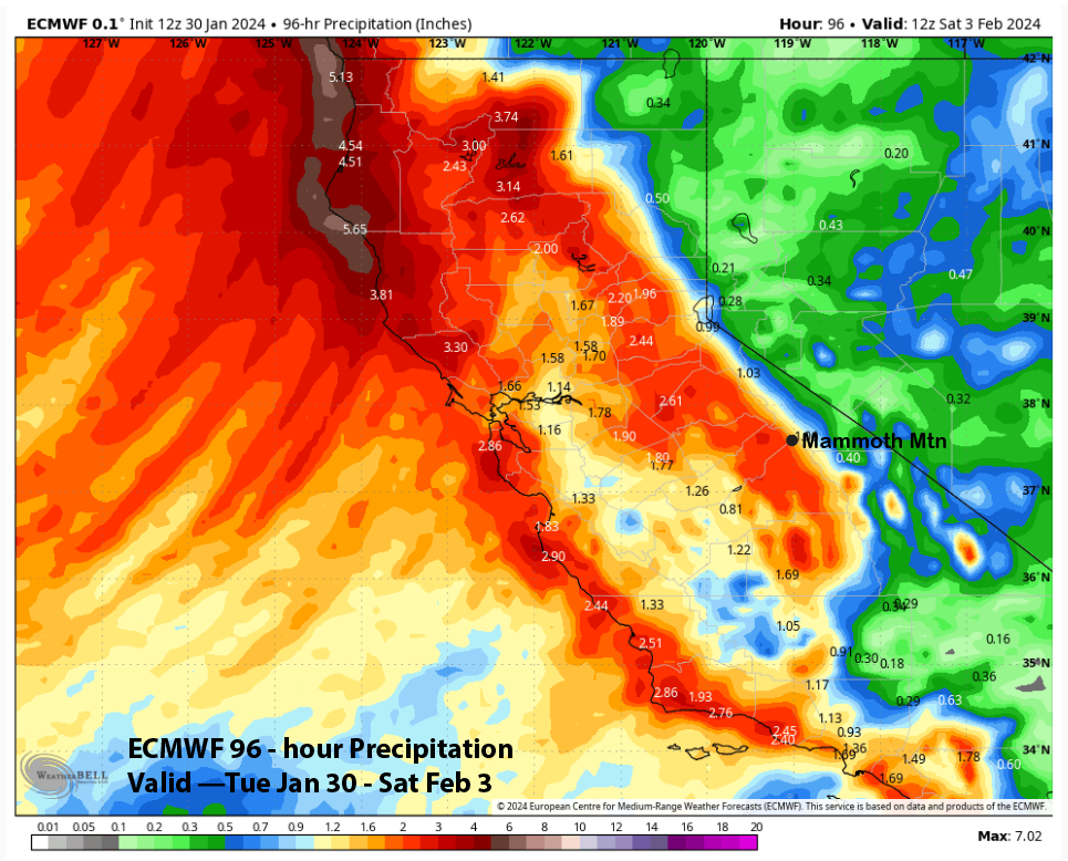
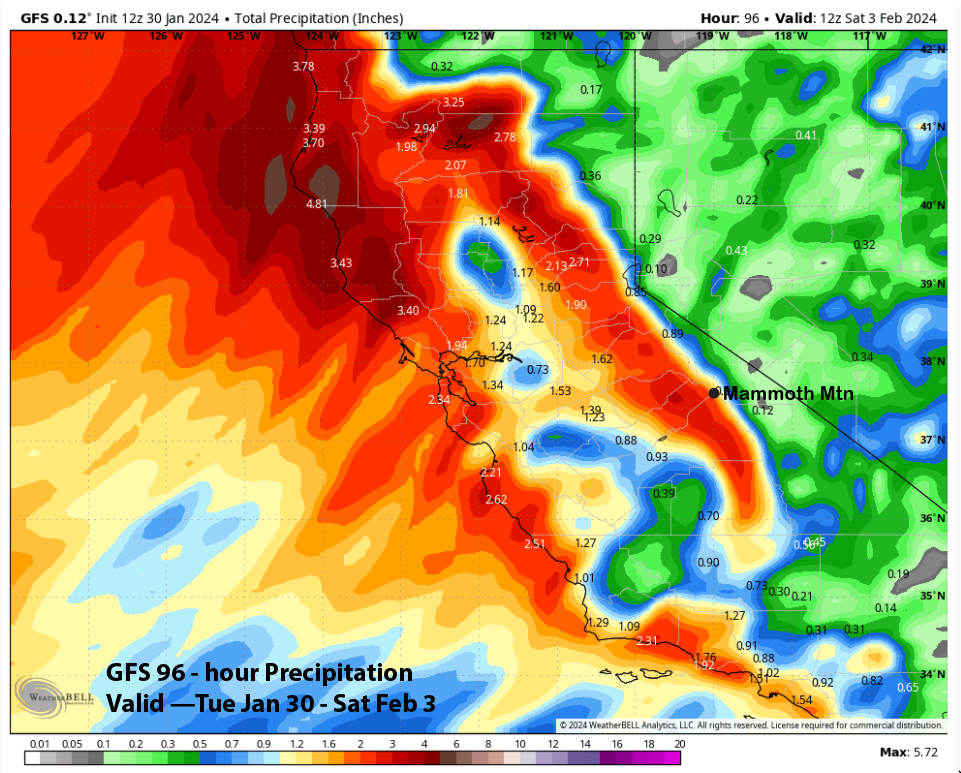
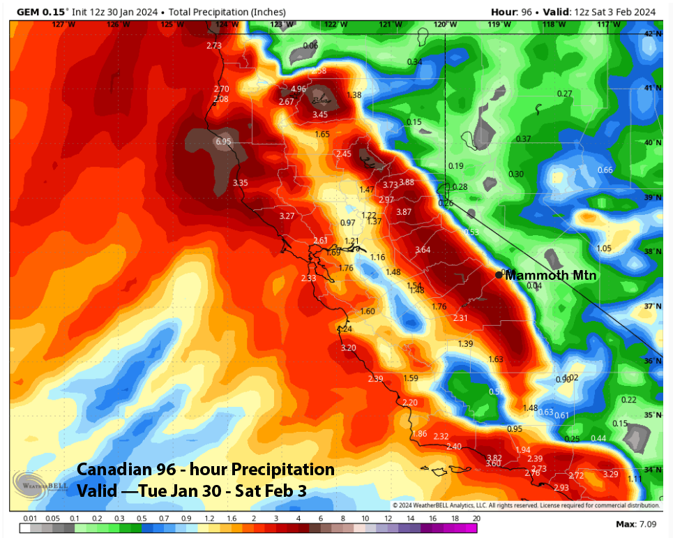
Model QPF is all fairly similar for Mammoth, with the ECM (image below) and GFS (two images below) both showing about 2” liquid for the event. The Canadian is slightly wetter at about 2.25” liquid and has 4” on the western slope of the Sierra.
The forecast leans a bit toward the wetter side of the guidance and is calling for about 20” of snowfall at Main or slightly more for the event. The guidance has most of the strong winds occurring Wednesday overnight and then isn’t showing any more strong winds through Saturday. Riders of the Storm should be happy on Thursday, with more powder on Friday and Saturday.
Long Range (Days 5+):
The longer-range guidance is now trending toward a possible larger snowfall event late over the weekend and into early next week. It has the potential to be the biggest event of the winter so far, with continued snowfall possible at times through next week.
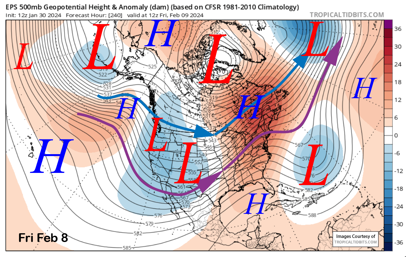
The model guidance never moves the upper-level low from the previous event onshore and keeps it quasi-stationary off the NorCal coast through the weekend. It also combines with a low-pressure system moving off the eastern Pacific from an enhanced southern branch of the jet stream and southwestward extending long-wave trough (images below).
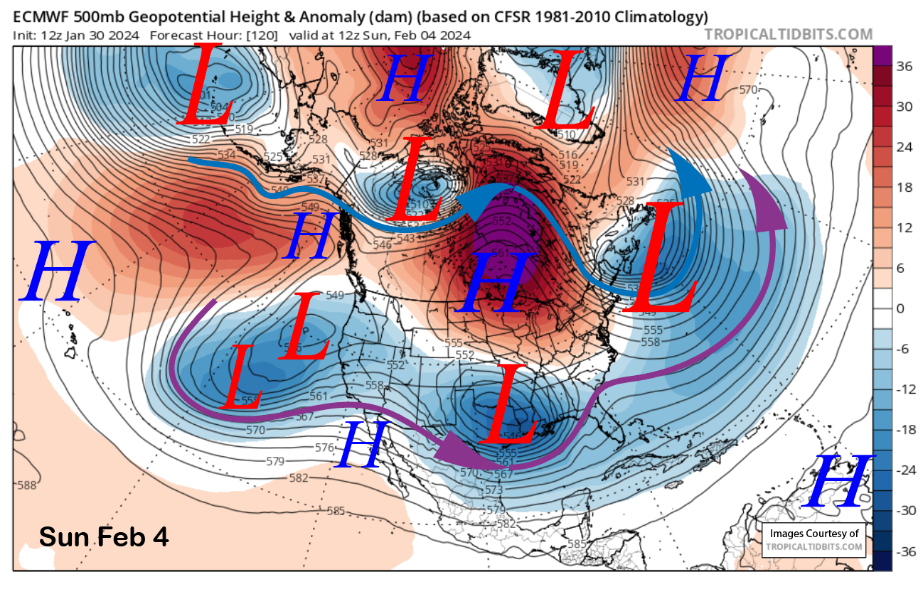
This pattern is favorable for about the Mammoth southward through SoCal as any storms would take a more southerly track through California. This pattern is well supported by the ensemble means of both models (GEFS below). Confidence is certainly moderate that a bigger event could unfold.
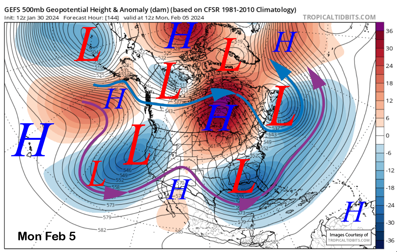
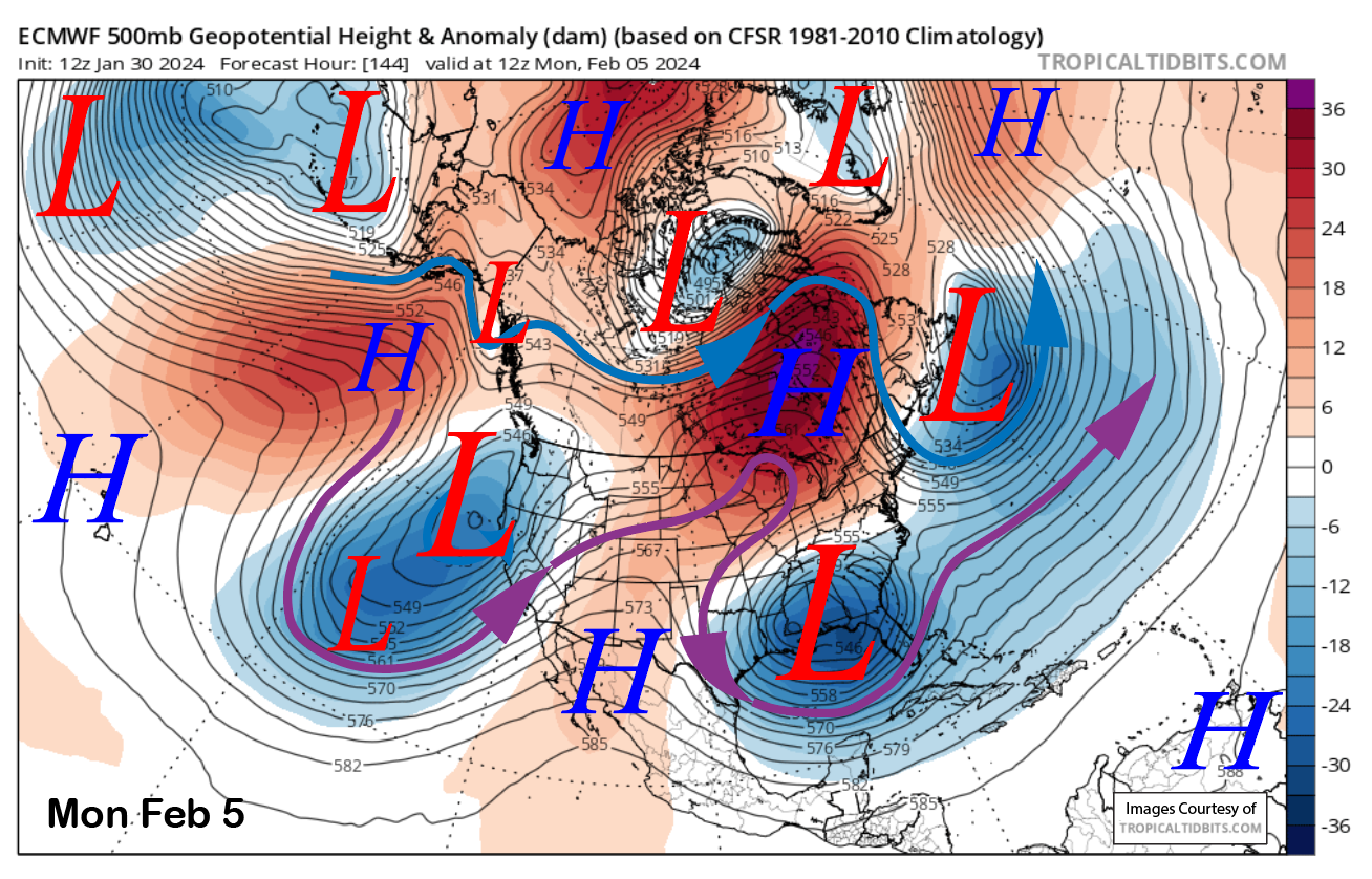
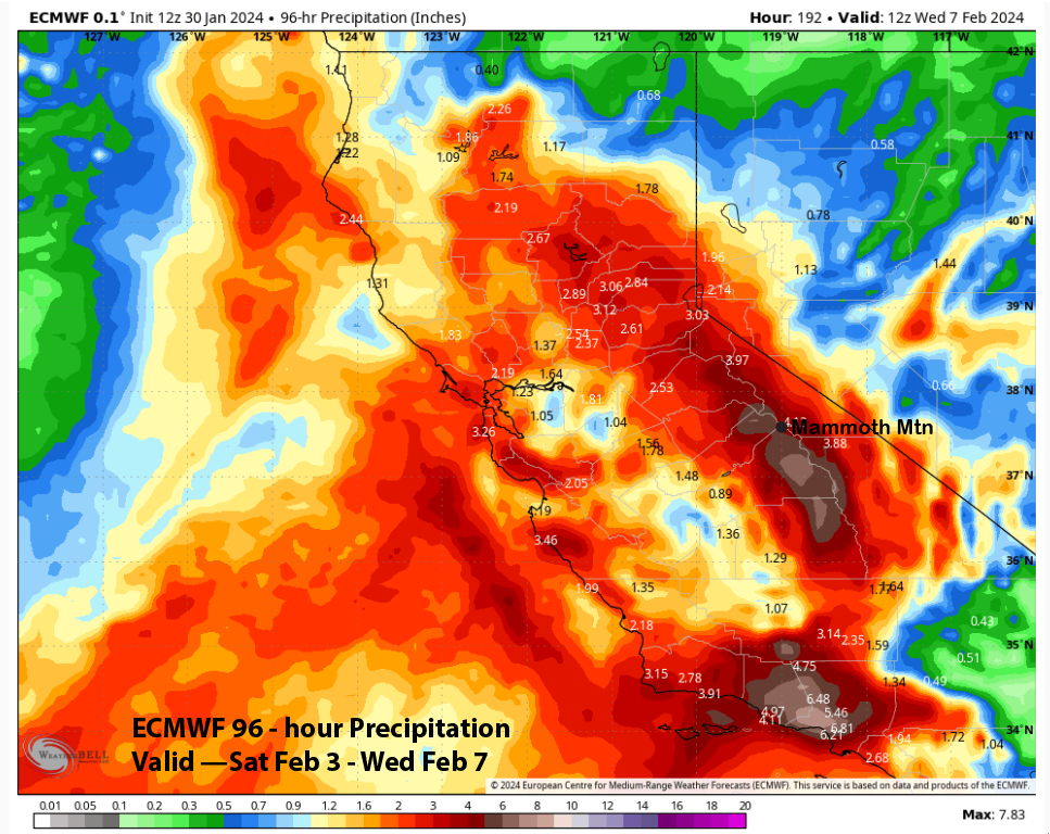
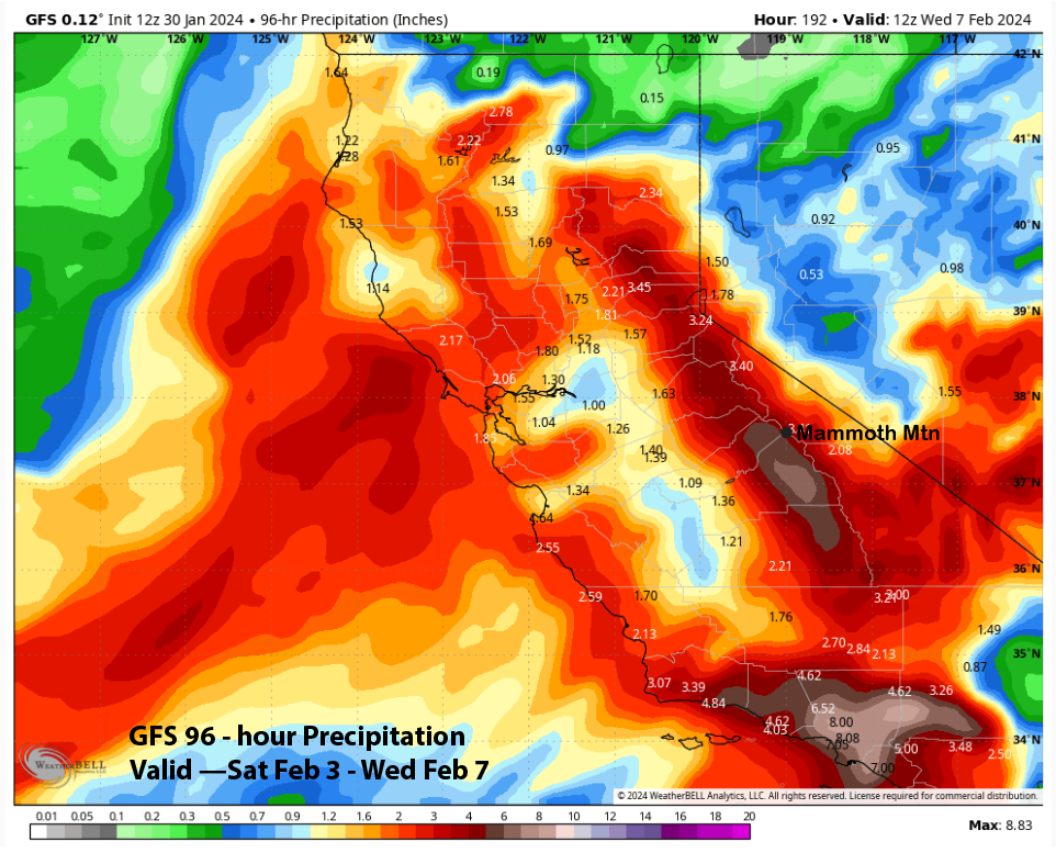
That is exactly what the current model guidance is saying, with the 12z runs of the ECM showing QPF around 5” liquid for Mammoth (image below), and the GFS is similar (two images below) for the four-day period into next week. That would mean 3-4 feet of snow at Main and 5-plus feet up top. Snow levels may start out lower, but would rise to near 7K by Monday.
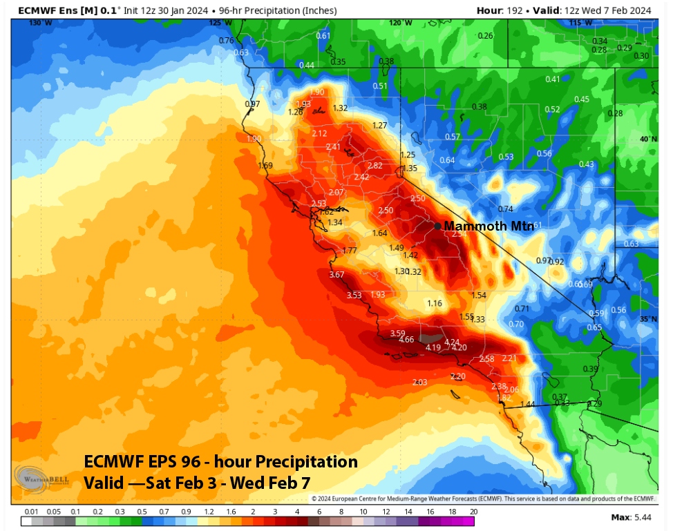
The forecast is still 5-6 days out and mostly follows the ECM EPS (image below) that has around 3-4” liquid or about 30” of snowfall at Main. I would say there is a good chance that the wetter solutions could be verified under this type of pattern.
The longer-range guidance does not move the long-wave trough eastward until the end of next week (image below). Thus, there could be continued snowfall at times, but probably only smaller storms.
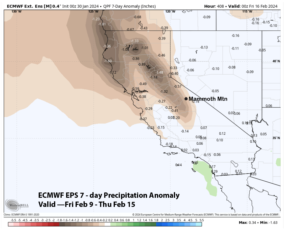
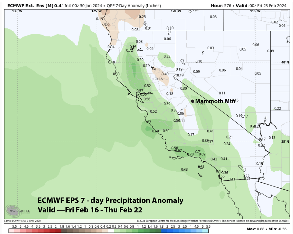
The ECM EPS climate model is then favoring a period of drier weather heading into mid-month (image below). It then suggests that storms may return after mid-month (two images below). Regardless, it looks like February will be off to a great start and many powder days. WG