Powder Forecast – Tuesday, December 5th, 2023
Ted Schlaepfer CCM —- Mammoth Mountain WeatherGuy
Snowfall forecasts are valid at the Sesame snow course (Main Lodge) for the prior 24 hours as reported in the 6-7 AM morning snow report.
**Snowfall forecast confidence ranges from very low (1) to very high (5)
Wed 12/6 = 0
Thu 12/7 = 1 – 2” **3
Fri 12/8 = 0”
Sat 12/9 = 0”
Sun 12/10 = 0”
Mon 12/11 = 0”
Tue 12/12 = 0”
Wed – Fri 12/13 – 12/15 = 0”
December Snowfall = 1”
December Forecast = 20 – 35”
Detailed 4-day Snowfall Forecast:
Wed 12/6 –Dry during the morning, then light snowfall likely during the evening, ending overnight. Accumulations 1 – 2”
Thu 12/7 –A chance for flurries during the evening, otherwise dry.
Fri 12/8 and Sat 12/9 – No snowfall expected on both days.
Forecast Summary:
Short Term (Days 1 – 4):
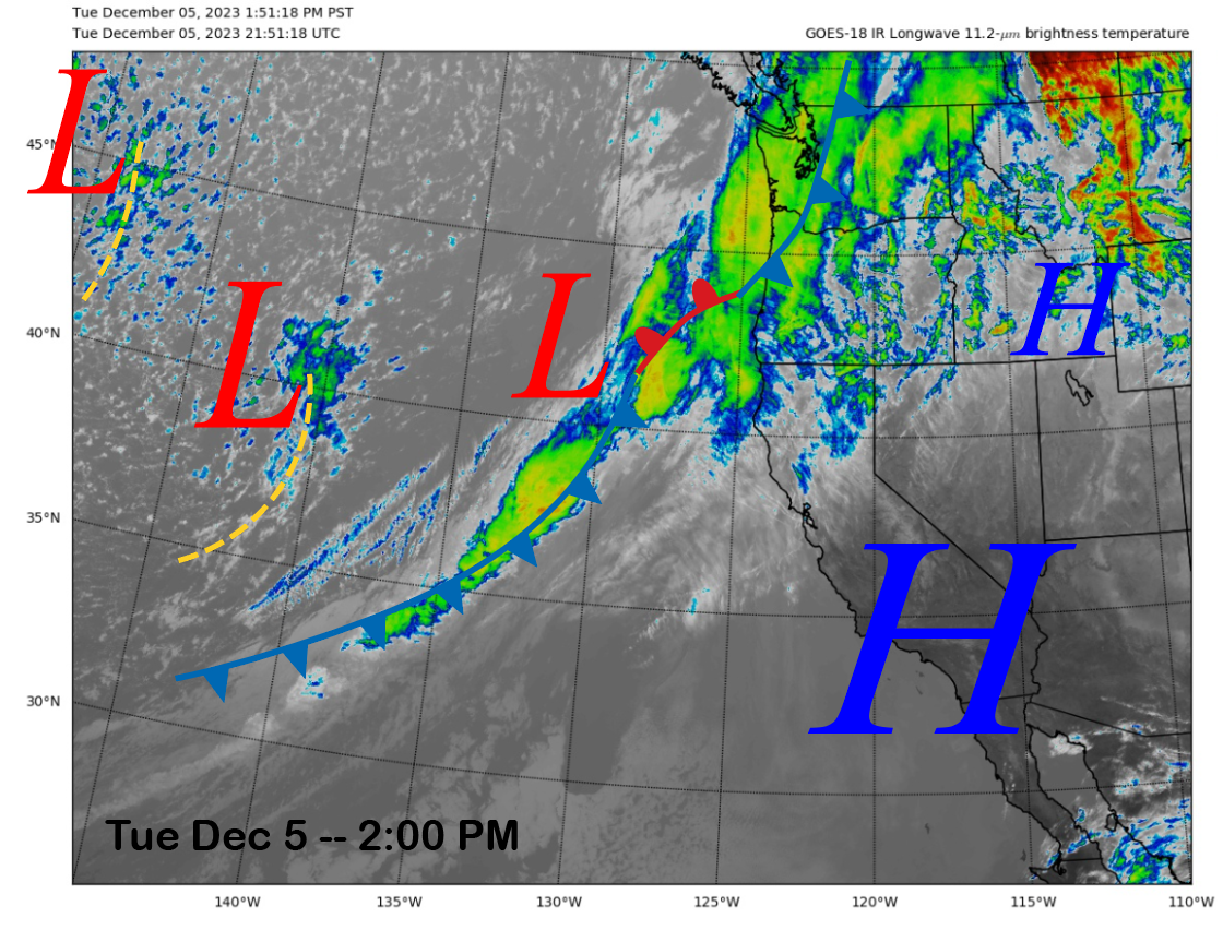
The current infrared satellite image (below) this afternoon shows high pressure moving eastward as a weather system positioned off the CA/OR coast slowly moves eastward with a front that extends southwestward into the eastern Pacific.
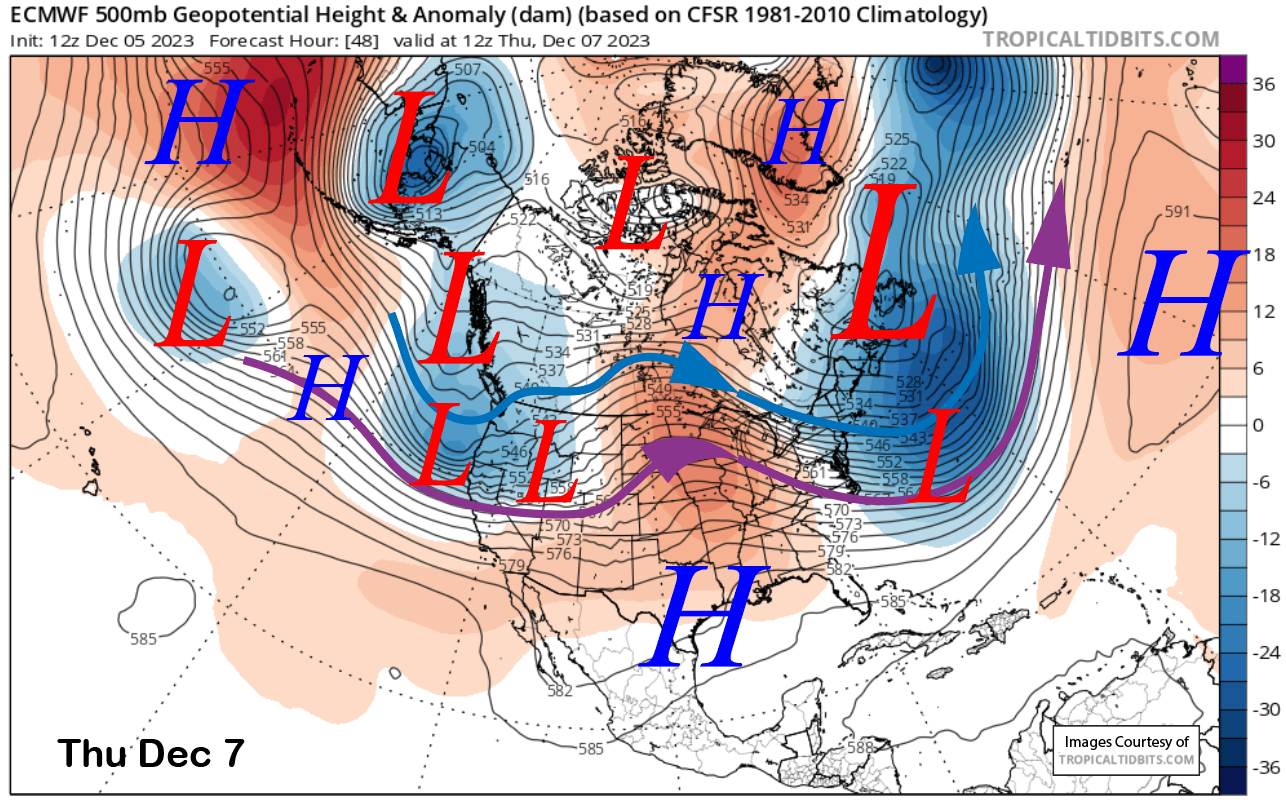
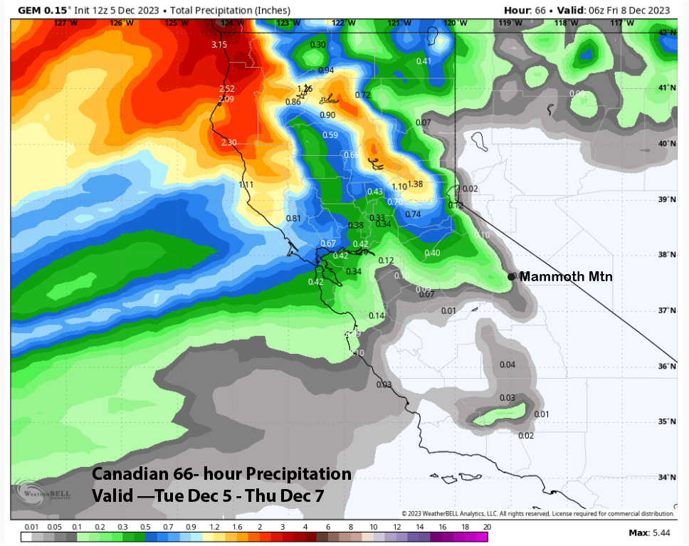
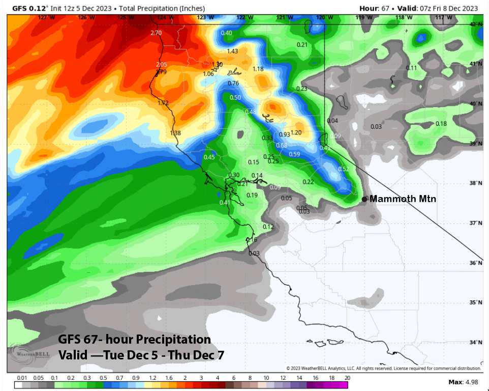
The models move the front into CA tomorrow followed by the upper-level low on Thursday (image below). The weather system is generally too far north of Mammoth for good snowfall with most of the precipitation remaining in NorCal.
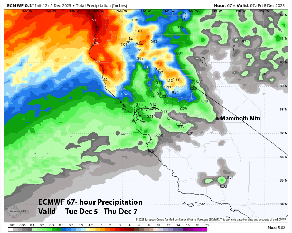
Nonetheless, the tail end of the front will brush Mammoth on Wednesday evening with some light snowfall with the trailing upper-low possibly producing some flurries on Thursday evening. Overall, the models (images below) only favor very light amounts and around a tenth of an inch of liquid. Thus, only an inch of snowfall is expected with maybe 2” up top. Nothing that is going to help with opening off-piste terrain.
High pressure then builds back into the state on Friday for a return of fair and dry weather through the weekend. Temperatures will remain seasonably cold into Saturday for good snow making before it warms up a bit Saturday night and Sunday.
Long Range (Days 5+):
The longer-range guidance has not changed much with the next expected chance for snowfall around mid-month with dry weather then favored to return thereafter. It looks like the snowmaking crew will be earning their dollars this year as they hope to at least get the groomer terrain open by the Christmas Holiday with Mother Nature not cooperating right now.
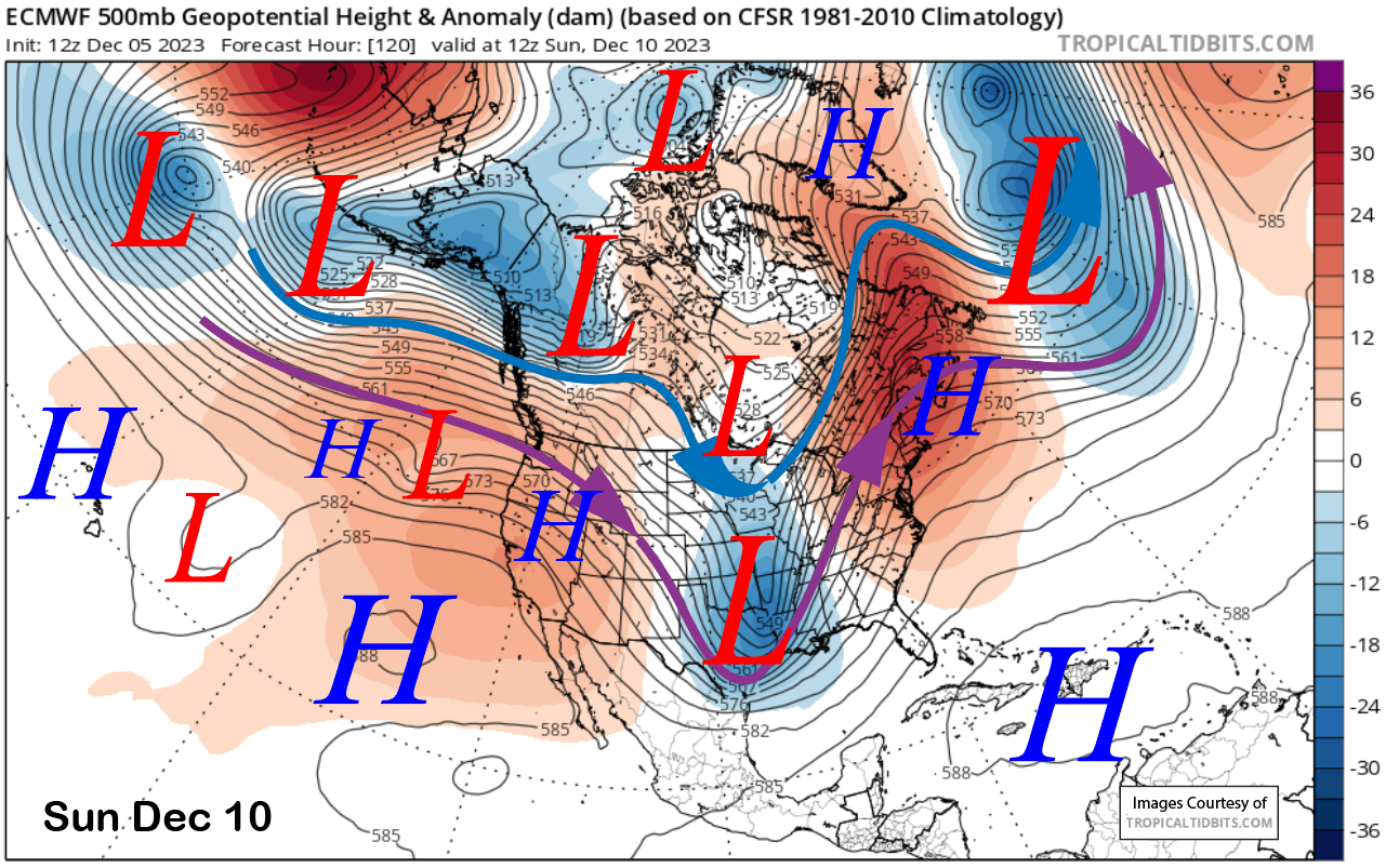
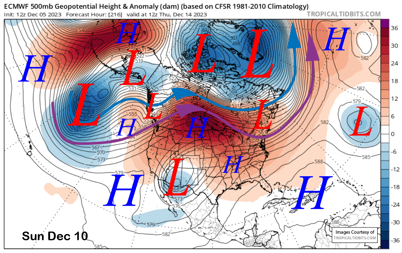
High pressure will hold through early next week with just a weak wave (image below) off the coast on Sunday moving through around Monday/Tuesday for slightly colder temperatures. It could also produce some breezy northeast winds. High pressure then rebuilds for the rest of the work week (two images below) for continued dry weather.
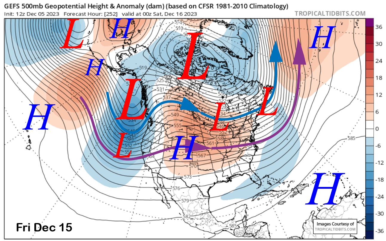
Changes in the weather pattern related to the MJO moving into phase 7 discussed in the last post are still possible just after mid-month, although confidence is not high as the models have backed off on the strength of the MJO.
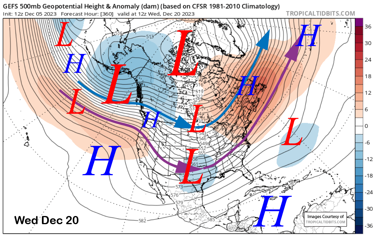
The GFS ensemble is still the most bullish about some decent snowfall as it shows a deeper trough (image below) versus the ECM that is weaker and farther northward. Let us hope the GFS is right as that model and the ECM model are favoring ridging to return by the 20th (two image below).
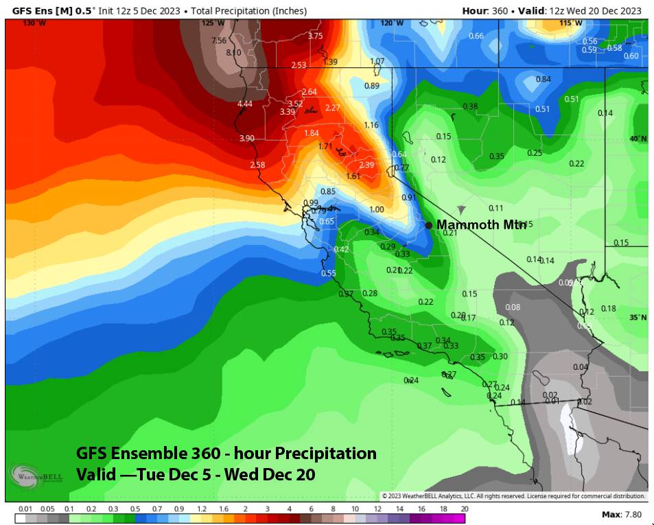
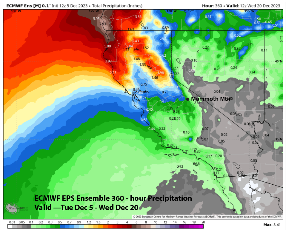
Total precipitation from the wetter 12z GFS ensemble model run is only favoring about half an inch (image below) or maybe 6” of snowfall. The ECM EPS has about half that amount (two images below) and maybe only a few inches of snowfall. But neither ensemble mean solution is the one we need right now to get some base and then powder skiing. Hopefully one of the wetter outlier solutions will happen as some are showing 2 feet of snowfall.
The super long range is looking a little better, but it is hard to have confidence in a 3-week forecast when the models have been forecasting wet conditions out at 3 weeks since November that have consistently not verified. Regardless, the GFS is showing about 3” liquid (image below) for the rest of the month while the ECM has about 2” (two images below).
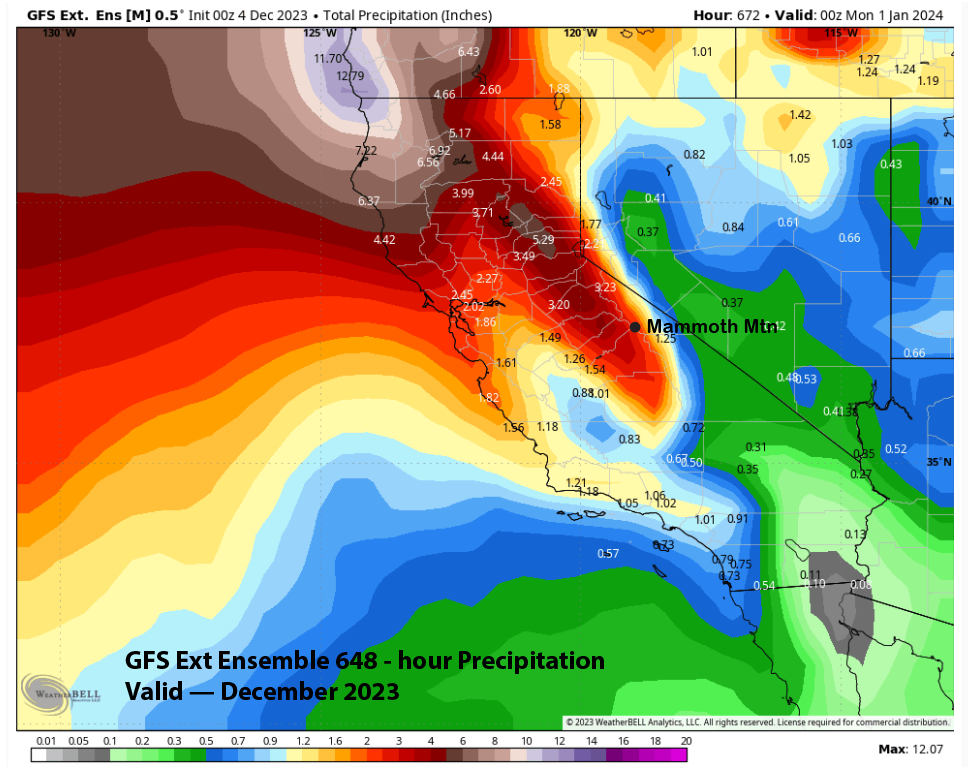
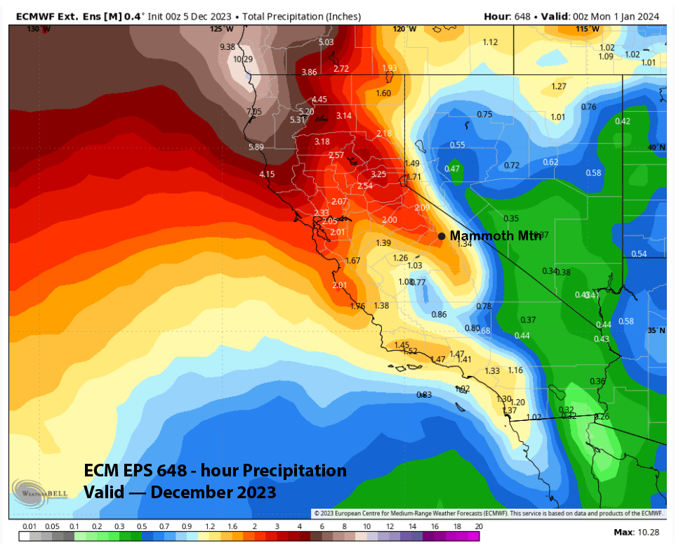
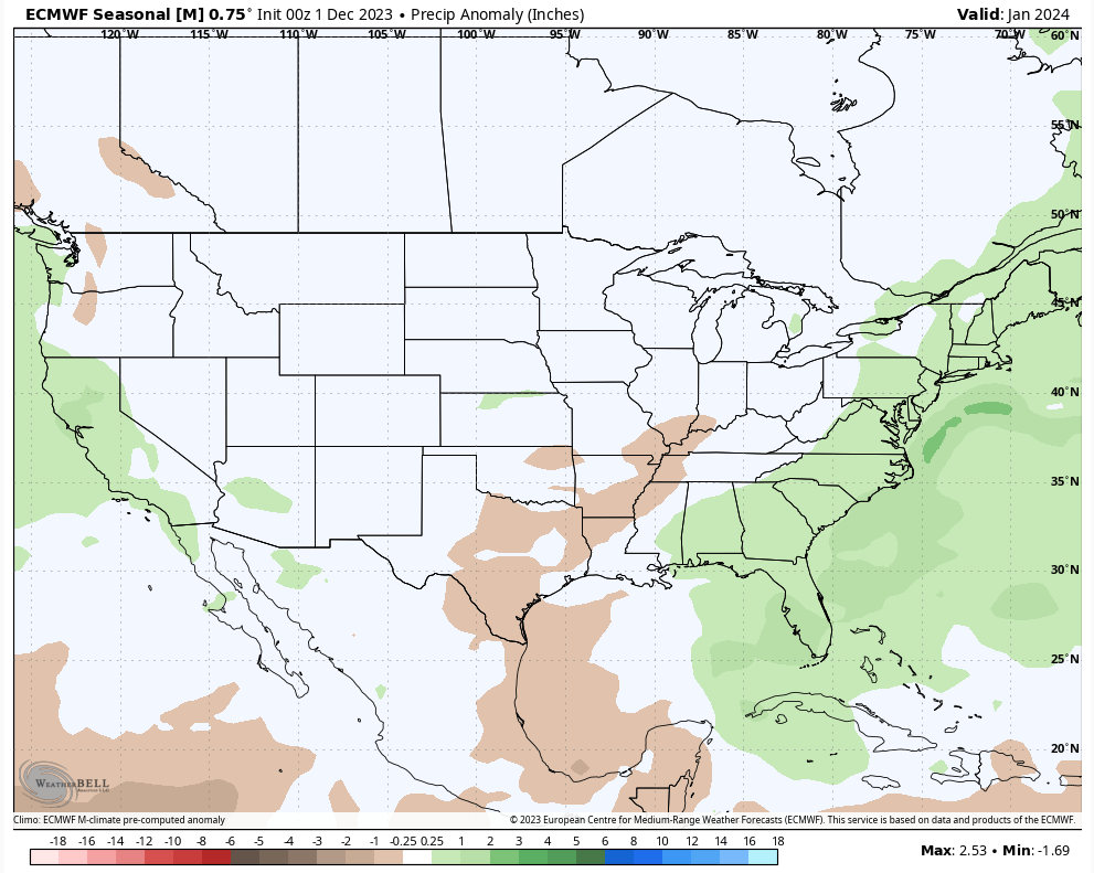
Unfortunately, the QPF is spread out over time and unless most of that 3” falls with one storm, we may be waiting until 2024 for powder days across the majority of the mountain and especially Lincoln Mountain. The latest seasonal run by the ECM is showing near-average precipitation in January or around 65” of snowfall. Fingers crossed that the El Nino finally gets going next year. WG